Acharn Burn, Kenmore, Perthshire

Tumulus:  OS Grid Reference – NN 7607 4294

Also Known as:

  1. Canmore ID 25011

Getting Here

Acharn Burn tumulus, Kenmore

From Kenmore, take the minor road on the south-side of Loch Tay for 1½ miles (2.4km) until you reach the hamlet of Acharn.  From here take the track uphill for ½-mile past the Acharn waterfalls and when you come out on the east-side of the trees, keep walking uphill parallel to the trees and burn until the land levels-out and the track heads away, east.  200 yards ahead, on the left-side of the track, you’ll see the large fairy-mound.

Archaeology & History

The tumulus looking NE

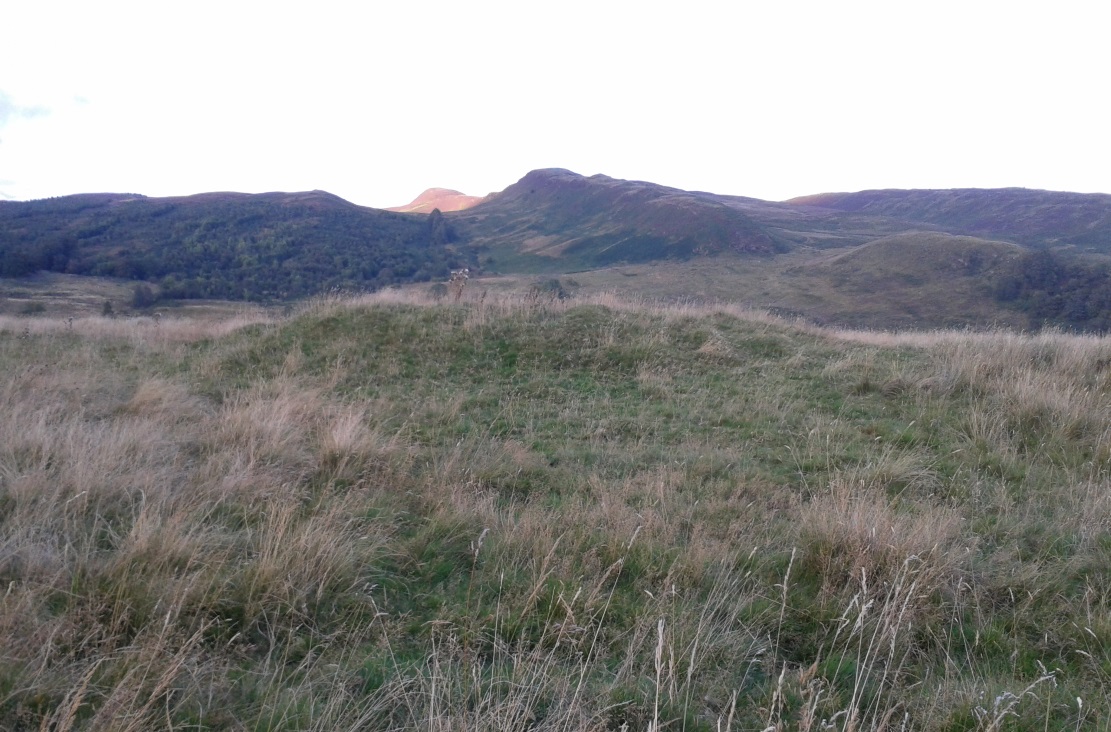
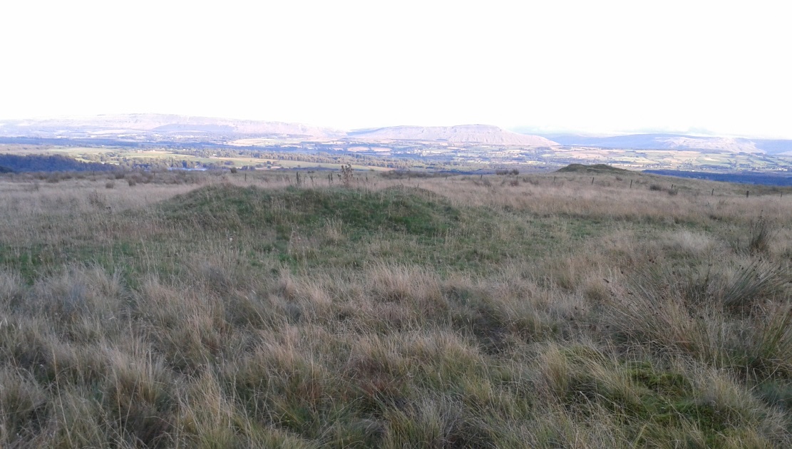
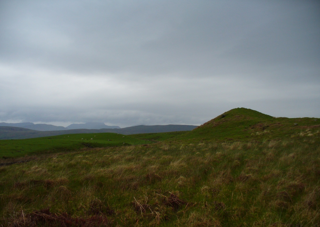
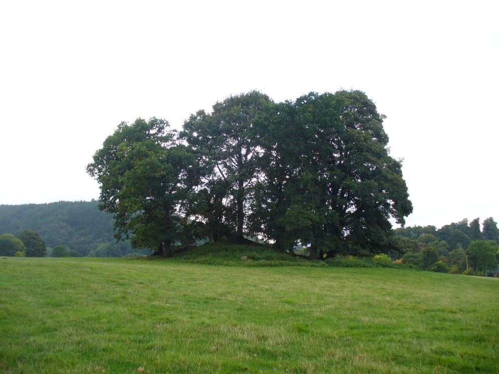
First reported in archaeological circles in the Discovery & Excavation Scotland mag in 1964, this archetypal fairy-mound or tumulus sitting on the grassy plain overlooking the eastern end of Loch Tay and district would have been known of by local people in older times, but I can find no early accounts of it, nor its traditions.  When Bob Money (1990) came here, he told of the grand vista stretching into the distant mountains:

“From here the views…are superb, and the little mound, which is an ancient tumulus, or burial mound, has sat here undisturbed for several thousand years, guarding the secret of its once important occupant.”

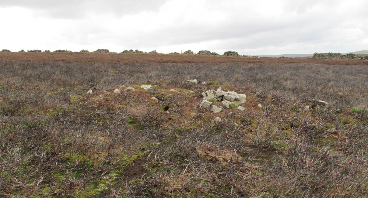
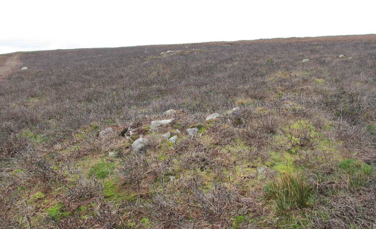
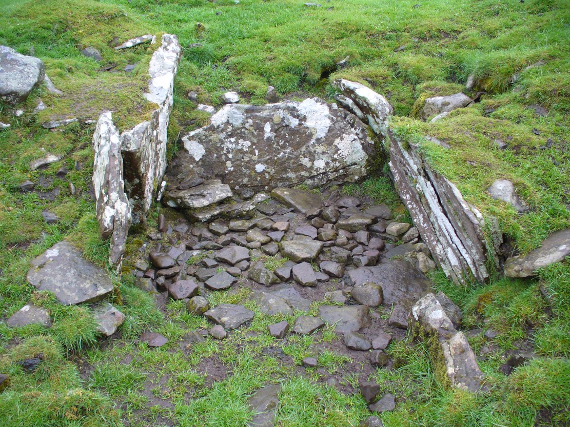
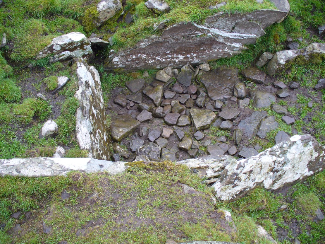
Circular in structure and measuring 20 feet across, the mound rises nearly four-feet high and is probably Bronze Age in origin.  Although mostly covered in grass, there are some loose stones visible on the side of the mound, seeming to indicate that it may be a covered cairn.  No excavation have yet taken place here.

References:

  1. Money, Bob, Scottish Rambles – Corners of Perthshire, Perth 1990.

AcknowledgementsMany thanks to the unholy bunch who helped travel, locate, photograph and take notes on the day of our visit here, including Aisha, Lara & Leo Domleo; Lisa & Fraser; Nina and Paul.  Let’s do it again and check out the unrecorded stuff up there next time!

© Paul Bennett, The Northern Antiquarian


Shotley Bridge, Consett, County Durham

Cist (destroyed):  OS Grid Reference – NZ 10 53

Archaeology & History

The location of what was, in all likelihood, a small Bronze Age burial on the edge of old Shotley Bridge (as it was in the mid-19th century) remains a mystery.  It’s likely that the position of the site  is now beneath someone’s house in the town.  Its existence was thankfully recorded in correspondence between a “Mr. John Dixon, of the  Engineer’s Office, Consett Ironworks,” and the great John Collingwood Bruce. Dixon’s letter dated October 13, 1856, told:

“I take the liberty of informing you of the discovery of a coffin, of some description or other, in a field near ShotleyBridge.  I have visited the place and enclose a sketch² made on the spot as it appeared when I saw it.  Some workmen were excavating sand and came upon it about a foot beneath the surface. The only remains that we can ascertain to have been in it, are a few pieces of bone, barely recog­nizable as such, and now in the hands of Dr.Renton.  I have not yet seen them.  He tells me that one fragment resembles a portion of a skull, but that they are in such small pieces it is difficult to say what they are.  I shall endeavour to get a piece — as, if the surface remains, I apprehend we shall be able to say whether they are human or not. Possibly it may never have been a human coffin —though from the paved bottom and the ap­pearance of great age the stones possess, and also the bearing NW and SE, I am inclined to think it must be one. The dry situation — a sloping hillside — would tend to preserve the remains of bones.  I cannot hear of any urns, or the fragments of any, having been found in it.  They may, if ever there were any, have been destroyed.  The coffin may have been opened before, and rifled — say hundreds of years ago.  It seems unaccountably short — as I believe the older ones are generally distinguished by their great size; but it may have been, and probably was, merely a receptacle for burnt remains, either in urns or not. The paving I mentioned had all disappeared when I saw it.  As it consisted of small stones, they had doubtfully been carried away.  Not being an antiquarian, or skilled in antiquarian lore, I cannot do more than form an idea about it, but shall be glad to hear your opinion at any time you may find it convenient.”

In a second letter, replying to Mr Bruce’s en­quiries, Dixon added that a piece of flint had been found amongst the debris which, he thought,

“might possibly turn out to be part of an ancient weapon; and if so, might lead to some solution of the question.”

As Dr. Bruce pointed out: many ancient British graves were not uncom­monly as short as three feet.  In so called “rude times it would seem that a grave was made much shorter than the body—which was doubled up, and thrust in.”  It was his opinion that the grave here was prehistoric.  We have to agree with him.  But where exactly was this place?  Does anyone know…?

References:

  1. Anon., “Discovery at Shotley Bridge,” in Proceedings Society of Antiquaries Newcastle-upon-Tyne, volume 1, no.22, 1856.
  2. The sketch seems to have been lost.

© Paul BennettThe Northern Antiquarian

Nether Glenny 02, Port of Menteith, Perthshire

Cairn:  OS Grid Reference – NN 5644 0202

Also Known as:

  1. Canmore ID 87382

Getting Here

Nether Glenny 2 tomb, looking east

Follow the same directions as if you’re visiting the nearby Nether Glenny 1 cairn; but look into the field immediately north (through the gate on the other side of the fence) about 100 yards away and you’ll see the telling bump rising out of the grasses.

Archaeology & History

Another burial mound of roughly the same size and form as its companion 100 yards to the south, but this one appears to be more intact than its close neighbour.  The top centre of the overgrown cairn seems to have been robbed sometime in the past—perhaps for use in the nearby walling; perhaps by treasure-seekers. We will probably never really know.

Nether Glenny 2 & its close neighbour

Although much overgrown in grasses (with species of shamanic fungi surrounding), the roughly circular tomb is between 3-4 feet high, roughly flat-topped, and measures 12 yards north-south, by 15 yards east-west.  There is no immediate evidence of the internal tomb and it has yet to be satisfactorily excavated.  A small outcrop of stones about 30 yards to the north possesses a highly impressive detailed multi-ringed neolithic petroglyph.

References:

  1. Bailey, G.B., ‘Nether Glenny (Port of Menteith parish)’, in Discovery & Excavation Scotland, 1987.

© Paul Bennett, The Northern Antiquarian


Cock Howe, Skelton Moor, Marske, North Yorkshire

Cairn:  OS Grid Reference – NZ 0811 0063

Getting Here

Cock Howe1 cairn

Take the minor high road between the hamlets of Marske and Fremington (up Hard Stiles from Marske side), turning up Stelling Road at the crossroads, and ⅔-mile (1.1km) along, turn right up Helwith Road. ¾-mile (1.2km) along, on the right, walk thru the gate onto the moor following the walling.  Nearly 400 yards on you meet a junction of walling: walk past this until you reach the next line of walling and then follow it northeast for just over 500 yards. Once there, look for the mounds in the heather immediately south, less than 50 yards away.

Archaeology & History

This is one of the “isolated cairns of fair size” mentioned in passing by Tim Laurie (1985) in his survey of the massive settlement and field systems scattering this gorgeous moorland arena.  It is one amongst a scatter of several in and around the eastern height of Cock Howe hill on the south side of Skelton Moor.  The area has sadly been scarred by an excess of old lime mines—many of which are visible close by—damaging with some severity the excess of prehistoric remains on these moors, none of which have yet been excavated in any detail.  This cairn included.

More cairns to the rear

Even though much of the heather here had been burnt back when James Elkington and I visited the place recently, the pile of stones was still very embedded into the peat.  The moorland rabbits had dislodged some of the stones, highlighting the mass of rocks much better.  It stands nearly a metre high and is roughly 7 yards by 8 yards in diameter from edge to edge, structurally similar to the many Bronze Age cairns scattering Rombalds Moor, Askwith Moor and other Yorkshire clusters.  A second cairn of similar size and stature exists some 30 yards to the southeast (visible on one of the photos).

For anyone who might visit this site, the most impressive features hereby are the huge settlement remains scattering the moors just north of the wall a few yards away.  When the heather has been burnt back, a veritable prehistoric city unfolds before your eyes, with extensive lengths of walling, hut circles and what can only be described as huge halls, in which tribal meetings probably occurred – much of it in superb condition!  Well worth visiting.

References:

  1. Laurie, T.C., “Early Land Division and Settlement in Swaledale,” in Upland Settlement in Britain: the Second Millennium B.C. and After, ed. Don Spratt and Colin Burgess, BAR British Series 143, 1985.
  2. Martlew, R.D., Prehistory in the Yorkshire Dales, YDLRT: York 2011.

© Paul BennettThe Northern Antiquarian


Ballachraggan, Callander, Perthshire

Chambered Cairn:  OS Grid Reference – NN 6805 0650

Also Known as:

  1. Canmore ID 73674

Getting Here

The mound of Ballachraggan tomb
The Ballachraggan tomb

Along the A84 road between Doune and Callander, take the tiny country lane up to your right to Drumloist (if you’re coming from Doune) or up the tiny unmarked road past Keltie Bridge on your left (if you’re coming from Callander).  Uphill for several miles, you eventually emerge from the trees and are on the top of the tiny road. Once here, keep your eyes peeled for Drumloist farm.  Best thing to do is walk up the track and ask at the farm. The fella there is a superb old Highlander who’ll point you to the place on the hill above.

Archaeology & History

A site that was never explored by that giant of chambered tomb research, Audrey Henshall.  A pity, as it has a lot of potential and seems to have a lot more to say about itself than the meagre findings reported by the Scottish Royal Commission doods.

Curious fairy mound to rear
One of two main chambers

Although there’s a very notable “fairy hill” eminence close by which strongly draws your attention, the actual hillock upon which this chambered tomb was constructed is in front of this, closer to the farm.  A couple of rows of ancient walling—Iron Age by the look o’things—run up the hillside, with one of them running into the eastern sides of the huge mound which this tomb plays a part in. The mound itself is about a hundred feet across, although seems to have been damaged over the centuries.  Although it is probably neolithic in origin, sections of the monument seem to have been altered and re-used for other purposes, giving it that distinctly multi-period look.

The farmer informed us how some of the stones from the mound had been robbed and used in some of the walling in the past.  He also told us how there are so many other archaeological features upon the moors above here that remain to be “officially” recorded, despite the efforts of some who swept the region for remains a few decades ago.

Looking into the main cist
Nature’s faded cup&ring

The main prehistoric section of the tomb that can be seen are the two opened cists, or stone-lined graves, to the top north-western edges of the mound.  They align together, NE to SW, with a gap of about three yards between the two open tombs.  The more northerly of the two is much more overgrown; whilst the southwestern grave comprises of three large flat upright stones, forming a traditional ‘box’ with smaller flat stones lining the floor.  But these two separate tombs (if indeed they were originally separated) point directly to the large, very prominent “fairy mound” about 100 yards north-east, on the north side of the Drumloist Burn.  The alignment seems very deliberate.

Walking over the boggy ground to the (unnamed) fairy mound, a natural ‘platform’ of rocks sticks out on its south-easterly side, and upon this are what I initially thought were two cup-markings, with the more easterly one of the two seeming to have a carved arc along its edge; but subsequent visits here at different times of day has shown that they are Nature’s handiwork.  Anyhow, looking from this mound, back across to the Ballachraggan tomb, the open flat landscape heading south-west is held where the sunset falls.  Sadly on the day we visited, Nature greeted us with grey cloud and the drizzle of light rain all afternoon, so we couldn’t make out if there was something, far away, which the tomb was truly aligned with…  A damn good site though!

© Paul Bennett, The Northern Antiquarian


Cairnpapple Carvings, Torpichen, West Lothian

Cup-Marked Stones:  OS Grid Reference – NS 98717 71739

Archaeology & History

Cup-marked stones from Cist A, Cairnpapple

A profile of two seemingly trivial cup-marked stones is called for, out of memory for the carvings and also because they are now hidden in some vault somewhere, out of view in one of the Scottish museums I presume.  In visiting the impressive Cairnpapple Hill the other day, I thought that the carvings should really be in situ, where they belong, and not in a box somewhere for the eyes of just a privileged few.

Cairnpapple Cist A
Cairnpapple Cist A

Two small, single, almost portable-sized stones—not unlike other cup-marked rocks found at sites like the Little Skirtful of Stones and elsewhere—were unearthed during the primary excavation of Cairnpapple by Stuart Piggott in the late-1940s.  Although there are many stone-lined cremation pits and graves at Cairnpapple, only one of the tombs seemed to possess any carvings—and these were found only in the western walling in one of the larger of the two tombs that are now housed inside the modern covering tumulus, in what Piggott (1950) called ‘Cist A’. (Curiously in all sketches of the tomb, he didn’t show where the carvings were found, typical of some archaeologists of that period who saw little importance in these relics.)

Cist A capstone, with large cup

The giant stone roof or covering stone to Cist A also has a large worked cup-marking on its western side.  There are also what seems to be other faint rectangular etchings on the same rock-face, but the age and nature of these elements need to be assessed with some caution.

References:

  1. Cox, Adrian, Cairnpapple Hill, Historic Scotland: Edinburgh 2010.
  2. Piggott, Stuart, “The Excavations at Cairnpapple Hill, West Lothian 1947-1948,” in Proceedings of the Society of Antiquaries, volume 82, 1950.

© Paul Bennett, The Northern Antiquarian


Church Field, North Ockendon, Essex

Church Field, N.Ockendon mapTumuli (destroyed): OS Grid-Reference – TQ 618 850

Also Known as:

  1. Monument No. 414124

Archaeology & History

Lay out of destroyed tumuli

As with many prehistoric sites, this too was unearthed and seemingly destroyed in the 19th century. Although it seems that nothing now remains of the place, the english archaeological fraternity have the site listed as a “Romano-British site”, which seems reasonable; although the lay-out of the barrows or tumuli described and portrayed in the sketch here give a more traditional Bronze Age look. But we may never know for sure.  Thankfully a fellow antiquarian called Walter Field (1863) was on hand to make a record of the place before its final destruction.  In a short paper he wrote for the Essex Archaeological Society, he told that:

“In the Spring of 1858, a number of labourers were employed in trenching some fields belonging to Holme Farm, forming part of a large tract of land called Bulphan Fen, and situated about a mile-and-a-half west of the village of North Ockenden.  In the course of their operations they found a number of beds of dark soil, in which were a large quantity of bones, supposed at first to be human, together with fragments of pottery and pieces of charcoal.  It was the general belief among the workmen that the field had been the scene of some great battle, a belief supported by some local traditions.  One thing seems certain, that it is the site of a Roman or early British Burial Ground, extending over a space of about sixteen acres; but whether it marks the battlefield of one of those many great struggles which took place in this county between the Britons and Romans, or whether it denotes the peaceful cemetery of a Roman Station, it is perhaps not very easy to determine.

“The little evidence, however, which the plough and the harrow have left remaining, seems in favour of the latter. The regular and almost equidistant arrangement of the lines of dark soil in many parts, and the many fragments of cinerary urns found in nearly all of them, seem to indicate rather the orderly interment of a cemetery, than the more hasty burial of a battle-field; but this is by no means conclusive.

“The graves are at once discernible from the surrounding soil, the natural soil being a yellow clay, whilst the earth of the graves is nearly black.  It is impossible, with any accuracy, to trace the exact forms of the graves, some appear to be circular, and to vary in size from 10 to 40 feet in circumference, others appear to be of an oblong form; one grave is much larger than the rest, and is of about 60 feet in length and 20 in width.  There are doubtless more of these graves in the bordering fields.  It is worthy of note that a neighbouring meadow is called the Church Field, and a portion of the land on which these discoveries were made is still called Ruin Field.  Both these names, probably, have reference to the formerly uneven sur&ce of the ground, caused by a great number of burial mounds.  The fragments of Pottery vary much in their character, some being of the very rudest workmanship, whilst others have been more carefully manufactured; and a few small pieces of Samian Ware were found; mingled with them, were the bones of different animals — the horse, the deer, the boar, etc., but no human bones; much of the earth, stones, and pieces of wood bear evident marks of the action of fire; beyond these there was nothing found, except a portion of a flint arrow-head and a part of a hand mill stone.  Not a single coin or piece of metal was discovered.  The circumstances that all the fragments of pottery, and nearly all the bones of animals, are broken up into small pieces lying equally at the bottom as at the top of the dark soil, and that the graves are about three feet deep, narrow at the bottom and widening to the surface, lead me to think that the present graves are only the trenches of the original barrows, but that the field has been gradually levelled for agricultural purposes, and that the plough and the spade have in process of time filled up the original trenches with the soil, urns, bones, &c., of the burial mound.”

References:

  1. Field, Walter, “Discovery of British and Roman Remains at North Ockenden and White Notley,” in Transactions of the Essex Archaeological Society, volume 2, 1863.

This site entry is dedicated to Sarah Hunt, once of North Ockendon, wherever she may be…

© Paul Bennett, The Northern Antiquarian


Aithernie, Scoonie, Fife

Tumulus (destroyed):  Grid Reference – NO 3769 0339

Also Known as:

  1. Canmore ID 31344

Archaeology & History

Aithernie tumulus on 1855 OS-map

A mile or so WNW of the fantastic standing stones of Lundin, and just a coupla hundred yards above where the lesser standing stone of Balgrummo lives, we could once see an impressive prehistoric burial mound on the small hilltop of Aithernie.  Sadly, like oh too many prehistoric sites in our landscape, it was vandalised and destroyed in the 19th century by the prevailing stupidity of the period.  Thankfully we have a couple of accounts describing the place.

The site had already passed into memory when the Ordnance Survey fellas got up here in 1854, but an account of it was made in the ‘Object Name Book’ of the parish a decade earlier.  Thankfully the story of the site was known locally and, along with the New Statistical Account describing the olde mound, A.S. Cunningham (1906) told the story of when it was “opened” and then of its subsequent demise. He wrote how,

“…in 1821 a much more interesting relic of antiquity…was opened in a field on the estate of Aithernie.  When digging moulding sand for Leven Foundry, the workmen struck right into the heart of an ancient tumulus.  This cemetery of prehistoric times contained as many as twenty rude stone cists.  These cists were typical of the prehistoric burial places found throughout the country.  They were constructed of slabs placed on edge, with a covering stone, and cemented with clay puddling.  Above the coffins was a covering of stones, the stones having hundreds of years before been so firmly cemented together with clay and sand that the workmen required the aid of picks to enable them to “rifle the tombs.”  Small urns were found in two of the coffins, and five of them contained larger urns, 14 inches in diameter and 24 inches in depth, and in another cist quantities of charred wood beads were discovered. All the coffins, except the five in which were the large urns, contained human bones, and innumerable bones were found outwith the mouths of the cists.”

When the Royal Commission (1933) lads visited the place in 1925, they reported “no existing indication of a tumulus” remained.  Gone!

References:

  1. Cunningham, A.S., Rambles in the Parishes of Scoonie and Wemyss, Purves & Cuningham: Leven 1906.
  2. Royal Commission on the Ancient & Historical Monuments, Scotland, Inventory of Monuments and Constructions in the Counties of Fife, Kinross and Clackmannan, HMSO: Edinburgh 1933.

© Paul Bennett, The Northern Antiquarian


Firtholme, Easington, East Yorkshire

Tumulus (destroyed):  OS Grid Reference – TA 4160 1748

Archaeology & History

In and around East Yorkshire, the fabled Yorkshire antiquarians William Greenwell and J.R. Mortimer uncovered and excavated many now-lost prehistoric tombs—some of which, beneath the rounded tumulus of earth, were constructed out of wood instead of stone.  A little-known site, now long gone, once existed in what is now the North Sea, just a few hundred yards off the Easington coast.  Other sites close by are soon to be completely swallowed back into Earth’s body, right on the water-line, but the site described here has long gone.  What little was known of it was described in Mortimer’s (1905) magnum opus, where he told:

“On the beach at Easington, in Holderness, under a tide-demolished barrow, Dr Hewetson and the writer on April 21st, 1894, discovered a double cist made of broad slabs split from the outer shell of the decayed trunk of a willow tree.  This barrow had been swept away by the waves, and its site was at about half-tide-line, and a considerable way from the very low cliffs.  Lining the grave with wood (the branches of trees) would not be difficult to accomplish and would be practised as a protection to the body.”

A henge monument and several other prehistoric barrows have been located in and around Easington, but they’re fading fast!

References:

  1. Mortimer, J.R., Forty Years Researches in British and Saxon Burial Mounds of East Yorkshire, A. Brown: London n.d. (1905).

© Paul Bennett, The Northern Antiquarian


Strowan, Crieff, Perthshire

Tumulus:  OS Grid Reference – NN 81998 20832

Also Known as:

  1. Canmore ID 25510

Getting Here

The faerie mound of Strowan

If you’re coming southwest out of Crieff on the A822, as you cross the river take the right-turn just before leaving the town along the country lane onto Strowan and Dalginross.  Nearly 2½ miles along there’s the small junction on your right to Strowan House and church. Just past this turning, the next field on by the roadside, has a large rounded tree-covered mound living quietly. That’s the fella!

Archaeology & Folklore

Found halfway between Crieff and Comrie in the field on the north-side of the road, this large oak-covered tumulus was, seemingly, first described in notes made by the old archaeologist O.G.S. Crawford following a quick visit he made here in 1936.  The place has, since then, never been excavated to find out exactly what might be hiding therein!  It’s quite a big fella too: about 10 feet high and 40 yards across (east-west)—similar in size and design to the prehistoric burial mounds at Tulloch and Kinpurnie.  Some large rocks make up the sides and edges of the mound, with smaller ones scattered here and there, giving the distinct impression of a very overgrown cairn of sorts.

Tis a quiet and tranquil arena, amidst fervent colours of meadows and old trees. Another 2 miles further down the same road is the equally tranquil (though ruined) megalithic ring of Dunmoid

© Paul Bennett, The Northern Antiquarian