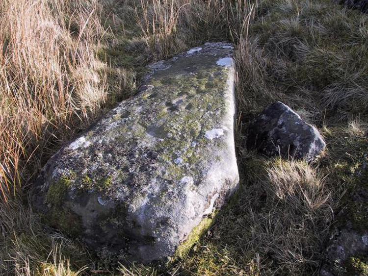
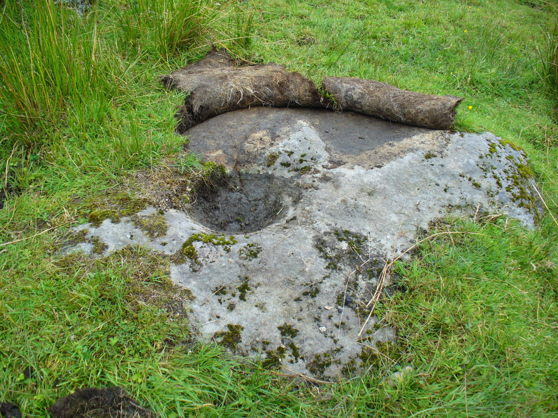
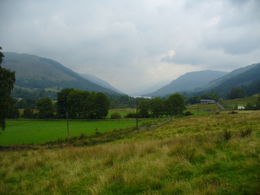
Take the B6265 east out of Grassington, thru Hebden, for another 2 miles till you pass the tiny road down to Skyreholme on the right. Another few hundred yards on, past Nussey Farm and Dry Gill house, park up and look for the track going south into the moors. Go down the track called Black Hill Road for a few hundred yards till y’ reach the gate on the right. A track bends downhill to the psilocybin-rich pastures of Nussey Green. Several hundred yards on, to the right-hand side of the track, we find this and its companions. Look around!
Archaeology & History
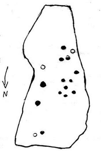
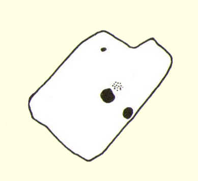
Quick sketch of design
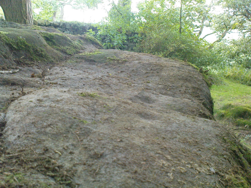
This medium-sized, recumbent standing-stone-shaped boulder has perhaps fifteen cup-markings on it. It’s a plain carving with others of a similar ilk in the area. First described by Stuart Feather in 1970 as one of “two cup-marked rocks” he found when ambling around; in Boughey & Vickerman’s (2003) survey they give it the wrong grid reference, though describe it correctly as a “long flat rock of irregular outline (with) fourteen to sixteen cups.” A cluster of other carvings are nearby, though some have been destroyed through mining operations.
References:
Boughey, Keith & Vickerman, E.A., Prehistoric Rock Art of the West Riding, WYAS: Wakefield 2003.
Feather, Stuart, “Appletreewick, W.R.,” in Yorkshire Archaeological Register, 1969, Yorkshire Archaeological Journal, part 168, 1970.
From Ilkley, take the directions up to the Panorama Woods 232 carving. From here you can step from this rock over the stride onto the cup-marked carving 231b, and then go onto the next adjoining rock surface a little lower down. From here, you’ll see another mossy rock surface in front of you by a yard or two. That’s the one!
Archaeology & History
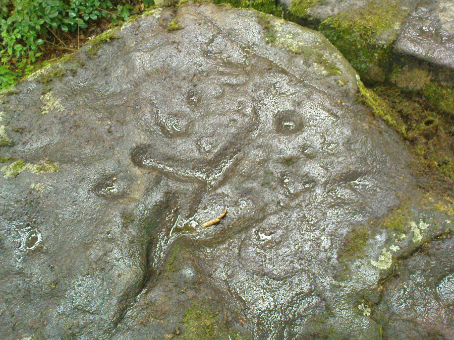
The three cup-markings
Here’s another simple cup-marked stone, probably only for the purists amongst you—although in visiting here please take into account the primary carving’s association with other more prominent designs that once existed only a few yards to the west where the houses now stand. There is also the cluster of other carvings right next to this stone. A prehistoric settlement was also in evidence adjacent to this carving which was destroyed in the latter half of the 19th century.
Close-up of the cupsJohn Hedges 1986 drawing
Described simply in John Hedge’s (1986) fine survey as a small “piece of rock with three clear cups and one depression.” Boughey & Vickerman’s (2003) survey added nothing more and merely copied the same words. For some reason or other (mebbe cos I’m simple!) I really like this otherwise innocuous design and its close simplistic relatives. It’s probably due to the trees amidst which the stones are found and the bright mosses on the rocks, giving the site a slightly extra sense of more living genius loci than others on the top of these moors, where the winds move the subtle spirits with greater ease.
19th century addition
If you step down and look at the vertical side of this stone, you’ll notice a more modern stylistic carving etched onto the surface. Not as deep as the prehistoric cups on the top, it seems probable that a local artist by the name of Ambrose Collins carved this on here (and other similar designs on other rocks nearby) in the late 19th century.
References:
Bennett, Paul, The Panorama Stones, Ilkley, TNA: Yorkshire 2012.
Boughey, Keith & Vickerman, E.A., Prehistoric Rock Art of the West Riding, WYAS: Wakefield 2003.
Hedges, John (ed.), The Carved Rocks on Rombalds Moor, WYMCC: Wakefield 1986.
Although now seemingly lost, it’s location is damn close to this: Along the A657 between Greengates and Bradford, where the New Line meets Carr Road, the dirt-track takes you into Calverley Woods, down Eleanor Drive. About 250 yards along (just before you get to the field on the left), take the footpath down the embankment towards the stream where it bends to the left and where the land levels out (don’t cross the stream). It’s somewhere round there!
Archaeology & History
This was one of two previously unrecognised carvings we came across sometime in 1985 (see West Woods 1 stone), when we were seeking out another missing carving in the same woods. It was clear and well-defined as the faded photo here shows; but having been back to try find it twice in the last two years in the hope of getting better photos, I’ve been unable to locate it. The carving was described in an article I did in an old earth mysteries magazine. It comprises simply of a large ring surrounding and enclosing two deep cups, which were linked to each other by a connecting carved line. Parts of the stone had been chipped in parts—including a section of the large ring— due to some industrial workings that had happened here in the past. Thankfully I managed to find the old photo and hopefully, perhaps, some local explorer could try and seek out where it’s hiding beneath the trees and other vegetation.
References:
Bennett, Paul, “The Undiscovered Old Stones of Calverley Woods,” in Earth no.2, 1986.
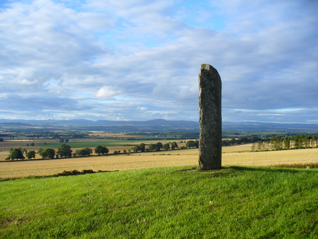
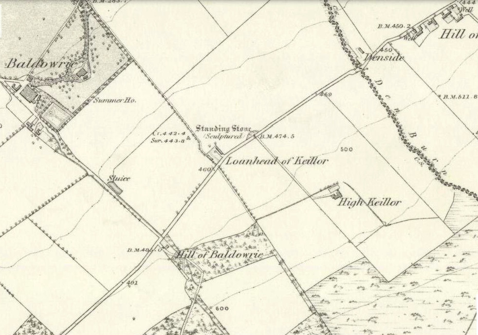
Take the minor road that runs from the small town of Newtyle (in Angus) westwards to Kettins (in Perthshire). Less than a mile on, go up the first turn-off on your left to Kinpurnie Castle and continue (past the castle) for less than a mile. Keep your eyes peeled on the right-hand side of the road, opposite the drive to High Keillor – and you can’t really miss it!
Archaeology & History
Another feel of Keillor’s Stone
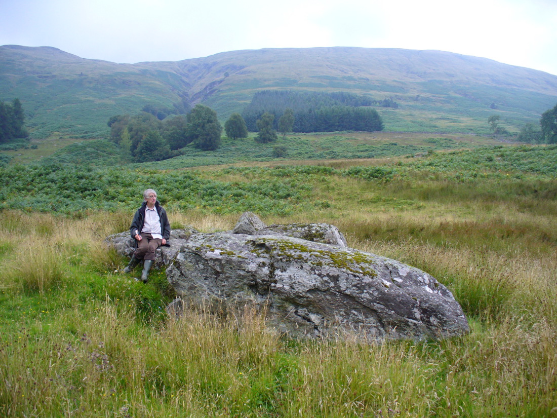
A fascinating site in an excellent setting. Here we have a 6-7 foot tall standing stone living upon a what is most probably a Bronze Age tumulus (possibly neolithic, but we aint sure), on whose south-face were carved a series of Pictish symbols many many centuries ago. In the surrounding district there is a vast wealth of similar sites (and many destroyed, like the lost Hill of Ballunie stone circle only a few hundred yards along the road), highlighting that this region was very important indeed to the prehistoric peoples of Strathmore and the Sidlaw Hills.
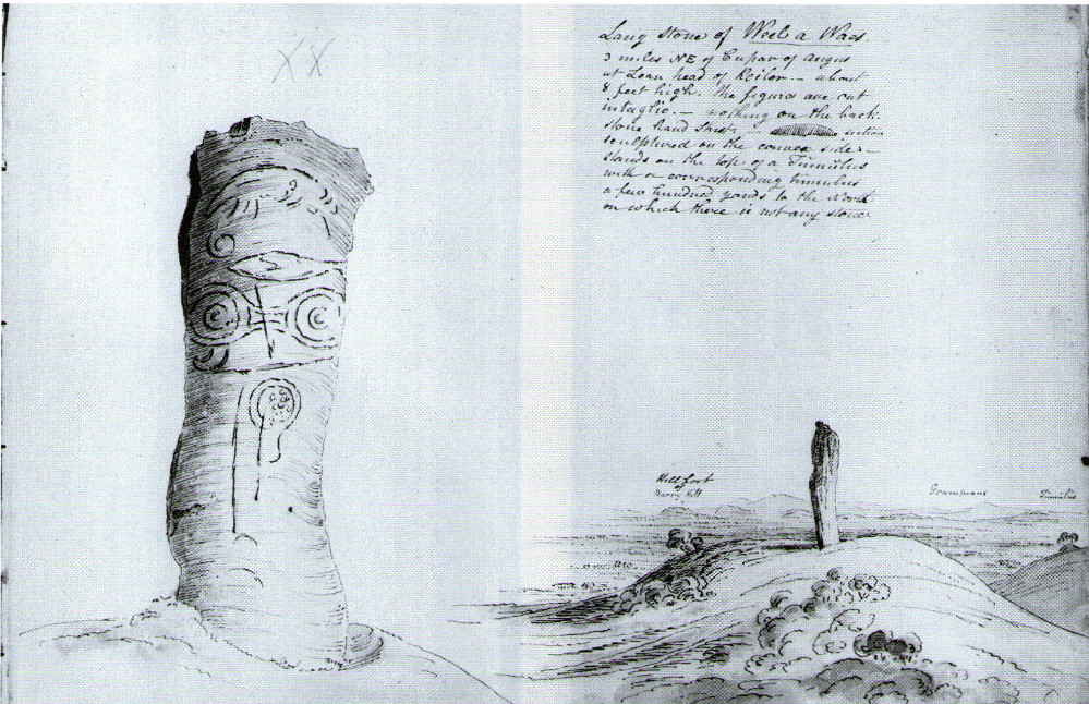
W.J. Skene’s 1832 drawing
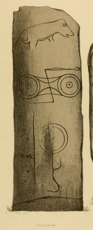
The Keillor stone was described and illustrated by several of the giant Scottish antiquarians. When James Skene visited the site in the 1830s, the tumulus upon which the stone stands was still pretty complete, as his old drawing from 1832 clearly shows. Since then the track beside the monument has widened and the road took away half of the burial mound. But the place has lost little of its majesty.
Another 19th century historian, William Oliphant (1875), when describing the beauty and history of the Sidlaw Hills, below whose edges the old hamlet of Keillor stands, told of this,
“old and striking monument, making the spot on which it stands historical, though no syllable of the history has come down to us. It is, one writer says, “one of those remarkable sculptured monuments of the ancient inhabitants of Scotland, embellished, in this instance, with the rude outline of the boar.” Another writer says, “at Baldowrie there is an erect Danish monument six feet high. It contains some figures, but they are almost entirely defaced.”
In John Stuart’s (1856) superb magnum opus he told that this carved pillar with “a boar” on it, standing on an ancient “tumulus of earth and stones” was found to have evidence of several burials inside when a dig at the site occurred which, he told, “I was present (at) in the autumn of 1854.” He described the site as follows:
Stone with carved symbols (after RCAHMS 1994)Stuart’s 1854 drawing of the carved stone
“The Stone at Keillor is placed on a tumulus on the north slope of the Hill of Keillor, in the Parish of Newtyle, and Shire of Forfar. It is a rough stone, formed of gneiss, convex in front, and rugged behind. The tumulus on which it is placed is formed of earth and stones, and several cists containing bones have been found in it. Ancient sepulchral remains have also been dug up in various parts of the adjoining field.
“The stone was broken across some years ago about a foot above the ground, but the parts have recently been clasped together, and the stone replaced in its original site by orders of Lord Wharncliffe. The present drawing was made with much care by Dr. Wise, and is more perfect than the copy in Mr. Chalmers’ volume. The surface of the stone is so rough, that it is sometimes with difficulty that the incised lines can be satisfactorily distinguished from natural fissures, but having examined the stone in a variety of lights, and compared Dr. Wise’s sketch with the original, I am inclined to think that the drawing is as satisfactory as can now be obtained. There is a rough sketch of the stone among Dr. Hibbcrt’s papers, with a supposed Gaelic inscription at the top, meaning “the burying place of the slain,” furnished to Dr. Hibbert by the late Mr. Donald Gregory. Of such inscription 1 could see no trace.”
The old stone himselfFaint carvings just visible
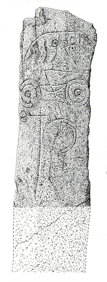
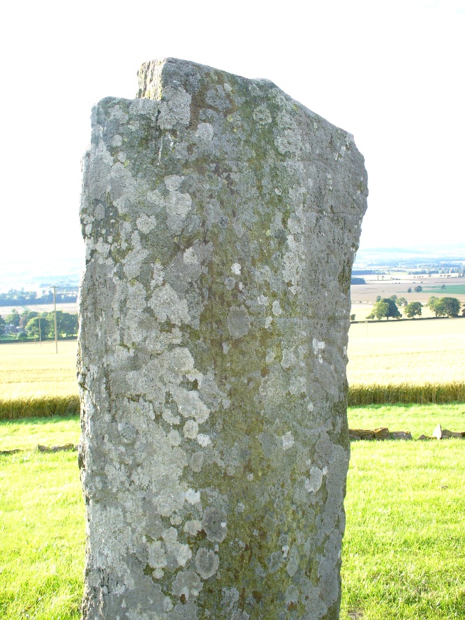
And as far as I am aware, this Gaelic inscription has not subsequently been recorded. But considering the position of the stone in the landscape, it’s understandable if some of the carvings have eroded away by simple weathering. Indeed, when Paul Hornby and I visited here only a couple of weeks ago, despite the weather conditions being excellent, the carvings were difficult to make out. Modern interpretations differ between the topmost animal carving being either a wolf or a boar. Below this we see the more common Pictish symbol described as a double disc and Z-rod symbol, for which academia still struggles to afford cogent explanations.
Keillor stone on 1865 map
Whilst the prehistoric age of the tumulus on which this stone stands is not in doubt, we don’t know exactly when this stone was first erected here. Whilst some of the early accounts—including the Ordnance Survey team who first visited here in 1860—describe it in an upright position, when A.J. Warden (1880) wrote about it in his massive survey of the region, he noted that wasn’t always the case:
“On the north slope of the Hill of Keillor, in the parish of Newtyle, there is a rough stone composed of gneiss, somewhat convex in front but rugged behind. It is placed on a tumulus formed of earth and stones, and several cists containing bones were found in it; while, in the adjoining field, ancient sepulchral remains have also been found. The stone was broken across about a foot from the ground, but the parts have been again united and the stone replaced on its original site. On the stone there is the figure of an animal, below which are the spectacle and other symbols, all incised.”
The stone presently stands on a modern plinth to protect it from the elements and such things. It was erroneously described in the Royal Commission’s 1999 survey of Pictish monuments as being just “1.4m in height”, whereas it is in fact some 6½ feet tall, or around 1.98m.
The Great Pyramid to the northwest
The view from here, east, north and west is superb. The high rolling hills of Angus stretch into the north and eastern skies; whilst more westerly are the grand olde mountain ridges into deepest Perthshire. And looking northwestwards from our old standing stone, one shapely mountain in particular is notable, standing out upon the ridge of distant hills: a great pyramid which I initially thought may have been Ben Vorlich. But thanks to the help of several local people, have found that it is in fact Schiehallion – the great Mountains of the Fairy Folk, about 50 miles away! Some folk think that it may have had relevance in the animistic formula with this monument—and I’ll hazard that it did too…
…to be continued…
References:
Allen, J. Romilly, Early Christian Monuments of Scotland, 1903.
Coutts, Herbert, Ancient Monuments of Tayside, Dundee Museum 1970.
Guthrie, James C., The Vale of Strathmore – Its Scenes and Legends, William Peterson: Edinburgh 1875.
Jervise, Andrew, Epitaphs and Inscriptions from Burial Grounds and Old Buildings in the North-East of Scotland – volume 1, Edmonston & Douglas: Edinburgh 1875.
Mack, Alastair L., Field guide to the Pictish symbol stones, Pinkfoot Press 1997.
MacPherson, J.G., Strathmore: Past and Present, S. Cowan: Perth 1885.
Marshall, William, Historic Scenes of Forfarshire, William Oliphant: Edinburgh 1875.
Royal Commission on the Ancient & Historical Monuments of Scotland, South-East Perth: An Archaeological Landscape, HMSO: Edinburgh 1994.
Royal Commission on the Ancient & Historical Monuments of Scotland, Pictish Symbol Stones: A Gazetteer, Edinburgh 1999.
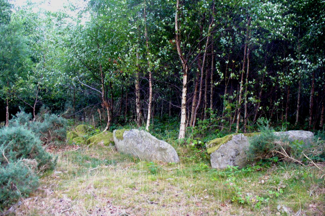
From Dunkeld, head out for a mile or so on the long and winding A923 road, taking your first road right along the Craigie and Caputh road, south of the Loch of Lowes. Go along here for about 2 miles, watching out for the little road to Black Hill on your left, where you can park up (if you hit a road junction, you’ve gone too far). Across the road, note the copse of trees. Go in there along the walling for about 50-70 yards, past the curious gathering of rounded stones, then walk into the trees where the giant fir trees stand. You’re damn close!
Archaeology & History
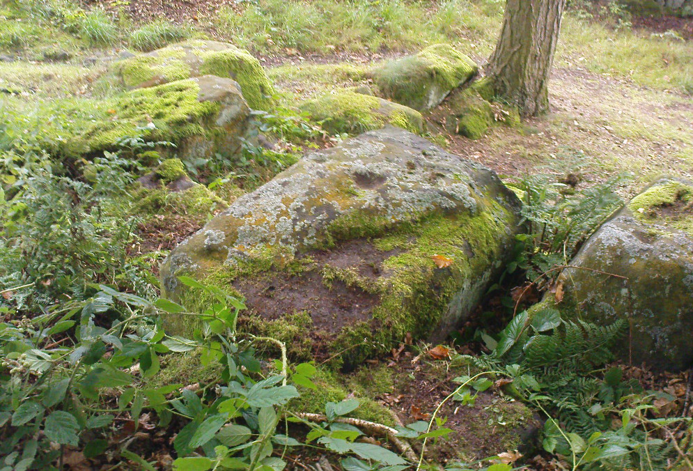
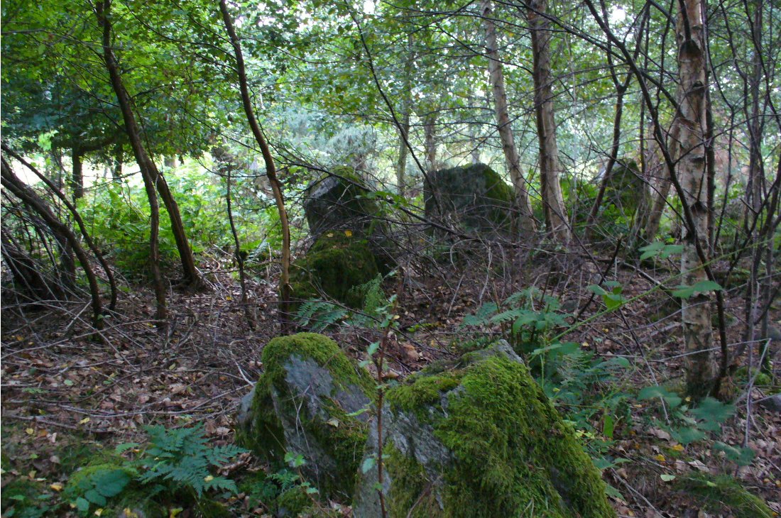
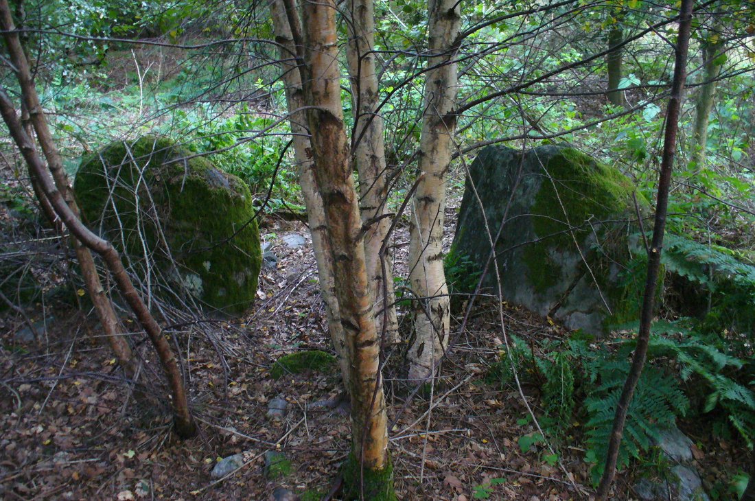
This is an excellent site, hiding away in a scattered copse of woodland, with young trees inside and very old ones in close proximity to its outer edge. We visited the place for the first time in the middle of summer, not knowing anything about it, and found Nature had covered much of the place in Her usual clothes of fern, bramble, gorse and other vegetation. Yet despite this, the site was superb! In a very good state of preservation this ring of small stones is more than 30 feet across, though the stones making up the ring are only small. Within the ring itself you’ll find many young birch trees growing over a mass of small rounded rocks, typical of cairn material such as found at other prehistoric sites of this nature up and down our northern counties, from the overgrown Roms Law, to Temple Wood and many others. No evidence of internal burial or cist of any form was noted on our visit, nor mentioned in the Canmore survey.
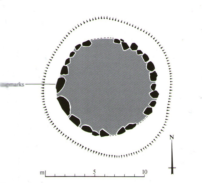
Section of the Ninewells ringPlan of the Ninewells ring (after RCAHMS)
Although rightly classed as a cairn circle or ring-cairn, I’ve seen sites like this labelled as ‘stone circles’ in the past — and it’s easy to see why once you’re inside this! If the internal scatter of cairn-material had been cleared in earlier centuries—as with many others—this site would be classed as a typical stone circle. Curiously it hasn’t fared too well in archaeological surveys, but thankfully the Scottish Royal Commission (1994) lads included the site in theirs, telling us,
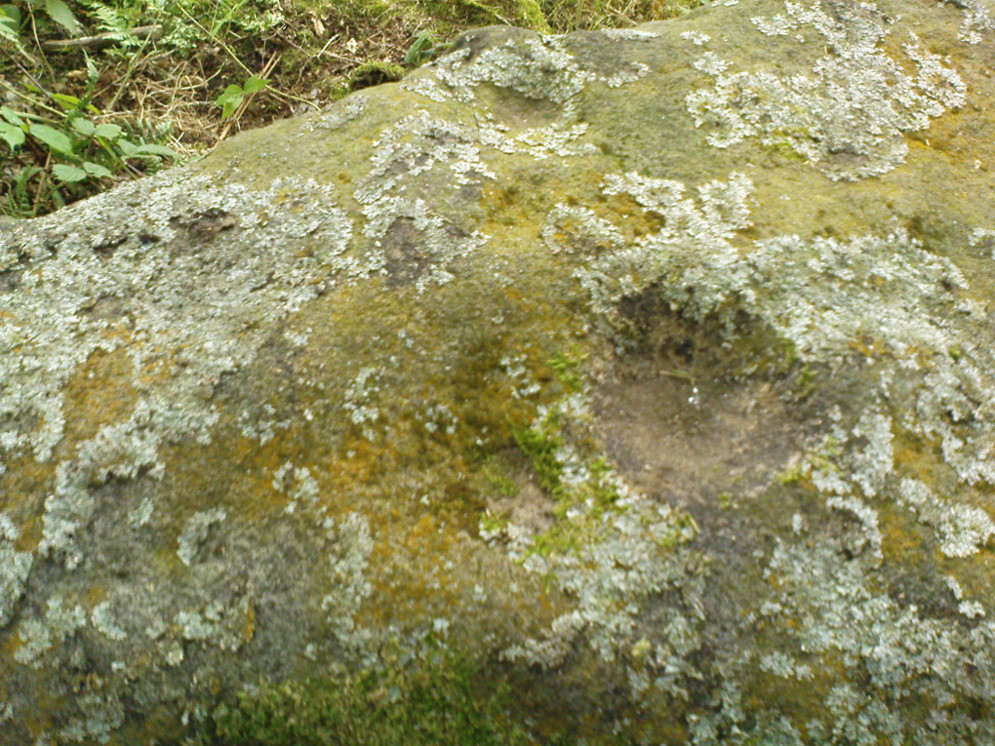
“This cairn measures 10m in diameter and 0.75m in height and has a near-complete kerb of large contiguous boulders and slabs set on edge. The kerb is graded so that the largest, though not the tallest stones are situated in the southwestern quadrant, and one of the stones on the west bears four cupmarks. Today the cairn material is roughly level with the top of the kerbstones, but there is no evidence to suggest that it has been heavily robbed and it was probably never much higher. Concentric with the kerb there is an external platform about 0.2m high. This type of feature is more usually associated with Clava ring-cairns and passage graves around Inverness, which are believed to be of late Neolithic date; but, despite the disturbance of the centre of the Ninewells cairn, there is no evidence of stones defining an internal court.”
Two of the largest stones
Some broken quartz stones were also found inside this ring. The cup-marked stone on the west side of the circle has an entry of its own. Whether or not the ‘opening’ or lack of stones in the north of the ring was intentional can only be known with certainty if an excavation happens here; suffice to say that North is the airt or direction most commonly representative of the Land of the Dead in many early northern cultures, which may explain this. A truly fascinating site…
The name ‘Ninewells’ derives from a cluster of healing springs of water that once flowed nearby. Several legendary waters with this name can be found in this part of southern Perthshire.
References:
Royal Commission on the Ancient & Historical Monuments of Scotland, South-East Perth: An Archaeological Landscape, HMSO: Edinburgh 1994.
From Balquhidder village, take the road east towards Auchtubh as if you’re heading to the Clach nan Sul or Wester Auchleskine cup-marked stones. Before reaching either of these sites, a few hundred yards on the road as you pass Tom na Cruich on the right-side of the road, you need to look in the next field past this house. About 40 yards past here in the field, and less than 10 yards from the wall, you can see the large rock from the roadside. If not, you’re damn close! Ask the owners of the adjacent house, who are very friendly and helpful.
Archaeology & History
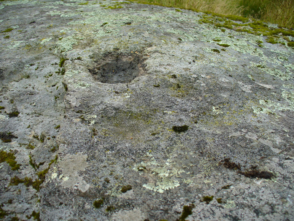
This curious, large, man-made cup-marking or bowl was first described in J.M. Gow’s (1887) essay on Balquhidder antiquities. He wrote:
“Regaining the high road, and still going east, about 40 yards from the cottage of Mr Macdiarmid, there lies just inside the road dyke a large five-sided stone, about 8 feet long by 5 feet broad at the broadest part, and about 2 feet above ground. It is called “Basan an Sagairt” (the Priest’s Basin). When the present road and dyke were made, its name must have saved it. The hollow or basin is 18 inches in diameter and 6 inches deep, and is unmistakably artificial. The stone is the mica slate of the district, hard and granitic.”
Looking down on the basin
The large bowl here was also deemed to be artificial by members of Ordnance Survey and Royal Commission archaeologists who have inspected the site. It is thought to have been a healing stone of some sort, or at least possessed some religious function, but we have no records stating this with any certainty. In examples similar to this, the water which collects in the carved bowl is deemed to have curative properties. It may have been a christian attempt to take locals away from magickal healing stone practices enacted at the Clach nan Sul, or Stone of the Eyes, just a couple of hundred yards along the road east of here. Or it may have being a stone used by indigenous medicine men for other medicinal purposes.
Carved stone in one of the fields across the road
On the other side of the road from here, in the field immediately past Wester Auchleskine farm, as you go through the gate just ahead of you is a rounded earthfast stone with a similar man-made circular impression like the Priest’s Basin carved upon it. (NN 5451 2089) However, this carving doesn’t appear to have been finished. Whether it has any mythic relationship to the Priest’s stone or the cupmarked rocks at Wester Auchleskine in the same field, is not known.
References:
Gow, James M., “Notes in Balquhidder: Saint Angus, Curing Wells, Cup-Marked Stones, etc”, in Proceedings of the Society of Antiquaries Scotland, volume 21, 1887.
From Balquhidder village, walk eastwards along the road for a few hundred yards until you reach Auchleskine Farm on your left. A short distance past here there’s a gate taking you into the rough field on the left. Go through here and note a large clump of rocks diagonally up the slope about 100 yards away. That’s your spot!
Archaeology & History
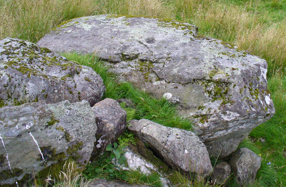
Very little has been said of this large cup-marked stone, just up from the road near Balquhidder. It was first found and described in J.M. Gow’s (1887) fine essay on the local antiquities of the area, where he told:
“About 400 yards directly east from the farm-house there is a group of three large water-worn boulders of coarse mica-schist, with veins of quartz, the largest of which is about 15 feet long, 7 feet broad, and nearly 5 feet above ground. On the top of this stone there are seven cup-marks of various sizes. The largest are 5 inches in diameter and 2 inches deep; the smaller ones are shallower and from 1½ to 2½ inches in diameter. There may have been more marks on this stone, as a portion of the top near the marks has been broken off, and there are several other faint hollows, but, in my opinion, not sufficiently pronounced to indicate that they ever were cups.”
Cupmarks on top of the rockThe carving from above
Although his caution on the number of cups on the stone is to be commended, it was obvious during our visit to the site a few days ago that there are at least 18 cup-marks on the surface of this large rock. There may be more (the grey cloudy day and misty light wasn’t good in allowing us to see the carving clearly). The most pronounced of the cups are on the very top of the stone, whilst others were carved mainly on the eastern slope of the rock.
At least two other cup-marked stones occur at the farmhouse itself, whilst on the road immediately below was once the cup-marked healing stone known as Clach nan Sul. It’s likely that other carvings are hiding away in the hills hereby…
References:
Gow, James M., “Notes in Balquhidder: Saint Angus, Curing Wells, Cup-Marked Stones, etc”, in Proceedings of the Society of Antiquaries Scotland, volume 21, 1887.
Looking down Balquhidder Glen from Clach nan Sul’s old home
Apparently destroyed, although some remains of the stone were said to be seen in the walling by the roadside; but when visiting this spot a few days ago the summer vegetation had completely covered any potential finds here. The stone fell foul of the usual self-righteous industrialists when the track alongside which it had sat for countless centuries was turned into a road and the stone was “blasted”. It was found some 20 yards below the large cup-marked stone known as Wester Auchleskine, seen amidst the clump of rocks in the field above.
The stone was described in MacKinlay’s (1893) fine survey on Scottish holy wells due to the healing properties of the waters that collected into the rock basin here. The earliest record of the site that I’ve found comes from the hallowed papers of the Scottish Society of Antiquaries, where—in J.M. Gow’s (1887) rambles just east of Balquidder—he told us the following:
“Going still further east to the first turning of the road beyond the farmhouse of Wester Auchleskine, and on the left-hand side, there used to be a large boulder with a natural cavity in its side, famous as a curing well for sore eyes. This stone was called “Clach nan sul” (the Stone of the Eyes). In 1878 the road trustees caused it to be blasted, as it was supposed to be a danger in the dark to passing vehicles. Its fragments were broken up, and used as road metal.”
Whether or not the site known as the Priest’s Basin, or Basan an Sagairt—a couple of hundred yards west by the roadside—was of a similar nature, or an attempt by christians to draw people away from the old healing Clach nan Sul and use this other one instead, we do not know. There are numerous accounts of other stones in this mountainous region of Scotland where rocks-with-hollows filled with water were attributed with healing properties, like the Whooping Cough Stone at Struan, the Measles Stone at Fearnan, and many others.
Folklore
The folklore described by Mr Gow was reiterated in MacKinlay’s (1893) survey. He also told how,
“The hollow in the Clach-nan-Sul at Balquhidder…contained small coins placed there by those who sought a cure for their sore eyes. Mr J. Macintosh Gow was told by some one in the district that ‘people, when going to church, having forgotten their small change, used in passing to put their hands in the well and find a coin.’ Mr Gow’s informant mentioned that he had done so himself.”
References:
Gow, James M., “Notes in Balquhidder: Saint Angus, Curing Wells, Cup-Marked Stones, etc”, in Proceedings of the Society of Antiquaries Scotland, volume 21, 1887.
MacKinlay, James M., Folklore of Scottish Lochs and Springs, William Hodge: Glasgow 1893.
Follow the directions to reach Panorama Woods carving 232. Barely a yard or two southwest across the small gap where the kids have their little den or hideout, this long curvaceous rock is the fella in question.
Archaeology & History
Cup-markings on the rock
Curiously not included in the ‘official’ records, this large piece of rock, living right in between the Panorama Woods carvings 231 and 232, has at least two, possibly three faint cup-marks etched in the top northeastern portion of the rock. Of the same style and probably period as the basic designs on stones 230 and 231, this is one in a cluster of petroglyphs that used to live at the edge of a prehistoric enclosure, destroyed at the end of the 19th century.
References:
Bennett, Paul, Of Cups and Rings and Things, unpublished: Shipley 1981.
Bennett, Paul, The Panorama Stones, Ilkley, TNA: Yorkshire 2012.
Take the Wells Road from Ilkley centre up towards White Wells, bending to the right as you hit the edge of the moor. Keep along the road, past the old college building with its lake and turn right up Westwood Drive. Keep going all the way up till you hit the small woodland on your right. Where the woodland ends – stop! Walk into the trees about 10-15 yards and you’ll see the large rocks ahead of you. Amongst other petroglyphs hereby, you’ll find this carving is on one of them.
Archaeology & History
Close-up of deep cups & grooves
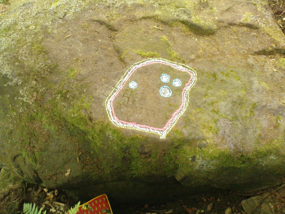
Although only given the usual dry description by our academic catalogue chaps, there’s something about this design that I’ve always liked. We first came across it ourselves in the late 1970s, in search of the legendary Panorama Stones, and found instead this large enclosure design with at least three cups inside it, still clearly visible. It is one of a cluster of carvings hereby, all of which were once adjacent to a prehistoric enclosure, described in the 1880s and destroyed soon after. This and the associated carvings very probably had some archaeocentric relevance to the lost enclosure.
Large carved ‘enclosure’, recently chalkedDrawing of the carving (after Hedges 1986)
The carving is sandwiched in between its petroglyphic companions, stone 231 and stone 233. As can be seen on some of the photos here, more recent vandalism has been inflicted on this carving and the recent chalk colouring is what local archaeologists Gavin Edwards and Alex Gibson have termed “social history”, implying fallaciously that cup-and-ring art could be seen as little more than neolithic and Bronze Age scribblings on rock, without any meaning other than it being comparable to “Leeds United Rules OK.” They may be right (highly unlikely) – but in reading copiously about prehistoric petroglyphs in cultures beyond the UK, we find that traditional societies tell such carvings relate to their creation myths, or river spirits, or rock spirits, and are intrinsically related to wider animistic cosmologies and social customs. This indicates, to me at least, that modern archaeologists who think of rock art as little more than childish scribblings still have a great deal to learn and we should beware their uneducated musings about our ancient carvings.
Although the complete carved ‘enclosure’ and its internal cups were mistakenly drawn in John Hedges (1986) survey, he described as being a,
“Roughly incised ‘enclosure’ with five cups in it, twenty eight shallow cups or depressions, one large oval marking, three irregular basins.”
In the later work of rock art students Boughey & Vickerman’s (2003), they simply said of the site:
“Large flat-topped, upstanding rectangular rock. Twenty-eight shallow cups, a few enclosed in two groups by grooves; irregular small basins.”
References:
Bennett, Paul, Of Cups and Rings and Things, unpublished: Shipley 1981.
Bennett, Paul, The Panorama Stones, Ilkley, TNA: Yorkshire 2012.
Boughey, Keith & Vickerman, E.A., Prehistoric Rock Art of the West Riding, WYAS: Wakefield 2003.
Hedges, John (ed.), The Carved Rocks on Rombalds Moor, WYMCC: Wakefield 1986.