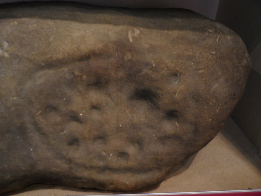
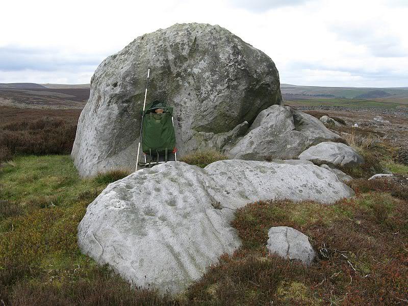
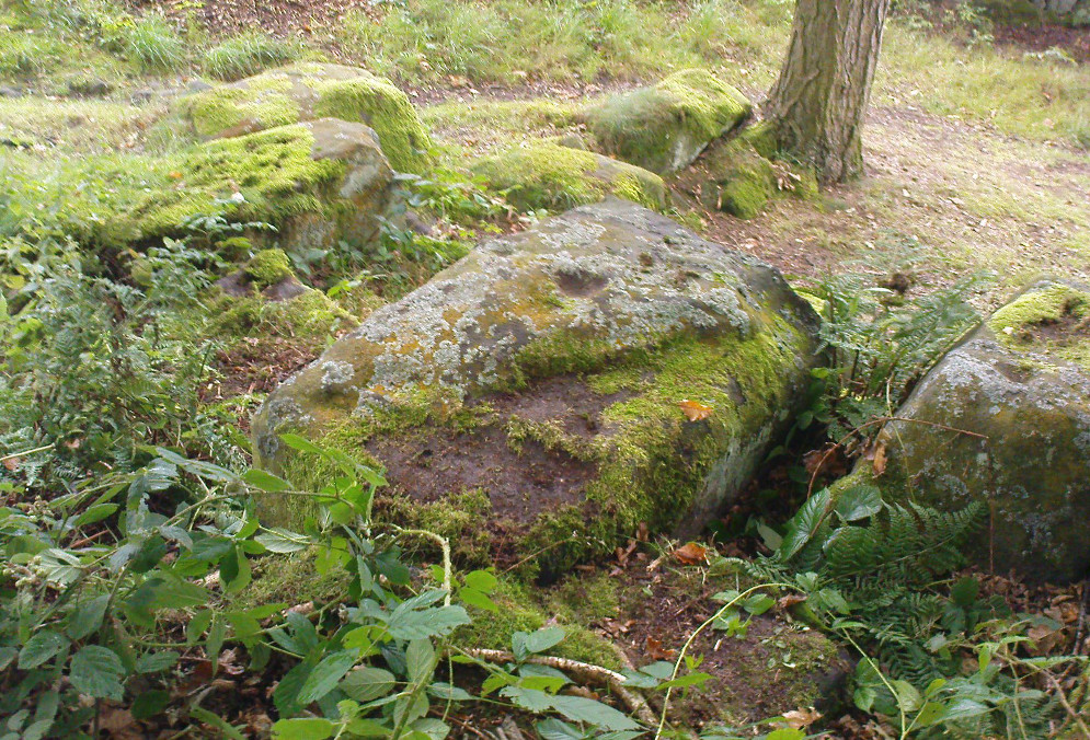
This is another carving (one of three here) that was removed from its landscape setting when found during excavations of the Iron Age hillfort of Ball Cross in the 1950s, and then placed into a box in Sheffield Museum, decontextualizing it and leaving future researchers slightly in the dark as to its possible nature. In removing the carving from its site, the stone was left with additional scratches and grooves slightly damaging the stone. Not good!
Ball Cross Carving (after Beckensall)Ball Cross Carving (after A. Cooper)
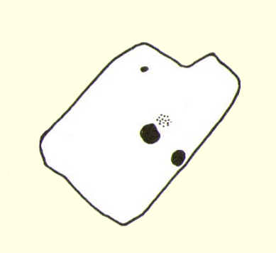
Although unlike the Ball Cross 2 and 3 carvings, the design here is structurally very similar to that found east of Gardoms Edge, with this one comprising of a large unbroken carved oval, with at least twelve cup-marks inside. Or as Beckensall (1999) described, it “has 12 cups inside a flattened ring.” Again, like the Gardoms Edge carving, a single cup-mark was etched outside of the enclosed ring. It was found with its companion carvings built into the main walled structure of the hillfort. It’s unlikely that the stones date from the same age as the hillfort: more probable that they were re-used in the structure, with their mythic nature perhaps already long forgotten…
References:
Barnatt, John & Reeder, Phil, “Prehistoric Rock Art in the Peak District,” in Derbyshire Archaeological Journal, 102, 1982.
Beckensall, Stan, British Prehistoric Rock Art, Tempus: Stroud 1999.
Beckensall, Stan, Circles in Stone: A British Prehistoric Mystery, Tempus: Stroud 2006.
Cooper, Ali, Archaeology Walks in the Peak District, Sigma: Wilmslow 2010.
Morgan, Victorian & Paul, Rock Around the Peak, Sigma: Wilmslow 2001.
Stanley, J., “An Iron Age fort at Ball Cross Farm, Bakewell,” in Derbyshire Archaeological Journal, volume 74, 1954.
Acknowledgements: HUGE thanks to Dean Thom for the use of his photo, plus helpful data on this site.
Cup-and-Ring Stone: OS Grid Reference – SK 2752 7328
Archaeology & History
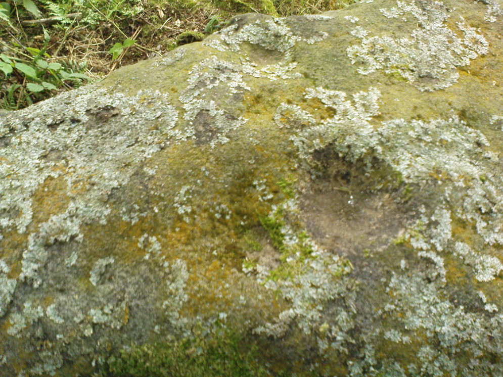
Gardoms Edge 2 carving, in Sheffield Museum (photo – Dean Thom)
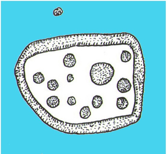
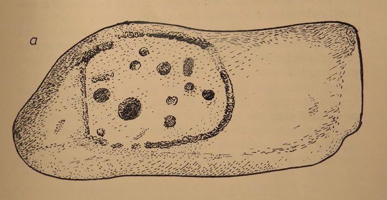
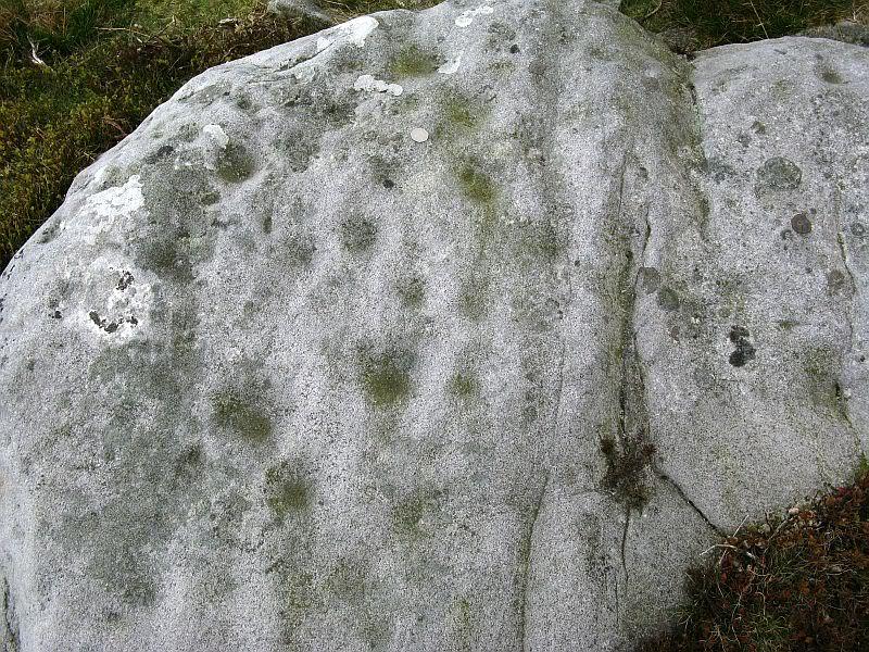
This carving is one of two cup-and-ring stones that were removed from this area and transported to Sheffield Museum, decontextualizing them from their landscape presence (this should not be done unless very severe damage is happening, or their destruction is imminent). It’s quite an intriguing carving, similar in design to one found not far away at Great Hucklow, the Middleton Moor 479 carving, etc. Like many Pennine cup-and-ring stones, it was located in a prehistoric cairn field (or necropolis), with hut circles not far away too, and really should have remained in situ for the benefit of future researchers.
Gardoms Edge carving (after Beckensall 1999)
The carving was cut into one end of a small rock and comprises of a singular unbroken, large oval, within which are enclosed thirteen or fourteen cups, plus a single cup on the outside of the ring. Lunar associations may be invoked by the 13 cups, enclosed within one cycle of the year. But I’m speculating of course. It’s probable that other carvings in the area remained undiscovered.
References:
Barnatt, John & Reeder, Phil, “Prehistoric Rock Art in the Peak District,” in Derbyshire Archaeological Journal, 102, 1982.
Barnatt, John & Robinson, F., “Prehistoric Rock Art in Ashover School and Further New Discoveries Elsewhere in the Peak District,” in Derbyshire Archaeological Journal, 123, 2003.
Beckensall, Stan, British Prehistoric Rock Art, Tempus: Stroud 1999.
Beckensall, Stan, Circles in Stone: A British Prehistoric Mystery, Tempus: Stroud 2006.
Acknowledgements: HUGE thanks to Dean Thom for the use of his photo here.
Take the B846 road out of Aberfeldy over the bridge towards Dull and Weem. As you go through Weem, watch closely for the signpost directing you into the trees of Weem Rock and Woods on the right. Follow this tiny road up until you reach the parking circle in the edge of the trees. Follow the directed footpath up into the woods & keep to the winding track, keeping your eyes peeled for the first large rocky crag above you, with a huge tree growing out of the edge. Once you get to the top of the steps and onto these crags, look right in front of you!
Archaeology & History
The nearest ‘officially recognised’ cup and ring carvings to the one we’re gonna see here, are those described by Kaledon Naddair (1990) in his brief descriptions of the Glassie Farm carvings a short distance northeast in the same woods. Other than that, I can find no account of the carvings I’m about to describe – other than a couple of short local history walking guides, which tell that one of the carvings here is “modern.” And that much is plainly evident.
Close-up of one section of the main design
There are at least seven carved stones here – all very close to each other on the top of an impressive crag with a large old tree growing out of the edge of the cliff. But the carvings are located on the flat ground above the cliffs and, it would seem, may well be modern. But I thought that since there are no accounts of the site on-line and no remarks in the Canmore registers, they should be mentioned as future students may mistake them as ancient. There is the possibility (unless someone can show us otherwise) that one or two of them are prehistoric, but I think it’s best we surmise that they are all recent additions in the landscape for the time being. And damn good designs they are too!
The triangular rock designs
The first and most notable of the group of seven (at least), is on the large earthfast triangular flat rock, pointing out to the cliff’s edge and the hills across the valley. This is where the greatest cluster of multiple cup-and-rings can be seen. Double- and triple rings surround several of the central cup-markings, with the traditional lines running out from the central cup. There are a great number of single cups scattering the surface; and we also find a typical ‘rosette’ element, comprised of a central cup surrounded by eight singular cups, which some students have interpreted as solar and lunar symbols (amongst other things) when found on other carvings (there is a prehistoric Rosette Stone is known on Ilkley Moor; but similar examples are known in Ireland, Northumberland and elsewhere).
Below this triangular rock (perhaps attached beneath the) is another long piece of earthfast stone, with more carvings on. But when Lindsey Campbell and I came here yesterday, it was obvious that some elements along this section of stone were carved in recent years. Two double-cup-and-rings are at the bottom-left of this section of rock, with a scattering of other cup-marks reaching across its surface. Several of these are obviously quite new.
Another multiple cup-and-ring
The third notable example is to the top-right of the triangular rock. This stone is mainly of quartzite rock, apart from near the top-end, where another multiple cup-and-ring (four, with a possible fifth broken ring fading away) stand out very blatantly. This carving also seems to be not that olde…
From this third quartz carving, look 10 yards (if that!) back towards the trees and there’s a large boulder. On the surface of this is another multiple cup-and-ring that was very obviously new, and several other cup-markings, also quite new. I presume that the other sections carved onto this stone have also been etched by the same modern artists.
Another boulder with new carvings
As I looked back to the main triangular carved stone, I noticed other small pieces of stone peeking up from the ground and, upon closer inspection, found one small rounded triangular piece with another multiple cup-and-ring that just fit onto the rock. And close by this was another long piece of stone which, when I rolled the turf gently back, found three simple cup-markings along the surface.
A seventh carving was found on one of the rocks that is falling slightly down the slope, close to the fourth ‘new’ carving that I described. This was heavily covered in moss and autumn’s fallen leaves, and I wasn’t about to take the moss away just for the sake of my curiosity. But it was obvious that other cup-markings were on the sloping face of this large stone.
We’ll have to venture back here soon and get some better photos and, with any luck, find some old locals who can tell us when the carvings first appeared. It’s quite a superb spot for a bimble, with the healing waters of St. David’s Well and his cave close by—and the woods were, so local legends tell, inhabited by dragons and good heathen creatures in centuries past. But the proximity of the Druid school—formed by the Ionian druids no less—around the 6-7th century, may have thankfully preserved these old tales and relate to some of the many other monuments found in this area. Although some of these carvings (possibly all) are of recent years, this is a gorgeous spot well worth exploring… And if anyone knows precisely when they were done – please let us know!
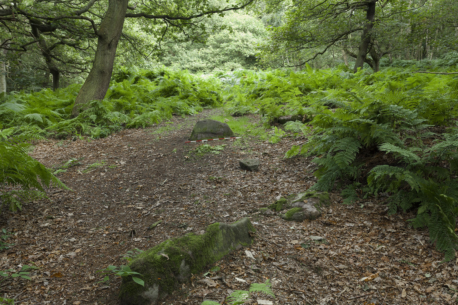
Mike Short tells: Walk ENE along Thornhill Drive (no vehicular access) to gate across road at the last house on the Drive and continue on for approx 475m where road starts to narrow slightly, becomes a little steeper and gently turns to E. Thornhill Drive is now cut into the hillside at this point with an upwards sloping bank on the S side of the path. After approx 25m further on at approx SE 20375 37950 look out on the S side of the path for a pile of boulders sitting on bedrock on top of the bank and a large rectangular tabular rock on the side of the bank. Ascend the bank and from the boulder pile the panel is approx 22m 200º(T) in the middle of an ephemeral E-W path more defined to W.
Archaeology & History
The profile (and ‘How to Get There’) for this recently discovered cup-marked stone was forwarded to me by fellow rock art explorer, Mike Short. The carving is another basic design found in Calverley Woods, between Leeds and Bradford, nearly halfway between the missing petroglyphs of West Woods 2 and Sidney Jackson’s Calverley Woods Stone. Rediscovered by Lisa Volichenko some time ago, Mike described the new carving here as follows:
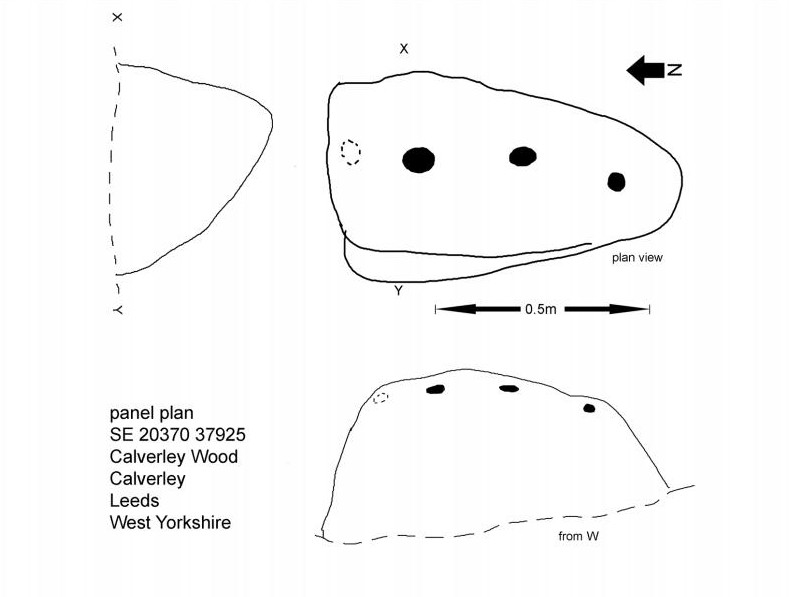
Sketch of the carving (courtesy Mike Short)Cup-Marked Stone nr centre (courtesy Mike Short)
“Panel is carved on W sloping face of a sub-triangular earthfast coarse-grained sandstone boulder 0.81m X 0.50m X 0.38m, the longest axis lying almost exactly N-S. Carving consists of 3 cups, the most N of which is elliptical approx 65mm X 55mm; the central cup is elliptical approx 50mm X 40mm and the most S is circular diameter approx 40mm. On the N edge of the W face is a shallow elliptical depression thought to be of natural origin. There is an area of damage along the ‘crest’ of the boulder close to its S end.
“Carved rock is the most E of five rocks, measuring between 0.70m and 1.15m in length, in very close proximity forming an arc, 3 of which are in the footpath and one of which is resting on a large slab of rock almost completely covered by soil and vegetation.”
And so the small number of cup-marked stones in this woodland slowly grows. One wonders how many more are hidden beneath the roots of the trees—and are all of the lines and cups atop of the great Hanging Stone, a short distant away, all Nature’s handiwork…?
Acknowledgements: Huge thanks for Mike Short for the data, photos and sketch of this carving.
Take the A59 road from Harrogate and Skipton and at the very top of the moors near the Gill Head Enclosures, take the small Kex Ghyll road up past the disused quarry works north for a mile or so. At the junction go left, past the Outdoor Centre, thru West End up Whit Moor Road, then go left down to Brays Cross Farm and over the ford. Note the clump of trees on the moors to the west and take the path there. Once here, a large outcrop of rocks will be seen about 150 yards on the moor to the west. That’s the spot! Otherwise, follow the directions of the legendary wandering Teddy!
Archaeology & History
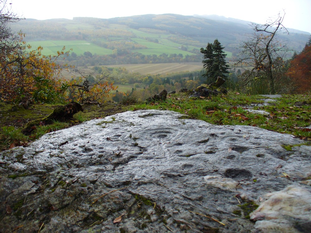
This dramatic looking outcrop of rocks rising out of the ground a half-mile due west of Bray farmhouse has long been known as the rocks of the ravens: oracular birds of ill-omen in all peasant traditions, yet carrier birds of shamans in their Underworld ventures, from accounts in Russia and Scandinavia, through the Scottish highlands and into Yorkshire’s northern hills, as folklore records show. Whether such mythical figures used the Raven Stones here for such magick, we have no firm accounts; but the existence of the many cup-markings on this particular rock (and others in the outcrop) show that animistic traditions of some form or another occurred here in prehistoric times at the very least.
Looking across the stoneLooking down on the cups (after QDanT)
Records of this place as an archaeological spot are scant indeed. It is passed with barely a mention by those Victorian antiquarian giants, Bogg, Grainge and Speight. The rock art students Boughey & Vickerman (2003) give the wrong grid reference here, but added the site to their inventory, saying only that it is “long, low, exposed bedrock. 22-25 cups; some very weathered and smooth.” A series of channels runs down the slope of the stone, but there are probably natural. However, a cup-and-line does occur on the eastern side of the carving.
References:
Armstrong, Edward A., The Folklore of Birds, Collins: London 1958.
Boughey, Keith & Vickerman, E.A., Prehistoric Rock Art of the West Riding, WYAS: Wakefield 2003.
Take the B6265 east out of Grassington, thru Hebden, for another 2 miles till you pass the tiny road down to Skyreholme on the right. Another few hundred yards on, past Nussey Farm and Dry Gill house, park up and look for the track going south into the moors. Go down the track called Black Hill Road for a few hundred yards till y’ reach the gate on the right. A track bends downhill to the psilocybin-rich pastures of Nussey Green. Several hundred yards on, to the right-hand side of the track, we find this and its companions. Look around!
Archaeology & History
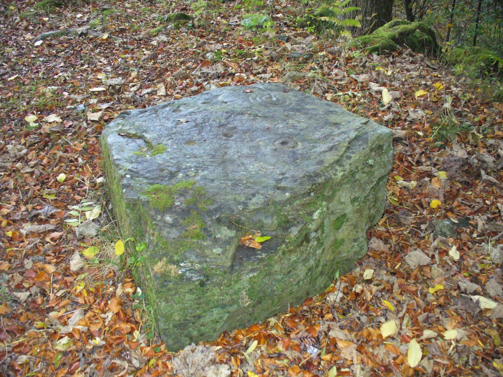
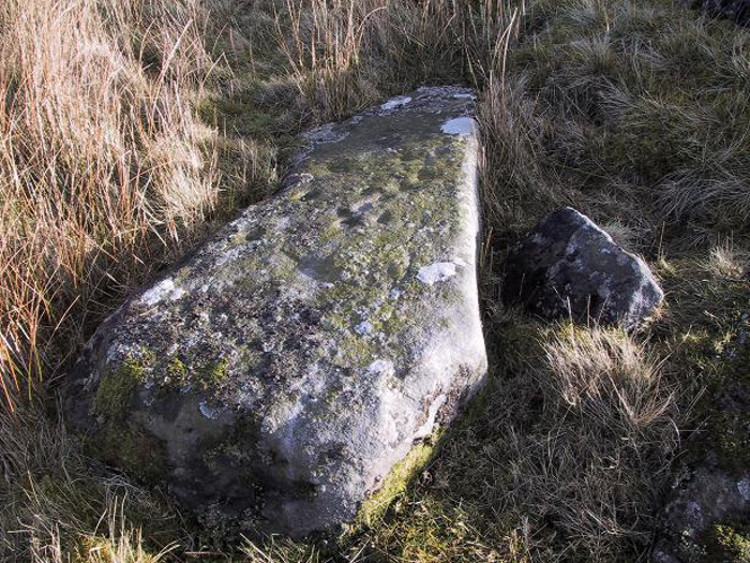
Quick sketch of design
This medium-sized, recumbent standing-stone-shaped boulder has perhaps fifteen cup-markings on it. It’s a plain carving with others of a similar ilk in the area. First described by Stuart Feather in 1970 as one of “two cup-marked rocks” he found when ambling around; in Boughey & Vickerman’s (2003) survey they give it the wrong grid reference, though describe it correctly as a “long flat rock of irregular outline (with) fourteen to sixteen cups.” A cluster of other carvings are nearby, though some have been destroyed through mining operations.
References:
Boughey, Keith & Vickerman, E.A., Prehistoric Rock Art of the West Riding, WYAS: Wakefield 2003.
Feather, Stuart, “Appletreewick, W.R.,” in Yorkshire Archaeological Register, 1969, Yorkshire Archaeological Journal, part 168, 1970.
From Ilkley, take the directions up to the Panorama Woods 232 carving. From here you can step from this rock over the stride onto the cup-marked carving 231b, and then go onto the next adjoining rock surface a little lower down. From here, you’ll see another mossy rock surface in front of you by a yard or two. That’s the one!
Archaeology & History
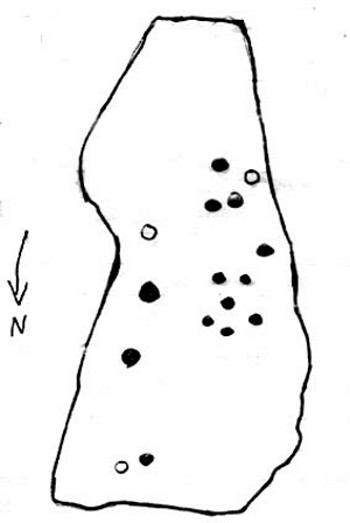
The three cup-markings
Here’s another simple cup-marked stone, probably only for the purists amongst you—although in visiting here please take into account the primary carving’s association with other more prominent designs that once existed only a few yards to the west where the houses now stand. There is also the cluster of other carvings right next to this stone. A prehistoric settlement was also in evidence adjacent to this carving which was destroyed in the latter half of the 19th century.
Close-up of the cupsJohn Hedges 1986 drawing
Described simply in John Hedge’s (1986) fine survey as a small “piece of rock with three clear cups and one depression.” Boughey & Vickerman’s (2003) survey added nothing more and merely copied the same words. For some reason or other (mebbe cos I’m simple!) I really like this otherwise innocuous design and its close simplistic relatives. It’s probably due to the trees amidst which the stones are found and the bright mosses on the rocks, giving the site a slightly extra sense of more living genius loci than others on the top of these moors, where the winds move the subtle spirits with greater ease.
19th century addition
If you step down and look at the vertical side of this stone, you’ll notice a more modern stylistic carving etched onto the surface. Not as deep as the prehistoric cups on the top, it seems probable that a local artist by the name of Ambrose Collins carved this on here (and other similar designs on other rocks nearby) in the late 19th century.
References:
Bennett, Paul, The Panorama Stones, Ilkley, TNA: Yorkshire 2012.
Boughey, Keith & Vickerman, E.A., Prehistoric Rock Art of the West Riding, WYAS: Wakefield 2003.
Hedges, John (ed.), The Carved Rocks on Rombalds Moor, WYMCC: Wakefield 1986.
Although now seemingly lost, it’s location is damn close to this: Along the A657 between Greengates and Bradford, where the New Line meets Carr Road, the dirt-track takes you into Calverley Woods, down Eleanor Drive. About 250 yards along (just before you get to the field on the left), take the footpath down the embankment towards the stream where it bends to the left and where the land levels out (don’t cross the stream). It’s somewhere round there!
Archaeology & History
This was one of two previously unrecognised carvings we came across sometime in 1985 (see West Woods 1 stone), when we were seeking out another missing carving in the same woods. It was clear and well-defined as the faded photo here shows; but having been back to try find it twice in the last two years in the hope of getting better photos, I’ve been unable to locate it. The carving was described in an article I did in an old earth mysteries magazine. It comprises simply of a large ring surrounding and enclosing two deep cups, which were linked to each other by a connecting carved line. Parts of the stone had been chipped in parts—including a section of the large ring— due to some industrial workings that had happened here in the past. Thankfully I managed to find the old photo and hopefully, perhaps, some local explorer could try and seek out where it’s hiding beneath the trees and other vegetation.
References:
Bennett, Paul, “The Undiscovered Old Stones of Calverley Woods,” in Earth no.2, 1986.
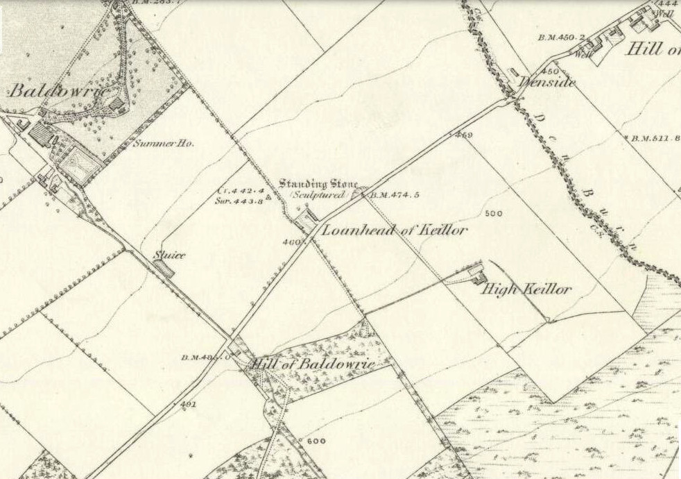
Take the minor road that runs from the small town of Newtyle (in Angus) westwards to Kettins (in Perthshire). Less than a mile on, go up the first turn-off on your left to Kinpurnie Castle and continue (past the castle) for less than a mile. Keep your eyes peeled on the right-hand side of the road, opposite the drive to High Keillor – and you can’t really miss it!
Archaeology & History
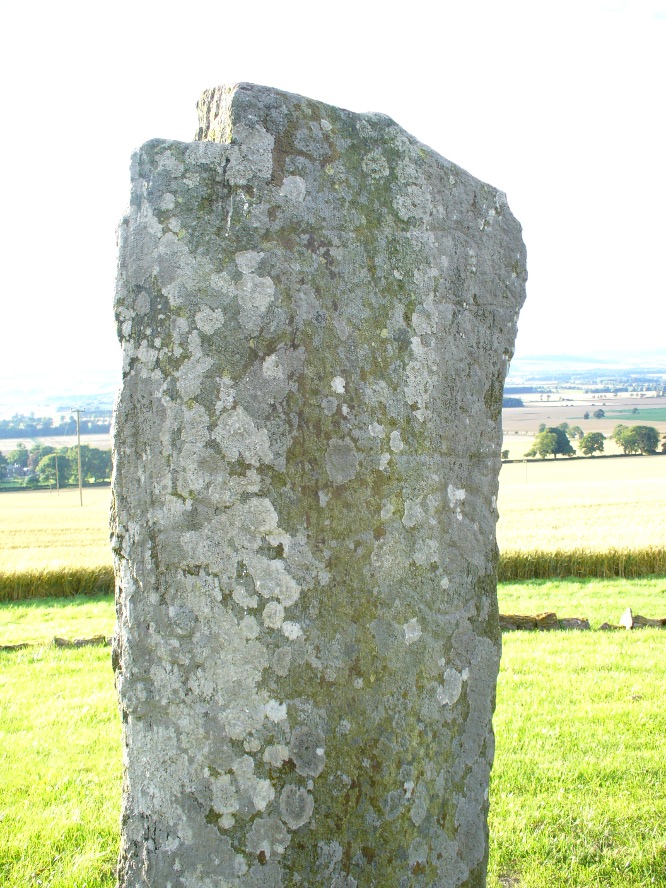
Another feel of Keillor’s Stone
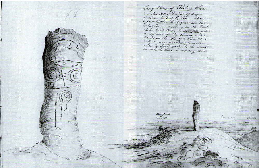
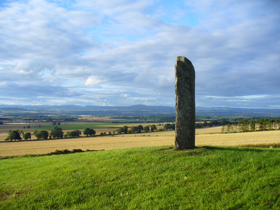
A fascinating site in an excellent setting. Here we have a 6-7 foot tall standing stone living upon a what is most probably a Bronze Age tumulus (possibly neolithic, but we aint sure), on whose south-face were carved a series of Pictish symbols many many centuries ago. In the surrounding district there is a vast wealth of similar sites (and many destroyed, like the lost Hill of Ballunie stone circle only a few hundred yards along the road), highlighting that this region was very important indeed to the prehistoric peoples of Strathmore and the Sidlaw Hills.
W.J. Skene’s 1832 drawing
The Keillor stone was described and illustrated by several of the giant Scottish antiquarians. When James Skene visited the site in the 1830s, the tumulus upon which the stone stands was still pretty complete, as his old drawing from 1832 clearly shows. Since then the track beside the monument has widened and the road took away half of the burial mound. But the place has lost little of its majesty.
Another 19th century historian, William Oliphant (1875), when describing the beauty and history of the Sidlaw Hills, below whose edges the old hamlet of Keillor stands, told of this,
“old and striking monument, making the spot on which it stands historical, though no syllable of the history has come down to us. It is, one writer says, “one of those remarkable sculptured monuments of the ancient inhabitants of Scotland, embellished, in this instance, with the rude outline of the boar.” Another writer says, “at Baldowrie there is an erect Danish monument six feet high. It contains some figures, but they are almost entirely defaced.”
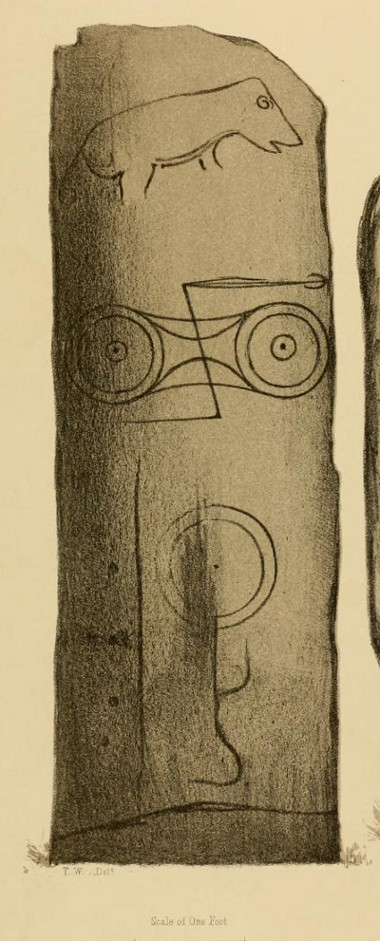
In John Stuart’s (1856) superb magnum opus he told that this carved pillar with “a boar” on it, standing on an ancient “tumulus of earth and stones” was found to have evidence of several burials inside when a dig at the site occurred which, he told, “I was present (at) in the autumn of 1854.” He described the site as follows:
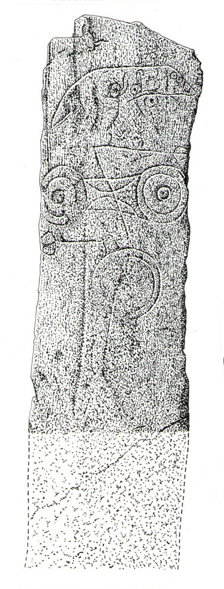
Stone with carved symbols (after RCAHMS 1994)Stuart’s 1854 drawing of the carved stone
“The Stone at Keillor is placed on a tumulus on the north slope of the Hill of Keillor, in the Parish of Newtyle, and Shire of Forfar. It is a rough stone, formed of gneiss, convex in front, and rugged behind. The tumulus on which it is placed is formed of earth and stones, and several cists containing bones have been found in it. Ancient sepulchral remains have also been dug up in various parts of the adjoining field.
“The stone was broken across some years ago about a foot above the ground, but the parts have recently been clasped together, and the stone replaced in its original site by orders of Lord Wharncliffe. The present drawing was made with much care by Dr. Wise, and is more perfect than the copy in Mr. Chalmers’ volume. The surface of the stone is so rough, that it is sometimes with difficulty that the incised lines can be satisfactorily distinguished from natural fissures, but having examined the stone in a variety of lights, and compared Dr. Wise’s sketch with the original, I am inclined to think that the drawing is as satisfactory as can now be obtained. There is a rough sketch of the stone among Dr. Hibbcrt’s papers, with a supposed Gaelic inscription at the top, meaning “the burying place of the slain,” furnished to Dr. Hibbert by the late Mr. Donald Gregory. Of such inscription 1 could see no trace.”
The old stone himselfFaint carvings just visible
And as far as I am aware, this Gaelic inscription has not subsequently been recorded. But considering the position of the stone in the landscape, it’s understandable if some of the carvings have eroded away by simple weathering. Indeed, when Paul Hornby and I visited here only a couple of weeks ago, despite the weather conditions being excellent, the carvings were difficult to make out. Modern interpretations differ between the topmost animal carving being either a wolf or a boar. Below this we see the more common Pictish symbol described as a double disc and Z-rod symbol, for which academia still struggles to afford cogent explanations.
Keillor stone on 1865 map
Whilst the prehistoric age of the tumulus on which this stone stands is not in doubt, we don’t know exactly when this stone was first erected here. Whilst some of the early accounts—including the Ordnance Survey team who first visited here in 1860—describe it in an upright position, when A.J. Warden (1880) wrote about it in his massive survey of the region, he noted that wasn’t always the case:
“On the north slope of the Hill of Keillor, in the parish of Newtyle, there is a rough stone composed of gneiss, somewhat convex in front but rugged behind. It is placed on a tumulus formed of earth and stones, and several cists containing bones were found in it; while, in the adjoining field, ancient sepulchral remains have also been found. The stone was broken across about a foot from the ground, but the parts have been again united and the stone replaced on its original site. On the stone there is the figure of an animal, below which are the spectacle and other symbols, all incised.”
The stone presently stands on a modern plinth to protect it from the elements and such things. It was erroneously described in the Royal Commission’s 1999 survey of Pictish monuments as being just “1.4m in height”, whereas it is in fact some 6½ feet tall, or around 1.98m.
The Great Pyramid to the northwest
The view from here, east, north and west is superb. The high rolling hills of Angus stretch into the north and eastern skies; whilst more westerly are the grand olde mountain ridges into deepest Perthshire. And looking northwestwards from our old standing stone, one shapely mountain in particular is notable, standing out upon the ridge of distant hills: a great pyramid which I initially thought may have been Ben Vorlich. But thanks to the help of several local people, have found that it is in fact Schiehallion – the great Mountains of the Fairy Folk, about 50 miles away! Some folk think that it may have had relevance in the animistic formula with this monument—and I’ll hazard that it did too…
…to be continued…
References:
Allen, J. Romilly, Early Christian Monuments of Scotland, 1903.
Coutts, Herbert, Ancient Monuments of Tayside, Dundee Museum 1970.
Guthrie, James C., The Vale of Strathmore – Its Scenes and Legends, William Peterson: Edinburgh 1875.
Jervise, Andrew, Epitaphs and Inscriptions from Burial Grounds and Old Buildings in the North-East of Scotland – volume 1, Edmonston & Douglas: Edinburgh 1875.
Mack, Alastair L., Field guide to the Pictish symbol stones, Pinkfoot Press 1997.
MacPherson, J.G., Strathmore: Past and Present, S. Cowan: Perth 1885.
Marshall, William, Historic Scenes of Forfarshire, William Oliphant: Edinburgh 1875.
Royal Commission on the Ancient & Historical Monuments of Scotland, South-East Perth: An Archaeological Landscape, HMSO: Edinburgh 1994.
Royal Commission on the Ancient & Historical Monuments of Scotland, Pictish Symbol Stones: A Gazetteer, Edinburgh 1999.
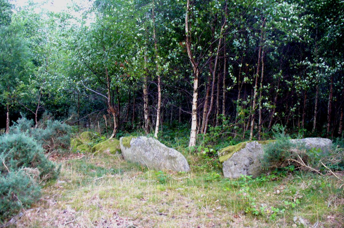
From Dunkeld, head out for a mile or so on the long and winding A923 road, taking your first road right along the Craigie and Caputh road, south of the Loch of Lowes. Go along here for about 2 miles, watching out for the little road to Black Hill on your left, where you can park up (if you hit a road junction, you’ve gone too far). Across the road, note the copse of trees. Go in there along the walling for about 50-70 yards, past the curious gathering of rounded stones, then walk into the trees where the giant fir trees stand. You’re damn close!
Archaeology & History
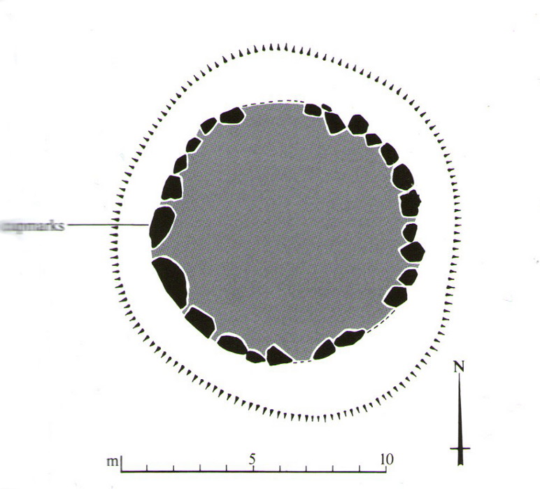
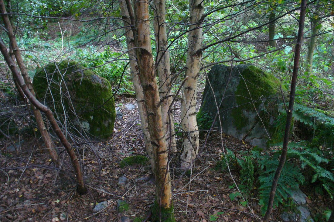
This is an excellent site, hiding away in a scattered copse of woodland, with young trees inside and very old ones in close proximity to its outer edge. We visited the place for the first time in the middle of summer, not knowing anything about it, and found Nature had covered much of the place in Her usual clothes of fern, bramble, gorse and other vegetation. Yet despite this, the site was superb! In a very good state of preservation this ring of small stones is more than 30 feet across, though the stones making up the ring are only small. Within the ring itself you’ll find many young birch trees growing over a mass of small rounded rocks, typical of cairn material such as found at other prehistoric sites of this nature up and down our northern counties, from the overgrown Roms Law, to Temple Wood and many others. No evidence of internal burial or cist of any form was noted on our visit, nor mentioned in the Canmore survey.
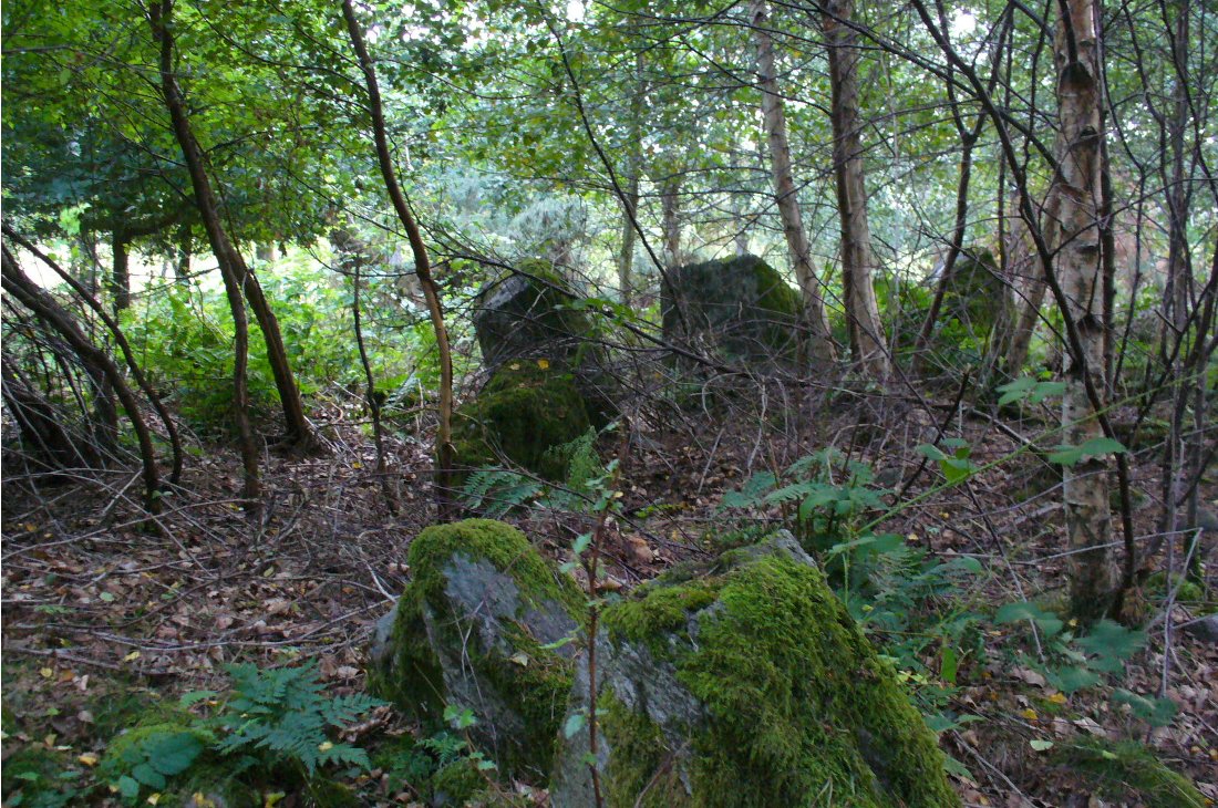
Section of the Ninewells ringPlan of the Ninewells ring (after RCAHMS)
Although rightly classed as a cairn circle or ring-cairn, I’ve seen sites like this labelled as ‘stone circles’ in the past — and it’s easy to see why once you’re inside this! If the internal scatter of cairn-material had been cleared in earlier centuries—as with many others—this site would be classed as a typical stone circle. Curiously it hasn’t fared too well in archaeological surveys, but thankfully the Scottish Royal Commission (1994) lads included the site in theirs, telling us,
“This cairn measures 10m in diameter and 0.75m in height and has a near-complete kerb of large contiguous boulders and slabs set on edge. The kerb is graded so that the largest, though not the tallest stones are situated in the southwestern quadrant, and one of the stones on the west bears four cupmarks. Today the cairn material is roughly level with the top of the kerbstones, but there is no evidence to suggest that it has been heavily robbed and it was probably never much higher. Concentric with the kerb there is an external platform about 0.2m high. This type of feature is more usually associated with Clava ring-cairns and passage graves around Inverness, which are believed to be of late Neolithic date; but, despite the disturbance of the centre of the Ninewells cairn, there is no evidence of stones defining an internal court.”
Two of the largest stones
Some broken quartz stones were also found inside this ring. The cup-marked stone on the west side of the circle has an entry of its own. Whether or not the ‘opening’ or lack of stones in the north of the ring was intentional can only be known with certainty if an excavation happens here; suffice to say that North is the airt or direction most commonly representative of the Land of the Dead in many early northern cultures, which may explain this. A truly fascinating site…
The name ‘Ninewells’ derives from a cluster of healing springs of water that once flowed nearby. Several legendary waters with this name can be found in this part of southern Perthshire.
References:
Royal Commission on the Ancient & Historical Monuments of Scotland, South-East Perth: An Archaeological Landscape, HMSO: Edinburgh 1994.