Tillicoultry House Carving, Tillicoultry, Clackmannanshire

Cup-and-Ring Stone (lost):  OS Grid Reference – NS 9240 9752

Also Known as:

  1. Canmore ID 48255

Archaeology & History

Multiple-ringed carving

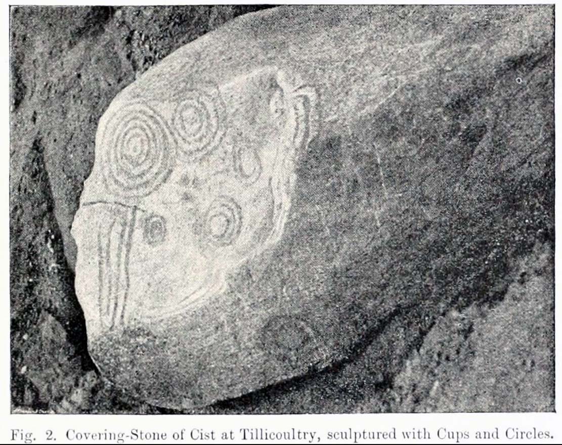
A recent visit to try find this intricate carving—the only one of its kind in Clackmannanshire—proved unsuccessful, and so I add it here in the hope that someone might know where it is and bring it back to light.  It looked like quite an impressive petroglyph.  If the stone isn’t hiding in undergrowth at the edge of someone’s garden, it may well have been destroyed—which would be appalling.  As a unique design, this important carving should have been preserved.  Even when the Victorian explorers found it, the covering stone circle had been greatly damaged and many stones in the ring had been removed.  This carved stone remained intact however.  When Mr R. Robertson (1895) and his friend visited the site, it was covered in sand and dirt and had fallen to the side of an internal cist:

“On clearing this away a remarkable feature was brought to light.  The block was found to be elaborately ornamented on its sides and upper surface, with rings, spirals and lines.  The labour of cutting these in the hard granite with primitive tools of the period must have been very great. Several successful photos of the stone and its carvings were taken by Provost Westwood, Dollar…. This stone has now been removed to the vicinity of Tillicoultry for safety.”

In the same article, George Black told slightly more of the design:

“The covering stone of the cist…bears on the face a series of concentric circles, and spirals springing from one of the groups of circles,  Four grooves also unite the same set of circles with the left-hand edge of the stone.  On the edge shown in the photograph there is another group, consisting of two concentric circles.  The unevenness of the surface of the stone appears to have been of no moment to the sculptor of the circles, as the incisions follow the surface into its sinuosities and depressions.”

Not long after Robertson & Black’s visit, the great megalithomaniac Fred Coles (1899) came here—and he found that the “spirals” that Mr Black described were nothing of the sort.

“The huge irregularly-shaped diorite boulder which covered the cist has several cup-and-ring marks on one face and one side…. These marks are now, so I was informed when inspecting them, very much less distinct than they were when the photograph was taken (above) in 1894.  It would be difficult now to describe the incised markings with accuracy; it is difficult even to see them when wet.  But…I must take exception to the term ‘spirals’ as applied to any of these ‘rings.’  There are three groups of rings so placed as to make the outermost ring in each group touch that of the others (not an uncommon form), but there is no one true volute.

“…What is more noteworthy is the group of four long parallel, nearly perpendicular grooves issuing (probably) from the outermost ring of the group of five rings, and ending at the edge of the boulder.”

Alison Young’s 1937 sketch

Cole also noted that the carvings were to be found on the upper surface of the stone.  It would seem very probable that the excessive erosion which Cole described was due to the fact that the stone was, many centuries earlier, exposed to the elements within the stone circle and not buried as it later came to be.  It makes sense.

The excessive erosion was spoken of by the Royal Commission (1933) lads, aswell as the last person to describe the site, Ronald W.B. Morris (1981), who said that during his visits here between 1966-75,

“the author has only found traces of possible cups visible on the rough surface, which has flaked badly.”

Morris (1981) said that the stone measured “1½m by 1¾m by ½m (5½ft x 4½ft x 2ft)”—and was last known to be some 10 yards NW of the Tillicoultry House cottage, but we could locate no trace of the stone or its carving.  If anyone is aware of the whereabouts or fate of this important neolithic carving, please let us know.

References:

  1. Coles, Fred R., (1899b) ‘Notices of the discovery of a cist and urns at Juniper Green, and of a cist at the Cunninghar, Tillicoultry, and of some undescribed cup- marked stones’, in Proceedings of the Society Antiquaries, Scotland, volume 33, 1899.
  2. MacWhite, Eoin, “A New View on Irish Bronze Age Rock-Scribings,” in Journal Royal Society Antiquaries, Ireland, 76:2, 1946.
  3. Morris, Ronald W.B., ‘The cup-and-ring marks and similar sculptures of Scotland: a survey of the southern Counties, part II’, in Proceedings of the Society Antiquaries, Scotland, volume 100, 1969.
  4. Morris, Ronald W.B., “The Cup-and-Ring and Similar Early Sculptures of Scotland; Part 2 – The Rest of Scotland except Kintyre,” in Transactions of the Ancient Monuments Society, volume 16, 1969.
  5. Morris, Ronald W.B., The Prehistoric Rock Art of Southern Scotland, BAR: Oxford 1981.
  6. Robertson, R., Black, G.F. & Struthers, J., ‘Notice of the discovery of a stone cist and urns at the Cuninghar, Tillicoultry‘, in Proceedings of the Society Antiquaries, Scotland, volume 29, 1895.
  7. Royal Commission on the Ancient & Historical Monuments of Scotland, Fife, Kinross and Clackmannan, HMSO: Edinburgh 1933.
  8. Young, Alison, “Cup-and-Ring Markings on Craig Ruenshin, with some Comparative Notes,” in Proceedings of the Society Antiquaries, Scotland, volume 72, 1937.

© Paul Bennett, The Northern Antiquarian

Castle Craig, Tillicoultry, Clackmannanshire

‘Fort’ (destroyed):  OS Grid Reference – NS 9116 9769

Also Known as:

  1. Canmore ID 48294

Archaeology & History

This ancient fort could once be seen in the ancient woodlands on the western side of the Mill Glen, above the village, going into the Ochils—but it was completely destroyed, as usual, by the Industrialists when they quarried the entire structure out of existence.  It was a big thing too, by all accounts.  When Stewart Cruden (1964) saw it, shortly before its final demise, it was still impressive to look at.  He told that the fort consisted of a deep rock-cut ditch with a stone wall on the inside and the remains of a stony rampart on the outside.  Although damaged it still measured 300 feet across.  Its interior contained an almost precise circular enclosure, more than eighty feet across inside the remains of a large stone wall some twelve feet thick.

Nearly a hundred years earlier, Miss Christian MacLagan (1875) told it to be much bigger!  Not only did she report how locals remembered a stone roof on top, but it possessed three concentric circular walls, thirty-five apart, with the central area eighty feet in diameter—much as Cruden later reported.  However, even in MacLagan’s day, she told how many of the stones from the fort were being used to construct sheepfolds.  This destruction was being lamented by the local historian William Gibson (1883), who wrote:

“On the west side of the burn, and overtopping the village, stands the beautiful Castle Craig, wooded to the top, and on which stood, in ancient times, a round Pictish fortress, the traces of which can still be distinctly seen. This craig is, I think, one of the most picturesque objects on the Alva estate, and it is a very great pity that it should be so disfigured by the extensive quarrying operations that are being at present carried on at it.”

On the top of the quarry edges can still be found old walled remains crumbling at the edge of the huge cliffs, but these are unlikely to have been attached to the ancient fortress, and may just be the fragmentary memories of the sheepfolds built from the old fort.

Folklore

Tradition told that this was one of the old forts of the Picts who lived in the Ochils.  If it was a fort, then the Pictish tradition is probably true.  Old lore also told that some of the stones from the fort were used in the construction of Stirling Castle, 7.8 miles (12.6km) to the west.

References:

  1. Corbett, L., et al., The Ochil Hills, Forth Naturalist & Historian 1994.
  2. Cruden, Stewart H., “Castle Craig, Tillicoultry,” in Discovery & Excavation Scotland, 1964.
  3. Feacham, Richard, Guide to Prehistoric Scotland, Batsford: London 1977.
  4. Gibson, William, Reminiscences of Dollar, Tillicoultry and other Districts Adjoining the Ochils, Andrew Elliot 1883.
  5. Maclagan, Christian, The Hill Forts, Stone Circles and other Structural Remains of Ancient Scotland, Edinburgh 1875.
  6. Royal Commission on the Ancient & Historical Monuments, Scotland, Inventory of Monuments and Constructions in the Counties of Fife, Kinross and Clackmannan, HMSO: Edinburgh 1933.
  7. Royal Commission on the Ancient & Historical Monuments, Scotland, The Archaeological Sites and Monuments of Clackmannan District and Falkirk District, Society of Antiquaries of Scotland 1978.
  8. Watson, Angus, The Ochils: Placenames, History, Tradition, PKDC: Perth 1995.

© Paul Bennett, The Northern Antiquarian

Coilsfield, Tarbolton, Ayrshire

Cup-and-Ring Stone (lost):  OS Grid Reference – NS 4469 2624

Also Known as:

  1. Canmore ID 42713
  2. King Coil’s Grave Stone
  3. Old King Cole’s Stone (Morris 1981)

Archaeology & History

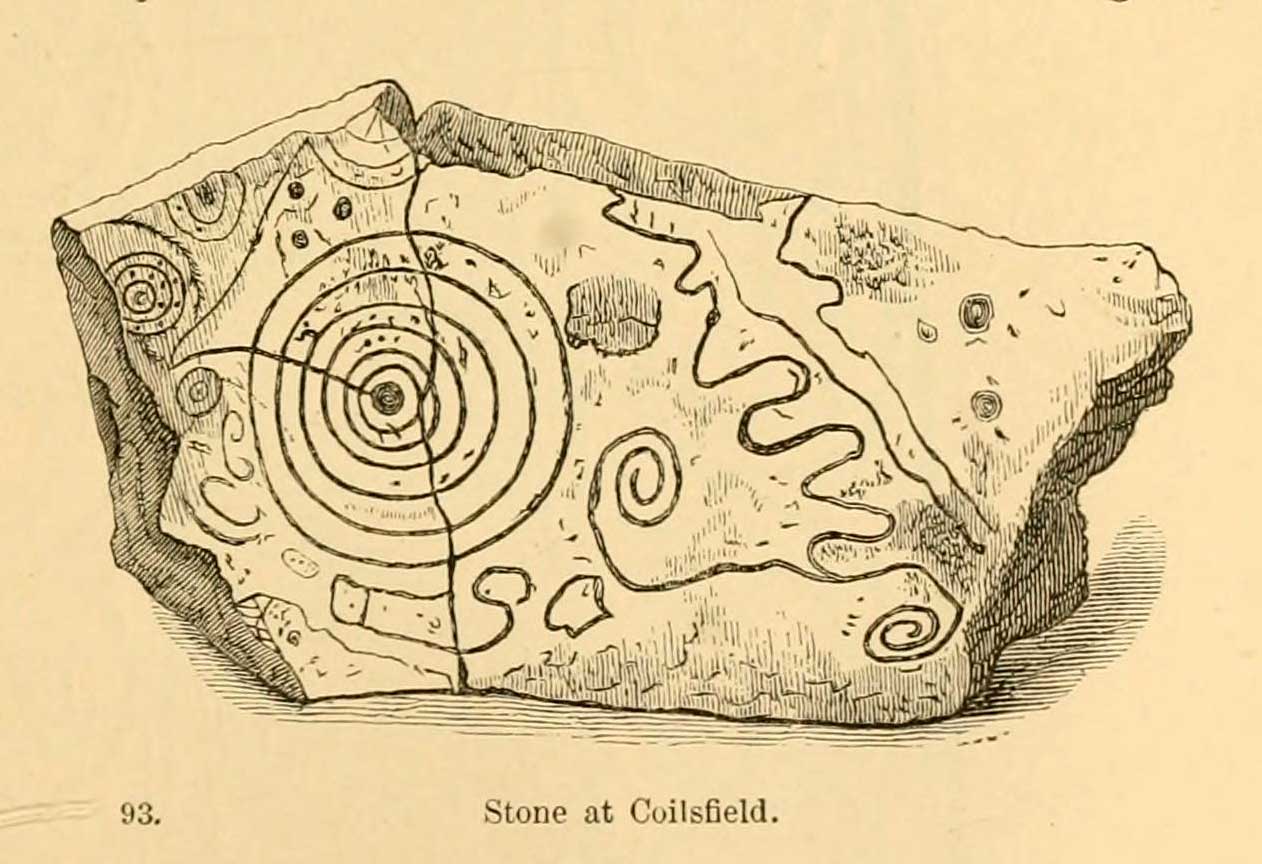
Daniel Wilson’s 1851 sketch

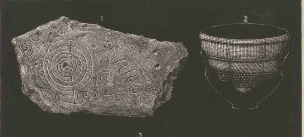
This fascinating and very ornate prehistoric carving was found on the underside of a grave-slab beneath Old King Coil’s Grave, or an adjacent prehistoric burial feature (we don’t know for sure).  In Daniel Wilson’s (1851) superb early work on prehistoric Scotland is a detailed drawing of this ornate petroglyph—similar in design and form to those found across the waters in Ireland—copied “from a drawing presented to the Royal Society of Edinburgh by Colonel Hugh Montgomery of Shielmorly, in 1785.”  Mr Wilson informed us that,

“It formed the cover of a cist, discovered in digging a gravel-pit at Coilsfield, in Ayrshire, and underneath it was found an urn filled with incinerated bones. The dimensions of the stone were about five feet in length by two and a half feet in breadth”

A few years later Sir James Simpson (1866; 1867) wrote and published the earliest (and still one of the finest) books on aboriginal rock carvings in the British Isles, and all but echoed what Wilson had described.  He added a further description of the designs that were carved onto the stone, telling us that,

“it had cut upon it a series of concentric circles, consisting of six rings placed around a central cup, the rings traversed by a straight radial groove.  On the drawing are marks of other cups and rings, or rather volutes, and a number of angular lines… This sculptured stone covered an urn…”

Following the descriptions of our early authors, many archaeologists and antiquarians explored the site but could find little else about the carving.  In Ron Morris’ (1981) most recent survey, he told us that it was,

“a gritstone slab, 1½m by ¾m (5ft x 2½ft), possibly broken after carving, had on one side (not now known if this was the inner of outer face); a cup-and-six-complete-rings with radial groove from the cup – diameter 50cm (20in) – 5 other cups-and-rings, mostly partly broken off or incomplete, an irregular ‘reversed-S-shaped’ single spiral with 3 convolutions at each end, other irregular grooved figures, 4 cups and about 7 ‘dots’ (6 of these are in the cup-and-six-rings).”

James Simpson’s 1866 sketch

The Royal Commission at Canmore tell us that “the present location of the food vessel and cist cover is unknown”; yet the rock art researcher Ronald W.B. Morris (1981) reported the petroglyph was “said to have been given to the Society of Antiquaries of Scotland but (is) now missing”; whilst the local writer E.H. Letham (1900) told us “the urns were conveyed to Eglintoun Castle.”  This aint good.  Has anyone subsequently found out what became of it?

Folklore

The tumulus of King Coil’s Grave was the legendary resting place of the “Old King Cole” of popular rhymes.  There were two such northern kings in ancient times and, as William Robertson (1889) said, “the only difficulty is to say which of the King Coils he was, whether the Coilu who lived three hundred and thirty years before Christ; or Coel, King of the Roman districts, who must have lived in the third century.”

References:

  1. Letham, E.H., Burns and Tarbolton, D.Brown: Kilmarnock 1900.
  2. Morris, Ronald W.B., The Prehistoric Rock Art of Southern Scotland, BAR: Oxford 1981.
  3. Morris, Ronald W.B. & Bailey, Douglas C., “The Cup-and-Ring Marks and Similar Sculptures of Southwestern Scotland: A Survey,” in Proceedings of the Society of Antiquaries, Scotland, volume 98, 1966.
  4. Morrison, Alex, The Bronze Age in Ayrshire, Ayrshire Natural History & Archaeology Society 1978.
  5. Robertson, William, Historical Tales and Legends of Ayrshire, Thomas D. Morrison: Glasgow 1889.
  6. Paterson, James, History of the County of Ayr – volume 2, Thomas Stevenson: Edinburgh 1852.
  7. Simpson, J.Y., “On Ancient Sculpturings of Cups and Concentric Rings,” in Proceedings of the Society of Antiquaries, Scotland, volume 6, 1866.
  8. Simpson, James, Archaic Sculpturings of Cups, Circles, etc., Upon Stones and Rocks in Scotland, England and other Countries, Edmonston & Douglas: Edinburgh 1867.
  9. Smith, John, Prehistoric Man in Ayrshire, Elliot Stock: London 1895.
  10. Wilson, Daniel, The Archaeology and Prehistoric Annals of Scotland, Sutherland & Knox: Edinburgh 1851.
  11. Young, Alison, “Cup-and-Ring Markings on Creag Ruenshin, with Some Comparative Notes,” in Proceedings of the Society of Antiquaries, Scotland, volume 72, 1937.

© Paul Bennett, The Northern Antiquarian 


Witch’s Stane, Craigie, Ayrshire

Legendary Rock (destroyed):  OS Grid Reference – NS 4268 3231

Also Known as:

  1. Canmore ID 42851
  2. White Stane
  3. Witches’ Stone

Archaeology & History

It is difficult to assess the precise nature of this megalithic site, sadly destroyed some two hundred years ago.  The Royal Commission thinks it may have been a rocking stone, but the legend said of it indicates it to have been associated with a giant prehistoric cairn, although nothing remains nowadays.  The site was mentioned briefly in James Patterson’s (1863) huge work on the townships of Ayrshire, where he described the site as “standing upright” and “being in a field on Lodgehouse Farm,” near the village church.

“It stood on three stones, so high that a man could crawl under. It was blasted in 1819 to build houses.  The farmer’s wife, it is said, took some antipathy to it, and would not give her husband rest until he consented to have it removed.  A person of the name of Jamieson, and an assistant, were employed to blast it, which was accordingly done.  When broken up, it filled twenty-four carts.  Such was the feeling of sacrilege occasioned by the removal of the stone, that it was observed the farmer’s wife became blind, and continued so for eight years, when she died. Jamieson, who blasted it, never did well afterwards.  He drank and went to ruin.”

Serves them right!  Additional lore gained from a local lady in the 1870s has one of those all-too-familiar elements to it, speaking of something more substantive.

Folklore

When Archibald Adamson (1875) wrote his fine work on the history of Kilmarnock and district, folklore elements more typical of the Cailleach—whose legends abound in our more northern climes—seemed to have been attached to this missing site.  It is worth telling in full:

“After partaking of refreshments in the village inn, and indulging in a chat with the landlord, I retraced my steps to the highway, and in doing so got into conversation with an old lady who was very loquacious and well versed in the lore of the district. Amongst other things, she informed me that once on a time the church of Craigie had a narrow escape of being destroyed by a witch who had taken umbrage at it. It seems that the hag selected a large stone, and having placed it in her apron, flew with it in the direction of the building with the intention of dropping it upon its roof.  Her design, however, was frustrated by the breaking of her apron strings, for, upon nearing the object of her spleen, they gave way, and the stone fell with a crash that shook the earth. This accident seemingly so disheartened the carlin that she abandoned the destructive idea and allowed her burden to lie where it fell. The boulder lay in a field near the churchyard wall, and was known as “The White Stane.” It was long regarded with superstitious awe by many; but the farmer on whose ground it lay being of a practical turn of mind, looked upon  it with an eye to utility, and had it blasted for building purposes. Strange to relate, when broken up the debris filled twenty-five carts–a circumstance that would lead one to suppose that the witch must have been very muscular, and must have worn a very large apron.”

It is most likely that the witch in this legend originally set off from the Witch’s Knowe, more than 500 yards to the west of the church (and still untouched, despite the mess of the quarrying immediately adjacent).  Any further information on this missing site would be greatly appreciated.

References:

  1.  Adamson, Archibald S., Rambles round Kilmarnock, T. Stevenson: Kilmarnock 1875.
  2. Paterson, James, History of the Counties of Ayr and Wigton – volume 1, James Stillie: Edinburgh 1863.

© Paul Bennett, The Northern Antiquarian


Culhawk Hill, Kirriemuir, Angus

Stone Circle:  OS Grid Reference – NO 3530 5620

Also Known as:

  1. Canmore ID 32209

Getting Here

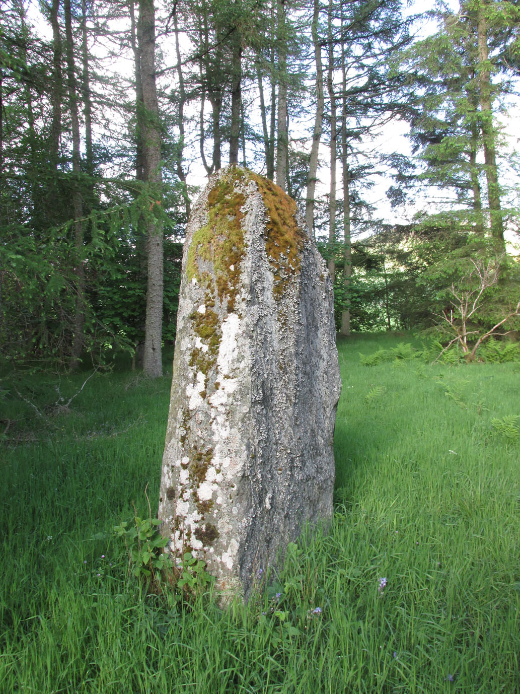
The largest stone in the ring

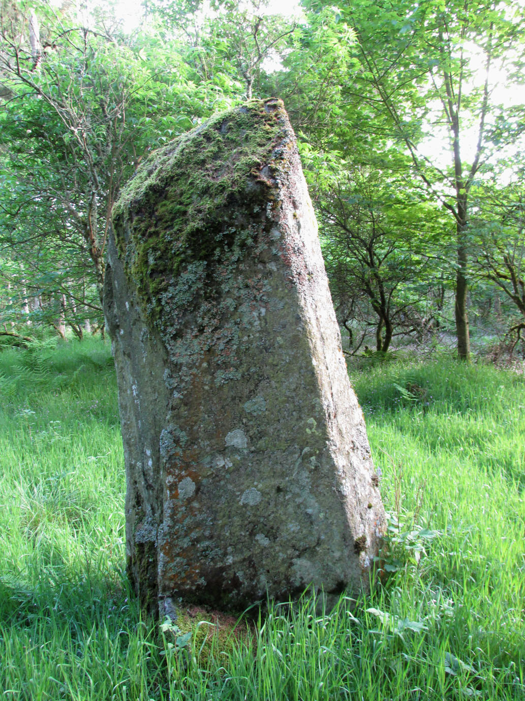
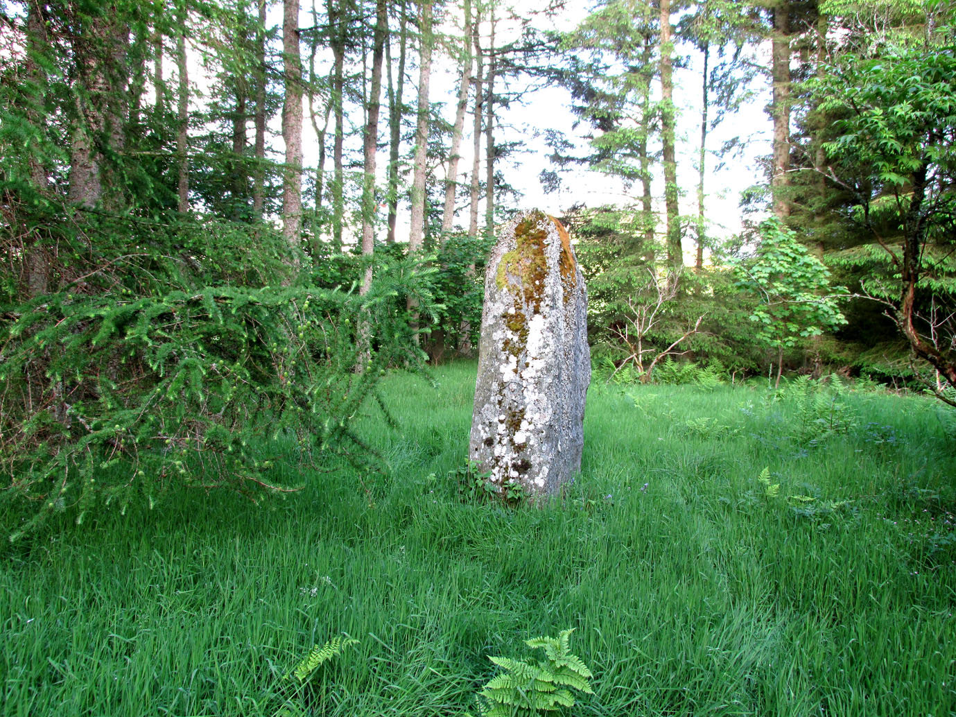
From Kirriemuir central, head up the Kinnordy road, going straight across the main road and continuing past the Kinnordy turn-off for just over a mile towards Mearns, stopping where a small copse of trees appears on your left.  From here, walk along the track to the west. It goes gradually uphill, cutting through a small cleft with a hillfort on the north and a cairn circle on the south until, ⅔-mile along, you reach the moorland.  Keep going on the same path for another ½-mile west where the grasslands level out.  Here, on the flat bit between the two hills, a small incomplete ring of stones lives, with one stone sticking out.  You’ll find it!

Archaeology & History

This is a curious site on several levels—not least, that its definition as a ‘stone circle’ is a fragile one; although to be honest, we do find here a large unfinished arc of stones in what looks like either an unfinished ring, or a deliberately constructed large arc.  But you won’t find it in the standard megalithic gazetteers of Burl, Barnatt or Thom as it was only relocated in the 1980s by local researchers Sherriff and MacKnight. (1985)  They didn’t have much to say about it either, simply telling that they’d found,

“A stone setting representing the remains of either a denuded cairn or a stone circle lies in the saddle between Culhawk Hill and Castle Hill. One erect and 4 prone boulders describe a portion of a roughly circular site some 10m in diameter.”

Arc of fallen stones, looking NE

Faint low ring, looking W

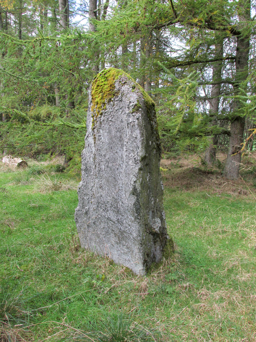
This is roughly the gist of it, with the largest and most prominent of the stones—barely three feet tall—standing on the western side (this is the stone which draws your attention – otherwise you’d never even notice it).  The rest of the stones seem to have been knocked down some time ago.  A barely discernible embankment constructed around the edge of the ring can be seen around the northern side.  It seems unlikely that it was a cairn, as no inner piles of stones were in evidence when we visited the site.  It may be a large hut circle.  But in truth it could do with an excavation so that we can suss out its exact nature.  Beneath the grasses we found an additional stone to those counted by Sherriff & MacKnight; but more intriguing is what Frank Mercer and I found before we even reached the small circle….

Trackway leading to the circle

More visibly distinct than the ring itself were two artificial raised embankments, running parallel with each other 3-4 yards apart.  The raised edges of these embankments were about a yard across, on both sides, with the inner area slightly lower than the outlying natural background.  These distinct linear earthworks are, quite simply, an early medieval or prehistoric trackway—and it leads directly into the circle!  It’s quite unmistakable and is clearly visible as it drops down the slope to the south and away into the fields below.  Sadly when we found it last week, darkness was falling and so we didn’t trace the trackway any further.  But the most notable thing was that it stopped at the circle and did not continue on its northern side, implying that it was constructed with the circle as its deliberate focal point.  The trackway and its embankments are roughly the same size as other recognized prehistoric routes, such as Elkington’s Track on Ilkley Moor and the other ancient causeway that runs past the prehistoric ring known as Roms Law.

Regarding the ring of stones: unless you’re a real megalith fanatic, you’ll probably be disappointed by what you see here.  It’s a bittova long wander to something that may once have been just a hut circle, but the avenue leading up to it is something else – and much more intriguing!

References:

  1. Sherriff, John R. & MacKnight, O., “Culhawk Hill (Kirriemuir p): Stone Setting,” in Discovery & Excavation Scotland, 1985.

Acknowledgements:  Thanks as always to Nina Harris and Frank Mercer; and to Paul Hornby for use of his photos.

© Paul Bennett, The Northern Antiquarian


Templelands, Auchterhouse, Angus

Stone Circle (destroyed):  OS Grid Reference – NO 355 360

Also Known as:

  1. Canmore ID 31855

Archaeology & History

In Mason Inglis’ (1888) fascinating history of the village of Auchterhouse, he describes a number of prehistoric antiquarian remains—some destroyed, others still in place.  But this old ring of stones is another of our ancient monuments that has fallen in the wake of the Industrialists with their ‘progress’ and ecocide.  Mr Inglis told,

“South of the Templelands another group of these mysterious circular stone relics of pagan times at one time stood, and was also held in much regard, and recognized as an ancient place of worship.  This group, however, unfortunately was demolished during excavations for railway purposes.”

He goes on to describe the finding of other prehistoric tombs and “unhewn slabs…in regular rows and at equal distances apart” in the same area.  It seems that many of these have also been destroyed.

References:

  1. Inglis, W. Mason, Annals of an Angus Parish, John Leng: Dundee 1888.

© Paul Bennett, The Northern Antiquarian

Tods Stone, Monifieth, Angus

Standing Stone (destroyed):  OS Grid Reference – NO 486 339?

Archaeology & History

The only reference I can find about this site is in A.J. Warden’s (1880) massive survey of the county of Angus—previously called ‘Forfarshire’—where, in his discussion of the hillforts of the area, he told us that,

“About a quarter of a mile distant from The Laws is the Gallow Hill of Ethiebeaton.  In a field, a little to the south, there formerly stood a large upright stone called Tods Stone.”

All trace of it disappeared when quarrying operations were undertaken there, also destroying a number of prehistoric tombs close by.  The monolith may have had some association with the tombs, but we cannot be certain.

The name of the stone, tods, probably derives from the word ‘foxes’, although we cannot be certain of this either, as there are a variety of other Scottish dialect words relating to ‘tod’that may have had bearing on the name.

If anyone has any further information about this long lost site, we would gladly welcome it.

References:

  1. Grant, William (ed.), The Scottish National Dictionary – volume 9, SNDA: Edinburgh 1973.
  2. Warden, Alex J., Angus or Forfarshire – volume 1, Charles Alexander: Dundee 1880.

© Paul Bennett, The Northern Antiquarian

West Mains (02), Turin Hill, Aberlemno, Angus

Cup-Marked Stone:  OS Grid Reference – NO 52150 53695

Getting Here

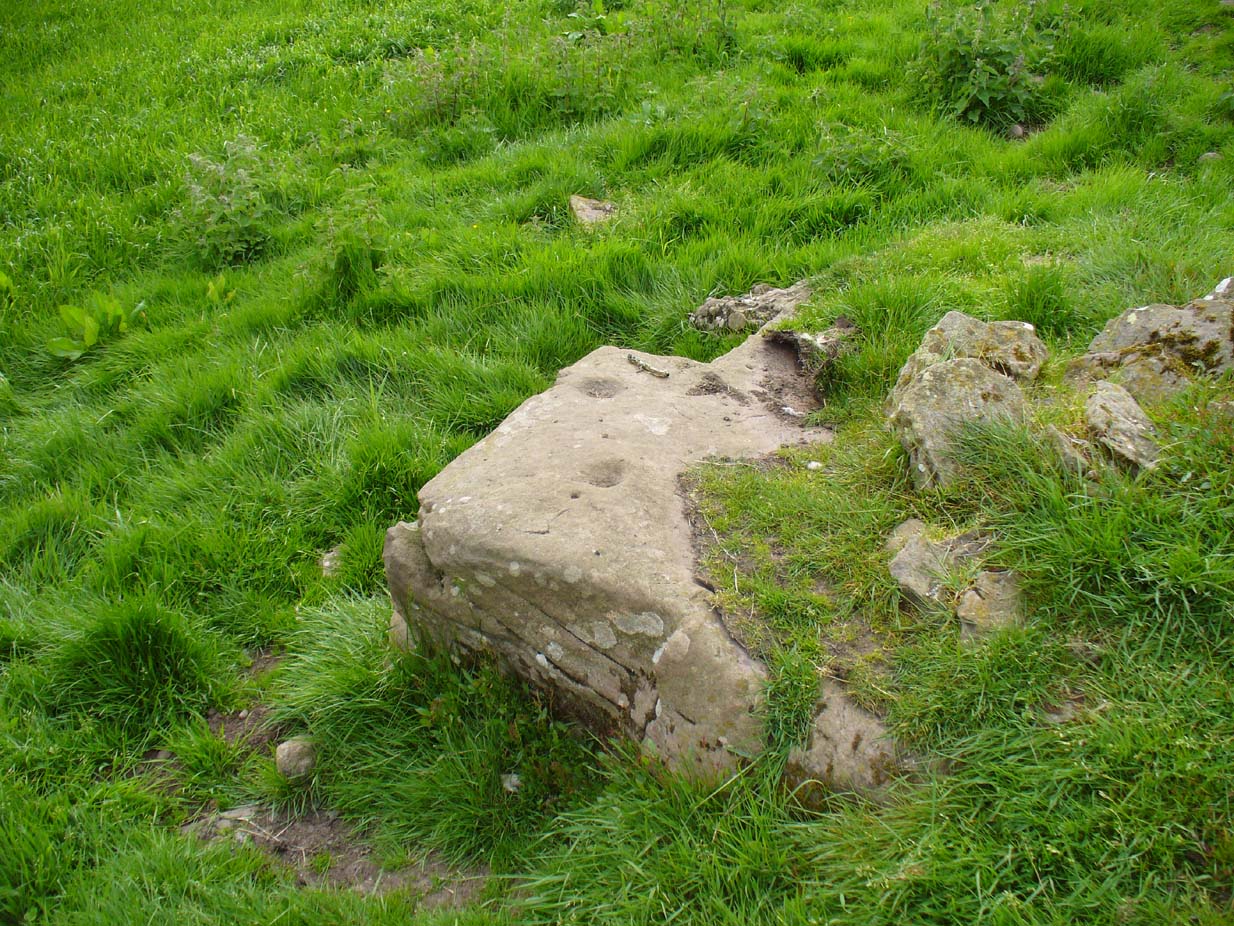
West Mains cup-marked stone

West Mains cup-marked stone

Follow the same directions as if you’re looking for the Doo’cot Woods carving; but, in the field that you have to cross before entering the trees, about 50 yards down from the top of the field, a geological ridge of stone runs along into the trees themselves.  The carving is along this ridge in the field.  Walk along and you’ll find it!

Archaeology & History

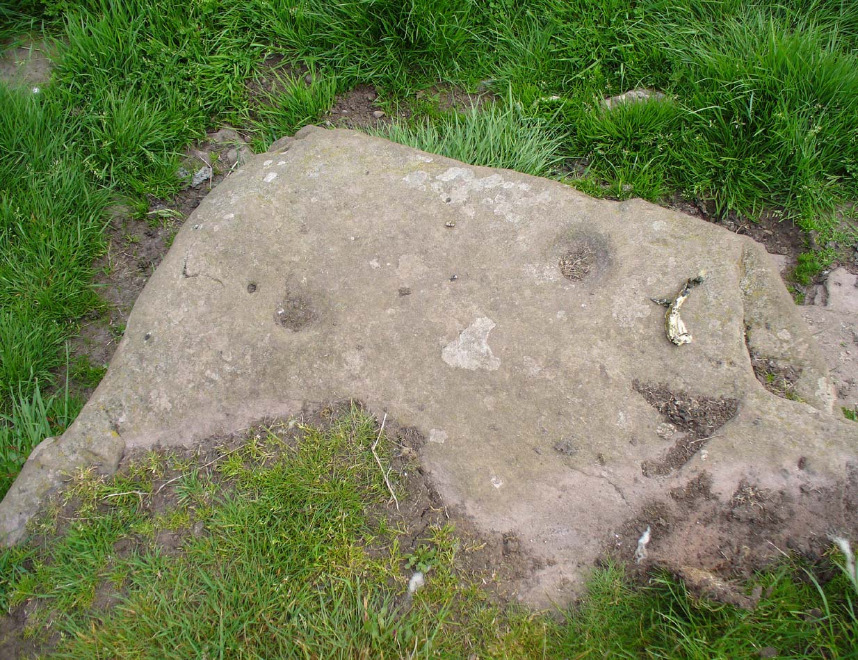
Not described in earlier surveys, this is one of two cup-marked stones close to each other along this long ridge of stone reaching across the field.  The carving has just two distinct cups, as illustrated, between 2-3 inches across and half-an-inch deep. As with the adjacent carving, no other features seem to visible.

Close-up of cup-marks

Close-up of cup-marks

We must, however, be cautious with this and other ‘cup-markings’ nearby, as a lot of the stone in this area is conglomerate with nodules of differing forms of rock (visible on nearby stones) falling away to leave cup-like impressions where the softer stone has eroded. Some of the cup-markings listed in John Sherriff’s (1995) survey of this region seem to be purely geological in nature and not man-made.

References:

  1. Sherriff, John, “Prehistoric rock-carving in Angus,” in Tayside & Fife Archaeological Journal, volume 1, 1995.

© Paul Bennett, The Northern Antiquarian

Kilry, Glen Isla, Angus

Standing Stone: OS Reference – NO 2432 5449

Also Known as:

  1. Canmore ID 31093

Getting Here

Take the B954 north from Alyth, and turn left onto the unclassified road at Craigisla House, turning right at Dykehead, then take the right fork at Faulds. Park up by the school about ¼ mile further on, and the stone is in a wooded glade on the opposite side of the road along a track to the left of ‘Standing Stone’ cottage.

Archaeology and History

Quoted in the Canmore database, A.J. Warden, writing in 1882, described the stone:

‘The standing stone on Broomhall estate is a large amorphous whinstone, standing in a small field near the confluence of the Kilry Burn and the River Isla.  It is c.7′ high and c. 10′ in circumference at the base. Tradition states that it commemorates a battle fought between the laird of Kilry and the Durwards of Peel.’

On the OS map the stone is aligned with the Pitmudie Stones and the Knowehead of Auldallan Stones to the north east.

References:

  1. Warden, A.J.,  Angus or Forfarshire: The Land and People, Descriptive and Historical – volume 3, Dundee 1880-5.

© Paul Hornby, The Northern Antiquarian

Girdle Stane, Dunnichen, Angus

Cup-and-Ring Stone:  OS Grid Reference – NO 52808 49737

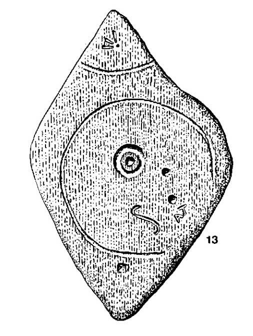
John Sheriff's 1995 drawing of Girdle Stane

John Sheriff’s 1995 drawing of Girdle Stane

Also Known as:

  1. Canmore ID 34662
  2. Dunnichen 1
  3. Girdlestane
  4. The Girdle Stane of Dunnichen
  5. Girdle Stone

Getting Here

From The Square in Letham village, go north up Auldbar Road and out of the village for 0.6 miles (1km).  Shortly before reaching the road junction at the top, on the left-side of the road is a recess with a stone and a small aging plaque telling you that you’ve reached the Girdle Stane.

Archaeology & History

The Girdle Stane

The Girdle Stane

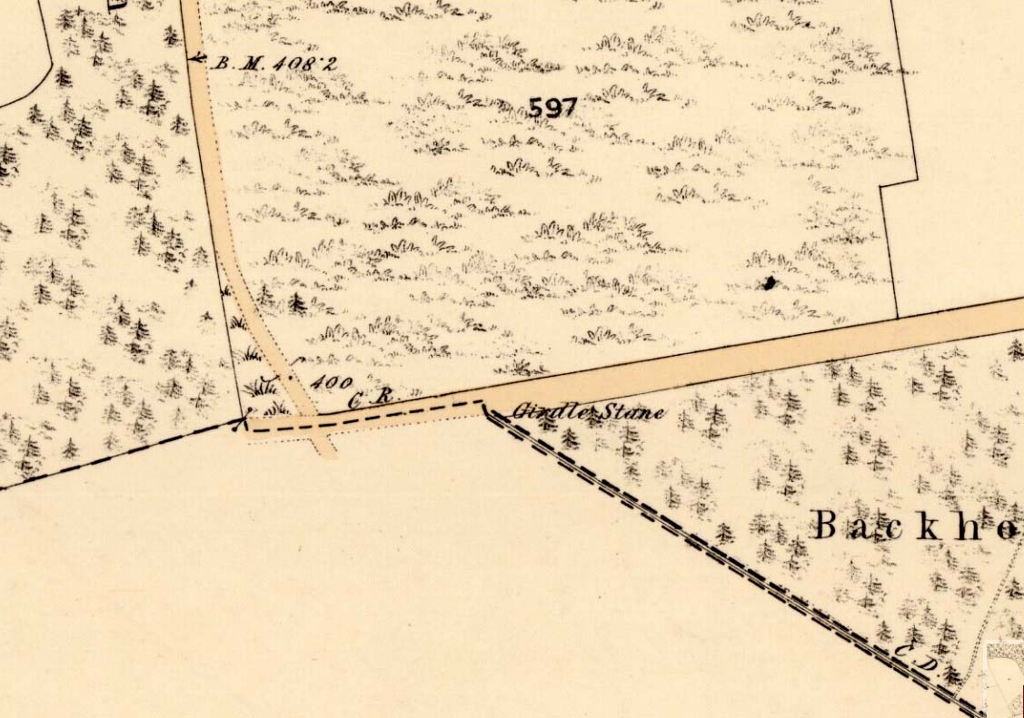
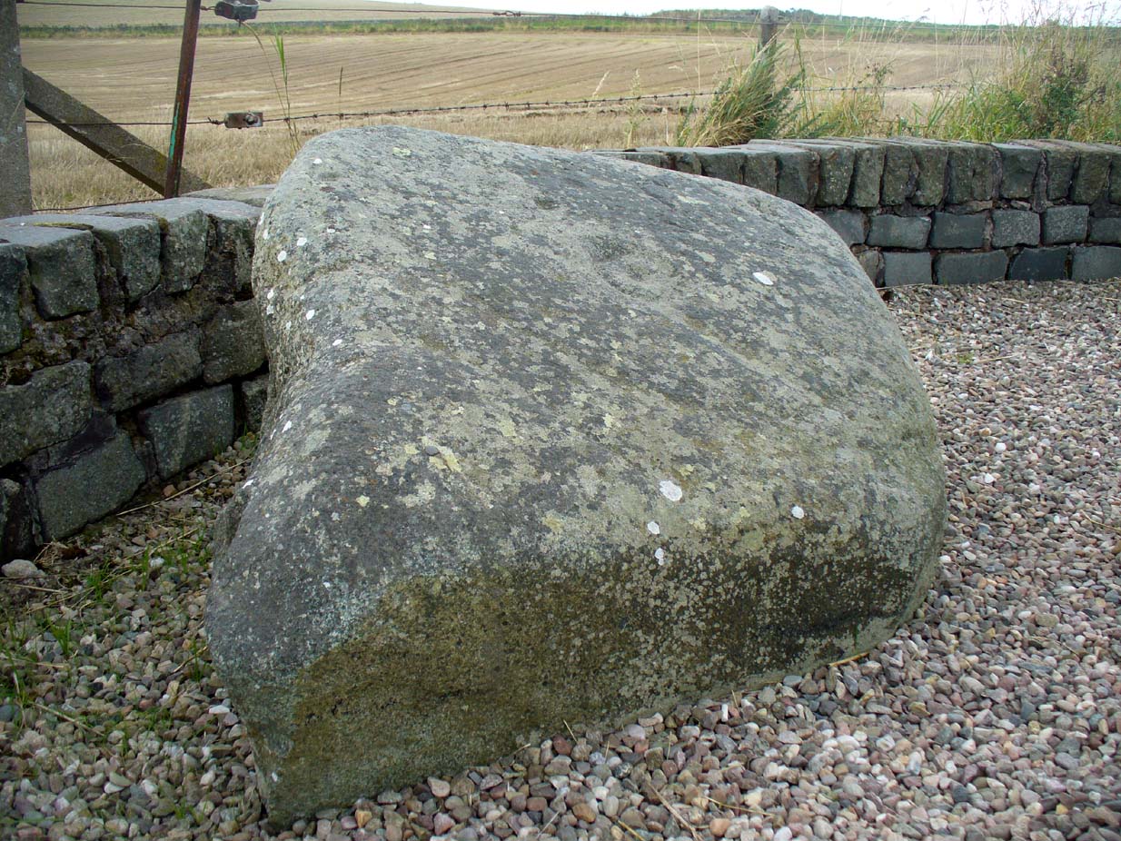
This cup-and-ring stone is not in its original position.  Although we know from Ordnance Survey records in the 1860s that it was located about 130 yards north of here, close to the road junction, even that is unlikely to have been its original position—but we know not where that might have been!  It is an undoubted multi-period carving, with the earliest section being our typical neolithic or Bronze Age cup-and-ring near the centre of the stone, with several outlying cup-marks toying with our intellect as per usual!  The central cup-and-ring may have an incised line running down out of it, although this isn’t highlighted on John Sheriff’s (1995) drawing of the stone.

Girdle Stane on 1865 map

Girdle Stane on 1865 map

Surrounding the central archetype, by some distance, is a much wider carved ring that almost reaches to defines the edges of the stone itself.  This large encircling motif and other features of the petroglyph—including a large elongated “S” and marks that were probably executed by the Ordnance Survey lads at the bottom corner—were ingredients which prompted Sir James Simpson (1867) to question the veracity of the Girdle Stane’s antiquity.  He wrote:

“The so-called ‘Girdle-stone’ in the…parish of Rescobie, about four feet long and three broad, is cut on its surface with two circles, the largest of which is above two feet and a half broad, and hence does not, I believe, belong to the class which we are considering in this essay”—

More recent "S"-shaped motif

More recent “S”-shaped motif

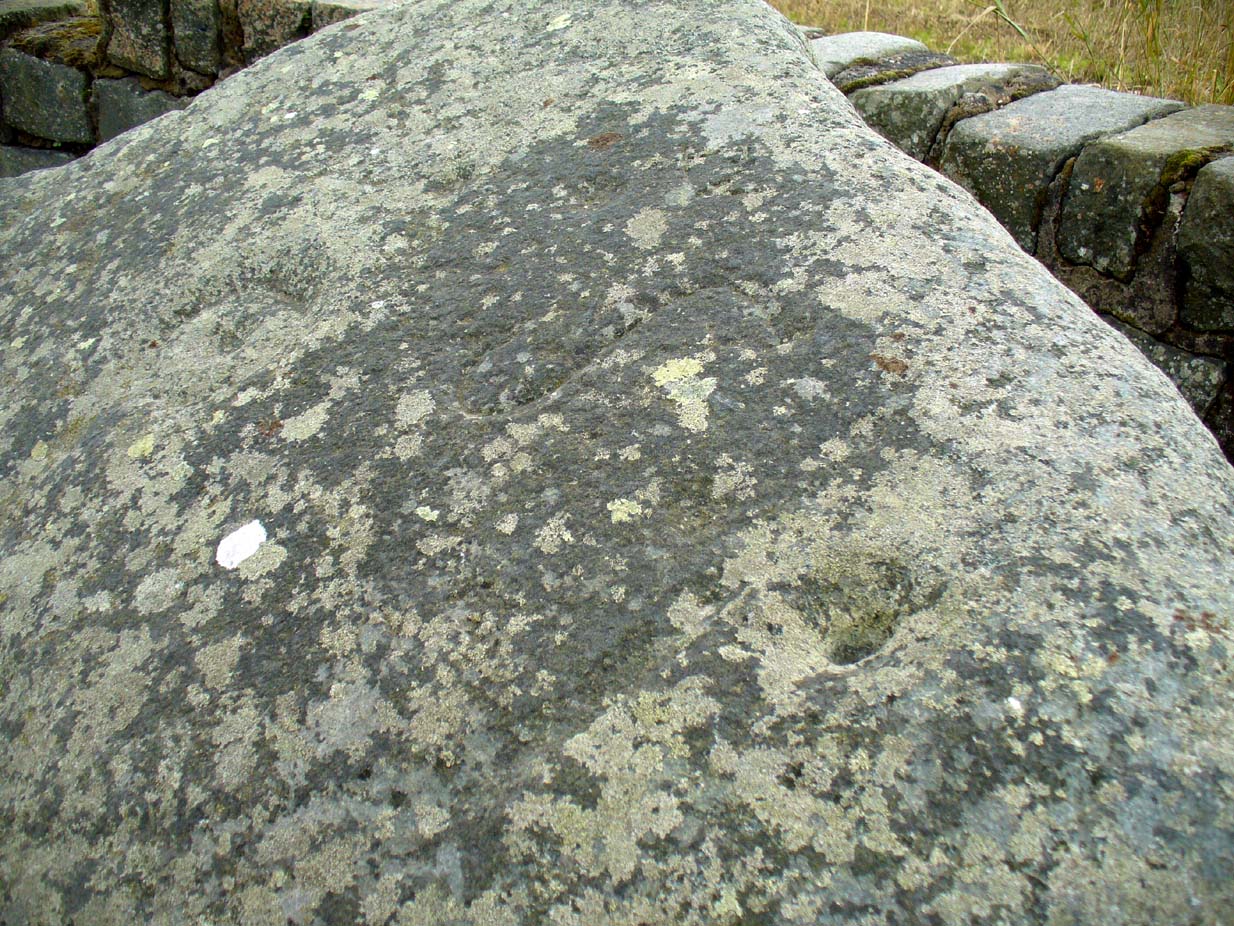
Close-up of cups, ring and lines

Close-up of cups, ring and lines

i.e., neolithic or Bronze Age petroglyphs.  And you can see his point!  My first impression when Prof Paul Hornby and I visited the site a few days ago, after the initial “that’s a cup-and-ring in the middle”, was to proclaim: “that bit’s much more recent, maybe Pictish?”  But it probably isn’t even Pictish.  This “more recent” carved element is a distinct large elongated “S”, which may have been marked onto it when the stone was used as a township boundary marker between the local parishes.  The grand historical writer Alex Warden (1882) talks about this in his magnum opus, saying:

“At the junction of two roads, a little to the northeastward of Letham, there is a rough boulder, about five feet long by three in breadth, having on its face a circle of about thirty inches in diameter, and another smaller circle about six inches across.  It is called the Girdle Stane of Dunnichen, from the larger circle resembling the utensil called the girdle, s.c. This stone marks the boundaries between the parishes of Dunnichen and Rescobie, also between the lands of Dunnichen and Ochterlony (Balmadies).  It is probably the Grey Stone referred to in a note on the marches of Dunnichen, about 1280.”

Folklore

The folklore of the stone indicates how its origins are rooted in prehistory, despite the later additional symbols.  Alex Warden (1882) tells the all-too-familiar creation myth, usually symptomatic of giant prehistoric cairns:

“Tradition says a witch was carrying this boulder from ‘the Crafts’ of Carmylie in her apron, when the strings broke, and the stone fell where it now lies.”

Carmyllie Hill is 5 miles (8km) to the south and is a place rich in fairy-lore and vandalized prehistoric sites.

References:

  1. Coutts, Herbert, Ancient Monuments of Tayside, Dundee Museum 1970.
  2. Kidd, Scott, The Churches of the Parish of Dunnichen, David Winter: Dundee 1995.
  3. Sherriff, John, “Prehistoric rock-carving in Angus,” in Tayside & Fife Archaeological Journal, volume 1, 1995.
  4. Simpson, James, Archaic Sculpturings of Cups, Circles, etc., Upon Stones and Rocks in Scotland, England and other Countries, Edmonston & Douglas: Edinburgh 1867.
  5. Warden, Alex J., Angus or Forfarshire – volume 3, Charles Alexander: Dundee 1882.

© Paul Bennett, The Northern Antiquarian