Culhawk Hill, Kirriemuir, Angus

Stone Circle:  OS Grid Reference – NO 3530 5620

Also Known as:

  1. Canmore ID 32209

Getting Here

The largest stone in the ring

From Kirriemuir central, head up the Kinnordy road, going straight across the main road and continuing past the Kinnordy turn-off for just over a mile towards Mearns, stopping where a small copse of trees appears on your left.  From here, walk along the track to the west. It goes gradually uphill, cutting through a small cleft with a hillfort on the north and a cairn circle on the south until, ⅔-mile along, you reach the moorland.  Keep going on the same path for another ½-mile west where the grasslands level out.  Here, on the flat bit between the two hills, a small incomplete ring of stones lives, with one stone sticking out.  You’ll find it!

Archaeology & History

This is a curious site on several levels—not least, that its definition as a ‘stone circle’ is a fragile one; although to be honest, we do find here a large unfinished arc of stones in what looks like either an unfinished ring, or a deliberately constructed large arc.  But you won’t find it in the standard megalithic gazetteers of Burl, Barnatt or Thom as it was only relocated in the 1980s by local researchers Sherriff and MacKnight. (1985)  They didn’t have much to say about it either, simply telling that they’d found,

“A stone setting representing the remains of either a denuded cairn or a stone circle lies in the saddle between Culhawk Hill and Castle Hill. One erect and 4 prone boulders describe a portion of a roughly circular site some 10m in diameter.”

Arc of fallen stones, looking NE

Faint low ring, looking W

This is roughly the gist of it, with the largest and most prominent of the stones—barely three feet tall—standing on the western side (this is the stone which draws your attention – otherwise you’d never even notice it).  The rest of the stones seem to have been knocked down some time ago.  A barely discernible embankment constructed around the edge of the ring can be seen around the northern side.  It seems unlikely that it was a cairn, as no inner piles of stones were in evidence when we visited the site.  It may be a large hut circle.  But in truth it could do with an excavation so that we can suss out its exact nature.  Beneath the grasses we found an additional stone to those counted by Sherriff & MacKnight; but more intriguing is what Frank Mercer and I found before we even reached the small circle….

Trackway leading to the circle

More visibly distinct than the ring itself were two artificial raised embankments, running parallel with each other 3-4 yards apart.  The raised edges of these embankments were about a yard across, on both sides, with the inner area slightly lower than the outlying natural background.  These distinct linear earthworks are, quite simply, an early medieval or prehistoric trackway—and it leads directly into the circle!  It’s quite unmistakable and is clearly visible as it drops down the slope to the south and away into the fields below.  Sadly when we found it last week, darkness was falling and so we didn’t trace the trackway any further.  But the most notable thing was that it stopped at the circle and did not continue on its northern side, implying that it was constructed with the circle as its deliberate focal point.  The trackway and its embankments are roughly the same size as other recognized prehistoric routes, such as Elkington’s Track on Ilkley Moor and the other ancient causeway that runs past the prehistoric ring known as Roms Law.

Regarding the ring of stones: unless you’re a real megalith fanatic, you’ll probably be disappointed by what you see here.  It’s a bittova long wander to something that may once have been just a hut circle, but the avenue leading up to it is something else – and much more intriguing!

References:

  1. Sherriff, John R. & MacKnight, O., “Culhawk Hill (Kirriemuir p): Stone Setting,” in Discovery & Excavation Scotland, 1985.

Acknowledgements:  Thanks as always to Nina Harris and Frank Mercer; and to Paul Hornby for use of his photos.

© Paul BennettThe Northern Antiquarian


St Medan’s Well, Kirkton of Kingoldrum, Angus

Holy Well (destroyed): OS Grid Reference – NO 33410 54961

Getting Here

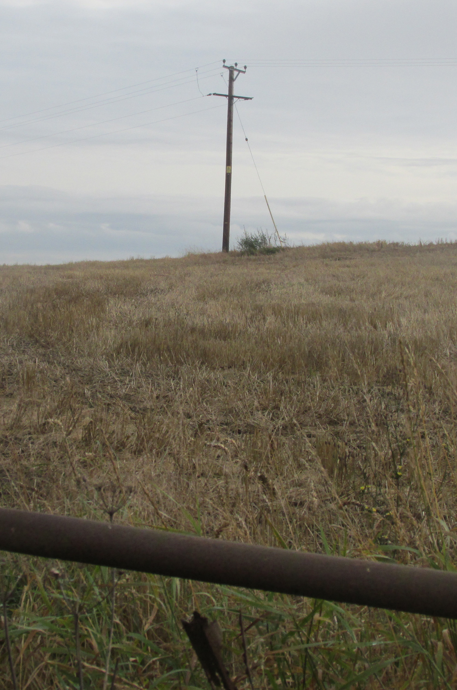
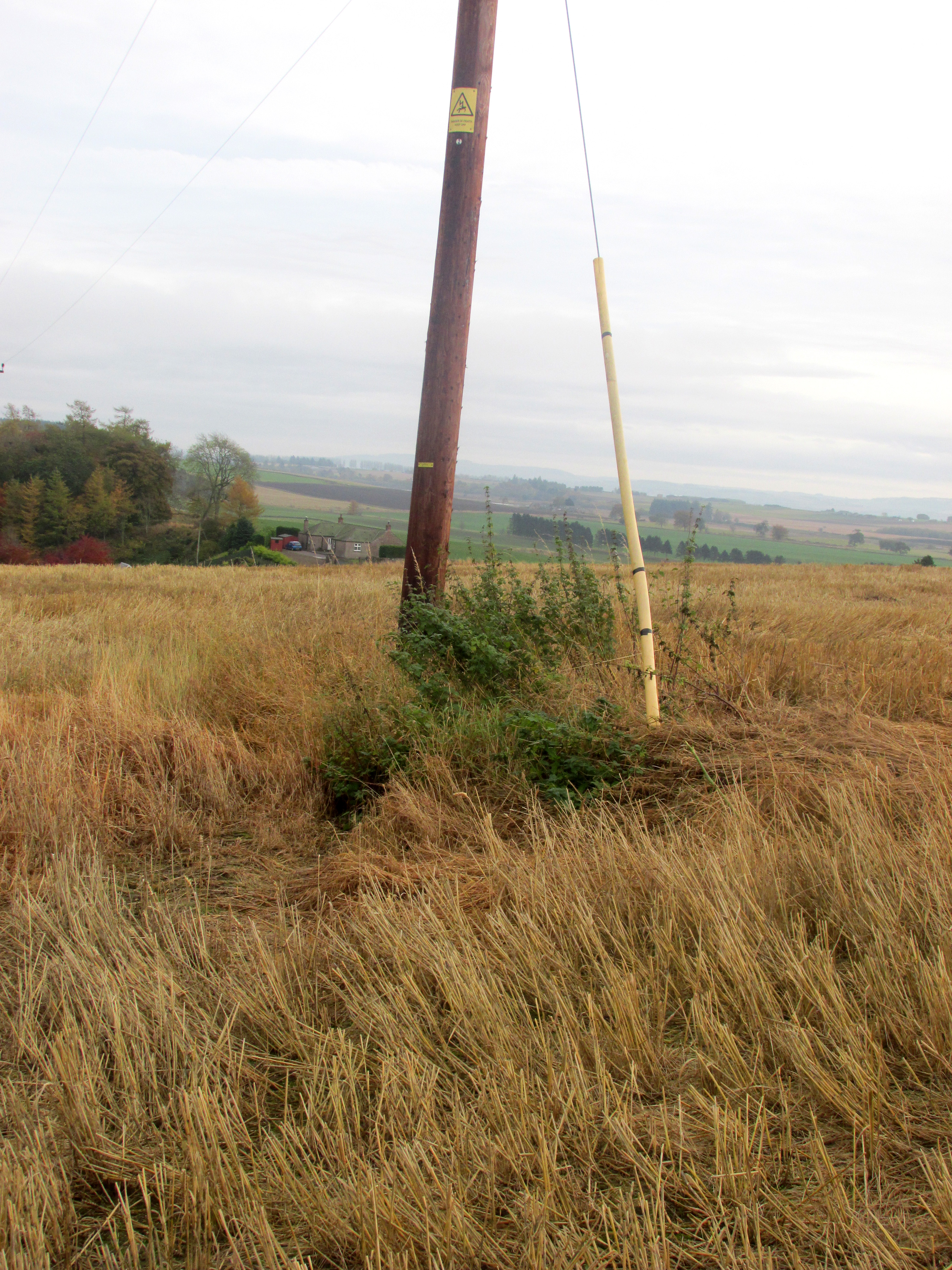
Travelling away from Kirriemuir towards the Braes of Angus on the B951, park outside the now disused Church of Scotland, and walk up the hill past the adjoining house, and turn left through the farm gate into the field. The site of the Well will be seen in front of you on the slope as a patch of nettles between an electricity supply pole and its ground tensioning wire.

The site of the well from the roadside.

Archaeology and History

According to Hew Scott’s Fasti Ecclesiae Scoticae (1925), ‘The church of Kingoldrum was dedicated to St Medan, and not far from it is St Medan’s Well‘.  The Canmore record in respect of  finds in the churchyard (Canmore ID 32254) has the following note in respect of a field visit by a Canmore official on 12 November 1975: ‘According to Mr Mackintosh, session clerk, St Medan’s Well (name verified) was a spring well situated on a hill slope “some 50 yards S of the cottage of the SW of the church. The ground was improved within living memory, and there is now no trace of the well.”‘

A close up of the well site.

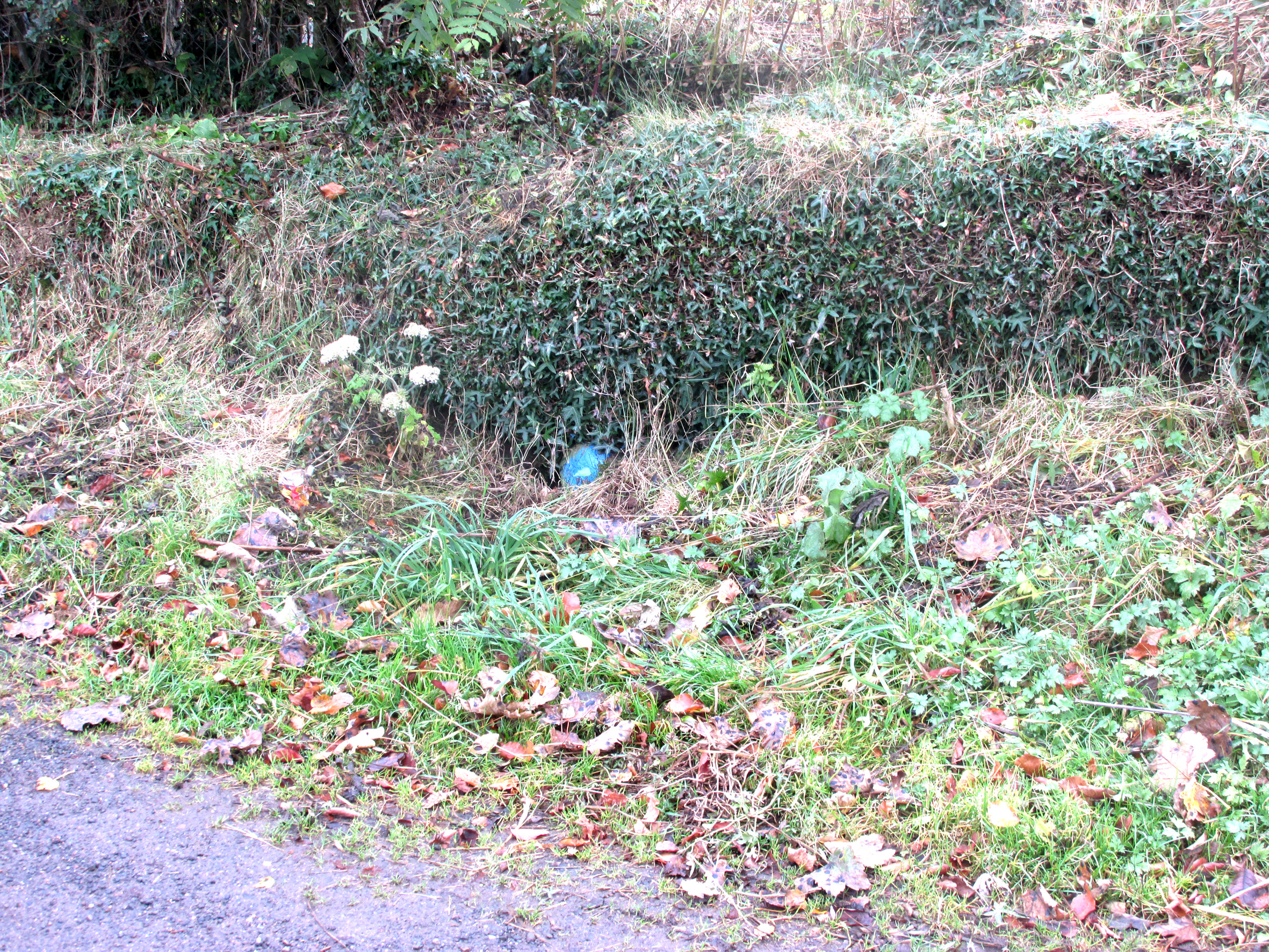
Despite what was stated in the above quote, the site of the well is visible as a patch of nettles exactly where stated, the adjoining house owner confirming that the water is now piped to a cistern in front of the house, and marked by a blue painted stone.

The well is not recorded in the Ordnance Survey Name Books, nor is its position shown on the maps, and that usually reliable source of information on the history of this area, Andrew Jervise, does not mention it in his Epitaphs and Inscriptions in North East Scotland.  As this writer does not have access to the works referenced by Hew Scott, he feels that, in common with other saint’s wells, there may be some uncertainty as to the exact identity of the patron saint of the well, but it is likely to be a separate person to Saint Madden who gave his name to St Medan’s Knowe at nearby Kirkton of Airlie. The argument for this separate identity is strengthened by the discovery in 1843 of a quadrangular bronze coated iron bell that had been buried with other artifacts in the Kingoldrum churchyard. The history of the bell of St Madden of Kirkton in Airlie is historically recorded.

The Water from the well is piped to a roadside cistern in front of the blue painted stone

Alexander Forbes (1872) refers to a St Medan whom he identifies as Saint Medana, and who may be the patron of the well and the original owner of the bell, but he records this Irish born saint as having been active in Galloway, but that she “ended her days near the blessed bishop and confessor Ninian” who was active in Angus. He writes of her: “A native of Ireland, fleeing from the admiration of a soldier, came in a vessel with two handmaidens only to Scotland…where she lived a life of labour and poverty. The soldier pursued her, whereupon she and her maidens embarked upon a stone, which floated thirty miles to a place called Farnes….the soldier still pursued her, and passed without noticing it, the house where she lodged with her maidens, but his attention was drawn to it by the crowing of a cock. She now climbed into a tree, and finding that it was her face and eyes that were the soldier’s attraction, she plucked out her eyes. The soldier repented, and the virgin descending from the tree washed her wounds in a fountain which then and there sprang up“. It seems we can not know if this is the mythic history of the origin of St Medan’s Well.

References:

  1. Forbes, Alexander, Kalendars of Scottish Saints, Edmonston & Douglas: Edinburgh, 1872.
  2. Scott, Hew, Fasti Ecclesiae Scoticanae, the Succession of Ministers in the church of Scotland from the Reformation – Volume V, Oliver and Boyd: Edinburgh 1925.

Links:

  1. Kingoldrum Parish Church

© Paul T. Hornby 2016 The Northern Antiquarian