Cup-and-Ring Stone (lost): OS Grid Reference – NY 3851 8149
Archaeology & History
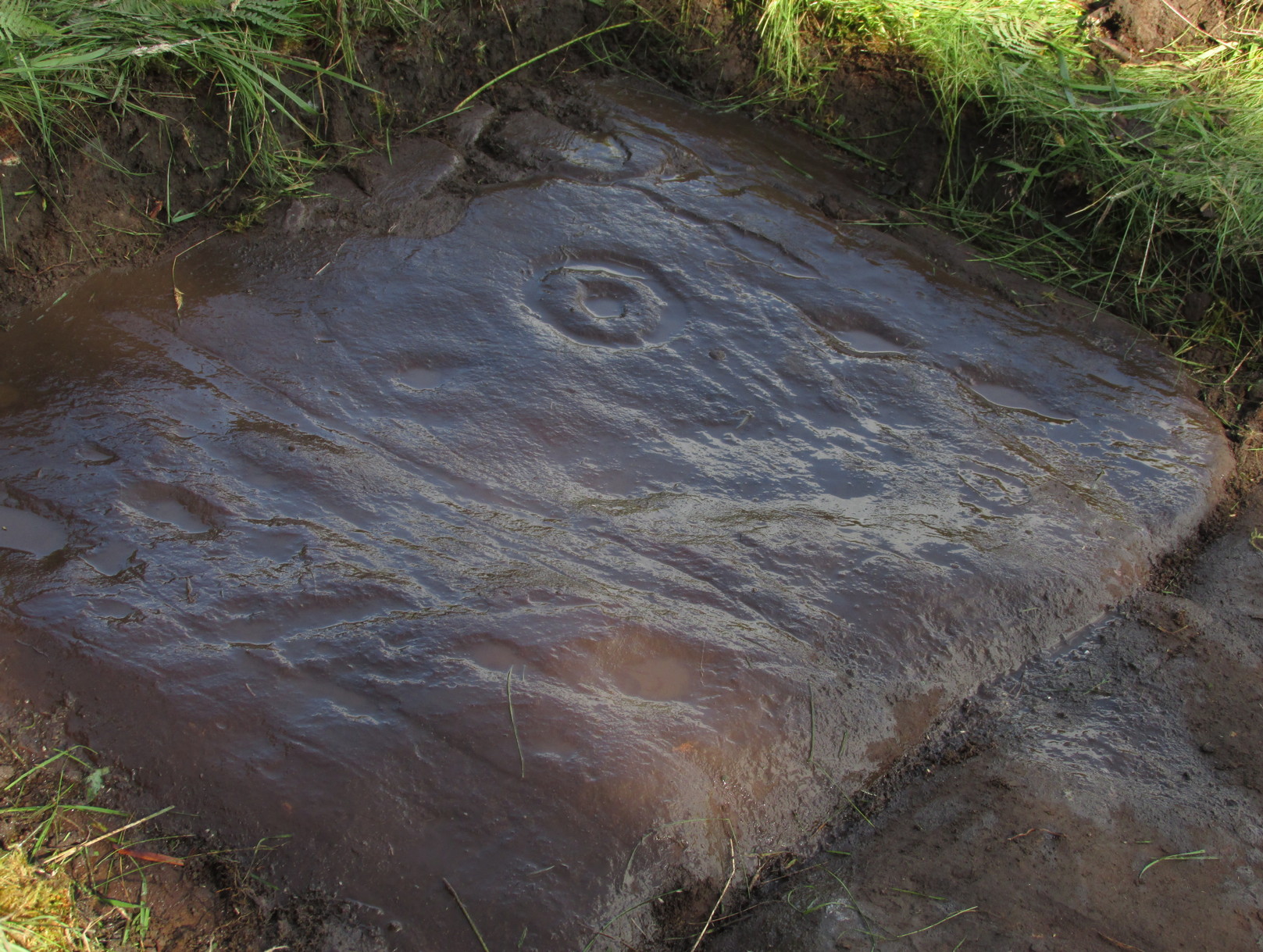
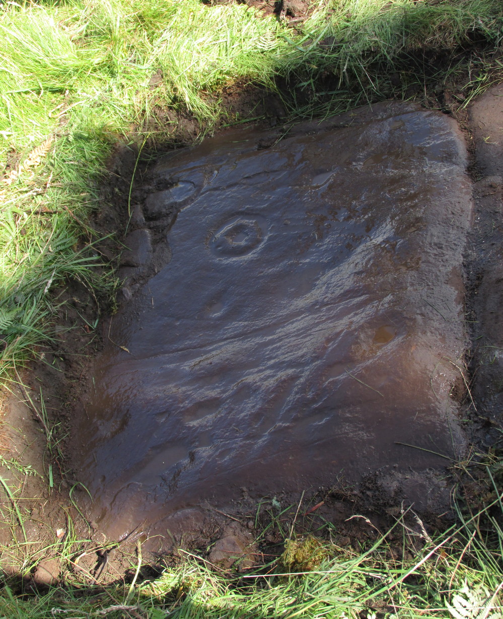
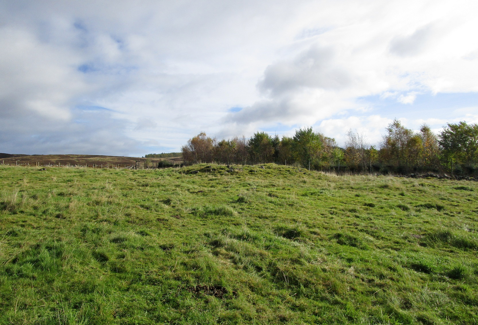
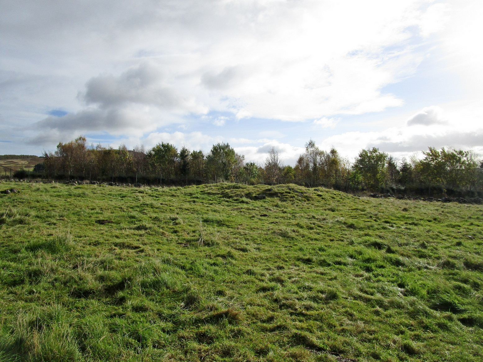
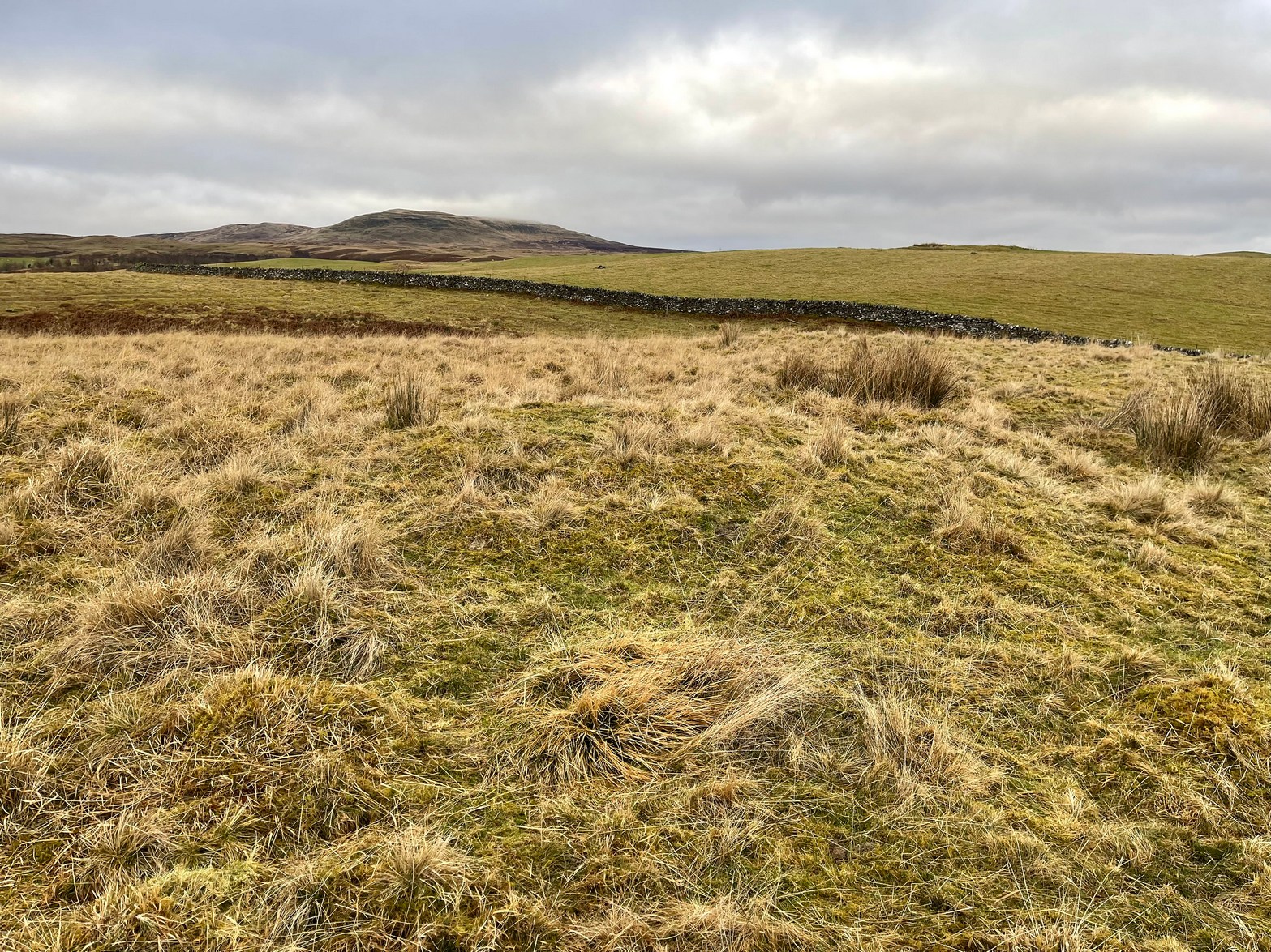
A petroglyph that was rediscovered as recently as 2003, by J. Ward, has, it would seem, already been lost. In all likelihood it has become hidden beneath vegetation. Found near the Petrifying Well, the carving is archetypal, consisting of a single cup surrounded by two rings, on a low flat piece of rock on the south-side of the Tarras burn, only a few hundred yards above the road. I’ve added the site here in the hope that a diligent petroglyph hunter can find it again and leave it open to the elements for us all to see. Let us know if you find it.
Along the A81 road from Port of Menteith to Aberfoyle, watch out for the small road in the trees running at an angle sharply uphill, nearly opposite Portend, up to Coldon and higher. Keep going, bearing right past Mondowie and stopping at the dirt-track 100 yards or so further up on the left (ignore the english fuckers up here who tell you it’s a pwivate road and they don’t want you parking there—unless you’re blocking the road obviously!). Walk up up here for ⅔-mile, as if you’re visiting the Over Glenny (5) carving, but as you get close to the defining sycamore tree, walk past it for about 60 yards towards the ruinous buildings. You’re looking for a reasonably large earthfast rock with a notable bowl about 12-inch across at the edge of the stone. That’s your defining feature.
Archaeology & History
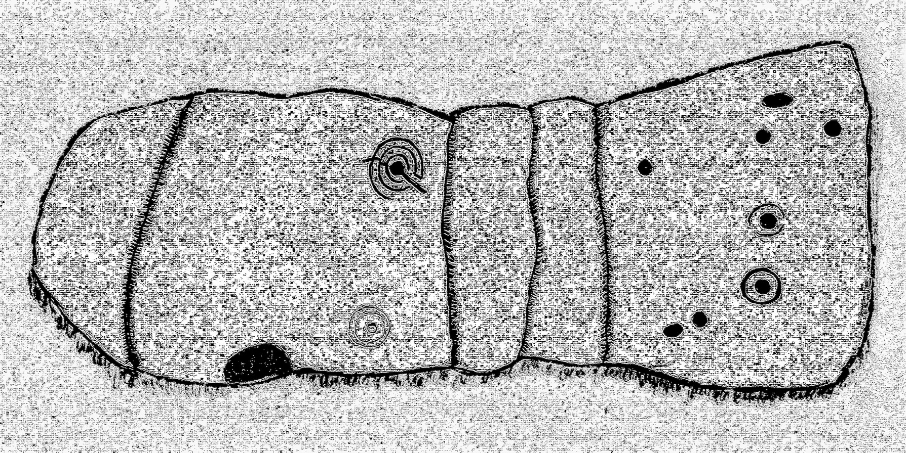
Arty sketch of the design
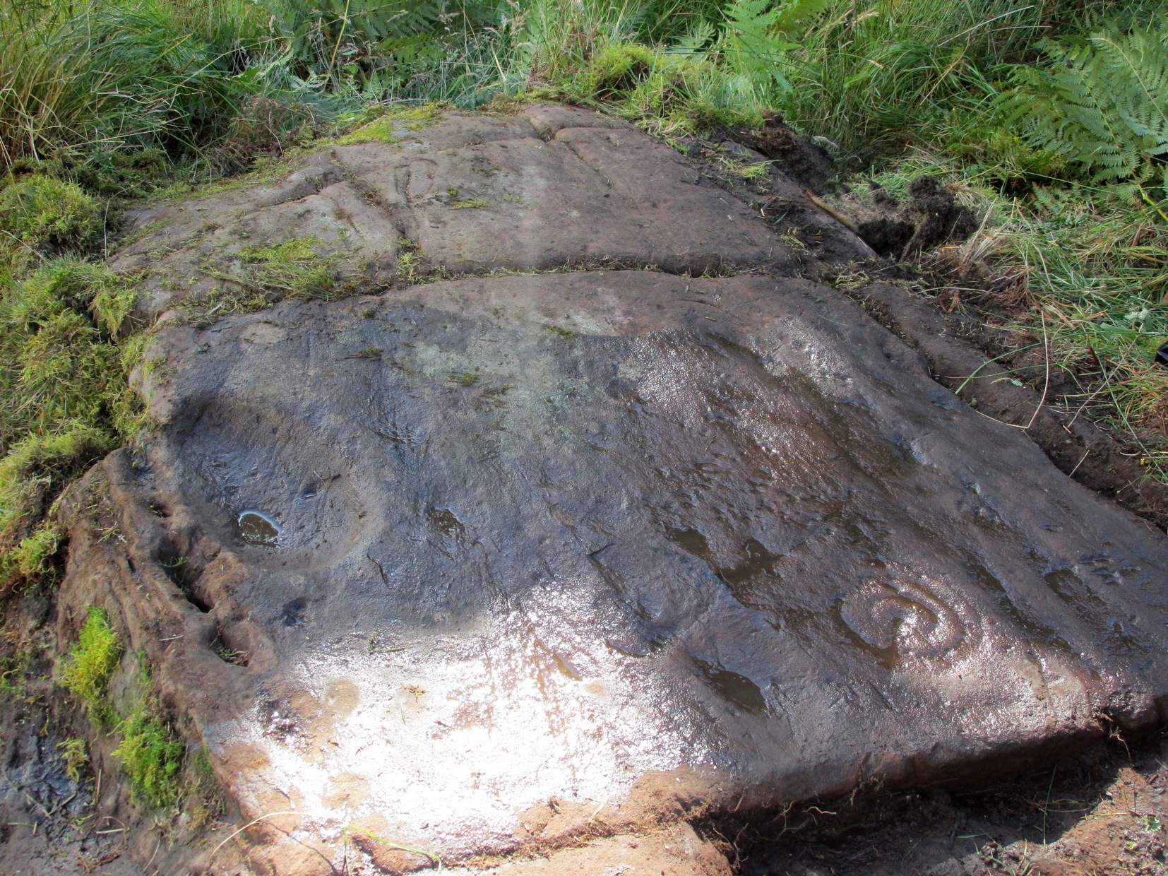
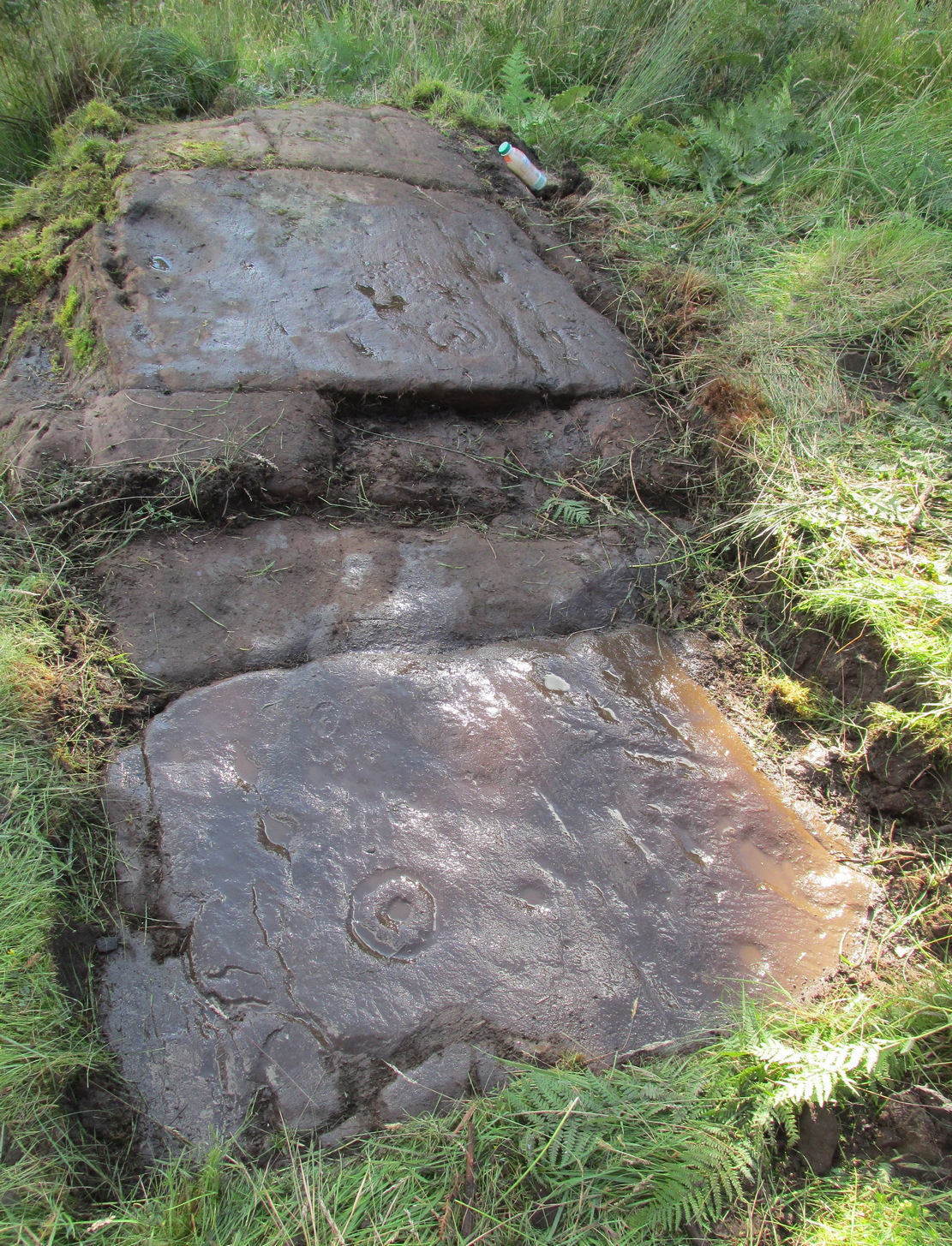
This is another decent design in the mass of petroglyphs on this plain overlooking the Lake of Menteith. On our first visit here ten yeas ago, only one half of the rock was visible—and half of that was covered with grasses! But with patience, we slowly rolled back the turf and slowly uncovered more and more, eventually seeing the main elements you can see in these photos and the arty sketch I’ve made here. (the Over Glenny [14] carving a few yards further east may be just be a continuation of this design)
Full length of the stoneThe triple cup-and-ring
When the carving was first noticed by George Currie (2010), he only noticed “a cup mark surrounded by two penannulars, an arc and a single radial”—ostensibly meaning, a cup-and-triple ring, with the outer ring incomplete, and a line running out from the central cup. But there’s more, obviously. On our second visit, a very faint but distinct cup-and-double-ring was noticed in low light on the same section of the rock where the triple-ringed element is carved. We weren’t able to get a photo that showed it, as the light wasn’t doing as we needed, but I’ve highlighted it on the sketch, where it’s to the right of the large ‘bowl’ at the very edge of the rock. This ‘bowl’ probably had utilitarian functions, whether it was for just crushing herbs or grains, or to make organic paints: and this function most likely had some relationship with the petroglyph—but we know not what! It’s possible that the people who lived in the adjacent ruin, several centuries ago, may also have made use of this.
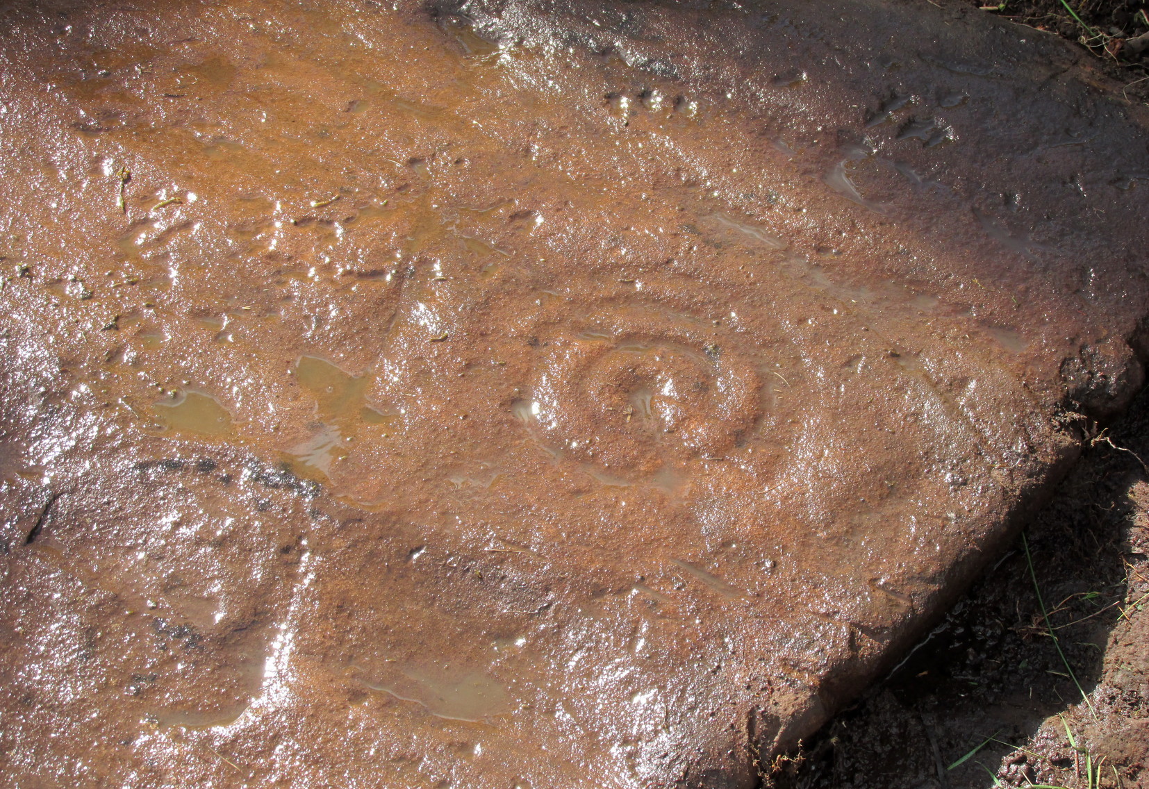
East-end of the designEast-end angular pose
When we exposed the other half of the carving, a very well-cut and well-preserved cup-and-ring sat beside another much more eroded partner, which was almost impossible to see from some angles. You can just make it out in the photos here. You’ll also notice a scatter of several other cup-marks and elongated ‘cups’ on the same section of rock. It was difficult to work out whether some of these marks in the stone were Nature’s handiwork, or the result of human hands. Some were obviously man-made, but we need to look at it again when the daylight conditions are good, so that we can make a more accurate assessment.
Currie, George, “Port of Menteith: Upper Glenny (UG 1), Cup-and-Ring Marked Rocks”, in Discovery & Excavation, Scotland, New Series – volume 11, 2010.
Acknowledgements:Huge thanks to the crew: Paul Hornby, Lisa Samson & Fraser Harrick in making this carving come to life, and for use of a photo or two.
From Kirkmichael village take the A94 road 2 miles south to the Balnabroich standing stone and another 100 yards past it, on the left (east) take the dirt-track uphill, following the directions to reach the Balnabroich hut circles. You’ll see the large prehistoric rock pile of the Grey Cairn on the near skyline just above the huts and roughly on the same level, 50 yards away to the south, you’ll see this scruffy lumpy dump of a cairn, all overgrown.
Archaeology & History
The cairn, looking S
Amidst the veritable scatter of a thousand clearance cairns (yes, that’s the estimate), there are a few up here that had more funerary functions than the rest. This being one of them. When Allan Stewart (1795) wrote about them all in the Statistical Account, he couldn’t have missed this one—and yet he made no mention of it. We had to wait another seventy years before the outside world became aware of its existence. Then, along with “a band of between twenty and thirty workmen,” John Stuart (1865) set out to see what lay beneath the rocky pile. In truth, much more attention was given to the huge Gray Cairn close by (understandably so), but at least some attention was given here. Stuart described this cairn as,
“about 9 yards across, defined by large boulders, with a raised ridge around, and a cup in the centre. The raised ridges and centre were all formed of small stones and earth. A trench was cut through it from the southeast, which showed that in the centre, at a depth of 2 feet, a deposit had been made, of which the remains were charred wood and fragments of charred bone, with traces of blackish matter, which had filtered into the yellow subsoil, as in the case of the graves at Hartlaw.’ Many fragments of white quartz pebbles appeared near the centre, as in other cairns to the east.”
Indeed, at least one of the “cairns to the east” is made entirely of quartz stones! Since Mr Stuart’s dig into the tomb, it has widened out slightly as rummaging cattle and other damage has been inflicted, and the grasses have coloured the tomb with their life. Check it out when you’re up here!
References:
MacLagan, Christian, The Hill Forts, Stone Circles and other Structural Remains of Ancient Scotland, Edmonston & Douglas: Edinburgh 1875.
Ramsay, John S., Highways and Byways of Strathmore and the Northern Glens, Blairgowrie Advertiser 1927.
Royal Commission on the Ancient & Historical Monuments of Scotland, North-East Perth: An Archaeological Landscape, HMSO: Edinburgh 1990.
Stewart, Allan, “Parish of Kirkmichael,” in Statistical Account of Scotland – volume 15, 1795.
Stuart, John, “Account of Excavations in Groups of Cairns, Stone Circles and Hut Circles on Balnabroch, Parish of Kirkmichael, Perthshire,” in Proceedings Society Antiquaries, Scotland, volume 6, 1865.
Acknowledgements:Huge thanks for use of the Ordnance Survey map in this site profile, reproduced with the kind permission of the National Library of Scotland.
From Callander head east along the main A84 road and nearly 300 yards past the entrance to the Keltie Bridge caravan park, take the tiny road on your left (north) and barely 100 yards along turn right and go up here for exactly 1 mile. Walk up the track from here and follow the directions to find the Black Park (1) cairn; and then the nearby small Black Park (2) cairn. From here you need to walk north-east round the small rounded hillock in front of you, and cross a small burn (stream) up to the next small grassy rise. Altogether this is about 200 yards from the Black Park (2) cairn. On this grassy rise lives the Black Park (3) cairn!
Archaeology & History
As with its compatriot Black Park (2) cairn 200 yards southwest, this can be hard to see. It’s an overgrown small singular cairn (it looks like a tumulus now) of no great note to look at: probably the resting spot of an individual or just a small family. Measuring some 5-6 yards across and less than a yard high at the most, its easily missed unless you’re really mean to find it. More impressive are the ones on the hill immediately above you to the east. Head there next!
References:
Royal Commission Ancient & Historical Monuments, Scotland, Braes of Doune: An Archaeological Survey, RCAHMS: Edinburgh 1994.
When the Grey Cairn above Balnabroich, Kirkmichael, was explored in the second-half of the 19th century by John Stuart (1865) and a number of local labourers, they found the floor of the tomb had been paved with a number of large boulders. Near its centre, along with finding remains of charred wood, they moved some of the rocks and,
“On turning over the stones a circular disc of stone with a hole in the centre was found, and also a small boulder with a cup on its flat face.”
Grey Cairn at sunfall
He made no further remarks about the carving and no intimation that it was removed, so we must presume it is still there, at the botton of the cairn. Any visitors to the site might want to have a look at the massive scatter of surface stones that make up the cairn to see if any further cup-marks exist on them. It’s not uncommon to find them on such giant tombs.
Folklore
A very curious folktale was known of the cairn in the 19th century, whose theme is recognized at numerous other prehistoric sites, but the mythic creature involved here is very much different from the ones we’re used to. Mr Stuart told that,
“The popular belief is that a mermaid is buried beneath it. This mermaid used to throw stones at people who were coming from church at Kirkmichael, and she could only be seen through a hole in the knot of the pine tree. At last she was chased to the hill at Balnabroch on her flight to the waters of Loch Marech, on the other side of the hill, and there killed, when the Grey Cairn was raised over her.”
References:
Royal Commission on the Ancient & Historical Monuments of Scotland, North-East Perth: An Archaeological Landscape, HMSO: Edinburgh 1990.
Stuart, John, “Account of Excavations in Groups of Cairns, Stone Circles and Hut Circles on Balnabroch, Parish of Kirkmichael, Perthshire,” in Proceedings Society Antiquaries, Scotland, volume 6, 1865.
Acknowledgements:Huge thanks for use of the Ordnance Survey map in this site profile, reproduced with the kind permission of the National Library of Scotland.
Along the A924 Strathardle road, a couple of miles south of Kirkmichael, about 100 yards south of the Balnabroich standing stone, look out for the dirt-track that runs up the slope on the east side of the road. Go up here, past Stylemouth house and further up the track where it opens out into the fields. Keep heading up the same track and you’ll notice on the near skyline a few hundred yards ahead of you, a mass of stones with a tree growing out of it. That’s the Grey Cairn; and about 75 yards below it, just to the right-side of the path low down in the grasses, you’ll see this hut circle.
Archaeology & History
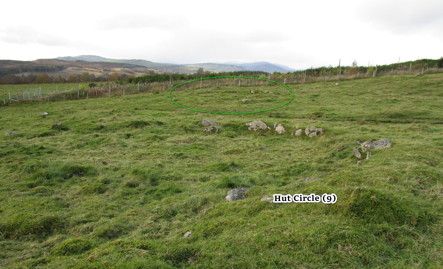
In an upland area that is literally teeming with ancient remains, this is a good place to start if you’re wanting a day out exploring. It’s the best and easiest of the hut circles to find and is a good indicator of what to look for when you’re seeking out the others close by. This particular prehistoric house has been noted in various books and essays: firstly by the great Scottish antiquarian John Stuart (1868) in his overview of the great mass of sites hereby, saying simply:
“A hut circle on the south-west of the Grey Cairn was dug into around the entrance, in the belief that in this situation articles would probably have been thrown out, but with no result. In the centre, charred wood and minute fragments of bones were found.”
Looking from aboveArc of walling north to east
The great Christian MacLagan (1875) came to survey the area shortly after Stuart’s visit, making a series of sketches of some of the circles. She noted fourteen huts hereby, but it’s not totally clear which of them is this particular “hut 9”. It seems to have been her hut circle no.13, which she told “has a central chamber 40 feet in diameter, and its wall is 10 feet broad.” This is pretty close to our modern measurements. From outer wall to outer wall, its east-west axis measures 47 feet, and its north-south axis measures 49 feet. The most notable section of the walling is on is northern and eastern sides where it is deeply embedded into the ground.
When you’re sitting in this hut circle, eating your sandwich or drinking your juice, remember that thousands of years ago someone was doing exactly the same thing in the place where you’re now sat!
Just 70 feet away is hut circle no.10 in this cluster; whilst above this is the massive prehistoric rock pile of the Grey Cairn; and the smaller earth-covered mound above you to the right is another prehistoric burial. A small stone circle is on the moorland level beyond that… There’s plenty to see here.
References:
Coutts, Herbert, Ancient Monuments of Tayside, Dundee Museum 1970.
Harris, Judith, “A Preliminary Survey of Hut-circles and Field Systems in SE Perthshire”, in Proceedings Society Antiquaries, Scotland, volume 114, 1984.
MacLagan, Christian, The Hill Forts, Stone Circles and other Structural Remains of Ancient Scotland, Edmonston & Douglas: Edinburgh 1875.
Royal Commission on the Ancient & Historical Monuments of Scotland, North-East Perth: An Archaeological Landscape, HMSO: Edinburgh 1990.
Stuart, John, “Account of Excavations in Groups of Cairns, Stone Circles and Hut Circles on Balnabroch, Parish of Kirkmichael, Perthshire,” in Proceedings Society Antiquaries, Scotland, volume 6, 1865.
Thorneycroft, Wallace, “Observations on Hut Circles near the Eastern Border of Perthshire, north of Blairgowrie,” in Proceedings Society Antiquaries, Scotland, volume 67, 1933.
Acknowledgements:Huge thanks for use of the Ordnance Survey map in this site profile, reproduced with the kind permission of the National Library of Scotland.
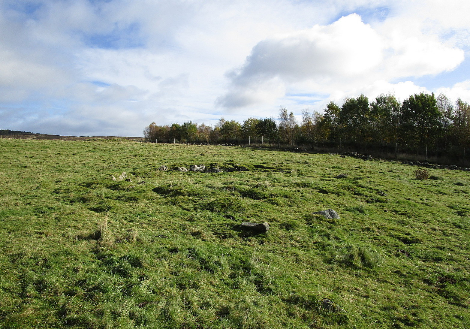
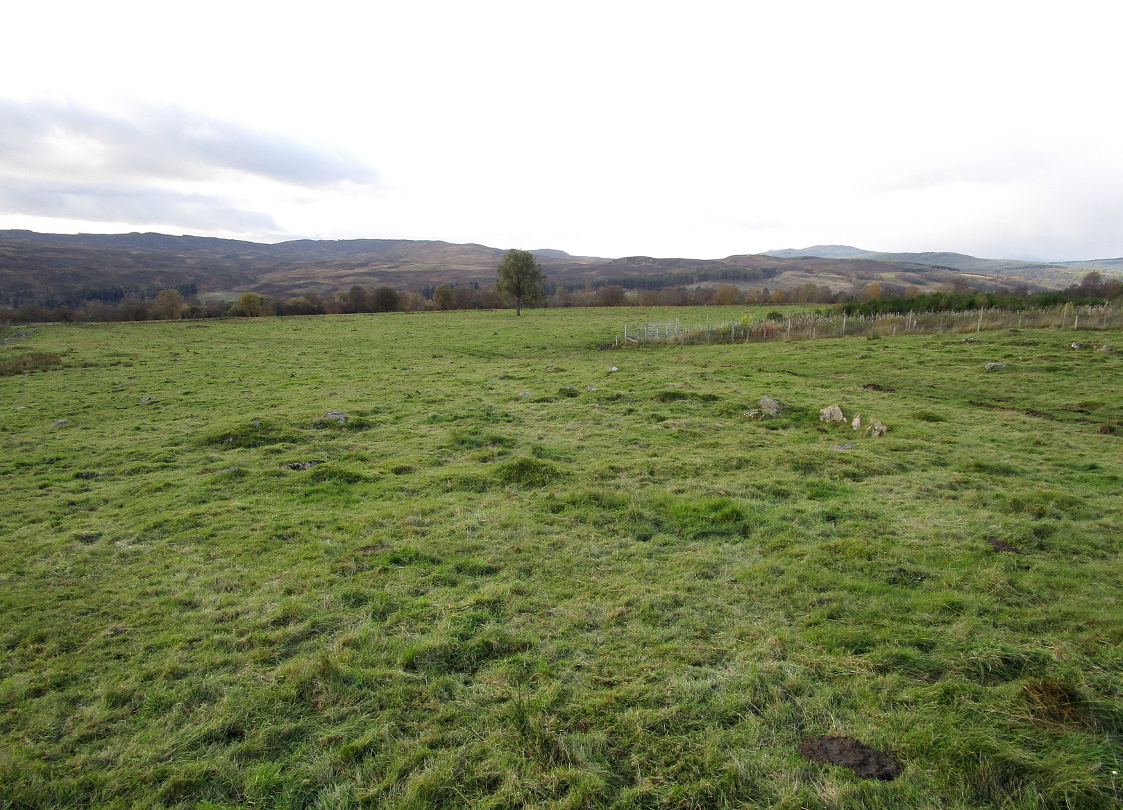
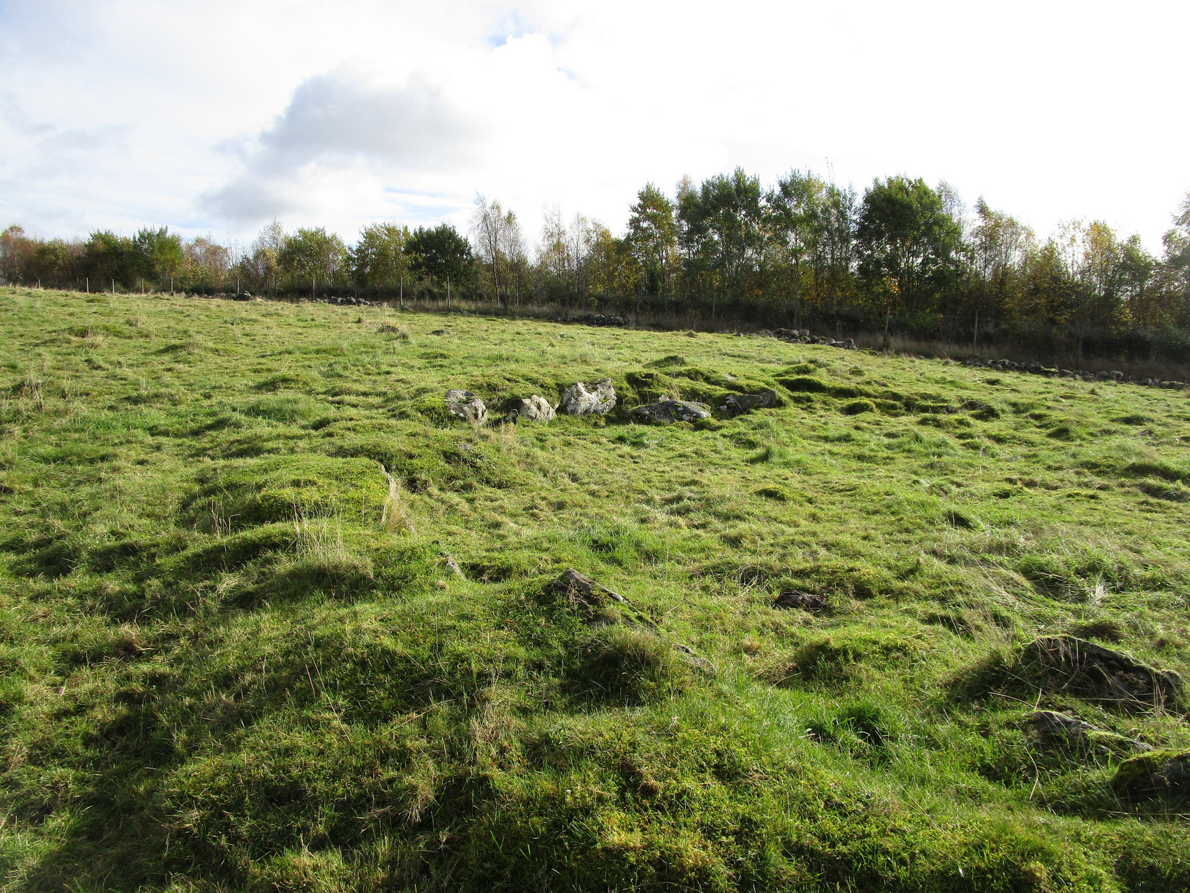
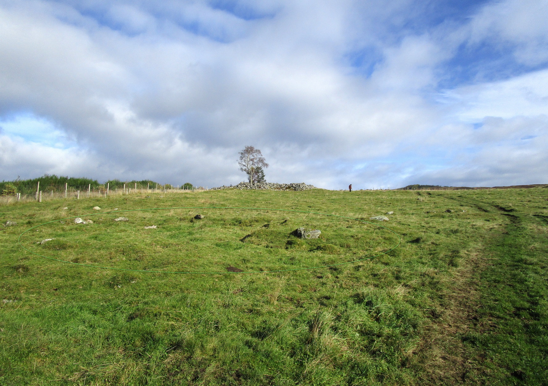
From Kirkmichael to the Balnabroich standing stone, take the same directions as if you’re heading up to the Balnabroich hut circle (9). Just over 20 yards NNW of it, on the other side of the faint footpath that takes you to the Grey Cairn, look closely at the ground and you’ll see a broken oval of stones in the grasses.
Archaeology & History
This can be difficult to see in poor light, and I found it easier to look at from above, closer to the Grey Cairn.
Hut remains, circled
It’s one of the twenty (known) hut circles in this archaeologically rich neck o’ the woods. Nothing special to look at, but it is perhaps 4000 years old! This one seems to have been listed by Christian MacLagan (1875) as her hut circle no.12 and which she described briefly, telling that “the central chamber of this circle is 36 feet in diameter, and the surrounding wall is 15 feet broad.” Much of the walling would seem to have been stripped away considerably since MacLagan’s time. The faded remains of its entrance can be seen on its southwestern side.
References:
Coutts, Herbert, Ancient Monuments of Tayside, Dundee Museum 1970.
Harris, Judith, “A Preliminary Survey of Hut-circles and Field Systems in SE Perthshire”, in Proceedings Society Antiquaries, Scotland, volume 114, 1984.
MacLagan, Christian, The Hill Forts, Stone Circles and other Structural Remains of Ancient Scotland, Edmonston & Douglas: Edinburgh 1875.
Royal Commission on the Ancient & Historical Monuments of Scotland, North-East Perth: An Archaeological Landscape, HMSO: Edinburgh 1990.
Stuart, John, “Account of Excavations in Groups of Cairns, Stone Circles and Hut Circles on Balnabroch, Parish of Kirkmichael, Perthshire,” in Proceedings Society Antiquaries, Scotland, volume 6, 1865.
Thorneycroft, Wallace, “Observations on Hut Circles near the Eastern Border of Perthshire, north of Blairgowrie,” in Proceedings Society Antiquaries, Scotland, volume 67, 1933.
Acknowledgements:Huge thanks for use of the Ordnance Survey map in this site profile, reproduced with the kind permission of the National Library of Scotland.
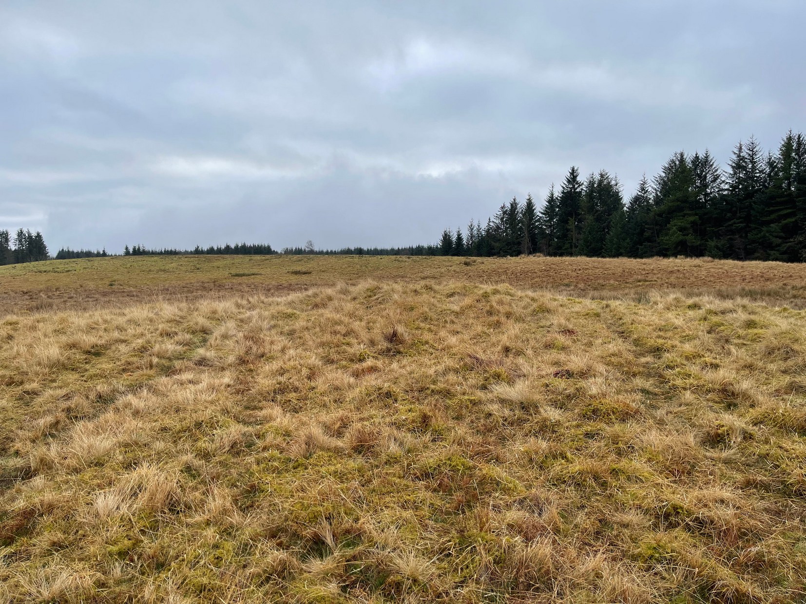
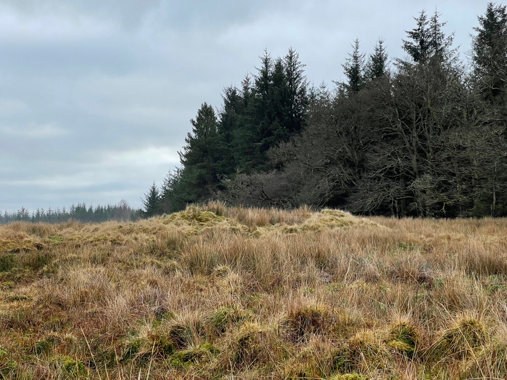
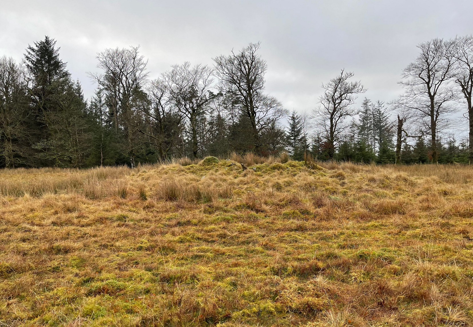
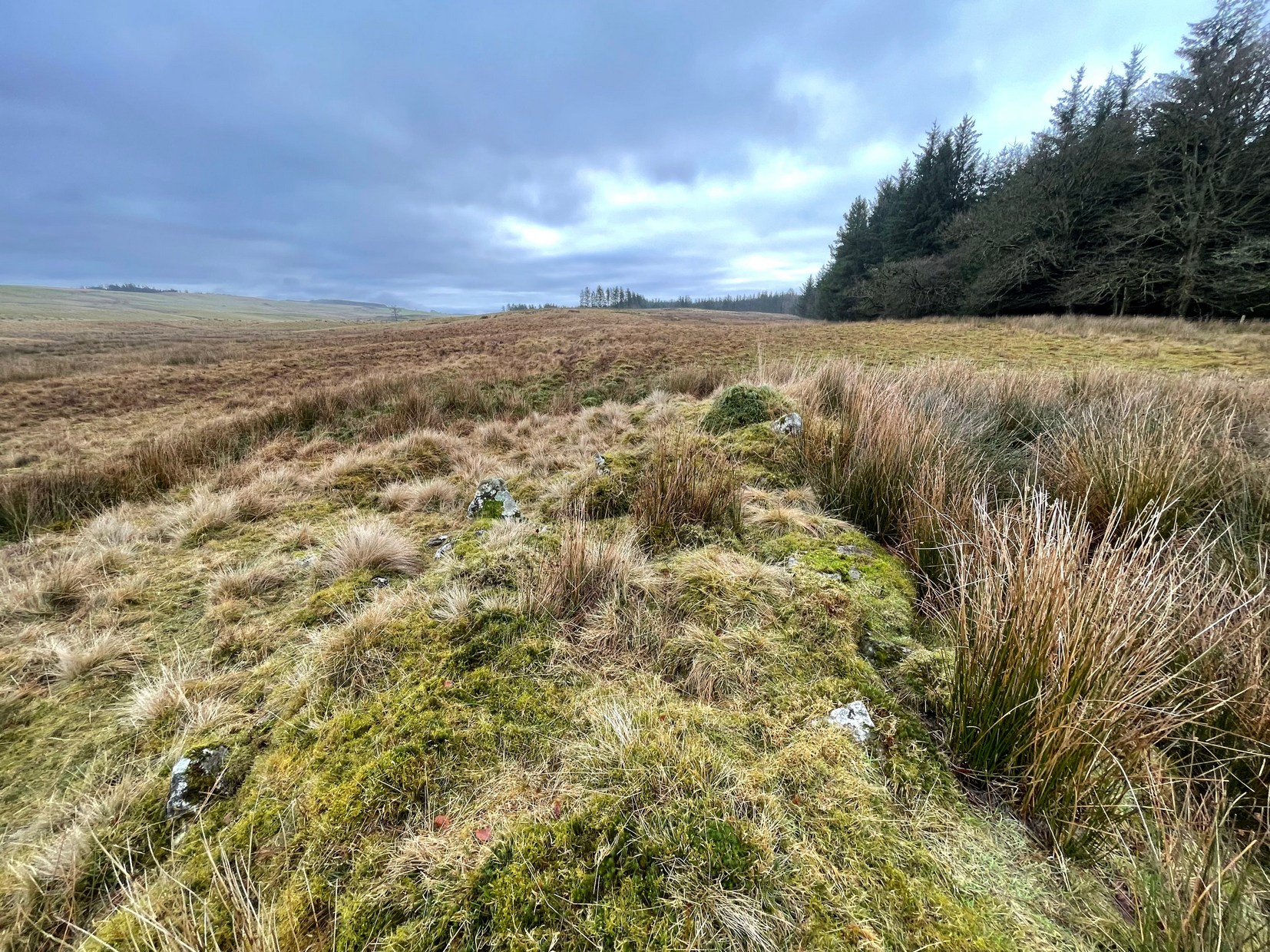
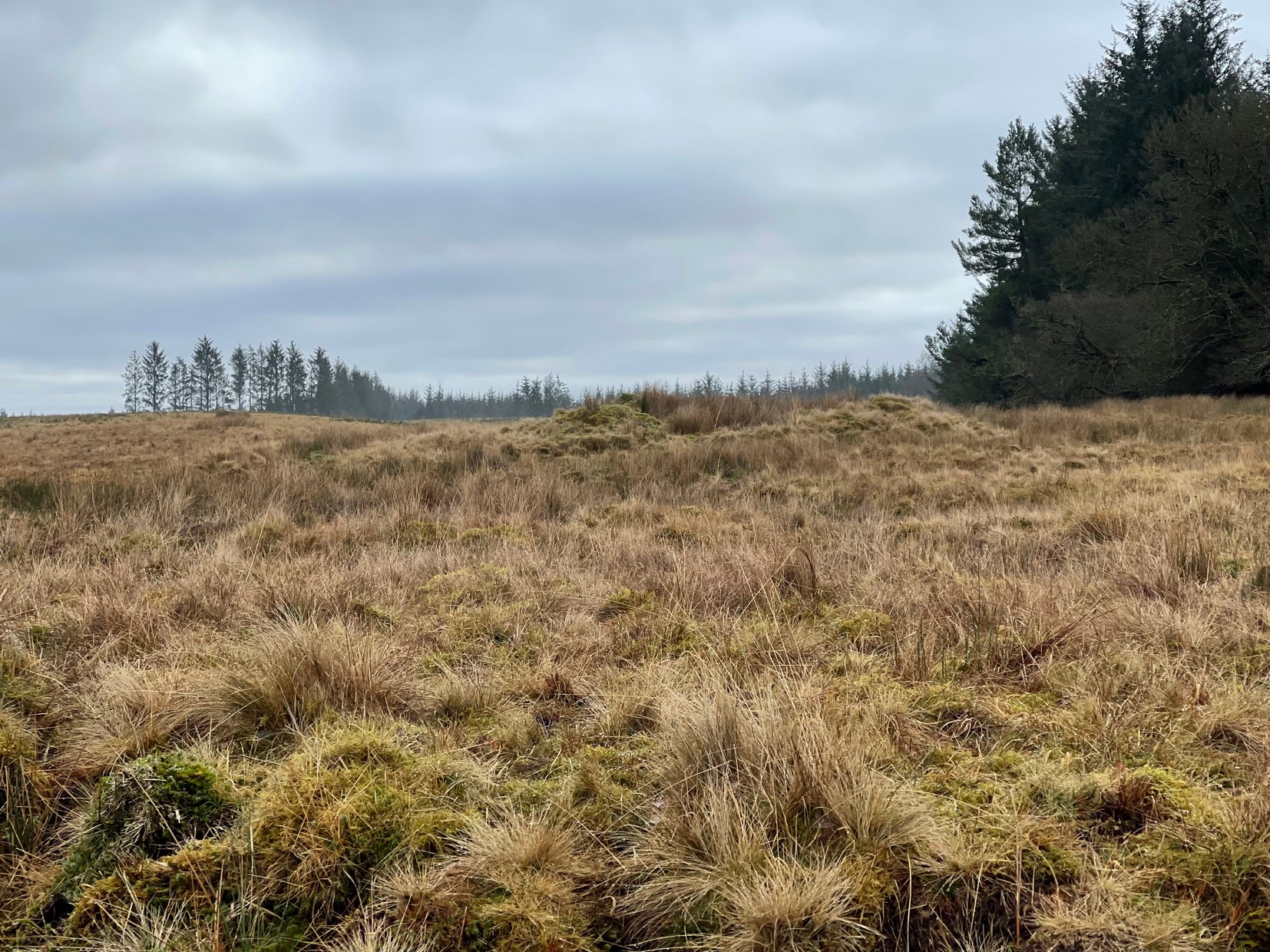
Take the same directions as if you’re going to visit the large Black Park (1) cairn, and from here look down the slight boggy slope to your right (east) and, across the other side of a small burn (stream) you’ll see a slightly raised grassy knoll. A curved dyke is to its left (west) side. You’re there!
Archaeology & History
This small cairn, barely two feet high at the most, and five yards across, is deemed as a possible Bronze Age cairn on Canmore and in the Royal Commission (1994) report of the area. There is certainly a pile of small stones here, but it may be a clearance cairn (I hope I’m wrong). Only an excavation will tell us for sure.
References:
Royal Commission Ancient & Historical Monuments, Scotland, Braes of Doune: An Archaeological Survey, RCAHMS: Edinburgh 1994.
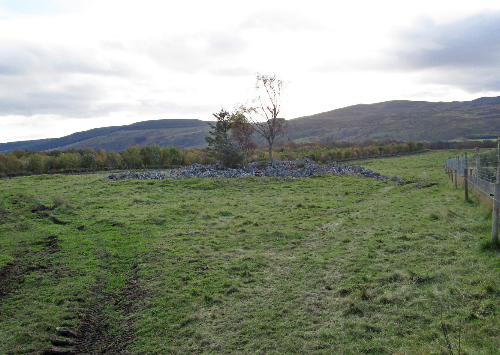
Less than a mile east of Callander on the main A84 road, nearly 300 yards past the entrance to the Keltie Bridge caravan park, take the tiny road on your left (north) and barely 100 yards along turn right and go up here for excatly 1 mile (give or take a few yeards) where track goes into the forest on your left and you can park-up here. Walk up the track into the silence for just under a mile where, as the track splits and you kink to the right, a gate appears. On the other side of the gate, turn immediately left, almost walking back on yourself, just above the curving waters of a burn, through boggy reeds, keeping to the fence-line until, less than 300 yards along, you’ll reach what you’re looking for.
Archaeology & History
Black Park (1), looking W
This reasonably large cairn and its neighbours (Black Park [2], [3], [4] and [5]) would appear to be relatively new discoveries as I can find nothing about it prior to the Royal Commission’s 1994 survey. They are even absent from Moray MacKay’s (1953) excellent work on the area! Hence, descriptions of it are scant and visitors to the place are few indeed (we did meet a local who knew about the old tomb, but said that nothing was known about it); but it is, nonetheless, a fine, albeit denuded and very overgrown cairn, living today amidst a quiet mass of reeds and surrounded by boggy ground—so make sure you’ve got your boots on!
Internal line of stoneworkBlack Park (1), looking SE
At its height, today, it stands less than four feet tall and measures roughly 16 yards across at its widest. Through one section of the tomb there runs a raised line of stonework that almost looks like internal walling, which may have been where a chamber once existed. It’s been hollowed out by someone in the not-too-distant past but, as I said, there are no records of such a thing, so whether or not that was a chamber or merely a fortuituous collapse of stone in a straight line, we can’t really say. Along its more northern edges there seems to be a small raised wall of stone defining its edge, although once again it requires a more discerning examination to work out whether this is part of its original facade, or is a result of some of the stone mass falling to the edges.
Visit the old place and sit with its silence for a while…
References:
Royal Commission Ancient & Historical Monuments, Scotland, Braes of Doune: An Archaeological Survey, RCAHMS: Edinburgh 1994.
Stone Circle (destroyed): OS Grid Reference – NY 549 182
Archaeology & History
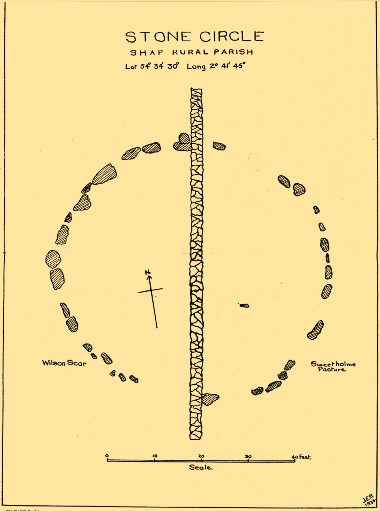
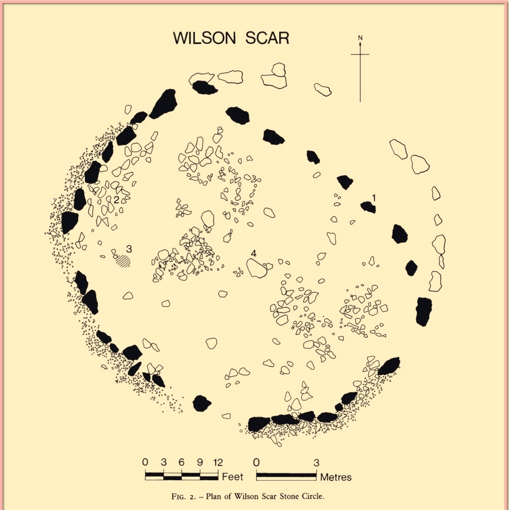
This site has been completely destroyed by the huge eyesore of a quarry that we all see when we’re travelling up the M6 north, above Shap. John Waterhouse (1985) told that “a rescue excavation” was carried out here with help from the kids at Penrith Queen Elizabeth School, shortly before its destruction in 1952, but now there is no trace left of it. When it was first described by J.E. Spence (1935), the circle had already been damaged by a wall that cut right through its centre. He told:
Spence’s 1935 plan
“The circle, which is 6o feet in diameter, is composed of 35 stones, 20 being on the west and 15 on the east side of the boundary wall running through the circle from north to south. The stones of which the circle is composed are Borrowdale erratics, a large number of which are scattered over the adjoining ground on both sides of the wall but more thickly in Sweet Holme Pasture. The stones, which vary up to 5 feet 9 inches by 3 feet, are larger and more numerous in the north-west quadrant where the tallest stands 1 foot 8 inches above the level of the turf. The ground within the circle is level, but to the south and west it slopes gently down from the edge of the circle in such a manner as to suggest that the area within the circle has been levelled.”
1952 plan laid over Spence’s 1935 plan
Spence told that an ancient “sunken trackway” led outwards from the circle to the south-west in the direction of Rosgill, but when the 1952 excavation occurred, no remains of such a track were found; nor was the wall that had cut through it; and the north-easterly section of the circle had been cut into and re-laid, presumably by the quarrymen. It was quite plain, wrote G.G. Sieveking (1984), “that this portion of the monument was encroached upon in the summer of 1952, and hastily reconstructed for the benefit of the archaeologists.”
Their excavation found that some internal sections of this ring had been paved with thin limestone slabs and they also uncovered two small cairns, neither of which possessed anything. However, they did find four funerary deposits within the monument: one at the northeastern section of the circle (no.1); another near the centre (no.4); and remains of a cremation west of centre (no.3); but the most complete find was at the western side of the ring, where a “disarticulated inhumation burial was lying immediately beneath the turf line in a shallow grave 1.35 m long, surrounded by a setting of small boulders.” It was a near complete human skeleton. This place was obviously, at times, used in ceremonies for the dead.
Shortly after the archaeological examination of the site, it was blasted away by quarrying. Gone!
References:
Barnatt, John, Stone Circles of Britain– volume 2, BAR: Oxford 1989.
Burl, Aubrey, The Stone Circles of Britain, Ireland and Brittany, Yale University Press 2000.
Farrah, Robert W.E., A Guide to the Stone Circles of Cumbria, Hayloft: Kirkby Stephen 2008.
Seton, Ray, The Reason for the Stone Circles in Cumbria, privately published: Morecambe 1995
Sieveking, G.G., “Excavation of a Stone Circle at Wilson Scar, Shap North 1952,” in Transactions Cumberland & Westmorland Antiquarian & Archaeological Society, volume 84, 1984.
Spence, J.E., “A Stone Circle in Shap Rural Parish,” in Transactions Cumberland & Westmorland Antiquarian & Archaeological Society, volume 35, 1935.
Waterhouse, John, The Stone Circles of Cumbria, Phillimore: Chichester 1985.