Cup-and-Ring Stone: OS Grid Reference – SE 0251 4384
On the opposite side of the road (B6265) from Airedale General Hospital, Steeton, you’ll notice a footpath going up the field into some woods. Go up here. Once you come out the top of the woods, follow the dodgy path on your right (west) along the rocky edges for 250 yards, following the edges of the field walling. You’ll eventually reach the field with lots of rocks in it. It’s the field before this one, close to the walling. Look around!
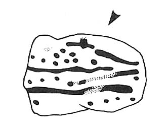
Archaeology & History
I’ve been a little cautious about putting this carving on TNA simply because it seems to be an isolated example and was a little unsure about its veracity. If I’d have found the stone on the edges of Ilkley Moor, Rivock Edge, or the heights above Askwith, I wouldn’t have hesitated. The fact that no other carvings occur nearby has been my main trouble. But I suppose if the carving turns out to be nowt of the sort, I can discard it at a future date and, of course, make sure that a lot of other cup-and-ring stones are disregarded at the same time (there are a number of other designs much less defined than this one which have been okayed by archaeo’s who’ve been into this subject for much shorter periods of time than myself). But less of the waffle!

When we first found this, in April 2009, I was out looking for the remains of an old well (called Jane Well, a few hundred yards west of here). The heaven’s opened and I ended up in the woodland and then found the field full of large rocks, some seemingly used by man in more recent centuries, atop of the woods, and so had to check them out! But this was one of the first stones we found.

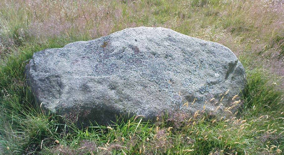
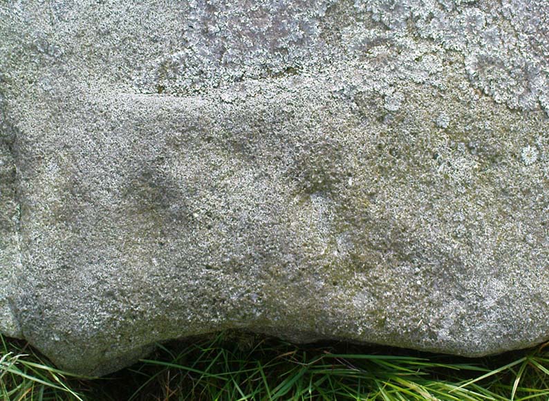
The rock itself, as the photo shows, appears to have had one end of it split or broken off (not unlike one edge of the Hanging Stones, Ilkley Moor) at some time in the past, intruding on the arc, or line, beneath which are two distinct ‘cups’. A possible third cup-marking and other linear aspects seem apparent, with the design giving the distinct impression of a face. I keep meaning to go back and get a rubbing of the carving, but aint got round to it yet. When (if!) I gerrit done, I’ll add it onto this profile.
And although there are said to be no other prehistoric remains close to this old carving, the fields a coupla hundred yards west used to be called the Barrow Fields, where tombs were once found; and a little further along the same geological ridge atop of the excellent Kirk rocks, possible cup-markings scatter the edges of two sections — but they’re a little dubious; then there’s the Dragon Stone and associated cup-marked stone not far away. In the adjacent woods are the remains of old walling, but I’ve not found other carvings hereabouts. However, the rule tends to be: “where there’s one, there are more!”
Watch this space!
© Paul Bennett, The Northern Antiquarian