Toscaig, Applecross, Ross & Cromarty

Standing Stones: OS Grid Reference – NG 715 384

Archaeology & History

The Cambridge biologist J. Havelock Fidler described finding three standing stones in the gorgeous little remote hamlet of Toscaig in his book Ley Lines (1983), which neither the Applecross Local History Society, myself, nor anyone else has been able to locate (the OS grid reference cited above is simply an approximation of their locality). In an updated version of his work, Mr Fidler seems to indicate they can be found a short distance south-east of the village, at the end of an alignment which is supposed to start at Fearnmore (NG 724 605), at the northern edge of the peninsula. If they exist, could anyone perhaps enlighten us as to their whereabouts…?

References:

  1. Fidler, J. Havelock, Ley Lines – Their Nature and Property, Aquarian: Wellingborough 1983.

© Paul Bennett, The Northern Antiquarian

Sowerby Lad, Mytholmroyd, West Yorkshire

Standing Stone (destroyed): OS Grid Reference – SE 024 244

Archaeology & History

Standing stone on 1894 map

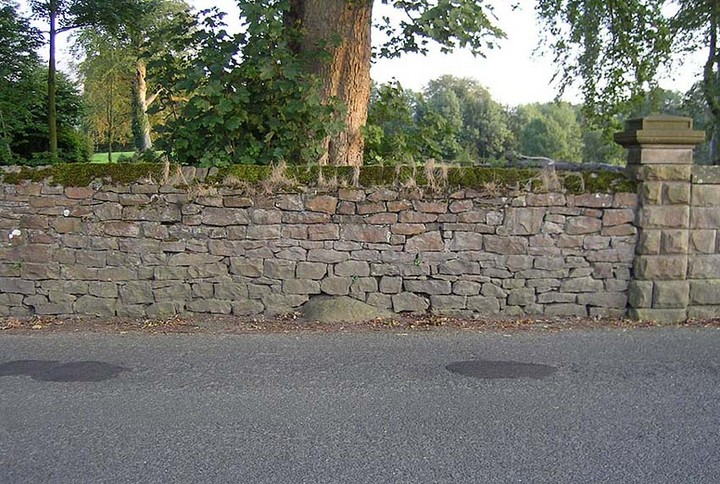
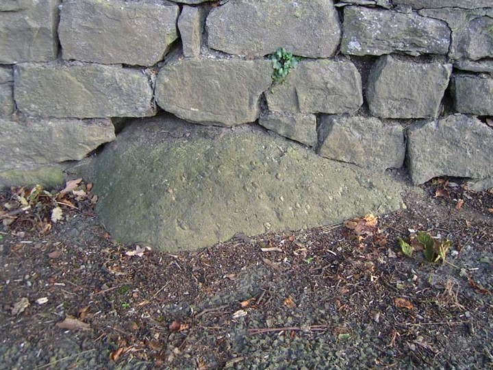
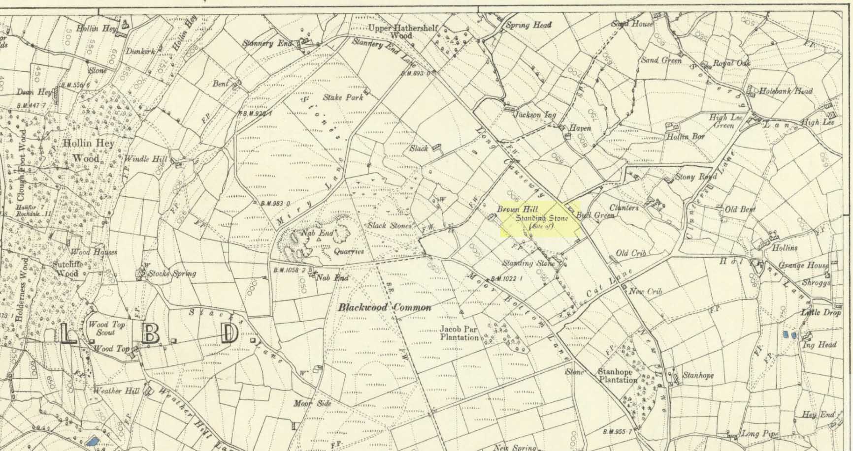
Also known as the Field House Standing Stone, this monolith seems to have gone.  It was first described in local Minister’s Accounts of 1403, and then again in the Wakefield court-rolls of 1515.  By the time John Watson (1775) wrote about the place there had been several other references describing this old “standyngstone”. It was still upright in 1852, but Ordnance Survey showed it as “Site of – ” at the beginning of the 20th century, and the stone had been moved a short distance away, further down from its original position to a spot at the side of the old trackway — but all trace of it has since vanished.

Folklore

This is thought to have been the standing stone which Robin Hood threw here, from the appropriately called Robin Hood’s Penny Stone at Wainstalls. The tale tells how he dug it out of the ground with a spade and threw it three-and-half miles across the valley until it landed here. Ooh, what a strong boy!

References:

  1. Bennett, Paul, The Old Stones of Elmet, Capall Bann: Milverton 2001.
  2. Smith, A.H., The Place-Names of the West Riding of Yorkshire, volume 3, Cambridge University Press 1961.
  3. Watson, John, The History and Antiquities of the Parish of Halifax, T. Lowndes: London 1775.

© Paul Bennett, The Northern Antiquarian

Wart Stone, Bradford, West Yorkshire

Standing Stone (destroyed):  OS Grid Reference – SE 15940 34211

Also known as:

  1. Ash Stone
  2. Pin Stone

Archaeology & History

Wart Stone on 1852 OS-map

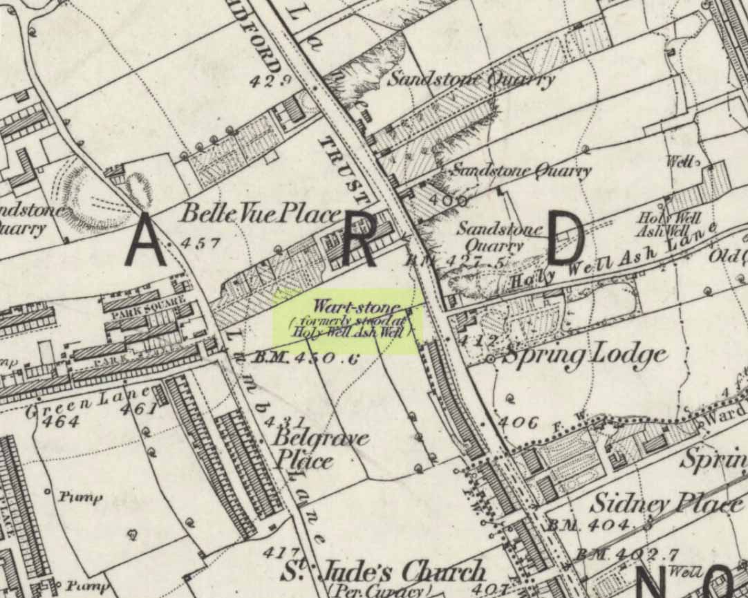
At Bradford City’s football ground there used to be the holy well known as the Holy Ash Well, adjacent to which was this old stone (as shown on the 1852 OS map).  For some reason it was uprooted and moved further up the hill around the end of the 19th century and was resurrected beside the old Belle Vue Hotel on Manningham Lane.  From thereon however, I’ve not been able to trace what happened to it, and presume it’s been destroyed.  It was known by local people to have had a ritual relationship with the adjacent healing well, to which people were said to visit from far and wide.

It seems to have been described first by Abraham Holroyd (1873), who told us that:

“In Manningham Lane there is a fine well, in old deeds called Hellywell, i.e., holy well, in a field now called Halliwell Ash, now a stone quarry… Near this is the ancient Pin Stone.”

The Bradford historian William Preston also made mention of the stone in one of his early surveys, where he told how local people also knew the stone as the Ash Stone, due to its proximity and ritual relationship to a great old tree.

Folklore

Also known as the Wart Stone, thanks to its ability to cure them and other skin afflictions.  Intriguingly, the building which now stands on the site is said to be haunted.

As my old school-mate, Dave Pendleton (1997), said of the place and its associated well:

“Prior to 1886 the only feature of any real note in the Valley Parade environs was a holy well that emerged near the corner of the football grounds Midland Road and Bradford End stands; hence the road Holywell Ash Lane. Today the site of the well is covered by the football pitch.

Only the road name survives as a reminder of what was apparently one of the district’s foremost attractions. On Sundays and holidays people would gather to take the waters and leave pins, coins, rags and food as offerings to the spirit that resided in the waters.

Accounts suggest that the well was covered and had a great ash tree standing over it (hence ‘holy ash’). There was also a standing stone called the wart stone of unknown antiquity. The stone had a carved depression that collected water. It was believed that the water was a miraculous cure for warts. Indeed, as early as 1638 the Holy Well had been credited with healing powers.

The well suffered a decline in popularity during the late nineteenth century and its keepers resorted to importing sulphur water from Harrogate, which they sold for a half penny per cup. The well disappeared under the Valley Parade pitch during the summer of 1886 and the wart stone was moved to the top of Holywell Ash Lane – which then ran straight up to Manningham Lane. The stone was still there as late as 1911 but thereafter it seems to have disappeared into the mists of time.”

Unfortunately we have no old photos or drawings of this lost standing stone – though I imagine that some local, somewhere must be able to help us out with this one.  Surely there’s summat hiding away…

References:

  1. Bennett, Paul, The Old Stones of Elmet, Capall Bann: Milverton 2001.
  2. Holroyd, Abraham, Collecteana Bradfordiana, Saltaire 1873.
  3. Pendleton, David & Dewhirst, John, Along the Midland Road, Bradford City AFC 1997.

© Paul Bennett, The Northern Antiquarian 

Picts Cross Stone, Sellack, Herefordshire

Standing Stone:  OS Grid Reference – SO 5607 2669

Archaeology & History

Picts Cross Stone (after Alfred Watkins, 1930)
Picts Cross Stone (A. Watkins, 1930)

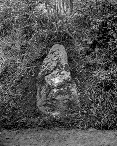
In September, 1928, the old ley-hunter Alfred Watkins was out on one of his many rambles when he “saw a tall stone almost buried in the bank at this crossroads,” appropriately known as Picts Cross, about a mile south of Sellack — so he called it the ‘Picts Cross Stone.’  He also said, “It was Pricker’s and Prick’s Cross in 18th century maps, and Pig’s Cross in the 1832 Ord. Map. Now ‘pig’ is the present Welsh word for “a peak, a point, a pike.””

And a lovely pointy old stone it looks in his old photo!  The monolith is in the hedgerow along the old boundary line.

References:

  1. Watkins, Alfred, The Old Standing Crosses of Herefordshire, Simpkin Marshall: London 1930.

© Paul Bennett, The Northern Antiquarian

Ox-Foot Stone, South Lopham, Norfolk

Standing Stone (destroyed):  OS Grid Reference – TM 052 809

Folklore

This slab of sandstone apparently used to stand upright in one of the fields of Oxfootstone Farm and on its surface is supposed to be the burnt impression of a cow’s hoof-print. Legend tells that there was a fairy cow which would come into the area when times of hardship occurred. During such periods she would freely give her milk to the people, but when the drought was over she stamped down on the stone upon which she stood, burning the imprint of her hoof onto it and magically vanished back from whence she came. A variation of the tale tells of a normal cow whose milk normally supplied the local villagers. But one night a drunken man (in another tale it is a witch) milked the cow dry through a sieve, until only blood came from her udders. At this point, the cow cried out in pain and kicked the stone so hard that she left the mark of her hoof-print on it.

Another tale tells that an ox got a large thorn stuck in its foot and rampaged through the local village, eventually stamping its hoof onto the stone so hard that it left the imprint of its foot here.

Now this might sound presumptious of me — but this tale has all the hallmarks of it being an old folk-remnant telling the origin of some cup-and-ring marked stone.  We find a number of cup-and-rings with creation tales similar to this.  Are there any local archaeologists or enthusiasts in Norfolk who might be able to locate any remains of this possible carved stone?

References:

  1. Burgess, Michael W., The Standing Stones of Norfolk and Suffolk, ESNA 1: Lowestoft 1978.
  2. Dutt, W.A., The Ancient Mark-Stones of East Anglia, Flood & Sons: Lowestoft, 1926.

© Paul Bennett, The Northern Antiquarian

Old Bess Stone, Oakworth Moor, West Yorkshire

Standing Stone:  OS Grid Reference – SD 978 389

Getting Here

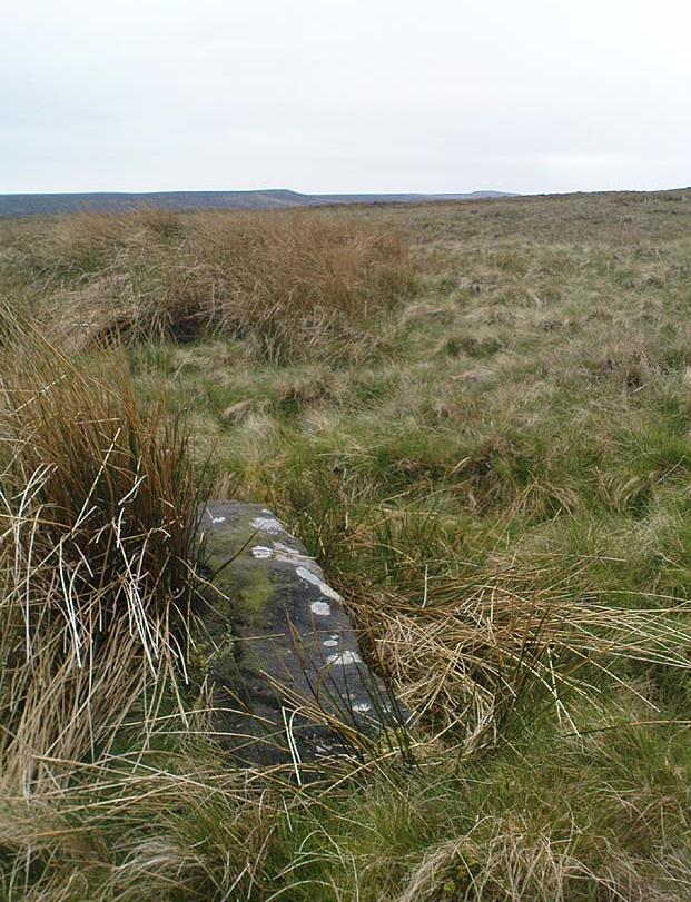
A bittova wander with not much to see, if truth be had.  Best way here’s from the top Oakworth Road heading to the Lancashire border, right on the moor-edge.  Go along the Hare Hill Edge road for a coupla miles till you hit the Pennine Way.  Walk along it up onto the moor, following the dead straight walling for several hundred yards.  Where the walling stops, all of a sudden, stop! (there’s a wooden post here)  Now walk left (west) across the heath for less than 100 yards.  You’ll find it…

Archaeology & History

Old Bess Stone, with Crow Hill on the distant skyline

I’ve found nothing of this site in archaeology records – but that’s likely down to me not looking hard enough!  I’m not even sure that it’s prehistoric – but as there’s nowt written about it, and there are other sites which relate to this old stone, it’s certainly worthy of mention.

The stone lays in the grasses, some four-feet long, with a more recent 18th-19th century boundary stone laid a few feet away.  It seems most likely that Old Bess had stood here much longer though.  Old Bess seems to be the first in a row of at least 6 seemingly unrecognized boundary stones running northwest in a straight line up to the Wolf Stones, about half-a-mile from here.  Neither the early, nor modern OS-maps show any of these stones, several of which are accompanied by earlier, more worn stones – two of which have the letters ‘C.C.’ or ‘G.C.’ carved on them.

Old Bess 'hut circle'
Old Bess ‘hut circle’ (it’s there – honest!)

About 10 yards north of Old Bess are the remains of a very noticeable oval-shaped ‘hut circle’ – or something closely resembling such remains.  About five yards across at the most, with stone walling making up the edge of the ring beneath the moorland grasses, an excavation here wouldn’t go amiss!  Although it’s hard to see in this photo (it’s the roughly circular rise in the middle), when you’re on the moor it’s obvious.   It looks and feels as if the remains were something from medieval times, or perhaps even later – but it’d be good to know for sure!  The remains of an old delph 100 yards south may account for more of Old Bess and its accompanying hut circle than owt prehistoric.

From Old Bess, walk in a straight line towards the large rock outcrop of the Wolf Stones, northwest of here.  After a short distance you’ll come across another large stone, cut and shaped in bygone centuries (not prehistoric though) laying in the boggy tussock grass and looking similar to Old Bess.  Another 100 yards on from here, along the same straight line towards the Wolf Stones, you’ll find another cut stone of similar dimensions; and from here you’ll see another stone about the same distance again ahead of you.  These would appear to be the lost medieval boundary stones which led to a boundary dispute between the counties of Yorkshire and Lancashire a few centuries ago.  For those medieval historians amongst you, check ’em out: it would appear that these are the lost stones (pushed over, obviously) which led to the said dispute.  How on earth no-one’s found ’em previously beggars belief!

Folklore

A little-known site with a spirit ancestor giving rise to its name.  Surrounding it are tales of little people, for just above it is where the faerie lived at the Fairy Fold Dike.  While a couple of hundred yards west lived an old hob (another faerie creature) who used to drink from an old well named after him, the Hob Ing Spring.  Victorian lore tells of druidic folklore further up the moor by the old Wolf Stones, which is linked to Old Bess by virtue of the line of old boundary stones running from here.

© Paul Bennett, The Northern Antiquarian

Kilninver, Oban, Argyll

Standing Stone (destroyed):  OS Grid Reference – NM 8250 2207

Also Known as:

  1. Canmore ID 22969

Archaeology & History

Marked on the earliest 6-inch Ordnance Survey map of this area (1875), this 4ft tall standing stone (now gone) once stood on the east bank of the River Euchar. The prehistoric cairn 400 yards to the west on the other side of the river would seem to have had some relationship with the stone, as they aligned to the equinoxes.

References:

  1. Royal Commission on the Ancient & Historical Monuments of Scotland, Argyll – volume 2: Lorn, HMSO: Edinburgh 1974.

© Paul Bennett, The Northern Antiquarian


Keill Vreeshey, Crosby, Isle of Man

Standing Stone:  OS Grid Reference – SC 3316 8014

Archaeology & History

Keeill Carved Stone (Shaw 1877)

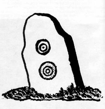
Seemingly destroyed, this carved standing stone was first described in Shaw’s Tourist Guide to the Isle of Man (1877), where he says it stood by the wall of the chapel, telling how it was “one of several stones inscribed with various designs and inscriptions.”

Hope that I’m wrong, but it seems like we’ve lost some more good old cup-and-ring art…

References:

  1. Shaw, N., Tourist Guide to the Isle of Man, 1877.

© Paul Bennett, The Northern Antiquarian

Hare Hill Stone, Oakworth, West Yorkshire

Standing Stone:  OS Grid Reference – SE 014 381

Archaeology & History

Hare Hill Stone, Oldfield, Oakworth

About a metre tall and found standing near the bottom of one of the fields diagonally across from the old farmhouse of Laverock Hall, here’s another old stone which may not have a prehistoric provenance.  It is seemingly unknown by all but local people and would seem to be an old rubbing post for cattle — albeit a small one!  There seems to be no written accounts of this stone; though until all of the local field-name maps have been checked, we can’t discount the possibility that this is the “standing stone” described in early place-name records that was mentioned by A.H. Smith in 1963.

References:

  1. Bennett, Paul, The Old Stones of Elmet, Capall Bann: Milverton 2001.
  2. Smith, A.H., The Place-Names of the West Riding of Yorkshire – volume 6, Cambridge University Press 1963.

© Paul Bennett, The Northern Antiquarian


Hamblethorpe, Low Bradley, Skipton, North Yorkshire

Standing Stones:  OS Grid Reference – SE 00303 47622

Getting Here

Hamblethorpe Stones, Low Bradley

Take the single-track country lane between Farnhill and Low Bradley until you reach Hamblethorpe farmhouse.  Where the birch woodland is on the slope going uphill, the field on the other side of the road, protected by walling, is where the stones are, just south of the farmhouse.  There’s nowhere to park any car hereabouts, so it’s best walking here.

Archaeology & History

It seems that nothing has previously been written of this place.  Hidden away at the top of the field we find two curious-looking standing stones: one nearly six-feet tall, and its companion about four-feet.  They’re near the bottom of the slope from the giant Round Cairn and Long Cairn tombs of Low Bradley Moor, several hundred yards to the east— and were it not for the fact that they have a distinctive Castlerigg-like appearance about them, perhaps I wouldn’t have given them a second chance.  Curious earthworks are in the same field, to which written records also appear silent.  Tis a lovely little spot…

© Paul Bennett, The Northern Antiquarian