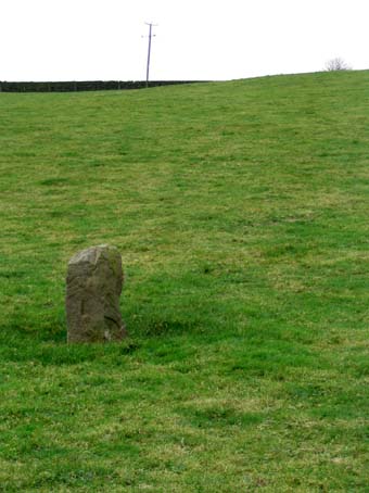
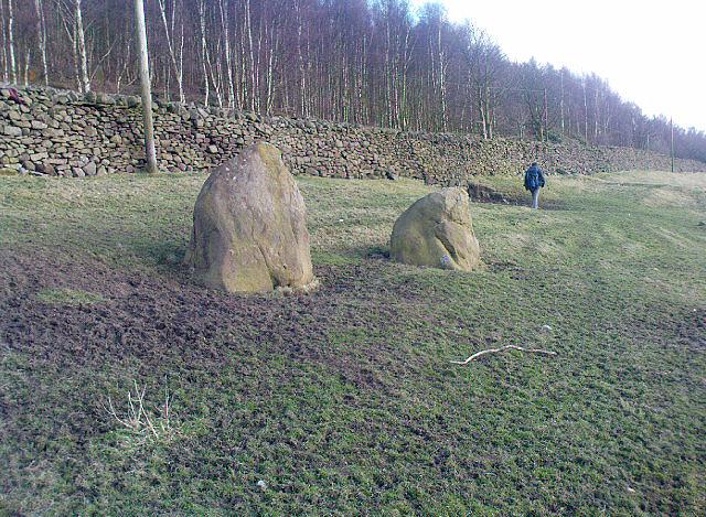
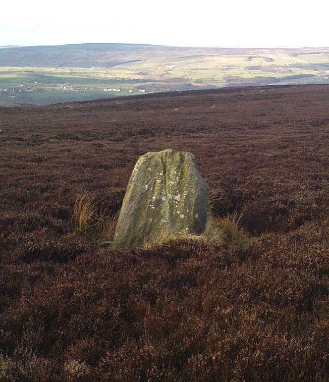
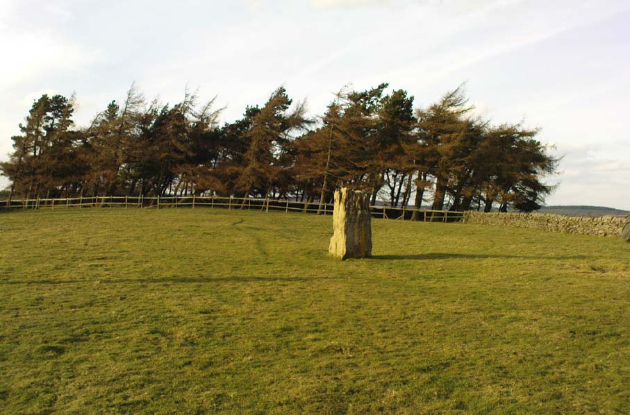
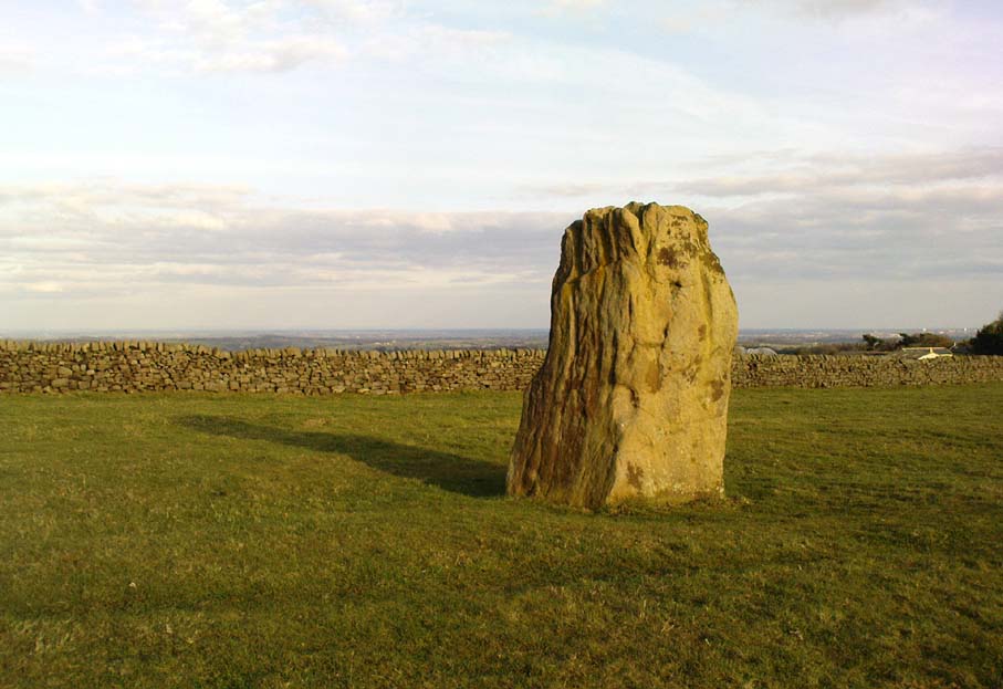
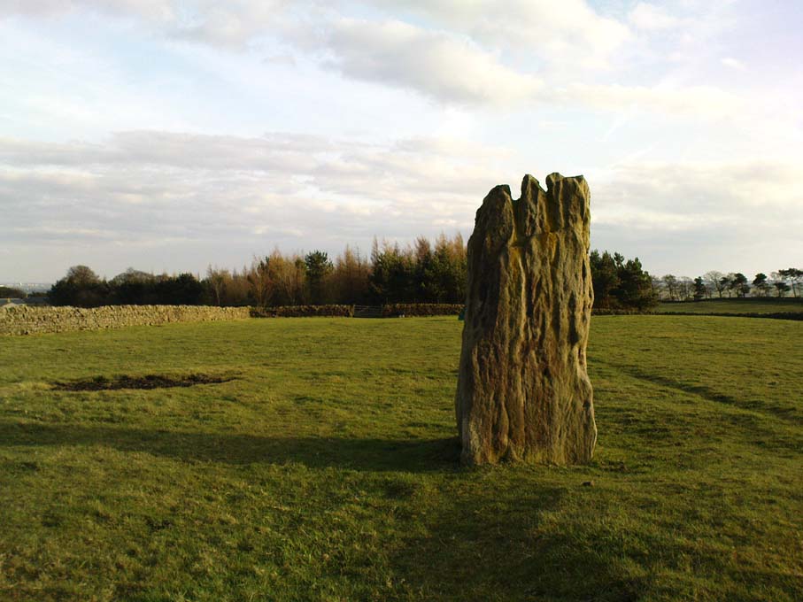
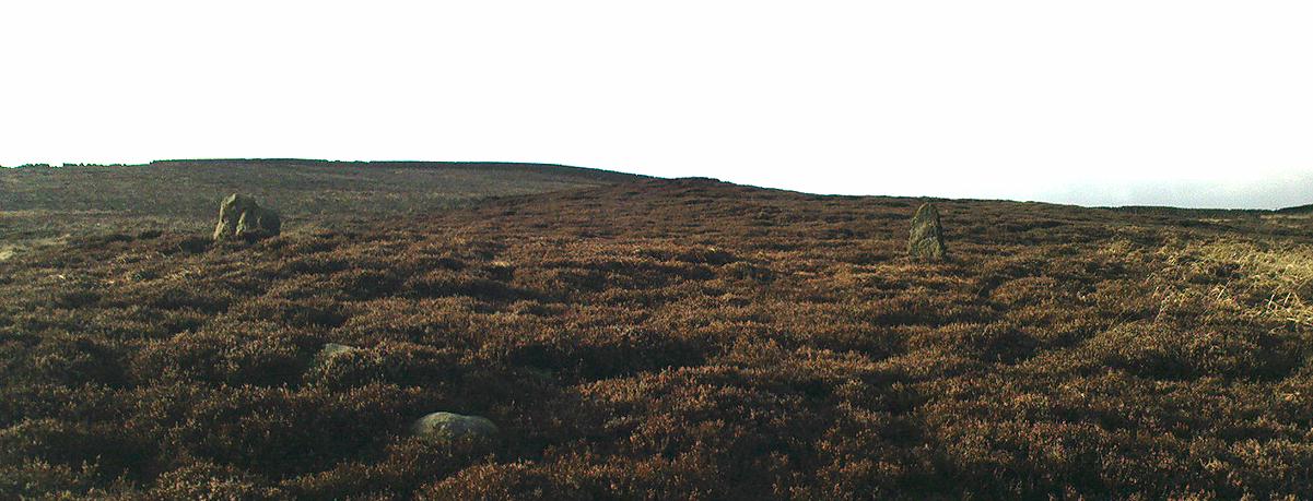
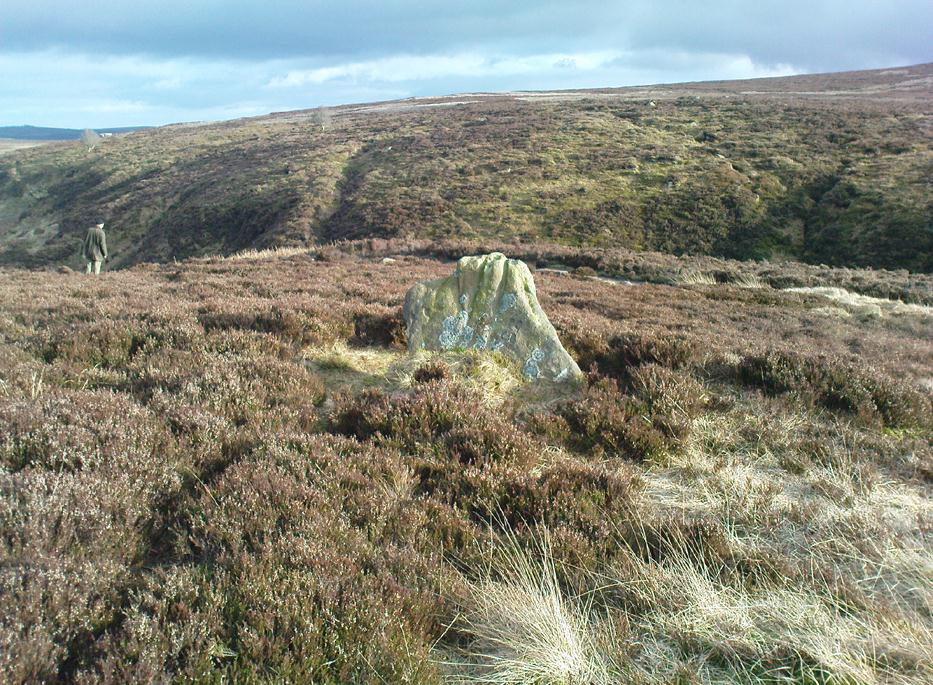
About a metre tall and found standing near the bottom of one of the fields diagonally across from the old farmhouse of Laverock Hall, here’s another old stone which may not have a prehistoric provenance. It is seemingly unknown by all but local people and would seem to be an old rubbing post for cattle — albeit a small one! There seems to be no written accounts of this stone; though until all of the local field-name maps have been checked, we can’t discount the possibility that this is the “standing stone” described in early place-name records that was mentioned by A.H. Smith in 1963.
References:
Bennett, Paul, The Old Stones of Elmet, Capall Bann: Milverton 2001.
Smith, A.H., The Place-Names of the West Riding of Yorkshire – volume 6, Cambridge University Press 1963.
Take the single-track country lane between Farnhill and Low Bradley until you reach Hamblethorpe farmhouse. Where the birch woodland is on the slope going uphill, the field on the other side of the road, protected by walling, is where the stones are, just south of the farmhouse. There’s nowhere to park any car hereabouts, so it’s best walking here.
Archaeology & History
It seems that nothing has previously been written of this place. Hidden away at the top of the field we find two curious-looking standing stones: one nearly six-feet tall, and its companion about four-feet. They’re near the bottom of the slope from the giant Round Cairn and Long Cairn tombs of Low Bradley Moor, several hundred yards to the east— and were it not for the fact that they have a distinctive Castlerigg-like appearance about them, perhaps I wouldn’t have given them a second chance. Curious earthworks are in the same field, to which written records also appear silent. Tis a lovely little spot…
The best way to get here it is to head from the Cow and Calf Hotel up the hillside to where the great rock is sticking out (the Pancake Stone). From here, head straight onto the moor toward the Idol Stone — close to the Idol Rock which you can see 400 yards south in front of you. From here, follow the footpath up the hill before you and keep on the path towards Lanshaw Lass. About 100 yards on, turn straight west into the heather and keep your eye towards the south. About 250 yards on, about 100 yards away from the Green Crag Top cup-marked boulder, you’ll see it!
Archaeology & History
One of very few solitary standing stones on Ilkley Moor, and one which I relocated after The Old Stones of Elmet (2001) had gone to press — which was a great pity. Nearly four feet tall, this is a good chunky monolith which stands close to being on line with the summer solstice alignment from the nearby Twelve Apostles stone circle. (I was gonna call it the Summer Stone, but thought better of it!)
There’s another recumbent stone, more than five feet tall when erected, 200 yards northwest of here. (This is also very close to being in line with with our chunky monolith, plus the Twelve Apostles. Anyone out there with a GPS who can check if this possible alignment is the last remnant of a summer solstice stone row? It probably isn’t, but it’d be good to find out.) On the same moorland level, heading back down, when the heather’s burnt back you’ll find a number of prehistoric tombs along the edge of the ridge. These don’t appear to be in the archaeological registers.
A half-mile south of the superb Brimham Rocks complex, take the straight road south until you hit the second farmhouse (and accompanying caravans). Go up the public footpath past Highfield Farm and just check with the landowner’s permission to wander his land if you want to see the stone. They’re OK about it if you ask. The lady there is very amiable and will tell you what’s what, giving directions right to it, telling us it was off the footpath in the middle of one of his fields.
Archaeology & History
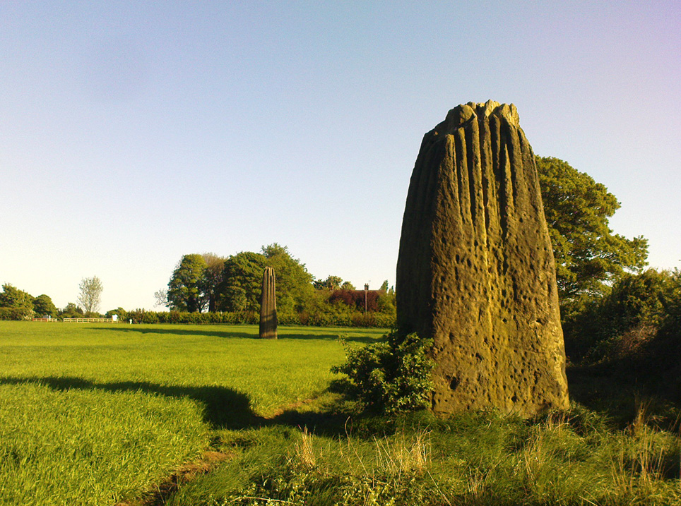
Archaeology texts are, once more, silent about this stone (and other monuments in the region), making you wonder just what the hell some of them are paid for! The stone appears to have given its name to the land upon which it stands which, as the locals tell, “has always been known as standing stone hill.” And no wonder — it’s a bloody decent standing stone! On its northern face we find well-eroded lines running down the stone, similar to the weathering found on the Devil’s Arrows a few miles to the east.
Standing Stone Hill stoneLooking south
Although just over 6-feet tall, this is a solid bulky old fella. But the spot he presently occupies isn’t his original standing place. He was found knocked over and lying on the ground in the middle of the 20th century, slightly out of position. But he was thankfully stood back upright by the local land-owners sometime in the 1960s, where he’s been stood ever since. It must have been one helluva job! And making it more difficult was the intriguing geological nature of the Earth right beneath this field. As the lady who now own the land told us,
“When the fields were tilled we found that all of them were easy to turn over, except the one with the stone in it! There’s virtually no soil of any depth to write home about,” she said. “It stands on only a few inches of soil and then you hit solid rock right underneath it. All the other fields are OK – but this one’s the odd one out.”
And before the fields were farmed, just over a hundred years ago, all this land was covered in moorland heather. Then the land was enclosed, the Earth’s heathland stripped out of existence and turned over to agriculture. But thankfully the standing stone was left here. It makes you wonder what else was destroyed when the moorlands were industrialised…
The stone does get a brief mention in Boughey & Vickerman’s (2003) Prehistoric Rock Art of the West Riding, where they mention there being “three possible cups in (a) line on one side” of the standing stone, but these are little more than Nature’s handiwork and nowt else. There are a couple of other cup-and-rings nearby which are the real thing – but the ‘cups’ on this stone aint man-made.
Once to be seen on the highest point of the island, this impressive 9-foot tall standing stone is thought to have been removed during construction of the old lighthouse around 1833. First described by a traveller here in 1784, it was mentioned just once again during survey work in 1829. The monolith appears to have recorded the midwinter sunset.
References:
Royal Commission on the Ancient & Historical Monuments of Scotland, Argyll – volume 2: Lorn, HMSO: Edinburgh 1975.
Best approached from Haworth and then walking along the Bronte Way footpath onto the moors (ask at the local Tourist Info if you aint sure). A few hundred yards along, cross the ‘Bronte Bridge’ and keep following the footpath up until you get past the trees and get onto the moors. Once on the heathland, a few hundred yards along keep your eyes to the right and at least one of the two stones here will appear!
Archaeology & History
The original Cuckoo Stone
This is a fascinating little site that has been mentioned in a few old local history guides, including John Lock’s Guide to Haworth (c.1965). First described in 1852 and only briefly noted in passing by Horsfall Turner (1879), the place was previously thought to have comprised just one standing stone, but in recent years explorations by Mark Davey and I found there to be two standing stones close to each other. They are not marked on any maps and are unknown even to many local people. However, the place once had a bit of a reputation (see folklore) and seemed to be well known in the region when the cult of the Church was at its height!
Both of the stones are between three and four feet tall, but the westernmost of the two was probably much taller in bygone days – that’s because the top of the stone was vandalised in centuries past, presumably by some christians if the folktale is anything to go by! On the north-facing side of the western stone is the faint carved outline of an old cross, first described by local historians in the 1960s. It’s faint, but you can work it out if your eyes work properly! The newly-recovered (July 2005) easternmost stone is in two sections, with the very top of it having been hacked off in centuries gone by, as seen in the photos.
The second Cuckoo Stone, resurrected!
When we unearthed the previously unknown Cuckoo Stone (which was laid in the earth and covered with heather and peat), a small deposit of quartz crystals was found in the original socket beneath it when we came to stand the stone back in position. Question is: who put the quartz there? The original builders, or the nutters who knocked it down? And then we might ask: what was the reason behind placing a large handful of quartz beneath the standing stone?
In the heather beyond, about thirty yards to the north, we also find what looks like the remains of an old prehistoric tomb. If we make sense of the Cuckoo Stone’s folklore, we can safely assert that these monoliths were the spirit-home of the old dood/s buried in the tomb behind…
Tis a lovely little place…
There’s also something from that strange electromagnetic-anomaly region attached to this site, well-known to students exploring the physics of megalithic sites. When my lovely friend Mark – “grope me baby! grope me!” – Davey and I rediscovered the second Cuckoo Stone, Mark brought with him a device that measures fluctuations in electromagnetic radiation. The readings taken were fine just about everywhere (background, with minor fluctuations), apart from two very curious straight lines which ran either side of the burial mound down towards the two Cuckoo Stones, with radiation readings being between 10 and more than 60 times above background! The highest readings came from those closest to the burial mound, with levels dropping as we approached the standing stones. Such magnetic anomalies have been found at a number of megalithic sites in the UK, as described in Paul Devereux’s Place of Power (1989) and other books. But the fact that the anomaly lines here seemed to run in lines would be something that those ley enthusiasts would no doubt be intrigued by!
Folklore
The creation myth of this site tells that once, long ago, a great giant lived upon these old moors. He wasn’t a good giant though, from all acounts: robbing and persecuting those who would venture onto the hills hereabouts. The local people wouldn’t dare venture onto the moors and they long sought for a hero who’d be able to sort him out! This eventually happened and in a great fight, our unnamed hero caught and killed the old giant. But just as the giant was about to die, he used his ancient magick powers and, “with a magical groan, he did transform before them and became the Cuckoo Stone.”
But that wasn’t the end of the matter because, as our unnamed hero realised, knowing that the head was the seat of the soul, even in his petrified stoney state the giant may one day recover his life, and so he chopped off the top of the Cuckoo Stone and rolled it into the valley below, dismembering the ‘head’ from the giant, seemingly forever…
It is said that the winnings of this old giant, stolen from his countless victims, are hidden somewhere high upon these hills, awaiting the shovel of some fortunate treasure hunter!
The motif of this tale is universal and archaic, echoing traditional or aboriginal lore from elsewhere in the world. The tale is a simple one: originally the ‘giant’ was a local hero, chief or medicine man who lived on these hills and the Cuckoo Stones his petrified body, and with the incoming christian cult, the giant became demonised. It seems that the ingredient of the giant’s death may infer a burial of sorts and, a hundred yards behind the Cuckoo Stones (both of whom have had their ‘heads’ hacked off), is a mound of earth which, when seen after all the heather’s been burnt away, has all the hallmarks of a prehistoric tomb (it is seen in the top photo above, as the mound in the background behind the standing stones).
Also known as the ‘Stones of Islay,’ these two old stones can be found on the west side of the road between Port Ellen and Ardtalla, up the steepish wood-covered slope, just south of the conical fairy hill of Cnoc Rhaonastil.
Archaeology & History
In recent years, the Scottish Royal Commission commented that “they do not appear to be of prehistoric date,” yet include it in the Argyll survey (vol.5:65), just in case! The larger of the two monoliths is nearly 6 feet long (it was on the floor when I came here, many years back), and its smaller companion about 3 feet long (also on the deck!).
Folklore
In 1794, in the Statistical Account of Scotland, it was said that these two curious standing stones marked the grave of Yla or Yula, “a daughter of one of the kings of Denmark,” which is most unlikely. Between these two stones, folklore tells, is known as the Tomb of Yla – a Danish princess whom legend tells gave Islay its name.
The hill above these old stones was long known to be the place of the faerie-folk. Indeed, the Queen of Faerie herself lived here. Otta Swire told a fascinating old folktale of this place, whose nature will be know to some:
“The Queen was much troubled by the stupidity of human women, for in the fairy world wisdom is chiefly possessed by the women, since it is they who hold the Cup. After much thought, She decided to try to improve matters, so she sent out an invitation to all the women of the world to visit Her in Her hall in the knoll on a certain date. The invitation spread over the wide Earth – it was carried by the winds and the sea waves, by birds and by fish, even the leaves of the trees whispered it. And the women of the world were very much interested and they talked eagerly together. Some laughed at it, some said they were wiser by far than the Little People, some held that the Little People were cleverer and more powerful than they and that this might be a trap. Indeed, the word of women ‘heaved like hive of bee or hill of ant or byke of wasp.’ Soon, women from all over the isles began to arrive in Islay. Some came to see, many more to be seen, and a few came truly seeking wisdom.
“When the day dawned the hill opened, and into the wonderful hall within streamed the women. And a very wonderful hall it was, hung with bright cloths woven from nettles and fairy lint and dyed with blood of shell-fish and sap of plants in such colours as only the Little People can achieve. Skins of beasts were spread on floors and seats, a banquet set on shells of pearl lay ready on the many tables of wood and stone, and for each guest there was placed ready a beautiful cup formed from a blue-eyed limpet’s shell. A soft green light pervaded the hall. When all were ready and the watchers saw no more coracles on the waters or maidens climbing the green slope, the doors to the outer world were closed and in walked the Queen Herself. She was smaller than any of Her guests but far, far more impressive. She wore a dress of long ago but it suited well Her gentle, kindly dignity and Her face shone with a strange and lovely light. She carried in Her two hands a wonderful flagon and after her came her maids, each holding a similar one. Other maids hastily distributed the cups of shell and then the Queen walked slowly by, pouring into the cup of each of those who, in her heart truly desired wisdom, a few drops of the precious fluid from Her flagon, which held the distilled wisdom of the world throughout the ages. And as each woman drank those few drops she suddenly grew wise and saw and understood much she had never known before. Some were able to see much, others but a little, yet all benefited in their degree. At last, all who sought wisdom had received it and the elixir was finished. Just as the ceremony ended there came a hammering on the walls and the doors. The Little People looked out and, behold!, their hill was covered with late-comers who had arrived after the doors were closed and so had been unable to enter and were now too late to receive the gift. There is still a saying in Gaelic about a stupid woman: ‘She was out on the knoll when wisdom was distributed.'”
A saying I remember my old grandad telling a few folk a few times when I was young!
References:
Royal Commission on the Ancient & Historical Monuments of Scotland, Argyll – volume 5: Islay, Jura, Colonsay and Oronsay, HMSO: Edinburgh 1984.
Swire, O.F., The Inner Hebrides and their Legends, Collins: London & Glasgow 1964.
Legendary Rocks (destroyed): OS Grid Reference – SE 187 545
Archaeology & History
The original position and nature of this site was difficult to ascertain and left us wondering whether the place was once a monolith, stone circle or legendary rock outcrop, as seemed that there were no remains left of the place. Aswell as that, the only reference we had that describing this place is from William Grainge’s History of Knaresborough (1871), where he wrote:
“At Busky Dike, a place between Cragg Hall and Fewston, according to the report of tradition, there once existed a Druidical altar; and that same venerable authority declares that the same place is the haunt of a Bharguest; and many of the country people yet tremble as they pass that place in the dark, for fear they should meet that strange and terrible beast.”
The latter remark would indicate that something decidely pre-christian was once of renown here. But it seems that an old rock outcrop was the place in question here, found in the now wooded area on the south side of the Busky Dike Road, just northwest a half-mile outside of Fewston itself. It would be good to hear more about this place…if anyone knows owt…
References:
Grainge, William, The History of Harrogate and the Forest of Knaresborough, 1871.
Grainge, William, The History and Topography of Little Timble, Great Timble and the Hamlet of Snowden, William Walker: Otley 1895.
This old stone is another one tucked away, but not too far south of Oban. Take the Kilninver road and keep heading southwest, past Loch Seil. Instead of following the road right, to Clachan and then onto Seil Island, bear left and towards Armaddy Castle. Where the single-track road turns into the woodland towards the castle, the track keeps on into the rocky hills. Keep going for about another 500 yards. You’re nearly there!
Folklore
By the coast just north of Loch Melfort, near the hamlet of Degnish, is the grand old Armaddy Castle. On the other side of the trees from here, to the east, Scottish writer and folklorist A.A. MacGregor tells there to be an old standing stone. In his Ghost Book of 1955, he tells the tale of a local man called Donald MacDougal who, returning home after his day’s work at the castle, crossed over the old burn of Eas nan Caerdach where the standing stone can be found, just past the bend in the track.
On reaching it, Donald became aware of a strange light a short distance in front of him. Thinking at first it was the lamp of his co-worker making for the Home Farm, he walked past the stone – but it wasn’t until he got home himself and found he was alone that he questioned what on earth he’d seen! Upon asking other people in the neighbourhood, it was found that other locals had seen the same light, traversing the land from the old standing stone along the footpath to the farm.
References:
MacGregor, Alasdair Alpin, The Ghost Book, Robert Hale: London 1955.
Dead easy to find! Turn off the A1(M) at the A6055 Boroughbridge road and head into town. Turn left after the Three Arrows Hotel, down Roecliffe Lane and the stones are a few hundred yards down, close to the motorway. The tallest is just off the road to the left, behind a gate (the owner of the adjacent house there is very pleasant), whilst the other two are across the road in the fields.
Archaeology & History
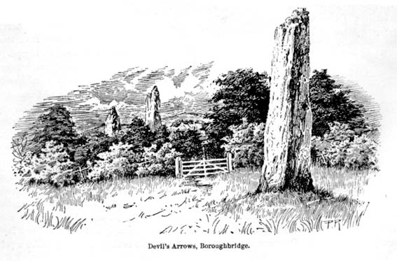
Devil’s Arrows (Percy Robinson, c.1895)
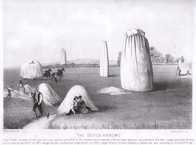
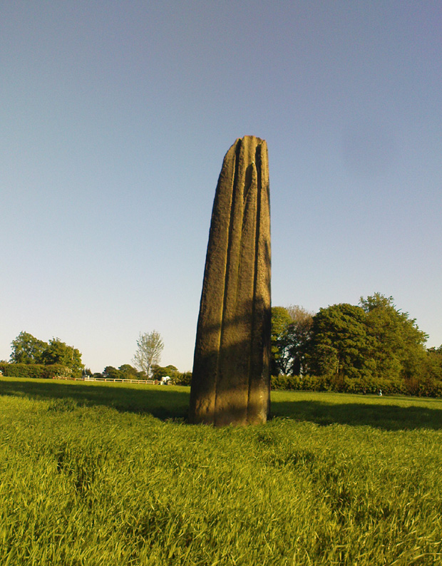
To many archaeo-megalithic and folklore fans, these huge standing stones need no introduction. These great heathen Arrows of the devil, today at least, are three gigantic standing stones, each one weighing several tons at least, standing in a rough straight line, nearly north-south. This is the greatest single stone-row anywhere in the British Isles.
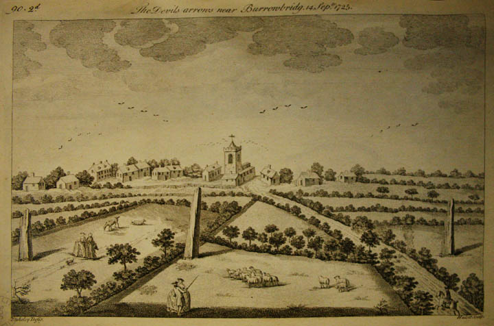
Just how many standing stones originally stood here is difficult to say. We know from the records of early antiquarians and travellers that we had at least five Arrows here in centuries gone by; but one curious account, mentioned by the Yorkshire antiquarian Edmund Bogg (1895) more than a hundred years ago told:
“Peter Franck, a fisherman who travelled much about the world to enjoy his sport, came to Boroughbridge in 1694 and says he saw seven of these standing stones, Dr Stukeley mentions five, and John Leyland, in his travels, saw ‘four great stones wrought by man’s hands,’ but no inscription upon them. Camden, in 1592, saw four, but one of them at the time was thrown down, ‘for,’ says he, ‘the accursed love of gain.’ Part of this one is still to be seen, built into the Peggy Bridge which crosses the Tut on the entrance to the town, the top portion being preserved in the grounds of Aldborough Manor and this goes far to prove — and I have very carefully considered the question and examined the ground — that the original number of stones was far greater, and reached from the Yore, in equal distances to the Tudland of Leyland’s time, or the Staveley Beck of today. If this argument is correct, 2000 years ago there would be a line of at least 12 standing monoliths guarding the western approach to Isur Brigantium.”
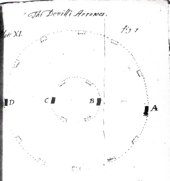
John Aubrey’s 1687 plan Devil Arrows Stone CircleWill Stukeley’s 1776 image
Well y’ never know! But who was this Peter Franck chap from the 17th century? It would be good to find out more of what he said.
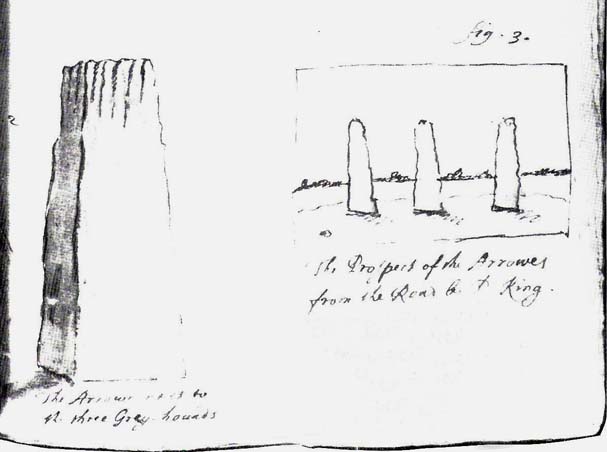
But this notion of there being a great many more stones here than the four or five that are accepted as standard, isn’t just to be found in the annals of some lost fisherman. The great Royalist antiquarian John Aubrey came here in September 1687 and, as illustrated here, saw the remaining three upright stones as remnants of a concentric ring of stones of obviously gigantic proportions. Following from a rough survey of the site and descriptions from local people, Aubrey placed the standing stones in their old line, of
“A. B. C. D., and I have drawn two imaginary circles in which it may be supposed that stones were placed, as at Avebury, Stonehenge, etc. Perhaps they might be more stones in each circle than I have fancied.”
Nearly two hundred years later, archaeologist John Ackerman (1847) echoed John Aubrey’s notion (or perhaps simply copied them) in his notion of the Devil’s Arrows once being part of a greater megalithic complex, saying,
“At Rudston and Boroughbridge, in Yorkshire, are supposed examples of maenhirs. Near the latter place there are four standing in a row, which are called by the country people the Devil’s Bolts; but, from their relative position, it is not unlikely that they are the remains of a large circle.”
Devil’s Arrows (from Smith’s ‘Reliquiae’)The top 2 Arrows
As if to tempt further enquiry, or at least require suitable explanation, is the nearby field-name of ‘Kringelker,’ or Cringles Carr — last described in 1316 — and which means very simply a circle by the marsh, or circular marsh, or variants thereof. (Source: Yorkshire Deeds, volume 4,YAS: Leeds 1904)
But prior to John Aubrey’s speculations on the Arrows being part of a giant ring of stones, he related the earliest survey done here, by a local (unnamed) man on April 17, 1669, telling that:
John Aubrey’s 1687 sketch of the Arrows
“In Yorkshire near Burrough-brig on the west side of the Fosse-way, about a quarter of a mile, (in the Lordship of Alburgh) stand three pyramidish stones called the Devills Arrowes. The Arrow standing towards the south is seven yards and a half in height: the compasse of it five yards and a half. The middle Arrow seven yards and a half, in compass six yards. The Arrow towards the north in height five yards and a half, in compass seven yards. Here was another stone that stood in a straight line, at D, that was taken down and a bridge made of it.”
Other regal antiquarians and learned writers of the period came soon after. When William Camden (1695) visited the place at the end of the 16th century, he was equally impressed and described the place as follows:
“Not farre beneath there standeth by Ure a little towne called Burrowbridge, of the bridge that is made over the river: which is now built very high and faire of stone worke, but in King Edward the Second his time it seemeth to have beene of wood. For wee read that when the Nobles of England disquieted this king and troubled the state, Humfrey Bohun Earle of Hereford in his going over it was at a chinke thereof thrust through the body about his groine by a souldiour lying close under the bridge. Neere unto this bridge Westward wee saw in three divers little fields foure huge stones of pyramidall forme, but very rudely wrought, set as it were in a streight and direct line. The two Pyramides in the middest, whereof the one was lately pulled downe by some that hoped, though in vaine, to finde treasure, did almost touch one another. The uttermore stand not far off, yet almost in equall distance from these on both sides. Of these I have nothing else to say but that I am of opinion with some that they were monuments of victorie erected by the Romans hard by the high street that went this way. For I willingly overpasse the fables of the common people, who call them the Devills Bolts, which they shot at ancient cities and therewith overthrew them. Yet will not I passe over this, that very many, and those learned men, thinke they are not made of naturall stone in deed, but compounded of pure sand, lime, vitriol (whereof also they say there bee certaine small graines within), and some unctuous matter. Of such a kinde there were Rome cisterns, so firmely compact of very strong lime and sand, as Pliny writeth, that they seemed to be naturall stones.”
Another early antiquary, John Leland, also passed by here a few hundred years back and wrote the following after his visit:
“A little without this Towne on the west part of Watiling-Streate stadith 4 great maine stones wrought above in conum by Mannes hand. They be set in 3 several Feldes at this Tyme. The first is a 20 foote by estimation in higeth and an 18 foote in cumpace. The stone towards the ground is sumwhat square, and so up to the midle, and then wrought with certen rude boltells in conum. But the very toppe thereof is broken of a 3 or 4 footes. Other 2 of like shap stand in another feld a good But shot of: and the one of them is bigger then the other; and they stand within a 6 or 8 fote one of the other. The fourth standith in a several feld a good stone cast from the other, and is bigger and higher than any of the other 3. I esteme it to the waite of a 5 Waine Lodes or more.
Inscription could I none find yn these stones; and if there were it might be woren out; for they be sore woren and scalid with wether.
I take to be a trophaea a Romanis posita in the side of Watheling Streat, as yn a place most occupied in Yorneying ad so most yn sighte.”
Possible cup-marks on northernmost Arrow
Rock Art on the Devil’s Arrows
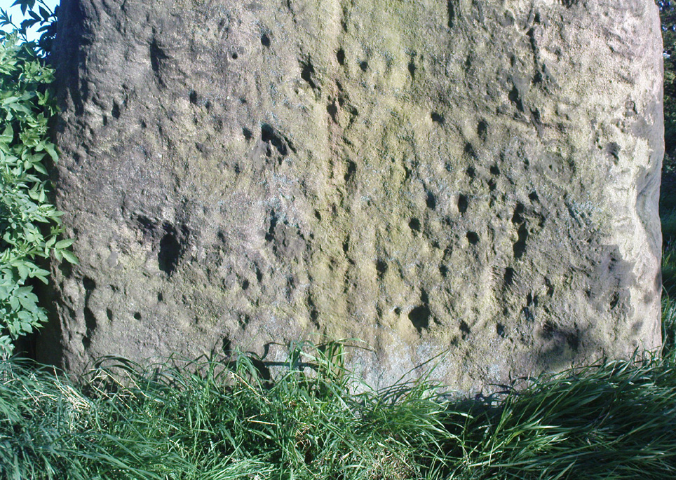
Although Leland told us he could find no inscriptions on the stones, he missed some which may be much older than the purely Roman marks his nose was seeking. Cup-and-ring stones — much in vogue nowadays thanks to the new, shamanically-inspired archaeo’s — aren’t etched here in anything like the styles expected of our Swastika Stone, or the Achnabreck carvings, but cup-markings seem to occur on the northernmost stone. Although a rather myopic bunch of earth-mystery people thought they were the first to discovered the cup-markings here in 2005, they were in fact first described way back in 1866, in Sir James Simpson’s precursory essay to his Archaic Sculpturings (1867), where he told:
“In England the most striking and magnificent group of monoliths that I have seen are the so called Devil’s Arrows at Borough-Bridge, in Yorkshire. Three only of these tall and enormous monoliths are now left, and stand in a line about a stone’s throw from each other. They are all pillars of a squarish shape, and said to bo formed of millstone grit. Two of them are above twenty-two feet in height, and the third measures eighteen feet. Each at its upper part is deeply and vertically guttered, apparently by long weathering and exposure ; and their lower portions show round, smooth, cup-like excavations upon some of their surfaces. The most northerly of these imposing monoliths is especially marked in this last way. Many, if not all, of these excavations, have probably been effected by the elements and weather; while some of them, which look more artificial, are of the same shape and form as those on the Kilmartin stones, etc. But unfortunately we have not here the presence of rings or circles around the cups to determine conclusively their artificial character.”
The central Arrow
Some of the cup-markings here are distinctly artificial; but as with these ancient non-linear designs in general, we are unable to ascertain any specific ‘meaning’ to them at this site, even in any mythic sense — as yet! (I’ll get some images of cup-markings next time I visit the Arrows, unless someone has some going spare!)
Folklore
Described by Bob Mortimer (1860) as a gathering place of the druids, who “met here to celebrate their great quarternal sacrifice”; not unsurprisingly there are a variety of other fascinating creation myths and folklore motifs raising their usual heads by these great stones. Mortimer told of more tales following his local society’s visit here at the end of the 1850s, saying:
“There lived a very pious old man (a Druid should we imagine) who was reckoned an excellent cultivator of the soil. However, during each season at the time his crops had come to maturity they were woefully pillaged by his surrounding neighbours; so that at this, he being provokingly grieved, the Devil appeared, telling the old man if he would only recant and throw away his holiness he should never more be disturbed in his mind, or have whatever he grew stolen or demolished. The old man, like Eve in the garden, yielded to temptation, and at once obeyed the impulse of Satan for the benefit of worldly gain. So when the old man’s crops were again being pillaged, the Devil threw from the infernal regions some ponderous arrows, which so frightened the plunderers by shaking the earth that never more was he harrassed in that way. Hence the name of the ‘Devil’s Arrows.'”
Another individual told me that it was believed by some that the stones sprung up one night in the very places they now occupy.”
Very close to the Arrows are antiquarian records of other sites which someone can hopefully throw more light on, as they may have had some relationship with the stones. Immediately west were (are?) the Penny Stones; plus a place called Bell’s Wife’s Field (Bel as a sun-god – though his wife may imply the moon). And just a few hundred yards east is the old Lady Well, mentioned elsewhere.
…to be continued…
References:
Ackerman, John Yonge, An Archaeological Index to the Remains of Antiquity of the Celtic, Romano-British and Anglo-Saxon Periods, J.R. Smith: London 1847.
The Stranger’s Guide; Being a Concise History & Description of Boroughbridge, John Mitchell: Boroughbridge 1846.
Bennett, Paul, The Devils Arrows, Heathen Earth: Keighley 2009.
Bogg, Edmund, From Eden Vale to the Plains of York, Goodall & Suddick: Leeds n.d. (c.1895)
Bogg, E., Richmondshire and the Vale of Mowbray (volume 1), Elliott Stock: London 1906.
Brayshaw,Thomas, ‘The Yorkshire Portions of Leland’s Itinerary,’ in YAJ 10, 1889.
Burl, Aubrey, ‘The Devil’s Arrows,’ in YAJ 63, 1991.
Burl, Aubrey, From Carnac to Callanish, Yale: New Haven & London 1993.
Camden, William, Britannia, or a Chorographical Description of Great Britain and Ireland, Edmund Gibson: London 1695.
Devereux, Paul & Thomson, Ian, The Ley Hunter’s Companion, Thames & Hudson: London 1979.
Elgee, F. & H.W., The Archaeology of Yorkshire, Methuen: London 1933.
Forrest, Bob & Behrend, Michael, ‘The Devil’s Arrows on Target,’ in The Ley Hunter,no.107, 1989.
Lawson-Tancred, Lady, A Guide Book to the Antiquities of Aldborough and Boroughbridge, J. Topham: Boroughbridge 1948.
Leadman, A.D.H., ‘The Devil’s Arrows,’ in The Antiquary, 1903.
Leland, J.J., The Itinerary of John Leland the Antiquary, Fletcher & Pote: Oxford 1770.
Lewis, A.L., ‘The Devil’s Arrows, Yorkshire,’ in Journal. Anthr. Institute, 8, 1878.
Longworth, Ian H., Regional Archaeologies: Yorkshire, Cory, Adams & Mackay: London 1965.
Lukis, W.C., ‘The Devil’s Arrows,’ in Proc. Soc. Antiquaries London, volume 7, 1877.
Lukis, W.C. (ed.), The Family Memoirs of the Rev. William Stukeley – volume 3, Surtees Society: Durham 1887.
Mee, Arthur, Yorkshire, West Riding, Hodder & Stoughton: London 1941.
Mortimer, Robert, ‘The Great Monoliths at Boroughbridge,’ in The Geologist journal, London 1860.
Phillips, Guy Ragland, Brigantia, RKP: London 1976.
Radley, J., ‘Prehistory of the Vale of York,’ in YAJ 1974.
Ross, Frederick, Legendary Yorkshire, William Andrews: Hull 1892.
Simpson, James Y., Archaic Sculpturings of Cups, Circles, etc., upon Stones and Rocks in Scotland, England and Other Countries, Edmonston and Douglas: Oxford 1867.
Smith, A.H., Place-Names of the West Riding of Yorkshire (volume 5), EPNS: Cambridge 1963.
Smith, Henry E., Reliquiae Isurianae, J.R. Smith: London 1852.
Somerville, Boyle, The Devil’s Arrows: Prehistoric Stone Monuments and their Orientation, B.A. Handbook, 1927.
Stukeley, William, Itinerarium Curiosum (volume 2), London 1776.
Thom, A.S. & Burl, Aubrey, Stone Rows and Standing Stones, BAR: Oxford 1990.
Turner, T.S., History of Aldborough and Boroughbridge, Arthur Hall: London 1853.
Tutin, John, ‘Theory about the Three Arrows,’ Yorkshire Life 3, 1954.
Walford, John. ‘An early description of the Devil’s Arrows, Boroughbridge, North Yorkshire,’ in Yorkshire Archaeological Journal, 79, 2007.
Wood, E.S., ‘The Grooves on the Devil’s Arrows, Boroughbridge,’ PPS 13, 1947.