Megget Stane, Yarrow, Selkirkshire

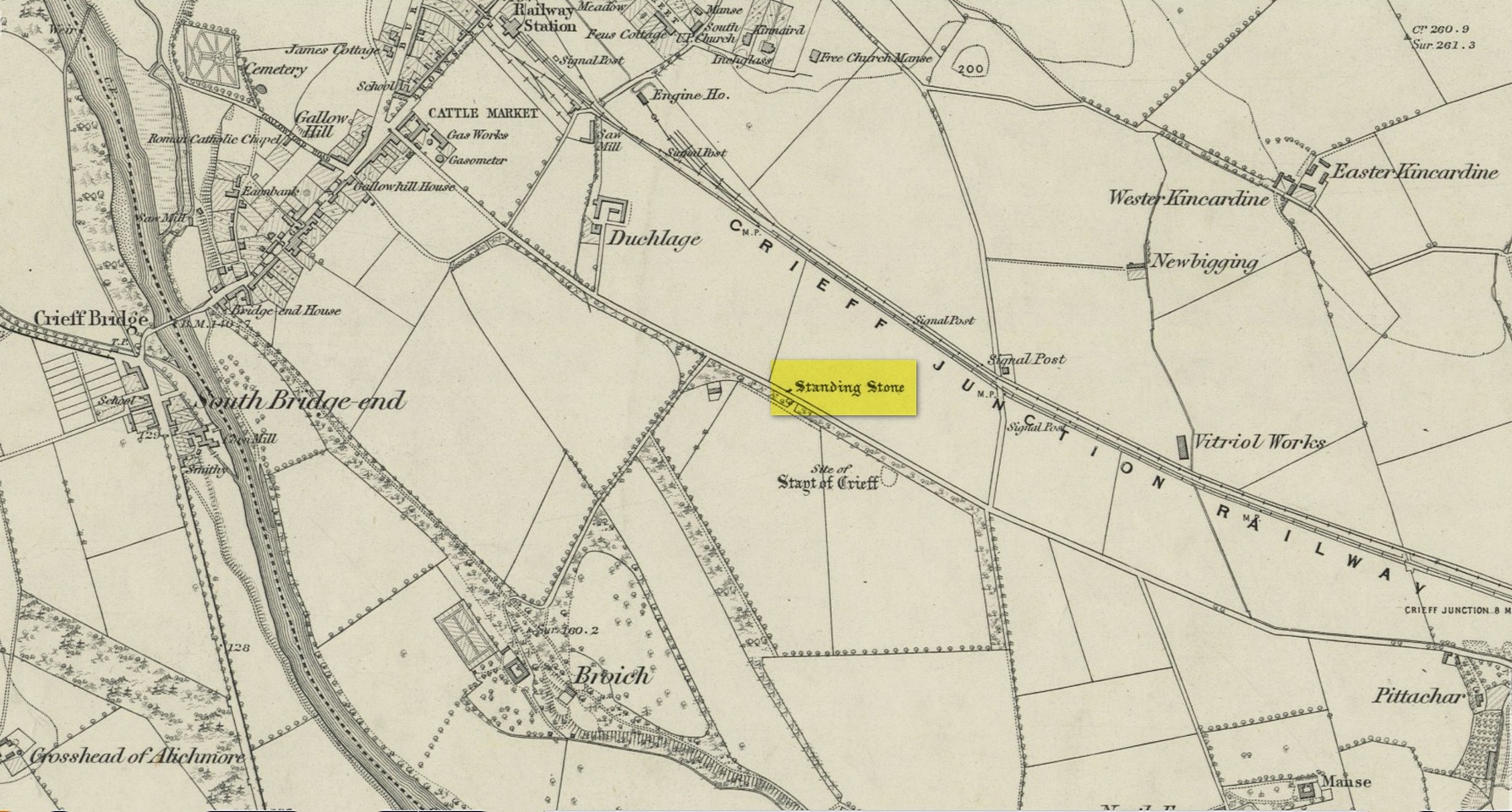
Standing Stone:  OS Grid Reference – NT 15061 20292

Also Known as:

  1. Meggat Stane

Archaeology & History

Small stone by the roadside

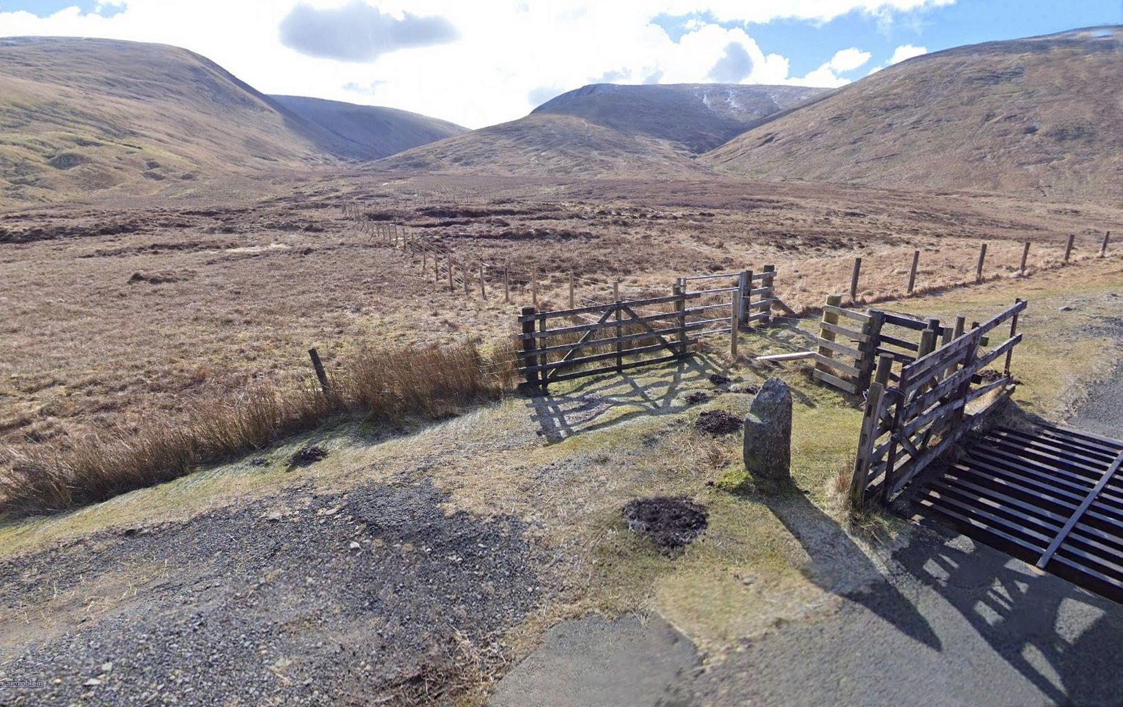
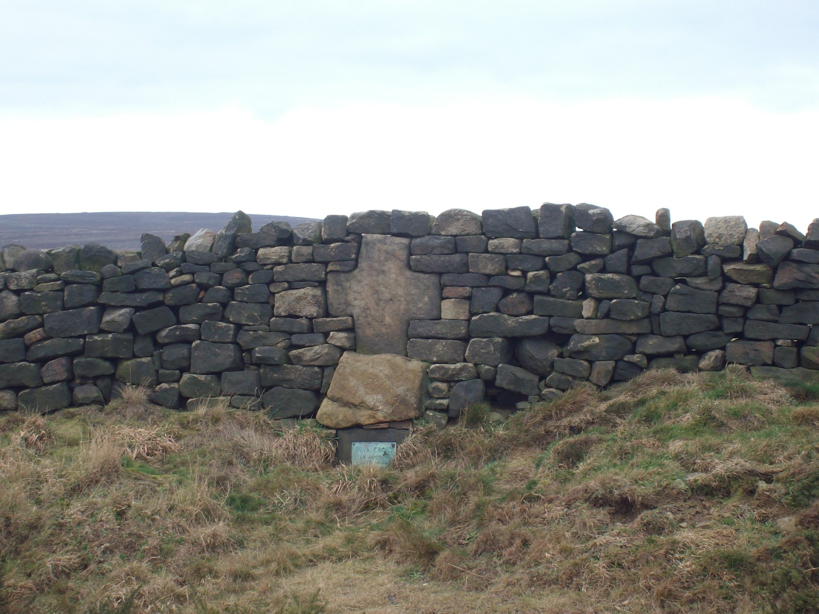
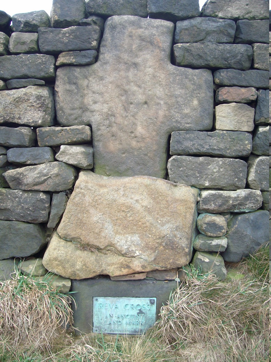
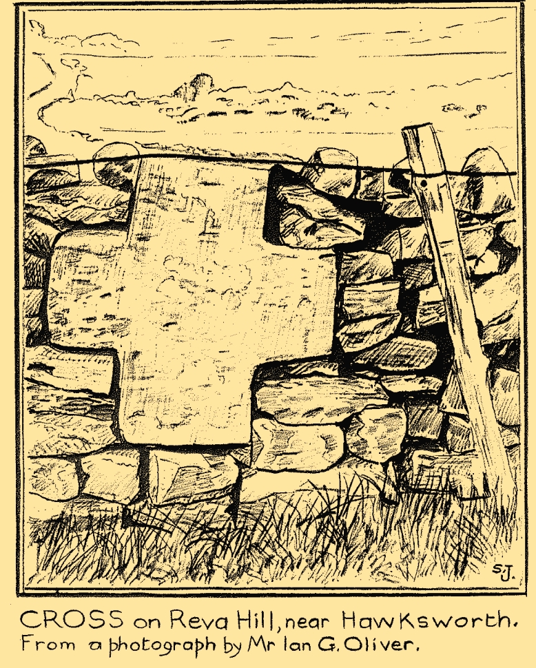
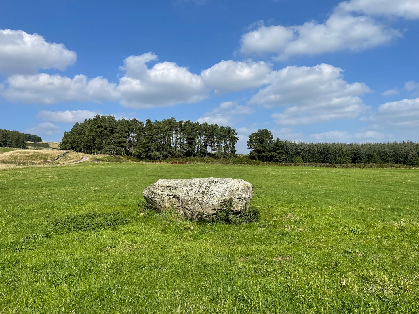
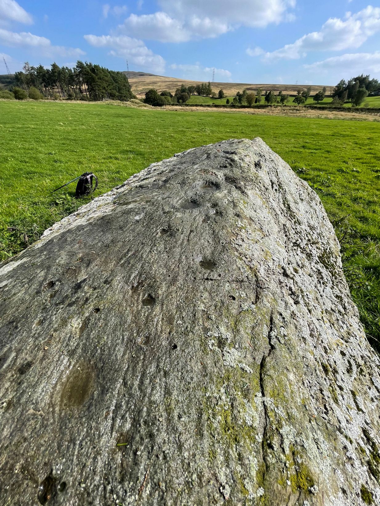
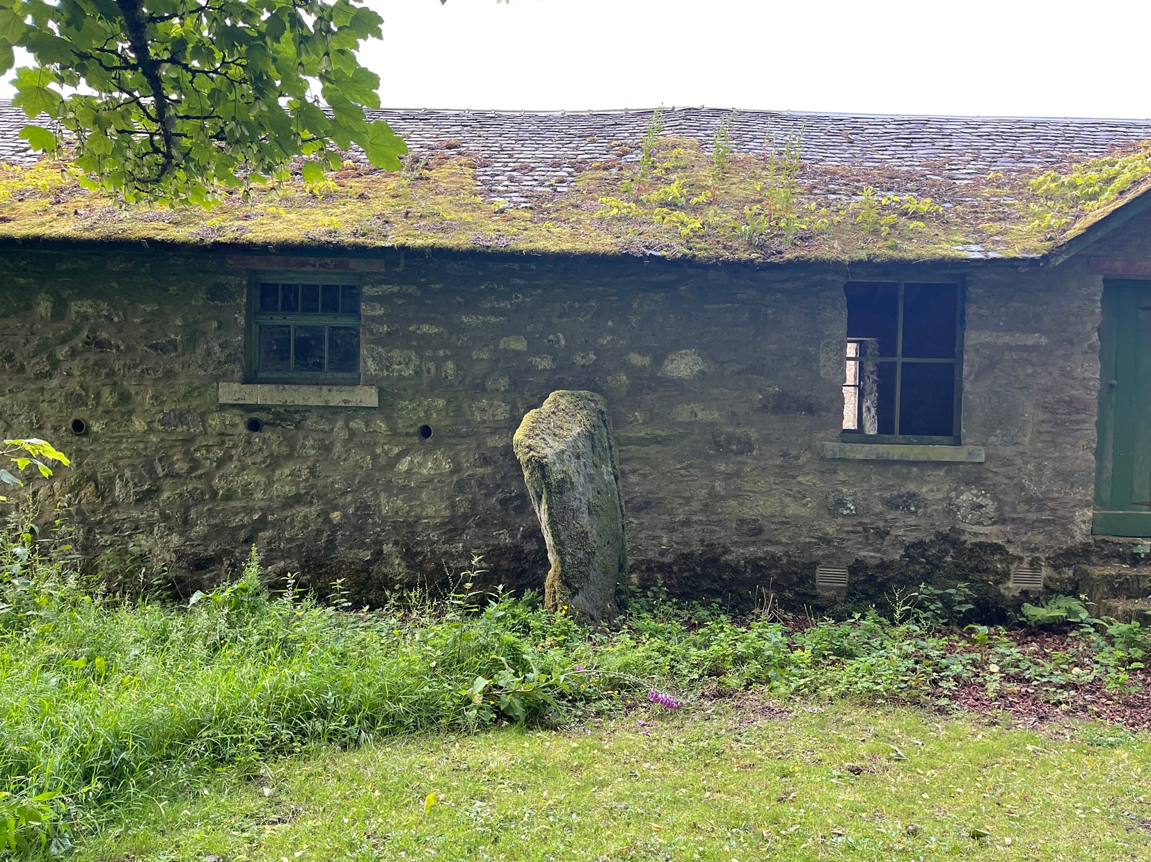
This curiously-named and barely frequented Megget Stane has seen better days.  Found in the middle of a veritable nowhere, when Duncan Fraser (1901) first wrote about it there was only a solitary pathway running between these uninhabited glens, with this old stone standing as a solitary sentinel—albeit a not very grand one!  It’s present position at the roadside was given it following a forced removal into a nearby ditch, when the old Edinburgh District Water authority who built the Talla Reservoir a couple of miles away all but destroyed it!  On one of Mr Fraser’s many visits, in August 1899, he found what he called his “old friend…lying among the heather broken into three pieces.”

“I frankly confess that this wanton act of vandalism filled me with the deepest indignation,” he wrote—and so he sought to redress the situation and find out who’d damaged the old stone.  It transpired that,

“The Edinburgh District Water Trust had a few months before this time purchased from Lord Wemyss the ground at the head of Meggat, which slopes down to Talla.  In marking off their new possession, the Trust had run a strong five-barred wire fence along the march, and as Meggatstane stood on the line, why, Meggatstane was bound to go!”

He contacted a local farmer and, between them, they protested to the water company who, eventually, fixed the pieces of the stone back together and erected it in the position that we see today, very close to its original spot.  Prior to it being damaged, Fraser told that it stood four feet tall, but when cementing it all back together again, some of its original size was lost.

Its history and legends had been forgotten even in his day and despite enquiries with other local wanderers, all that was ever told of it were variants on it standing hereby since time immemorial.  For my part, I’m somewhat sceptical about it having a prehistoric provenance, despite the Royal Commission (1957) lads suggesting a Bronze Age origin—but that’s just my own feeling on the place.  I’m more inclined to see this as an early mediaeval stone—but would love to be wrong.  It may, perhaps, even date from Viking times…..

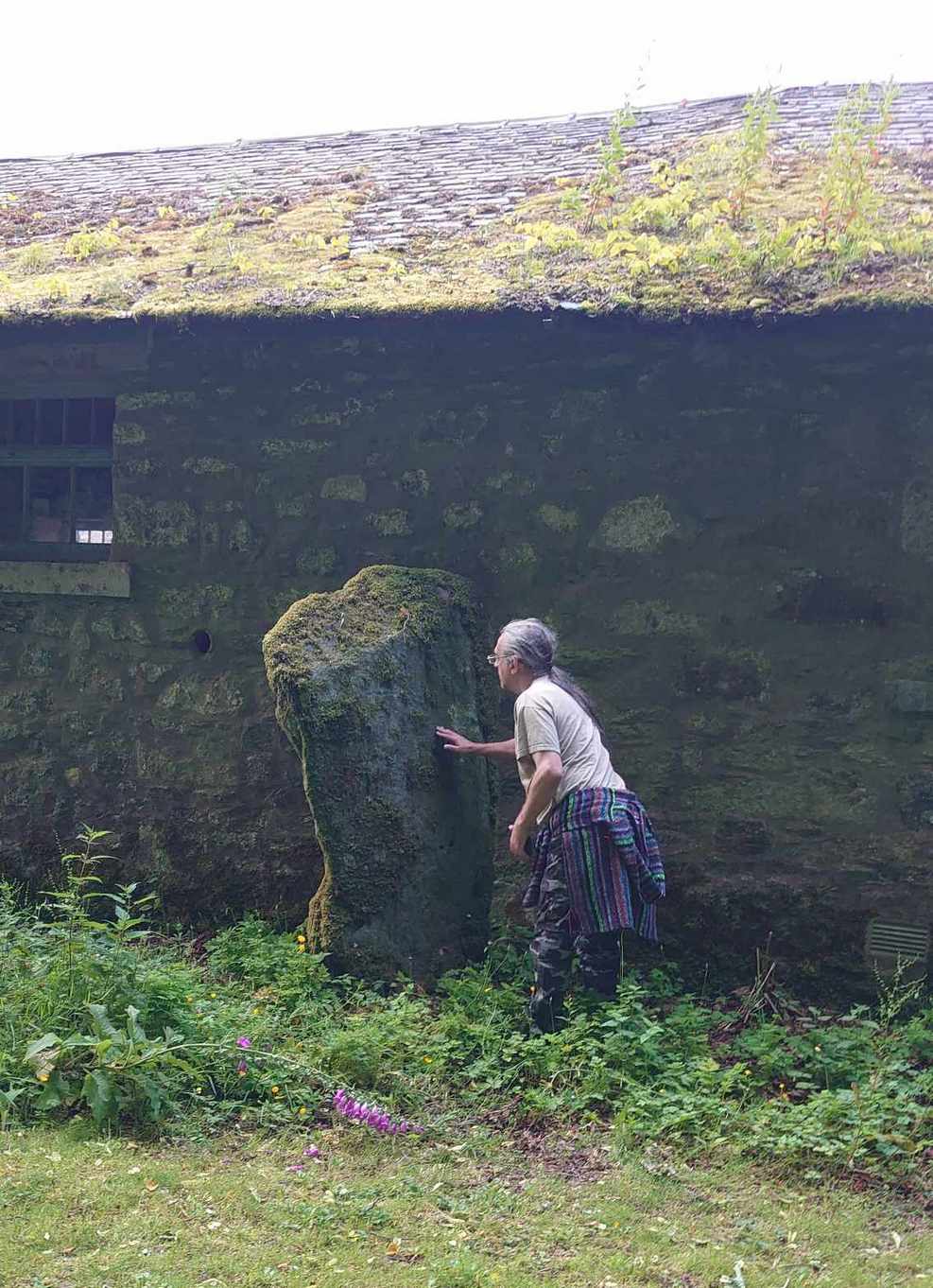
Fraser told us an intriguing note when the stone was eventually re-assembled,

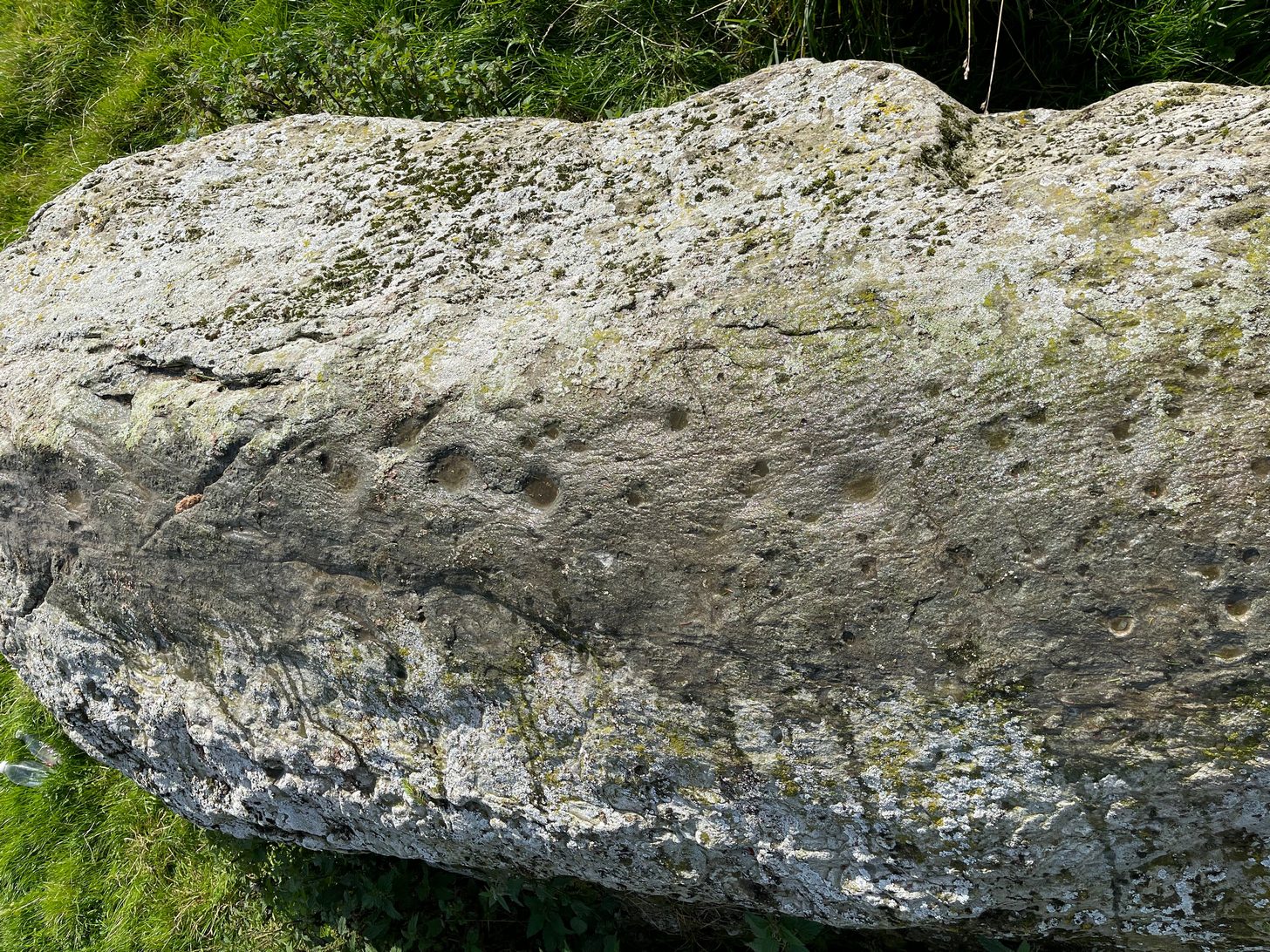
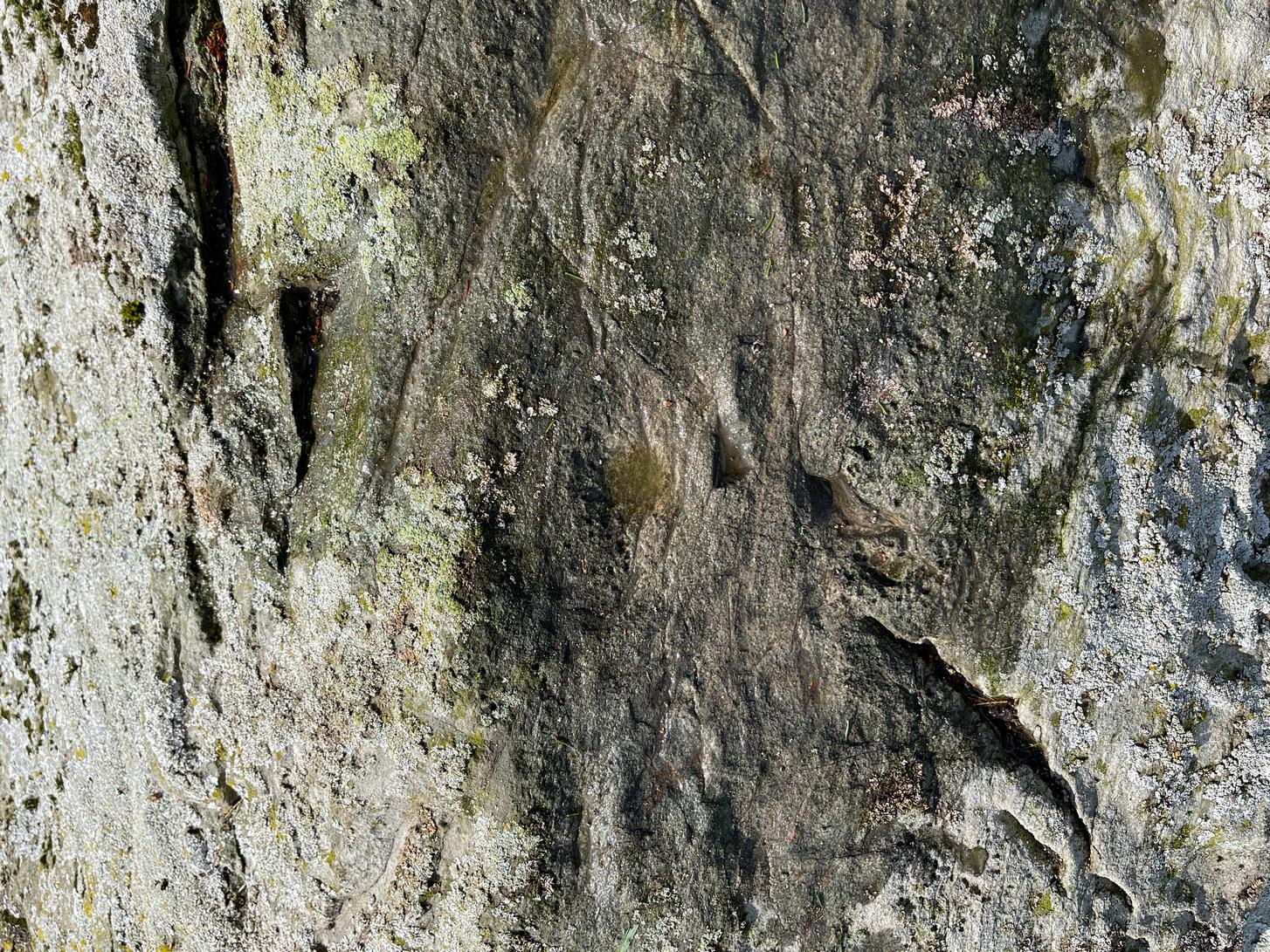
” I was interested to learn that when they dug to the bottom of the stone, they found the part underground covered with certain runic-like characters.”

These don’t appear to have been seen since.

References:

  1. Fraser, Duncan, “Meggatstane – An Incident in a Riverside Ramble,” in Border Magazine, volume 6, no.70, November 1901.
  2. Royal Commission Ancient & Historic Monuments, Scotland, An Inventory of the Ancient and Historical Monuments of Selkirkshire, HMSO: Edinburgh 1957.

Acknowledgements:  Huge thanks for use of the Ordnance Survey map in this site profile, reproduced with the kind permission of the National Library of Scotland

© Paul BennettThe Northern Antiquarian

Reva Hill, Hawksworth, West Yorkshire

Cross:  OS Grid Reference – SE 15297 42972

Also Known as:

  1. Plague Stone
  2. Riva Cross
  3. Stone Cross

Getting Here

Reva Hill cross in walling

Two main routes to get here: i) from Dick Hudson’s public house, head left (east) along Otley Road (passing Weecher reservoir) for 1.9 miles (3.1km) until you reach Reva reservoir where a track leads you to the waters, and there’s a small parking spot on the left-side of the road. Stop here. (ii) coming from Hawkworth and Guiseley, head west along Hawksworth Lane which runs into Goose Lane and, at the T-junction at the end, turn right and nearly 500 yards along on the left-side of the road is the same small parking spot. From here, walk uphill for nearly 150 yards and then look at the walling to your left.

Archaeology & History

Reva Cross on 1851 map

This relic can be found on the far eastern edges of Hawksworth Moor, near Guiseley, and was said by the historian Eric Cowling to have originally stood upon a large rock nearby.  It has an odd history. Initially, the cross was an ancient boundary or mark stone, referred to in a 15th Century document and outlined by William Preston in 1911, that marked the limit of the southern township of Burley township.  Local historian C.J.F. Atkinson asserted that this cross in fact came from Otley, although his ideas were considered somewhat “fanciful” by archaeologists and other historians.

Its present position by the roadside is relatively new as it stood, not too long ago, a short distance away in the field to the rear, as highlighted on the early OS-map of this area.  E.C. Waight of the archaeology division to Ordnance Survey wrote:

“Situated at SE 1530 4297 on the western side of the gate from the road into the field containing the remains of Reva Cross is a cross base (apparently in situ) serving as a bolster stone to the wall head at the gate opening.”

He described the dimensions of the base and the remainder of the cross, both of which “are contemporary with one and other,” he told.  In the 1960s, the local council moved the cross to its present position.

Tradition told that despite its religious symbolism, it was also used as a market cross in bygone times. A certain Mrs Fletcher (1960), writing to the Cartwright Hall Archaeology Group, narrated that,

“Mrs Turner Greenwood….tells me that her mother, who, if living, would be in her nineties, lived at Gaping Goose Farm on the western side of Reva Hill… Mrs Greenwood’s father.. .remembered the cross erected on this hill, and related seeing the roads black with people climbing to it from Otley and Bingley, for the market held there.”

Despite this, Sidney Jackson was somewhat sceptical of it being the site of a market.  Weather conditions and the bleakness of the spot would have made this site somewhat intolerable, he thought.  However, people in previous centuries were much hardier than modern people and so it’s not as unlikely as you’d initially think.

Close-up of cross
Sid Jackson’s sketch

A much more interesting tradition of the cross was its use in times gone by as a Plague Stone. However, this name only applied to the cross-base at the time as no cross was stood upon it; merely a natural rock laid upon the moorside with a basin cut into it. It gained this name around the time of the great plague of 1660.  During the plague, food was left on this table-like rock and money in return was placed in a basin full of vinegar.  This tradition may have originated at the large natural rock bowl on one of the earthfast stones near the very top of Reva Hill a short distance to the west (also a number of cup-marked stones are close by and folklore records show that some cup-marks had healing properties).  One account tells that it was Sir Walter Hawksworth (of the legendary Grand Lodge of ALL England masonic lodge) who was responsible for the siting of the cross as a Plague Stone.

References:

  1. Cowling, Eric T., Rombald’s Way, William Walker: Otley 1946.
  2. Cowling, Eric T., ‘Letter,’ in Cartwright Hall Archaeology Group Bulletin, 5:5, May 1960.
  3. Fletcher, Elsie, “Letter,” in Cartwright Hall Archaeology Group Bulletin, 5:5, May 1960.
  4. Jackson, Sidney, “Ancient Crosses,” in Cartwright Hall Archaeology Group Bulletin, 1:12, 1955.
  5. Jackson, Sidney, “Cross on Reva Hill,” in Cartwright Hall Archaeology Group Bulletin, 5:1, p.2, 1960.
  6. Jackson, Sidney, “Reva Hill Cross Base Found,” in Cartwright Hall Archaeology Group Bulletin, 9:9, September 1964.
  7. Jackson, Sidney, “Fresh Site for Reva Cross,” in Cartwright Hall Archaeology Group Bulletin, 11:7, July 1966.
  8. Preston, William Easterbrook, “On an Ancient Stone Cross on Riva Hill,” in Bradford Antiquary, New Series 3, 1911.

Acknowledgements:  Huge thanks for use of the Ordnance Survey map in this site profile, reproduced with the kind permission of the National Library of Scotland

© Paul BennettThe Northern Antiquarian

Foulford, Fowlis Wester, Perthshire

Cup-and-Ring Stone:  OS Grid Reference – NN 89986 26994

Also Known as:

  1. Connachan Lodge

Getting Here

The old stone in his field

Take the A85 road east out of Crieff and after roughly 2 miles at Gilmerton, turn left up the A822 Dunkeld road.  Go along here for nearly 2½ miles, where you’ll reach the Foulford golf course on the right-hand side of the road.  Directly opposite the entrance into the golf course, a dirt-track leads you into the fields where, laying alone and standing out like a sore thumb about 300 yards away, you’ll see a large rounded boulder sitting there minding it’s own business.  You can see it quite clearly from the roadside.  Nice n’ easy.

Archaeology & History

For such a large conspicuous stone, you’d think there’d be quite a lot written about it as well as hope for a good ornate design—but alas!, both hopeful expectations are lacking.  Although, as usual, there’s more to it than is described in the official records—although not much more….

Long stone & its  cupmarks
Cups along the spine

As you walk towards it, it seems as if a rounded earthfast boulder is in front of you, but once you reach it you realise that it’s nothing of the sort.  Indeed, the more you looked at the stone, the more it seems as if it might have stood upright not too many centuries ago; the prevalence of other standing stones in the area being well known.  But, along the spine of this long stone, a number of cup-marks speak out to you: at least seven of them, perhaps eight.  There are a number of smaller “cups” roughly along the same length of stone, but these are Nature’s handiwork; but, it looks as if one or two of the man-made cups might have started their lives as Nature’s indentations and been worked into the symbols that still remain to this day.

Faint ring around a cup
Nose of stone, looking E

The official records tell us of the cup-marks, but says nothing of the faint but distinct rings around two or three of the cups.  The most notable one, albeit faint, is near the southeastern part of the stone, where the ring seems to be an artistic partnership of Nature and man.  You can make it out in the photo, albeit not too clearly.   Nearer to the middle of the stone at least one of the cups has a semi-circle around it and, just to the side of it, a natural crack in the stone has been enhanced and carved into a short line.  On the whole, it’s not a visually impressive carving and the design is troublesome to see if the lighting isn’t right (as usual), but is worth having a look at if you’re in the area.  Very little’s been written about it apart from brief notes in the regional megalithic surveys of both Finlayson (2010) and Watson (2006).

References

  1. Finlayson, Andrew, The Stones of Strathearn, One Tree Island: Comrie 2010.
  2. Watson, David, A Simple Introduction to the Stone Circles and Standing Stones of Perthshire, Photoprint 2006.

Acknowledgements:  Huge thanks for use of the Ordnance Survey map in this site profile, reproduced with the kind permission of the National Library of Scotland

© Paul BennettThe Northern Antiquarian

Millhills, Crieff, Perthshire

Stone Circle (destroyed):  OS Grid Reference – NN 88808 19823

Archaeology & History

In 1995, an aerial survey done in this neck o’ the woods found a number of distinct shadows in the landscape showing a considerable number of unrecorded prehistoric archaeological sites.  One of them indicated a previously unrecognized “four poster” stone circle.  It was described briefly on Canmore as follows:

“The four-poster is visible (as) a square setting 6m across. It is situated between the cropmarks of a palisaded settlement…and a possible enclosed settlement.”

No excavation has yet been performed.  A very clear ring ditch was also discovered some 50 yards to the east in the same field.

Folklore

There is no known folklore or traditions relating to this site or immediate locale.

References:

  1. Burl, Aubrey, Four Posters: Bronze Age Stone Circles of Western Europe, BAR 195: Oxford 1988.

© Paul BennettThe Northern Antiquarian

Duchlage, Crieff, Perthshire

Standing Stone (destroyed):  OS Grid Reference – NN 8655 2079

Archaeology & History

Site on the 1866 map

There is seemingly no trace left of this once impressive tall, slender standing stone that had lived for thousands of years on the south-side of Crieff.  It was destroyed by some retard in the middle of the 20th century (anyone know their name?).  Highlighted on the 1866 Ordnance Survey map of the area, it was visited and described by the late great Fred Coles (1911) when it still stood at the side of the road.  He told that it was,

“In shape a narrow rhomboid at the base, this Stone rises to an acute angle at a height of 6 feet.  Its longer axis is E.S.E. 52° by W.N.W. 52°, and in basal girth it  measures 8 feet 11 inches.”

Coles’ 1911 sketch

Some 200 yards to the south-east there used to be the curiously-named Stayt of Crieff burial mound which had been used as a court hill for many centuries.  This outlying standing stone may have been the “witness” on which oaths were sworn before the court.  Sadly the history of the Stayt of Crieff mound is also somewhat sparse and it too has, appallingly, been destroyed.  The destruction of these antiquities and their ancient traditions is nothing short of a fucking disgrace.

References:

  1. Coles, Fred, “Report on Stone Circles Surveyed in Perthshire, Principally Strathearn” in Proceedings of the Society of Antiquaries, Scotland, volume 45, 1911.
  2. Finlayson, Andrew, The Stones of Strathearn, One Tree Island: Comrie 2010.

Acknowledgements:  Huge thanks for use of the Ordnance Survey map in this site profile, reproduced with the kind permission of the National Library of Scotland

© Paul BennettThe Northern Antiquarian

Cowcliffe Cross, Fartown, Huddersfield, West Yorkshire

Cross:  OS Grid Reference – SE 13949 18935

Getting Here

Lizzi by the cross-base

Nice ‘n easy: from Huddersfield central, take the A641 road north to Brighouse, but barely a half-mile out of town turn left up the Halifax Old Road.  Go on here for nearly a mile, then keep your eyes peeled for the aptly-named South Cross Road on your right.  Go up here all the way to the end where it meets with Cowcliffe Hill Road.  Here, at the junction, right by the roadside at the edge of the wall, is the remains of the old cross-base, all but covered in vegetation.  You’ll see it.

Archaeology & History

The little-known remains of a post-medieval cross base can still be seen, albeit very overgrown, right by the roadside.  The upstanding stone cross that once stood upon it has long since gone (perhaps broken up and built into the wall).  It may have been one of two such crosses relatively close to each other: as this one is found at South Cross Road, there may have been another one at the nearby North Cross Road, but history seems to be silent on the matter.

Top of the cross-base

The cross-base itself has several holes cut into it where the standing stone cross was fixed upright.  Very little seems to be known about this monument.  George Redmonds (2008) told simply that, “the base of a cross survives on Cowcliffe Hill Road, no doubt marking the ancient crossroads. It explains the names North and South Cross Roads.”  He added that, “The base of the cross survives, partly hidden in the undergrowth, and it is the only visible evidence we have of several similar crosses in the township.”

References:

  1. Redmonds, George, Place-Names of Huddersfield, GR Books: Huddersfield 2008.

Acknowledgements:  Huge thanks to Liz Sykes for helping out big-time to uncover the base from beneath the mass of herbage.

© Paul BennettThe Northern Antiquarian

Oakfield, Lochgilphead, Argyll

Standing Stone:  OS Grid Reference – NR 85726 88528

Also Known as:

  1. Auchindarroch Stone

Getting Here

Oakfield Stone, Argyll

On the west side of Lochgilphead, at the roundabout where the A83 Ardrishaig road meets the A816 Oban road, cross the road and walk up the sloping drive to the Crinan canal crossing less than 100 yards up. From here, walk straight across along the “Private” drive where, after a few hundred yards, you’ll reach the large old manor house.  Ask the good people there to direct you to the stone, which is a bit further round the track at the back of the house, standing up against some old disused office buildings.  You’ll find it.

Archaeology & History

There’s something about this stone, rarely visited these days (perhaps that’s the thing!), nestling quietly against an old building.  For some reason, an odd reason obviously—a “superstitious” reason probably—it’s been left standing upright against the old walls, untouched by those who made the much more recent structure.  Usually you’d expect such old stones to be destroyed, or at least incorporated into the more modern building — but not this one.

Feeling Nature’s cups
Standing against the wall

Standing nearly six feet in height, the first written records I have of this are from Colin Leitch’s (1904) local history work, where he refers to it as an ancient “Celtic stone” set up against the wall of the dairy (as it was back then).  It is described in the standard Royal Commission (1988) report and local surveys of Marion Campbell (1964; 1984), who give us the respective dimensions of the stone—1m x 0.23m at the base, aligning WSW by ESE—and curiously it seems that little else is known of it.  There are several “cup-marks” on the stone (you can see me fondling them in the photo), but these are Nature’s handiwork and not man-made.  Early 20th century accounts told of two other standing stones near this old fella, but they were seemingly the remains of old gateposts, long since fallen.

References:

  1. Campbell, Marion, Mid Argyll – An Archaeological Guide, Dolphin: Glenrothes 1984.
  2. Campbell, Marion & Sandeman, M., “Mid Argyll: An Archaeological Survey,” in Proceedings Society of Antiquaries Scotland, volume 95, 1964.
  3. Leitch, Colin, Ardrishaig and its Vicinity, John Cossar: Govan 1904.
  4. Royal Commission on the Ancient & Historical Monuments of Scotland, Argyll – Volume 6: Mid-Argyll and Cowal, HMSO: Edinburgh 1988.
  5. Ruggles, Clive, Megalithic Astronomy, BAR: Oxford 1984.

Acknowledgements:  To my little animal, Naomi – for getting us over here again. 

© Paul BennettThe Northern Antiquarian

Boreland Mote, Parton, Kirkcudbrightshire

Stone Circle (destroyed):  OS Grid Reference – NX 693 709

Archaeology & History

In March 1844, Rev. W.G. Crosbie in his survey of the parish of Parton, mentioned the mediaeval earthworks, or motte, above the west side of the Borland Glen:

“At a short distance from this,” he wrote, “are the remains of a small Druidical circle.”

This “Druidical circle” was subsequently described in Fred Coles’ (1895) megalithic survey of Kirkcudbrightshire, where he added that the circle was “some two hundred yards distant” from the motte—but it had already been destroyed when he wrote about it and its exact location seems to have been forgotten.  Logic suggests that the circle would have been on the lands immediately west of the motte, where the land is relatively level and possesses several small hillocks, which would be perfect for megalithic siting. (the grid-reference cited above is an approximation)

References:

  1. Burl, Aubrey, The Stone Circles of Britain, Ireland and Brittany, Yale University Press 2000.
  2. Coles, Fred, “The Stone Circles of the Stewartry of Kirkcudbright”, in Proceedings Society Antiquaries, Scotland, volume 29, 1895.
  3. Crosbie, W.G., “Parish of Parton,” in New Statistical Account of Scotland – volume 4, William Blackwood: Edinburgh 1845.

© Paul BennettThe Northern Antiquarian

Priest’s Stone, Lethnot & Navar, Angus

Standing Stone (destroyed):  OS Grid Reference – NO 5404 6892

Archaeology & History

Priest’s Stone on 1865 map

Despite being shown on the early OS-maps of the area, I can find few references of this place.  The Ordnance Survey lads themselves, when visiting here in 1863, merely told that this it was “a standing stone of which nothing is known except the name.  It is 3 feet high, three feet in diameter at base, and a foot and a half at top.”  Even in Cruikshank’s (1899) definitive survey of this township he could add little more, merely telling:

“About a quarter-of-a-mile north of Bellhill is a field known as “the Priest’s Field.” There is a large right stone in the middle of it, called “the Priest’s Stone,” and it is so given on the Ordnance Survey map. not simply because such is the local name, but also because the skilled surveyors after examining it concluded that it had been used for sacrifice. It stands just behind the site of the old farm steadying of Upper Argeith, or vulgarly, Townhead.”

Quite what he meant by saying that “it had been used for sacrifice,” god only knows!  But the writer was the local minister and so would have been possessed by the usual delusions.  Anyhow, the stone was uprooted and destroyed by the farmer at Newbigging, sometime prior to 1958.  Idiot!

A half-mile north of this could once be seen a stunner of a site: a double-ringed giant tomb from where hundreds of cartloads of stone were taken.  It too no longer exists!

References:

  1. Cruikshank, F., Navar and Lethnot: The History of a Glen Parish in the North-east of Forfarshire, Black & Johnston: Brechin 1899.
  2. Royal Commission on the Ancient and Historical Monuments of Scotland, The Archaeological Sites & Monuments of Central Angus, Angus District, Tayside Region, HMSO: Edinburgh 1983.

Acknowledgements:  Huge thanks for use of the Ordnance Survey map in this site profile, reproduced with the kind permission of the National Library of Scotland

© Paul BennettThe Northern Antiquarian

Wellford, Fern , Angus

Standing Stone (destroyed):  OS Grid Reference – NO 483 603 (approximation)

Archaeology & History

In an area once teeming with megaliths, this is but one that lost its life in the 19th century.  It would seem that the only reference of its existence—and demise—comes from the pen of the great regional historian Andrew Jervise (1853) who, in a description of the nearby holy well of St Ninian, in a field near Wellford,

“within the last half century there were two or three large rude boulders nearby, which were called Druidical stones.”

References:

  1. Jervise, Andrew, The History and Traditions of the Land of the Lindsays in Angus and Mearns, Sutherland & Knox: Edinburgh 1853.

© Paul BennettThe Northern Antiquarian