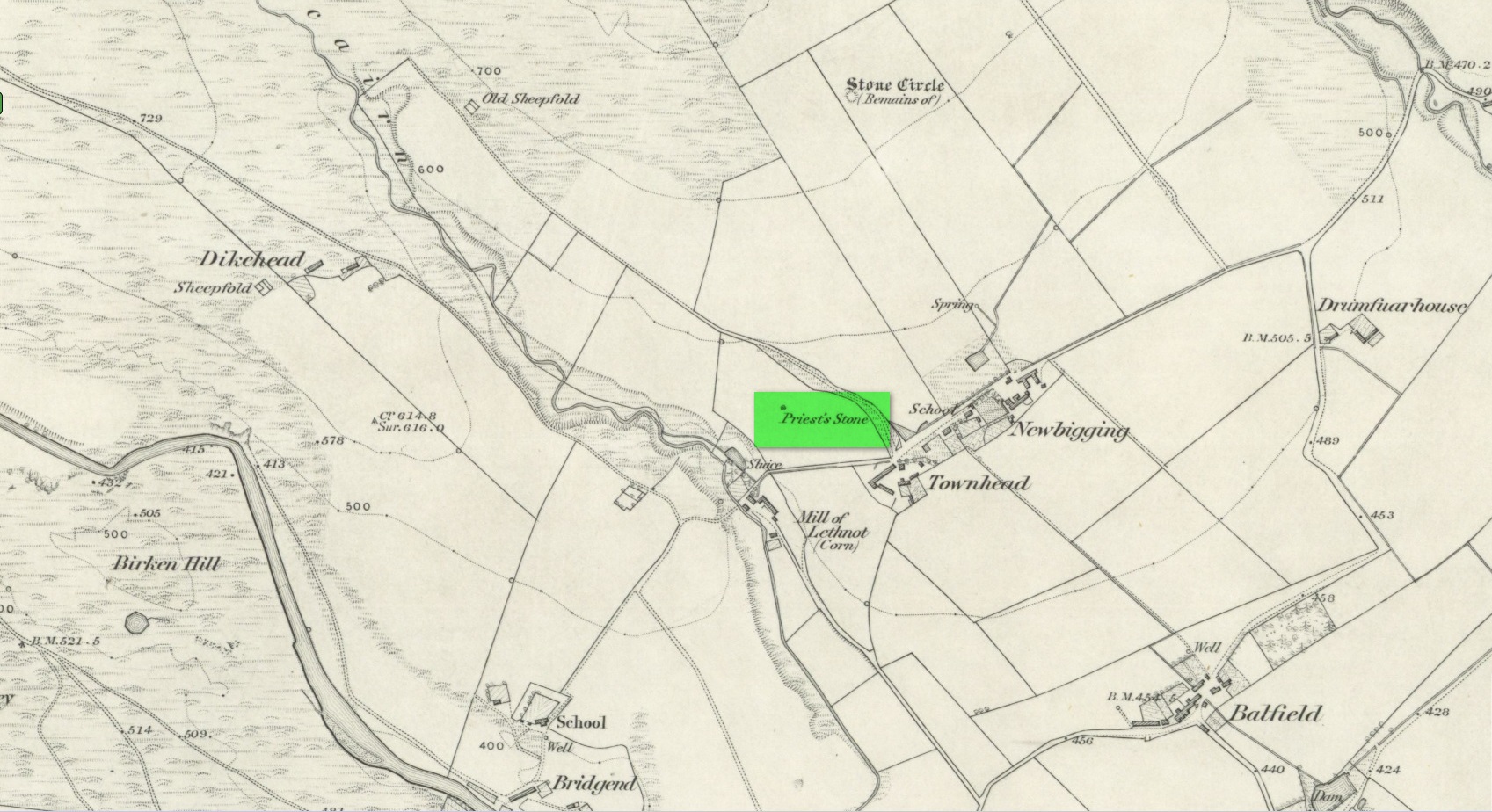
Standing Stone: OS Grid Reference – NR 85726 88528
Also Known as:
- Auchindarroch Stone
Getting Here
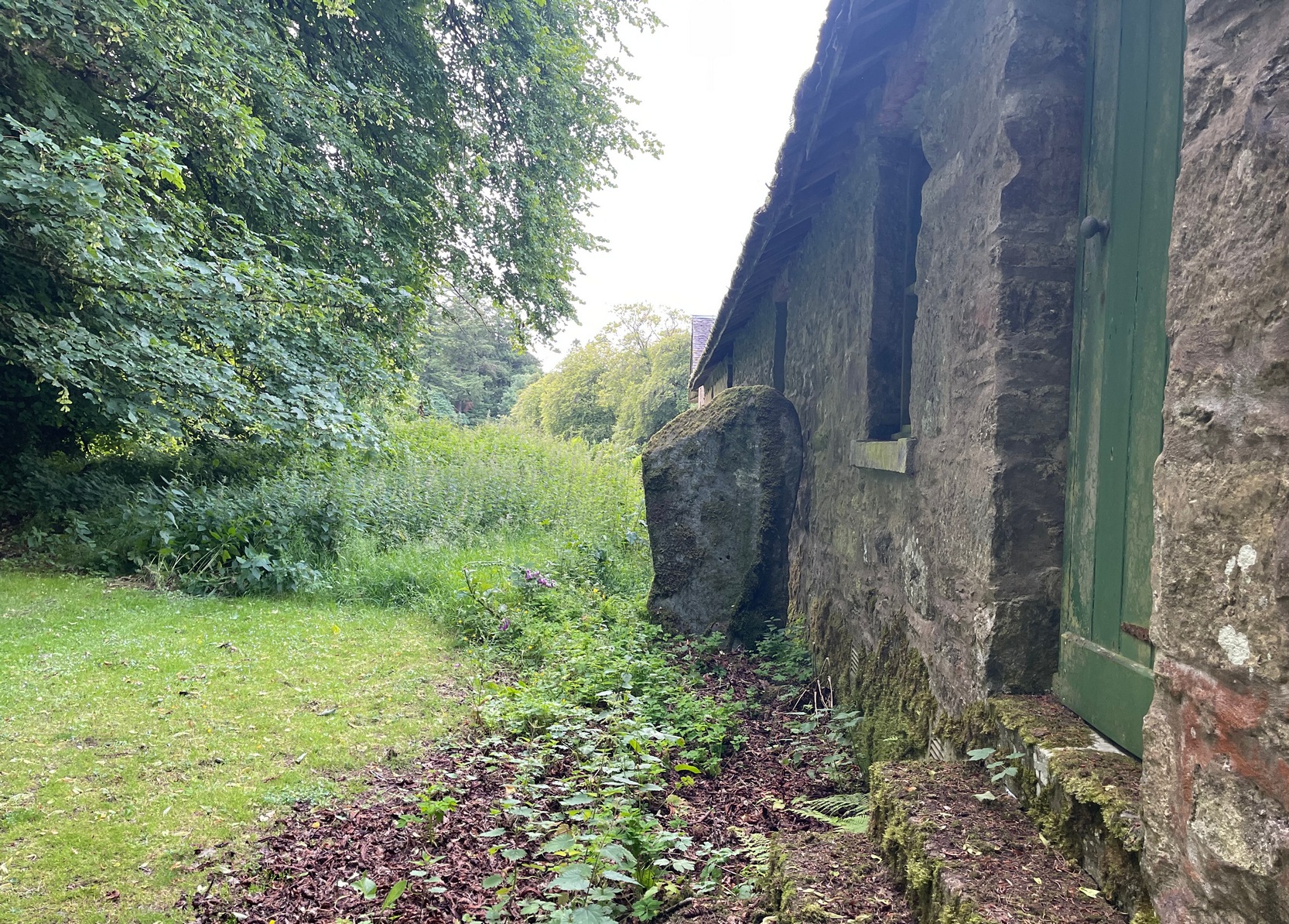
On the west side of Lochgilphead, at the roundabout where the A83 Ardrishaig road meets the A816 Oban road, cross the road and walk up the sloping drive to the Crinan canal crossing less than 100 yards up. From here, walk straight across along the “Private” drive where, after a few hundred yards, you’ll reach the large old manor house. Ask the good people there to direct you to the stone, which is a bit further round the track at the back of the house, standing up against some old disused office buildings. You’ll find it.
Archaeology & History
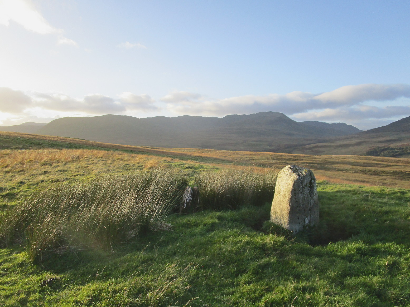
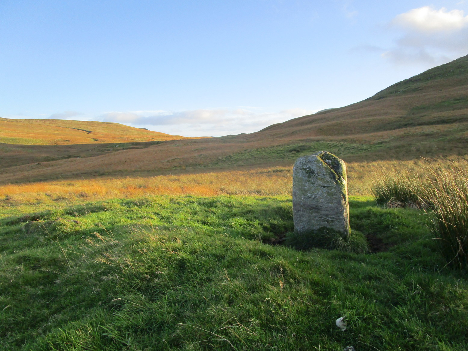
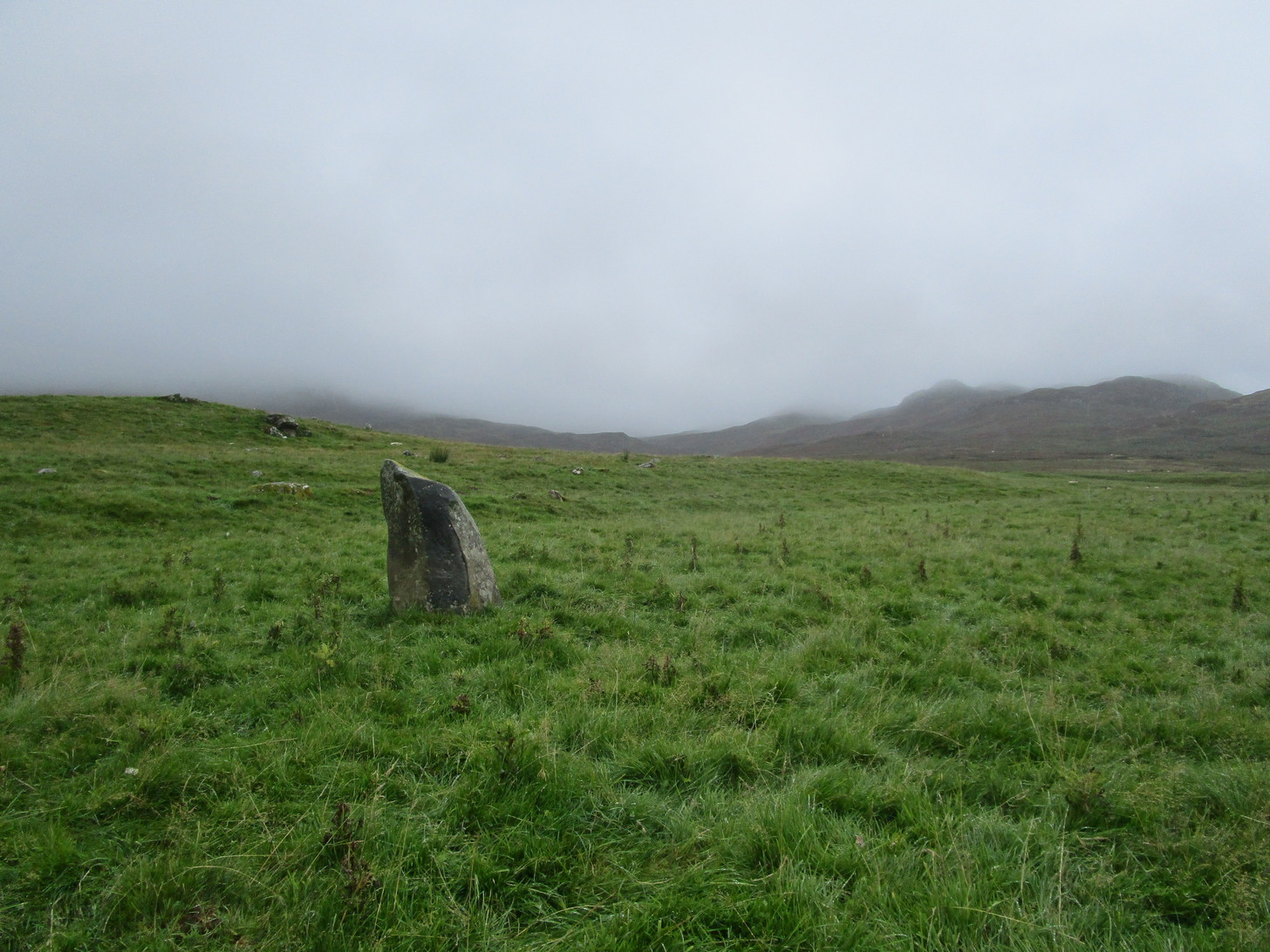
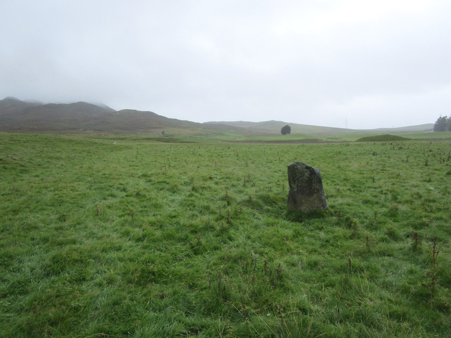
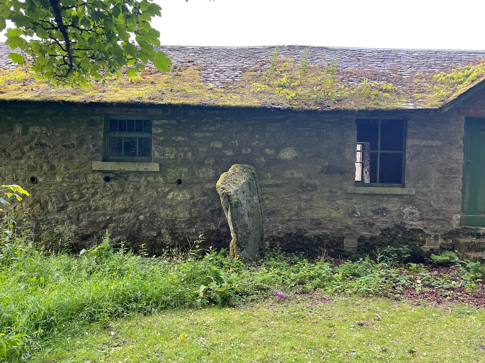
There’s something about this stone, rarely visited these days (perhaps that’s the thing!), nestling quietly against an old building. For some reason, an odd reason obviously—a “superstitious” reason probably—it’s been left standing upright against the old walls, untouched by those who made the much more recent structure. Usually you’d expect such old stones to be destroyed, or at least incorporated into the more modern building — but not this one.
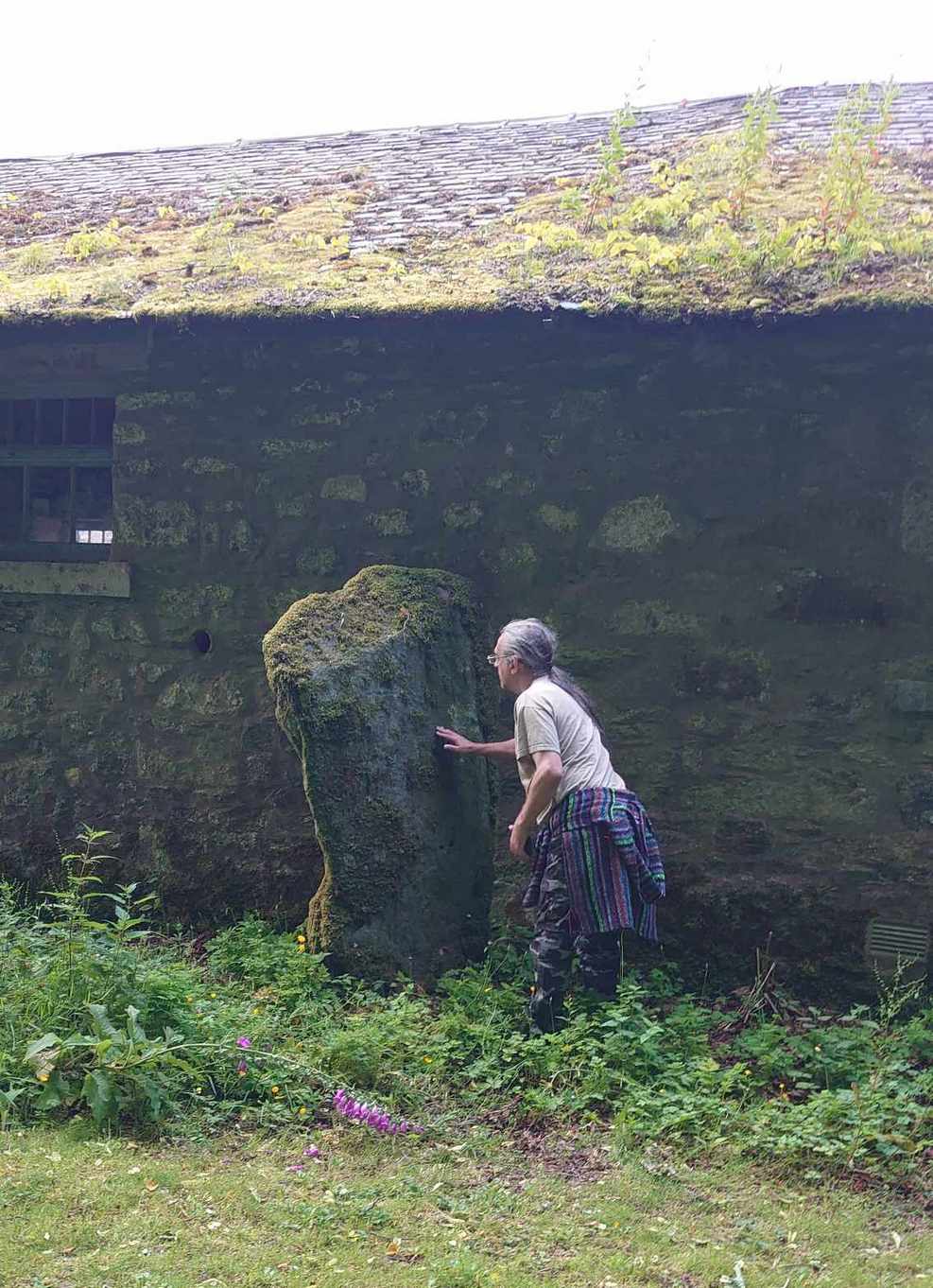
Standing nearly six feet in height, the first written records I have of this are from Colin Leitch’s (1904) local history work, where he refers to it as an ancient “Celtic stone” set up against the wall of the dairy (as it was back then). It is described in the standard Royal Commission (1988) report and local surveys of Marion Campbell (1964; 1984), who give us the respective dimensions of the stone—1m x 0.23m at the base, aligning WSW by ESE—and curiously it seems that little else is known of it. There are several “cup-marks” on the stone (you can see me fondling them in the photo), but these are Nature’s handiwork and not man-made. Early 20th century accounts told of two other standing stones near this old fella, but they were seemingly the remains of old gateposts, long since fallen.
References:
- Campbell, Marion, Mid Argyll – An Archaeological Guide, Dolphin: Glenrothes 1984.
- Campbell, Marion & Sandeman, M., “Mid Argyll: An Archaeological Survey,” in Proceedings Society of Antiquaries Scotland, volume 95, 1964.
- Leitch, Colin, Ardrishaig and its Vicinity, John Cossar: Govan 1904.
- Royal Commission on the Ancient & Historical Monuments of Scotland, Argyll – Volume 6: Mid-Argyll and Cowal, HMSO: Edinburgh 1988.
- Ruggles, Clive, Megalithic Astronomy, BAR: Oxford 1984.
Acknowledgements: To my little animal, Naomi – for getting us over here again.
© Paul Bennett, The Northern Antiquarian