Devil’s Stone, Winceby, Lincolnshire

Legendary Rock:  OS Grid Reference – TF 3127 6901

Also Known as:

  1. Big Stone of Slash Lane

Archaeology & History

Stone shown on 1887 map

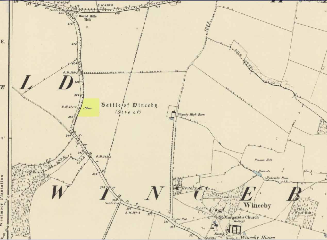
There is no specific archaeological information about this stone.  However, we must take note of the so-called “devil’s footprint” that was on the boulder.  In some parts of the UK, some devilish and other mythic footprints on stone are prehistoric cup-markings; but we have no idea whether this impression was such a carving or—more probably in this case—Nature’s handiwork.  The field in which the stone existed was said to be the place where the so-called Battle of Winceby occurred.

Folklore

The stone was mentioned in several old tomes, with each one generally repeating the same familiar story, and with motifs that will be familiar to antiquarians and folklorists alike.  In an early edition of Notes & Queries we were told of,

“the large stone in Winceby field, where soldiers had sharpened their swords before the battle. This was a stone of fearful interest, for much treasure was supposed to have been buried under it. Numerous attempts have been made to get at this treasure, but they were always defeated by some accident or piece of bad luck. On the last occasion, by ‘yokkin’ several horses to chains fastened round the stone, they nearly succeeded in pulling it over, when, in his excitement, one of the men uttered an oath, and the devil instantly appeared, and stamped on it with his foot.  “Tha cheans all brok, tha osses fell, an’ tha stoan went back t’ its owd place solidder nur ivver; an’ if ya doan’t believe ya ma goa an’ look fur yer sen, an’ ya’ll see tha divvill’s fut mark like three kraws’ claws, a-top o’ tha stoan.’  It was firmly believed the lane was haunted, and that loud groans were often heard there.”

The tale was retold in Grange & Hudson’s (1891) essay on regional folklore.  In Mr Walter’s (1904) excellent local history survey, there was an additional shape-shifting element to the story which, in more northern climes, is usually attributed to hare; but this was slightly different.  The stone, as we’ve heard,

“was supposed to cover hidden treasure, and various attempts were made at different times to remove it, sometimes with six or even eight horses. At one of these attempts, his Satanic Majesty, having been invoked by the local title of ‘Old Lad’ appeared, it is said, in person, where upon the stone fell back, upsetting the horses.  On another occasion a black mouse, probably the same Being incarnate in another form…ran over the gearing of the horses, with a similar result.  Eventually, as a last resort, to break the spell, the boulder was buried, and now no trace of the boulder, black mouse, or Satan’s foot-print remains.”

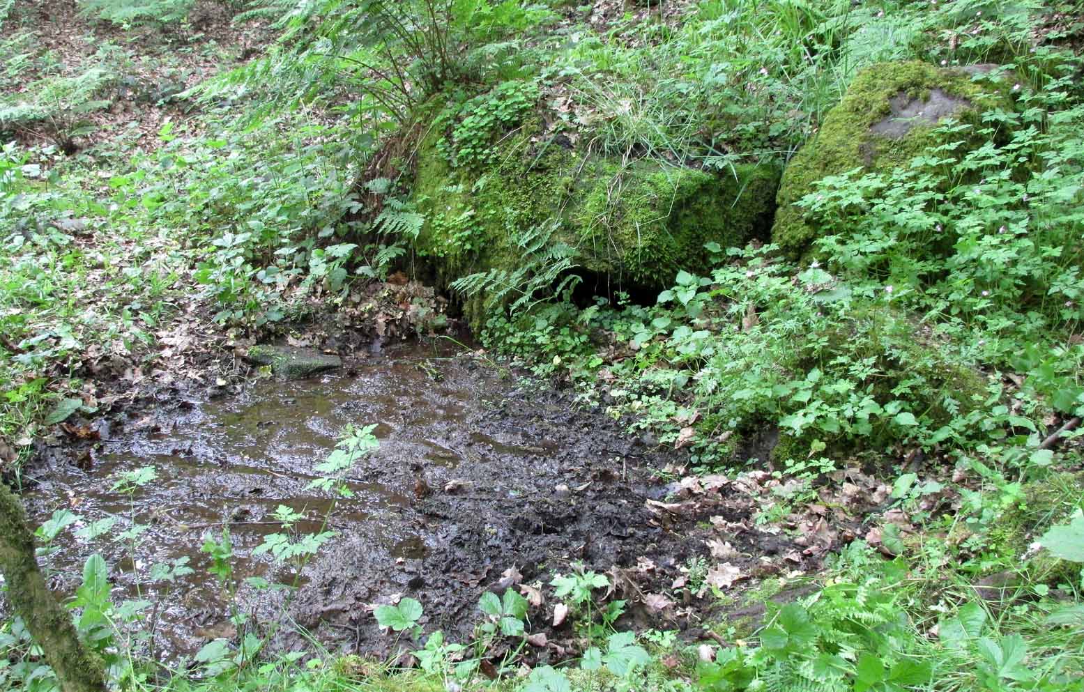
Sadly we have no sketches of the devil’s ‘footprint’; and if local lore is right, we’ll never know.  For tis said that a local farmer in the 1970s dug down and removed the stone completely.  All that he found were numerous broken ploughshares around the rock, indicating that many tools had been used to shift the stone.  In much more recent times however, a fellow antiquarian has said that it can still be found: so, if you can get a good photo of it, stick it on our Facebook group.

References:

  1. Grange, Ernest L. & Hudson, J.C. (eds.), Lincolnshire Notes and Queries – volume 2, W.K. Morton: Horncastle 1891.
  2. Gutch, Mrs & Peacock, Mabel, Examples of Printed Folklore Concerning Lincolnshire, David Nutt: London 1908.
  3. Walter, J. Conway, Records, Historical and Antiquarian of Parishes around Horncastle, W.K. Morton: Horncastle 1904.

© Paul BennettThe Northern Antiquarian

Acknowledgements:  Huge thanks for use of the Ordnance Survey map in this site profile, reproduced with the kind permission of the National Library of Scotland

Low Well, Bradford, West Yorkshire

Sacred Well (destroyed):  OS Grid Reference – SE 1589 3132

Archaeology & History

Low Well on 1852 map

Along the now-lost Low Well Road between Little Horton and West Bowling, could once be found this innocuous-sounding water source.   Shown on the 1st OS-map of the area in 1852, the site was deemed to be little other than a ‘public well’.  At the end of the 19th century, a small well-house was built over the waters; and the years following that saw its complete demise.  Its name you would think relates to a position in the land, but the dialect word low, or lowe can mean “a flame, blaze, light, glow”, it can also refer to a prehistoric tomb.  However in this case it most likely derives from “a pond or standing pool”.

…And if some of you wonder why I have given this so-called Public Well the provenance of being a “sacred well”, please keep reading…

Folklore

Although it was deemed a simple ‘public well’ by historians and the public water authority, local folk knew there was much more to it than that!  In the Bradford area, this innocuously-named Well is the most promiscuously supernatural of all water sources, with a hidden history of magickians, ghosts and black dogs haunting its once ancient flow.  It was a site remembered as having oracular powers, where local people used it in scrying the future.  For such powers to work here, one had to gaze into the waters as they stilled at 6 o’ clock in the morning – a common time used by ritual magickians for the invocations of spirits.

The Bradford historian William Scrotum (1889) told us that in the 1860s, local people reported that the phantom black dog—or Bharguest as it was known—with its glowing red eyes, was seen coming out of the well after dark and scaring people half out of their wits.  Very soon people would not even venture out after dark for fear of encountering this great harbinger of Death.  Several years passed before local people called upon the abilities of a ritual magickian in the hope that he could lay the ghostly hound and bring peace and stability back to the hearts and minds of those living hereabouts.  Eventually, after much work, the magickian exorcised the waters and cast the black dog back into the depths of the Earth from whence it had come and, to this day, sightings of the spectral hound have stopped.

Water sources that possess ingredients of hauntings, magic and oracular properties are universally ascribed as ‘sacred’ in one way or the other.  In pre-industrial times I have little doubt that, amongst the animistic pantheon of local Bradfordians, this was no exception.

References:

  1. Scruton, William, Pen and Pencil Pictures of Old Bradford, Thomas Brear: Bradford 1889.
  2. Wright, Joseph, The English Dialect Dictionary – volume 3, Henry Frowde: London 1902.

© Paul BennettThe Northern Antiquarian


Tammy Mill’s Well, Laurieston, Falkirk, Stirlingshire

Healing Well (lost):  OS Grid Reference – NS 910 790

Also Known as:

  1. Tammy Milns Well

Archaeology & History

This all-but-forgotten site situated somewhere on the north side of Lauriston was mentioned in Falkirk’s Notes & Queries (1906) journal, but its whereabouts is somewhat of a mystery (to me at least!).   In a series of question and answers about the site, the editor of the journal, James Love, told us:

“Mr Charles Brown, factor to the Marquis of Zetland, kindly informs us that on a late occasion there passed through his hands a copy of a feu contract by the Right Honorable Francis Lord Napier in favour of Alexander Cowie, brewer, at New Merchiston (now Laurieston), of a piece of ground lying to the north of Mary Street.  This is dated 7 August, 1762 and contains the following clause:  ‘Providing also that the said Alexr Cowie and his foresaid have the Liberty of the water of Tammy Milns Well in common with the said Lord Napier’s other vassals ay New Merchiston.'”

The well was mentioned again in 1781 with similar historical information.  As to the name of the well, Mr Love wrote,

“it would appear, from the circumstance, that an old infirm man belonging to the village, called Thomas Mills or Milns, used to sit with his wooden cup at the spring which flowed from the face of the hill, over which the present structure now stands, and served out to the weary passers-by the cooling and refreshing draught for any small pittance they in their generosity might think proper to give him.  After the lands of Lauriston passed into the hands of Sir Laurence Dundas, he took the advantage of such a copious supply of what then was pure water, and built the present reservoir over the spring, and had it conveyed to Kerse House by means of leaden pipes.”

But he fails to tell us what “the present structure” was that covered the well, nor the whereabouts of the “reservoir over the spring”; and as there’s no such feature on any of the Ordnance Survey maps at the time he wrote his article, nor beforehand, I remain puzzled as to its exact position.  This situation isn’t helped by the earlier description, which said it was found on “a piece of ground lying to the north of Mary Street”.  There are two wells literlly on the other side of Mary Street, but Kerse House meanwhile—whose water supply came from the well—is about 1½ miles to the north!  All in all there are more questions than answers here.  Added to this, in John Reid’s (2009) magnum opus on local place-names, the site is mentioned, albeit in passing, where he gives us the vague grid-reference of just NS 91 79, but this may just be educated guesswork on his part.  It would be good to know exactly where it was…

References:

  1. Love, James (ed.), “Tammy Mills (or Milns) Well, Laurieston”, in Local Antiquarian Notes & Queries, Falkirk – volume 1, 1906.
  2. Reid, John, The Place-Names of Falkirk and East Stirlingshire, Falkirk Local History Society 2009.

© Paul BennettThe Northern Antiquarian


St. Patrick’s Well, Ballinvalley Upper, County Wicklow

Holy Well (destroyed):  OS Grid Reference – T 2481 8173 

Archaeology & History

Highlighted on the 1838 OS-map, Grogan and Kilfeather (1997) report that there are  “no visible remains” to be seen of this holy well.  The cult of St Patrick is still celebrated in Ireland every year on 17 March.

References:

  1. Grogan, Eion & Kilfeather, Annaba, Archaeological Inventory of County Wicklow, Stationery Office: Dublin 1997.
  2. Lynch, Geraldine, “The Holy Wells of County Wicklow,” in Wicklow History and Society (edited by K. Hannigan & W. Noland), Dublin 1994.

© Paul BennettThe Northern Antiquarian 

Petrifying Well, Grosmont, North Yorkshire

Sacred Well:  OS Grid Reference – NZ 82844 06665

Archaeology & History

Petrifying Well on 1853 map

Petrifying wells are found across the British Isles and would be deemed as being medicinal, or curative at the very least.  In Jeremy Harte’s (2008) massive study, he infers that some of them will have been regarded as sacred or ‘holy’. This makes sense.  The water’s ability to calcify objects (turn them to stone) would be seen as a very strange effect indeed!  Yet despite this Eskdale example being shown on the first OS-map in 1853, its history seems to have been forgotten.  Back then, you could find it on the east side of the Murl Slack Beck, nearly a mile north of Grosmont village.  I highlight the site in the hope that someone may be able to unearth something about its past and/or its present condition.

References:

  1. Harte, Jeremy, English Holy Wells – volume 1, Heart of Albion Press: Marlborough 2008.

© Paul BennettThe Northern Antiquarian


Wood Well, Shipley Glen, Gilstead, West Yorkshire

Healing Well:  OS Grid Reference – SE 12797 39277

Getting Here

Wood Well on 1852 map

Best reached by going up Shipley Glen, to the Brackenhall Circle enclosure; keep going for a couple of hundred yards and then drop down into the trees, taking the directions directly to the Cloven Hoof Well.  Just past the well, a small footpath leads you downhill towards the large stream at the bottom, where there’s a rocky crossing (an old ford).  Go over here and, barely 50 yards upstream to your right, a large singular moss-covered boulder is set back, just a few yards above the stream with a small pool in front of it.  That’s it!

Archaeology & History

The ‘directions’ to find this might seem a little confusing to locals at first.  This is because the whereabouts of the Wood Well is on the eastern boundary edge of Gilstead – which is down at the bottom of Shipley Glen.  The steep muddy hill above it is almost always slippy and wet through, so it’s easiest to approach from the Baildon side.

The shallow muddy waters in a hot summer

The site is shown on the 1852 map of the area, but I can find no written material telling of its qualities.  If it ever had any medicinal virtues, they have long since been forgotten.  Whilst the water here is fresh and drinkable, in times of drought and low rainfall the water subsides and leaves only a muddy pool – just as it was when I last visited, making it quite undrinkable.  But to me, the main aspect of this site is its natural spirit, its locale, as it’s surrounded by unerring hues of rich greens, cast out by the landscape of mosses prevalent in a region almost bereft of such voices.  If you like y’ wells – check it out!

© Paul Bennett, The Northern Antiquarian

Lady Well, Aldborough, North Yorkshire

Holy Well:  OS Grid Reference – SE 400 662

Archaeology & History

Ladywell Lane is shown on the 1855 OS-map (right).

At present we have no information or images about this site. Be the first person to contribute material by emailing us with info or images to the usual address – megalithix@yandex.com


Robin Hood’s Well, Allerston High Moor, North Yorkshire

Site shown on 1854 map

Sacred Well:  OS Grid Reference – SE 8831 9559

Also Known as: 

  1. Robin Hood’s Spring

Archaeology & History

At present we have no information or images about this site. Be the first person to contribute material by emailing us with info, field notes or photos to the usual address – megalithix@yandex.com


Netherfoodie Cottage, Dairsie, Fife

Standing Stones (destroyed):  OS Grid Reference — NO 4128 1769

Also Known as:

  1. Dairsie Stones

Archaeology & History 


View of the field where the stones stood (Paul Hornby)

Recent archaeological investigations at the site which has become known as the Dairsie Hoard—where many pieces of broken Roman silverware were seemingly deposited in one spot, adjacent to a dried bog “which may arise from a former spring” of water—brought about the discovery of much earlier megalithic remains.  The position of two previously unrecorded standing stones were found during the archaeological dig here.  In the most recent edition of Current Archaeology, Fraser Hunter (2018) described the position of the Roman silverware close to some ancient pits or sockets in the ground. This “group of features was…intriguing”, he told,

“for two of them contained stumps of standing stones, one in association with probably Bronze Age pottery. This hoard had been buried in a memorable, perhaps even a sacred site, between an intriguing wet spot on one side and, on the other, two standing stones, which were already ancient by the time the silver was buried.  Such burial of valuables in association with prehistoric monuments can be readily paralleled elsewhere.  It suggests this silver was placed under the care of the gods, probably as a sacrifice rather than a burial for safekeeping.”

Two thousand years before the Roman silver deposit had been deposited, megaliths here stood.  Sadly they’re long gone, leaving more questions than answers as usual…

References:

  1. Hunter, Fraser, “Solving a Silver Jigsaw,” in Current Archaeology, 335, February 2018.

Acknowledgments:  Many thanks to Paul Hornby for use of his photo in this site profile.

© Paul Bennett, The Northern Antiquarian


Fuke Well, Pudsey, West Yorkshire

Healing Well (destroyed):  OS Grid Reference – SE 22 33

Archaeology & History

Ths curiously-named site is described just once in very early field-name records as the ‘Fukewell’.  Included in A.H. Smith’s (1961) magnum opus, he passes over the place-name without comment.  But in finding his 12th century literary source, we read that it was located on some land given to the monks of Kirkstall Abbey, Leeds.  Written in early disjointed Latin, we find that the Fukewell was mentioned on a grant that described five acres of land given by one Adam Samson to the monks of the Abbey.  On one of the acres was a site known as the Cold Well, whilst the Fuke Well was found on a piece of land adjacent to a house, but its precise location seems to have been lost.  Nothing is mentioned about it by great Pudsey historan Simeon Raynor, despite him naming a number of other wells in the area – so we must presume that the site had already gone when he came to write his work.

But what does the word fuke actually mean?  There is nothing to explain it in Wright’s Dialect Dictionary, nor other regional dialect or place-name works.  I was wondering if it derived from the old english word ‘fuck’, which was common parlance in earlier centuries.  ‘Fucking’ was a word that didn’t have the debased christian ideology attached to it: of something not to be talked about, or be hidden.  To have a fuck, or go fucking, was always quite normal; and to most people in the real world we use the same term with absolute ease – because we all do it!  But this etymological idea is pure speculation on my part.  Can anyone give clear light to fuke’s real meaning?

References:

  1. Fryer, Peter, Mrs Grundy, Dennis Dobson: London 1963.
  2. Lancaster, W.T. & Baildon, W. Paley (eds.), The Coucher Book of the Cistercian Abbey of Kirkstall, Thoresby Society: Leeds 1904.
  3. Smith, A.H., The Place-Names of the West Riding of Yorkshire – volume 3, Cambridge University Press 1961.

© Paul BennettThe Northern Antiquarian