Our Lady’s Well, Runwell, Essex

Holy Well:  OS Grid Reference — TQ 7510 9658

Also Known as:

  1. Running Well

Getting Here

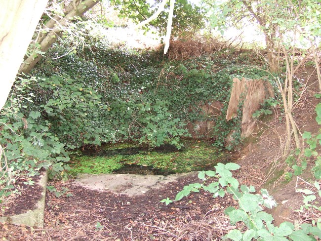
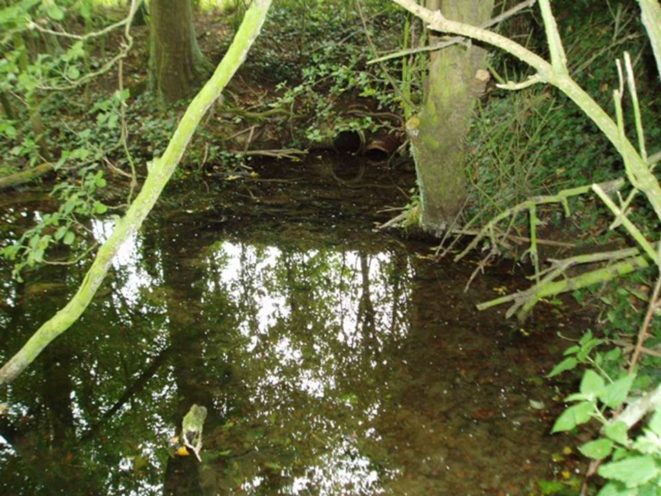
The runwell. copyright with permission http://www.spiritrealms.co.uk/gallery.htm
The Runwell (copyright with permission http://www.spiritrealms.co.uk/gallery.htm )

It can be found by taking a road off the A132 (Wickford Road) which leads to Stock (directly opposite the Parish Church), continuing until you reach another minor road to Rettendon. A short way up this road it forks. Take the road to the right & continue until one reaches a minor drive to Poplars Farm (distinctive with its trees each side of the drive). Continue up here until one passes the house to a small piece of tarmac. Here a footpath continues directly in front, continue until one reaches on the left a gate. Enter through here, and head across the field towards a notable tree, and a gap in the hedge. To the left, follow the edge of the field, until one sees another opening into the well. The approach from the south is the only route worth considering as northerly access is blocked by a fence. It can be extremely muddy, so good footwear is advisable.

Archaeology & History

Philip Morant (1763-8) is the first to mention it, suggesting that the settlement is named:

“..from a considerable Running well in the Parish.”

Again, Chandler (1896)—noted in Collins (1986)—emphasises:

“a remarkable spring of water on Poplars Farm, which is always running and has never been known to fail.”

Despite this obvious assumption, Ekwall (1936) suggested that the prefix originates from O.E rune for ‘mystery’ or implying a well possessing a secret of some religious observance. This is suggestive of the strange legends and traditions involved with the site.  Alternatively it could derive from hruna referring to the tree trunk—and it does arise in a copse. A roman road runs by here.

The only reference to a religious site appears to be in 1602 when the parish register records ‘Shrine of the Bl. Virgin of RunnyngeWelle’.  However, stone remains found over the years around the well may support the idea of a well chapel; these remains were two pieces of limestone window mullion and a piece which appears to be part of a step as well as pieces of Kentish ragstone.

Folklore

According to Bazille-Corbin (1940), Runwell is steeped in lore and legend. One must take these stories as possible antiquarian fancy as there does not appear to be any concrete evidence for them.  Doubtless some of it is true, other bits not. He states that in the Sixth Century AD, Christian missionaries Lucus and Lucilus visited Essex and found a scene of paganism here, built a chapel, and rededicated the well to “Our Lady St Mary.”  The floor of this chapel had a unique designed cross, with black flint and red strawberry stone, to show the teachings of the tenets of the Christian Faith.

To protect this and collect subsequent devotional gifts, a nunnery, of six members, was developed around the site. They tended to the shrine, well head and the statue of Our Lady, to which many miracles were attributed. Little evidence exists concerning this foundation, but it is believed to have been dissolved in the 16th Century. Locally it is said parts of the nunnery were incorporated into the nearby farm-house ‘The Poplars’. In the 1980s, Andrew Collins, searched for records of this local priory, but found none.

Another legend connected with the well accords that a young nun, Sister Lucy, after renouncing her vows, found the outside world not to her liking and returned in repentance, one snowy night, to the chapel for forgiveness. Yet, upon reaching the chapel steps, she slipped and fell into the icy waters of the well. (cf. The Single or St. Thomas’ Well at Ifield, Kent)

Her ghost is said to haunt the area, preserving perhaps the memories of these past water deities. This is enforced by the belief by some authorities that the well’s dedication indicates a Christianisation of the Iceni goddess Epona. This is supported by these horseshoe-shaped motifs, and that the approach to the well being haunted by a horse.

Andy Collins (1986) was informed that a concrete water tank was installed over the spring.  This proved to be inaccurate, but the well was defined by a concrete chamber.  Collins thought that this may be the remains of some adaptation for a spa bath, but no hard evidence was forthcoming regarding this.

It certainly had passed through considerable years of neglect, as noted by the Runwell Rector John Edward Bazille-Corbin (1942), who said it was “in much need of dredging and cleaning out.”

The photo shown in Collins’s (1986) work shows a concrete lined rectangular pond, defined by corrugated iron. He was thus responsible for its repair and clearing away the years of neglect, also revealing the concrete rectangular pond, which was reached by a series of steps from its north side. A flight of steps appear to enter the well itself from the front. The body of water is of considerable size and depth and one could easily immerse oneself in it. When I last visited here, the water appeared murky but a sample revealed (apart from the pond fauna) a remarkable clarity.

Within recent years the well appears to have attracted a ‘cult following’, clearly manifesting itself in two ways. One is a seasonal Boxing Day walk to the well started in 1975, which is still undertaken (see link, below). The other more traditionally is the attachment of rags or cloutties to the surrounding shrubbery. Such activity, although probably done by those ‘in the know’ rather than any continuation of any local tradition, is the only such example I have come across in East Anglia—although recent photographs fail to show this and it appears that the tree has been cut down where these have been placed and the area opened up.

References:

  1. Bazille-Corbin, J. E., Runwell St. Mary: A farrago of History, Archaeology, Legend and Folk-lore, 1940. 
  2. Collins, Andrew, “Devilish Mysteries at Runwell,” in Essex Countryside Vol. 33 no.431, p38-39, 1985.
  3. Collins, Andrew, The Running Well Mystery, 1986.
  4. Ekwall, Eilert, Studies in English Place and Personal Names, Lund 1931.
  5. Ekwall, Eilert, The Concise Oxford Dictionary of English Place-Names, Oxford 1936.
  6. Morant, Philip, The History and Antiquities of the County of Essex – 3 volumes, London 1763-8 (reprinted by EP: Wakefield 1978).
  7. Parish, R.B., Holy Wells and Healing Springs of Essex, Pixy Led Publications 2008.
  8. Reaney, Paul, The Place-Names of Essex, Cambridge University Press 1935.

Links:

  1. Runwell Boxing Day History Walk – Wickford History
  2. Runwell History Walk – Photo Guide

This site profile is an edited extract from the book Holy wells and healing springs of Essex

© R.B. Parish, The Northern Antiquarian

Single Well, Ifield, Gravesend, Kent

Holy Well (destroyed):  OS Grid Reference – TQ 6538 7081

Also Known as:

  1. St. Thomas’ Well
  2. Shingle Well

Archaeology & History

Sadly the site is gone no longer in existence it was in the roadway along the Roman Watling Street, at its junction with Church Lane, where it joins the relatively recently named Hever Road with Mailings Cross.

Local opinion, erroneously believes that its name derives from there only being one well in the district, but it originates from its substrate, being once called ‘Shinglewell’ describing the substrate. It ended its days as a traditional winch well, with a depth of 150 yards. Watt (1917) described the draw well as having a sign, reading ‘This water is not fit for drinking’— the result of contamination by a nearby stagnant pond. This wooden framework was removed during the First World War, when the well was filled in and domed over. Later, in 1935, a granite slab inscribed with: ‘Site of the Ancient Well, Singlewell Parish or Ifield’ was placed there. Unfortunately, this was removed by the County Council in 1952, and along with the combination of road improvements, the site was largely forgotten.

Folklore

Recorded in a Latin MS and translated by the Rector of Ifield between 1912-1935, the Rev K. M. Ffinch tells of a tradition in great detail, and the following is a brief resume. The legend involves a village girl called Salerna, who is said to have ‘thrown’ herself down the well after being accused of stealing some cheese. Yet, as she fell, she cried out for St. Thomas to save her from her impending doom, and upon finishing her plea, landed on some planks lying at the bottom of the well. They broke her fall, and thus saved her from her dreadful fate. She was then subsequently rescued and because of the ‘miracle’ the well was dedicated to the saint.

The incident is said to have occurred soon after St. Thomas’s martyrdom, and is said to have been one of his first miracles.  The name ‘Salerna’ suggests a Roman origin, supported by its location along Watling Street, a Roman Road. Bayley (1978), using a low-land British dialect, which he believed survived until this century, states that ‘Salire Naias’ is ‘the water nymph, who springs forth and runs down’. Consequently, the story of St. Thomas miracle may have been introduced to remove the pagan tradition and refocus the beliefs of the people using a local saint.

References:

  1. Bayley, M.,(1978) Ancient, and Holy and Healing Wells of the Thames Valley, and their Associations.
  2. Ffinch, K.M., (1957) The History of Ifield and Singlewell
  3. Parish, R.B., (1997) “The Curious Water-lore of Kent II: Ghosts, Fertility and Living Traditions”, in Bygone Kent, Volume 18, pp.427–32.
  4. Watt, F., (1917) Canterbury Pilgrims and their Ways

(Extracted from the forthcoming book Holy Wells and Healing Springs of Kent)

Links:

  1. In Search of Holy Wells and Springs

© R.B. Parish, The Northern Antiquarian 

Holy Well, Garenden, Loughborough, Leicestershire

Holy Well:  OS Grid Reference – SK 507 180

Getting Here

The path down to the well

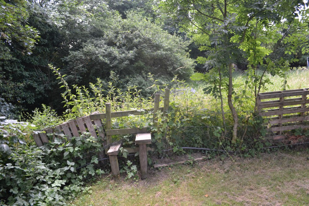
On the outskirts of Loughborough is an area called Holywell, but pronounced ‘holly’. The holy well can be found at the furthest north west part of the park, behind the large Garendon block of the Holywell complex. Here behind some hydrogen cylinders (!) follow the brook on the left until you reach a stile. Climb over this and the well in front of you. It is unclear what the access rights are, but there are no private signs.

Archaeology & History

The stile with the well in the background

Virtually swallowed up by Loughborough University is the estate of Holywell Haw, the present farmhouse taking its name from a spring nearby. Of the house itself: it probably began life as a hostel for those lost in the most substantial Charnwood Forest, which has since retracted around it.  However by 1180, it had become a hermitage owned by Garendon Abbey and is then first noted by the name of ‘Holywell Haw’, the latter word deriving from haw meaning enclosure, the same origin as hawthorn.  Potter, in his History and Antiquities of Charnwood Forest (1842), notes it was mentioned in a grant by Robert de Jort to the abbey, with the site being described as heremitorium de Halliwellhaga.

Later, the 13th century Testa de Nevill, records ‘a dairy, with a small wood, called Haliwelle Hawe’, which by the 14th century the Leicester Abbey purchased from a Henry Lord Beaumont “a certain parcel of wood called Holy-well Haw for £28.”  It was they who appeared to have developed the area to what can be seen today: fishponds and moats, and probably used the site as a grange and possible a diary.  What remains today is mainly 15th century, with fragments of a medieval structure such as gothic doorways and timbers. Whether it was Holywell Haw or Hall is unclear.  This discrepancy has been blamed on the Ordnance Survey—and indeed, some blunders have been done by them in the past. However, it is possible that a 19th century owner, March Philips, had some sort of pretensions for the building and thought the name was better.  By the 18th century, the name Holywell Dyke was an eighteenth-century boundary mark for Charnwood Forest.

The spring is icy cold and never run dry, and produces—according to Bob Trubshaw (1990)—20,000 galloons a day and is one of the only non-incorporated spring in the Severn Trent catchment classed as A1 Drinkable.

The Site Today…

The not-very-interesting looking site today

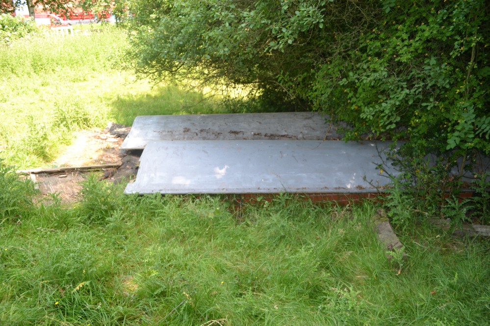
Despite a leaflet mentioning the well from the University (available as a pdf-file), it is a little reticent as regards to whether it can be visited.  However, exploring around the back of the enormous Holywell complex, a small path passes some gas cylinders and then to a stile. No keep out signs are present so I assumed it was okay to jump over. There almost in front of me is a large brick chamber covered by two large fibre glass up turned boats. These appear to cover the well.

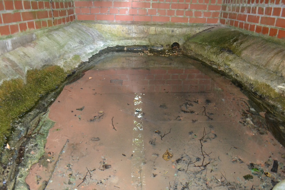
Within, with natural rock & medieval stonework?

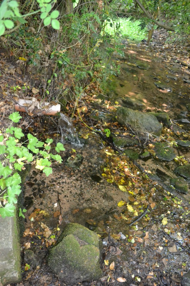
Peering between a gap however, this rather unpromising edifice reveals something more interesting. The brick chamber encloses an elliptical natural stone or possibly medieval basin, into which a copious flow enters and fills and then flows through a pipe into the brook below. Despite the rather ugly surrounds there is still something ancient and mysterious about this most well-known of Leicestershire sacred springs. The local farm, the Holywell Haw, still apparently uses the water and it is regularly checked by the University authorities. One hopes it can get a better cover.  Surely the university could afford a metal grid more worthy of this venerable site.

Folklore

Local tradition states that it has medicinal qualities. Nichols (1795–1815) notes:

“The excellent spring is yet preserved.”

Potter (1852) notes that it:

“derives part of its name from a well, to the waters of which, even in recent times, considerable virtues have been attributed.”

However, its most famous legend is said to date from the 15th century. Potter (1852) notes that:

“The popular idea seems to be, that the Comyns (of Whitwick Castle) were great giants. One of them, said my informant, attempted to carry off one of the Ladies of Groby Castle, who left that place for security, intending to take sanctuary at Grace Dieu. Going, however, by a circuitous route, to avoid Charley and Whitwick, she was benighted, and would have perished in the Outwoods, but for one of the Monks of the Holy Well.”

The overflow runs into a delightful brook

The legend tells how after a considerable pursuit, she upon reaching the hermitage, collapsed and died. A monk then used the water to bring her back to life. Potter (1942) tells the story in verse:

“The oaks of the forest were Autumn-tinged,
And the winds were at sport with their leaves
When a maiden traversed the rugged rocks
That frown over WOODHOUSE EAVES.

The rain fell fast – she heeded it not
Though no hut or home appears;
She scarcely knew if the falling drops
Were rain drops or her tears.

Onward she hied through the OUTWOODS dark
(And the Outwoods were darker then)
She feared not the Forest’s deepening gloom She feared unholy men.

Lord Comyn’s scouts were in close pursuit,
For Lord Comyn the Maid had seen,
And had marked her mother’s only child
For his paramour, I ween.

A whistle, a whoop from the BUYK HYLLS side,
Told Agnes her foes were nigh:
And screened by the cleft of an aged oak,
She heard quick steps pass by.

Dark and dread fell that autumn night:
The wind-gusts fitful blew:
The thunder rattled: – the lightning’s glare
Showed BEACON’s crags to view.

The thunder neared – the lightning played
Around the sheltering oak;
But Agnes, of men, not God afraid,
Shrank not at the lightning’s stroke!

The thunder passed – the silvery moon
Burst forth from her cave of cloud,
And showed in the glen “Red Comyn’s” men,
And she breathed a prayer aloud:-

“Maiden mother of God! Look down
List to a maidens prayer:
Keep undefiled my mother’s sole child
The spotless are thy care”

The sun had not glinted on BEACON HILL
Ere the Hermit of the HOLY WELL
Went forth to pray, as his wont each day,
At the cross in Fayre-Oke dell.

Ten steps had he gone from the green grassy mound
Still hemming the HOLY WELL HAW,
When, stretched on the grass – by the path he must pass
A statue-like form he saw!

He crossed himself once, he crossed himself twice,
And he knelt by the corse in prayer:
“Jesu Maria! cold as ice –
Cold – cold – but still how fair!”

The Hermit upraised the stiffened form,
And he bore to the HOLY WELL:
Three Paters or more he muttered o’er,
And he filled his scallop shell.

He sprinkled the lymph on the Maiden’s face,
And he knelt and he prayed by her side
Not a minute’s space had he gazed on her face
Ere signs of life he spied…..

Spring had invested the CHARNWOOD oaks
With their robe of glistening green,
When on palfreys borne, one smiling morn,
At the HOLY WELL’s HAW were seen.

A youth and a Lady, passing fair,
Who asked for the scallop shell:
A sparkling draught each freely quaffed,
And they blessed the HOLY WELL.

They blessed that Well, and they fervently blessed
The Holy Hermit too;
To that and to him they filled to the brim
The scallop, and drank anew.

“Thanks, Father! Thanks! – To this well and thee,”
Said the youth, “But to Heaven most,
I owe the life of the fairest wife
That CHARNWOOD’s bounds can boast.

“The blushing bride thou seest at my side.
(Three hours ago made mine)
Is she who from death was restored to breath
By Heaven’s own hand and thine”.

“The Prior of ULVERSCROFT made us one,
And we hastened here to tell
How much we owe to kind Heaven and thee,
For the gift of the HOLY WELL”.

“In proof of which – to the HOLYWELL HAW
I give as a votive gift,
From year to year three fallow deer,
And the right of the Challenge drift”.

“I give, besides, of land two hides,
To be marked from the Breedon Brand:
To be held while men draw from the Well in this Haw
A draught with the hollow hand”.

The Hermit knelt, and the Hermit rose,
And breathed “Benedicite!
And tell me”, he said, with a hand on each head,
“What heaven sent pair I see!”

“This is the lost de Ferrers’ child,
Who dwelt at the Steward’s Hay;
And, father, my name – yet unknown to fame
Is simply EDWARD GREY”.

It is thought that after being revived she gave her name to God and became a prioress and some historians link it to a  real life account of Eleanor Ferrars whose was carried off. It also has similarity to legends associated with Essex’s Running Well and Kent’s St. Thomas’s well at Singlewell.

References:

  1. Hope, R. C, 1893, Legendary Lore of the Holy Wells of England, London: Elliot Stock.
  2. Nichols, J.,1795-1810, History and Antiquities of the County of Leicester, London: Nichols
  3. Potter, C.1985, ‘The holy wells of Leicestershire and Rutland’, in Source, 1st series, 1:15–17.
  4. Potter, T. R 1852, History and antiquities of Charnwood Forest
  5. Rattue, J., 1993, ‘An inventory of ancient, holy and healing wells in Leicestershire’, Tr. of the Leicestershire Arch. & Hist. Soc. 67: 59–69. Richardson, L. R., 1931, Wells and Springs of Leicestershire, Memoirs of the Geological Survey.
  6. Trubshaw, B., 1990, Holy Wells and Springs of Leicestershire and Rutland, Heart of Albion, Wymeswold.

Links:

  1. Holy and Healing Wells

Based on the following and part of a forthcoming Holy wells and healing springs of Leicestershire.

©  Ross Parish


Teddy Stone, Blubberhouse Moor, North Yorkshire

Cup-Marked Stone:  OS Grid Reference – SE 13495 54929

Getting Here

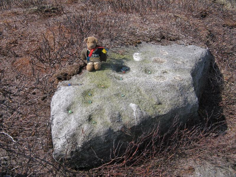
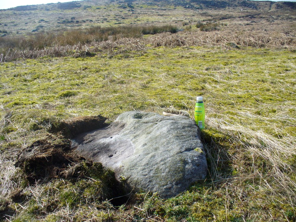
Teddy's very own cup-marked stone!
Teddy’s very own cup-marked stone!

ON the A59 Harrogate to Skipton road, right on top where it crosses the barren moors, get to the parking spot right near where the road levels out at the highest point. Walk up the footpath from here onto the moors (south) for about 200 yards till you notice a small black pool ahead of you. From here, walk left (east) offpath and into the heather, roughly along the ridge for about another 150-200 yards. Zigzag about and keep looking. You’re damn close!

Archaeology & History

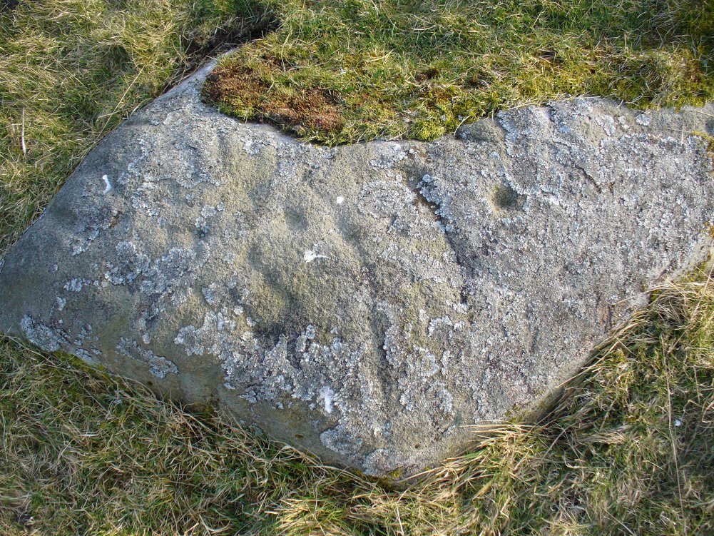
Close-up of some of the cups

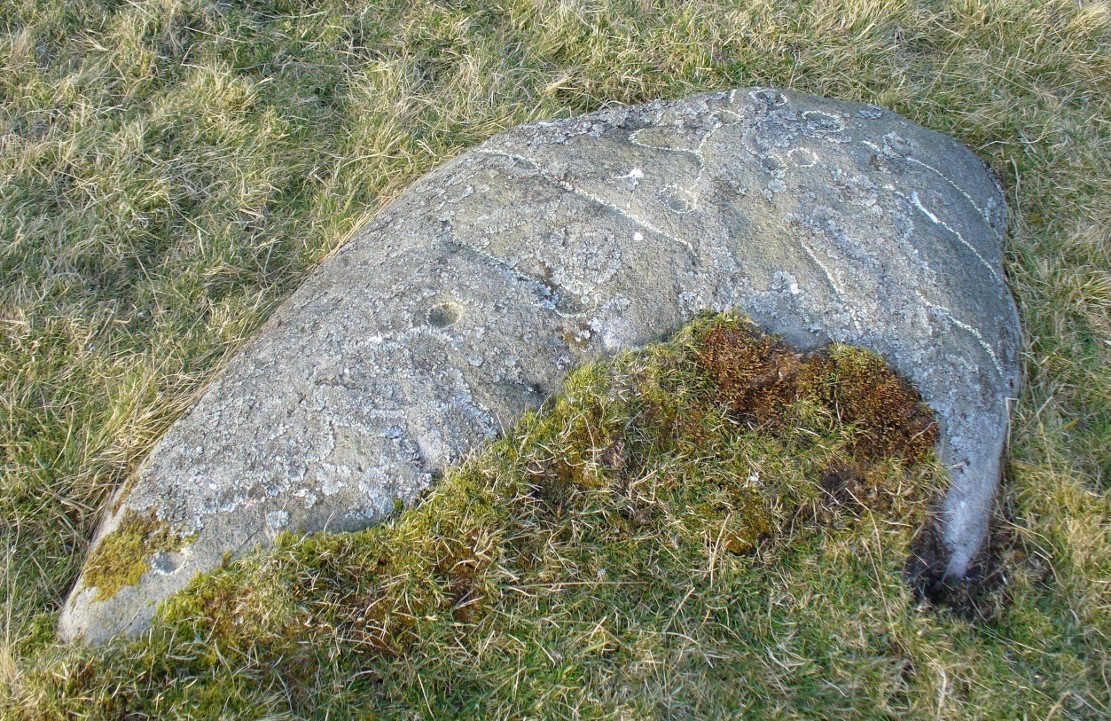
Not far from the Gill Head stone and walling, another previously unrecorded cup-marked rock was discovered on the afternoon of Saturday, May 3, 2014, by Danny Tiernan and his famous teddy bear!  The stone seems to have been previously well-covered, but was made visible thanks to the annual heather-burning on this part of the moor. He came across it during an exploratory Northern Antiquarian wander to examine a cluster of other neolithic remains hidden on this moor.  The carving consists of a series of plain cup-markings, between eight and twelve in number, running along the middle of the rock and outwards nearer to the edges. The cups are between 1-2 inches across and a half-inch deep at the most. The design was first highlighted on Danny’s walking blog, Teddy Tour Teas — and is gonna be difficult to find once the heather’s grown back.

Links:

  1. The Teddy Stone

© Paul Bennett, The Northern Antiquarian

Lady Well, Headon, Nottinghamshire

Holy Well:  OS Grid Reference – SK 748 779

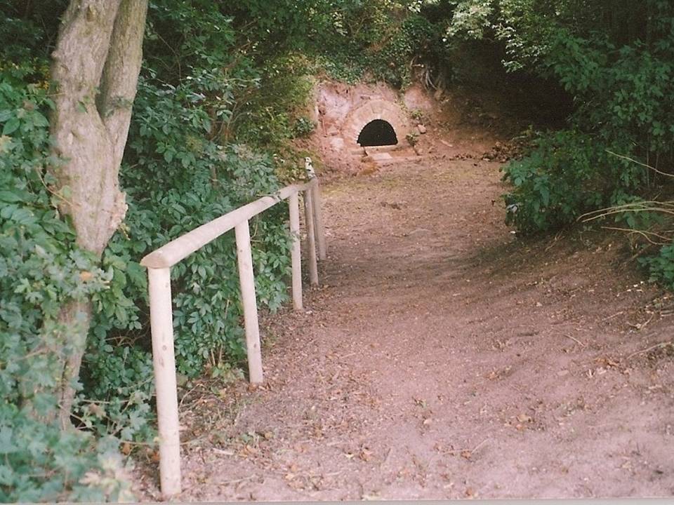
Lady Well, Headon
Lady Well, Headon

Getting Here

Follow the road around from Headon village to the Ladywell estate and on the left hand side is a small copse and footpath. It is near the junction of Greenspotts Lane and Lady Well Lane. Park carefully near here and walk down the small ravine to the well.

History & Archaeology

Close-up of the well

Only two dates can be confirmed of this site. One a reference in County records of mending a bridge to a ‘Ladyewell‘ in the nearby Markham parish, but this could easily be another site.  A better date is that  1718 which is carved on its arch. It was used as a source of water  until the 1930s. One of the most atmospheric and pleasantly situated sites, the spring is located in a small wooded dell and arises from the rock in a small alcove or cave.  This is fronted by a red brick arch, and the water fills a trough set partly into the ground with a small overflow lip and a channel to fill it, presumably this was for animals. On the key stone of the arch are the initials ‘HW’ and a date which possibly reads 1718.

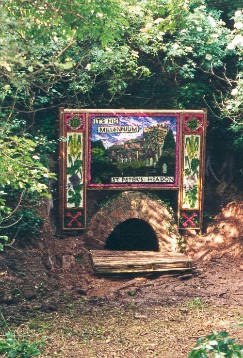
Dressed for 2000AD
Dressed for 2000AD

Folklore

I have found no traditions of healing or other folk belief. However, the site was one of the few Nottinghamshire well dressing sites.  This began in 1981 and continued until 1991, and there was a one-off occurred in 2000 AD.  It was done on the weekend of the churches Patronal festival—St. Peter’s—and was used to use to pay for the church repairs.  The well dressing boards were of a Derbyshire tradition, as can be seen here to the right.

References:

  1. Parish, R.B, (2010) Holy Wells and Healing Springs of Nottinghamshire

Copyright © Pixyled Publications


St. Alkmund’s Well, Derby, Derbyshire

Holy Well:  OS Grid Reference – SK 351 371 

Geting Here

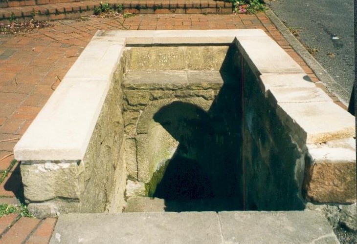
St. Alkmund’s Well, Derby

It can be found by taking North Street off Duffield Road (A6) continuing until it joins North Parade and here a little lane, called Well Street comes off and the spring is at the junction of this and Bath Street on the left hand side.

Archaeology & History

First recorded in 1190 in a rental agreement but considering its association probably earlier. The well is dedicated to the Saxon saint who died 800 AD and whose tomb or shrine was located in church nearby (and is now located in the Derby Museum).  Little is recorded of its history however.

The well is below ground level with four steps to its water which flows with some force into an oval basin. A stone carving states its name. The plaque reads:

“Until the area was built up from 1814, the well was in a rural setting, part of St Helen‟s Park. The stone niche surrounding the well was built by the Rev Henry Cantrell in the early 18th century”.

It now sits rather incongruously in an area of urban landscape,  an odd juxtaposition amongst the older houses and tower blocks still exists, but is often prone to vandalism. and has suffered from it. Well dressings were discontinued due to vandalism and it was blocked off my tall metal fencing for a period recently. Now it is surrounded by a small wall and black railings which has blocked access but will protect it.

Folklore

Cox (1875–9) records that a vicar of S. Werburgh’s was cured of his low consumption, after constantly drinking its water, although the sign It has been traditionally dressed, revived in 1870 and continued infrequently until 1993, stopping because the boards were thoughtlessly vandalised. The demolishing of the St. Alkmund’s Church in the 1960s for road widening stopped the tradition of processing to the well. I was told by a local elderly lady that she still drank the water and that it was very pure…I was not sure myself!

References:

  1. Parish, R.B, (2010) Holy Wells and Healing Springs of Nottinghamshire

Copyright © Pixyled Publications


Holy Well, Lower Burnham, Haxey, Lincolnshire

Holy Well:  OS Grid Reference – SE 785 021

Also Known as:

  1. Alley Well

Getting Here

Often noted under Lower Burnham, although this is a hamlet and not strictly the parish, is in Haxey.  The spring can be found by taking the footpath after Starkey’s farm, top of Holy Well lane, with Holy Well House the nearest dwelling.

Archaeology & History

Holy Well, Haxey
Holy Well, Haxey

Potentially if Hunt (1923) quoted in Hills (1967) is to be believed, this is the most famed holy well in the county, as he believes that this was the site where King Oswald—later St Oswald—was slain and here the well was St Oswald’s Well rather than at Oswestry. He notes that:

“The Holy Well at Lower Burnham in the parish of Haxey is supposed to mark the site where King Oswald fell. People took away the soil until a deep hole was formed which filled with water…It has been known for 1300 years as the Holy Well, and annual feasts were held near it until recent years. This confirms the Ven. Bede’s statement about the sanctity of the soil in the eyes of the people.”

According to Garner (1991) by the early 19th century the well’s popularity had waned and the spring fell into private ownership and the water was used to run two water mills, and as such a gully of considerable depth constructed. However the spring did not produce enough continuous water and the scheme failed. A similar attempt was made by Rev. Thomas Skipworth Rector of Belton was more successful but only because a dam was constructed although still the power was not great enough. Interest in the well had not completely disappeared, and an announcement in 1875, in the Epworth Bells stated:

“Firmly believing in the efficacy of the Burnham water in the cure of some outward bodily complaints, we sometime since urged the importance of making that water once more available to the public, and at the same time we urged the desirability of the public availing themselves of the water.”

Responding to this plea, a group of local men, Cooper, Starkey, Ducker, Skelton, Meggitt and Templerton came together to ‘re-open the well’ It had been for years only a dry, roughly rectangular, hollow but ‘within minutes of digging, water gushed out, and the hollow filled.’ No evidence of constructional material was seen but the landowner, Mr. Lockwood, agreed to allow the well to be kept open and the water to be freely available when he did not have cattle in the field, as such the well was fenced in probably as local people reported in the Crowle Advertiser (1960) with white railings. Indeed, up until the 1940s the well remained fenced off with barbed wire as a cattle water place and at some point it was filled in.

This meant that the well had again fallen into disused and its exact location was perhaps becoming unclear, when in the 1960s when three Epworth men, Frank and David Lindley with Jack Warriner.  A report in the Crowle Advertiser of 1960 noted that:

“At a spit depth, what seem to be known locally as water stones began to be turned up; at about two feet six there was a promising slab, followed by another, at a little deeper level; and after discovery of several hand-made bricks had dispirited the diggers somewhat, three more irregular shaped stones of considerable size were scraped clean of the mud that overlaid them. By now there was bared to view what could have been the stepped entrance to the well which from visual testimony of old residents, the explorers hoped to find.”

This stepped entrance consisted of eight steps according to local people. The group then discovered at about four feet timber was found and on this two corner stones were found rested. This was thought to have been the remains of the enclosure which went around the well.

In March 1961 another attempt was made to open the well in view of a pilgrimage by the Lincoln Diocesan Youth Pilgrimage, this time the excavators had gone twice as deep and the strata of waterstone was hit, but no evidence of a constructed well. This was not a concern of the Vicar of Owston Ferry, Canon L. D. Ravins who was of the opinion that an actual construction would have been unlikely if the above description by Hunt was to have happened. This time according to the Crowle Advertiser:

“Both he and Canon Ravins feel that the water may well have medicinal qualities (they noticed they say an unmistakably sulphurous smell from it during the excavations) and they are intending to have the chemical analysis made.”

However, the analysis did not reveal any sulphur but it did have Magnesium and Calcium sulphates and Calcium bicarbonate all linked to spa waters and hence verifying its medicinal role. The well was visited by the pilgrimage and Garner (1991) recollects that a white timber enclosure was placed around the site with a sign proclaiming ‘The Holy Well’ according to him the ‘whole site now barely discernible save for a lone willow sentinel-like over the place revered by myriad generations in days long since past.’

However, this was not the case when I visited the site and found a large pool with a pipe at one end, from which a channel appeared to flow.  Although Garner (1991) noted a ‘few elder citizens of Burnham strongly favour its position a few metres south of the spot popularly referred to”.

Folklore

However this name has not been recorded and the site is best known simply as the holy well. This site was, according to Gutch & Peacock (1908),

“ …dedicated to the ever-blessed Redeemer, and on the festival of His Ascension was supposed to possess the power of healing all sorts of deformities, weaknesses, and cutaneous diseases in children, numbers of which were brought from all parts to be dipped in it on that day.”

The earliest mention appears to be Peck (1809) who stated:

“a Spring called the Alley Well of very cold water which was very much resorted to by the people in their neighbourhood, being very proper for those of a weakly habit.”

Stonehouse (1839) notes:

“about one hundred and twenty years ago, the concourse of visitors was so great that a Village Feast was held at the same time… and at a much later period conveniences were annually made for the use of the bathers, and gingerbread-stalls and other slight reflections were provided on the spot. This practice has, however, of late years fallen altogether into disuse… The spring now appears in a dirty and neglected state.”

The fame of the spring led to it being immortalised in Hamilton’s novel Captain John Lister where the titular hero watches during the early morning of Haxey Fair, a melancholy procession through the main street of women, accompanied by diseased and deformed children. In the book, the innkeeper explains by saying:

‘They are going to the Holy Well at Nether Burnham. ‘Tis a famous spring, and has been many ages, and on this day there is virtue in the water to cure almost any disease or sickness in a child, if be dipped before noon…out of Nottinghamshire and Yorkshire and I don’t know where all.’

(Essay taken from R.B. Parish Holy Wells and healing springs of Lincolnshire)

References:

  1. Garner, J. R. (1991) Burnham – the story of an Axholme village.
  2. Gutch, E. & Peacock, M. (1908) Country Folklore Vol. VI: Folklore of Lincolnshire
  3. Hills, P.J. (1967) The Holy Well of Burnham the site of the Battle of Maserfield-the identification re-examined.
  4. Stonehouse, W.B. (1839), The History and Topography of the Isle of Axholme.
  5. Various anonymous cuttings from Crowle Advertiser (1960)

Links:

  1. Holy and Healing Wells

Copyright © Pixyledpublications


Coldstone Beck, Burley Moor, West Yorkshire

Cup-Marked Stone:  OS Grid Reference – SE 143 453

Getting Here

Coldstone carving, looking S

From Burley train station, take the road uphill onto the moor edge, turning right at the top. Go on for a few hundred yards and park up round the sharp bend. Walk up the steep-ish path on the right-hand side of the rocky valley of Coldstone Beck. Once your on the level with the moors, veer to your right (west) on the footpath parallel with the walling. Barely 50 yards along, watch in the grasses and heather to your left (south).  Keep looking and you’ll find it. (apologies for just a 6-figure grid-ref for this stone, but I paid little attention to its position when I was in walkabout mode)

Archaeology & History

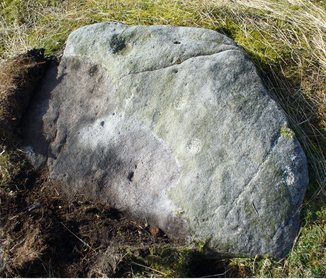
A couple of hundred yards east of the Cold Stone monolith is another petroglyph that has evaded the diligent archaeologists of the region!  But it’s easily missed if the daylight conditions aren’t too good.  The most notable element on the stone is the large, possibly natural cup-marking on its top-right SW side.  It’s that which initially gets your attention and, due to its initial singularity on the rock, you’d turn away and shake your head, muttering that well known petroglyphic mantra of “dunno.”  But when the sun and air are clear or low on the horizon, other more faint etchings, almost lost in the worlds of erosion, catches the eye.

Carving faintly highlighted
Looking straight down

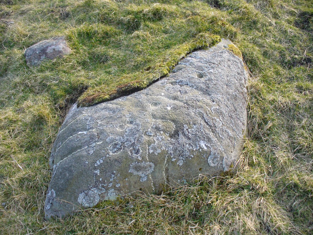
At least four cups are visible on the stone, perhaps six, mainly near its middle and faintly highlighted in one of the images here.  But there is also a pecked carved line here too, running across the shorter northern side of the stone.  Near the bottom of this line there is the faint impression of a carved ring, but whether this is a trick of the light or real, I won’t hazard to guess.  Not far away is the curiously shaped Chair Stone and its cup-marks. Others are in the vicinity.

© Paul Bennett, The Northern Antiquarian

Lichen Stone, Burley, West Yorkshire

Cup-and-Line Stone: OS Grid Reference – SE 15065 43578

Also Known as:

  1. Dreadlocks Stone

Archaeology & History

Lichen Stone cup-and-ring
Lichen Stone cup-&-ring

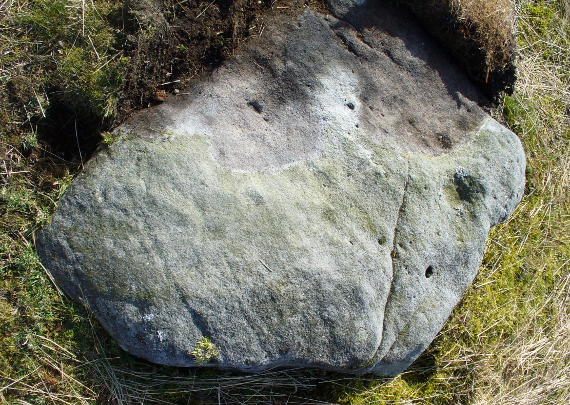
This is another of the many unrecorded cup-and-ring carvings in the region—and one in a small cluster hereby.  It was rediscovered several years ago on a Northern Antiquarian outing and, thankfully, remains in good condition.  Encrusted by layers of gorgeous lichens, deep into the rock, it has hence proven difficult to explore the entirety of the exact design without tearing off the old lichen covering—which I’ve no intention of doing.

Lichen Stone, from above

There are at least a dozen cup-markings etched onto the upper surface of this curved stone, with the majority of them clustering around its eastern side.  It seems there’s only one cup-marking on the western section of the rock, with the majority of them carved near the middle of the rock and then moving to its eastern section.  But the curious features are the interlinking carved lines which you can see have been highlighted on the top and sides of the stone.  Initially you get the impression that they’re natural, but it becomes obvious the more you look at them that they’re an integral part of the carving.  Some of the lines typically link-up with other cups, whilst a number of them have been carved along and down the vertical faces of the rock, primarily on the east and north-east edges.  At least seven of them have been done and they all reach down to ground-level.

Cups & carved lines
Cups & carved lines
Carved lines highlighted

It seemed obvious that an even larger design was apparent on the rock, but the stone had been covered in an age of lichen (hence the name) which I didn’t want to disturb; and although no distinct cup-and-ring can be seen here, it looked as if one such motif might have been hiding beneath the lichen cover.  But let’s leave the rock and lichen to their own quiet life and move on our way…. to the other carvings nearby, like the impressive Fraggle Rock, or the more basic Snake Stone.  Then follow your nose and seek out the other carvings in these fields…

© Paul Bennett, The Northern Antiquarian
Cold Stone, Burley Moor, West Yorkshire

Standing Stone:  OS Grid Reference – SE 14236 45433

Getting Here

Cold Stone, looking NW

From Burley-in-Wharfedale train station, take the road uphill to the moors, turning right at the top, until you hit the bend where the stream and rocky valley of Coldstone Beck appears. Walk up the right-hand (west) side of the beck until the moorland levels out.  Walk along the footpath above Stead Crag for a coupla hundred yards, keeping your eyes peeled for the largest upright stone in the heather about 50 yards into the moors. The other way is to get to Woofa Bank Enclosure and keep walking east through the heather for a coupla hundred yards till you see the tallest upright stone in the heather.

Archaeology & History

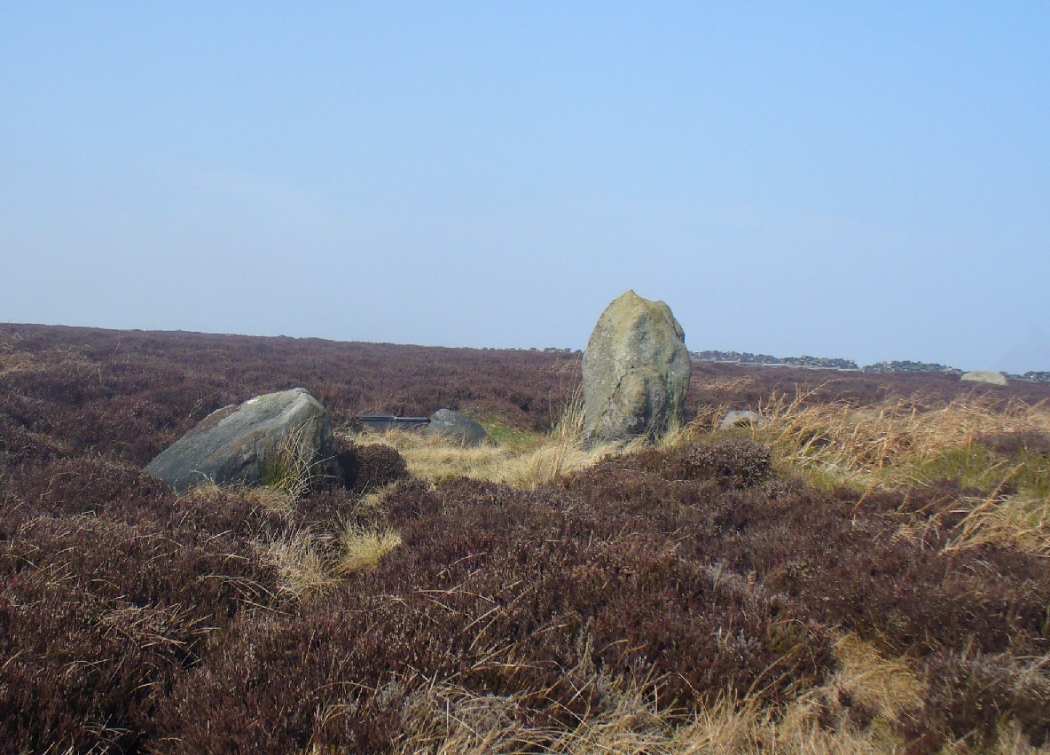
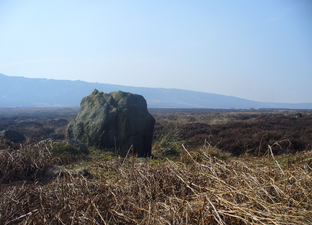
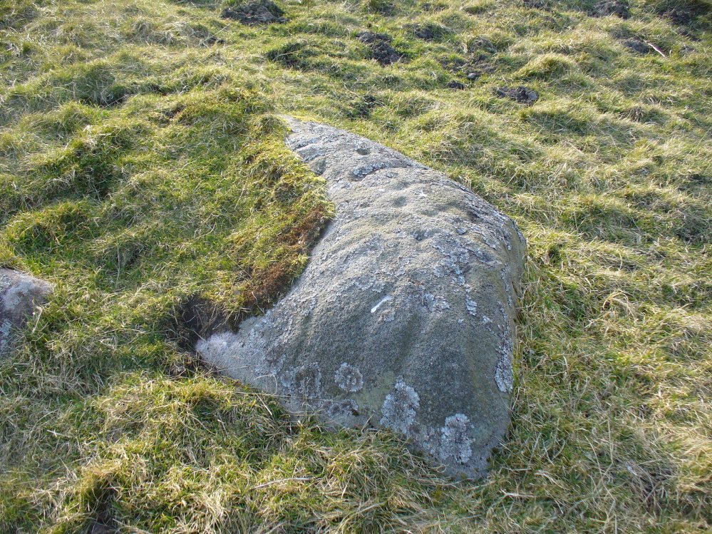
Apart from my own short entry about this site in The Old Stones of Elmet, we have no archaeological account of this standing stone, less than four feet tall and nearly as wide at its maximum, living in a landscape renowned for its excess of neolithic and Bronze Age remains.  For those of us who love our megaliths it’s nothing special — but at the same time it’s worth looking at, if only because of the other mass of prehistoric remains close by.  It received its name from the adjacent Coldstone Beck a short distance to the east, whose etymology isn’t clear.

Cold Stone, looking east
Gazing into a hazy SW

Although we know that many of the sites on this ridge are prehistoric in origin (incredibly some of it still aint registered by those who get paid to do such things), we also need to take into consideration that this site may have been effected by the early industrialists who also made their mark on this section of the moor: they have scarred some cup-and-rings along here, destroyed other remains and left incisions on some rocks which could easily be mistaken as ancient.  There is also the possibility that this upright and its adjacent stones were once part of a cairn.   If evidence comes to light that the Cold Stone is more recent, we will of course amend this site entry.

Folklore

A number of Cold Stones are found scattered across upland Britain, in the form of crags or solitary stones.  In North Yorkshire and beyond, the name is sometimes a corruption of a Call Stone, i.e., a site where village matters were called out prior to the institution of a bell-man.  The old Market Cross in Kendal village, also known as the Cold Stone was where village notices were proclaimed.

References:

  1. Bennett, Paul, The Old Stones of Elmet, Capall Bann: Chieveley 2001.

© Paul Bennett, The Northern Antiquarian