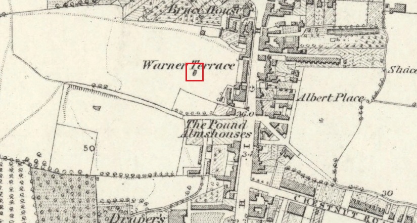
Tumulus (possible): OS Grid Reference – TQ 2856 7555
Also Known as:
Mount Nod
Archaeology & History
Located on the old boundary line between Clapham and Battersea, what might have been a forgotten tumulus, whose memory was thankfully preserved by the renowned folklorist and historian Walter Johnson (1903), was described in his work on prehistoric Surrey. He seemed to think it serious enough to add to his survey, where he told us that,
“there still exists, near Cedars Road, Clapham, what may possibly be a round barrow. It is in the garden of a house opposite St. Saviour’s Church, and is visible to anyone passing along the old, narrow passage called Wix’s Lane. Mr. J.W. Grover, who brought the matter before the Archaeological Association in 1884, had been struck by the discovery that old maps marked the spot ‘Mount Nod Fields.’ …The mound must originally have been 70 or 80 feet across, but had been tampered with on one side for the construction of an ice-house. Mr. Grover suggested that the mound may be of Celtic date. To us, the height—some 12 feet or more—together with marked signs of reconstruction at a comparatively modern date, indicate the necessity of withholding judgment. The original tumulus may simply have been increased in height, but…digging alone could settle the question.”
Local historian Michael Green (2010) has found that there were prehistoric tombs on Clapham Common only 500 yards away, so this one along Cedar Road was not in isolation. Is the site named on the boundary perambulation records? Has it been explored since Johnson wrote about it and, if so, has its veracity as a prehistoric tomb been ascertained, or is it merely the remains of some post-medieval creation?
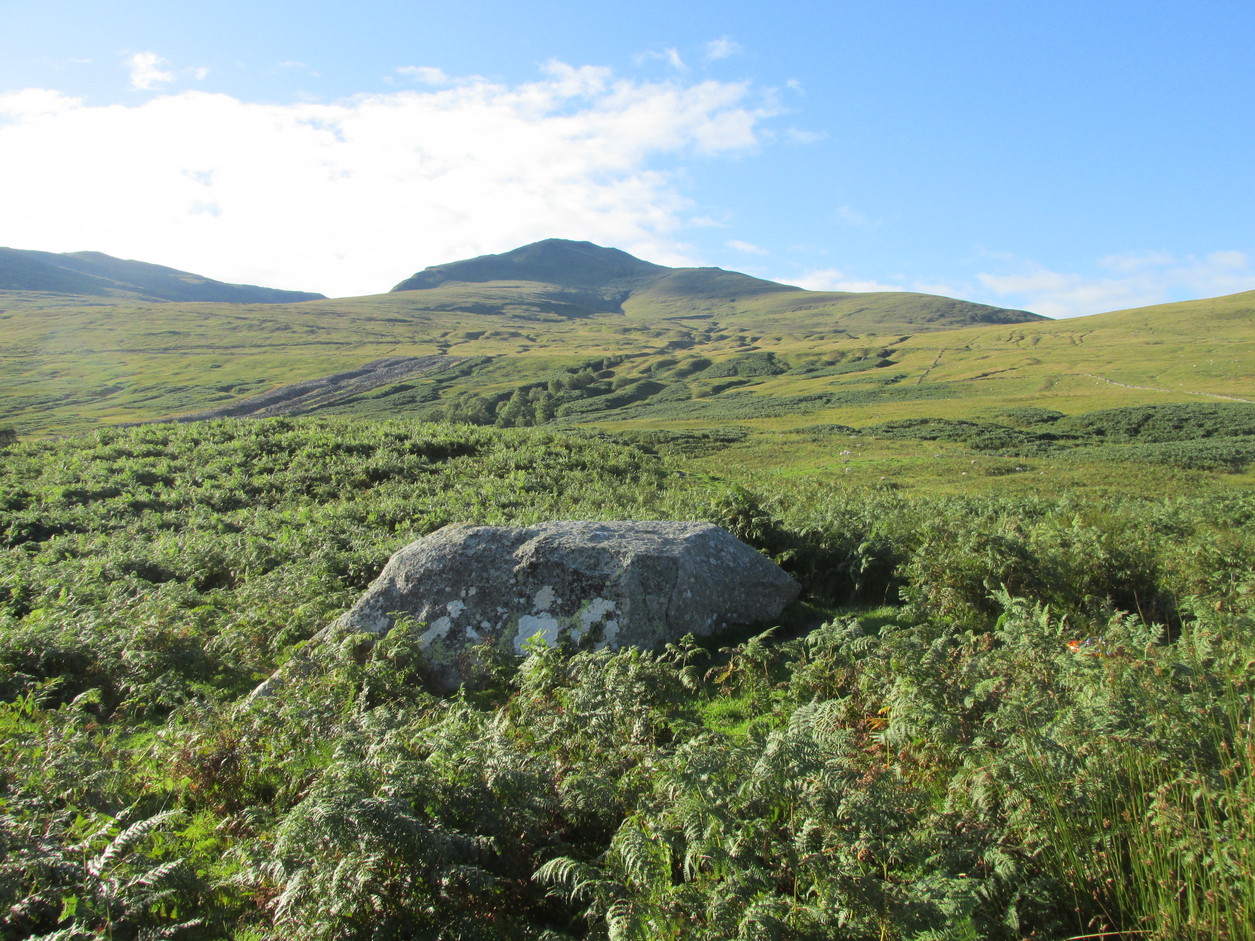
From Killin, take the A827 road to Kenmore. 6 miles along, on your right, is the track down to the Big Shed at Tombreck. Keep on the A827 for exactly ⅓-mile (0.53km), and opposite the driveway to Craggantoul is a small parking spot. A few yards on the road, over the burn, go thru the gate on your left. Follow the straight line of walling up for 400 yards it meets where another line of walling running right (E), into the boggy pasture-lands. Walk along here for roughly another 400 yards then go up the slope as if walking up Ben Lawers (N). You’ll come to 2 large boulders next to each other where the slope levels out. It’s the one on your left!
Archaeology & History
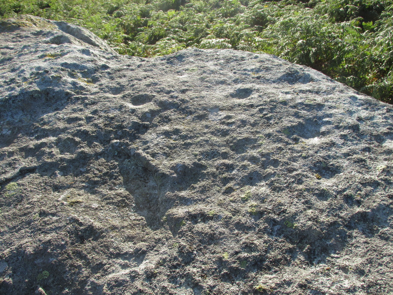
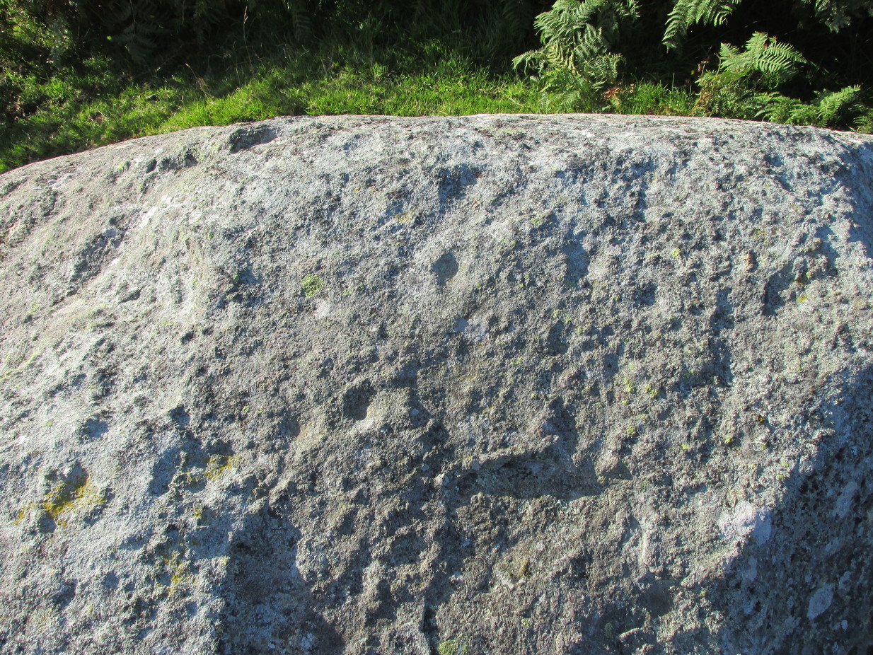
This carving is really for the purists amongst you. It’s like most of the carvings along this contour line in that the design is simplistic. Consisting of at least nine cups all on top of the stone, they can be difficult to see amidst the rough garnet and lichen-encrusted rock.
Cupmarks on its west faceLooking down on the cups
On one of our visits here, when the light cut across the surface at a lower angle, it seemed as if one of the cups had a faint ring around it; but it looked as if the outline of it had been started, but then for some reason the ring was never actually carved. This outline is very faint. We’ve found examples of this at two of the Duncroisk carvings, several miles to the west, where the faintest trace of a ring was outlined, but never carved. Of the cup-marks: five of them are carved on the east-side of the rock and are pretty easy to see (with the ring around one of them), whilst the other four—slightly more difficult to make out—are on its west side. A couple of hundred yards north you can see the Cragganester 10 carving.
Healing Wells (destroyed): OS Grid Reference – TQ 3094 7889
Also Known as:
Lambeth Spa
Near Well and Far Well
Archaeology & History
This once famous healing or spa well has long gone. It was located where the buildings that now constitute 104-105 Lambeth Walk presently stand: an area which the great London historian William Thornbury (1878) told was already “a favourite resort of Londoners, and celebrated for the variety of sweet-smelling flowers and medicinal herbs growing there,” complementing the healing waters before and during the spa craze. The great herbalist John Gerard did his collections here.
I can find no information regarding its early use by our peasant ancestors, so its written history simply begins when it had been appropriated by those well-to-do up-market types who took this medicinal spring for their commercial gain in the early days of the trendy spas. Supplied by two separate springs known as the Nearer and Farther Wells respectively, the Well House built here was “formally opened in April 1696” and subsequently had almost daily accompaniments of music, including French and country dancing! But as the popularity of the Lambeth Spa increased, so did its problems. Phyllis Hembry (1990) told that by July 1715, one visitor to the spa,
“was so depressed to find that the many people there were mostly rakes, whores and drunkards, idlers such as Guard officers, or young pleasure-seeker like attorneys’ clerks, mingling with loose women of the the meanest sort. The Lambeth Wells also became a public nuisance, so a dancing license was refused in 1755.”
The so-called Great Room which had been the place of great occasions by spa users ended up being the meeting place “for Methodist meetings.” Oh how the winter nights must have flown by…..
There was a decided improvement in the years that followed and social events at the spa increased again. It became what Thornbury said “was another place of amusement.” The Lambeth Wells, he wrote,
“were held for a time in high repute, on account of their mineral waters, which were advertised as to be sold, according to John Timbs, at “a penny a quart, the same price paid by St. Thomas’s Hospital.” About 1750, we learn from the same authority, there was a musical society held here, and lectures, with experiments in natural philosophy, were delivered by Dr. Erasmus King and others. Malcolm tells us that the Wells opened for the season regularly on Easter Monday, being closed during the winter. They had “public days” on Mondays, Thursdays, and Saturdays, with “music from seven in the morning till sunset; on other days till two!” The price of admission was threepence. The water was sold at a penny a quart to the “quality” and to those who could pay for it; being given gratis to the poor. We incidentally learn that there were grand gala and dancing days here in 1747 and 1752, when “a penny wedding, in the Scotch manner, was celebrated for the benefit of a young couple.”
By this time, a rival St. George’s Spa of had been created a short distance away on the parish boundary and with it, the popularity and attendance at Lambeth Wells began to decline. By the end of the 18th century, the rot had truly set in and its days were finally numbered.
As for the medicinal properties of these wells, little seems to have been recorded. Aside from repeating the common description of them being mineral waters, William Addison (1951) simply added that they were also purgative.
References:
Addison, William, English Spas, Batsford: London 1951.
Crosses / Legendary Rocks (destroyed): OS Grid Reference – SE 1975 2909
Archaeology & History
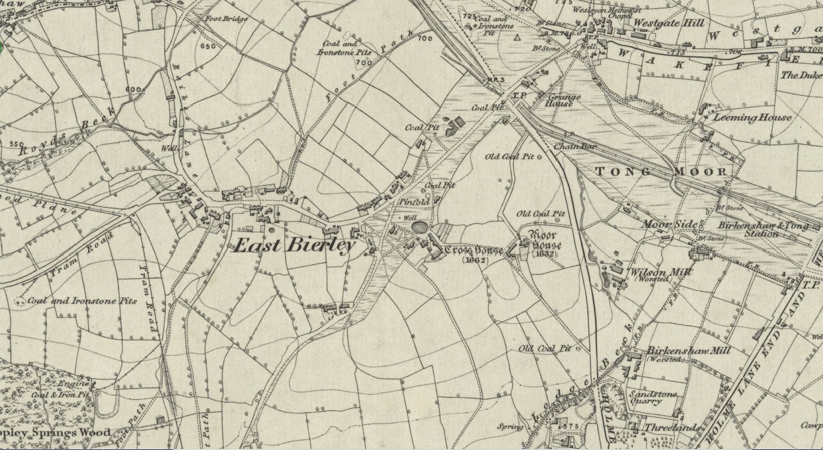
Site location at Cross House
Not to be confused with a much more renowned namesake above Ilkley, this was the name given to two old stones that once existed in the middle of the East Bierley hamlet (as it was then) southeast of Bradford. They were two large boulders next to each other, not far from the early farmstead of Cross House (see map, right) and were described in James Parker’s (1904) historic collage of the area, where he informed us that:
“On the village green (are) the primitive large stones locally called the “Cow and Calf stones,” which used to be in days gone by a Preaching Cross and Market Cross.”
When William Cudworth (1876) described the place nearly thirty years prior, he only mentioned a single cross, telling us:
“There is a lane which has long been called Kirkgate at Birkenshaw, leading up to an ancient cross on the hill. The fact of this cross being on the hill must have given rise to the name Kirk (church) gate, as there was not, until a few years ago, any church at Birkenshaw. In a previous paper we had occasion to notice the existence of the cross as an evidence of a pre-church period.”
The meaning behind the name Cow & Calf is unexplained by our respective authors, although Cudworth’s citation of “the cross as an evidence of a pre-church period” is probably not without merit here. It seems very likely that the animal names of the two large stones—akin to the Cow & Calf Rocks at Ilkley and others of the same name elsewhere in the country—that sat near the top of the hill, probably possessed a creation myth similar to others of the same name. From this, it seems logical that local folk held the rocks as important, which would have obviously attracted the regressive attention of Church—so they stuck a cross here to christianize the place and in doing so ensured that local people could continue using the place as a meeting place. This practice (as if you didn’t already know) was widespread.
Although Mr Cudworth seems to give the first real account of the place, field-name records of 1567 listed a ‘Cowrosse’, which may have been the “cross on the Cow” stone. A.H. Smith (1961) listed the site and suggested the element –rosse may derive from a local dialect word meaning a marsh, but a ‘cow’s marsh‘ seems a little odd. It is perhaps just as likely that an error was made in the writing of rosse instead of crosse.
References:
Cudworth, William, Round about Bradford, Thomas Brear: Bradford 1876.
Parker, James, Illustrated History from Hipperholme to Tong, Percy Lund: Bradford 1904.
Smith, A.H., The Place-Names of the West Riding of Yorkshire – volume 3, Cambridge University Press 1961.
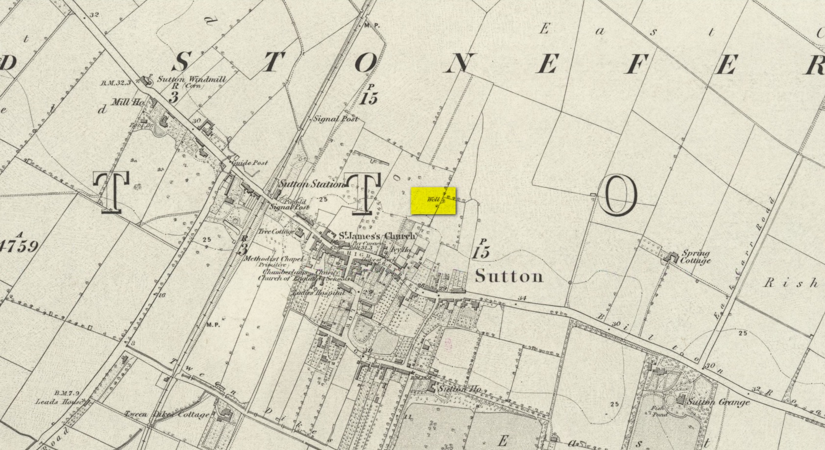
We don’t know for certain the precise whereabouts of this long lost healing well, but it would seem to be the one highlighted here (right) on the 1855 OS-map. However, I think it equally possible that the small unnamed building, roughly halfway between the highlighted ‘Well’ and Spring Cottage, where the walling meets, could be the site in question. It’s one or the other!
Folklore
When Thomas Blashill (1896) wrote of the Blind Well in his standard history work of the area, memory of it was already falling away. In discussing where local people could wash and look after their health, he told that
“There was one place in the parish where washing seems to have been practised as a curative measure. Down in the East Field, near to Spring Cottage Farm, was the Blindwell, to which the people had access. If they used its waters freely when suffering from sore eyes, their faith would probably be rewarded.”
Holy Well (destroyed): OS Grid Reference – SE 80528 42531
Also Known as:
St Everildis Well
Archaeology & History
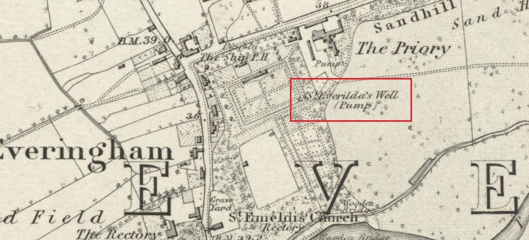
Shown on the 1855 Ordnance Survey map as a ‘pump’, in the grounds of Everingham Priory, the ‘seat’ of the lord of the manor, it was in an enclosure formerly open to the people of the village. It was filled in prior to 1923. The water was described as ‘abundant and excellent.’ Graeme Chapman, in his Yorkshire Holy Wells website states:
‘A few metres to the south of the site of the well the modern OS map marks the start of a stream (SE 8055 4250) which could be the original source of the Holy well’s water.’
The well shown on the 1855 6″ OS Map.
The present writer has not been able to verify this from the materials available to him.
Everilda, also known as Everild and Averil, is recorded in the York Breviary, printed in 1493. She was a mid Yorkshire Saint who died around 700 CE. According to this source she was of a noble Wessex family who went to Yorkshire with companions Bega and Wulfreda, settling on land called Bishop’s Farm, an estate of the Bishop of York, St Wilfrid , which he gave to them, the place being then called Everildisham. There they established a nunnery, of which all trace is now lost. Her Saint’s day is July 9th. The name of St Everilda has been changed to ‘Emeldis’ in the dedication of the church at Everingham. Some historians claim the village is not named after her, but as a derivation of ‘ham of Eofor’s people’. The only other church known to be dedicated to her is at Nether Poppleton, some 17 miles north west of Everingham.
Folklore
The water of the village and the mothers of Everingham are said to have been blessed by St Everilda, and the Reverend Smith wrote that over a fifty year period, no mother had died in childbirth.
References:
Farmer, David, The Oxford Dictionary of Saints, Oxford University Press, Oxford, 1987
Raine, James, The Dedications of the Yorkshire Churches, The Yorkshire Archaeological and Topographical Journal, Vol II, 1873
Salisbury, Matthew Cheung, The Use of York: Characteristics of the Medieval Liturgical Office in York, Borthwick Institute, York, 2008
Smith, Rev William, Ancient Springs & Streams of the East Riding of Yorkshire, A.Brown & Sons, London, Hull & York, 1923
Mentioned only in passing in the Becca and Aberford Enclosure Act of 1825, all remains of this site have gone. It was subsequently referred to by Edmund Bogg (1904) in his journey through Elmet as previously standing where the Roman road veered off to the northeast from the “new road”, as it was then. Bogg’s brief description told that from Nut Hill,
“A little distance south, where the old and new roads part, formerly stood a cross; Highcross Cottage keeps its memory green.”
References:
Bogg, Edmund, The Old Kingdom of Elmet, James Miles: Leeds 1904.
Holy Well (destroyed): OS Grid Reference – SJ 836 985
Archaeology & History
Long since lost beneath the metal and concrete of modern times, even references to this forgotten place are very faint indeed. I expected to find something of it in Henry Taylor’s (1906) giganteum, but it even slipped through his considerable work; and, even where mention of it exists, it is only in passing. In William Proctor’s (1874) survey of early Manchester, he found deeds relating to the land and its early owners wherein the one and only mention of this well appears. It was located near the middle of the city centre, between the Law Courts and Manchester cathedral, in the area known today as the Parsonage Gardens on the east-side of the River Irwell. In earlier centuries this was the abode of a Christian minister, or parson, and the water from this well supplied his religious abode. Proctor wrote:
“Crossing over to the Parsonage, we find that, in 1780, one of its residents was Mr John Quincey, linen-draper, uncle to the English Opium-Eater. In the previous year Mr Quincey was married to Miss Martha Goodyear, of Ardwick. His residence was bounded, it seems, on the north and west by “a narrow street or passage called Black Fryars”; while on the other points of the vane his prospect is thus shown by an extract from a lease dated 1758: — “The orchard or garden plot adjoining the river; it is now fenced out with hedges and ditches.” Some years earlier mention is made of a summer-house, fruit trees, and plants in abundance, with “free liberty of way to the spring or well called the Parsonage Well.” In 1686, Thomas Heyrick of Manchester, gentleman, leased a “tenement and parcel of land abutting upon a messuage and garden heretofore in the possession of George Tipping, deceased, and now the dwelling-house of the warden [Richard Wroe] of the said College; bounded on the east part with the old Parsonage ditch adjoining to the tenement of Mr John Oldfield. Close by are or were the residences of John Nield, Hugh Boardman, Richard Haworth, Esq., and lately Jane Haworth, his widow.” A worn parchment proves the existence, in 1698, of “Parsonage Croft;” another of “Parsonage Pool;” and an order of the Court Leet, 1594, required the tenants to “go along the hedge-side, keeping the footway towards the Parsonage style, for their fetching of water from the river.” In 1765, an advertisement in the Mercury mentions “the sign of the Grey Horse in or near Parsonage Brow.” St Mary’s Church covers the ground once known as the Parsonage Green.”
Holy Well (destroyed): OS Grid-Reference – SE 100 254
Archaeology & History
This sacred site seems to have been destroyed sometime at the end of the 19th century. It was located on the great slopes heading up to Beacon Hill. In 1787, a property survey showed six houses here called Holy Well Cottages and on the 1852 OS-map a “Well” is highlighted at the bend in the pathway of the Old Bank as you’re going uphill, which is the place in question. On my last visit here about thirty years ago, its position was preserved under a large manhole.
References:
Heginbottom, J.A., “Early Christian Sites in Calderdale”, in Proceedings Halifax Antiquarian Society 1988.
The site of the well, which was in the historic county of Middlesex, appears to have been on the west side of the present Moorefields Road just north of the junction with St Loy’s Road. The OS reference is an approximation. The restored circular well house to the south of the High Cross at the High Road – Philip Lane junction now popularly known as ‘The Old Well’ or ‘The Old Pump’ by Tottanham Green has been referred to as being ‘St Eloy’s Well’ but this is not the historic well described in this profile.
Archaeology & History
Likely position of the well on the 1873 6″ OS Map
The well was still in existence in 1876, but by the time of the revision of the OS map around 1894, it had been destroyed following building of the Great Eastern Railway’s Enfield branch line and the construction of terraced housing along the new St Loy’s Road.
So where was the well? The 1873 6″ OS map shows a field on parts of which the railway line and St Loy’s Road are now built, and a small area of water is shown in this field which is the likely position of St Loy’s Well on the eve of its destruction, when it was described as a dirty pool of water full of mud and rubbish. If this was the position of the well then it has now been completely built over…
It was described by Robinson in his 1841 History of Tottenham as being:
‘..in a field….on the western side of the High Road…surrounded by willows…it is bricked up on all sides, square and about 4 feet deep..’ ‘ In Bedwell’s time [it was]…always full of water, but never running over; the water of which is said to exceed all other near it.’.. ‘the properties of the water are similar to the water of the Cheltenham springs’.
Thomas Clay ‘s 1619 map of Tottenham, illustrated in Robinson’s book shows a field north west of Tottenham High Cross called ‘Southfeide at St Loys’. The Tottenham historian Wilhelm Bedwell described the well in 1631 as:
‘“nothing else but a deep pit in the highway, on the west side thereof;”….”it was within memory cleaned out, and at the bottom was found a fair great stone, which had certain letters or characters on it; but being broken or defaced by the negligence of the workmen, and nobody near that regarded such things, it was not known what they were or meant.’
This fair great stone with its ‘certain letters or characters that no one knew what they were or meant’ is intriguing especially in view of the well’s proximity to the Roman Ermine Street (Now the High Street). Were those mysterious characters spelling out an undecipherable Latin inscription on a Roman stone? We shall never know, but it hints at a pre-Christian origin or veneration of the well. Another hint is that before the Reformation there was nearby a chapel of St Eloy known as the Offertory*, which may have been originally built to ‘Christianise’ a pre-existing heathen sacred spring. The Roman origins of the well are also hinted at (probably erroneously) by W.L. Bowles in 1830, writing of a ‘Druidical Tour’ that one Sir Thomas Phillipps undertook on the continent, first quoting Phillipps before adding his own conclusion:
‘“Near Arras in France, are found the mount of St. Eloi and the very name of a place, Tote. I have no doubt Druidical remains will be found there, if this be not the very country of Carnutes.”
Now let me observe, that Tote is Taute —Tot—Thoth, latinized into Tewtates by Lucan, &c. the chief deity of the Celts. St. Eloi is neither more nor less than the Celtic word Sul, turned into the Greek the Sun; and Elios, turned into the Catholic St. Eloi, as at Tottenham, Middlesex, anciently Tote-ham, the ham of Taute or Tent, where is also the sacred well of St. Eloi, or ‘Helios’, the Sun !’
Saint Eloi / Eloy /Loy / Eligius, is the patron saint of those who work in the alchemists’ metal of the sun – goldsmiths! He is also the patron saint of blacksmiths, farriers, and all who earned their livings from horses, and lived from around 588 to 660 to become Bishop of Noyon and the evangelising apostle for much of modern day Belgium. His feast day is 1st December, and he had a widespread cult in mediaeval Europe, including England. In addition to being a healing well for humans, one writer hints that the well’s waters may have been employed for healing horses…they certainly would have drunk from it with its proximity to what is now the High Street.
Around 1770, an artist called Townsend (the sources are unsure as whether it was a Mrs or Mr) produced a romanticised drawing of the well, which was exhibited at the Royal Academy in 1770-1. It depicts a hermit beside the well (the Hermitage of St Anne stood to the south of High Cross prior to the Reformation) receiving an offering from a lady. It was engraved and sold as a print, and may be the only image of the well before its demise.
Folklore
In 1819 – 20, John Abraham Heraud wrote a poem about St Loy’s Well, set in the time of St. Edward the Martyr, (the late 970s), entitled ‘ Stanzas in the Legend of St Loy‘ of which the most relevant verses are;
‘TOTEHAM! the Legend of thine olden day, To the last note hath on thine echoes died; But the Bard’s soul still lingers o’er the lay, To muse upon thy transitory pride The pride of times that hath been — blank and void— When all was Nature, big with many a song Of Chivalry and Fame, with Love allied— But Time both changed the scene — now houses throng Where once was solitude — and people crowd along.
Where now thy WOOD, that spread its misty shade O’er twice two hundred acres? — past away! And vain its PROVERB, as the things that fade, Earth, sun, moon, stars, that change as they decay! The lonely CELL, the tenor of the lay, Its grove, which hermit tendance loved to rear; And, St. LOY, mouldering to Time’s gradual sway, Thy rites, thy OFFERTORY disappear;— Forgot thy SPRING OF HEALTH no votary worships there!
Forgot, neglected — still my harp shall dwell On thee, thou blest BETHESDA of ST. LOY! As Fancy muses o’er the vital WELL On years of storied yore, with grief and joy, Exults they were — weeps Truth should e’er destroy! Thrice I invoke the Spirit of the Stream With charm she may not question, or deny, And, like a Naiad, o’er the watery gleam She rises to my voice, and answers thus the theme:— ‘
Heraud wrote a further poem mentioning the well, his ‘Tottenham‘ of 1820, the relevant verse being:
‘St. Loy! here is this fountain—emblem pure Of chaste unostentatious charity— Never in vain intreated, ever sure ; Yet o’er the marge thy waters fair and free Ascend not, overflowing vauntingly, But in thy bounty humble as unfailing, In grief, disease, and sickness, visit thee. But part in joy, changed by thy holy healing To manhood, strength, and life, thy far renown revealing. There is thy offertory, and thy shrine, Simple, inartificial ; nor of fame, Nor any honour, save that it is thine, And all its glory centres in thy name !’
*Footnote – Brian Spencer’s book on mediaeval pigrim badges recovered by archaeologists in London refers (p222) to a distinct ‘London pattern’ of St Eloi badge – is this a hint that the Offertory was a local shrine to St Eloi where such badges were sold to pilgrims? Further research is needed to try to verify this speculation.