Bleasdale Circle, Lancaster, Lancashire

Timber Circle:  OS Grid Reference – SD 57717 46004

Getting Here
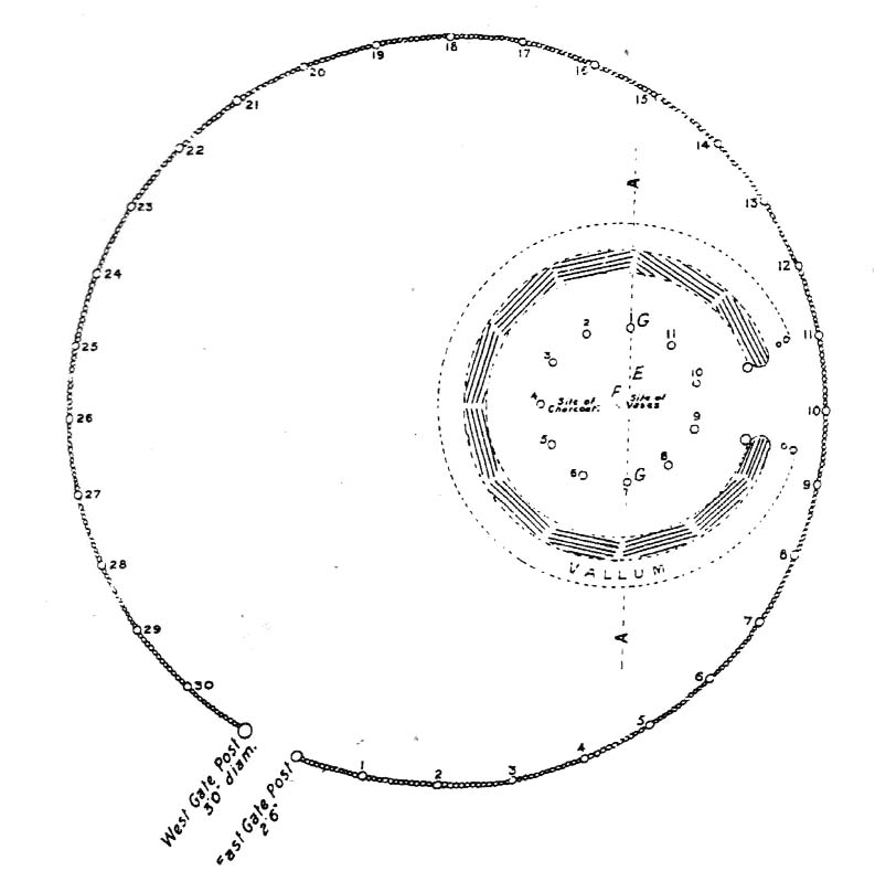
Bleasdale Ring & enclosure plan (Syd Wilson, 1900)

Pretty easy to find, and a nice walk to boot! Head up to Bleasdale Church (worth a look in itself!), keep going up the path north to the aptly named Vicarage Farm.  From here you’ll notice a small copse of trees on your left (east) heading to the hills.  To those of you who like Predator, “it’s up there – in them trees…!”

Archaeology & History

On my first visit here in the company of John Dixon and other TNA regulars, my first impression was “this is a henge” – and noted subsequently that it’s been described as such by several writers.  But the general category given to this fascinating place is a ‘timber circle.’

Bleasdale ‘henge’ circle

First discovered at the end of the 19th century and described in considerable detail by Mr Dawkins (1900), this is a gorgeous-looking monument was erected in at once a gentle and tranquil, aswell as an imposing natural setting, at the foot of Fair Snape Fell (to the northwest) and Bleasdale Fell (due southwest).  These aspects of the landscape would have  had obvious mythic importance to the people who built this ring amongst the trees.  A condensed version of Dawkin’s material was described in J. Holden’s (1980) Story of Preston, that outlined this circle as being,

“a centre for religious worship in about 1700 BC.  It was made up of a circle of timber posts which enclosed an area 45 metres in diameter. In the centre was a small mound surrounded by a ring of oak posts and a circular ditch.  Inside the mound there was a grave that had in it two pottery urns filled with human bones and ashes. Examination of the contents of these urns shows that the bodies were wrapped in linen and burnt on a funeral pyre. A small ‘accessory’ cup was found inside one of the urns and this may have contained food or drink for the afterlife.”
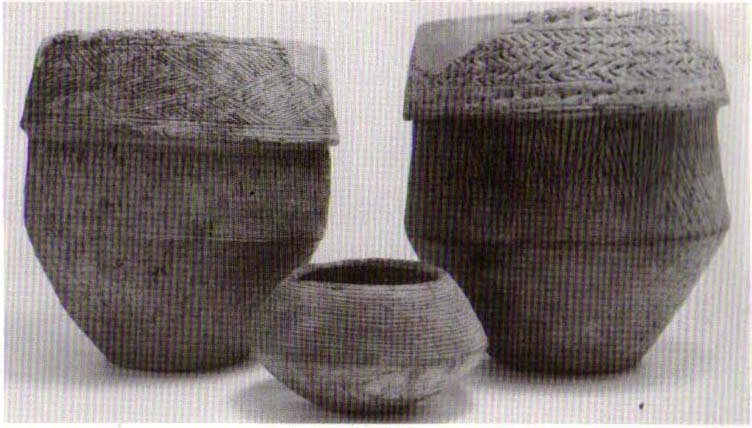
Urns from Bleasdale Ring
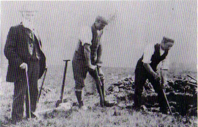
1898 photo of Shadrach Jackson (left) & Tom Kelsall (centre) digging the site

Located within a much larger circular enclosure, the internal Bleasdale ‘henge’ Ring consisted of a small circle of eleven timber posts near the edge of the ditch, and an entrance way to the east, to or from which was an avenue of further wooded posts that led to the edge of the larger enclosure.  It gives the impression that this was some sort of avenue along which a ceremonial procession may have took place, strongly suggesting a ritual function.  Robert Middleton (1996) told that,

“The post circle and barrow appear to respect each other  (in date), whilst the enclosure may be later.  The post circle has been dated to around 2200 BC, although the context and reliability of this date is unclear.”

Looking out eastwards from the middle of the internal henge-style ring and through the ‘entrance’ we find an alignment with a large notch on the skyline which, modern folklore ascribes, is where the midwinter sun rises — which is very believable, but I aint seen it proven anywhere yet.

A much greater and full excavation report of this site was written by Raymond Varley (2010), whose essay I urge fellow antiquarians to read.

References:

  1. Dawkins, W.B., ‘On the Exploration of Prehistoric Sepulchral Remains of the Bronze Age at Bleasdale,’ in Transactions of the Lancashire & Cheshire Antiquarian Society, volume 18, 1900.
  2. Dixon, John, Journeys through Brigantia – volume 8: Forest of Bowland, Aussteiger Publications: Barnoldswick 1992.
  3. Edwards, Ben, “The History of Archaeology in Lancashire”, in Newman, 1996.
  4. Gibson, Alex, Stonehenge and Timber Circles, Tempus: Stroud 1998.
  5. Holden, Jennifer (ed.),  The Story of Preston, Harris Museum: Preston n.d. (c.1980)
  6. Middleton, Robert, “The Neolithic and Bronze Age,” in Newman, 1996.
  7. Newman, Richard (ed.), The Archaeology of Lancashire, Lancaster University 1996.
  8. Sever, Linda (ed.), Lancashire’s Sacred Landscape, History Press: Stroud 2010.
  9. Varley, W.J., ‘The Bleasdale Circle,’ in Antiquaries Journal, volume 18, 1938.
  10. Varley, Raymond, “The Bleasdale Bronze Age Timber Circle,” in Lancashire History Quarterly, 2010.

© Paul Bennett, The Northern Antiquarian

Holed Stone, West Overton, Wiltshire

Enclosure & Stone:  OS Grid Reference – SU 1285 7151

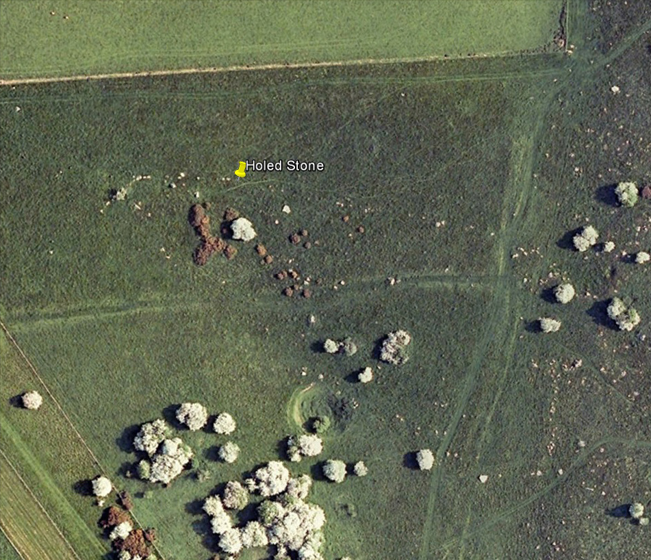
Aerial image of site

Getting Here

Follow the same directions as if you’re visiting the Polisher Stone at the top-end of Overton Down where it meets Fyfield Down.  From here, walk down the slope for a hundred yards or so where you’ll notice, just above the long grassy level, a line of ancient walling running nearly east to west.  It’s very close to the yellow marker in the attached aerial image shot to the right.  If you walk along this line of walling you’ll find what you’re looking for.

Archaeology & History

Overton’s Holed Stone

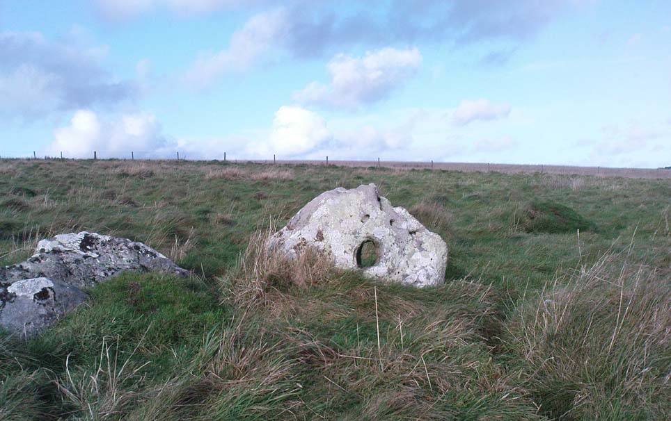
As I’ve only been here once, and briefly — under the guidance of the Avebury expert Pete Glastonbury — my bearings on this site may need revising.  There are two distinct sections of walling here: one has been excavated by Peter Fowler and his team; the other hasn’t. (correct me if I’m wrong Pete)  And in Fowler’s (2000) fine survey of this area he does not describe this very distinct holed-stone in the line of walling, or adjacent “linear ditch F4”, as it was called.  But then, many archaeologists don’t tend to find items such as these of any interest (unless their education stretches to other arenas, which isn’t usually the case). But the stone seems to be in a section of walling that isn’t in their survey; standing out in aerial imagery as a less well-defined, but still obvious line of walling that is closer to the fence, 70-80 yards north, with a decidedly Iron-Age look about it!

But, precision aside! — as you can see in the photos, the holed stone here isn’t very tall — less than 2 feet high; though we don’t know how deep the stone is set into the ground.  This spot is on my “must visit again” list for the next time we’re down here!

Folklore

Veritable vagabonds, Mikki, June, PeteG & Geoff, readying themselves for fertility rites!

There’s nowt specific to this stone, nor line of walling, nor settlement (as far as I know), but it seems right to mention the fact that in British and European folklore and peasant traditions, that holed stones just like the one found here have always been imbued with aspects of fertility — for obvious reasons. Others like this have also acquired portentous abilities; whilst others have become places where deeds and bonds were struck, with the stone playing ‘witness’ to promises made.

References:

  1. Fowler, Peter, Landscape Plotted and Pierced: Landscape History and Local Archaeology in Fyfield and Overton, Wiltshire, Society of Antiquaries: London 2000.

© Paul Bennett, The Northern Antiquarian

The Polisher, West Overton, Wiltshire

‘Standing Stone’:  OS Grid Reference – SU 12828 71508

Also Known as:

  1. OD II (Fowler)
  2. Parsons Penning Stone
  3. The Polissoir

Getting Here

The Polisher at rest

We were graciously guided to this spot by local archaeological authority, Pete Glastonbury — which is good, cos otherwise it’d have probably taken us all day to find the damn thing!  Best way to get here is out of the Avebury circle, east, up for about a mile up the Herepath or Green Street till you hit the ancient track of the Ridgeway.  Turn left and walk up the gentle slope for another 350 yards or so, then note the footpath on your right.  Go down the slope for about 150 yards, keeping your eyes peeled for the smooth rock with the slits in it, not far from the Holed Stone!

Archaeology & History

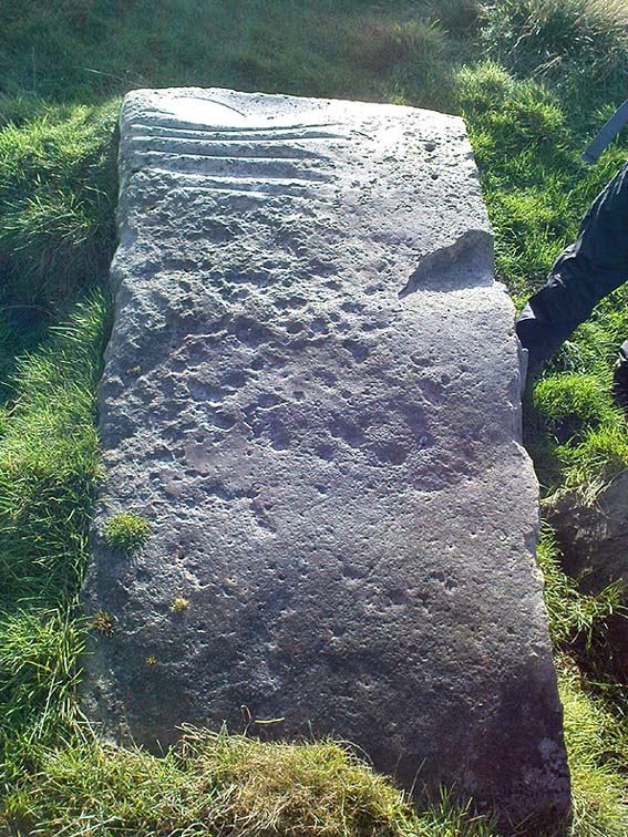
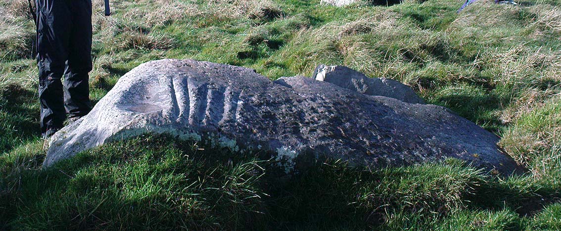
Although classified on the Wiltshire Sites & Monuments Record as an “unclassified feature,” this is one of a number of whetstones (as we call ’em up North) that feature in various settings in and around the Avebury region: literally, a rock used for sharpening axes, daggers and other metallic artifacts. First rediscovered in the spring of 1963 by a Mr Inigo Jones when he was out exploring the many rocks hereby for rare lichens and any more cup-markings like the one at nearby Fyfield Down, the site we see today is merely a long piece of stone with five or six long lines or grooves cut into the top-end, along which the ancient weapons and tools slid and cut into the rock, sharpening them.

It was thought until recently that this was the prime function of this stone; but following excavation work done here by Pete Fowler and his team in 1963, it seems that the stone actually stood upright!  Digs were made on three sides of the stone and some earlier disturbance seemed apparent:

“The material appeared to be redeposited on top of an earlier ground surface, inferentially of medieval or earlier date.  At the north end of the sarsen bench, the lip of a pit or trench was partly excavated.  It showed clearly in plan as a feature dug into the top of an undated surface level with the disturbed top of the clay-with-flints; it was filled with flinty, clayey humus similar to that through which it was cut.  In the top of that fill was a heavily weathered sarsen, c 0.6m by 0.45m, and a cluster of smaller, broken sarsen stones.  The hole was at least 0.45m deep, its bottom as excavated marked by an increase in the density of flints.  The evidence, though incomplete, suggested very strongly that the feature was part of a hole dug to take the pollisoir as an upright stone.” (my italics, Ed)

In the same dig, a medieval coin of King John (1199-1216) and the remains of a medieval horseshoe were found beneath the stone, giving Fowler and his team the notion that the stone had been split and pushed over at this period.  Consistent evidence of activity from the neolithic period onwards was expected and found here.

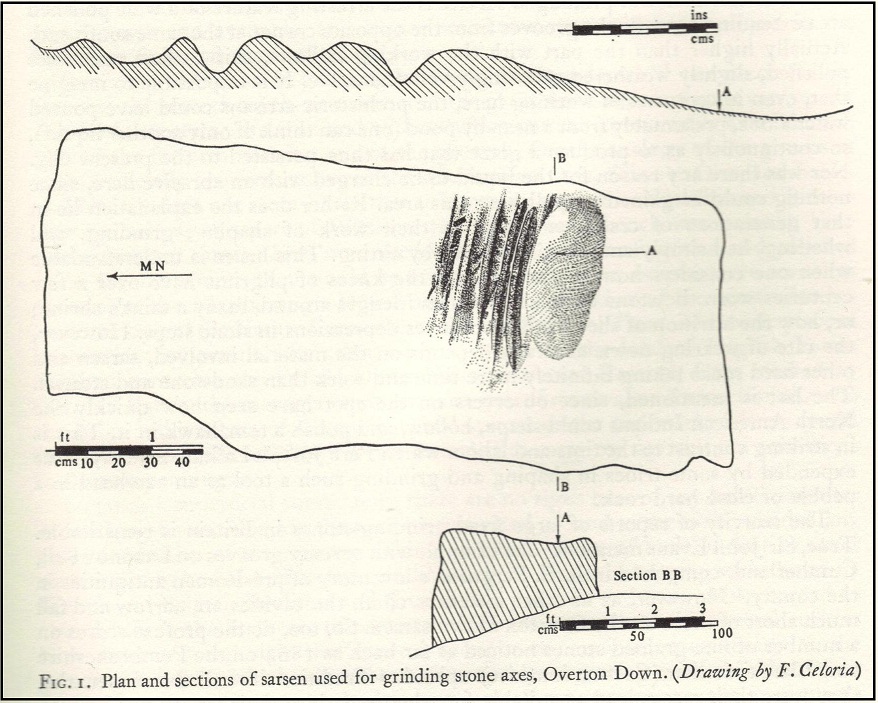
In Lacaille’s (1963) original description of the site, he gave a most accurate description of the dimensions of the stone and its incisions.  Highlighting its proximity to a cluster of other stones, as well as being close to a wide ditch, Lacaille’s measurements were thus:

“From 1ft (0.31m) above ground at its south end the regular surface of the sarsen slopes to the grass, its main axis being aligned about 15° west of the true north and south line.  In length the stone measures 5ft 6in (1.68m) above the grass, and 2ft 10in (0.86m) in width.

“Closely grouped in the south-eastern corner of the sarsen there are six hollows.  In plan the largest and southernmost is of long elliptical shape, 1ft 8in (0.5m) long and 9in (0.23m) at widest and 1in (0.0254m) deep.  From its wider end near the eastern long margin there protrudes a short groove.  Beside this, and curving slightly inward, there is another groove, 1¼in (0.028m) wide and ½in (0.013m) deep.  It is as long as the large basin-like cavity.  Next to it there runs one of similar length and width, but of only half the depth.  In turn, a third groove, ½in (0.013m) wide, 1ft 8in (0.5m) long, has been worn at right angles to the long edge but to a much deeper hollow than its companions.  At 2in (o.051m) to the north a lesser version of the main basin occurs.  Like this it measures 1ft 8in (0.5m) in length, but is only 2¼in (0.058m) wide and ¾in (0.016m) deep.  Vague in places over its interior length of 10in (0.25m), but attaining a maximum width of 1¼in (0.028m), a last hollowing shows faintly at both ends and nowhere deeper than 1/8in (0.0032m).”

The Polisher & its marks
Celoria & Lacaille’s 1963 drawing of the stone

It appears that this fallen standing stone was being used to sharpen knives and axes whilst it stood upright and, in all probability, as a result of this ability would have been possessed of magickal properties to our ancestors.  Metalwork was an important province of shamanism and smiths, whose practices were deeply enmeshed in the very creation of mythical cosmologies.  Hence, the simple act nowadays of sharpening metal tools onto rocks would not have been a mere profanity to the people who came and used this stone to re-empower their weapons, but would have been entwined within a magickal cosmology.  The spirit inherent in this stone would likely have been named and recognised.  Today it is forgotten…

It also seems that this standing stone was part of some ancient walling.  Aerial views clearly show it along the line of some sort of enclosure that runs down the slope, along the bottom and back up and around.  In the same stretch of this enclosure walling we find the Holed Stone a little further down the slope.  And holed stones, as any student of folklore and occult history will tell you, have long-established magickal properties of their own…

References:

  1. Fowler, Peter, Landscape Plotted and Pierced: Landscape History and Local Archaeology in Fyfield and Overton, Wiltshire, Society of Antiquaries: London 2000.
  2. Grigson, Geoffrey, The Shell Country Alphabet, Michael Joseph: London 1966.
  3. Lacaille, A.D., ‘Three Grinding Stones,’ in Antiquity Journal, volume 43, 1963.
  4. Watts, Ken, “Fyfield and Overton Downs, Wiltshire: A Prehistoric and Historic Landscape,” in 3rd Stone, no. 33, January-March 1999.

Links:

  1. The Polisher – on The Megalithic Portal

© Paul Bennett, The Northern Antiquarian

Ciceley Low, Houndkirk Moor, South Yorkshire

Ring Cairn:  OS Grid Reference – SK 27535 80800

Getting Here

Located just off Hathersage Road, by Parsons House outdoor pursuits centre with parking in a roadside layby. Don’t Park at Parsons House – they won’t like it!  Head up the old road besides Parsons house and take the entrance onto the moor about 100 metres past the pursuits centre track.  If memory serves me correct, it’s by the second wall on the right. Follow the post-and-mesh fence to the end of the wall and turn right, following the wall for around 70 metres down hill and you’ll be able to see the cairn’s bank before you in the heather.  The stone pictured lays in the banking by the entrance which faces NNW.

History and Archaeology.

There’s no excavation taken place here that I know of, but the site is well known and mentioned in an old report I found Here.   The article also contains an old map of the area showing the site.

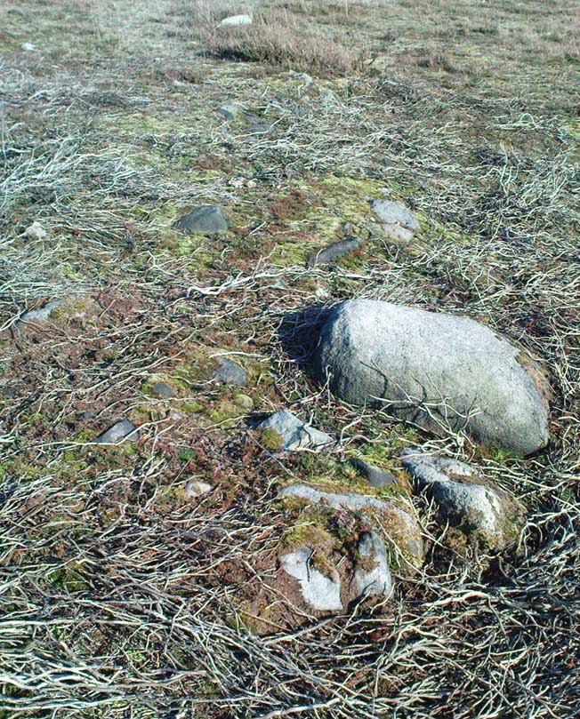
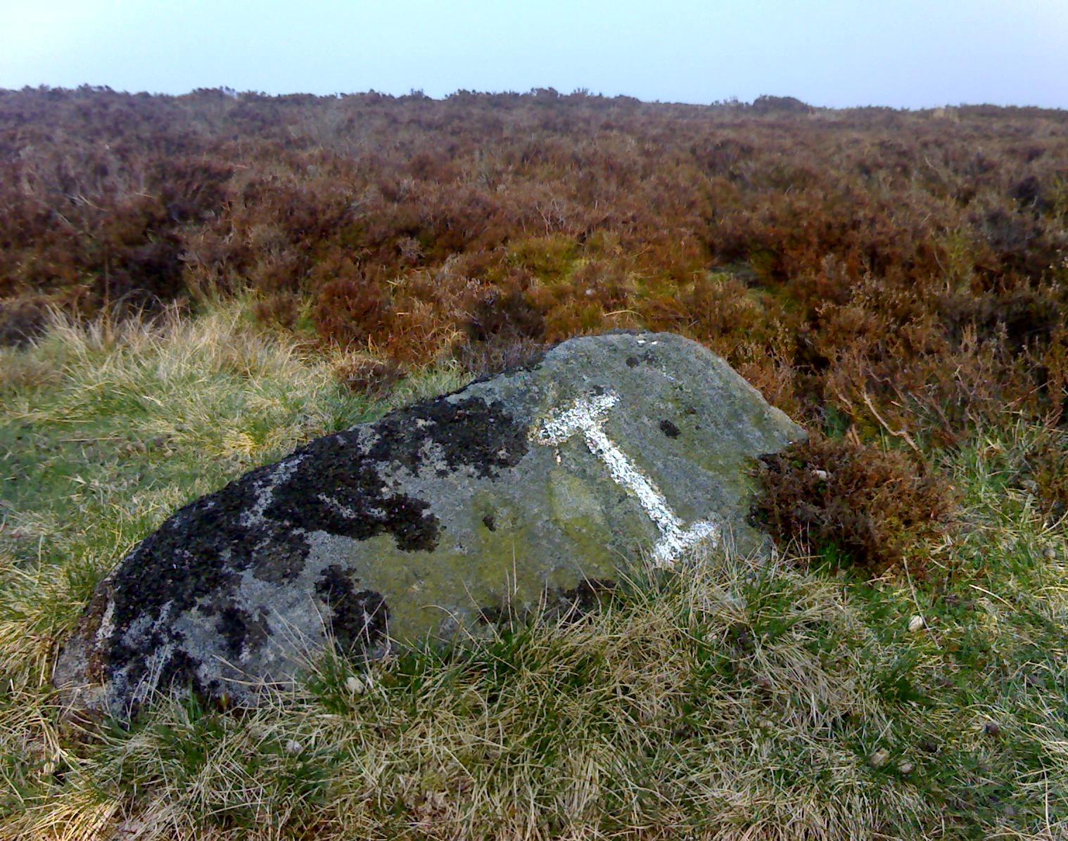
Also mention is made of a stone referred to as the Fingeram stone.  There is a stone laid flat in the position marked on the map,  but I’m unsure whether it’s the standing stone mentioned.  According to the old text the ring cairn has a diameter between 83ft and 95ft.  Directly to the north and roughly 50 metres onto the moor, in line with the wall, is an interesting egg-shaped  and weather-worn boulder that’s also worth a look at.  This whole area is a sea of sandstone.

© Geoff Watson, The Northern Antiquarian


North Ring, Mucking, Stanford-le-Hope, Essex

Enclosure (destroyed):  OS Grid Reference – TQ 675 811

Archaeology & History

North Ring, Mucking (after Brown, 2001)

This large circular enclosure, measuring about 120 feet across, seemed to be a small settlement with several internal structures (fences, pits, cremations and a sunken-floored structure) that was first excavated in 1978 and described as a Bronze Age enclosure.  Akin to a henge monument in some ways, this small settlement site had two entrances: one on the east and the other opposite on its west side.  However, the main ‘entrance’ was on the eastern (sunrise) side, where post-holes laid a pathway over the ditch and into the structure itself.

The excavation on the eastern side of site revealed two periods of construction with associated structures, including three circular buildings.  Some excavations to the east produced evidence for a range of contemporary activities.  The assemblage of Late Bronze Age material included pottery, metalwork, cremation remains, sickle moulds and equipment for salt production.  For further info and imagery, see the Link below.

References:

  1. Bond, Dermot, Excavation at the North Ring, Mucking, Essex, East Anglian Archaeology 1988.
  2. Brown, N., “The Late Bronze Age Enclosure at Springfield Lyons in its Landscape Context,” in Essex Archaeology & History, volume 32, 2001.

Links

  1. North Ring, Mucking

© Paul Bennett, The Northern Antiquarian

Springfield Lyons, Chelmsford, Essex

Enclosure:  OS Grid Reference – TL 7357 0818

Archaeology & History

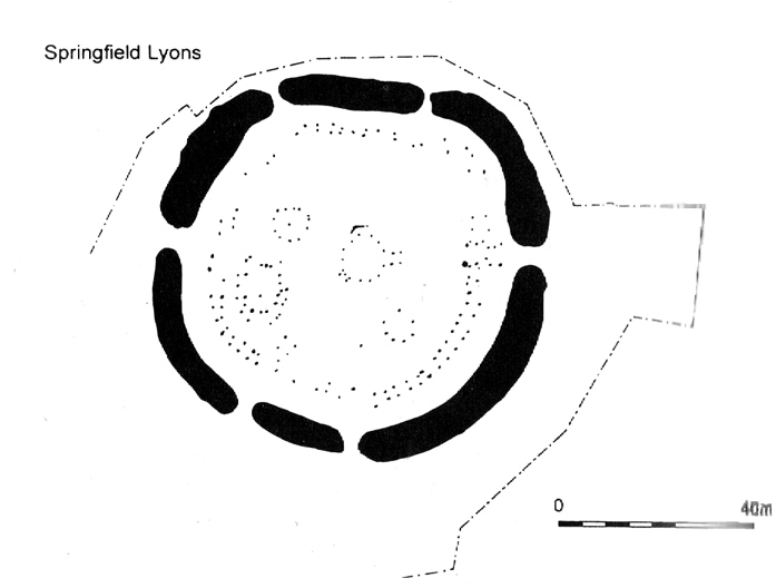
Springfield Lyons enclosure (after Brown, 2001)

We’ve known that there was an excessive number of prehistoric archaeological sites in and around the Chelmsford region for quite a long time now, but defining precisely the age and nature of the finds takes some doing! (as you’d expect)  It hasn’t helped, of course, with the housing estates and other ecologically destructive building operations in and around the area, screwing up a more accurate and patient assessment of the material there.  And this predicament was exemplified with the Springfield Lyons neolithic causewayed enclosure just as much as at the Springfield Cursus and other sites nearby.

Although excavations here found a large, deep ditch with impressive ramparts and entrance, in Oswald, Dyer & Barber’s (2001) survey of these giant monuments, they defined the remains here as “probable,” pending further investigations.  But the site was primarily defined by the large deep ditch, broken in several places round its edges with the ’causeways’ built leading onto the site.  The enclosure gave good views over the small valley from here and had streams running either side of it.

Adjacent to the site were the remains of a “small circular enclosure with multiple entrances,” saying that excavation here,

“has proved that it is of late Bronze Age date and might be interepreted variously as a defended settlement, or a ritual monument.”

This external small enclosure site was then conjectured, quite spuriously it’s gotta be said, to be a mini-version of the great causewayed enclosure monument, saying:

“Its siting and form both hint that it could have been a conscious imitation of, or re-invention of, the perceived form of the earthworks of the neolithic enclosure.”

I like the idea, it’s gotta be said — but without direct evidence we’ve gotta take this idea with a large pinch of salt!

…to be continued…

References:

  1. Brown, N., ‘The Archaeology of Essex 1500 – 500 BC,’ in Bedwin, O. (ed.), The Archaeology of Essex, ECC: Chelmsford 1996.
  2. Brown, N., “The Late Bronze Age Enclosure at Springfield Lyons in its Landscape Context,” in Essex Archaeology & History, volume 32, 2001.
  3. Oswald, Alastair, Dyer, Caroline & Barber, Martyn, The Creation of Monuments: Neolithic Causewayed Enclosures in the British Isles, EH: Swindon 2001.
  4. Priddy, D., ‘Excavations in Essex, 1987,’ in Essex Archaeology & History, 19, 1988.

© Paul Bennett, The Northern Antiquarian

Stanbury Hill Enclosure, Bingley Moor, West Yorkshire

Enclosures:  OS Grid Reference – SE 109 433

Getting Here

Follow the same directions as to find the Lunar Stone, Spotted Stone, etc.  Go thru East Morton village up the steep moorland road, east, and where the road levels out there’s a right turn and a trackway on your left which leads onto the moor.  Go ½-mile up this track till you hit a moorland ‘footpath’ signpost.  Stop here and walk due west (left) for a coupla hundred yards.  If the heather’s grown back you aint much chance of finding owt – but if there’s only low growth, amble about zigzagging – and keep your eyes peeled!

Archaeology & History

Section of cairn rubble & walling

Although there’s been no written record of the Stanbury Hill remains until very recently, it seems quite probable that Mr Stuart Feather would have come across at least parts of these remains when he uncovered the rock-art in the same vicinity, but he never made public his finds.  He was a diligent researcher and finder of cup-and-ring stones, nose to the ground sorta chap, and it would be odd for him to miss the other remains on this hill.  For as we now know, there are undeniable evidences of considerable neolithic and/or Bronze Age walling scattered along (mainly) the southern side of Stanbury Hill, running mainly along an east-west axis, but there are also examples of the walling running roughly north-south.  In at least one position near the western end of the ridge, halfway down the south-facing slope, is what seems to be the unmistakable trace of an enclosed hearth.  At the time of writing a series of archaeological digs are, slowly, being done hereabouts, so it will be good to read their final evaluations.

Very close to some parts of the walling we find the remains of old cairns, and at least one cup-and-ring stone has been carved along the axis of one line of walling (it reminded me very much of the Bronze Age settlement remains found at Snowden Moor, over the northerly horizon, in the Washburn Valley).  Several other previously unreported cup-marked stones have also been found here (we’ll highlight them on TNA in the coming weeks).

Upon first impression the remains found upon and around Stanbury Hill seem more related to mortuary practices than what we’d call ‘domestic’ living practices, as the prevelance of carvings and cairns indicates.  But we’ve gotta be cautious here, as in many sites the dead were kept with the living; and as we find in many traditional or aboriginal cultures, the land of spirits and that of the living are much more closely allied than in our profane ‘Western’ paradigm.

More from this site in due course…

© Paul Bennett, The Northern Antiquarian

Yarnbury Settlement, Grassington, North Yorkshire

Settlement:  OS Grid Reference – SE 012 655

Getting Here

Dead easy.  Take the road up through Grassington village, up Moor Lane, onto the grassy tops towards Yarnbury.  As the road levels out, and before you reach the tree-border of Yarnbury house, there’s a field on your left-hand side, opposite the one where the Yarnbury Henge lives.  If y’ go in there to check out this walling, shut the effing gate!

Archaeology & History

Section of walling, Yarnbury

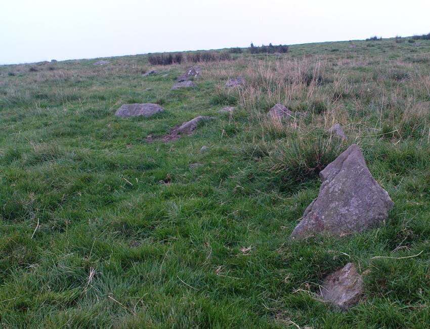
It appears that there’s little information on the remains of what seems to be some Iron Age walling a few hundred yards away, northwest of the little Yarnbury ‘henge’ monument.  Mikki Potts noticed it first of all, in one of the Northern Antiquarian ambles here t’other day.  The walling is quite distinct and typical of finds elsewhere, particularly the excessive Iron Age and Bronze Age walling remains less than a mile west of here, down the slopes near Grasssington.  At least two lines of walling are clearly apparent, running roughly northeast-southwest.  Another section runs off towards the extant walling back towards the road.  But more intriguing (for me anyway!), is what seems to be the remains of an old circle less than 100 yards north, on the other side of the footpath in the same field.

We didn’t spend too much time here and so another visit is obviously needed for further exploratory wanderings, but there appear to be further remains.  Although much of the terrain hereabouts is scattered with an excess of medieval archaeological relics — including some disused shafts at the very top of this same field — this section of walling has all the hallmarks of a much earlier period.  (sadly, a lot of the early mine-workings up here has destroyed a considerable amount our earlier prehistoric heritage).  As one local told us a a coupla weeks back, “There’s loadsa stuff up here which aint in the record books!”

Certainly seems like it!

(In the event that these remains turn out to be of a later period, this profile entry will be removed from TNA.)

© Paul Bennett, The Northern Antiquarian

Ring Stones, Worsthorne, Lancashire

‘Stone Circle’:  OS Grid Reference – SD 886 330

Also Known as:

  1. Ringstones

Getting Here

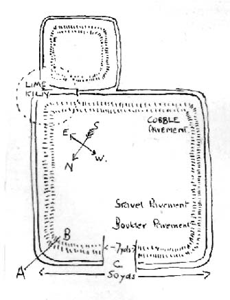
Ring Stones plan (after Bennett 1946)

Various ways to get here. From Worsthorne village, go east, up past the church, uphill following the dead straight path.  After about 600 yards there’s a crossing in the footpath: go left here and walk another coupla hundred yards, over 2 walls, and after you’ve past the second wall you’ll notice the earthworks in the ground to your right.  That’s it!

Archaeology & History

There’s nowt much to see here to be honest.  It was included in Walter Bennett’s (1946) survey of ROMAN remains (oh dear) in the region — and his archaeological description of this place certainly seems to imply it was those doods (the Romans) who built this structure and not our neolithic ancestors.  He wrote:

“Ringstones is a rectangular enclosure 50 yards square, surrounded by a mound or rampart 2 yards wide and one yard high, and an outer ditch two yards wide. Sepereated from the main enclosure by the ditch on the southeast side is another enclosure 18 yards square. Excavations made in 1925 gave the following information: a gateway, seven yards wide, was paved with boulder stones regularly laid on a gravel foundation, and on the south side of the gateway flat stones were sunk below the general floor level to act as a drain; a regular course of large stones flanked the gateway entrance on either side, and a foundation or irregular boulder stones was laid outside the gateway between the rampart and the ditch: inside the enclosure and 9 inches below the present grass surface., a floor had been made of gravel in some places and of flat stones or cobbles in others; the rampart was of earth and stones; a well-constructed road, 7 feet wide, ran from the earthwork in the direction of Bottin Farm, wich is situated on the Worsthorne-Roggerham road.”

There used to be a rough circle of stones on top of the site (probably giving the place its name), but these were apparently from the old remains of a lime-kiln from the 16th or 17th century — not prehistory.  There is, therefore, a case that this site may not be prehistoric as archaeologists have classed it — and if the ground-plan above is anything to go by, you’d have to say it looks less than promising.  More diggings are needed!

References:

  1. Abraham, John Harris, Hidden Prehistory around the North West, Kindle 2012.
  2. Bennett, Walter, History of Burnley – volume 1, Burnley Corporation 1946.

© Paul Bennett, The Northern Antiquarian


Enclosure Carving, Ilkley Moor, West Yorkshire

Cup-and-Ring Stone:  OS Grid Reference – SE 12836 46147

Also Known as:

  1. Carving no.129 (Hedges)
  2. Carving no.288 (Boughey & Vickerman)

Getting Here

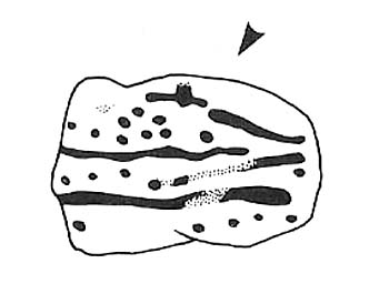
Enclosure Stone design (after Hedges 1986)

Nice n’ easy.  Get to the Haystack Rock and walk on the path west (past the Three Cups Stone) and where the path swings round following the edge of the small Backstone valley, keep going for 150 yards or so.  Keep your eyes out for the remains of walling in the Green Crag Settlement on your left.  This flat stone is amidst the heather in and amongst the enclosure (hence the name).  If you walk back and forth hereabouts for a short period, checking for flat stones amidst the heather about 20 yards off the path, you’ll find it!

Archaeology & History

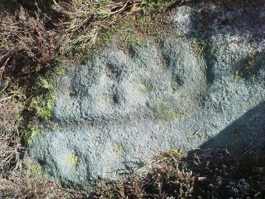
Top-left section of CR-288 - note the carved line 'enclosing' the cups which aint on the archaeo-drawings
Top-left section of CR-288

This is another one of those carvings which had been seen by a number of people, bimbling about across this part of the moor, before it saw the literary light of day in Hedges Carved Rocks book (1986).  It’s a nicely-preserved design, usually covered over by much heather growth, but is worth the exploration if you like your cup&rings.  The drawing of this stone however (in both Hedges and Boughey & Vickerman) does not convey the actuality of the carving, as we can see here.  But that’s the case with many cup-and-rings: linear precision and the artisty of the carving are two very different things.  As we can see here, one section of the stone has a defined ‘enclosure’ of cups etched upon the rock surface: something that is clearly missed in the archaeologist’s drawing.  Check it out y’self and see what you think!

References:

  1. Boughey, Keith & Vickerman, E.A., Prehistoric Rock Art of the West Riding, WYAS 2003.
  2. Hedges, John (ed.), The Carved Rocks on Rombalds Moor, WYMCC: Wakefield 1986.

© Paul Bennett, The Northern Antiquarian