Cup-and-Ring Stone: OS Grid Reference – NC 635 384
Archaeology & History
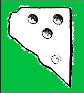
This small cup-marked stone came to light following the work of Mr Angus MacKay of Sutherland, more than 100 years ago. In his essay in the Scottish Antiquaries journal (1905), he wrote the following:
Grumbeg carving
“A cup-marked stone was found by me in the burial place of Grumbeg, Strathnaver, September 1905, standing upright at the head of a grave, and showing about 6 inches above the ground. It is evidently a fragment of a larger slab: its extreme length is 20 inches, and it is about 15 inches at its broadest part. The upper three circles are 2.5 inches in diameter and 1.5 inches deep, very symmetrically hollowed out, but the fourth and lower circle is shallow and indistinct. As the stones covering the other graves are for the most part what is called rough mountain slabs, it seems to me that this cup-marked fragment was found in its present condition elsewhere, and placed here to conveniently show a lair.”
If such was the case, a good contender might be the denuded chambered cairn close by.
Prehistoric petroglyphs are rare things indeed in Leicestershire! But the example that was found here — at the now destroyed prehistoric tomb which archaeologists catalogued as ‘Lockington Barrow VI’ in this small graveyard — shows that such ritual art spreads further afield than previously reported by archaeologists. Yet as with countless other cup-marked stones, it should come as no surprise to be found associated with a tumulus. Death and petroglyphs are common bedfellows – even in this part of Britain!
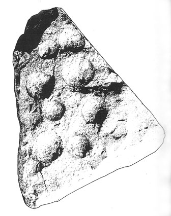
Lockington cup-marking (courtesy Gwilym Hughes)Lockington cup-marked stone
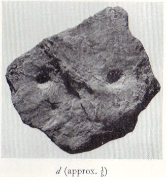
Found on the northern edge of a ring ditch surrounding this once-fine tomb, the carving was found on a small, triangular-shaped, broken piece of rock , less than 12 inches across along its longest side. The small stone has what seems to be eight cup-marks (5 seem certain) pecked onto the stone: simple, without additional ingredients, akin to the basic forms found at Baildon and other more northern climes. The stone itself didn’t seem to be local and was thought by Hughes (2000) “to be from one of the outcrops of millstone grit to the north of the site in southern Derbyshire.”
Less than 7 feet from this petroglyph, inside the barrow, was a pit containing a hoard of ancient gold and copper ware — though any likely relationship between the carving and the treasure hoard is doubtful. The carving was probably a “portable” relic, carried some distance and put here for some reason or other: perhaps as an offering; perhaps a magickal artifact — we’ll probably never know…
An intriguing site this, as it doesn’t appear to be in the Canmore archaeological register – unless it’s the Canmore site 34750. Yet Alexander MacGregor (1937) mentions the place in his folklore study as being a site where the little people lived. Shown on the first OS-map of the region as ‘Fairyfold Hillock’, Mr MacGregor (1937) said of it:
“Near the summit of Carmylie Hill is a large barrow or tumulus, which was believed at one time by the natives to be a favourite haunt of the fairies, where, with much splendour, they held their nightly revels. It still bears the name of ‘Fairy-Folk Hillock.'”
However it seems that quarrying operations may have destroyed the site. The tomb here was probably the same one described by Mr Andrew Jervise in the Journal of the Kilkenny and South East of Ireland Archaeological Society (1864-66), where he wrote:
“Many years ago I took note of another example of these ‘footmarks,’ which was found in the parish of Carmyllie… This was discovered in the course of making agricultural improvements some thirty-five years ago, on which occasion stone coffins or cists were got, and in one of these was a bronze (?) ring, of about three inches in diameter, now said to be lost. Apart from the cists there was a rude boulder of about two tons weight; and upon the lower side of it, as my informant told me, was scooped the representation of a human foot. This too was associated with the elves; for the hillock upon which these discoveries were made was called the ‘fairies’ knowe;’ and tradition says that, but for a spirit that warned the workmen to suspend operations when they began to prepare for the foundations of the parish church, the church would have been built upon that spot!”
An intriguing entry inasmuch as we don’t know the full history and nature of the site. Whether this site was the “druidical circle” mentioned in the 1791 Old Statistical Account of Scotland ” upon the heights of Sheriffmuir,”(vol.3, p.210), we cannot be sure. The site was certainly described by Mr Hutchinson (1893) more than a century ago as a “stone circle”, but earlier still in a short piece in the Stirling Journal of May 5, 1830. It read:
“About eight miles from Stirling by the Sheriffmuir Road, near a place called Harperstone, there is a remarkable circle of stones, supposed to have been a druidical place of worship of old. The site of this circle is rather uncommon in this country — being on the back summit of a high hill, one of the Ochils called the Black Hill, and exposed to every wind that blows. It is about two english miles south of the present roadway.”
The writer’s notes then told of some curious finds by this circle, giving the impression that it may have had another function: perhaps a cairn of sorts; perhaps an ancient building — we may never know. Nevertheless, his information is intriguing.
“Tradition records two remarkable circumstances connected with this druidical circle, which may perhaps be worthy of being preserved. About the middle of last century (c.1750) there were dug up at the foot of the larger stones three vessels of clay of antique shapes, containing coins of very ancient date, which were long preserved by Monteath of Park, but are now, we regret to say, lost. So late as 1770, these coins were, it is said, to be seen at Park House, all of gold. About the year 1715, some stones on which had been engraved inscriptions were dug up at the same place; and at a previous period specimens of ancient Pictish armour were dug up from the bowels of this hill, which had been carefully deposited of yore some feet below the surface in crypts of curious description.”
When Mr Hutchinson came to explore this region in search of the stone circle, his nose took him to a site a few hundred yards north of nearby Harperstone Farm, where he found a large stone:
“It is 9 feet long by 6 feet across on the top, is 3 feet thick and measures 26 feet round. This appears to have been a centre stone, and a surrounding circle is traceable more or less distinctly — moreso to the west and north, less so to the east and south. The radius of the circle is about 15 yard, and a similar distance separates each of the larger stones yet traceable in the circle. The ground beside the great central stone appears to have been excavated…”
Black Hill, Sheriffmuir, looking eastArc of 3 stones in large ellipse
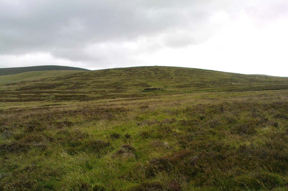
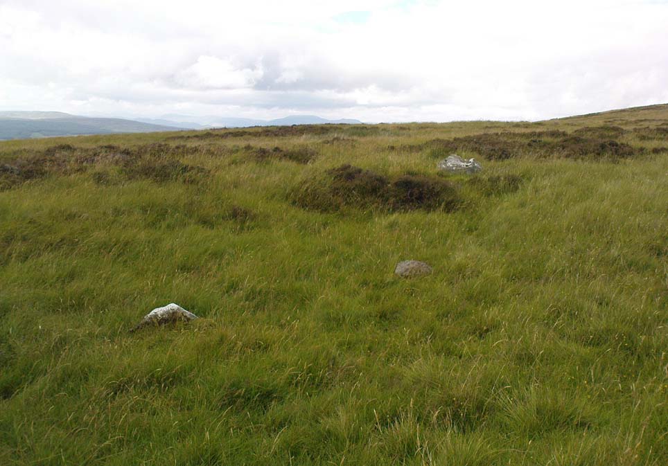
But it would seem that Hutchinson’s site and the one described in the Stirling Journal of 1830 are two distinctly separate items if their relative topographical descriptions are to be accepted. No doubt — like many a-local who’s found these same written accounts — when we visited and wandered back and forth over the Black Hill site in Autumn 2010, we were as puzzled as others before us in finding nothing on the named Black Hill. Nothing that could remotely be viewed as the circle described was anywhere in evidence. The only thing that we found of any potential was on the flat below the southern ridge of the hill, heading towards the small copse of trees, where is a possible ring of seven stones, albeit a low one, in an ellipse formation. The ground was much overgrown and a spring of water emerged from the edge of where might have been an eighth stone. The photo shown here was the best we could get of the site. It’s unlikely to be the place which Messrs Hutchinson and company wrote about.
A more detailed examination of the landscape around this ‘Harperstone Circle’ is needed.
References:
Hutchinson, A.F., “The Standing Stones of Stirling District,” in The Stirling Antiquary, volume 1, 1893.
This is an intriguing find inasmuch as cup-marked stones are rare in this part of the British Isles. Antiquarians have noted examples of such carvings in the Cornish townships of Davidstow, Delabole, Portreath, but very few others are known about. But in the once-impressive Tregulland Burrow barrow that was found here on the south-side of the road a few hundred yards up from Cold Northcott, just next to the old township boundary line, as many as eighteen carved stones were unearthed!
Fig.2
They were all found inside different sections of the barrow, which was built on top of an earlier cairn structure, which appears to have been built upon an even earlier concentric ring of upright wooden poles. The cup-marked stones appear to have been introduced, or etched, around the time when the cairn structure was laid on top of the concentric ring of stake-holes. This “tradition” of adding cup-marked stones to cairns is a feature found at a number of sites in the northern lands of Yorkshire, Northumbria and across the Scottish counties, but such a celebrated event as this in the far southwest is highly unusual! (although the custom is pretty universal and is found, not only in the UK, but in many parts of the world).
Fig.3Fig.4
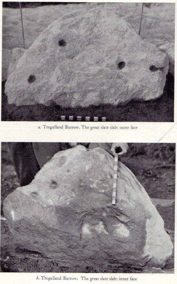
In Paul Ashbee’s (1958) excellent essay on this prehistoric tomb, he described the carvings at some considerable length — which is unusual for an archaeologist of that period — noting them as the “cup-marked and ornamented stones”. I hope that people won’t mind me repeating his lengthy notes on the relevant carved stones found in the tomb, the largest of which was on a big slab near the middle of the cairn that possessed cup-markings “and an ‘eyebrow’ motif”,* (figure 1, above) as he called it. He described the respective carvings as follows:
“From the Cairn-Ring:
1-2. A hog-backed outlined slate slab (figure 1, above). The bottom has a straight worked edge which suggests that the form was deliberate. On the inner face are four close-set cup-marks, and an ‘eyebrow’ device which has been made around a natural flaw, whilst the outer half has been formed by pecking and bashing to remove an appropriate amount of the laminated slate structure to form a depression. On the outer face there are four widely set cup-marks, one being connected by a channel to the edge of the slab…
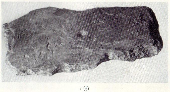
3-4. A roughly rectangular slate slab. The upper face bears two cup-marks, one much smaller than the other, together with one abortive cup-mark, the lower a single cup-mark. Four perforations had been used to remove this slab from a parent block, the halves of these perforations gracing the upper edge. The slab was incorporated in the upper part of the cairn-ring material stacked against the largest of the sub-megalithic blocks of the cairn-ring.
5. The slab is hog-backed in outline, resembling No.1 above in general form. On the upper face, at a right-angle to the straight bottom edge, a channel had been produced by pecking, the marks of a pointed instrument being clearly discernible at the bottom of the channel. This channel extends almost from edge to edge of the slab, being narrow at the bottom and then expanding, being thus wider and then gradually tapering. Were it not asymmetrical it could be considered as a dagger representation.
6. A small block of roughly pentagonal outline, one side being irregular. The device it bears has been made by pecking an outline and removing the intervening laminated slatey rock. Found at the base of the cairn-ring on the south side.
7. A weathered pillow-like lump of a coarse sandstone-like rock. The plane face bears at least seven small ‘cup-marks.’ On other sides there are more weathered and uncertain marks which may well be natural. It was found surmounting, in a central position, the faced walling on the western side of the cairn-ring. Dr F.S. Wallis reports that: “This is evidently a sandstone rock with a large amount of quartz. This is a very generalized rock and I am afraid that it is not possible to tie it down to any particular part of Cornwall. The rock is much weathered and, judging from the print, I should say that the pits are entirely natural. Such a rock would hardly contain fossils and thus the pits could not have an organic origin.”
8. A roughly rectangular slate slab with opposing ‘cup-marks’ broken through before complete perforation. In addition there is a single cup-mark on the upper edge. (see figure 2) It was in the banked stones on the western side of the cairn-ring.
“From the soil bank:
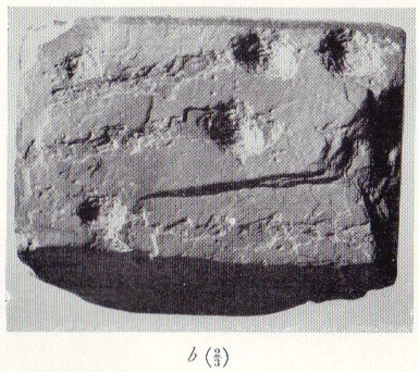
1. An even, rectangular slab bearing a group of three cup-marks in one corner, and single cup-marks in two other corners. (see figure 3) From the outer cup-marks of the group run two channels. A channel runs from one of the solitary corner cup-marks. It was found, cup-marks and channels uppermost, almost exactly above the satellite cremation trench-grave.
2. A roughly triangular slab, bearing on its upper face a single centrally set cup-mark. Found by the cairn-ring in the eastern quadrant.
3. A small slab, of pentagonal outline, bearing a single shallow cup-mark. Found by the cairn-ring in the eastern side.
4. A thin U-shaped slab which has been battered into shape by edge chipping. A concavity has been made along the upper edge.
“From the ditch infilling:
5. A tough, quartz-veined slab with a shallow battered cup-mark. From the western side of the barrow.
6. A small, tough, even, rectangular piece of slate, bearing an abortive cup-mark. From the western side of the barrow.
7. A thin piece of slate bearing a small cup-mark set at a point where laminae of slate have left the piece. From the eastern side of the barrow.
“Unstratified:
All the “unstratified” cup-marked slabs recovered from the central disturbances, both recent and earlier, may well be derived from the destruction of the central grave arrangements.
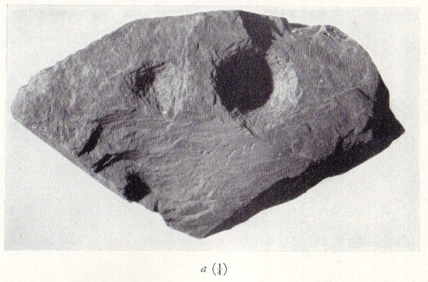
8. A thick lozenge-outlined slab bearing one large cup-mark, and one smaller set side-by-side. (figure 4, above)
9. A roughly square-outlined slab with two cup-marks of even size set across one diagonal. (figure 5, below) One cup-mark has a smaller one close by it.
10-11. Irregular pieces of thin slate, bearing traces of perforations on their edges, one bearing cup-marks.
12. A roughly triangular slab bearing an ? unfinished cup-mark.
13. An even hexagonal slab that appears to have been, by edge trimming, worked into this form.”
Fig.5
The prolific collection of cup-marked stones in this once-impressive monument would probably indicate that the character buried here was of some significance to the local people, both to those who knew him and, evidently, in the subsequent mythologies surrounding the site (click here for the details of Tregullan Burrow barrow if you wanna know the archaeology and structure of the site). And although we find, statistically speaking, a lacking of other cup-markings in this region, it’s more than likely there are others that are hiding away amidst other old tombs and rocks…
References:
Ashbee, Paul, “The Excavation of Tregulland Burrow, Treneglos Parish, Cornwall,” in Antiquaries Journal, volume 38, 1958.
* the eyebrow motif description was used by a number of archaeo’s for sometime following publication of O.G.S. Crawford’s book, The Eye Goddess, to which the Antiquity Journal editor speculated some cup-and-rings may have owed their origin.
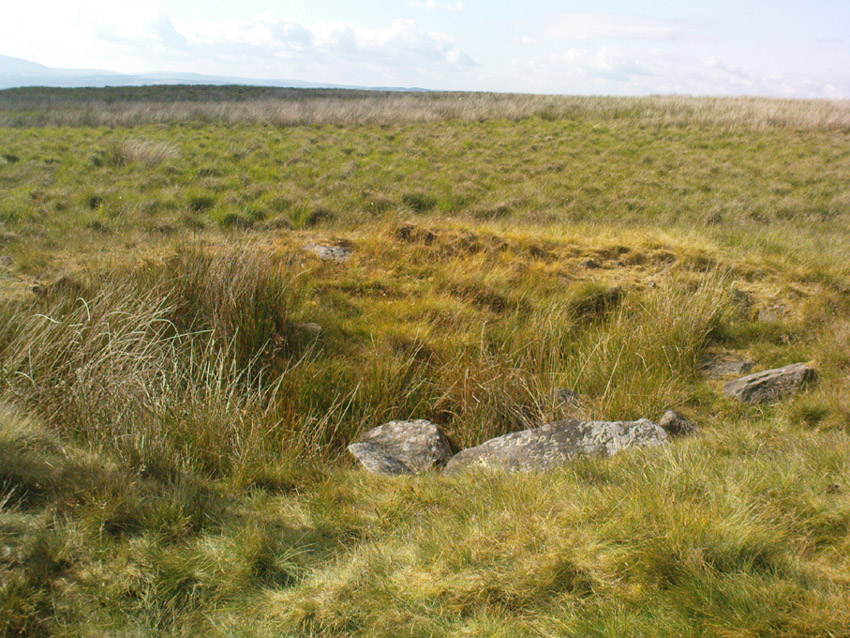
From Sabden, head up the steep Clitheroe Road towards the Nick o’ Pendle, turning left 100 yards before the hilltop and along the dirt-track for a few yards, before veering up the winding footpath to the hilltop. When you’re at the peak of this little bit o’ moorland, go to your left (west), following the small path into the grasses and heather all the way on for a few hundred yards till you hit the triangulation pillar. Go past this, over one stile (north) and then immediately at right-angles (west) over another stile and downhill for about 100 yards until you’re on the rough grassland level. Keep your eyes peeled as you’re walking until you see what looks like a denuded stone-lined pit, much overgrown — with the main feature (showing that you’ve hit the target) being the engraving on one of the larger rocks: “Jeppe Knave Grave”.
Archaeology & History
The Jeppe Knave Grave
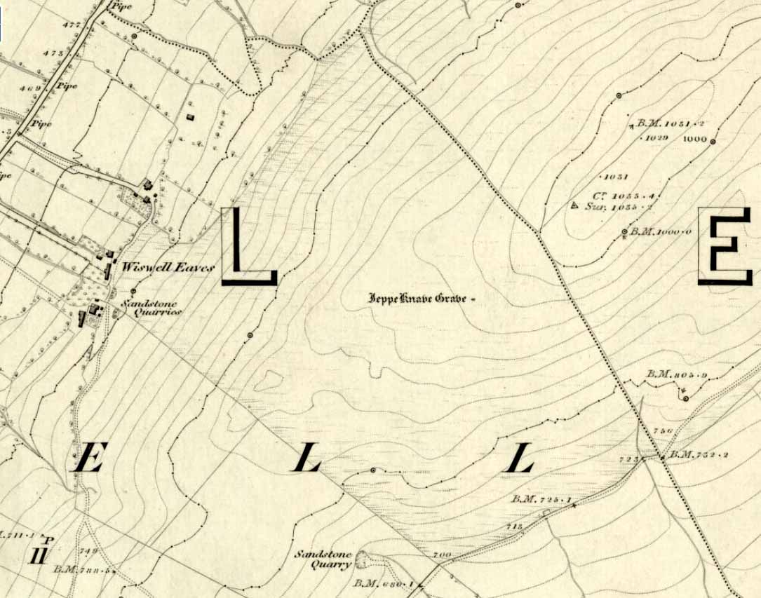
First described in early perambulation records of 1326 CE, this is a small but intriguing site found on the far southwestern slopes of Pendle Hill, on the ridge beneath the triangulation pillar of Wiswell Moor. It’s a small and overgrown cairn with a general archaeological association of prehistory attached—though no detailed excavation has ever been done here, despite local archaeologists having access to a large grant to explore this region a short while ago.¹ But up North, as many of us know, archaeology is given little priority and those who do decent exploratory work under the umbrella of such academic quarters tend to be few and far between. Thankfully we had the northern antiquarian and local writer John Dixon (1993) nearby who gave us the best overview of the site. He wrote:
“This landscape feature, known as Jeppe Knave Grave, stands at a place called The Lows high on Wiswell Moor and takes the form of a low grass-covered mound 16M in diameter with a stone filled depression in the centre 5 x 3 M. This feature appears to be a mutilated cairn and has been tentatively ascribed to the Bronze Age. The outer ring of stones can be discerned in the rough pasture at the perimeter – yellow in dry conditions, showing the circular shape. Given the large size of the stones here, the cairn may have been of a chambered type/passage tomb of the Neolithic period, and if this was the case the burial (or burials?) was one of great importance.
“Upon the largest stone are inscribed the words ‘JEPPE KNAVE GRAVE and a cross (inscribed by the Scouting Association in the 1960’s). The stone marks the final resting place of Jeppe Curteys (Geoffrey Curtis), a local robber who was decapitated for his crimes in the first year of Edward III, 1327. The name first occurs in a record of the boundaries between Wiswall and Pendleton dated 1342.
“…In those times the punishment of decapitation was unusual, being reserved for those of noble birth. So who was this Jeppe Curteys, punished by decapitation and later buried on the high ridge of Wiswell Moor in a pre-Christian burial mound on the then boundary of parishes? That intriguing story we may never know. But to be buried in such a manner and place was indeed a great indignity – interment in what might be considered in those times to be a ‘pagan’ or ‘devilish’ spot. It may be that to bury a man in such a place was to literally ‘send him to the devil’. Alternatively one could ask: ‘Was the site thought then to be the burial spot of some noble ancestor, and Jeppe being of possible noble birth interred with great dignity? Again we may never know, yet it is significant that this lonely spot is still identified with a man who was executed 700 years ago.
In 1608 it was stated that one Robert Lowe had taken a stone from the grave and used it as a cover of his lime kiln.”
Old codgers from the local Senile Society, inspecting York Minster!Agatha Lyons’ 1871 sketch
The design of the cairn here is unlike the ones you usually come across on the Lancashire and Yorkshire moorlands. The edges of the Jeppe Knave Grave are walled and much more well-defined than the large rock piles that we find scattering our uplands. A similar though larger cairn with features similar to these can be seen in the large Low Hill tumulus on Elslack Moor near Earby, about ten miles northeast of here…
Other prehistoric remains scatter the many rolling hills that you can see from here: mainly prehistoric tombs sat upon hilltops as far as the eye can see. John pointed out what may be the remains of another tumulus that can be seen on the nearby horizon a few hundred yards NNW from here, overlooking the gorgeous village of Pendleton and the landscape beyond…
References:
Dixon, John, Journeys through Brigantia – volume 9: The Ribble Valley, Aussteiger Publications: Barnoldswick 1993.
Whitaker, Thomas Dunham, An History of the Original Parish of Whalley – volume 2, George Routledge: London 1876.
¹ John Dixon informed us how the people in question spent the grant — somewhere in the region of £50,000 — on exploring some modern architectural features, instead of exploring some of the little-known sites and seeking out others on these hills.
* John is the author of many fine historical travel guides, including the Journeys through Brigantia series. See the titles in the Lancashire Bibliography and Yorkshire Bibliography for a more complete listing of all his books to date. If you wanna buy any of his works, or make enquiries regarding them, email John at: lancashirebooks@fsmail.net – or write to him direct, at: John Dixon, Aussteiger Publications, 21 Lowergate, Clitheroe, Lancashire BB7 1AD.
From Sabden village, walk up the Clitheroe Road towards the hairpin Nick o’ Pendle, but take the turning left 100 yards before the Nick. Walk along the dirt-track for less than 100 yards, watching for the small upright on the right-hand side of the track. You can’t really miss it!
Archaeology & History
The Coffin Stone
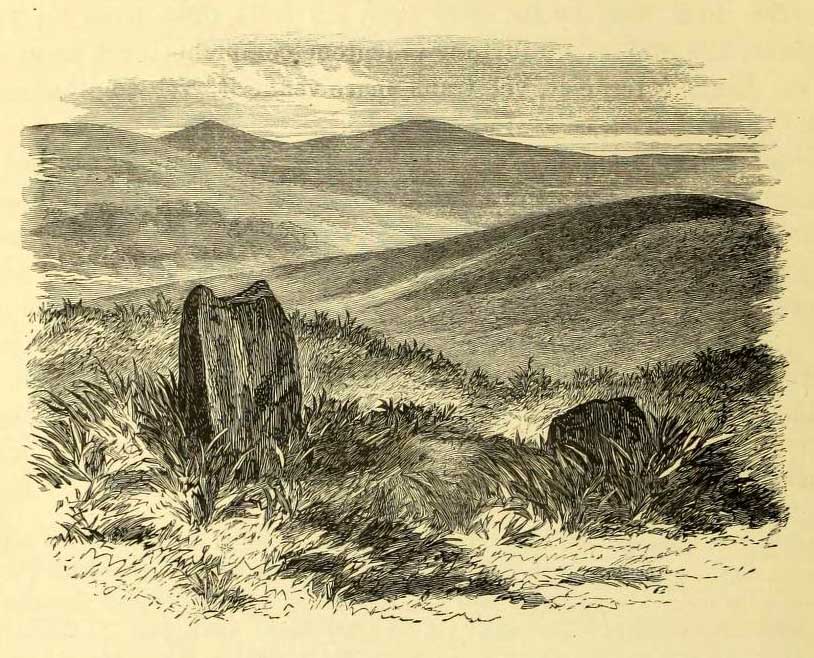
To be found on the far southern flanks of Pendle Hill, the Lancashire writer and historian, John Dixon,* brought us to this little-known stone a few days back — and gave us the history of the place. (Dixon 1993) He pointed out how it’s situated right alongside the legendary cross-Pennine prehistoric route that was labelled ‘Rombald’s Way’ by Eric Cowling. (1946): an important trackway which ran from coast to coast, allowing for the passage and transmission of flints, salt and early metals carried for barter and other uses. What may be another standing stone is on the nearby skyline a couple of hundred yards east; and on the slopes either side of here are the prehistoric tombs of Jeppe Knave Grave and the Devil’s Apronful (amongst others). A fine little standing stone!
Folklore
The name derives from it being a place where, in bygone days, when coffins were carried along the ancient routeway hereby, it was rested by this stone. As John Dixon (1993) told:
“It was used to mark a resting point for coffins en route from Pendle Forest to Whalley, allowing the mourners to refresh and pray by the curative Marion well, in a time before the ‘Newchurch’ of St. Mary was established at Goldshaw Booth in 1544.”
…and from another angle
The Marion Well he mentions is more popularly known as Our Lady’s Well and can be found a hundred yards up the hillside above our Coffin Stone. If you walk up the slope you’ll see the site emerging where a small boggy pool appears on the hillside, and the course of the small stream marked by the reeds growing down the grassy slopes. Although it became very much a Roman Catholic practice to venerate the Virgin Mary by this old well, the ritual was of course a much older heathen one.
John has also reminded me to mention “the fossil markings on the side of the stone – some plant from a former age” which you can see curving up from the bottom of the upright.
References:
Cowling, Eric T., Rombald’s Way: A Prehistory of Mid-Wharfedale, William Walker: Otley 1946.
Dixon, John, Journeys through Brigantia – volume 9: The Ribble Valley, Aussteiger Publications: Barnoldswick 1993.
* John is the author of many fine historical travel guides, including the Journeys through Brigantia series. See the titles in the Lancashire Bibliography and Yorkshire Bibliography for a more complete listing of all his books to date. If you wanna buy any of his works, or make enquiries regarding them, email John at: lancashirebooks@fsmail.net – or write to him direct, at: John Dixon, Aussteiger Publications, 21 Lowergate, Clitheroe, Lancashire BB7 1AD.
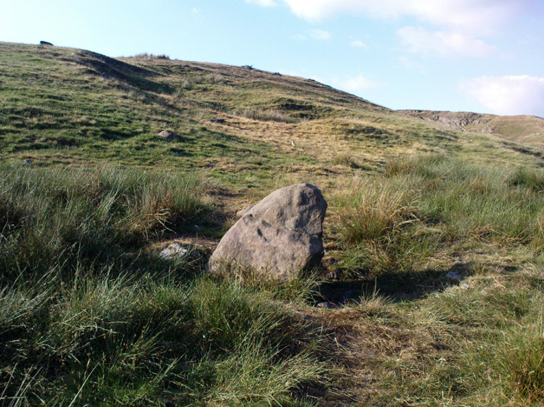
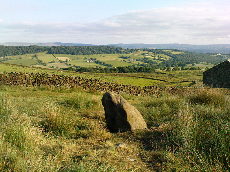
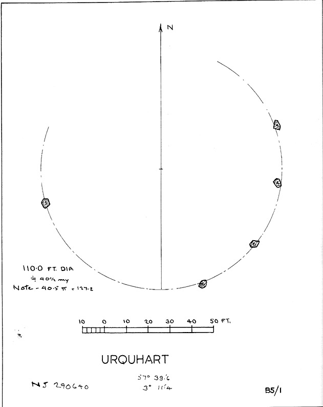
Described in early local history journals, this stone circle of many names is composed of mainly small upright stones — though one of them stands nearly six feet tall — yet it has quite a large diameter of 110 feet (or 40.4 megalithic yards). Alexander Thom (1980) measured its circumference as being precisely 127 megalithic yards. It is thought to have originally consisted of twelve stones, but today only five remain. And in a landscape where recumbent stone circles reign supreme, Aubrey Burl (in Thom, Thom & Burl 1980) thought the lay-out of the site suggestive of just such a monument, saying:
“The apparent grading of the stones towards the S-SSW and the 19th century reference by the Minister of Urquhart to “nine tall stones in a circle, two of them at the entrance to the altar” suggest that this may have been a recumbent stone circle, from which the recumbent and its flankers have subsequently been removed. It is noteworthy that the westernmost stone has several small cupmarks on it, a pillar which would have been close to the recumbent in that restricted area where cupmarks are to be found in recumbent stone circles.”
A singular TNA profile entry of the said cup-marked stone will be added in due course. The middle of the circle was dug sometime prior to 1870, but no human or other remains were found.
Folklore
Described by two local ministers as ‘Nine Stanes’ back in Victorian days, with at least one of the stones being recumbent, it was the great Fred Coles (1906) in one of his many articles on the megalithic remains of Scotland who narrated the following tale, told to him first-hand by a local man called Mr T. Geddie, after some of the standing stones from this circle were removed in the nineteenth century.
“One of the stones,” wrote Mr Geddie, “was to be taken away to be built into a new steading at Viewfield. Mr Brown thinks this was prior to the building of the Innesmill steading, which dates from 1843. No sooner had the Stone been deposited in the toon, however, than uncanny signs and omens began to manifest themselves, and it was resolved to get rid of it. While it was being taken back to its original position, the horse stuck or fell when taking a somewhat steep little brae, and the Stone was taken no further, but buried where it was. The spot it about 80 or 100 yards from the circle.”
Grinsell (1976) also tells the tale that if you visit the circle at midnight and walk round the circle three times, the devil can appear.
References:
Coles, F.R., ‘Report on Stone Circles Surveyed in the North-East of Scotland, Chiefly in Banffshire’, in PSAS 40, 1906.
Grinsell, Leslie V., Folklore of Prehistoric Sites in Britain, David & Charles: London 1976.
Thom, A., Thom, A.S. & Burl, Aubrey, Megalithic Rings, BAR 81: Oxford 1980.
Although there are several routes to this site, for those who are not used to walking or find maps difficult to read [get a life!], it is best approached from the Ilkley side of the moor. Follow the old track that cuts the moor in half past the remains of Graining Head quarry where the moor begins to level out. Once here cut straight east until you find the footpath which, after a while, you will see leads to a wooden seat right in the middle of nowhere. Here is our Badger Stone.
Archaeology & History
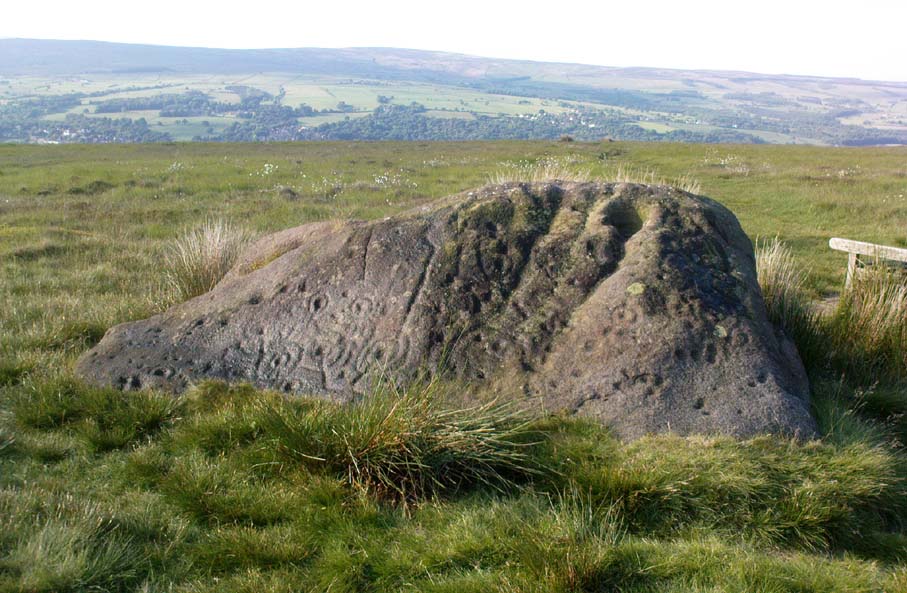
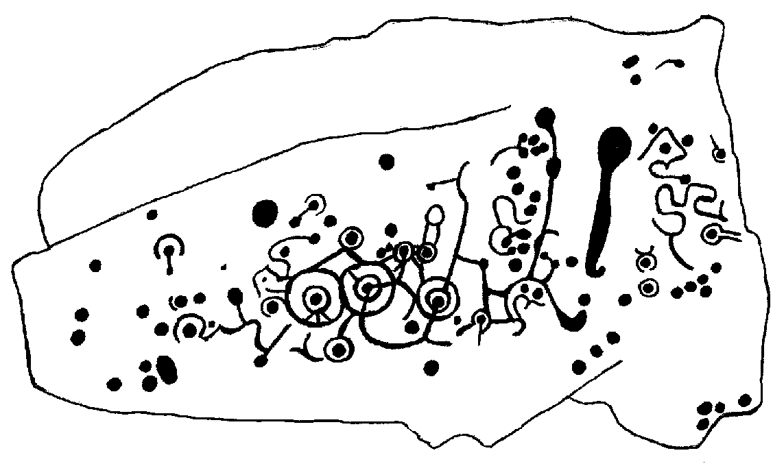
An eroded but quite excellent cup-and-ring stone — one of the very best on Ilkley Moor — comprising nearly a hundred cups, ten rings, what seems to be a half-swastika design, plus a variety of other odd motifs. It’s one of the best carvings on the entire moor and has been written about by many folk over the years. First described in an early essay on cup-and-ring stones by J. Romilly Allen (1879) — who must have visited it in poor light, as some elements of the carving weren’t noticed — he described it as a “sculptured stone near Grainings Head”, saying:
“This stone…is a block of gritstone 12ft long by 7ft 6in broad, by 4ft high. The largest face slopes at an angle of about 40° to the horizon, and on it are carved nearly fifty cups, sixteen of which are surrounded with single concentric rings. At the west end of the stone are a group, three cups with double rings and radial grooves. At the other end, near the top, is a curious pattern formed of double grooves, and somewhat resembling the “swastika” emblem… At the highest part of the stone is a rock basin 8in deep and 9in wide. On the vertical end of the stone are five cut cups, three of which have single rings. This is one of the few instances of cup and ring marks occurring on a vertical face of rock.”
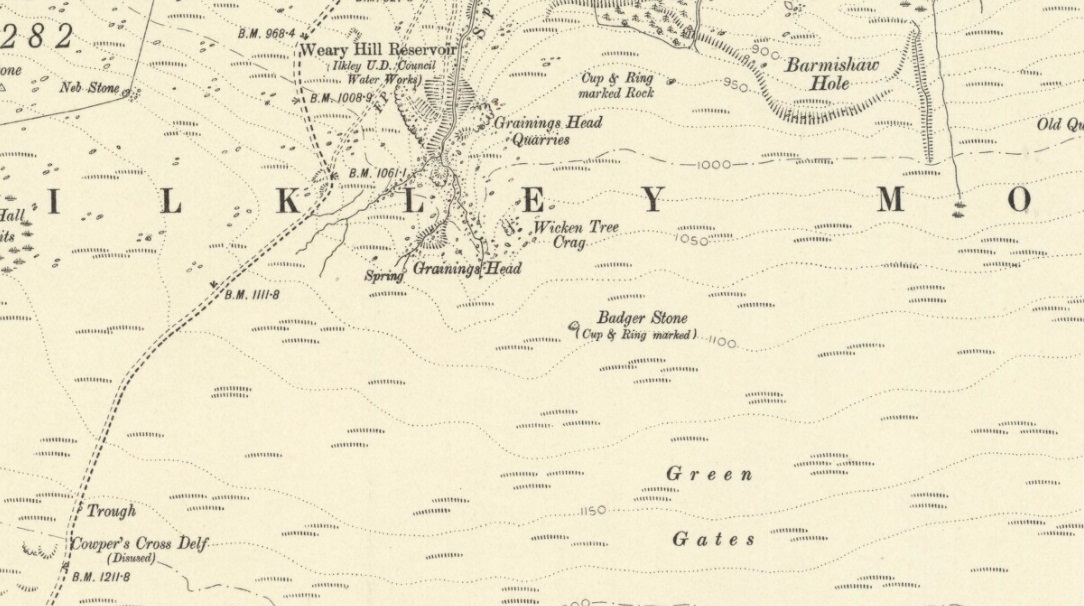
Badger Stone on 1910 map
The title “badger” dates back to at least medieval times when, as the Yorkshire historian Arthur Raistrick (1962) explained, the word represented “a corn dealer, corn miller or miller’s man.” It is likely that this traditional title goes much further back, probably into prehistory, as grain was one of the earliest forms of trade. Very close to this sacred old stone are place-names verifying this, like Grainings Head and Green Gates. A little higher upon the moor is the twelfth century Cowper’s Cross (which used to have cup-markings etched upon it) where, tradition tells, a market was held that replaced an older one close by.
The Badger Stone carvingClose-up of cup-and-rings
Our Badger Stone rests beside the prehistoric track which Eric Cowling termed “Rombald’s Way” (after the legendary giant, Rombald, who lived with his old wife upon these hills): an important prehistoric route running across the mid-Pennines. This ancient route runs east-west, traditionally the time of year when agricultural needs are greatest at the equinoxes. This may have been the time when any ancient grain traders met here. (In modern times a number of archaeologists have emphasized such routes as “trade routes”: a notion that derives from the modern religion of Free Market Economics in tandem with the rise of Industrialism and social Darwinism, much more than the actuality of them as simple pathways or means of accessible movement).
There are accounts from other places in Yorkshire about these badger men. We find a number of other “badger” stones, gates, ways, stoops and crosses on our Yorkshire hills. One of them in North Yorkshire, wrote Raistrick (1962), “is an ancient trade way.” In Richmond, North Yorkshire, around the time of the autumn equinox, Badger men from across the Dales followed the old routes over the hills into town, held annual festivities and sold their grain. (see Smith 1989; Speight 1897) It is perhaps possible that our old Badger Stone would have been a site where some form of indigenous British Demeter was revered.
Sketch of Badger Stone carving
Some elements of the Badger Stone carving have what could be deemed as primitive human images (anthropomorphic) mainly on the northwestern side of the rock, emerging from the Earth Herself. And certainly amidst the same portion we have a very distinct ‘solar’ symbol, very much like the ones found at Newgrange and, for that matter, many other parts of the world.
Some New Age folk have given the fertility element to the Badger Stone a deeper status, using imagination as an aid to decode these old carvings. When feminist New-Age writer Monica Sjoo visited Badger Stone she described it as “erotic”, with the carvings giving her a distinct impression of “vulvas” and she also thought orgies of sorts had been enacted here. (Billingsley & Sjoo, 1993) The vulva imagery is a well-known idea to explain cup-and-rings and in some cases this will be valid; but when I passed an illustration of this rock-art to a number of people (all women), there was not a vulva to be mentioned — merely the OM symbol, sperm entering the egg, a snail, a bicycle, a willy, a paw-print, eyes, a face, a tadpole, cartoon breasts, the rear end of a dog, grapes, letters, numbers, ears and a snake! Awesome stuff! Take a look at the design yourself and see what you can see in it. Answers on a postcard please! (The dilemma of making specific interpretations of these carvings is that we tend to approach them with dominant ego perspectives, many of them reflecting little more than our own beliefs or search for identity, imposing unresolved journeys and conflicts on that which we encounter, as with the above case.)
As with prehistoric rock-art in general, they are a number of things: functional, ritual, history, spirit; different at each and every site. As if to exemplify this at Badger Stone, note how the detailed carvings have been executed mainly on the southern face of the stone. The northern face has little if anything to show on it. It would suggest therefore, that this stone had some mythic relationship with events during daylight hours. But we have to be careful here…
At sunrise on a good morning, we note how the eastern edges of this stone show up very clearly indeed. If Nature’s conditions are damp and wet (as they tend to be each morning on the hills), the visible outline of these cup-and-rings show up very clearly indeed. Oddly, as the sun then passes through the daytime sky each and every day on its cyclical movement, the petroglyphic content becomes a little less visible unless the stone is wet. Indeed at sun-high (midday period) the carving doesn’t show up as well as it did in the morning light. And we find the same characteristic as the sun goes to set in the west: where that part of the carved stone shows up very clearly again — much clearer than during full daytime hours. If rain has fallen, the glyphs stand out very clearly indeed.
As all cultures imbued the natural world with animistic, living qualities, it seems probable that these periods of the day (sunrise and sunset) were significant at this particular carving. It may be, very simply, that the Badger Stone “came to life” with the sunrise and its mythic nature was alive during this period; whereas with many other carvings (both on these moors and elsewhere in Britain) their strong mythic associations related to the northern Land of the Dead. But then, I could be talking bullshit!
The Badger Stone is also a strong contender for it being a painted stone. Many petroglyphs like this in other cultures were ceremonially coloured-in using lichens and other plants dyes at certain times of the day or year, relating specifically to important mythic relationships between the people and the spirit of the rock at such places. This probably occurred here.
References:
Allen, J. Romilly, “The Prehistoric Rock Sculptures of Ilkley,” in Journal of the British Archaeological Association, volume 35, 1879.
Bennett, Paul, The Old Stones of Elmet, Capall Bann: Milverton 2001.
Billingsley, John & Sjoo, Monica, “Monica Sjoo in West Yorkshire,” in Northern Earth Mysteries, no.53, 1993.
Boughey, Keith & Vickerman, E.A., Prehistoric Rock Art of the West Riding, WYAS: Leeds 2003.
Hedges, John, The Carved Rocks on Rombald’s Moor, WYMCC: Wakefield 1986.
Cowling, Eric T., Rombald’s Way, William Walker: Otley 1946.
Raistrick, Arthur, Green Tracks on the Pennines, Dalesman: Clapham 1962.
Smith, Julia, Fairs, Feasts and Frolics: Customs and Traditions in Yorkshire, Smith Settle: Otley 1989.
Speight, Harry, Romantic Richmondshire, Elliot Stock: London 1897.
Take the road from Ilkley town centre up towards the White Wells and keep following it along until it curves up and onto the moor itself and becomes a rocky dirt-track. Go up here, past the old quarries (left) until you hit the footpath which runs east (left) onto the flat level of the moorland. Follow this footpath along for literally half-a-mile, where a footpath runs up onto the tops of the moorland. Go up here for 100 yards and you’ll see a small standing stone by the right-hand side of the footpath; on the left, into the moorland about 20 yards away, this carving is to be found!
Archaeology & History
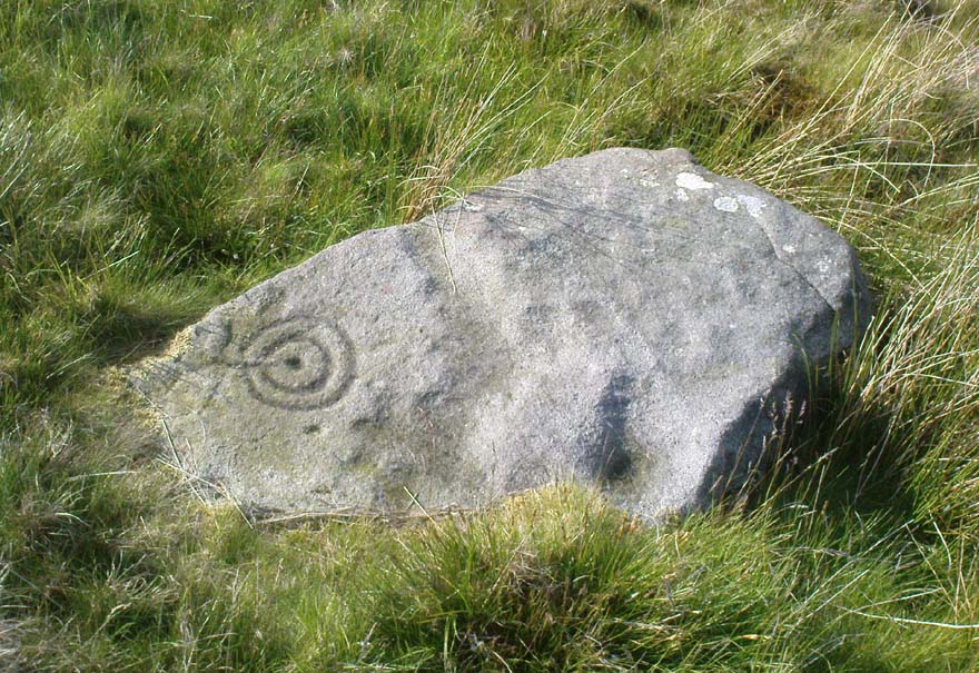
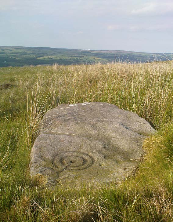
This is an excellent, archetypal cup-and-ring stone carving and is in a very good state of preservation. Found just a few yards away from the aptly-named Pitchfork Stone, the carving here on a large single stone mainly comprises of a double cup-and-ring. A couple of other possible outlying cup-marks can be seen: one just below the double-ring, and the other towards the top-end of the rock. It was first reported by Stuart Feather in the Bradford Archaeology Group’s journal in 1961, then listed in the surveys of Hedges (1986) and his followers.
Carving 257, looking NE
When Michala Potts, Dave Hazell and I we visited this carving the other day, some halfwit had been up here in the not-too-distant past and, as with some of the carvings on the moors north of Ilkley, had daubed some paint or oily resin onto the carvings themselves to specifically highlight aspects of the carved rock (not one part of the uncarved stone had anything on it). We aint quite sure exactly what the substance is that’s been daubed onto the carvings (it aint ordinary paint), but seems like an oil or industrial substance. And, whoever’s done this, obviously seems to have some knowledge of the rock art they’re painting over: they certainly have good grid-references and enjoy walking the hills. This aint just some idiot/s into vandalizing the carvings for the sake of it, nor the whim of some airy-fairy New-Ager. Whoever’s done this (and it’s been done on other cup-and-rings around this locale) have deliberately set out to locate and paint over specific carvings — a number of them off-path — with the intention it would seem to highlight them for photographic enhancement. So — whichever retard has done this, might I suggest that you keep your industrial waste where it belongs: in your own house you fucking moron! If anyone knows who is doing this to the carvings round here, please email me (anonymously if necessary) with all relevant info. Any such communications regarding this matter will be kept strictly confidential.
References:
Boughey, Keith & Vickerman, E.A., Prehistoric Rock Art of the West Riding, WYAS: Leeds 2003.
Hedges, John, The Carved Rocks on Rombald’s Moor, WYMCC: Wakefield 1986.