Tumulus (destroyed): OS Grid Reference – SE 0095 2748
Archaeology & History
Up behind the old pub that was The Mount Skip, high on the ridge above Hebden Bridge and Mytholmroyd, overlooking the Calder Valley for many miles, was once — it would seem — a number of fine prehistoric remains, long since destroyed by the industrial advance of quarrying and such likes. Amidst what seems to have been settlement remains and, perhaps, timber circles, an ancient grave was also known here. In Mr Ling Roth’s (1906) essay on the prehistoric remains of the Halifax region, he wrote:
“In May, 1897, a grave was discovered at a quarry above Mount Skip Inn. The first indications were the rolling down of pieces of urns which the delvers called flower pots. Then in digging into a hole to fix the leg of a crane, human bones were discovered, Mr Crossley Ainsworth told me: “The grave was about 6ft (1.8m) long, from 14 to 18in (35-45.7cm) wide and about 2ft (61cm) deep…the head and feet were almost exactly north and south, with the face right towards the midday sun.” The bones were very brittle and crumbled easily in the hand. There was a lot of charcoal in the grave. In the ends of the grave which were undisturbed, “there appeared to be about 6in (15cm) thick of charred wood and bones mixed together at the bottom. Flints were also found. Also the larger half of a small earthenware vessel which had rolled down into the quarry ; this was picked up by a man named Thos. Greenwood, of Shawcroft Hill.”
The site was mentioned again nearly fifty years later in Geoffrey Watson’s (1952) survey, but with no additional details.
References:
Roth, H. Ling, The Yorkshire Coiners 1767-183; and Notes on Old and Prehistoric Halifax, F. King and Son: Halifax 1906.
Watson, Geoffrey G., Early Man in the Halifax District, Halifax Scientific Society 1952.
This little known site, long since destroyed during the construction of Keighley Railway Station, was found in a curious spot, close to the bottom of the Aire Valley. Most (known) prehistoric burials occur on the higher grounds in this area. And though we don’t appear to have the exact location of the find, it was pretty close to either side of Keighley’s old railway station (which is shown as 100 yards to the other side of the road of the present station on the 1852 OS map). This may position the site as being on the grounds opposite and below St. Anne’s Church; otherwise it was getting closer to where the River Worth runs by. In Keighley & Holmes’ early (1858) work they told that,
“Whilst excavating for the Railway within about a hundred yards of the Keighley station, one of the labourers discovered three urns containing a quantity of human bones. Two of them were unluckily broken, one being large enough to hold eight or nine quarts. The one brought away whole, and seen by the present writer, may hold about a quart; it is somewhat distastefully designed, moulded by hand out of the common clay, without glaze, and rudely ornamented on the outside by some sharp implement. The once animated contents of each urn were covered by a square flat stone.”
This final remark seems to indicate the urns were located in a cist (a small stone grave), but we don’t know whether this was found within the remains of a denuded tumulus or stone cairn. However, considering the lack of any remarks about a large pile of stones (which would have been very noticeable) covering this burial site, it would seem more probable that this site was originally an earth-covered tumulus, whose visibility and knowledge had long since diminished in this part of Airedale.
References:
Keighley, William & Homes, Robert, Keighley, Past and Present, R. Aked: Keighley 1858.
Cursus Monument (destroyed): OS Grid Reference – TL 735 084
Also Known as:
Springfield Barnes Cursus
Archaeology & History
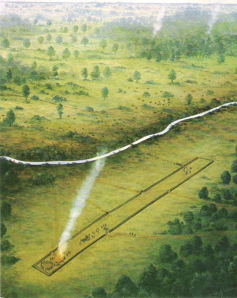
The first cursus monument discovered in Essex, archaeologists were fortunate when they came to excavate the site in 1979 as they found it almost complete. A rarity these days! Close to the Springfield Lyons causewayed enclosure monument, the cursus here was some 45 yards across and 750 yards long. Like a number of other cursuses, the Springfield one was dead straight all the way down, running northeast to southwest with squared terminii at both ends. (of the Bi category, as Loveday called them) And it appears to have had quite a long period of use.
Springfield Cursus (painting by Frank Gardiner)
The ditch that constitutes the very outline of the cursus — averaging between 3-4 feet in depth all round — was cut into the earth in the neolithic period. It had small ‘entrances’ at certain points along its longer axis, both on the east and west sides. The flat ends of the cursus were both ‘closed’, without entrances or breaks of any kind. Some depositional remains were found scattered at different spots along the course of the ditch: neolithic pottery and flints in both the northern and eastern ditches, but archaeologists were unsure whether these deposits were left at the time the monument was in use, or at a later period — though it seemed consensus opinion that the deposits were from a period when the cursus was in use. Charcoal remains were also found, but these were associated with an internal timber circle that was erected within the northeastern end of the cursus. The timber circle was found to have consisted of 14 upright wooden posts arranged in a near-complete ring, some 26 metres in diameter. It seems highly likely that this part of the monument had some ritual or ceremonial function relating to the dead (“mortuary practices” is the term used at the moment!).
Later excavation work here in 1984 found there to be various other linear and pit-like features within the confines of the monument, and what seemed to be the remains of a barrow beyond its eastern end.
Archaeologist David McOmish (2003), thought that “alignment is also significant,” saying that the “Springfield Cursus, 700 metres long, is aligned on a smaller enclosure some 300 metres away.” The alignment potential here was first suggested by Pennick & Devereux (1989), albeit pointing “to the village of Wexford just over two miles to the southwest.” McOmish also suggested there may have been some an astronomical reason for the alignment of the monument NE-SW, but I’m not aware whether this has been explored further.
The creation of these huge monuments had obvious relationships with human death rites, the spirits of trees, and celestial gods. But much more research is needed at these sites if we’re to find out more about the nature of these prehistoric giants in the landscape.
References:
Buckley, D.G., Hedges, John & Brown, N., “Excavations at a Neolithic Cursus, Springfield, Essex, 1979-85,” in Proceedings of the Prehistoric Society, volume 67, 2001.
Hedges, John D. & Buckley, D.G., Springfield Cursus and the Cursus Problem, Essex County Council 1981.
Loveday, Roy, Inscribed Across the Landscape: The Cursus Enigma, Tempus: Stroud 2006.
McOmish, David, ‘Cursus: Solving a 6000-year-old Puzzle’, in British Archaeology, 69, March 2003.
Pennick, Nigel & Devereux, Paul, Lines on the Landscape, Hale: London 1989.
In the superb work of the legendary J.R. Mortimer (1905) he tells what was found when him and his team excavated this “remarkable barrow,” as he called it. Although Mortimer’s contemporary researcher, Canon Greenwell (1877), also looked at the site, the “mound was covered with a clump of old fir trees” which prevented further examination at the time. Mortimer and his team seemed to have worked here when the trees had been felled and following “a three-week free use of the pick and shovel during July and August, 1878,” they opened up this prehistoric mound to see what lay within.
Their discoveries here were intriguing: for this wasn’t merely a burial site in its early phase but, moreso, a house of the dead no less, where the people whose bodies, or those who cremated ashes were deposited herein, lived in their spirit-life. It was an abode for the spirits of the dead. Mortimer’s lengthy notes tell the story:
“At the time of opening, it measured 4½ feet from base to summit, and the natural surface of the ground beneath it stood fully 1 foot higher than the present surface of the land for some distance round its margin. It was formed entirely of chalk rubble and soil, mainly obtained from an encircling trench, which on the northwest side was very deep and wide.
“We turned over the whole of this mound except its outskirts. Near the northwest margin there was an excavation (D on the plan) extending 8 to 10 inches below the base of the mound, and measuring 8½ feet by 6½ feet, the floor of which was covered with a film of dark matter, in which were small bits of burnt wood. No relic, nor the slightest trace of an interment was observed. A little west of the centre (at B) there was s still larger excavation, 18 inches deep. It contained rough chalk, but no traces of an interment. East of this was a third excavation (E), oval in form and 3 feet deep. Like the previous one it was filled with chalk and contained no relic or trace of a skeleton. The digging of these had preceded the erection of the mound, as there were no indications of it having been cut through. These excavations were doubtless graves, the bodies having entirely decayed.
“This was not, however, the case with the secondary and comparatively recent interments of six adult skeletons, found at the south-east side of the mound, 1 foot to 2 feet below its base. Though unaccompanied by any relic, the very narrow form of the graves and the extended and slightly flexed position of the interments alone showed them to be Anglo-Saxons.
“Below these secondary graves was an older and far more interesting excavation. Its form and position is shown on the plan at A. At first it was thought to be a huge grave, but as the work proceeded appearances indicating it to have served some other purpose were visible. Its filling-in was peculiar. It consisted of broken chalk, surface soil, and burnt wood, presenting altogether a very unusual arrangement. Along its centre for a distance of about 15 feet were six carbonized uprights of wood, 6 to 9 inches in diameter, at about equal distances and in a row. Wood ashes were also found on the sides and bottom, and scattered in the material filling the excavation.
“Also along the centre many of the large flat pieces of chalk stood on their edges, and at various depths were portions of animal and probably human bone, burnt as well as unburnt, and many fragments of a reddish urn. It was observed that the east end of this excavation became narrower and shallower. It now seemed evident that it was a habitation. Its form, as shown on the (above) plan, was oblong, with a ground floor 25 feet by 4½ feet; and its greatest depth was 6 feet. To its east end was a passage 11 feet long, gradually sloping to the surface.
“”On the south side, commencing at the inner end of the passage and extending inwards for about 12 feet, was a ledge or rock-seat, about 13 inches above the opposite side of the floor, as shown by the dotted lines in the plan and section. The whole width of the floor at the south-west end, for a distance of about 6 feet, was 10 to 12 inches above the centre and lowest part of the floor. The roof of the cave had most probably been formed of horizontal timber, supported by strong uprights of the same material, and then covered with a mound of earth and stones. The roof eventually gave way and the superincumbent earth and stones slid into the dwelling, several of the large flat stones…remaining on their edges.
“The abundance of wood ashes affords unquestionable evidence of the dwelling having been burnt. The preservation of the remains of the six uprights was due entirely to their having been completely charred. The fragments of red pottery are quite plain and belong to three or more vessels, which were probably used for domestic purposes.
“The roof of the cave must have fallen in long previous to the Anglo-Saxon interments, as where the skeletons were found, partly over the cave and partly upon the undisturbed rock, not the slightest distortion was visible, which would have been the case had not the filled-in portion under the bodies become firm. Near the south-side of the dwelling, at about the base of the mound, were several broken human bones and pieces of a dark-coloured urn. Probably these belonged to a disturbed Anglo-Saxon burial.
“We also found in the mound, between the graves E, B, D, a considerable quantity of detached animal and human bones; the latter indicated three or more individuals; a few of the bones showed traces of fire. There were also several small pieces of a dark plain urn.”
Mr Mortimer then commented on the unusual ‘habitation’ section within the mound, not thinking that the dead themselves “lived” here! But we can forgive him this small detail as his work in general was superb. The site was of course a decent East Yorkshire chambered tomb, wherein the dead were laid and, if entrance was ever possible by our tribal ancestors when it was erected, would have paid homage the ancestral figures buried here. Traditional death ceremonies were pretty inevitable I’d say.
References:
Mortimer, J.R., Forty Years Researches in British and Saxon Burial Mounds of East Yorkshire, Brown & Sons: Hull 1905.
Follow the directions to reach the Dumpit Hill A circle. From here walk about 100 yards ENE till you see an arc of small upright stones. If the heather’s in full growth it’s highly unlikely you’ll see anything; but if the heather’s been burnt away, the site’s worth looking at.
Archaeology & History
As with the small companion Dumpit Hill A circle more than 100 yards to the southwest, this site of similar dimensions was first reported by Arthur Raistrick in 1963, and then described — albeit briefly — in H.G. Ramm’s “Yorkshire Archaeological Register” for 1964, as “33ft in diameter. One third of the circle robbed but other stones standing.” And apart from that (with a repeat of the same info in Burl’s [2000] magnum opus) little else has been said. But there’s quite a bit more to this place than what our mentors have written…
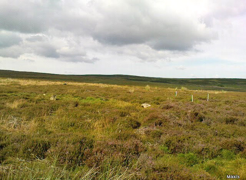
Northern arc of circle, with stones A, B, C & DDumpit B Stone Circle (white sticks showing position of stones)
In a team visit to the site last week, it was Paul Hornby who called our attention to Dumpit Hill B. Thankfully the heather had been burnt back several months earlier, fortunately allowing us a better assessment of the place than Mr Raistrick’s initial survey forty years ago. Instead of just the 3 stones that he found here, we uncovered a near-complete ring of eight stones, arranged in a pretty decent circle (Alexander Thom would have classed it as a Type 1 circle). Paul’s attention was first drawn to an arc of three obvious upright stones and another laid down along the same arc. This arc then turned out to be a semicircle when he found another stone laid half-covered in the peat.
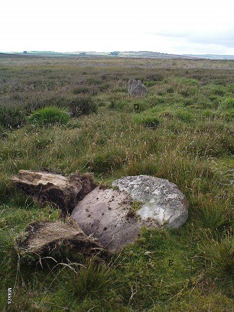
Western stones D & EStone F
But then it seemed, if this was an authentic stone circle, we were gonna struggle to see the rest of it as the deep heather had grown up over the southern side of this semi-circle of stones. But thankfully, with just a little bit of stomping on the ground in the right areas, three other stones of similar size and stature were located and within just a few minutes this small arc of stones had become a full prehistoric ring — except perhaps on the eastern side, where there was a distinct gap in the monument. Michala Potts and Paul did come across a couple of stones in this “missing” section, but they were just small rocks and didn’t account for an expected 9th stone. If such a stone ever stood at this eastern point in the circle, it remains unfound.
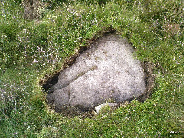
Two of the stones (G & H) that were initially covered in heather, after we’d carefully peeled the vegetation back, had what seems like small packing stones at one end, where it seemed obvious they had stood upright. It was tempting to carefully stand each stone back up into position, but we managed to overcome the temptation! None of the stones are higher or longer than 3 feet. At least three of them seemed to have been set along their longer axis rather than being set in the tall upright position — but again, this needs verifying by excavation. (With good evidence, some students posit that upright stones are male; rounded, wider stones are female — though such a lay-out here seems unlikely)
Stone GStone H
An additional curiosity was found in the middle of the circle, where there was a small but distinct scattering of stones, very much like a denuded cairn. If this turns out to be the case (as seems likely) it’d mean a new classification for this monument. We could do with having another look at this place the next time the heather’s been burnt away, enabling us to find out more about its nature and function.
…And if you walk west down the slight slope, over the couple of small drainage-ditch streams (which they really should stop cutting into our moorlands) and then up the slight slope towards the trackway, stopping some 20 yards before it, you’ll find you’ve walked right into the middle of a previously undiscovered Bronze Age enclosure, or settlement: the Dumpit Hill enclosure. It’s pretty impressive aswell! (more on that in due course)
References:
Burl, Aubrey, The Stone Circles of Britain, Ireland and Brittany, Yale University Press 2000.
Ramm, H.G., “Yorkshire Archaeological Register, 1964,” in Yorkshire Archaeological Journal, part 163, 1965.
ACKNOWLEDGEMENTS: Huge thanks again to Dave Hazell, Paul Hornby and Michala Potts in seeking out & helping with this and the adjacent sites!
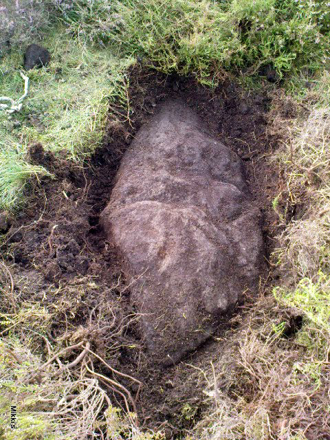
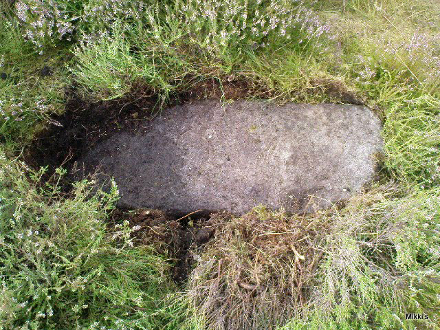
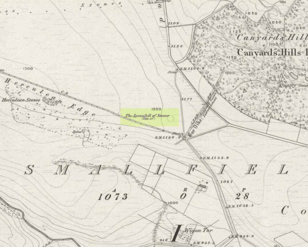
This was another example of the many giant cairns that scatter the upland moors on the Pennines, but much of it has been destroyed, with some halfwits in recent years cutting a track right through whatever remains there might have been! It was first described in John Watson’s (1776) essay on the local antiquities of Bradfield and district where, in relative conjunction with the curious Bar Dike, he told that “this is not the only curiosity on this common.” He continued: “there is on one part of it a large carnedde, called by the country people the Apron-full of Stones”, where he conjectured there laid a British tribal chief after he’d been slaughtered by the Romans. This might have been the folklore of the place, but we know such places were thousands of years earlier than the Romans.
It was later described in Joseph Hunter’s Hallamshire (1819) as a giant barrow, or ‘vast carnedde’, even then in the past tense; but some recent investigation here found “a few small stones and some lumpy turf which looked to be covering a few clumped stones.” The site requires further investigation by local people to assess the state of damage inflicted on this once great tomb.
Folklore
Said to have been the site of a local battle in ancient times; this is also another site which, as A.H. Smith (1961) tells, “is explained in folklore by tales of the devil undertaking some major building project and tripping up, only to deposit his apronful of stones” here. Does anyone out there have any more info on this place?
References:
Hunter, Joseph, Hallamshire: The History and Topography of the Parish of Sheffield in the County of York, Lackington: London 1819.
Smith, A.H., The Place-Names of the West Riding of Yorkshire, Cambridge University Press 1961-63.
Watson, John, “An Account of some Hitherto Undescribed Remains of Antiquity”, in Archaeologia, volume 5, 1776.
Many ways to get here, but you’ve gotta amble off-path through the woods to eventually find it — but it’s not difficult. From Kilmartin village head to Slockavullin and walk up the winding track which takes you towards the Ballygowan cup-and-ring stones, but follow it into the woods instead. The OS-map’s gonna be your best guide here. I first visited this spot from the south and ambled about, aimlessly at times for several hours, after I’d first been to the great ruined mansion of Poltalloch. Well worth checking out if you enjoy finding allsorts!
Archaeology & History
The old tomb is actually a few hundred yards beneath the small rocky summit of Barr a’ Chuirn, with the overgrowth of the woods imposing itself upon it. The Scottish Royal Commission report (1988) told that there was a large seat built here in the 19th century called the Lady’s Seat, and actually set up on the cairn itself so giving groovy views all round to those who came here. The Seat was made from large slabs of stone, which may originally have come from the old tomb. An excavation here in the mid-19th century,
“found the remains of two cists and some burnt bones, with a ‘skeleton of later date, between the two cists, but probably put there by the men who destroyed the cairn.’ In 1929 Craw re-examined the site and found that the central cist had chambered and grooved slabs. This cist is aligned ENE and WSW, and the E end-slab is now missing; the cist measured about 1m by 0.5m and about 0.3m in depth internally. The northern side-slab is grooved at the west end.”
References:
Royal Commission on the Ancient & Historical Monuments of Scotland, Argyll: volume 6 – Mid-Argyll and Cowal, HMSO: Edinburgh 1988.
Cup-and-Ring Stone: OS Grid Reference – NC 635 384
Archaeology & History
This small cup-marked stone came to light following the work of Mr Angus MacKay of Sutherland, more than 100 years ago. In his essay in the Scottish Antiquaries journal (1905), he wrote the following:
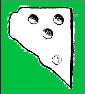
Grumbeg carving
“A cup-marked stone was found by me in the burial place of Grumbeg, Strathnaver, September 1905, standing upright at the head of a grave, and showing about 6 inches above the ground. It is evidently a fragment of a larger slab: its extreme length is 20 inches, and it is about 15 inches at its broadest part. The upper three circles are 2.5 inches in diameter and 1.5 inches deep, very symmetrically hollowed out, but the fourth and lower circle is shallow and indistinct. As the stones covering the other graves are for the most part what is called rough mountain slabs, it seems to me that this cup-marked fragment was found in its present condition elsewhere, and placed here to conveniently show a lair.”
If such was the case, a good contender might be the denuded chambered cairn close by.
Prehistoric petroglyphs are rare things indeed in Leicestershire! But the example that was found here — at the now destroyed prehistoric tomb which archaeologists catalogued as ‘Lockington Barrow VI’ in this small graveyard — shows that such ritual art spreads further afield than previously reported by archaeologists. Yet as with countless other cup-marked stones, it should come as no surprise to be found associated with a tumulus. Death and petroglyphs are common bedfellows – even in this part of Britain!
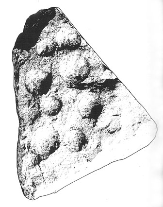
Lockington cup-marking (courtesy Gwilym Hughes)Lockington cup-marked stone
Found on the northern edge of a ring ditch surrounding this once-fine tomb, the carving was found on a small, triangular-shaped, broken piece of rock , less than 12 inches across along its longest side. The small stone has what seems to be eight cup-marks (5 seem certain) pecked onto the stone: simple, without additional ingredients, akin to the basic forms found at Baildon and other more northern climes. The stone itself didn’t seem to be local and was thought by Hughes (2000) “to be from one of the outcrops of millstone grit to the north of the site in southern Derbyshire.”
Less than 7 feet from this petroglyph, inside the barrow, was a pit containing a hoard of ancient gold and copper ware — though any likely relationship between the carving and the treasure hoard is doubtful. The carving was probably a “portable” relic, carried some distance and put here for some reason or other: perhaps as an offering; perhaps a magickal artifact — we’ll probably never know…
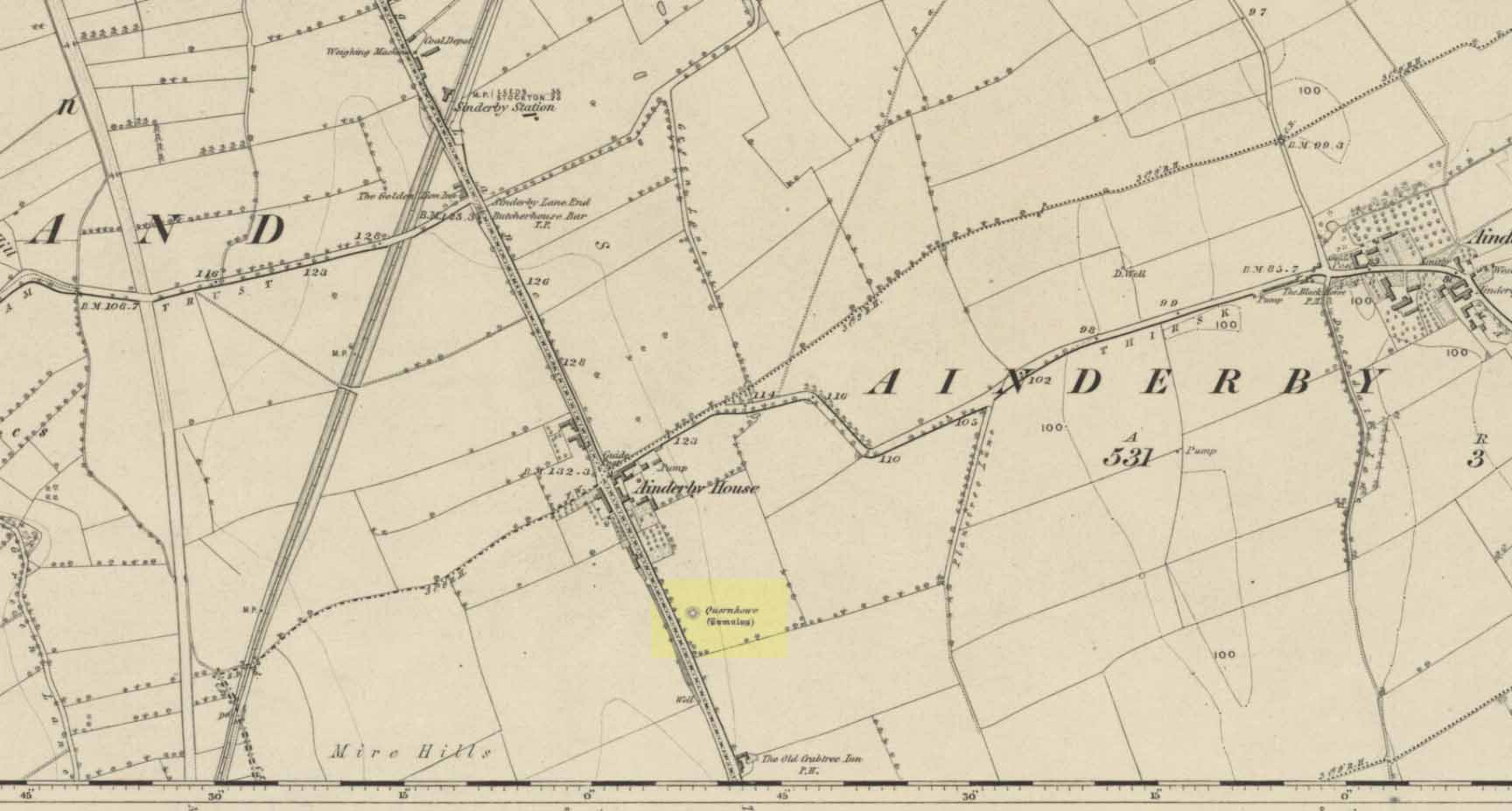
Long since destroyed by the self-righteous advance of the Industrialists, this was a pretty impressive-looking tomb according to the account of D.M. Waterman (1951). Found between the villages of Ainderby Quernhow and Kirklington, right at the side of an important prehistoric trackway—later used by the Romans and known as Leeming Street (on what is now the A1 motorway). Waterman cited it as being “of primary importance in prehistoric times” as it stood on the great plain between the three great henges of Thornborough to the north and those on Hutton Moor to the south, accompanied by a number of other tumuli nearby.
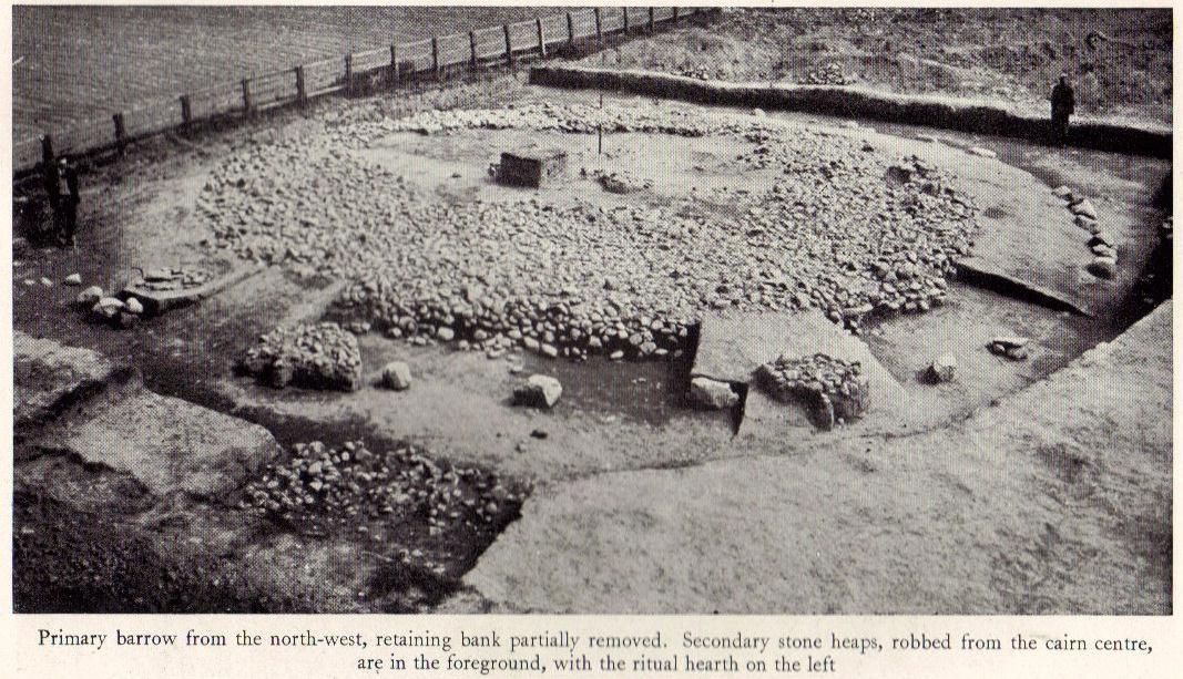
Quernhow tomb on 1856 OS mapThe excavated monument
When Waterman and his team arrived here, the barrow “appeared as a low-spread mound, about 3ft in elevation, the exact limits of which were difficult to define,” due to large parts of it being covered over in mud that’d been dumped there by the local land-owner, aswell as erosion due to other farming or industrial activity. But once the archaeologists had stripped the centuries of soil from the damaged surface of the monument, a most impressive site emerged! At the heart of this great burial mound was found “an imposing stone cairn, more or less flat-topped and with a circular constructed face.” He (1951) continued:
“The material of the cairn was composed of cobbles or boulders, all of local geological origin, ranging in size from a few inches up to a foot in diameter or more. A stone considerably larger in size was occasionally encountered , the largest found measuring 23in by 20in and from 3in to 5in in thickness. The stones were heaped up without any deliberate attempt at producing a stable structure and used indiscriminately, irrespective of size or shape, although there was a tendency for the larger stones to occur towards the perimeter of the cairn. Since the cairn itself was built to a flat surface, and the underlying barrow-mound assumed a saucer-shaped profile, the cobbles perforce increased in depth towards the cairn face; at the very centre they were laid one, occasionally two deep, at the face three or four deep, although irregular size and placing precluded any consistency whatsoever in the work. The standard of the building in fact differed considerably throughout the structure. On the northeast and northwest the facing-stones were quite carefully laid, standing to a height of 22in, the work becoming increasingly shoddy towards the south where the construction had so deteriorated that whole sections of the facing had fallen bodily away from the cairn mass, slipping down the tail of the underlying mound…”
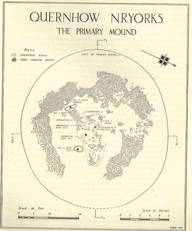
Plan of Quernhow
In the middle of the large cairn were found four small pits and a number of small cremations in and around them. There were also found the usual broken remains of pottery, human bones, charcoal, foods vessels and burnt pieces of oak and other vegetation. Near the centre of the cairn was a curious “four poster” of upright stones, “about 1.4ft long and rather less in breadth and thickness (which) suggest, from consideration of their obviously deliberate and careful placing, some significant function in burial ritual.” The four corners of these stones were close to the cardinal points: north, south, east and west.
References:
Waterman, D.M., “Quernhow: A Food Vessel Barrow in Yorkshire,” in Antiquaries Journal, volume 31, 1951.