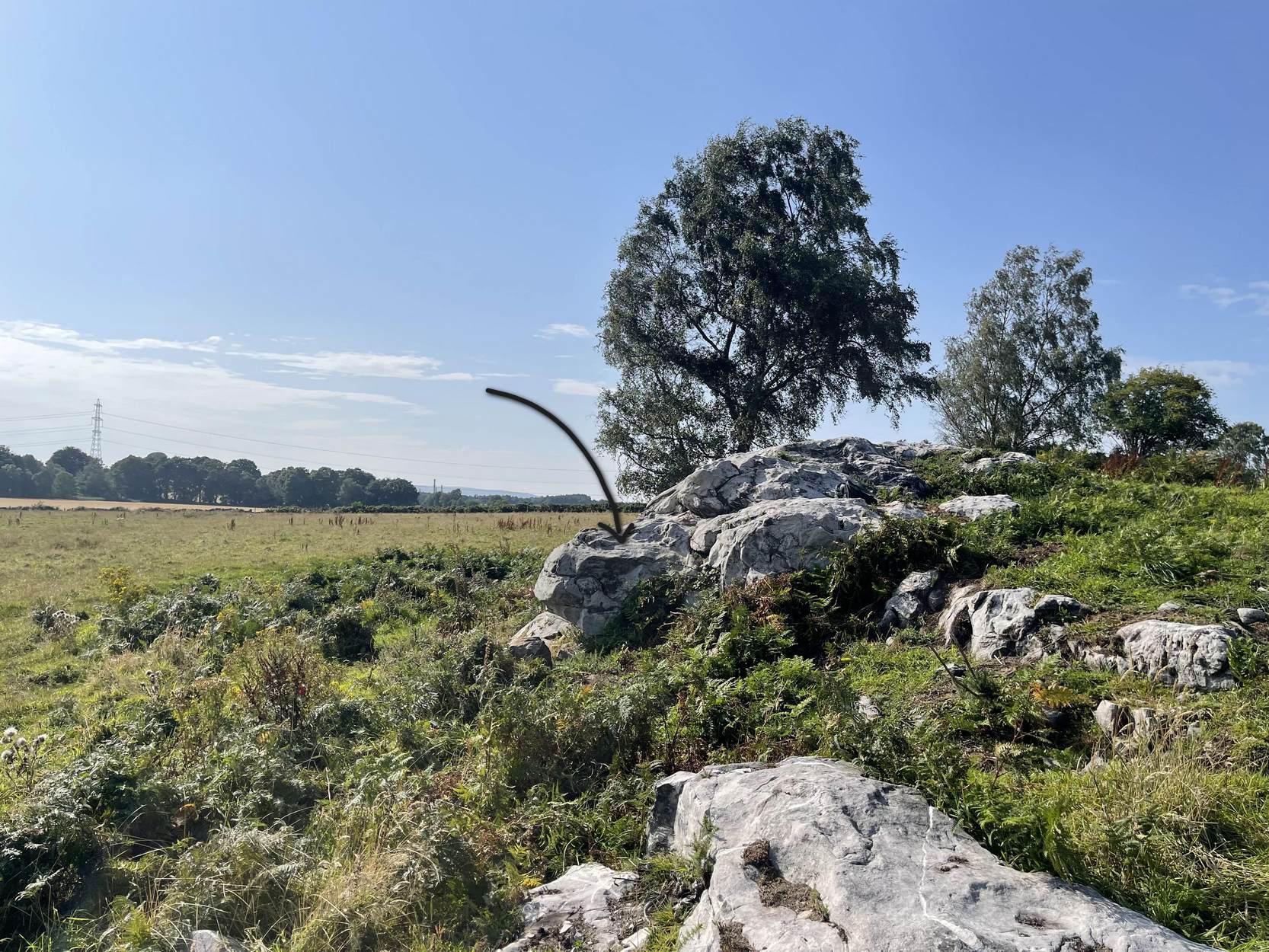
Follow the directions as if you’re visiting the impressive multi-ringed design of the Castleton (10) carving. Once there, walk south-east along the geological ridge for 45 yards where the small cliff drops down to the field. Just where this drop occurs, on a lower horizontal level of the rock face (only a small section) you’ll notice two distinct “cups”. You can’t really miss it!
Archaeology & History
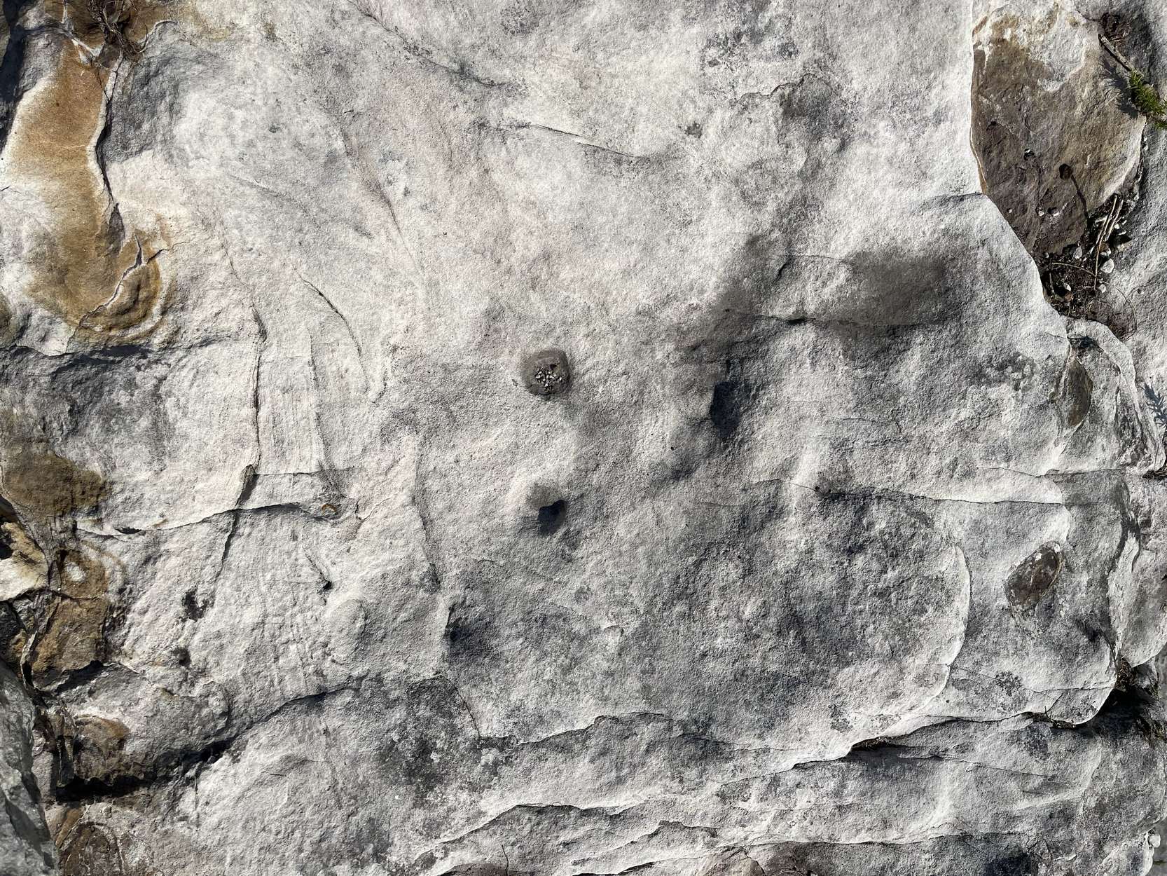
This very basic cup-marked stone was, until recently, covered in dense gorse, making access to the site almost impossible. But following a fire that happened here not too long ago, the smoldering remains needed to be cleared and, once the job was done, we were able to see the two distinct ‘cups’ that were first described in Maarten van Hoek’s (1996) survey. But the cups that he described are, most likely, little more than Nature’s handiwork. I’m somewhat skeptical of them as being the real deal. In the same survey, he added another site, which are just natural bowls in the rock just over 100 yards southwest of here as being cup-marks — which they’re not!
References:
van Hoek, M.A.M.,”Prehistoric Rock Art around Castleton Farm, Airth,” in Forth Naturalist & Historian, volume 19, 1996.
To reach here from Stirling or Bannockburn, take the B9124 east to Cowie (and past it) for 3¾ miles (6km), turning left at the small crossroads; or if you’re coming from Airth, the same B9124 road west for just about 3 miles, turning right at the same minor crossroads up the long straight road. Drive to the dead-end of the road and park up. You’ll notice that this is a crossroads of dirt-tracks. Walk along the one that heads to the houses you can see on a rise above the fields, eastwards. About 300 yards on, instead of going up towards the houses, walk thru the gate and along the wall-edge for 85 yards and go thru the gate to your right. You’ll see a small rise covered in gorse trees 100 yards in front you and roughly in the middle of it all, you’ll find this carving.
Archaeology & History
The naked stone
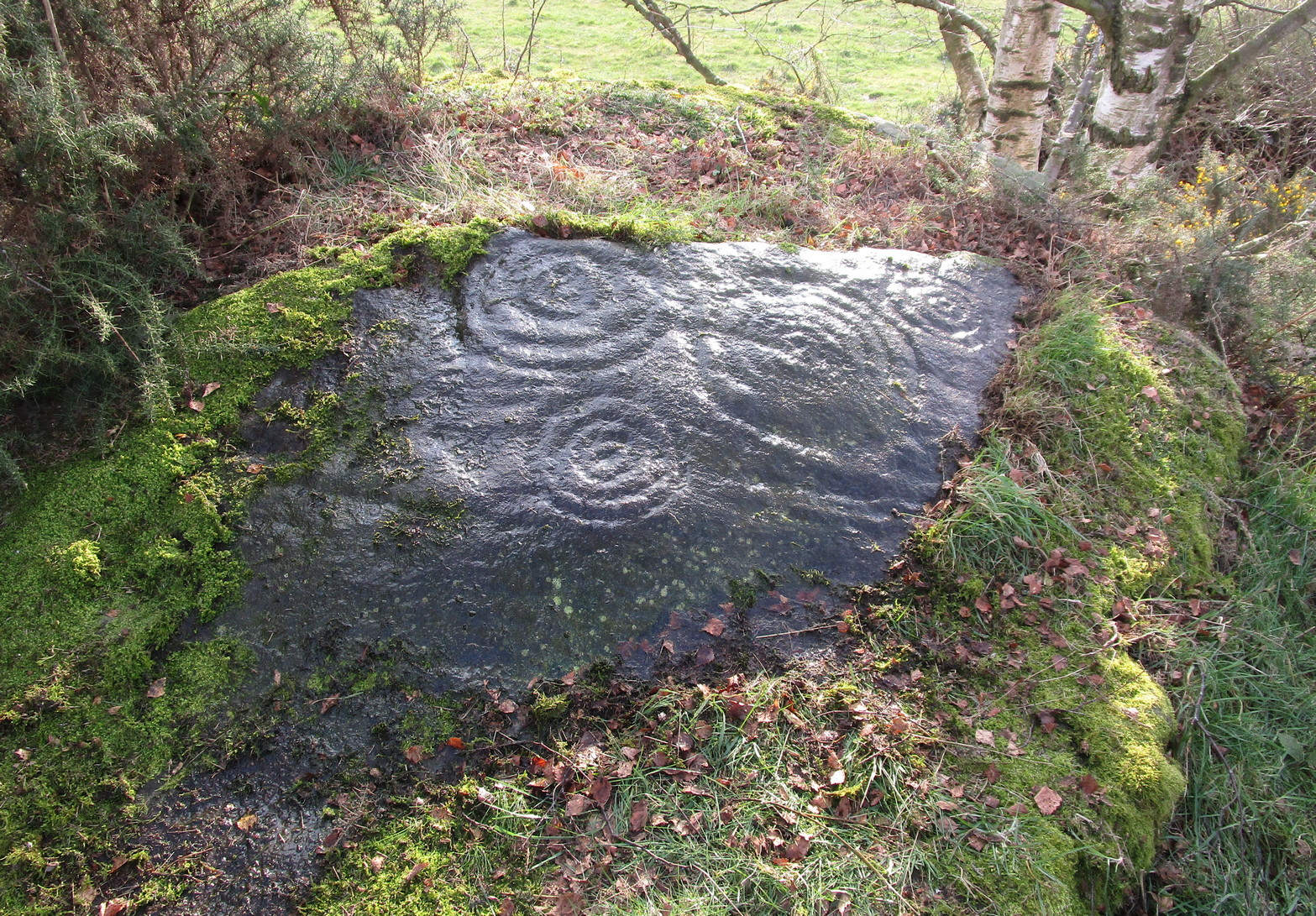
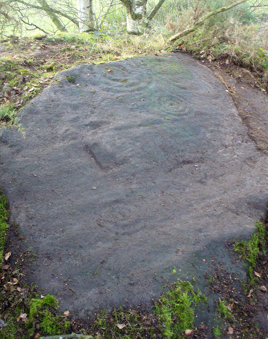
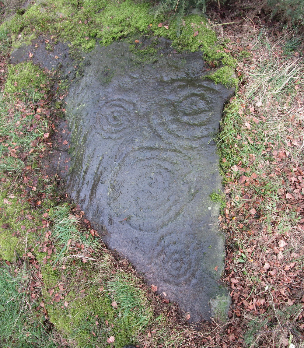
When John Bruce (1896) wrote his article on the mighty Cochno Stone a few miles north of mighty Glasgow, he left some end-notes about a petroglyph near Carnock (near Castleton) that was “found to bear a few much weathered cups with concentric circles.” He wasn’t at all clear where the carving was located, merely telling that it was “in the Gosham Park” area on the Carnock estate. This vague description was probably the reason why, when the lads from the Royal Commission came looking for it in August 1955, they left without success. Nevertheless, when Ron Morris (1981) explored this area he located the place-name of Gosham Field and, therein, this multi-ringed carving. It seems more than likely that this was the carving described by Mr Bruce – and it’s an impressive one!
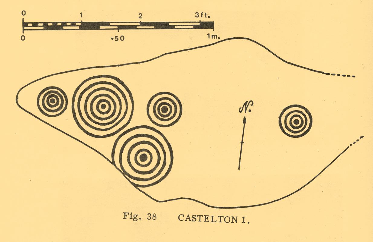
Despite being eroded by the passage of time, the carved design is still pretty easy to see, comprising a cluster of archetypal cup-and-multiple rings in close proximity to each other, etched onto a sloping stone. Ron Morris’s (1981) description told that, 125 yards east of Gosham Field’s western wall,
“is a prominent greywacke outcrop, part of a rocky ridge running NW-SE, exposed in 1969-75 for 3m by 2m (10ft x 6ft), 4m (12) high on its S, but at ground level elsewhere, sloping 15° NE. On its fairly smooth surface are:
“5 cups-and-complete rings, with no grooves, 3 with three rings, 1 with four, and 1 with five rings, up to 36m (14in) diameters and 1cm (½in) depth.”
Ron Morris’ 1981 sketch
Yet contrary to Morris’ description, there are some “grooves”, or carved lines emerging from some of the rings; faint but definitely there. You can make them out in the accompanying photos above. (are there any sketch artists out there could accompany us to these carvings, so we get some good portraits of the stones?) When Maarten van Hoek (1996) visited this carving he also missed these ‘ere carved grooves.
An additional feature that needs to be mentioned is the cluster of small geological deep natural cups, inches away from the carved rings on the southern edge of this stone (completely covered in vegetation in the attached photos). The same feature also exists on the southern edges of the Castleton 5, Castleton 6 and Castleton 12 carvings and it probably had some mythic relationship with the petroglyph.
There’s another cup-marked stone about 30 yards east of here, along this same geological ridge. It was previously covered in gorse, which was thankfully removed following a fire caused by the hot weather at one of the other carvings, preventing a cracking of the rock which would damage the carvings. All of the rock surfaces in the Castleton complex need to be laid bare to enable a greater visual experience of the wider Castleton complex and to prevent them being damaged by the gorse roots cracking the rocks, as well as stopping fires which will also damage these vitally important petroglyphs. People in the Cowie area want to see and experience their own local history…
Morris, Ronald W.B., The Prehistoric Rock Art of Southern Scotland, BAR: Oxford 1981.
Ritchie, Graham & Anna, Edinburgh and South-East Scotland, Heinemann: London 1972.
Royal Commission on the Ancient and Historical Monuments of Scotland, Stirlingshire: An Inventory of the Ancient Monuments – volume 1, HMSO: Edinburgh 1963.
Royal Commission on the Ancient & Historical Monuments of Scotland, Archaeological Sites and Monuments of Stirling District, Central Region, Society of Antiquaries of Scotland 1979.
van Hoek, M.A.M.,”Prehistoric Rock Art around Castleton Farm, Airth,” in Forth Naturalist & Historian, volume 19, 1996.
40-50 yards southwest of the Castleton (11) cup-and-ring stone, beneath the marauding mass of spindly-killer-bushes (or ‘gorse’ as it’s known in the common tongue) could once be seen another impressive cup-and-ring, etched along the edge of the small rocky rise. But Nature has done Her bit and hidden the old stone for the time being. A pity – for as the old photos and sketches show, it’s quite a good one.
Listed in several archaeo-surveys, the best descriptions of this carving are from the reliable pens of Messrs Morris (1981) and van Hoek. (1996) Morris first told us that,
“Leading S from near the farm to Bruce’s Castle (a ruin) is a greywacke ridge, up to 7m (24ft) high on its SW, but at ground level elsewhere, partly turf-covered. Faint cup-marks, some possibly ringed, can still be traced at various points on its top. On a shelf about 7m by 2½m (23ft x 8ft), sloping mostly 20° W, near the steep SW edge, are:
“7 cups-and-complete-rings — in one case broken off at rock edge — one with five rings, 2 with three, and 4 with two rings, up to 51cm (20in) diameter and 2cm (1in) deep. The cup-and-five-rings has a cup-and-two arcs budding from it.”
Fifteen years later, when van Hoek visited the place, it was already “becoming overgrown with gorse,” but fortunately he was able to give us a slightly more detailed description. “There are two engraved surfaces” here, he wrote,
van Hoek’s 1996 sketch
Sketch from Morris’s text
“The north part slopes 9° to the north and has two cups with two rings each. The smaller is clearly unfinished and possibly the pocking of the east part of the outer ring caused a part of the ring to flake off. Undescribed (by Morris, PB) are a very small cup and one complete ring, and a faint cup with incomplete ring in between the two larger devices although Morris…gives a clear photograph of all these features. (above) The south group is dominated by a large but worn cup-and-five-complete-rings on a sloping surface 16° SSW. It is encircled by four rather distinct cup-and-rings and one very faint cup with one incomplete ring, which has never been reported. All single cups drawn on the plan are very doubtful and probably all are natural, especially the small ones.”
This doesn’t necessarily mean to say that these “probably natural” cups had no bearing on the man-made designs; such elements have been given mythic importance in traditional cultures elsewhere in the world, and some ‘bowls in the UK possess curative folklore of their own.
Due to the importance of this carving, effort needs to be made to clear it of the gorse and so allow fellow students the ability to contextualize it and probably uncover yet more cups-and-rings further along the surface of the rock.
Morris, Ronald W.B., The Prehistoric Rock Art of Southern Scotland, BAR: Oxford 1981.
Royal Commission on the Ancient & Historical Monuments of Scotland, Archaeological Sites and Monuments of Stirling District, Central Region, Society of Antiquaries of Scotland 1979.
van Hoek, M.A.M.,”Prehistoric Rock Art around Castleton Farm, Airth,” in Forth Naturalist & Historian, volume 19, 1996.
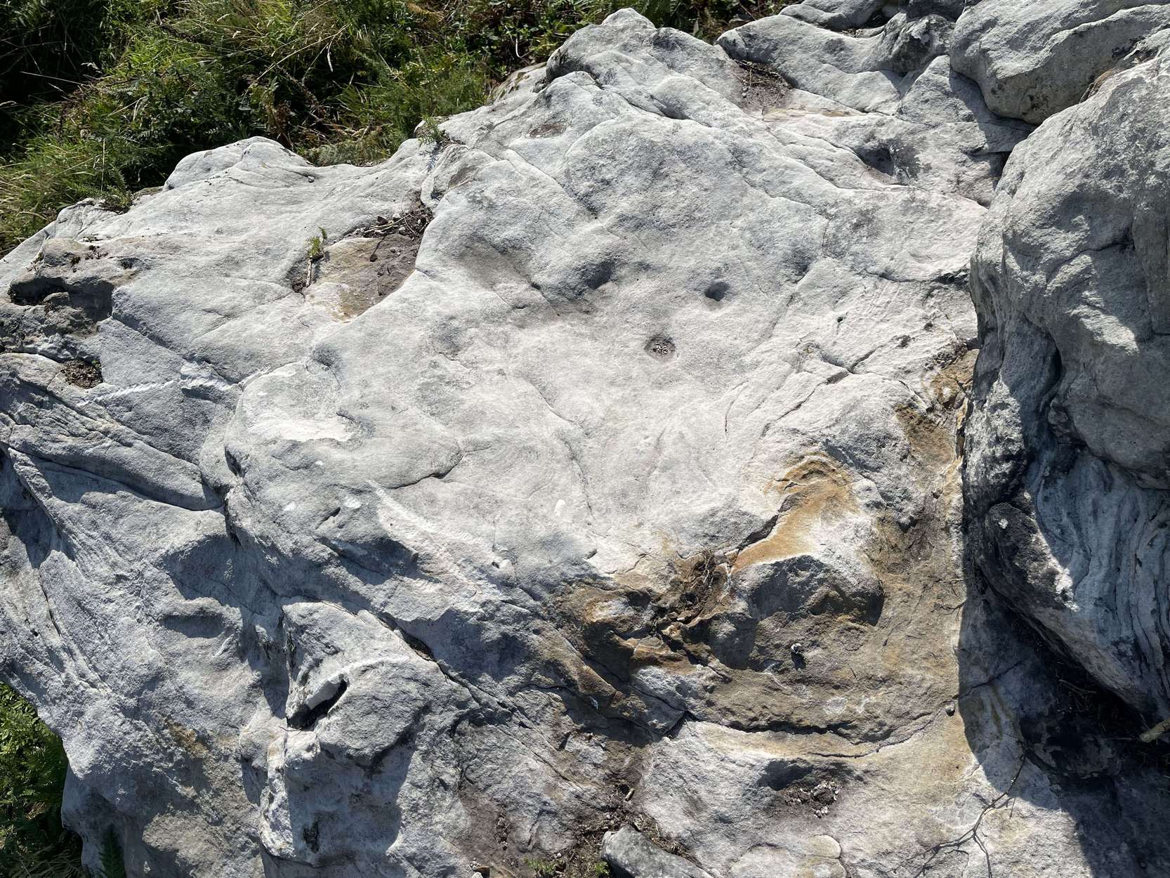
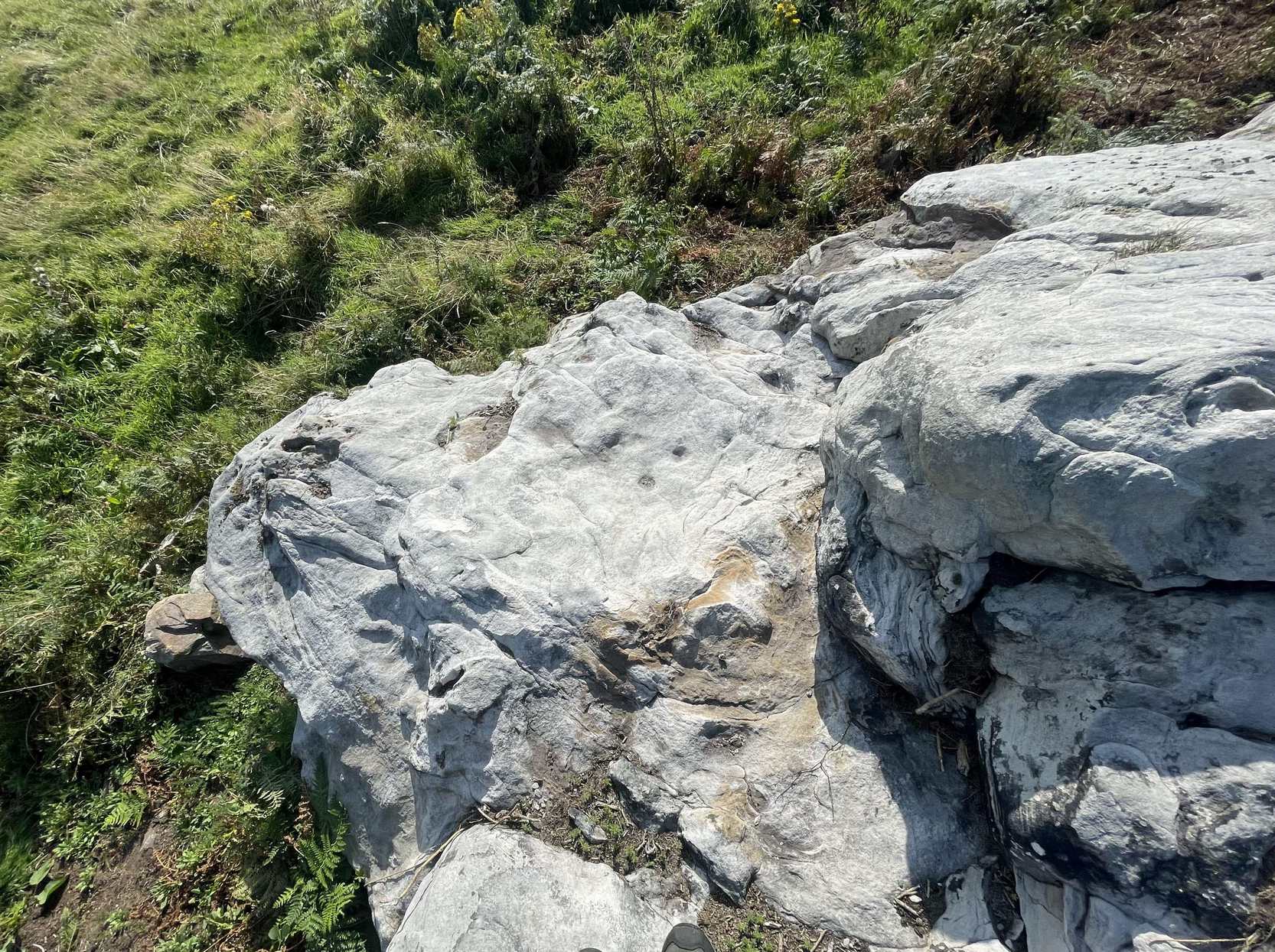
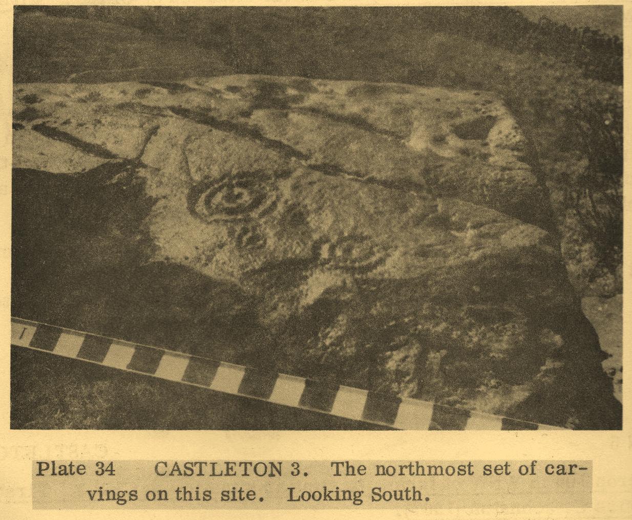
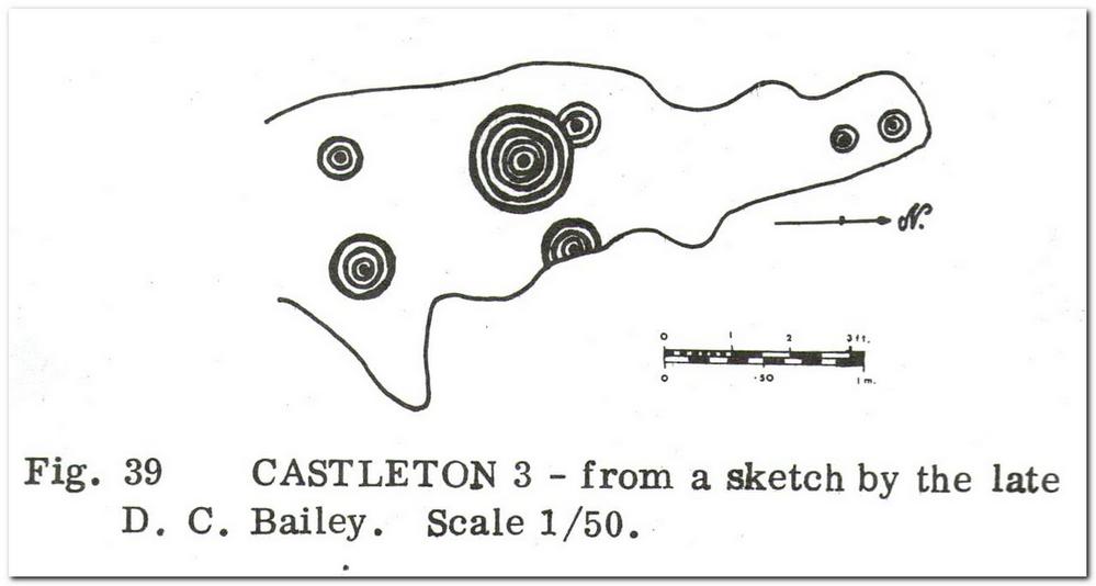
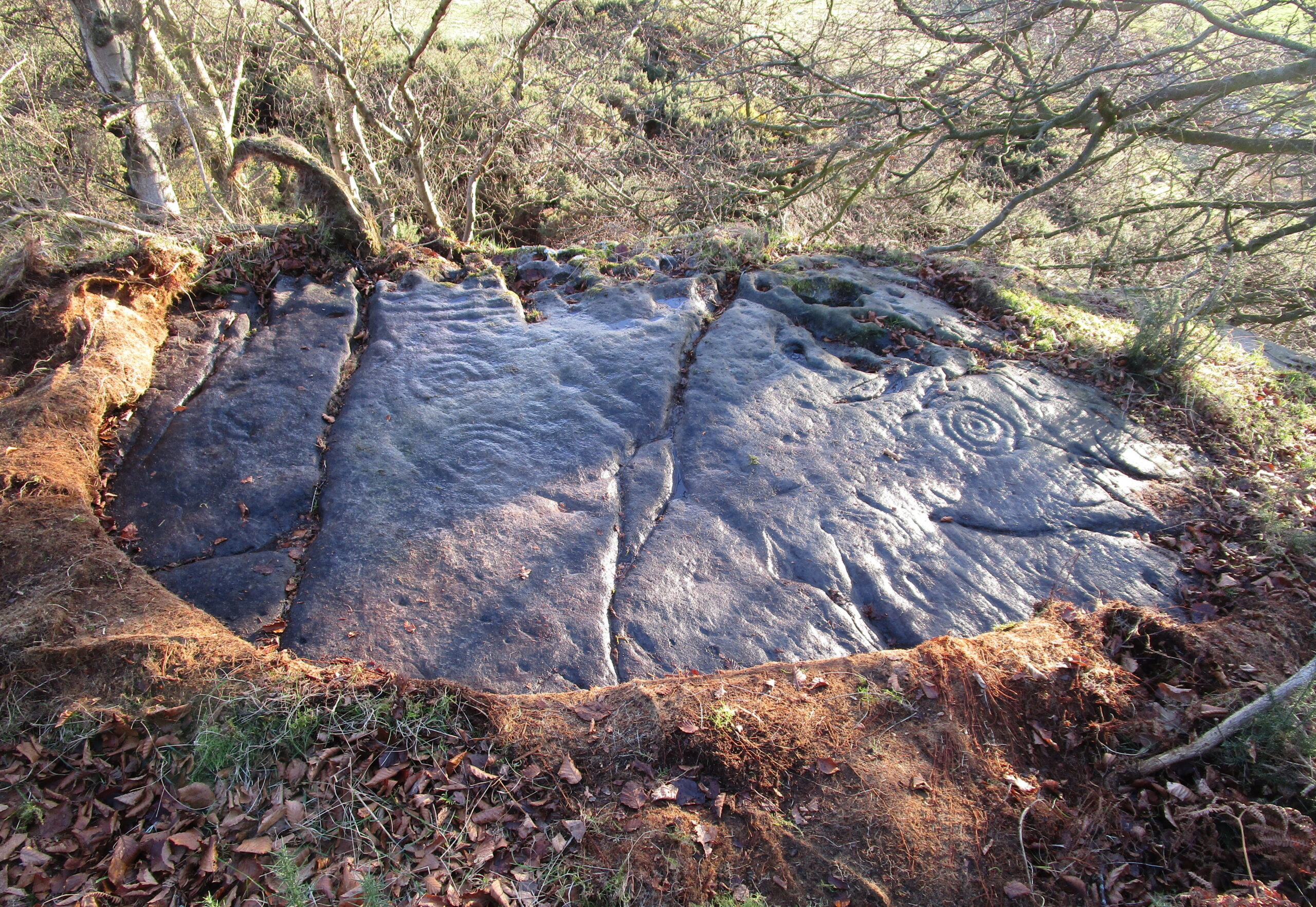
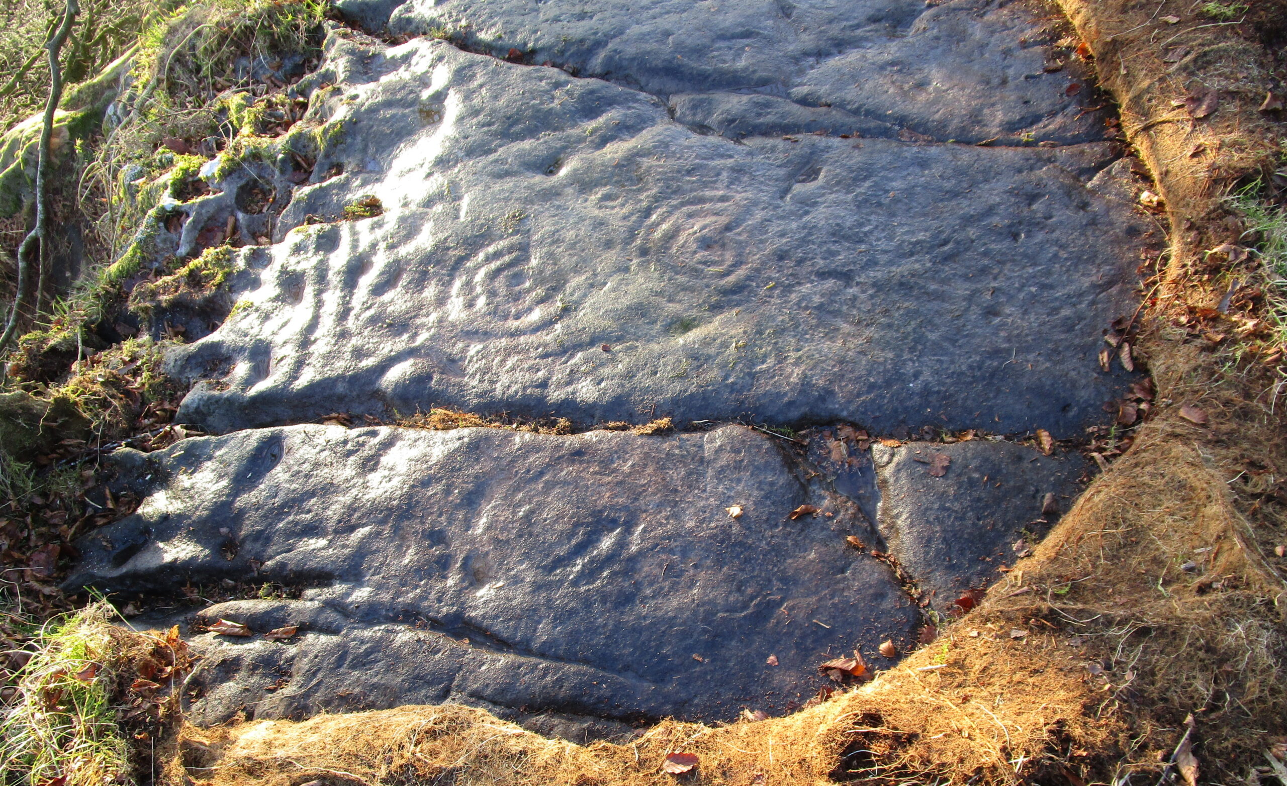
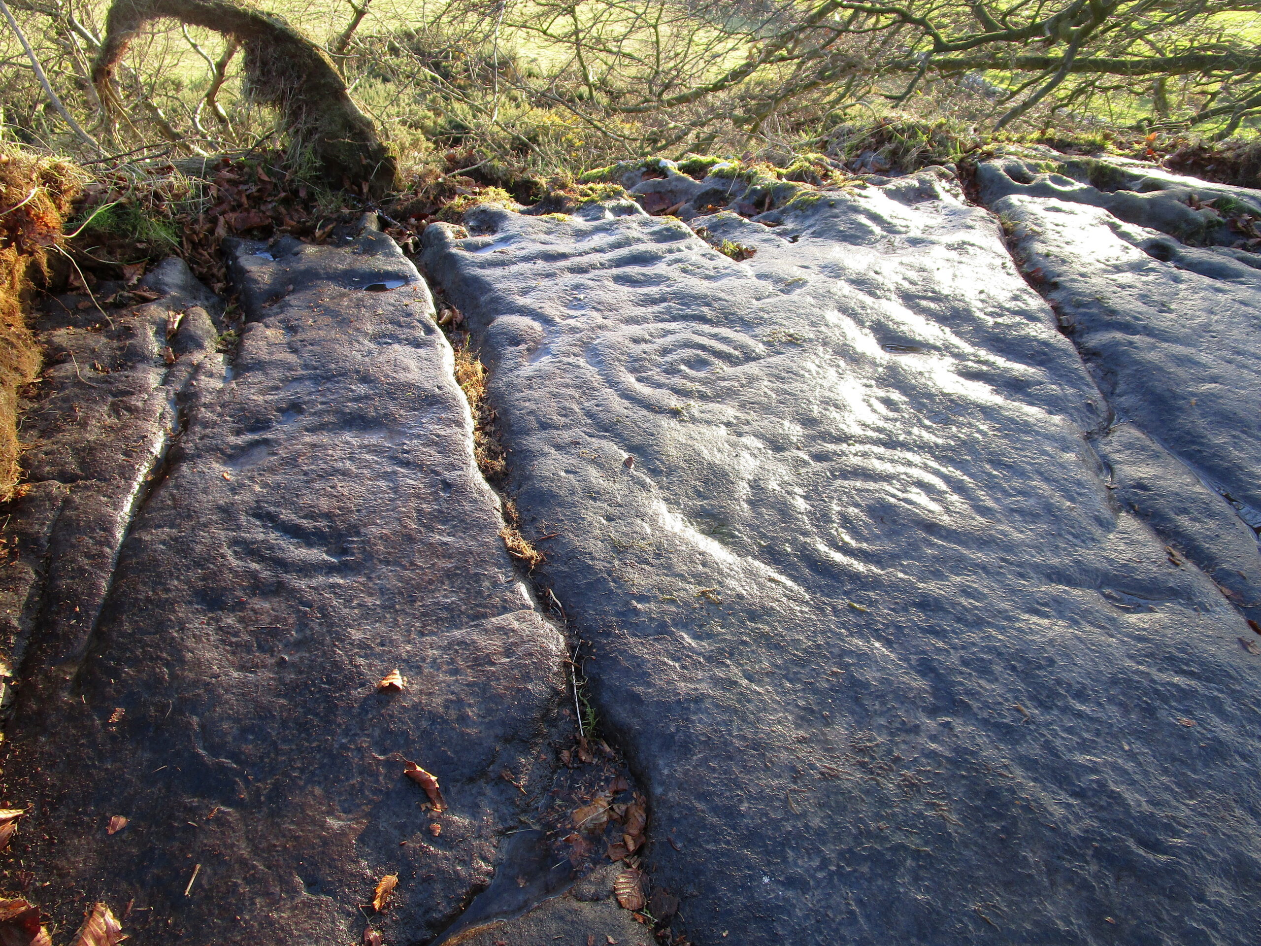
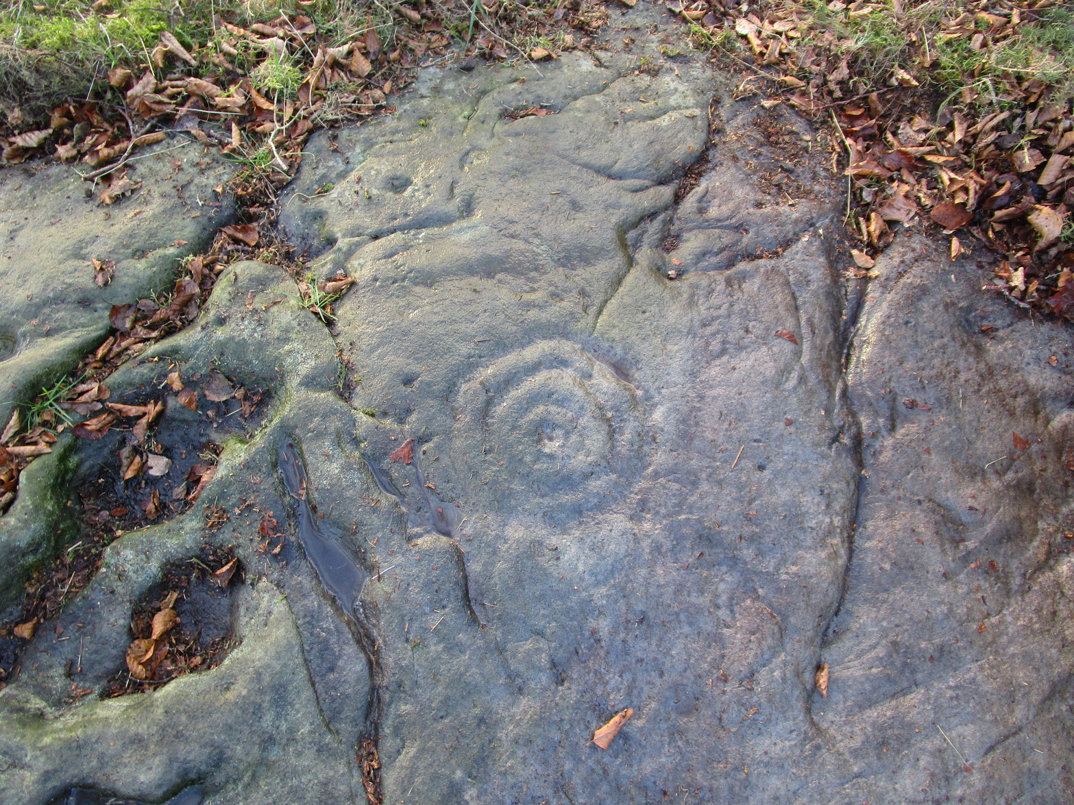
Located near the top of one of Castleton’s rocky island outcrops and overlooking extensive flatlands many miles to the south, this impressive multi-ringed carving was rediscovered in May 1985 by the Ordnance Survey lads and, I believe, was first described in an article by Maarten van Hoek (1996), whose description we’ll get to shortly. It’s a design that incorporates some of Nature’s own cup-marks alongside the marks of men.
The overall design here is captured within three sections of the rock: between three large natural cracks running roughly north-south, as clearly shown in the accompanying photos. It’s a multi-period carving, executed over what seems to be a considerable period of time—probably several centuries. I base this on the differing degrees of erosion between the respective multiple rings — a factor found several of the Castleton carvings.
Eastern & central cup ring symbols
Closeup of central rings
One of the most eroded sections can be seen on the eastern side of the rock, where a very faded cup-and-three-rings was carved. Initially it looked as if there was no central cup to this, but as I looked across this towards the falling sun, what seemed to be a possible ‘dot’ was noticed in the centre, very faint indeed. There are several single cup-marks just a few inches east of this triple-ring, which look more recent than its eroded companion.
On the other side of the long natural crack we see two quite distinct multiple cup-and-rings: one with three rings and another with four, both of which have short carved lines running from their centres westwards. Between these, a smaller single cup-and-ring nestles quietly, almost innocuously, minding its own business! But below these two large multiple-ringers there’s a very faint cup-and-double ring, only visible when the light conditions are just right. In numerous attempts I made to catch this element in my photos, none were successful. (I’m a crap photographer, which doesn’t help!) Due to the erosion on this element, this is possibly the earliest section of the carving. Above these rings, close to the edge of the small cliff, one or two carved lines can be seen that run into natural ‘bowls’ which, in all probability, were of some significance to those who made this design. In cultures outside the UK, such elements have sometimes been afforded mythic importance.
Several other natural small ‘bowls’ exist above the most blatant of the cup-and-rings here, on the west side of the rock, which consists of a cup-and-triple-ring no less. Erosion levels on this would seem to suggest that it was the most recent element of this petroglyph.
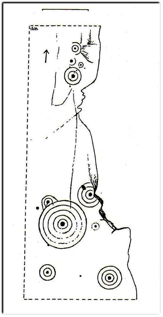
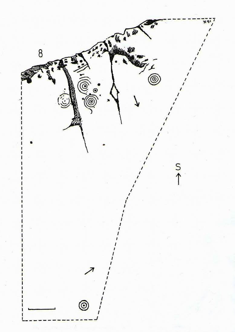
When Maarten van Hoek (1996) wrote his report, there was much less vegetation covering the stone and another cup-and-ring could be seen on the northernmost section of the rock – as his sketch here shows. He wrote:
Westernmost element
van Hoek’s 1996 sketch
“Near the edge are five cup-and-rings and possibly up to four single cups, all on rock sloping about 6″ to 12″ NW. The easternmost set consists of the worn remains of three rings (the innermost hardly visible) without a distinct central cup. Across a crack is a cup with four rings, the outer incomplete and curving away; another cup with four rings, mostly incomplete. A small cup-and-one-ring sits in between. South of this group may be some grooves and a single cup, all doubtful being very near the cliff-edge which is heavily pitted by erosion. The westernmost cup with three ovalish rings is the best preserved set of the group. Further away from the scarp is one single cup on a horizontal part and even further N is a cup-and-two-rings on a part sloping 6″ SW.”
It would be good to completely clear this rock and make it all visible again, as it was long long ago…
References:
Morris, Ronald W.B., The Prehistoric Rock Art of Southern Scotland, BAR: Oxford 1981.
van Hoek, M.A.M.,”Prehistoric Rock Art around Castleton Farm, Airth,” in Forth Naturalist & Historian, volume 19, 1996.
Healing Wells (destroyed): OS Grid Reference – NS 77 91
Archaeology & History
Old drawing of the lost wells
The old line drawing here is all that remains of a pair of healing wells that once bubbled up within their ancient stone well-houses, close to each other, in the middle of the old woods west of Stirling in the massive quarries at Gillies Hill. It’s possible that the large pools of water that are now in the overgrown quarries are thanks to these ancient wells; although one of them was close to the old building of Fir Park, whose overgrown remains are within the woods at grid-reference NS 7787 9124. Very little has been written about these wells, but thankfully the local historian Mr Fleming (1898) captured their demise in his lovely antiquarian work, saying:
“The sketch, opposite (taken in 1850) of the picturesque wells, then situated in a marshy dell and surrounded by a dense pine wood near to the ancient ‘Boiling Springs’, now dried up by the sinking of the lime pits, and immediately off the old bridle road from Stirling to Glasgow by Murrayshall, shows very ancient remains of wells connected with the original water supply of Stirling by lead pipes from ‘Lessfeerie Springs’, situated in the Touch Hills. This supply was begun in 1774, and thus antiquity and interest are given to the sketch. These wells, with their fringes of mosses and ferns and bramble bushes, are now, with the pine wood, demolished, and the whole face of the district changed by the operations in a quarry recently opened up in Gillies Hill crag, causing the locality to be now unrecognizable.”
References:
Fleming, J.S., Old Nooks of Stirling, Delineated and Described, Munro & Jamieson: Stirling 1898.