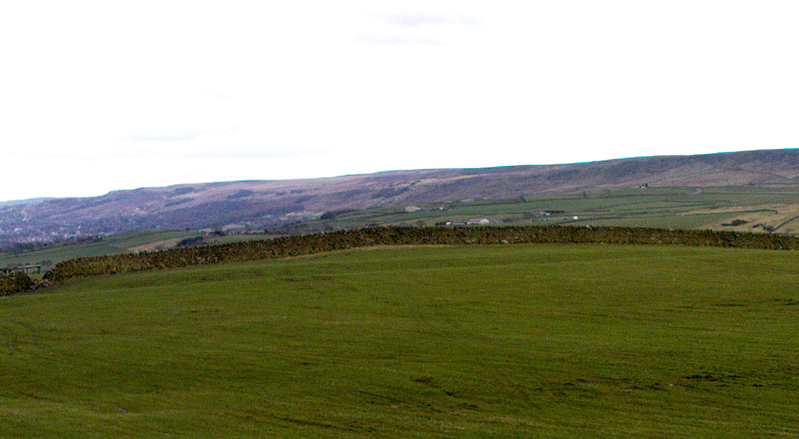
From Ilkley, take the Wells Road heading towards White Wells, bending round the bottom of the moor, making sure you keep left along Westwood Drive (not further up the moor along the Keighley Road). Keep along Westwood Drive – it becomes Panorama Drive after a while – until you come to the small copse of woods on your right, a short distance before the end of the road. Go along the footpath by the wall at the side of the house, bending into the woods after 10 yards. Another 10 yards on, you’re near the edge a drop down the slope, where a number of large rocks are seen. Look around!
Archaeology & History
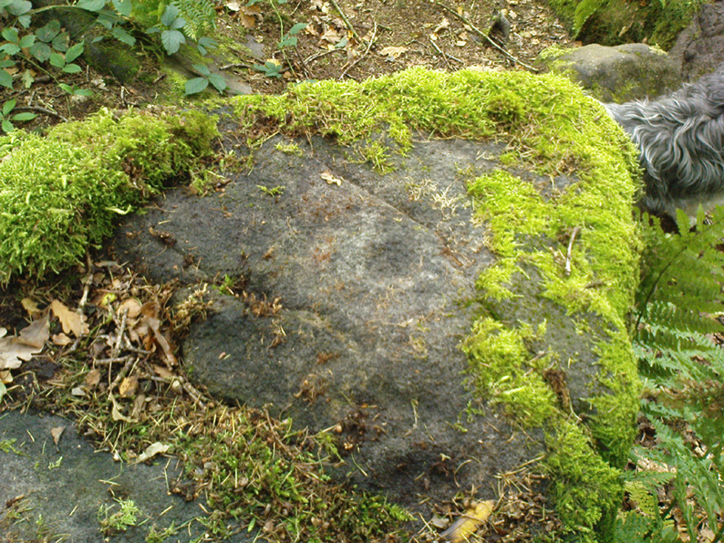
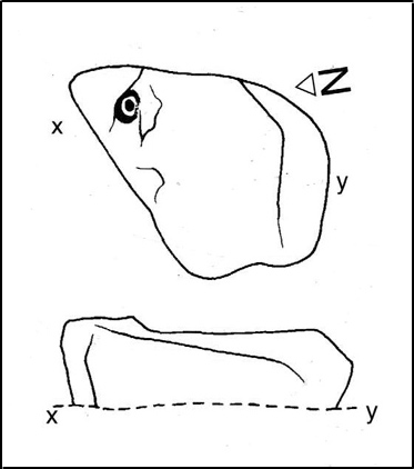
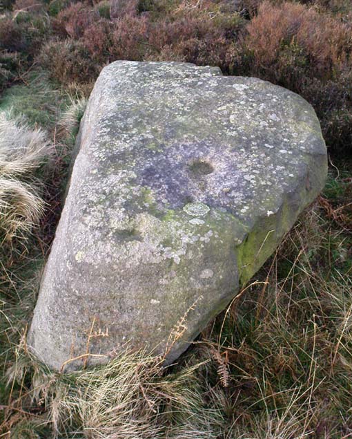
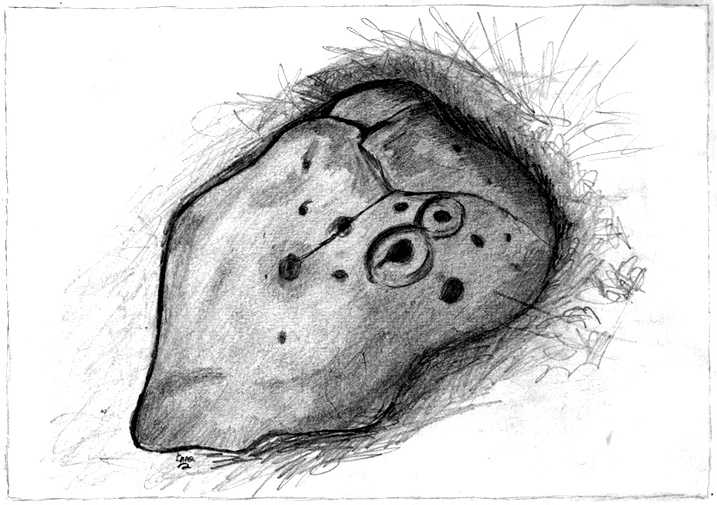
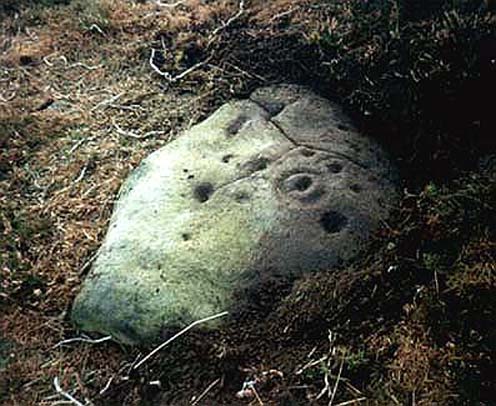
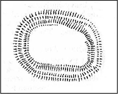
Carving 236 (after Boughey & Vickerman)
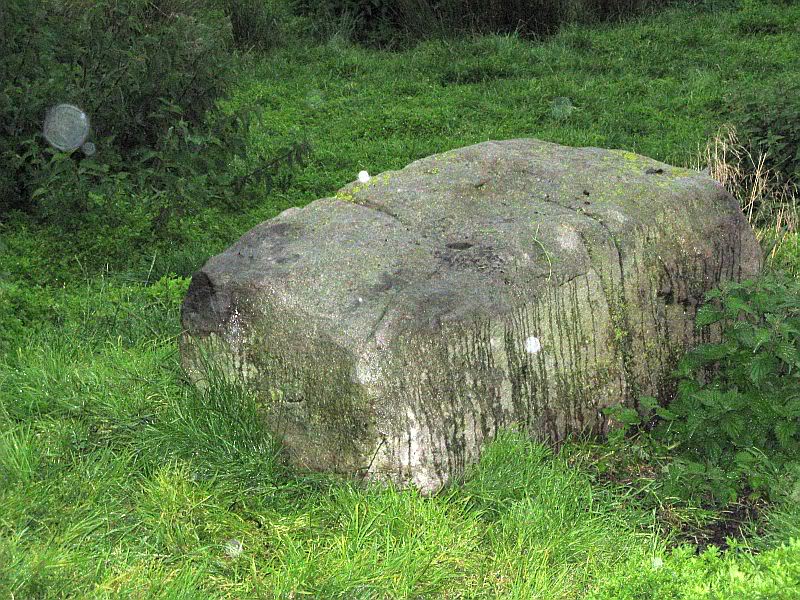
A singular cup-and-ring carving can be seen, rather faintly, near the nose-end of this large mossy stone, close to the edge of the ridge. It is one of a small cluster of carvings that remain in this small bit of woodland. Other highly ornate carvings could once be seen in the same stretch of woodland — where the rich houses now stand — amidst remains of a prehistoric enclosure or settlement of some sort. All remains of this settlement have been destroyed, which is a pity as it may have given us helpful information about the nature of this carving and its nearby relatives.
References:
Bennett, Paul, The Panorama Stones, Ilkley, TNA: Yorkshire 2012.
Boughey, Keith & Vickerman, E.A., Prehistoric Rock Art of the West Riding, WYAS: Wakefield 2003.
Hedges, John (ed.), The Carved Rocks on Rombalds Moor, WYMCC: Wakefield 1986.
From the B6265 valley road between Bingley and Keighley, just near Riddlesden Hall, take the road up and over the canal into Riddlesden, bearing left up past West Riddlesden Hall and up Banks Lane. As you reach the T-junction at the top, where you hit the Silsden Road that goes round the moors, park up. Turn left and walk along the Silsden Road, counting the field on your left, moorland-side. At the fourth, go through the gate uphill, keeping to the walls on the right and going through the second gate up. Walk straight on for nearly 130 yards (119m) where you’ll see this group of three earthfast rocks right next to each other.
Archaeology & History
‘Ring of cups’ motif
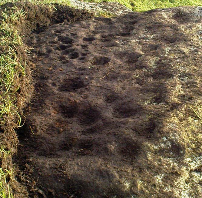
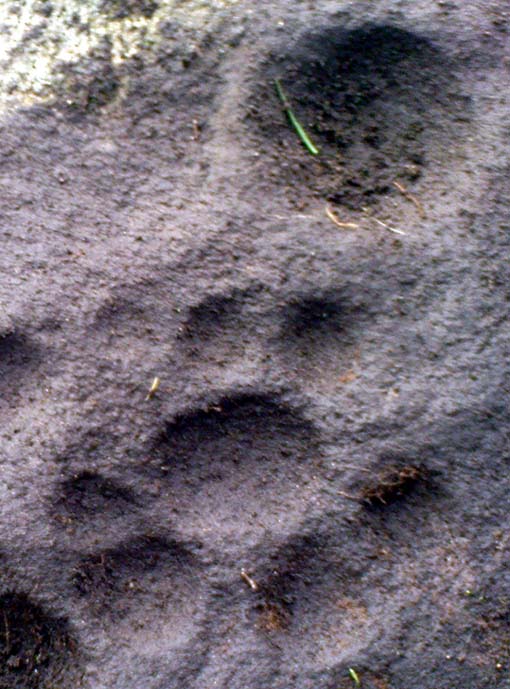
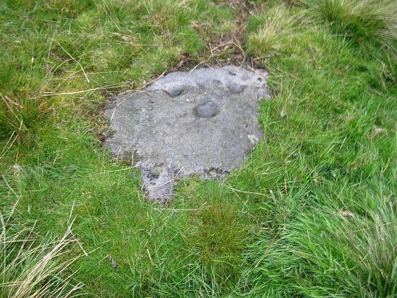
Not included in any pervious archaeological survey, this is a fine cup-marked stone with at least 25 cups etched into this average-sized rock, halfway up this field of stones. When this carving was rediscovered on Friday, 6 January, 2012, it was noticed that a couple of cup-marks were peeking out from the edge of the grasses covering the rock — and so a careful and gradual uncovering of the rock itself was slowly exposed and see if the initial suspicions of an authentic carving were correct. Thankfully it turned out right!
When first spotting this, I undercovered more beneath the soil, although it’s not clear how much of this stone is covered in carvings, as the Earth has grown considerably over the top of it. There is also what seems to be a geological curiosity on the eastern section of the stone; whereby some apparent ‘cups’ seem to have been created by natural process. However, these have been added to by human hands at a distant time, long ago. The cup-marks themselves vary in size, from small ones barely an inch across, to larger ones measuring some 3-inches in diameter; and oddly, the cups seem to get larger the further west you travel across the stone! More research is needed at this site to ascertain the a more complete image of the petroglyph.
From the B6265 valley road between Bingley and Keighley, just near Riddlesden Hall, take the road up and over the canal into Riddlesden, bearing left up past West Riddlesden Hall and up Banks Lane. As you reach the T-junction at the top, where you hit the Silsden Road that goes round the moors, park up. Takes the footpath across the road and walk straight uphill, all the way to the top just above where the tree line ends and you’re on the moorland flat. Bear right, over one wall, then walk 20-30 yards further and the stone in the photo here should be roughly under thine nostrils!
Archaeology & History
There’s no previous record of this as a cup-marked stone, so it needs adding here. I’ve gotta admit that I’m not 100% sure about it as a real prehistoric carving — but considering the dubious nature of the nearby Carving no.58 and the Rivock Nose Stone, this is roughly somewhere in-between in terms of its legitimacy as an ancient carved stone. Certainly I’ve come across other cup-markings, adjudged by newly-qualified ‘professionals’ as fine, but which I find highly questionable — so this one that Dave Hazell came across a couple of years ago should certainly be added to their professional rock art catalogues.
Close-up of the cupmarks
It’s simple enough: a four-feet long stone, whose top east-facing edge has been worked in more recent centuries by the miners who dug on the slopes below (perhaps to turn it into a gatepost?). There are three notable ‘cups’ that are clearly visible on the photos here. The topmost cup is something pretty recent, having had industrial attention given it; the largest cup may be natural; but the one in the middle seems to be what our English Heritage rock-art enthusiasts term a legitimate prehistoric petroglyph. It certainly seems a good one! Have a look for yourself and see what you reckon! It’s in a good spot and is certainly worth the wander, if only to have a look at other cup-and-rings in the region.
Tumulus (destroyed): OS Grid Reference – SE 302 337
Archaeology & History
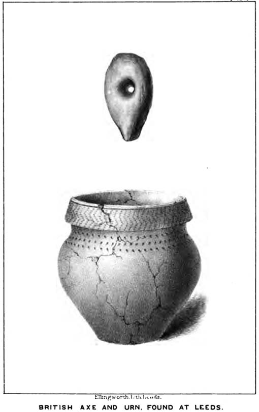
Remains from Briggate’s tomb
We don’t know for sure whether the burial site that once stood near Leeds city centre was a cairn, a tumulus, or just a stone-lined cist (stone grave), but due to the prevalence of similar prehistoric sites in the neighbourhood, it’s most likely to have been a small tumulus that once existed here. All trace of it has obviously gone. The most detailed reference we have of this place was the account given by the 19th century Leeds historian, James Wardell (1853), who thankfully gave us the drawing of remains found within the tomb and who wrote:
“In the year 1745, a most interesting discovery occurred, of an urn containing ashes, calcined bones, and a stone axe perforated for a shaft, which were found by a carpenter at a depth of about two feet, on sinking a tenter post, in a field near to the top of Briggate, in Leeds. The urn was of rude formation, imperfectly baked, and ornamented after the usual maimer of the Britons, with encircling rows of indentations; it measured about twelve inches in height, and was placed with its mouth upwards, having a cover, wliieh was broken by the workman. The whole of these artielt^s were taken pos- session of by Mr. Alderman Denison, the owner of the field, who resided near ; their subsequent fate is unknown, and their loss as a local one is to be deplored; but fortunately small sketches of them were made at the time, which has enabled me to give the drawings contained in Plate I. These relics lay claim to an earlier date…and have appertained to some warrior of the prehistoric period, whose simple, yet solemn funeral rites, were here performed, and in memory of whom the cairn, or the barrow was raised.”
There is a remote possibility that the position of St. John’s Church, a short distance north of Briggate, may have had some relationship with this sacred burial site. St. John was the christian church’s midsummer saint.
References:
Wardell, James, The Antiquities of the Borough of Leeds, John Russell Smith: London 1853.
From the B6265 valley road between Bingley and Keighley, just near Riddlesden Hall, take the road up and over the canal into Riddlesden, bearing left up past West Riddlesden Hall and up Banks Lane. As you reach the T-junction at the top, where you hit the Silsden Road that goes round the moors, park up. Cross the road and follow the footpath up the field, but walk up the side of the field-wall where the woods are, all the way to the top. On the flat, you’ll see a gap in the woods on your left, and the triangulation pillar atop of Rivock Edge 150 yards away. Head towards it, watching out for one of the natural rocks rising near the middle of the grasses. It’s one of them!
Archaeology & History
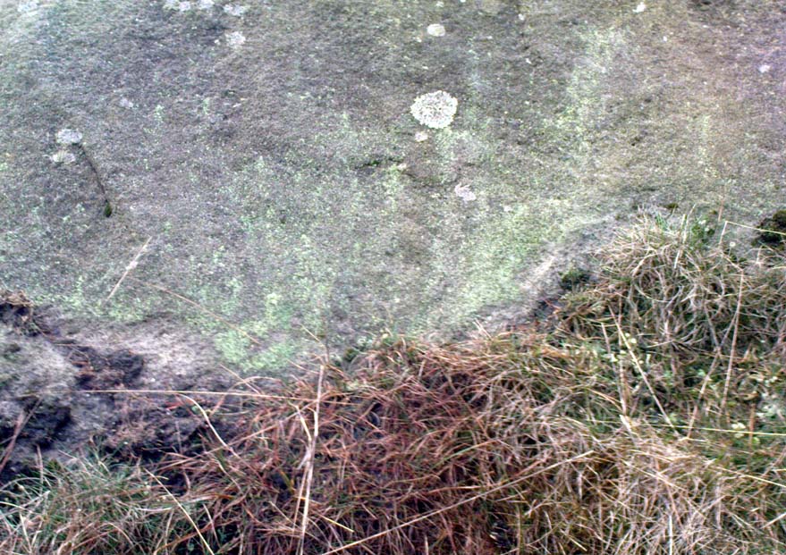
Faint cup-and-ring, centre of photo
Exactly halfway between the cup-marked Niplet Stone and the large flat Carving 58 (Boughey & Vickerman survey) is this natural long upright rock, shaped in the form of a house-roof, with its apex running along an axis SE-NW, its sloping sides dropping either side into the deep wet heather. Upon its crown is what may be a singular cup-marking, almost perfectly formed, though is just as likely to be Nature’s handiwork as much as anything else. But on its western-face, within the mass of old lichen painting the rock surface, a more distinct man-made cup-mark has been cut.
On its eastern face, close to where the rock meets the boggy Earth, a singular faint cup-and-ring design can be made out, albeit a somewhat mis-shapen one. It’s easily missed if the lighting isn’t too good as it’s very eroded indeed. The carving was first described in Mr Hedges (1986) survey, where he told:
“Rough grit rock with ridge, in crowberry and heather with cup and ring on E edge and possible cups and grooves.”
The stone’s certainly worth visiting, as a number of other cup-and-ring stones scatter this region — half of them officially recorded, but nearly as many again that aren’t. It’s a good area to explore.
References:
Bennett, Paul, “The Prehistoric Rock Art and Megalithic Remains of Rivock & District (parts 1 & 2),” in Earth, 3-4, 1986.
Boughey, Keith & Vickerman, E.A., Prehistoric Rock Art of the West Riding, WYAS 2003.
Hedges, John (ed.), The Carved Rocks on Rombald’s Moor, WYMCC: Wakefield 1986.
Morris, Ronald W.B., “The Prehistoric Rock Art of Great Britain: A Survey of All Sites Bearing Motifs more Complex than Simple Cup-marks,” in Proceedings of the Prehistoric Society, volume 55, 1989.
Take the same directions as if you’re visiting the Rivock Edge 060 Carving. It’s 25 yards NNW – you can’t really miss it!
Archaeology & History
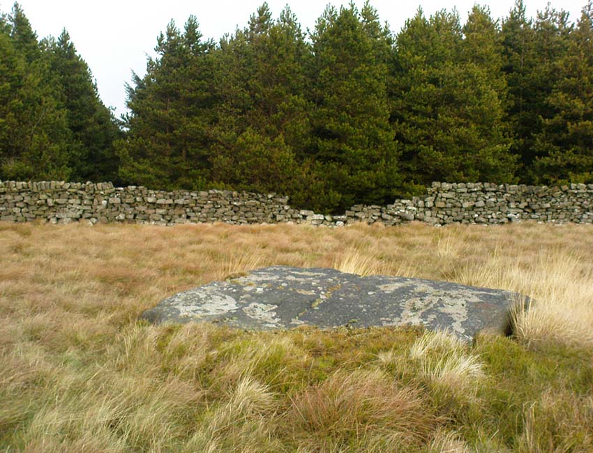
Rivock Edge, carving 58
This large flat rock, with a couple of long lines almost splitting the rock into sections, was first mentioned as a prehistoric site in John Hedges (1986) survey, where he described it simply as, “Large rough grit rock with possible four cups, in crowberry.” Boughey & Vickerman (2003) said even less about it! One of the cups is very distinct, but the others are somewhat faded and perhaps even dubious. It’s still worth a look at, if only due to the other better carvings nearby.
References:
Bennett, Paul, “The Prehistoric Rock Art and Megalithic Remains of Rivock & District (parts 1 & 2),” in Earth, 3-4, 1986.
Boughey, Keith & Vickerman, E.A., Prehistoric Rock Art of the West Riding, WYAS 2003.
Hedges, John (ed.), The Carved Rocks on Rombald’s Moor, WYMCC: Wakefield 1986.
Takes a bitta finding unless you’ve got a GPS system, or someone like me to show you where it is! The best way’s probably via the Askwith Moor Road car park, up the road 160 yards till you hit the straight line cut into the moor on your right, where the landscape’s been damaged.* Walk along this for less than 100 yards, then walk right, through the heather and onto the singular tree roughly 200 yards away. From here, walk 75 yards (strides) north from the tree. You’re damn close!
Archaeology & History
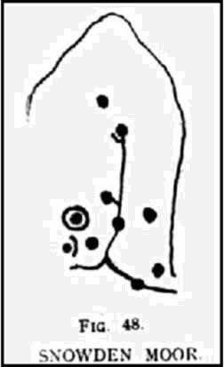
About 20 feet from a line of ancient walling in an area pretty rich in prehistoric sites, is this medium-sized stone with a lovely cup-and-ring design. The carving was first recorded by fellow antiquarian, Eric Cowling (1937), in his short survey of other carved stones in the area. He called this ‘carving no.7’ and described it, thus:
“In the central area of Snowden Carr is a barrow group, which occupies a slight ridge running from the edge of the bog to the east, almost to the moor road on the west. The ridge is almost devoid of vegetation except at the higher end. Here, on a heather-covered boulder, is marking no.7. The cups are smaller than usual, and only one ring completely surrounds a cup. The lines linking the cups are only lightly incised, and the whole marking has a delicate appearance.”
Old photo of the carvingCowling’s 1937 sketch
I first visited this stone in the 1980s with fellow rock art student and author, Graeme Chappell, and for some reason it has always impressed me (I recall Graeme laughing whilst I made joyous noises and stroked the rock, reverentially!). Cowling’s description of the stone as ‘delicate’ is appealing, as the stone and its design has a nurturing aspect to it, female in nature. (forgive me — but many of these stones tend to capture me in such ways!) The stone was described more clinically in Boughey & Vickerman’s (2003) more recent survey, in the way that archaeologists tend to do, saying plainly:
“Fairly large, flat, smooth grit rock with crack. Up to seventeen possible cups, one with complete ring, one with partial ring, one with possible ring; connecting groove.”
Doesn’t quite capture the feel of the place, which I’m sure they’d admit. The next time I’m up here, I’ll get some better photos of the carving.
References:
Boughey, Keith & Vickerman, E.A., Prehistoric Rock Art of the West Riding, WYAS 2003.
Cowling, E.T., ‘A Classification of West Yorkshire Cup and Ring Stones,’ in Yorkshire Archaeological Journal 1940.
Cowling, E.T., Rombald’s Way: A Prehistory of Mid-Wharfedale, William Walker: Otley 1946.
Cowling, E.T. & Hartley, C.A., ‘Cup and Ring Markings to the North of Otley,’ in Yorkshire Archaeological Journal 33, 1937.
ACKNOWLEDGEMENTS: Huge thanks to one of my fine ladies, Inmaculada Ibanez-Sanchez, for the drawing! Cheers Inma!
* A pipeline was laid across the moor here, and subsequent work (I presume by the same company) was done again in early 2011, cutting through and damaging several prehistoric monuments and destroying at least one prehistoric cairn. An archaeological survey of the region should have been done before any work proceeded here, but I’m unaware of any such excavations, or archaeological reports preceding or concurrent to the ecological and historical damage performed.
Take the A6034 road between Addingham and Silsden and, at the very top of the hill between the two towns, at Cringles, take the small road of Cringles Lane north towards Draughton. Less than a mile on, veer to left and go along Bank Lane until you reach the track and footpath on your right that takes you to Moorock Hall. On the other side of the Hall, take the track on your left, along the wallside; and where the track turns left again, look into the field on the other side of the wall. You can see some of the ditch and embankment running across the field.
Archaeology & History
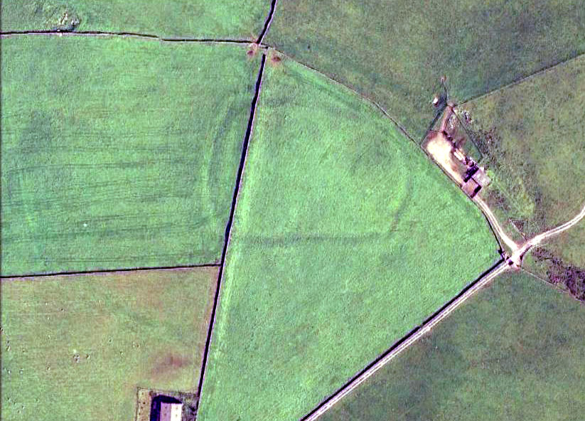
Found within the southwestern segment of the gigantic Counter Hill enclosure, near Woofa Bank, Eric Cowling (1946) described “an almost obliterated fortification” which has certainly seen better days — though you can make out the ditched earthwork pretty easily at ground level. When T.D. Whitaker visited this place sometime before 1812, he described it as a camp that “was found to contain numbers of rude (?!?) fireplaces constructed of stone and filled with ashes.” He also thought the enclosure was Roman in nature.
Western line of embankment
It’s a large site. Running around the outer edge of the embankment, this enclosure measures roughly 378 yards (345m) in circumference. It has diameters measuring, roughly east-west, 132 yards (121m); and north-south is 95 yards (87m). The ditch that defines the edges of the enclosure averages 6-7 yards across and is give or take a yard deep throughout — but this is not an accurate reflection of the real depth, as centuries of earth have collected and filled the ditch. An excavation is necessary to reveal the true depth of this. There also seems to have been additional features constructed inside the enclosure, but without an excavation we’ll never know what they are. Examples of cup-marked stones can be found nearby.
The Marchup Hill enclosure was described by the early antiquarian James Wardell (1869), who visited this and the other earthworks around Counter Hill. He told that this was,
“of oblong form, but broadest at the west end, and rather larger than the other. When the area of this camp was broken up, there were found some numbers of rude fireplaces constructed of stone and filled with ashes, and also a large perforated bead of jet.”
E.T. Cowling’s plan
Modern opinion places the construction of this enclosure within the Iron Age to Romano-British period, between 1000 BC to 300 AD. E.T. Cowling (1946) thought the Iron Age to be most likely, but it may indeed be earlier. His description of the site was as follows:
“At the foot of the southern slope of Counter Hill and close to the head waters of Marchup Beck is an almost obliterated fortification. These remains are roughly rectangular, but one side is bent to meet the other; the enclosure has rounded corners and has a ditch with the upcast at each side. The inner area is naturally above the level of the surrounding ground. In spite of heavy ploughing, the ditch on the western side still has a span of fifteen feet and a depth of five feet between the tops of the banks. Whitaker states that the camp “was found to contain numbers of rude fireplaces constructed of stone and filled with ashes.” These hearths appear to be the remains of cooking-holes such as are often found on Iron Age sites… Cup and ring markings are close at hand, but no flints have been found or trace of Mid-Bronze Age habitation. The enclosure is badly planned, the upcast on the western side would aid an attack rather than the defence.”
…to be continued…
References:
Cowling, Eric T., Rombald’s Way, William Walker: Otley 1946.
Wardell, James, Historical Notes of Ilkley, Rombald’s Moor, Baildon Common, and other Matters of the British and Roman Periods, Joseph Dodgson: Leeds 1869. (2nd edition 1881).
Whitaker, Thomas Dunham, The History and Antiquities of the Deanery of Craven in the County of York, (3rd edition) Joseph Dodgson: Leeds 1878.
We know very little about the site that once stood here — even Aubrey Burl (2000) found no history here. It seems that antiquarian records were never made in this outlying district and even folklore records seem to have missed this region! (surely not?) A. Lindsay Mitchell (1992) told that the circle here had been built into the church, but knew no more.
First described in the old Statistical Account of Scotland in 1794, even then it was in the past tense, as they said that “a Druidical temple is said to have stood in the vicinity of Balkethly. Not the smallest vestige can now be seen.” Balkaithly Farm is a few hundred yards east of Dunino. In the New Statistical Account of the region in 1845 it was reported that three stones close to the west wall of the minister’s garden at Dunino were said to be part of the ruined circle. The site had truly gone. By 1925 when the Royal Commission (1933) lads visited the place to look for any remains, they told:
“The stone circle which formerly existed near the church at Dunino has now been entirely destroyed, but what are believed to be portions of some of the original stones are built into the dyke on the north side of the roadway at the south-west of the churchyard, about 100 yards east of its junction with the main thoroughfare to St. Andrews.”
A few hundred yards west of the circle, “a short cist containing a fine food-vessel urn was accidentally discovered during ploughing on the farm of Beley.” This was sent to Edinburgh’s National Museum.
Folklore
Locally, there are several places alleged to have been the actual spot where the circle once stood. Several stones within nearby Dunino church have typical Mason marks carved on them which, local folklore says, identifies them as coming from the circle and then subsequently being built into the church. Also in the churchyard is a small carved upright stone, which local people visit and leave offerings upon.
References:
Batchelor, Richard A., Origin of St. Andrews: Moon, Magicians and Maidens in Fife, Shieling: St. Andrews 1997.
Burl, Aubrey, The Stone Circles of Britain, Ireland and Brittany, Yale University Press 2000.
Follow the same directions as if you’re going to the excellent Morphing Stone cup-and-ring carving. From the carving, look up the field to the where the dirt-track is and, by the closest gate with a tree near it, walk straight towards it. Roughly halfway between the Morphing Stone and the gate you’ll find — eventually — the small stone in the photo with well-defined cups on it. You might need to wander back and forth until you find it, as there’s many rocks to check out here!
Archaeology & History
Possible cup-marked rock
This small cup-marked stone was rediscovered by Danny Tiernan in the late afternoon of Thursday, August 18, 2011, just as the heavens opened and the rains poured down! With at least one well-defined cup-mark and another two near the edge of the stone where the grasses had grown, this stone probably needs another look at it, as there may be more beneath the surface, much like when we first found at Morphing Stone.
Danny also found and photographed another larger boulder, a bit further up the field closer to the fence, where what may be a single cup-mark is clearly seen living on top of the rock. It’s one of those dodgy English Heritage ones though, so I’ll let those ‘qualified’ chaps check this one out and give it their expertise! It could well be another unrecorded cup-marked stone though…