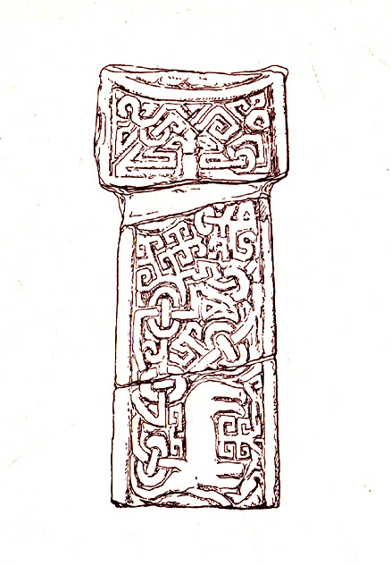
Many churches strive to find evidence in the greater antiquity of their foundations than the industrial age; and even those whose origins are medieval hope to find much older roots. Such is the case with this Norman church of St. Peter, where just such an antiquity was found in the middle of the 19th century, embedded in the old walling where it had been encased many centuries before. Thought to have been carved around the 8th century, the design on the stone typifies much ‘Celtic’ art, as it tends to be called, such as are found all over northern England. As we can see here, the main feature is a series of curved and interlocking lines covering most of the rock face (sadly, no swastika occurs on this stone, but it’s common on many others of this period). The old vicar of the church — Harold Rogers — takes up the story:
“About the year 1841, when part of the chancel work was taken down, some fragments of curiously ornamented sandstone were discovered embedded in the masonry. They were carefully removed, put together, and placed in the churchyard where, protected from injury by a glass case, they may now be seen. The carved ornamentation on this ancient relic was probably executed about the 8th century, and it is conjectured that the stone formed part of a cross placed there by some early Saxon converts…to commemorate the spot where the gospel was first preached in this locality.”
A brass inscription attached to the encased carved stone informs the visitor the same information. The proximity of this early carved stone to the River Bollin and, very probably, an ancient ford crossing, implies the waters here were held as sacred in ancient days and hence the supplanting of the ornate carved cross at this position in the landscape.
References:
Rogers, Harold W., Prestbury and its Ancient Church, Arthur Clownes: Macclesfield n.d. (c.1960)
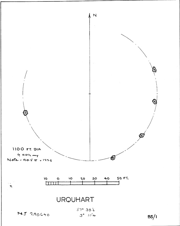
Described in early local history journals, this stone circle of many names is composed of mainly small upright stones — though one of them stands nearly six feet tall — yet it has quite a large diameter of 110 feet (or 40.4 megalithic yards). Alexander Thom (1980) measured its circumference as being precisely 127 megalithic yards. It is thought to have originally consisted of twelve stones, but today only five remain. And in a landscape where recumbent stone circles reign supreme, Aubrey Burl (in Thom, Thom & Burl 1980) thought the lay-out of the site suggestive of just such a monument, saying:
“The apparent grading of the stones towards the S-SSW and the 19th century reference by the Minister of Urquhart to “nine tall stones in a circle, two of them at the entrance to the altar” suggest that this may have been a recumbent stone circle, from which the recumbent and its flankers have subsequently been removed. It is noteworthy that the westernmost stone has several small cupmarks on it, a pillar which would have been close to the recumbent in that restricted area where cupmarks are to be found in recumbent stone circles.”
A singular TNA profile entry of the said cup-marked stone will be added in due course. The middle of the circle was dug sometime prior to 1870, but no human or other remains were found.
Folklore
Described by two local ministers as ‘Nine Stanes’ back in Victorian days, with at least one of the stones being recumbent, it was the great Fred Coles (1906) in one of his many articles on the megalithic remains of Scotland who narrated the following tale, told to him first-hand by a local man called Mr T. Geddie, after some of the standing stones from this circle were removed in the nineteenth century.
“One of the stones,” wrote Mr Geddie, “was to be taken away to be built into a new steading at Viewfield. Mr Brown thinks this was prior to the building of the Innesmill steading, which dates from 1843. No sooner had the Stone been deposited in the toon, however, than uncanny signs and omens began to manifest themselves, and it was resolved to get rid of it. While it was being taken back to its original position, the horse stuck or fell when taking a somewhat steep little brae, and the Stone was taken no further, but buried where it was. The spot it about 80 or 100 yards from the circle.”
Grinsell (1976) also tells the tale that if you visit the circle at midnight and walk round the circle three times, the devil can appear.
References:
Coles, F.R., ‘Report on Stone Circles Surveyed in the North-East of Scotland, Chiefly in Banffshire’, in PSAS 40, 1906.
Grinsell, Leslie V., Folklore of Prehistoric Sites in Britain, David & Charles: London 1976.
Thom, A., Thom, A.S. & Burl, Aubrey, Megalithic Rings, BAR 81: Oxford 1980.
Crowned by a clump of trees (planted in 1740), this hilltop site is one of the more impressive of a number of tombs hereby, with its nearest other neighbour being 70 yards southeast of here. One of Dorset’s early tribal meeting places (Anderson 1934), the tomb was illustrated on Isaac Taylor’s 1765 map of the region and was dug into in 1858 “on the orders of a local magnate” (Marsden 1999), damaging some substantial portion of the tomb. Of this, craniologist and antiquarian John Thurnam was most displeased; for in his description of the opening of Culliford Tree he wrote:
“A wide trench had been dug through it one side, from the summit and the rubble which had been thrown out had not been replaced… Another subject of regret was the fact that though, as we were told by the neighbouring rustics, human remains, with pottery and certain other relics, were found in the barrow, no authentic account of the exploration had, so far as we could learn, been put to print.”
Leslie Grinsell (1959) found the same trouble in his assessment of this site; and the Royal Commission (1970) lads could only describe the site thus:
“Large trench on south and top almost certainly dug in 1858 when four secondary extended inhumations, one with necklace of amber and two gold-plated beads, and cremation with incense cup in collared urn, were found.”
However, it seems that the necklace and gold-plated beads have been “lost” — i.e., someone has them in their own private collection somewhere!
Folklore
This is one of very few tombs in this part of the country where we find the tradition of fairy music. Grinsell (1959) told that:
“The Culliford Tree barrow, formerly the meeting place of the Hundred of Culllingford Tree, is also known as the Music Barrow from the belief that music could be heard beneath the mound by those who listened at the apex at midday.”
References:
Anderson, O.S., The English Hundred-Names, Lunds Universitets Arsskrift 1934.
Marsden, Barry M., The Early Barrow Diggers, Tempus: Stroud 1999.
Royal Commission on Historical Monuments, An Inventory of Historical Monuments in the County of Dorset – Volume 2: South-East, Part 3, HMSO: London 1970.
Warne, Charles, Celtic Tumuli of Dorset: An Account of Personal and other Researches in the Sepulchral Mounds of the Durotriges, Smith: London 1866.
Tumulus (destroyed): OS Grid Reference – TA 0422 7726
Archaeology & History
A once-impressive haunted burial mound on the southern edge of Folkton parish, all that remains of the place now are aerial images showing the ghostly ring of its former site. Commenting on the destruction of this burial mound before he had chance to give it his full attention, in William Greenwell’s (1877) magnum opus he wrote the following:
“Elf Howe had been removed to a great extent, and the grave had been dug out before I had an opportunity of examining it. I however got an account of what was discovered from the foreman on the farm, and I was able personally to inspect a small portion which had not been disturbed. The barrow had been 60ft in diameter and 6ft high, and was made of earth and chalk. Near the centre a deposit of burnt bones was met with, over which some large flints were placed; this was at a depth of 4ft, and as a great quantity of burnt earth was observed immediately round the bones, it is probable that the body had been burnt on the spot where the bones were placed. Two unburnt bodies were found on the south side of the mound, with one of which a vessel of pottery was associated. At a distance of 17ft south-south-east of the centre I found the body of a strongly-made man, laid on the right side, with the head to the south and the hands to the knees; he body was placed about 6in above the natural surface. Immediately below the head was the body of a very young child, the bones of which were too much decayed to admit of anything being made out beyond the fact that it was a child’s body which was laid there. Still lower, and on the natural surface, was a patella, a radius, and some other bones of a body, which had been disturbed, probably in the interring of the person who was found buried above. At the centre was a grave, lying northwest and southeast, 7ft by 6½ft and 2½ft deep. On the bottom at the north side was the body of a strongly-made man in the middle period of life, whose head…was to the south, but my informant could not remember on which side the body was laid; at the head was a ‘food vessel’, which, from the fragments that have been preserved, must have been a rudely-made one with unusually thick walls.”
Folklore
Although antiquarians and archaeologists such as Elgee, Grinsell, Gutch, Johnson and others each tell (in their own respective ways) that Elf Howe “testifies to a widespread belief in goblin-haunted barrows” — albeit in the linguistic ‘elven’ of the Scandinavian invaders — we appear to have lost the original tale behind this fairy-haunted site.
References:
Greenwell, William, British Barrows, Clarendon Press: Oxford 1877.
This once impressive tumulus a half-mile east of the village was first mentioned in the Bardney Cartulary in the early 13th century, where is was written as Spelhou. Suggested by Olof Anderson (1934) to have been an early moot site — “the meeting place of the Torbar Hundred” — this appears to be confirmed in Smith’s (1937) etymological analysis where he ascribes Spell Howe to be literally, “‘Speech mound’, from OE spell, speech and haugr” (burial mound). Rising about four-feet above ground level, this is a traditional ’round barrow’ type of tumulus. In recent years, reports tell that it has been built onto with some fencing. Hopefully the present land-owners now look after the place!
References:
Anderson, O.S., The English Hundred-Names, Lunds Universitets Arsskrift 1934.
Mortimer, J.R., Forty Years Researches in British and Saxon Burial Mounds of East Yorkshire, Brown & Sons: Hull 1905.
Smith, A.H., The Place-Names of the East Riding of Yorkshire and York, Cambridge University Press 1937.
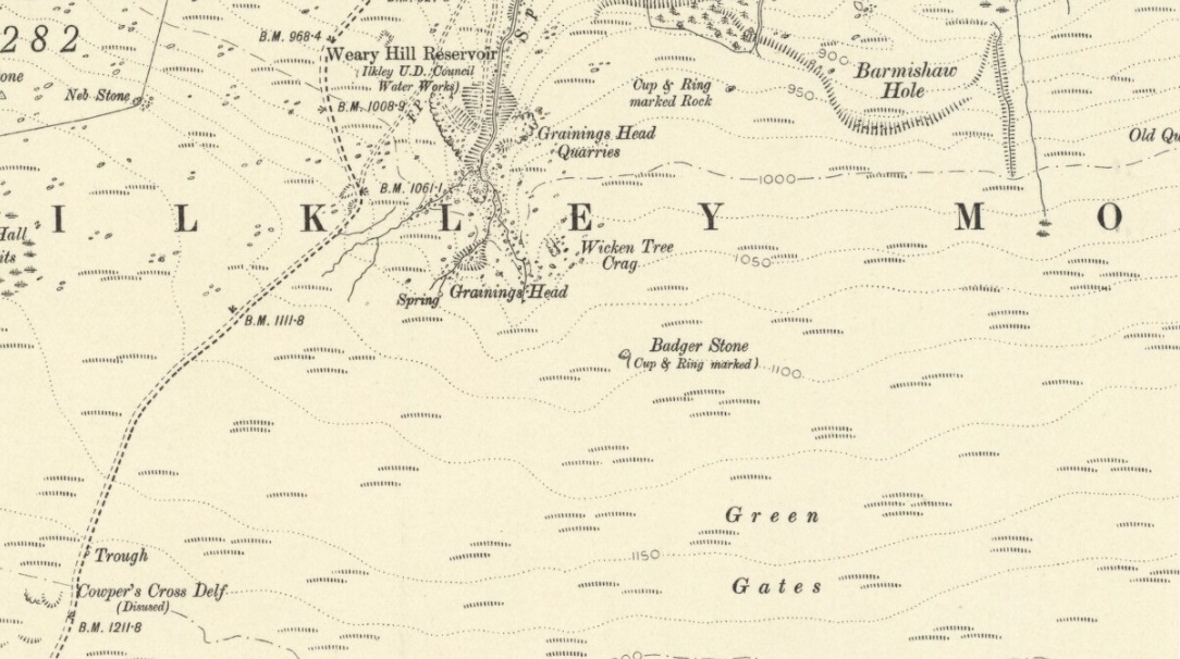
Although there are several routes to this site, for those who are not used to walking or find maps difficult to read [get a life!], it is best approached from the Ilkley side of the moor. Follow the old track that cuts the moor in half past the remains of Graining Head quarry where the moor begins to level out. Once here cut straight east until you find the footpath which, after a while, you will see leads to a wooden seat right in the middle of nowhere. Here is our Badger Stone.
Archaeology & History
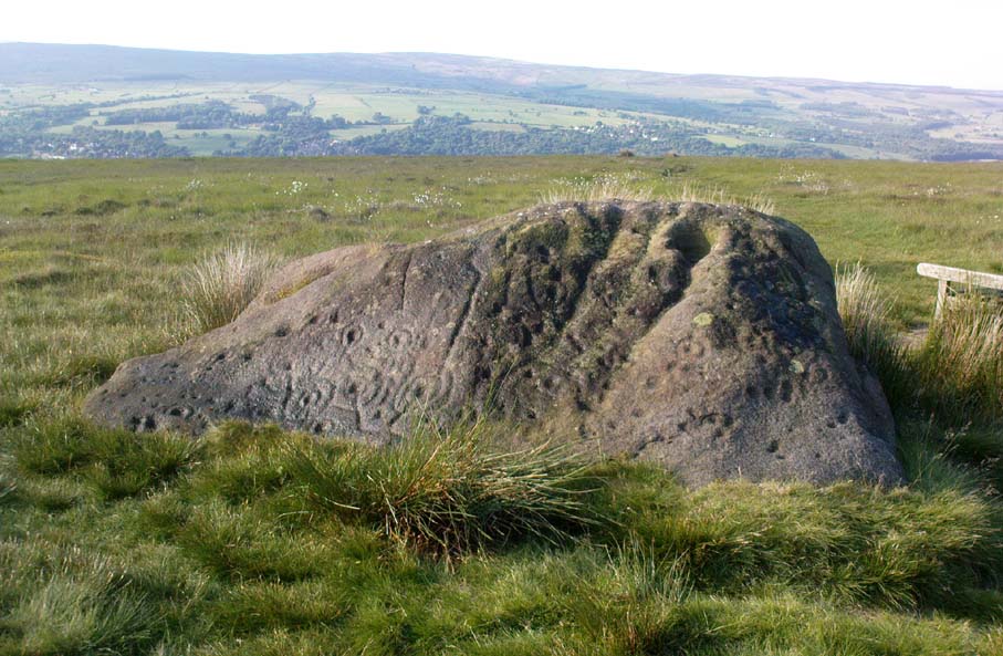
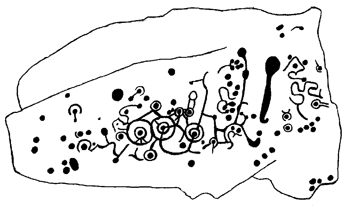
An eroded but quite excellent cup-and-ring stone — one of the very best on Ilkley Moor — comprising nearly a hundred cups, ten rings, what seems to be a half-swastika design, plus a variety of other odd motifs. It’s one of the best carvings on the entire moor and has been written about by many folk over the years. First described in an early essay on cup-and-ring stones by J. Romilly Allen (1879) — who must have visited it in poor light, as some elements of the carving weren’t noticed — he described it as a “sculptured stone near Grainings Head”, saying:
“This stone…is a block of gritstone 12ft long by 7ft 6in broad, by 4ft high. The largest face slopes at an angle of about 40° to the horizon, and on it are carved nearly fifty cups, sixteen of which are surrounded with single concentric rings. At the west end of the stone are a group, three cups with double rings and radial grooves. At the other end, near the top, is a curious pattern formed of double grooves, and somewhat resembling the “swastika” emblem… At the highest part of the stone is a rock basin 8in deep and 9in wide. On the vertical end of the stone are five cut cups, three of which have single rings. This is one of the few instances of cup and ring marks occurring on a vertical face of rock.”
Badger Stone on 1910 map
The title “badger” dates back to at least medieval times when, as the Yorkshire historian Arthur Raistrick (1962) explained, the word represented “a corn dealer, corn miller or miller’s man.” It is likely that this traditional title goes much further back, probably into prehistory, as grain was one of the earliest forms of trade. Very close to this sacred old stone are place-names verifying this, like Grainings Head and Green Gates. A little higher upon the moor is the twelfth century Cowper’s Cross (which used to have cup-markings etched upon it) where, tradition tells, a market was held that replaced an older one close by.
The Badger Stone carvingClose-up of cup-and-rings
Our Badger Stone rests beside the prehistoric track which Eric Cowling termed “Rombald’s Way” (after the legendary giant, Rombald, who lived with his old wife upon these hills): an important prehistoric route running across the mid-Pennines. This ancient route runs east-west, traditionally the time of year when agricultural needs are greatest at the equinoxes. This may have been the time when any ancient grain traders met here. (In modern times a number of archaeologists have emphasized such routes as “trade routes”: a notion that derives from the modern religion of Free Market Economics in tandem with the rise of Industrialism and social Darwinism, much more than the actuality of them as simple pathways or means of accessible movement).
There are accounts from other places in Yorkshire about these badger men. We find a number of other “badger” stones, gates, ways, stoops and crosses on our Yorkshire hills. One of them in North Yorkshire, wrote Raistrick (1962), “is an ancient trade way.” In Richmond, North Yorkshire, around the time of the autumn equinox, Badger men from across the Dales followed the old routes over the hills into town, held annual festivities and sold their grain. (see Smith 1989; Speight 1897) It is perhaps possible that our old Badger Stone would have been a site where some form of indigenous British Demeter was revered.
Sketch of Badger Stone carving
Some elements of the Badger Stone carving have what could be deemed as primitive human images (anthropomorphic) mainly on the northwestern side of the rock, emerging from the Earth Herself. And certainly amidst the same portion we have a very distinct ‘solar’ symbol, very much like the ones found at Newgrange and, for that matter, many other parts of the world.
Some New Age folk have given the fertility element to the Badger Stone a deeper status, using imagination as an aid to decode these old carvings. When feminist New-Age writer Monica Sjoo visited Badger Stone she described it as “erotic”, with the carvings giving her a distinct impression of “vulvas” and she also thought orgies of sorts had been enacted here. (Billingsley & Sjoo, 1993) The vulva imagery is a well-known idea to explain cup-and-rings and in some cases this will be valid; but when I passed an illustration of this rock-art to a number of people (all women), there was not a vulva to be mentioned — merely the OM symbol, sperm entering the egg, a snail, a bicycle, a willy, a paw-print, eyes, a face, a tadpole, cartoon breasts, the rear end of a dog, grapes, letters, numbers, ears and a snake! Awesome stuff! Take a look at the design yourself and see what you can see in it. Answers on a postcard please! (The dilemma of making specific interpretations of these carvings is that we tend to approach them with dominant ego perspectives, many of them reflecting little more than our own beliefs or search for identity, imposing unresolved journeys and conflicts on that which we encounter, as with the above case.)
As with prehistoric rock-art in general, they are a number of things: functional, ritual, history, spirit; different at each and every site. As if to exemplify this at Badger Stone, note how the detailed carvings have been executed mainly on the southern face of the stone. The northern face has little if anything to show on it. It would suggest therefore, that this stone had some mythic relationship with events during daylight hours. But we have to be careful here…
At sunrise on a good morning, we note how the eastern edges of this stone show up very clearly indeed. If Nature’s conditions are damp and wet (as they tend to be each morning on the hills), the visible outline of these cup-and-rings show up very clearly indeed. Oddly, as the sun then passes through the daytime sky each and every day on its cyclical movement, the petroglyphic content becomes a little less visible unless the stone is wet. Indeed at sun-high (midday period) the carving doesn’t show up as well as it did in the morning light. And we find the same characteristic as the sun goes to set in the west: where that part of the carved stone shows up very clearly again — much clearer than during full daytime hours. If rain has fallen, the glyphs stand out very clearly indeed.
As all cultures imbued the natural world with animistic, living qualities, it seems probable that these periods of the day (sunrise and sunset) were significant at this particular carving. It may be, very simply, that the Badger Stone “came to life” with the sunrise and its mythic nature was alive during this period; whereas with many other carvings (both on these moors and elsewhere in Britain) their strong mythic associations related to the northern Land of the Dead. But then, I could be talking bullshit!
The Badger Stone is also a strong contender for it being a painted stone. Many petroglyphs like this in other cultures were ceremonially coloured-in using lichens and other plants dyes at certain times of the day or year, relating specifically to important mythic relationships between the people and the spirit of the rock at such places. This probably occurred here.
References:
Allen, J. Romilly, “The Prehistoric Rock Sculptures of Ilkley,” in Journal of the British Archaeological Association, volume 35, 1879.
Bennett, Paul, The Old Stones of Elmet, Capall Bann: Milverton 2001.
Billingsley, John & Sjoo, Monica, “Monica Sjoo in West Yorkshire,” in Northern Earth Mysteries, no.53, 1993.
Boughey, Keith & Vickerman, E.A., Prehistoric Rock Art of the West Riding, WYAS: Leeds 2003.
Hedges, John, The Carved Rocks on Rombald’s Moor, WYMCC: Wakefield 1986.
Cowling, Eric T., Rombald’s Way, William Walker: Otley 1946.
Raistrick, Arthur, Green Tracks on the Pennines, Dalesman: Clapham 1962.
Smith, Julia, Fairs, Feasts and Frolics: Customs and Traditions in Yorkshire, Smith Settle: Otley 1989.
Speight, Harry, Romantic Richmondshire, Elliot Stock: London 1897.
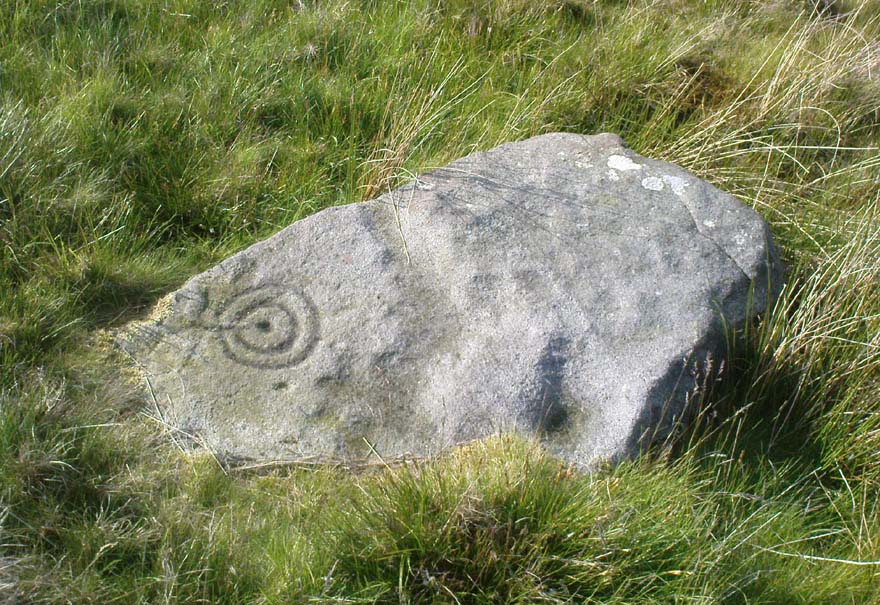
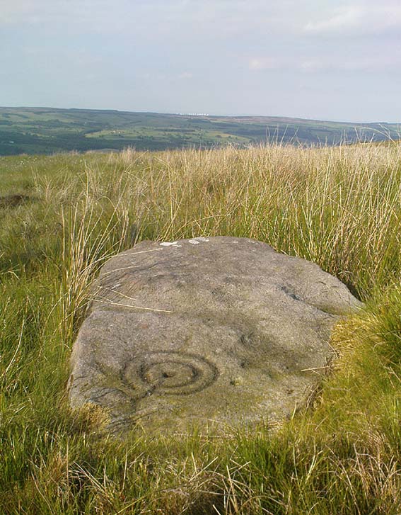
Take the road from Ilkley town centre up towards the White Wells and keep following it along until it curves up and onto the moor itself and becomes a rocky dirt-track. Go up here, past the old quarries (left) until you hit the footpath which runs east (left) onto the flat level of the moorland. Follow this footpath along for literally half-a-mile, where a footpath runs up onto the tops of the moorland. Go up here for 100 yards and you’ll see a small standing stone by the right-hand side of the footpath; on the left, into the moorland about 20 yards away, this carving is to be found!
Archaeology & History
This is an excellent, archetypal cup-and-ring stone carving and is in a very good state of preservation. Found just a few yards away from the aptly-named Pitchfork Stone, the carving here on a large single stone mainly comprises of a double cup-and-ring. A couple of other possible outlying cup-marks can be seen: one just below the double-ring, and the other towards the top-end of the rock. It was first reported by Stuart Feather in the Bradford Archaeology Group’s journal in 1961, then listed in the surveys of Hedges (1986) and his followers.
Carving 257, looking NE
When Michala Potts, Dave Hazell and I we visited this carving the other day, some halfwit had been up here in the not-too-distant past and, as with some of the carvings on the moors north of Ilkley, had daubed some paint or oily resin onto the carvings themselves to specifically highlight aspects of the carved rock (not one part of the uncarved stone had anything on it). We aint quite sure exactly what the substance is that’s been daubed onto the carvings (it aint ordinary paint), but seems like an oil or industrial substance. And, whoever’s done this, obviously seems to have some knowledge of the rock art they’re painting over: they certainly have good grid-references and enjoy walking the hills. This aint just some idiot/s into vandalizing the carvings for the sake of it, nor the whim of some airy-fairy New-Ager. Whoever’s done this (and it’s been done on other cup-and-rings around this locale) have deliberately set out to locate and paint over specific carvings — a number of them off-path — with the intention it would seem to highlight them for photographic enhancement. So — whichever retard has done this, might I suggest that you keep your industrial waste where it belongs: in your own house you fucking moron! If anyone knows who is doing this to the carvings round here, please email me (anonymously if necessary) with all relevant info. Any such communications regarding this matter will be kept strictly confidential.
References:
Boughey, Keith & Vickerman, E.A., Prehistoric Rock Art of the West Riding, WYAS: Leeds 2003.
Hedges, John, The Carved Rocks on Rombald’s Moor, WYMCC: Wakefield 1986.
Walk up from Ilkley to the White Wells and keep following the footpath upwards, up the steps and onto the moor itself. Once you’ve got to the top of the steps above the rocky valley, look straight up the slope in front of you and walk directly up the hill. As you near the top, there’s a large cairn sat on the brow of the hill (known as the Coronation Cairn). This ‘ere carving is just a few yards below it.
Archaeology & History
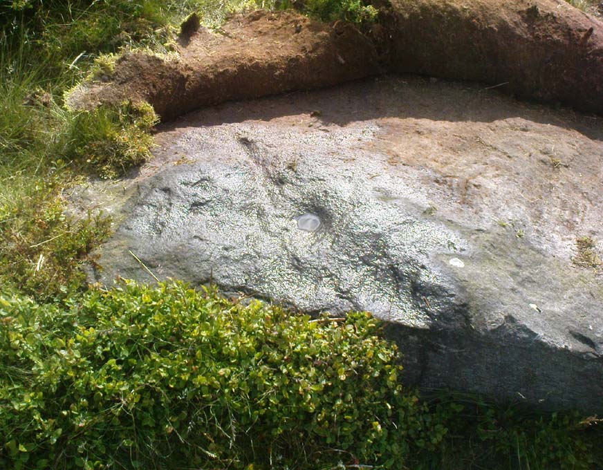
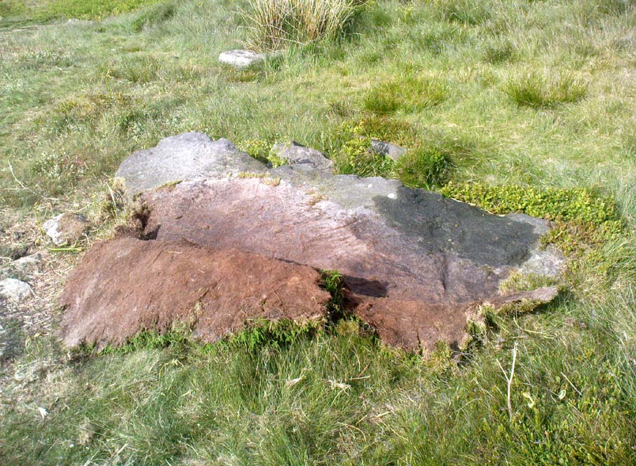
Very little has been written of this albeit innocuous carving — if indeed it is a carving! Found on the large (though overgrown) flat stone just a few yards below the Victorian cairn, all that we appear to have here is a large cup-marking with a small arc pecked around its southern side and a distinct straight line running outwards from the cup (though the line doesn’t actually touch the cup-mark and does give the distinct impression of being pretty recent). A sort of “cup-and-half-ring” with extended line is perhaps the best description!
Close-up of cup & linesCarved Stone 270
It was first reported by some English Heritage archaeologist — which, as is generally acknowledged, isn’t necessarily a good pointer for authenticity when it comes to identifying prehistoric rock art.* But it’s certainly got a bit more about it than some “carvings” they’ve reported in the past! Boughey & Vickerman (2003) made the following notes of this stone:
“”Low, flat gritstone rock quarried away on E side, fairly smooth but uneven. One large cup and deep groove slightly curving round edge of cup.”
Which is about right. I don’t really think too many of you will be into this unless you’re a real rock-art fanatic!
References:
Boughey, Keith & Vickerman, E.A., Prehistoric Rock Art of the West Riding, WYAS: Leeds 2003.
Hedges, John, The Carved Rocks on Rombald’s Moor, WYMCC: Wakefield 1986.
* A number of cup-marked stones identified by English Heritage archaeologists have transpired to be nothing more than natural erosion.
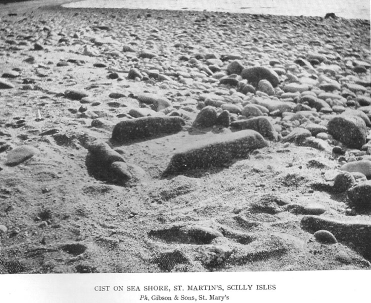
The remains of this old tomb were first noted by Mr Alexander Gibson, whose photograph of the site is here reproduced. Thought by Paul Ashbee (1974) to date from between the Iron Age and Romano-British period, the site was first described in O.G.S. Crawford’s (1928) essay in Antiquity journal. It was just one of several such sites in relative proximity to each other and which, due to them being so close to the sea, have been all-but washed over by Nature’s advance. Mr Crawford told that this,
“cist on the shore…is on St. Martin’s, between Crethus Hill and English Island Point, about 20 yards from the edge of the rushy bank, and at approximately high water-mark. It is oriented north and south and is 3 feet long by 2 (feet) wide. It has now no capstone. The cist when found was full of coarse, gravelly sand and stones, which were cleared out; amongst this were parts of leg bones (the joint-ends missing) and smaller fragments; then a piece of a human jaw, without teeth, and finally the skull. The facial portion was missing. The skull fell to pieces on removal but it and all the other pieces were preserved and the cist filled in again.”
In the same article, Crawford notes that,
“nearby, to the west, were two or three other cists of the same type, and many years ago yet others were observed, both round this bay and at Lawrence’s, to the west of Crethus Hill.”
References:
Ashbee, Paul, Ancient Scilly, David & Charles: Newton Abbot 1974.
Crawford, O.G.S., “Stone Cists,” in Antiquity Journal, volume 2, no.8, December 1928.
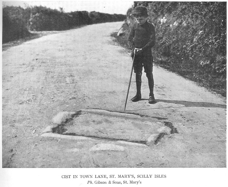
In Crawford’s (1928) article on stone-lined burials, or cists, this was one site that he described from the Scilly Isles, though little can be seen of the site nowadays as a road was built on top of it. It was first discovered by a Mr Alexander Gibson (who took the photo, here reproduced) and was described as “the cist in the road”, due to its position in the middle of the old lane. A number of flints and other Crawford told that it,
“is in Town Lane, about midway between Holy Vale and the Marconi Station, St. Mary’s (lat. 49° 55′ 35.2″ N, long. 6° 17′ 52.5″ W). Nothing is known about it, but presumably it was found when the road was made by Mr Augustus Smith more than 80 years ago. It measures about 3 feet in length by 2 feet in width, and is oriented approximately NE-SW. There is said to have been another near it, but Mr Gibson has searched without success.”
In Paul Ashbee’s (1974) fine archaeological survey, he describes there being several other small prehistoric burials found in fields a little further down the same lane.
References:
Ashbee, Paul, Ancient Scilly, David & Charles: Newton Abbot 1974.
Crawford, O.G.S., “Stone Cists,” in Antiquity Journal, volume 2, no.8, December 1928.