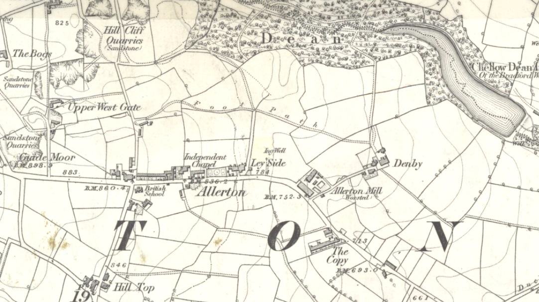
Healing Well (destroyed): OS Grid Reference – SE 1174 3443
Archaeology & History
Ing Well on 1852 map
This ‘Well of the Meadow”, or Ing Well, is one of countless springs in and around the Bradford metropolis that have been destroyed by that thing they call ‘development’. It was one of the main water sources for the villagers of Allerton village in the 19th century and earlier. Highlighted on the 1852 OS-map of the region, a singular footpath once led to the waters and no further. There appear to be no antiquarian or historical references detailing its traditions or medicinal qualities—unless of course, you know different.
The name Ing Wells is one of the most common of all titles given to water supplies in England, meaning having the same meaning and general history just about everywhere it occurs. The place-name itself was given extensive attention in two separate studies by Eilert Ekwall (1962) and Sigurd Karlstrom (1927).
References:
Ekwall, Eilert, English Place-Names in -Ing, Lund: Uppsala 1962.
Karlstrom, Sigurd, Old English Compound Place-Names in -Ing, Lund: Uppsala 1927.
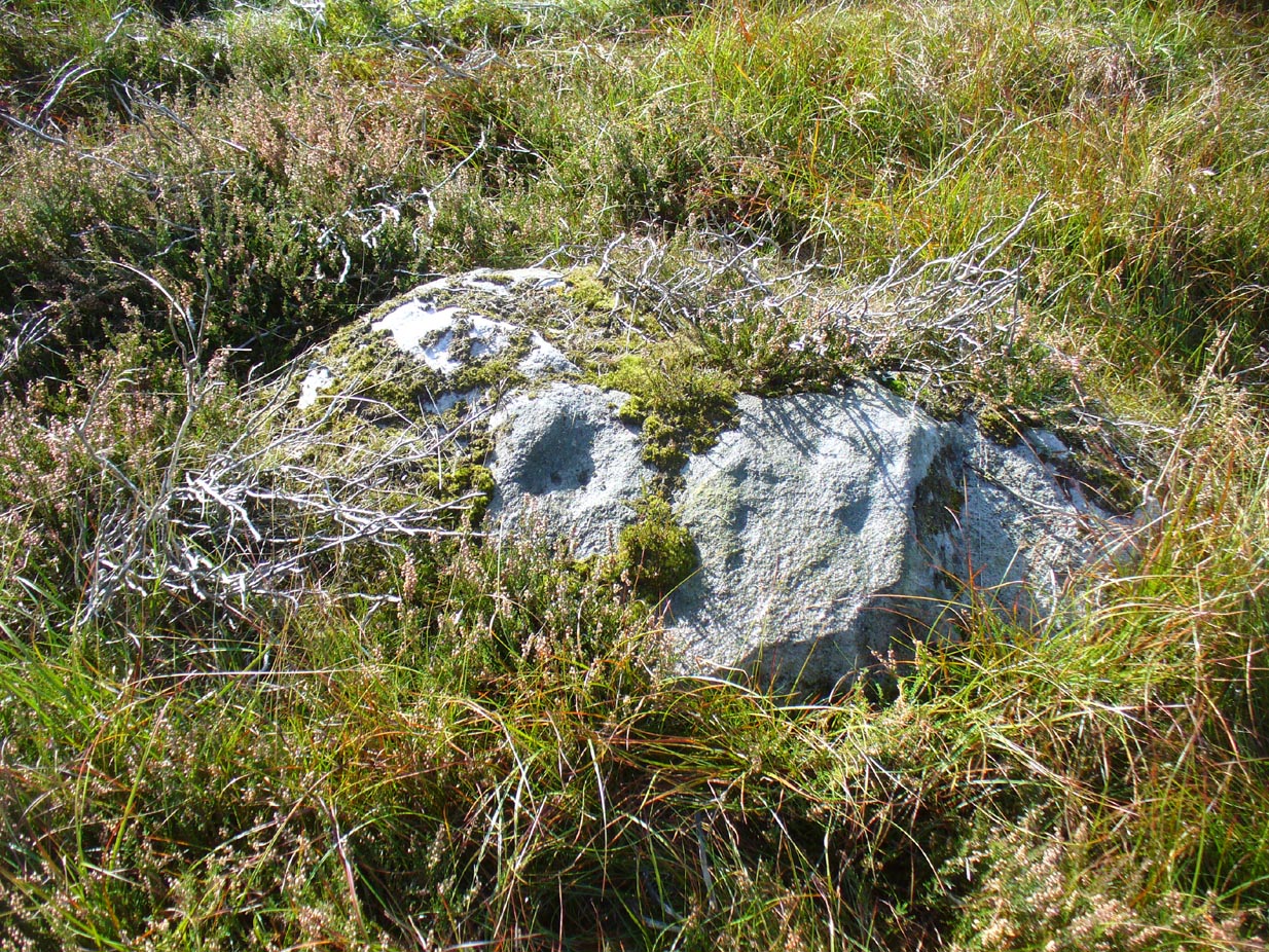
Take the directions as if you’re visiting the ornate petroglyphs known asthe Lunar Stone and the Spotted Stone. Walk past them and down the slope, NW, as if you’re heading to the small valley a few hundred yards away. As you reach the bottom of the slope, closer to the stream, a large boulder catches your attention. This carved stone is just a few yards before you reach it.
Archaeology & History
This simple cup-marked design below the northern slope of Stanbury Hill has, on its northeastern sloping face, a single cup-mark; then, past a curiously-etched line (probably more recent) is a larger circular feature, like a very shallow ‘bowl’ as in the one found in the superb Stag Cottage petroglyph complex 300 miles north (and several other carvings). A few yards away, a large single cup-mark has been etched onto another stone. As with quite a few carvings in this region, they have been missed in the standard archaeocentric surveys.
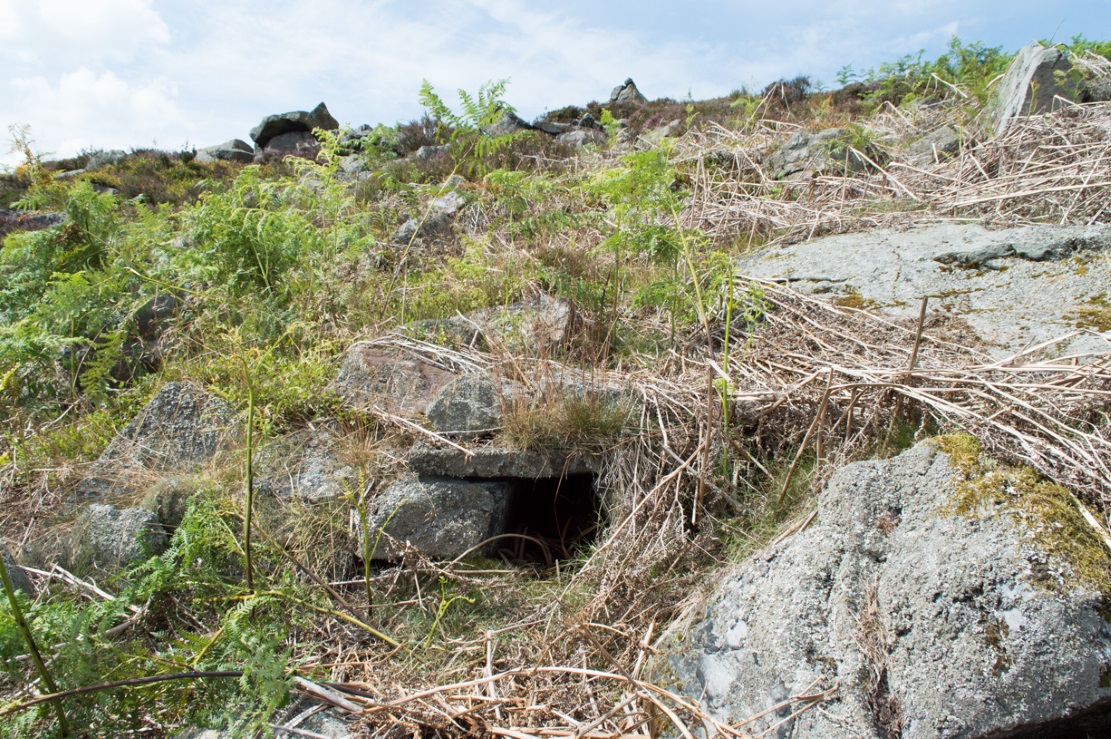
Fairy Mine, Bingley Moor (photo by James Elkington)
This is a strange one. A really strange one….. The site would not have even been written about had it not been for James Elkington pushing me to make its existence visible to a wide audience. As with many sites that I’ve rediscovered, this is one of many that I never seem to write about, for various reasons…although I did do a short piece on it (Bennett 2001) many years back in a little earth mysteries mag, but kept the location quiet. But now, James has got me to change my mind about it. If anyone can throw any light onto what they think this site might be, feel free to let us know. With the exception of is early history, this is its story…
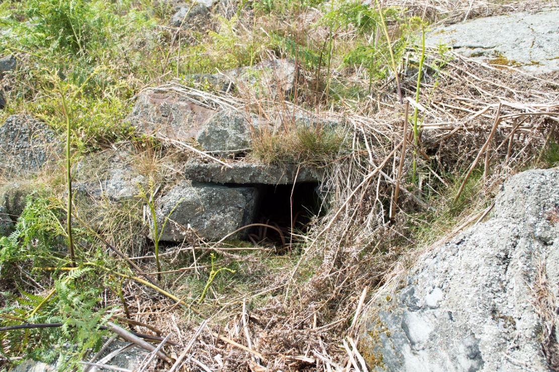
Close-up of the entrance (photo by James Elkington)
One weekend in the early Spring of 1977, Jon Tilleard and I made our weekly wander onto the southern edges of Rombalds Moor, doing little as usual apart from maybe seeking out the curious cup-and-ring stones and other ancient remains, along with walking through the obligatory bogs and wetlands, getting filthy and wet through as healthy kids do at that age. After making our way to Horncliffe Well (generally our first point of call most weeks), we decided to head straight west, off-path as always, and eventually sat ourselves down for something to eat near Wicking Crags on Bingley Moor.
As we packed up again, readying ourselves to walk further onto the moor, John stood upright. In doing so, he dislodged a stone by his feet—right where I was still sitting on the ground!
“Watch out!” he exclaimed loudly—and I quickly rolled forward to get out of the way of the impending stone. Thankfully it wasn’t too big. But then as I turned round to see what had happened, I saw John stood on the small rocky rise he’d been sitting upon—and right beneath his feet, the stone that he’d dislodged had been hiding a very curious secret indeed…
As the photos show, a small opening led into the Earth right underneath where Jon had been sitting. The stone he’d accidentally kicked away had covered and sealed a previously unrecorded entrance. Now, after however many centuries it had been closed and secret, he’d uncovered it again. For us two fourteen-year-old lads gazing into this passageway, our imaginations started running riot!
“What the hell izzit!?”—we must have exclaimed a dozen times or more to each other! To this day, we still don’t know.
I’m not sure how long we stayed here after we’d first found it, but before we left we made sure that the covering stone which had sealed the entrance was propped back upright, securely, so that no one else could find it. The site was quite a way off-path, at the head of a very large boggy area where—to this day—people very rarely walk (in all my years of walking these moors, I’ve yet to see another human walking in this area).
In looking into the tunnel for the very first time, the ground on the outside was of course covered by the usual moorland vegetation; but an inch behind where the stone had sealed this tunnel, the floor was grey dust, all the way in. There were no animal tracks, neither mice nor others, no droppings, no nothing (which we thought was rather unusual). No plants of any form were evident. This ‘door’ had been closed for a very long time it seemed. …Today if you visit the site, ferns and other small plants have encroached several feet into the tunnel.
The entrance itself is about 14 inches across, and from the ground to the top covering stone the entrance is less than 12 inches high, showing quite clearly that no humans can walk in or out of it. Which added to the puzzle: what the hell is it? And why was it sealed with a covering stone? But the more we looked (it became our regular port of call each time we were on the moors) the more obvious it became that a huge amount of work had gone into creating this antiquarian oddity.
As Winter came and cleared all the vegetation surrounding the site, we got an increasingly clear picture of it. But this wasn’t before we tried to get inside! Jon and I failed, but our torches showed that it went in for about 20-30 feet or so and then appeared to be stop, blocked by another stone. Thankfully I had a younger brother, Phil, who was seven-year old at the time—so we took him up to have a look at the place. We figured that only a small person could get inside the tunnel, but we didn’t tell him this (nor my parents!) until we arrived.
With torch in hand, Phil slithered into the entrance and, eventually, his little feet disappeared into the ground. He didn’t seem too happy about it as I remember—but I was his big brother! (cruel – cruel – cruel!) Shouting back down to us as he slithered further and further in, when he reached the blocking stone in the tunnel he exclaimed—”You can go round it!”
“What!? Really!?”
We were excited.
“Keep going Phil,” we urged. But he wouldn’t.
“I’m scared Paul,” he said. “I won’t be able to get back out”—or something along those lines. And he was probably right.
But he managed to get his young tiny body slightly round the blocking stone that he’d reached and shone the torch-light down the extended tunnel. He told that the it just kept going into the hill still further, keeping the same size and dimensions and straightness for about the same distance again—but then it started to curve very slightly, bending to the left (northwest) until it disappeared underneath the entire hillside, stretching out of sight. It seemed from his description, subsequently, that the tunnel went on for another 50 feet at least.
Once he was safely back out, he reiterated how far in it seemed to go. We walked up the hill under which it had been built and Phil bimbled to roughly where he thought the tunnel was as he saw it with the torchlight. Standing on the hilltop, this was obviously an extraordinary feat as there are thousands of tons of rock and earth covering it! Curiously, years later, a dowser who visited the place walked the same route that Phil had described when he went inside it (we told the dowser nothing of Phil’s venture until afterwards).
Denuded walling leading to entrance (photo by James Elkington)Low walling leading to the ‘Mine’ (photo by James Elkington)
When all the moorland vegetation has died back, you can clearly see how the tunnel has been built upon by a large mass of earth and rocks, some of them loose. All round it is an extended collapse of what seems to be quarried stone tumbling down the hillside. At the top of the hill are the remains of old walling and at least two walled structures—although they appear to be post-medieval in nature, not prehistoric. At the entrance itself is evidence of continued walling of some form. It seems as if a wider man-made chamber of some sort may once have stood here, right in front of the present-day entrance. Even if this proves not to be the case, there is very clear evidence that the tunnel which goes into the hillside was once longer, as low walling continues outside away from the entrance, bending away some 50 yards to the southeast, before ending with no indication of additional structural remains. This walled structure swerving out from the entrance is equally perplexing.
The closest prehistoric feature is an unrecorded cairn and petroglyph a few hundred yards away. As far as I’m concerned, this tiny little entrance into the ground isn’t prehistoric. But I’m nonetheless still very intrigued by it, not least because of a few very strange things that subsequently occurred here after we’d discovered it.
Whoever did this, went to a helluva lot of trouble and immense effort to build it. And for what? …Since being opened nearly 40 years ago, very few people have been to see this curious entrance into the Earth. I’ve kept its location hidden. But amongst the visitors has been an archaeologist, a historian, antiquarian authors, occultists and friends. None have been able to say what this site might be. From souterrains to mine-shafts, probably the best suggestion so far was by Mr Paul Hornby who suggested it might have been some sort of kiln, as there seems evidence of fire against one of the stones. But there are anomalies with the site that don’t quite fit the glove of a normal kiln. The extended collapsed ‘tunnel’ which reaches way out, past the entrance which Jon broke in the 1970s, doesn’t make sense; nor the fact that the tunnel goes way into the natural hillside. Indeed, many things here don’t make sense, simply—I presume—because we haven’t asked the right question yet.
But one thing seems obvious: there may be something at the end of this tunnel, deep inside the hill, which someone many centuries ago, for some odd reason, wanted to keep hidden for a long long time. What’s at the end of this tunnel? And if it’s valuable treasure deep in there—it is NOT going to some museum which then, in later years, will be sold off cheaply to some wealthy dood when the museum runs out of money. It should be kept within the safe holdings of The Northern Antiquarian. If this becomes an issue, whatever lies at the end will simply be re-buried elsewhere.
Fortean History
On that fine Spring morning when we first discovered this “mine shaft for little people” as we called it, before we went on our way, we placed the stone that Jon had dislodged that had covered the entrance back into position so that no one could see the opening leading into the ground and under the hill. It was firm and secure when we left—we made sure of it.
The following Sunday morning we made our way back up past Horncliffe Well again and onto this little mine-shaft to sit and have summat to eat. The rocky arena here made it difficult to locate, even though we knew where it was. But when we eventually did find it again, the covering-stone was missing. In fact it had been rolled a good 5 yards away from the entrance. This was odd, we thought—considering that no one even knew of its existence. We wondered if an animal had taken up residence inside, but there were no tracks or remains consistent with this initial idea. We puzzled about it, ate our food, and said our au revoirs. Before we left, we repositioned the covering stone again to block the entrance. This time we made it a little more secure than previously.
The following Sunday morning we visited the site again—and the covering stone had been removed, again! So we replaced it, securely, and visited the place a week later—and the same thing had happened again. This occurred time after time, month after month, year after year. Every single time we covered the entrance, something came and removed it. Yet no one ever comes on this section of the moorland—and even if they did, the site is very difficult to locate. Until now, the site has never been added to any archaeology or history records anywhere—so no one knew of its existence (in asking two of the moorland rangers who’ve worked here over the decades, neither of them knew what we were talking about).
When Andrew Hammond and I left school at 18 (in 1981), we decided as a ritual to bring our school books onto the moor and burn them as the sun was setting in the northwest. We sat near the little mine-shaft and sang our songs of joys at being out of school at last—and as the darkness began to fall over the moor, we replaced the entrance-stone again. Within 30 minutes Nature had cast pitch black across the moor and we fell asleep.
Awaking at sunrise the following day, we wandered down the slope to the little mine-shaft where we’d repositioned the stone only hours previously. It had been moved again, several yards away from the entrance. No animal could have moved it. Whatever it was, it kept doing it every time we repositioned the covering stone. No animal tracks, droppings, or any evidence whatsoever of Nature’s creatures being responsible for the constant removal of the covering stone has ever been found. The constant removal of the covering stone remains a complete mystery.
When a dowser came and tried tracing the underground route of the tunnel in the early 1990s, his rods took him to the top of the rocky hill above, then led him in a small curve to the northwest for more than 100 yards before stopping.
Note:
In the event that archaeologists ever get round to excavating or assessing this site, I would appreciate being contacted before anything is done and would love to be involved in any work performed at the site. I’ll be a good boy! Other remains nearby (usually covered by heather) need appraising to enable a more complete analysis, otherwise all subsequent reports would lack wider archaeocentric contextualization. Thanks, in advance. 🙂
References:
Bennett, Paul., ‘Into a Mythic Domain – a Passage into the Ilkley Underworld,’ in Northern Earth, 87, Autumn 2001.
Acknowledgements: Huge thanks to James Elkington for use of his photos to illustrate this site profile.
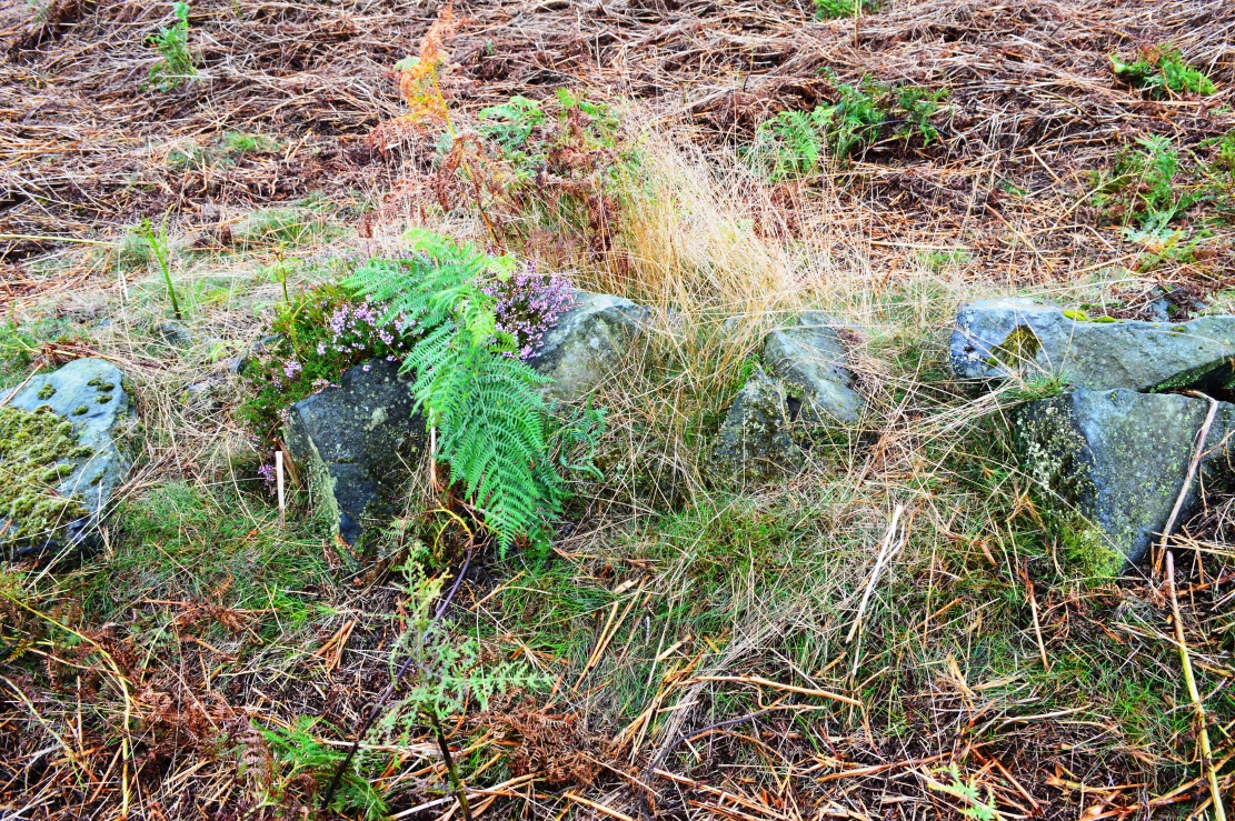
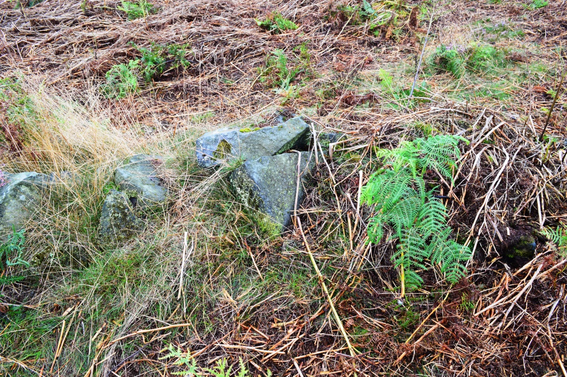
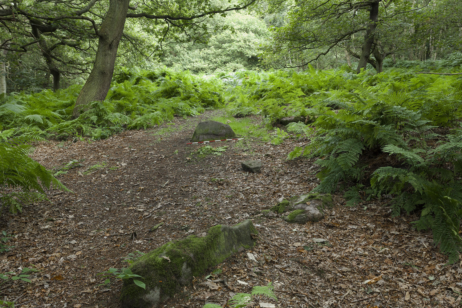
Having lived close to these woods in the past, I have searched extensively for any remains of the stone circle described by a Miss Alice Wells in the very first issue of the Cartwright Hall Archaeology Group Bulletin, but to no avail. A meeting to examine this site was supposed to have taken place in September 1953, “but as Miss Wells was unavoidably absent this was not seen.” And still to this day it remains hidden [or non-existent, whatever the case may be]. There is ample evidence that prehistoric man roamed this region, as finds of cup-and-ring stones and iron age walling indicate. A possible contender for this stone circle could be the small ring of rocks seen near the bottom of the wooded hill beneath the giant Hanging Stone, close to grid reference SE 2003 3748. About 10 yards across, this looked like a smaller version of the Roms Law circle several miles west, but is much overgrown and not visible beneath the undergrowth of summer vegetation.
The presence of prehistoric cup-marked stones in this woodland clearly indicates Bronze Age activity here and—as such petroglyphs have a tendency in West Yorkshire to be associated with tombs and death in many cases—may indicate the lost site was indeed a cairn circle and not a true stone circle. Seems likely to me. If anyone has any photos of this site, or can ascertain its exact whereabouts, please let us know and all credits will be given for its rediscovery.
References:
Bennett, Paul, The Old Stones of Elmet, Capall Bann: Milverton 2001.
Jackson, Sidney (ed.), “Calverley Wood,”in Cartwright Hall Archaeology Group Bulletin, 1:1, July 1954.
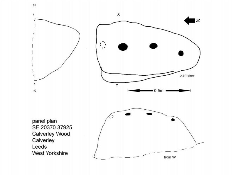
Mike Short tells: Walk ENE along Thornhill Drive (no vehicular access) to gate across road at the last house on the Drive and continue on for approx 475m where road starts to narrow slightly, becomes a little steeper and gently turns to E. Thornhill Drive is now cut into the hillside at this point with an upwards sloping bank on the S side of the path. After approx 25m further on at approx SE 20375 37950 look out on the S side of the path for a pile of boulders sitting on bedrock on top of the bank and a large rectangular tabular rock on the side of the bank. Ascend the bank and from the boulder pile the panel is approx 22m 200º(T) in the middle of an ephemeral E-W path more defined to W.
Archaeology & History
The profile (and ‘How to Get There’) for this recently discovered cup-marked stone was forwarded to me by fellow rock art explorer, Mike Short. The carving is another basic design found in Calverley Woods, between Leeds and Bradford, nearly halfway between the missing petroglyphs of West Woods 2 and Sidney Jackson’s Calverley Woods Stone. Rediscovered by Lisa Volichenko some time ago, Mike described the new carving here as follows:
Sketch of the carving (courtesy Mike Short)Cup-Marked Stone nr centre (courtesy Mike Short)
“Panel is carved on W sloping face of a sub-triangular earthfast coarse-grained sandstone boulder 0.81m X 0.50m X 0.38m, the longest axis lying almost exactly N-S. Carving consists of 3 cups, the most N of which is elliptical approx 65mm X 55mm; the central cup is elliptical approx 50mm X 40mm and the most S is circular diameter approx 40mm. On the N edge of the W face is a shallow elliptical depression thought to be of natural origin. There is an area of damage along the ‘crest’ of the boulder close to its S end.
“Carved rock is the most E of five rocks, measuring between 0.70m and 1.15m in length, in very close proximity forming an arc, 3 of which are in the footpath and one of which is resting on a large slab of rock almost completely covered by soil and vegetation.”
And so the small number of cup-marked stones in this woodland slowly grows. One wonders how many more are hidden beneath the roots of the trees—and are all of the lines and cups atop of the great Hanging Stone, a short distant away, all Nature’s handiwork…?
Acknowledgements: Huge thanks for Mike Short for the data, photos and sketch of this carving.
Although now seemingly lost, it’s location is damn close to this: Along the A657 between Greengates and Bradford, where the New Line meets Carr Road, the dirt-track takes you into Calverley Woods, down Eleanor Drive. About 250 yards along (just before you get to the field on the left), take the footpath down the embankment towards the stream where it bends to the left and where the land levels out (don’t cross the stream). It’s somewhere round there!
Archaeology & History
This was one of two previously unrecognised carvings we came across sometime in 1985 (see West Woods 1 stone), when we were seeking out another missing carving in the same woods. It was clear and well-defined as the faded photo here shows; but having been back to try find it twice in the last two years in the hope of getting better photos, I’ve been unable to locate it. The carving was described in an article I did in an old earth mysteries magazine. It comprises simply of a large ring surrounding and enclosing two deep cups, which were linked to each other by a connecting carved line. Parts of the stone had been chipped in parts—including a section of the large ring— due to some industrial workings that had happened here in the past. Thankfully I managed to find the old photo and hopefully, perhaps, some local explorer could try and seek out where it’s hiding beneath the trees and other vegetation.
References:
Bennett, Paul, “The Undiscovered Old Stones of Calverley Woods,” in Earth no.2, 1986.
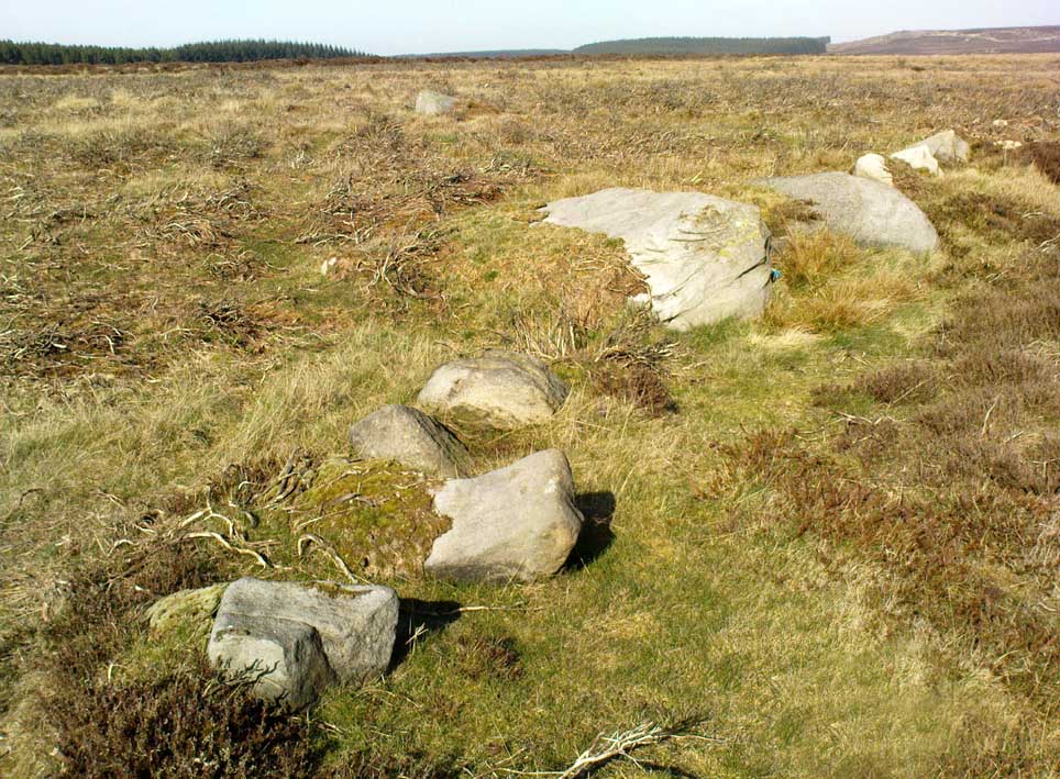
Follow the directions to reach the small Rivock East Carving just on the level of the small moorland. From here, walk less than 100 yards east, staying just on the edge of the moor, keeping your eyes peeled for the irregular shaped rocks running in lines roughly parallel with the footpath above the edge of the crags.
Archaeology & History
Recent explorations in and around the Rivock Edge area found, not only a number of undiscovered cup-and-ring stones, but the overgrown remains of an undoubted prehistoric enclosure on the ridge of moorland above the rock escarpment which has not previously been reported in archaeological surveys. Much of the time the area is covered in deep heather, but thanks to this small section of moor being burnt back a short while ago, the lines of walling that mark the enclosure are there for all to see. It’s obvious that some sections of the old walls have been removed in the not-too-distant past for use in more modern walling and, nearby, old quarries and farming have probably been responsible for other destructive elements.
Easternmost line of Rivock enclosure walling
This enclosure is of a rough, rounded, scalene triangular formation, with the main piece of extant walling running roughly northeast-southwest. The walling is typical of other settlements and enclosures in the region, probably Bronze Age in nature, Iron Age at the latest, with some natural earthfast boulders marking parts of the outline and many smaller pieces of rock and packing stones being added to build up the structure. The same layout is found at other nearby prehistoric enclosures at Crow Well, Dumpit Hill, Snowden Moor, Woofa Bank and many others.
Of the larger upright stones in the Rivock Enclosure, several of them stand about three feet high, with some of them having been knocked down. The longest line of walling, running roughly east-west, is less than 50 yards long; whilst the enclosure wall running roughly north-south on its eastern side is 30 yards long. Much of the walling along its northern side appears overgrown and sections of it are missing.
For a long time I puzzled as to whether there had been any settlements on this part of Rombald’s Moor, rich in cup-and-rings stones — and at last we find that there was at least one such site. Forays back and forth across the level ground all around here failed to locate any other similar enclosure remains; but it may be that some have been covered (or were destroyed) in the adjacent forestry plantation to the west. Further explorations by fellow antiquarians may prove worthwhile when the forest is cut down in the next few years.
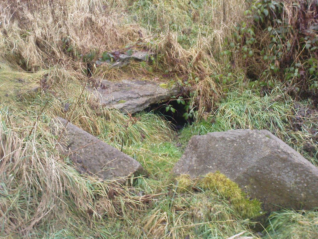
Whether you’re coming here from Wrose or Eccleshill, go along Wrose Road and turn down Livingstone Road at the traffic lights. Down here, when the road splits, head to your right until you meet with those stupid road-block marks (where you can only get one car through). Just here, walk down the slope and path on your right, and before you hit the bottom of the slope, walk down the small valley for about 20 yards until you see the small stream appear from beneath some overgrown man-made stone lintels. That’s it!
Archaeology & History
When I was a kid I used to play down this tiny valley when the waters here still had small fish swimming away (we used to call them ‘tiddlers’). The fish seem to have gone, but there are still waterboatmen on the surface, indicating that we still have fresh water here – and on my most recent visit, I cautiously tasted the waters and found them OK (the prevalence of broken bottles and beer cans from locals doesn’t inspire you to drink here though).
Initially located on the local boundary line between Eccleshill and Wrose, the waters used to be found running into a trough about 100 yards further up the small valley, but this has been lost and housing now covers its original site. You can see how the stream has cut the valley further upstream, but now it bubbles up from beneath the rocks shown in the photo. Bradford historian Robert Allen (1927) described the site in his survey as originally being between North Spring and South Spring Wood.
Although the name Sweet Willy Well remains a mystery, one of its other titles — the Lin Well — relates to the presence of linnets that used to be found in great numbers here. The ‘Sugar Stream’ name is one we knew it as locally as children, due to the once sweet taste of the waters. It is likely to have had medicinal properties, but these have been forgotten. No archaeological survey has ever been done of this site.
References:
Allen, Robert C. (ed.), The History Of Bolton In Bradford-Dale; with Notes on Bradford, Eccleshill, Idle, Undercliffe, Feather Bros: Bradford 1927.
Takes a bit of finding this one, and isn’t that impressive, so is probably only of value to the real enthusiasts. From Shipley, head up to Northcliffe and take the walk into the woods. Walk along the valley bottom, past the old train line at the bottom of the valley, and keep going for a few hundred yards until you meet with the small pond or damn on your left. Somehow cross over the stream and walk up the overgrown hill right above the pond. You’ll notice a single rock, on the right-hand side of the tiny stream running down the slope you’re walking up, just on the top of the ridge near the tree-line about 20 yard or so before the golf course. That’s it!
Archaeology & History
Drawing of the Northcliff carving
This little-know cup-and-ring stone, seemingly in isolation just over the northern edge of the golf-course about 20 yards into the woods at the top of the ridge, cannot be contextualized with any adjacent monuments as the area has been badly damaged by the industrialists, as usual, with both quarrying and the golf course – much like the damage done at Pennythorn Hill, above Baildon.
This rock has what seems to be at least five cup-markings: two quite prominent, the others smaller and more faded. Earlier surveys by the likes of Sidney Jackson (1962) saw another two cups on the stone, but these seem to be natural. A curious large ring runs around the cup near the top of the stone, but this is pretty faint nowadays. One of the cups along the edge of the stone also looks like it may have had an arc carved around the top of it, but this needs exploring at different times of day and in different lighting conditions to verify or deny this.
References:
Jackson, Sidney, “Cup-Marked Rock, Northcliff Wood,” in Cartwright Hall Archaeology Group Bulletin, 7:6, 1962.
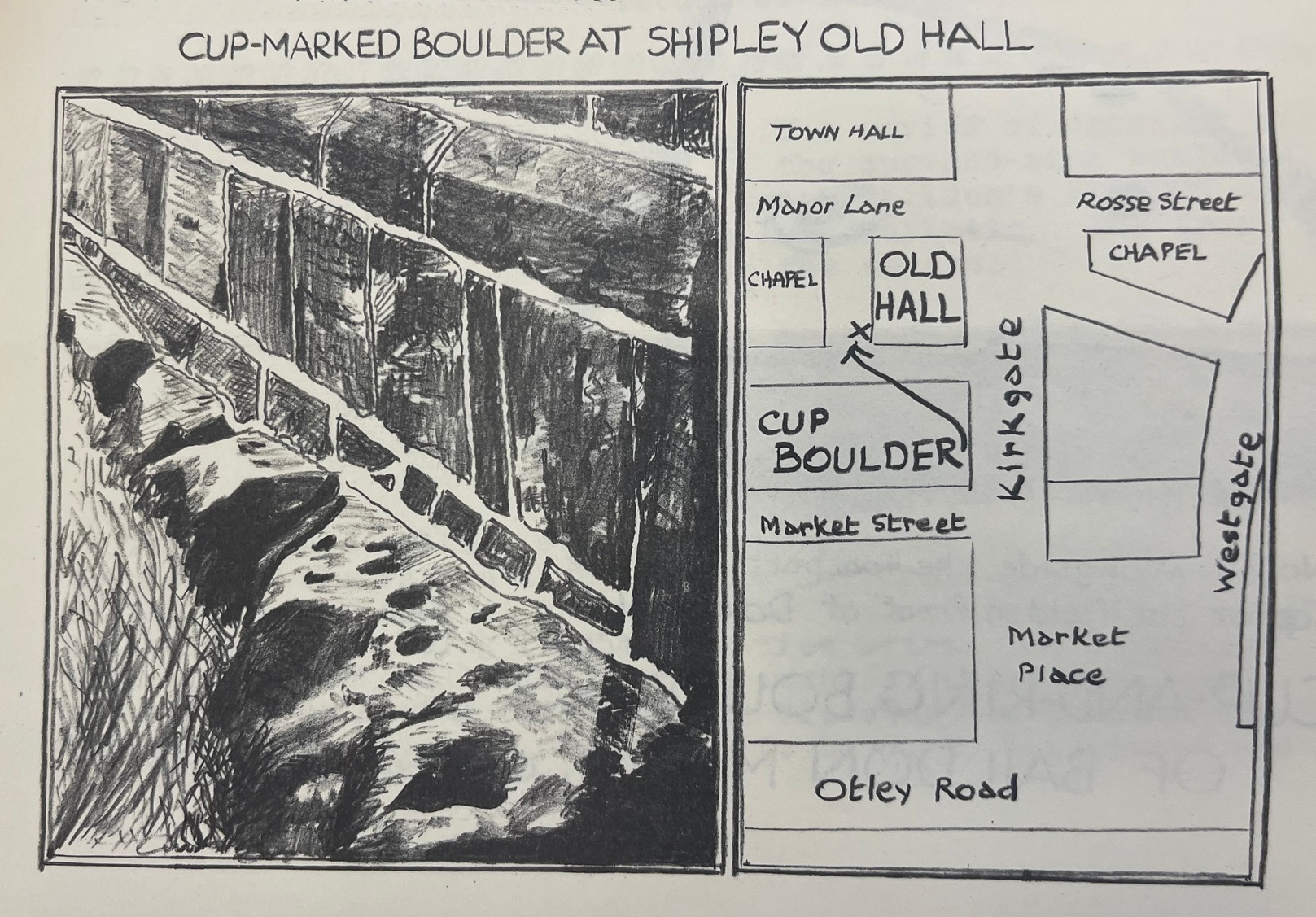
From Shipley town centre open market, take the Kirkgate road up to Saltaire, past the old town hall. On the other side of the road take the little path into the Bowling Club, in the trees (if you hit the church you’ve gone too far). Once standing in front of the bowling green itself, you need to walk along the left-side path. Two-thirds of the way down, now laid in the ivy-covered area below the old quarry face, you’ll find what you’re looking for.
Archaeology & History
I remember first seeking out this carving when I was still at school and wondering how the hell it got here – and believed it to be a fallen standing stone at the time! It seems that the stone was cut and readied for use as a gatepost instead, at some time long ago.
Close-up showing cups & linesIn its previous locale
The curious cup-marked stone has travelled about a bit, somehow. Formerly at the edge of a field in the grounds of Bradford Grammar School 3 miles away (at SE 1523 3583), the fella was then built into the wall of the now-demolished Shipley Old Hall, before reaching its present resting place at the edge of the bowling green. Consisting of around 16 cup-markings with carved lines seeming to link them here and there, it was first mentioned by the late great Sydney Jackson (1955) in an early edition of the Bradford Archaeology Journal. The carving was recently included in the Boughey & Vickerman (2003) survey, where they described it as,
“Medium-sized fairly smooth grit rock with coarse line down top, probably natural, evidence of quarrying on edge. Sixteen or seventeen cups, one with a groove out has a deeper cut within it and twelve of the others are linked in pairs by short grooves. This has been interpreted as feathering for quarrying, but the grooves are across the line of likely split, rather than along it.”
And for those of you who live nearby: if you check this out, see if you can locate an earthfast boulder near here which I recall having a cluster of distinct cup-marks running on top of the rock along one side. I couldn’t find it when I looked a short while ago, it’s not in the archaeology survey lists, and it remains lost—in the heart of Shipley no less!
References:
Boughey, Keith & Vickerman, E.A., Prehistoric Rock Art of the West Riding, WYAS: Wakefield 2003.
Jackson, Sydney, “Cup-Marked Boulder, Shipley Old Hall,” in Bradford Cartwright Hall Archaeology Group Bulletin, 1:10, 1955.