Sacred Well (destroyed): OS Grid Reference – NO 32898 50521
Also Known as:
Carling Well
Archaeology & History
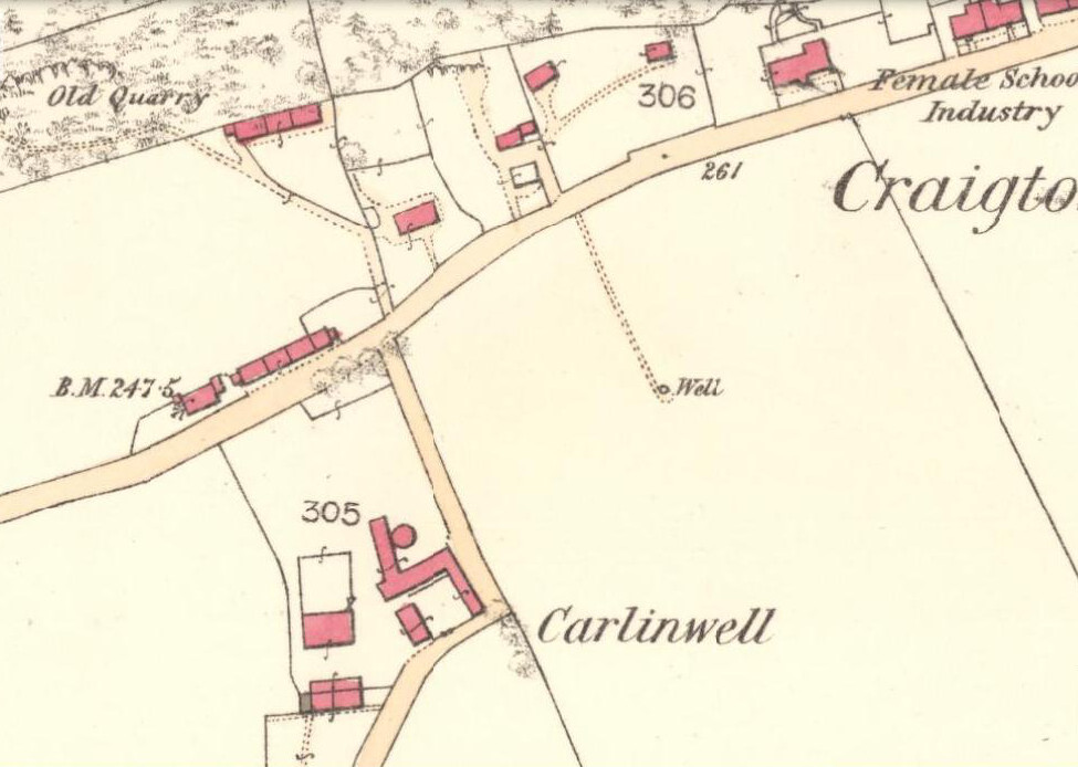
Carlin Well on the 1865 OS-map
Also known as the Carling Well, this place was shown on the earliest Ordnance Survey maps near the middle of the field next to Carlinwell Farm. On that map (as we see here) the water source had a singular track leading straight from the road to the well and no further. But by 1900 both the track and the well had been covered over and seemingly destroyed. A great pity…for if the place-name and dialect analysis is correct, this was once another sincere site dedicated to the cailleach, or Old Woman, or witch of Gaelic legend: the prima Mater of indigenous Scottish, Irish and northern myth.
The dip in the field where Carlin Well once appeared
The word “carlin/g” is explored in some detail in William Grant’s (1941) magnum opus, giving all possible derivations as found in Scotland. Whilst one definition relates the word to being “the last sheaf of corn in the harvest field”, this element relates to the wider mythic virtues of the cailleach Herself. It’s general form relates specifically to a “woman, generally an old woman and often in a disparaging sense”; aswell as “properly an old crone, but now generally in sense of a big woman.” Again, these are attributes central to the cailleach Herself. The derivation of “a witch” is widely known, and is a term used across the northern lands in stories of pre-christian lore and Creation Myths, specific to the cailleach. One more derivation tells of the word relating to a corruption of Yule plays (possibly relating once again to Nature’s cyclical traditions as enacted by our peasant ancestors which would once more have been attributed to the cailleach) and another saying how the word was used as a derogatory term to insult men!
But unless good evidence to the contrary can be show, this covered site is, in all probability, another example of a place that was dedicated to the primary heathen female deity, or Earth goddess, as She was known throughout the northern lands of England and Scotland.
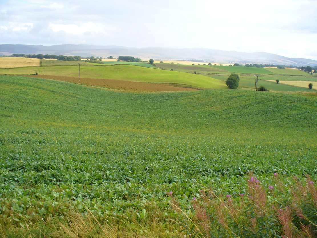
Carling Well field, looking north
The field in which the well once emerged has a distinct ‘bowl’ shape to it, exactly where the Carlin Well is shown on the map—and this large bowl can be seen clearly from the A926 road above, as shown in the photo here. When we visited the site a week ago, the field was still full of crops so we didn’t explore the site; and we could find no one at the adjacent farm of the same name, who we hoped might have been able to give us further information. If anyone has any further information about the place, please let us know!
References:
Grant, William (ed.), The Scottish National Dictionary – volume 2, SNDA: Edinburgh 1941.
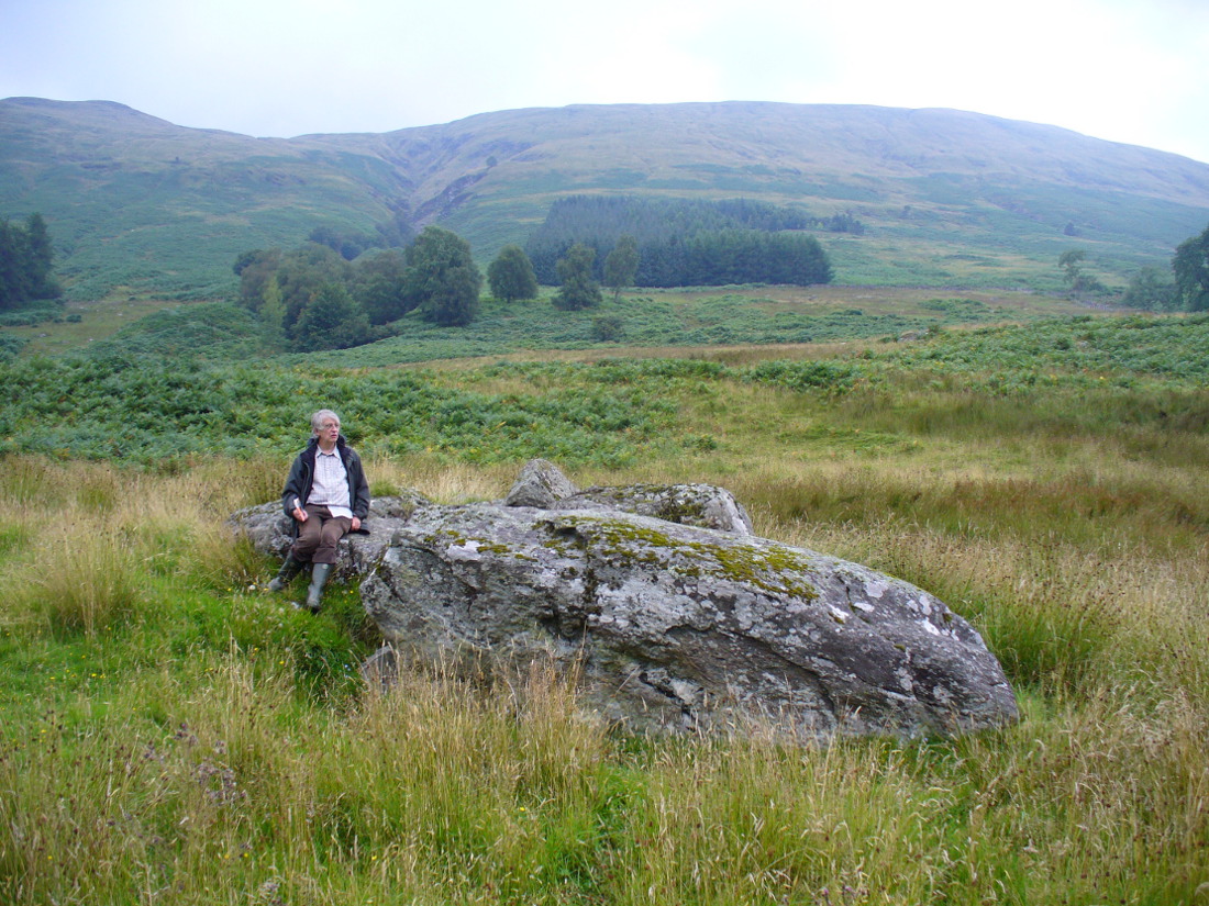
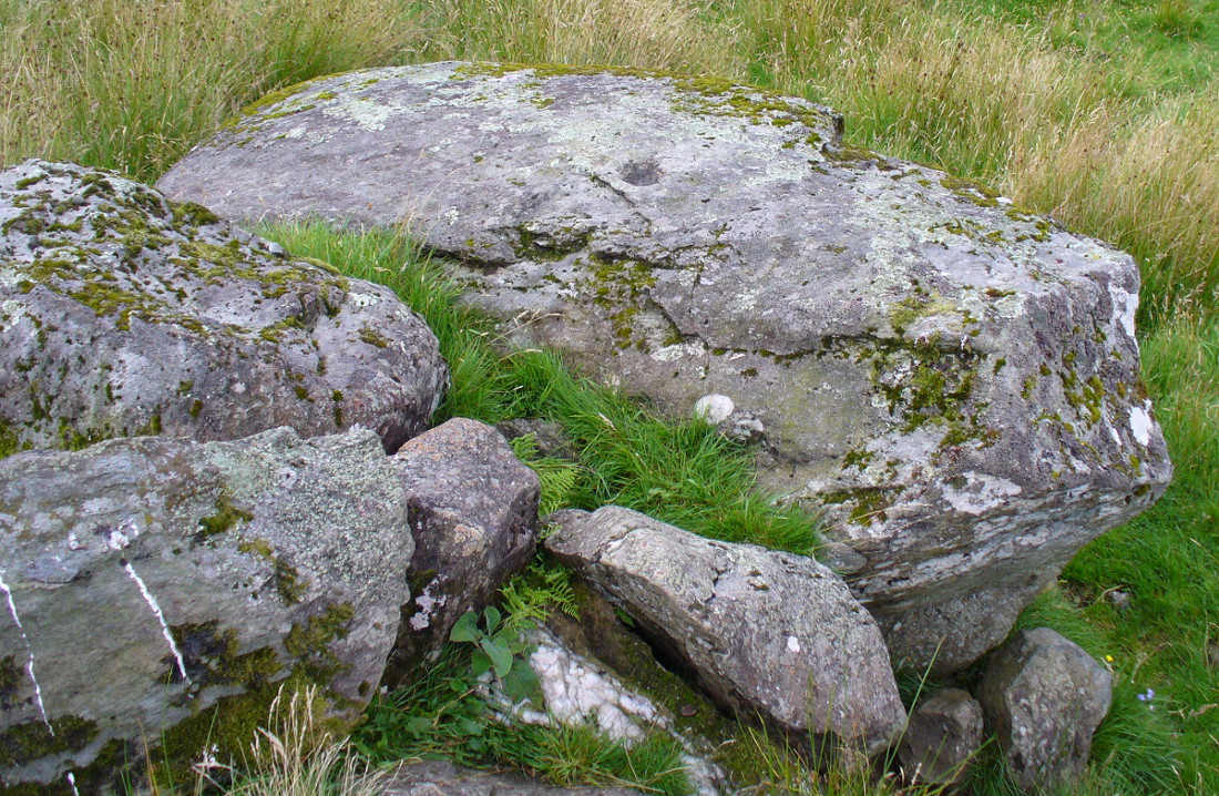
From Balquhidder village, walk eastwards along the road for a few hundred yards until you reach Auchleskine Farm on your left. A short distance past here there’s a gate taking you into the rough field on the left. Go through here and note a large clump of rocks diagonally up the slope about 100 yards away. That’s your spot!
Archaeology & History
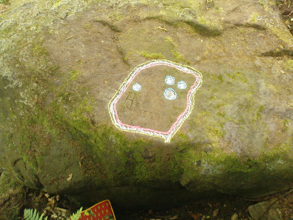
Very little has been said of this large cup-marked stone, just up from the road near Balquhidder. It was first found and described in J.M. Gow’s (1887) fine essay on the local antiquities of the area, where he told:
“About 400 yards directly east from the farm-house there is a group of three large water-worn boulders of coarse mica-schist, with veins of quartz, the largest of which is about 15 feet long, 7 feet broad, and nearly 5 feet above ground. On the top of this stone there are seven cup-marks of various sizes. The largest are 5 inches in diameter and 2 inches deep; the smaller ones are shallower and from 1½ to 2½ inches in diameter. There may have been more marks on this stone, as a portion of the top near the marks has been broken off, and there are several other faint hollows, but, in my opinion, not sufficiently pronounced to indicate that they ever were cups.”
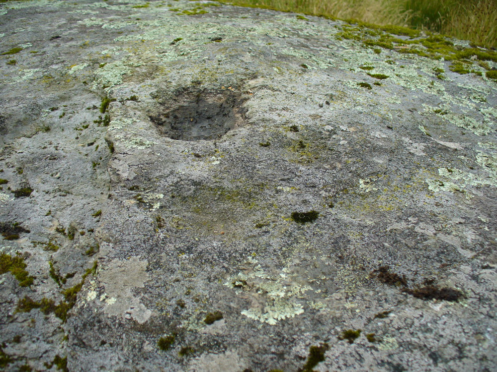
Cupmarks on top of the rockThe carving from above
Although his caution on the number of cups on the stone is to be commended, it was obvious during our visit to the site a few days ago that there are at least 18 cup-marks on the surface of this large rock. There may be more (the grey cloudy day and misty light wasn’t good in allowing us to see the carving clearly). The most pronounced of the cups are on the very top of the stone, whilst others were carved mainly on the eastern slope of the rock.
At least two other cup-marked stones occur at the farmhouse itself, whilst on the road immediately below was once the cup-marked healing stone known as Clach nan Sul. It’s likely that other carvings are hiding away in the hills hereby…
References:
Gow, James M., “Notes in Balquhidder: Saint Angus, Curing Wells, Cup-Marked Stones, etc”, in Proceedings of the Society of Antiquaries Scotland, volume 21, 1887.
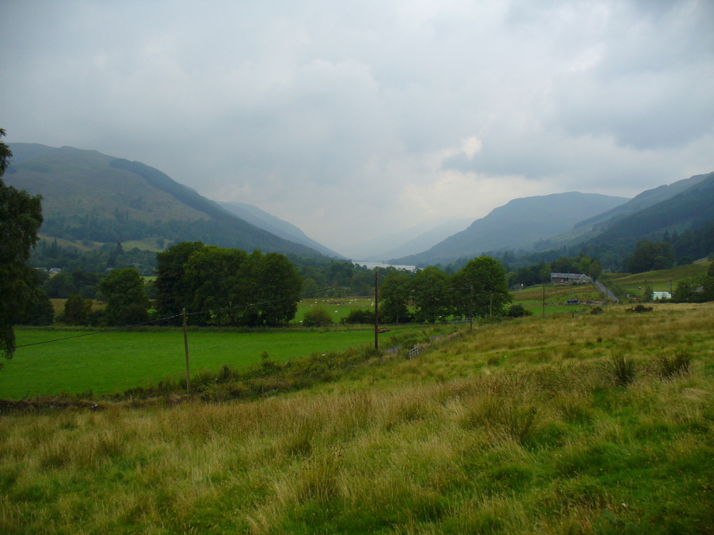
Looking down Balquhidder Glen from Clach nan Sul’s old home
Apparently destroyed, although some remains of the stone were said to be seen in the walling by the roadside; but when visiting this spot a few days ago the summer vegetation had completely covered any potential finds here. The stone fell foul of the usual self-righteous industrialists when the track alongside which it had sat for countless centuries was turned into a road and the stone was “blasted”. It was found some 20 yards below the large cup-marked stone known as Wester Auchleskine, seen amidst the clump of rocks in the field above.
The stone was described in MacKinlay’s (1893) fine survey on Scottish holy wells due to the healing properties of the waters that collected into the rock basin here. The earliest record of the site that I’ve found comes from the hallowed papers of the Scottish Society of Antiquaries, where—in J.M. Gow’s (1887) rambles just east of Balquidder—he told us the following:
“Going still further east to the first turning of the road beyond the farmhouse of Wester Auchleskine, and on the left-hand side, there used to be a large boulder with a natural cavity in its side, famous as a curing well for sore eyes. This stone was called “Clach nan sul” (the Stone of the Eyes). In 1878 the road trustees caused it to be blasted, as it was supposed to be a danger in the dark to passing vehicles. Its fragments were broken up, and used as road metal.”
Whether or not the site known as the Priest’s Basin, or Basan an Sagairt—a couple of hundred yards west by the roadside—was of a similar nature, or an attempt by christians to draw people away from the old healing Clach nan Sul and use this other one instead, we do not know. There are numerous accounts of other stones in this mountainous region of Scotland where rocks-with-hollows filled with water were attributed with healing properties, like the Whooping Cough Stone at Struan, the Measles Stone at Fearnan, and many others.
Folklore
The folklore described by Mr Gow was reiterated in MacKinlay’s (1893) survey. He also told how,
“The hollow in the Clach-nan-Sul at Balquhidder…contained small coins placed there by those who sought a cure for their sore eyes. Mr J. Macintosh Gow was told by some one in the district that ‘people, when going to church, having forgotten their small change, used in passing to put their hands in the well and find a coin.’ Mr Gow’s informant mentioned that he had done so himself.”
References:
Gow, James M., “Notes in Balquhidder: Saint Angus, Curing Wells, Cup-Marked Stones, etc”, in Proceedings of the Society of Antiquaries Scotland, volume 21, 1887.
MacKinlay, James M., Folklore of Scottish Lochs and Springs, William Hodge: Glasgow 1893.
Healing Well (destroyed): OS Grid Reference – SD 540 293
Archaeology & History
Here we have another example of one of the many healing wells destroyed thanks to those industrialists who tend to do that sort of thing. Found in close proximity to several other water sources — including the Syke, Preston’s main watercourse in bygone times — very little has been written of the place. However, in Dave Hunt’s (2005) recent work on Preston, he told us the following:
“The Minspit Well in Mainsprit Weind at the foot of the Church Street ridge is close to the line of the Syke, has a good claim to be one of Preston’s earliest wells, and remained one of the principle water sources well into the 18th century. The ‘spit’ or ‘sprit’ element in the name perhaps indicates the original strongly flowing spring or fountain. The site is now covered over, but Kuerden, writing in the 1680s, describes the picturesque early morning scene as the town’s housemaids collected water in what was accordingly referred to as Pettycoat Alley.”
References:
Hunt, David, The Wharncliffe Companion to Preston: An A to Z of Local History, Wharncliffe: Barnsley 2005.
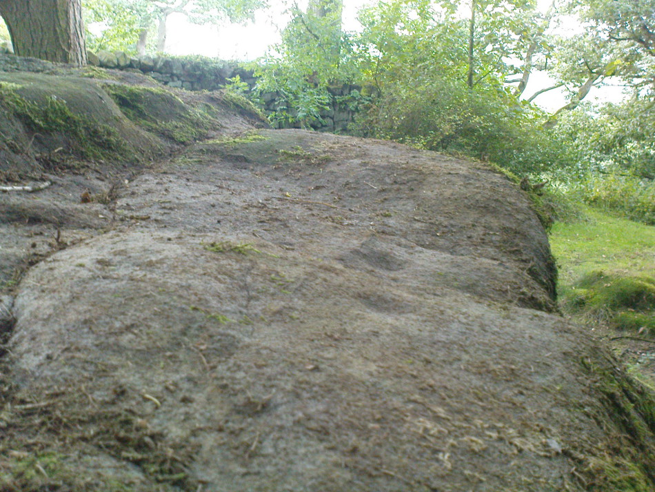
Follow the directions to reach Panorama Woods carving 232. Barely a yard or two southwest across the small gap where the kids have their little den or hideout, this long curvaceous rock is the fella in question.
Archaeology & History
Cup-markings on the rock
Curiously not included in the ‘official’ records, this large piece of rock, living right in between the Panorama Woods carvings 231 and 232, has at least two, possibly three faint cup-marks etched in the top northeastern portion of the rock. Of the same style and probably period as the basic designs on stones 230 and 231, this is one in a cluster of petroglyphs that used to live at the edge of a prehistoric enclosure, destroyed at the end of the 19th century.
References:
Bennett, Paul, Of Cups and Rings and Things, unpublished: Shipley 1981.
Bennett, Paul, The Panorama Stones, Ilkley, TNA: Yorkshire 2012.
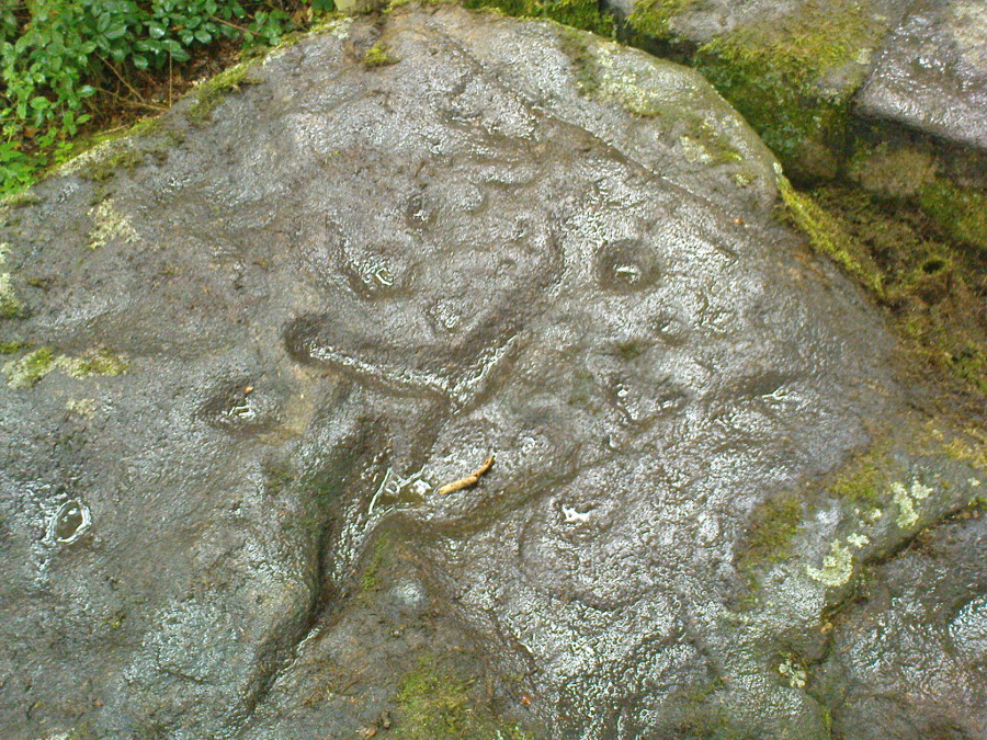
Take the Wells Road from Ilkley centre up towards White Wells, bending to the right as you hit the edge of the moor. Keep along the road, past the old college building with its lake and turn right up Westwood Drive. Keep going all the way up till you hit the small woodland on your right. Where the woodland ends – stop! Walk into the trees about 10-15 yards and you’ll see the large rocks ahead of you. Amongst other petroglyphs hereby, you’ll find this carving is on one of them.
Archaeology & History
Close-up of deep cups & grooves
Although only given the usual dry description by our academic catalogue chaps, there’s something about this design that I’ve always liked. We first came across it ourselves in the late 1970s, in search of the legendary Panorama Stones, and found instead this large enclosure design with at least three cups inside it, still clearly visible. It is one of a cluster of carvings hereby, all of which were once adjacent to a prehistoric enclosure, described in the 1880s and destroyed soon after. This and the associated carvings very probably had some archaeocentric relevance to the lost enclosure.
Large carved ‘enclosure’, recently chalkedDrawing of the carving (after Hedges 1986)
The carving is sandwiched in between its petroglyphic companions, stone 231 and stone 233. As can be seen on some of the photos here, more recent vandalism has been inflicted on this carving and the recent chalk colouring is what local archaeologists Gavin Edwards and Alex Gibson have termed “social history”, implying fallaciously that cup-and-ring art could be seen as little more than neolithic and Bronze Age scribblings on rock, without any meaning other than it being comparable to “Leeds United Rules OK.” They may be right (highly unlikely) – but in reading copiously about prehistoric petroglyphs in cultures beyond the UK, we find that traditional societies tell such carvings relate to their creation myths, or river spirits, or rock spirits, and are intrinsically related to wider animistic cosmologies and social customs. This indicates, to me at least, that modern archaeologists who think of rock art as little more than childish scribblings still have a great deal to learn and we should beware their uneducated musings about our ancient carvings.
Although the complete carved ‘enclosure’ and its internal cups were mistakenly drawn in John Hedges (1986) survey, he described as being a,
“Roughly incised ‘enclosure’ with five cups in it, twenty eight shallow cups or depressions, one large oval marking, three irregular basins.”
In the later work of rock art students Boughey & Vickerman’s (2003), they simply said of the site:
“Large flat-topped, upstanding rectangular rock. Twenty-eight shallow cups, a few enclosed in two groups by grooves; irregular small basins.”
References:
Bennett, Paul, Of Cups and Rings and Things, unpublished: Shipley 1981.
Bennett, Paul, The Panorama Stones, Ilkley, TNA: Yorkshire 2012.
Boughey, Keith & Vickerman, E.A., Prehistoric Rock Art of the West Riding, WYAS: Wakefield 2003.
Hedges, John (ed.), The Carved Rocks on Rombalds Moor, WYMCC: Wakefield 1986.
Take the same directions as if you’re visiting the multiple-ringed Agra Woods petroglyph (West Agra 8). From just below here, keep to the woodland side, and follow the line of tall drystone walling along to the east for a hundred yards or more, keeping your eyes peeled for the stone in question, just in front of a nice oak tree. You can’t really miss it!
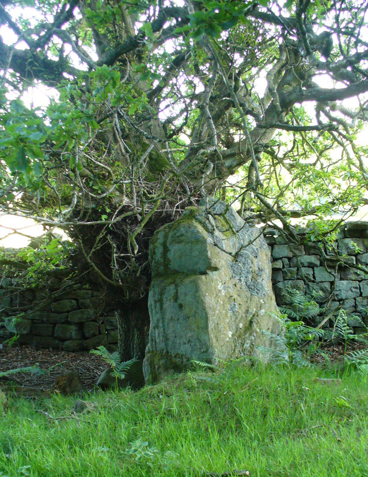
Archaeology & History
Not too far away from the scattered cluster of West Agra’s cup-and-ring stones, can be found this very bulky six foot tall standing stone, near the edge of the old walling on the inner-side of the Agra Woods. It was rediscovered by Paul Hornby on a Northern Antiquarian outing in May 2011, who told it to be “quite a massive thing!” (I’ve yet to visit the site so can’t give my personal impressions of the site)
Get to Pubil at the top of Glen Lyon, then walk on the track on the north side of Loch Lyon. Several miles along you turn up Glen Meurain. When you reach the crossing of the stream, follow the waters up Allt Meurain for about 3-400 yards until you find a small flat section of marshland right by the streamside. You’ll notice rocky undulations of human remains here, and a distinct small cairn of rocks near the top of this section. Have a good rest here (and I’d advise avoiding the place in the summer months).
Archaeology & History
Remote indeed is this small cairn—less than 3 feet high and 4 feet across—sitting by the burn-side in a place many miles from any human habitation. It is found amidst a small cluster of other archaeological remains close to each other, as if indicating a settlement of sorts, abandoned probably around the time of the Highland Clearances. Although it is highlighted on modern OS-maps in antiquated lettering, the cairn here looks like it is only a few centuries old. A larger mass of rubble stone is found adjacent to the small pile of rocks, from which it may originally have been taken. Without archaeological analysis we will not know for certain the real age of this old tomb.
MacRee’s Cairn & adjacent rubble
Folklore
The small grassy hillside immediately across the trout stream here is known as Sith Trom’aidh – the Sad Fairy mound, whose history appears to have been lost. Alexander Stewart (1928) told that this cairn was the burial place of one of Colin Campbell’s dairymaids, found and slain here during a skirmish with cattle raiders in the 16th century.
References:
Stewart, Alexander, A Highland Parish; or, The History of Fortingall, Alex MacLaren & Sons: Glasgow 1928.
A very well-preserved prehistoric cist and cairn (grave), sat amidst a valuable prehistoric landscape full of megaliths and other important prehistoric remains. Megalith enthusiast and antiquarian, Nik Megalithic, told that:
“The cairn is about 12 m diameter and 1 metre high, and has a large Kist in the middle. The cist has side slabs about 2 metres long and spaced 1 metre apart, and it is about 0.7m deep. The large capstone is tipped off to the west, and can be seen protruding above the cairn from quite some distance away.”
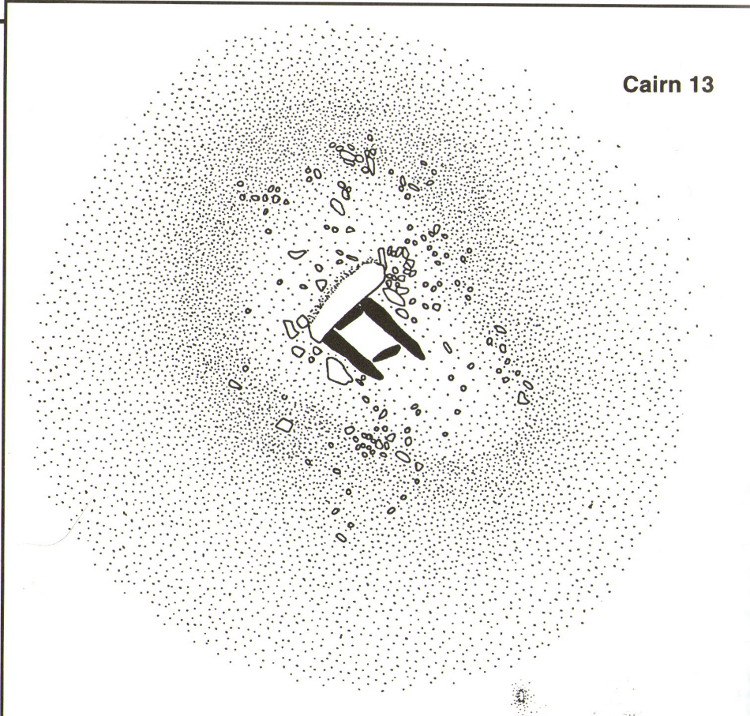
Described in association with the rich mass of other tombs and megalithic stone rows here, author Jeremy Butler told that,
“Cairn 13 is also in line with (cairns) 1-4, but just out of sight around the hillside 150m to the northwest. The mound contains a well-preserved cist, “a very fine example”, according to Worth, who cleared it out about 1900 but with “no result from excavation.” The displaced cover and massive side-slabs project well beyond its ends.”
Both Butler and Worth mention how cairn 13 is part of an alignment with two other cairns very close by.
Folklore
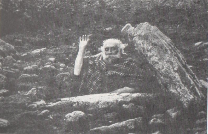
Spike Milligan in his tomb
Although legends of giants and pixy folk are well known round here, there is nothing specific I can find to this one site. One of the most important finds in recent years—as the photo above shows quite clearly—was the fact that before joining The Goons, the British comedian Spike Milligan used to live in this prehistoric tomb. When asked why he didn’t live in a house like other normal people, he invited us in for a cup of tea. Some historians believe that the person in the photo is in fact Mr R.H. Worth—author of Worth’s Dartmoor—but Mr Milligan insisted that Worth was an imposter!
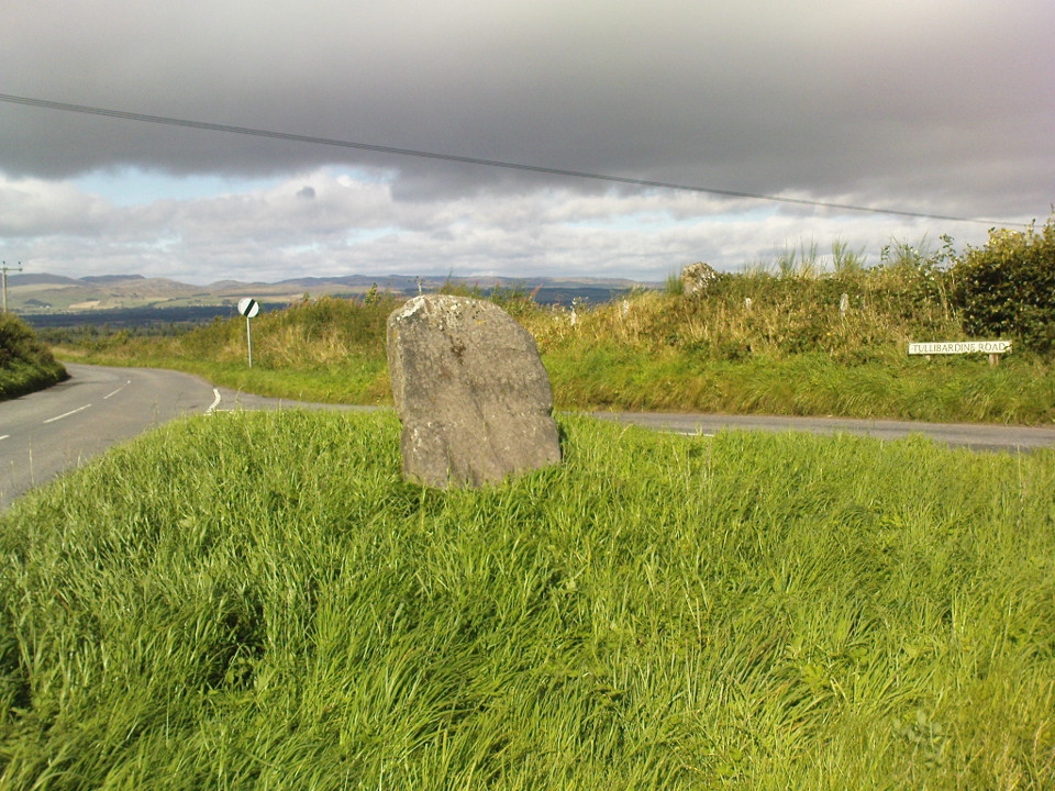
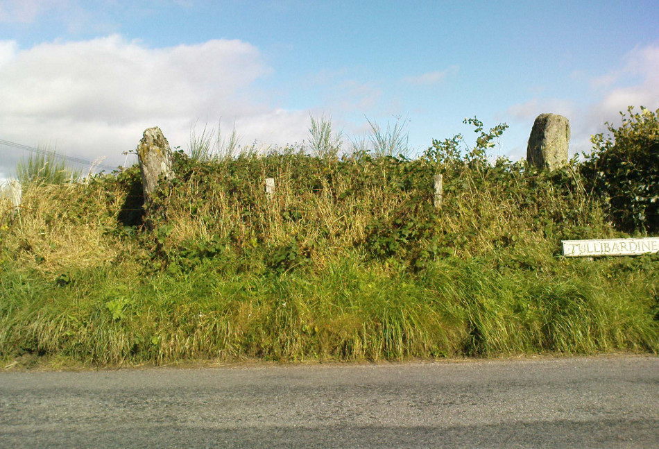
From Auchterarder’s A824 main street, going out towards the golf course take the Orchil Road on your right and then about fifty yards along, turn right again up Tullibardine Road. Park up somewhere about a hundred yards along, then just walk further down the road until you’ll see the standing stone right at the road junction. Look into the field on your right, above you, and another two are hiding in the brambles and grasses.
Archaeology & History
Included in Andy Finlayson’s (2010) fine local survey, this is an intriguing little group of three standing stones (and a fourth buried beneath the turf), all very close to each other. They are shown on the modern Ordnance Survey maps as “standing stones”, but have been catalogued by archaeologists as the denuded remains of a ‘Four Poster’ stone circle. Despite this, the circle wasn’t included in Aubrey Burl’s (1988) definitive work on the subject, nor his megalithic magnum opus. (Burl 2000)
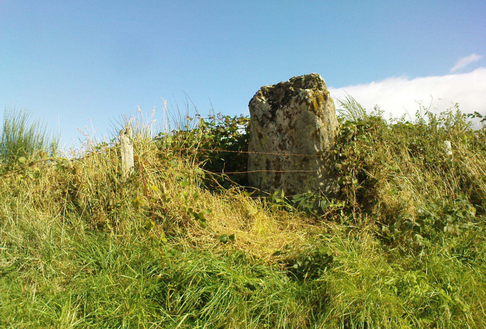
Northern hedgerow stone…and two in the hedgerow
Of the two uprights above the roadside at the field edge, a faint carved hand can be found on the upright west-facing side of the southernmost of the two standing stones. Although faint, this doesn’t appear to be ancient. Written accounts of these stones are few and far between it seems. The earliest seems to be in the lengthy essay written by Mr Hutchison (1893), in which he gave an excellent account:
“Less than a mile to the west of (Auchterarder)…is a fine group of stones, two only of which are now standing. These stand on the summit of what has been a well-defined mound, and the stones now lying where the roads unite seem to have stood originally at the same height. The road has been driven through the group at a lower level than the summit of the mound, and the stones have been thrown down and laid in the waste space at the point of junction. The small mercy to be thankful for is that they have not been broken up altogether and used for road metaL This has probably been due to the circumstances that one of these stones has a curious encircling groove running round it, which perhaps impressed even the vandal roadmakers with the idea that it might be worthy of preservation. It would be interesting to know whether, when the circle or group of stones was cut through, any cist or interment was found. One would expect such to be the case, but I have not yet got any information on the point. There are several stones lying on the spot which may or may not be pieces of the original standing stones. Two considerable bits of old red sandstone, at least, look as if they were fragments of an original whole. Two great stones, however, are unmistakably prostrate standing-stones; and from the positions in which they lie, it seems to me as if the persons who had uprooted them had laid them down as nearly as possible on the sites they had occupied (at the original higher level, of course) when standing.
“The direction in which both of the standing stones point is 236º, and a line taken from each of the prostrate stones to the opposite standing one gives very nearly the same angle (240º). The prostrate stones are of metamorphic schist. The northerly one measures 7 feet in length by 3 feet in width, and is from 12 to 18 inches thick. A grove or furrow, 2 inches deep at its greatest depth, and from 2 to 4 inches wide, appears to run right round it, at a distance of 2 feet 10 inches from the end, which may have been about the middle height of the stone when erect. The lower side of the stone cannot be seen, but the appearance at the edges indicates that the furrow is carried all the way round. It looks just such a hollow as might be worn in stone by the long continued attrition of an iron chain. The more southerly prostrate stone is 6 feet in length, 4 feet wide, and has an average thickness of 18 inches. The two stones still standing are on the high bank above the road, just inside the hedge. These are both of old red sandstone, thinnish slabs, facing in the direction already mentioned. That to the south is 4 feet 10 inches in height, 2 feet 8 inch broad at the base, and 10 inches thick. The other is 5 ft. 3 in. at its greatest height, 3 feet 10 inches wide, and from 13 to 15 indies thick. On its northern face it shows a number of depressions or indentations curiously resembling prints of human feet. These Mr Kidston considers to be due to natural weathering.”
Southern carved stone
Yet the “prints of human feet” are very much man-made. A closer examination of these carvings is obviously needed.
Whether these stones originally played a part in an old tumulus, a cairn circle, or a typical stone circle, is hard to say with any certainty now. We are in a landscape where megalithic remains were once in great excess: with the standing stones of Blackford to the south; the lost circle of Gleneagles nearby; the megaliths near Muthill and many many more…
References:
Burl, Aubrey, Four Posters: Bronze Age Stone Circles of Western Europe, BAR 195: Oxford 1988.
Finlayson, Andrew, The Stones of Strathearn, One Tree Island: Comrie 2010.
Hutchison, A.F., “The Standing Stones of Stirling District,” in The Stirling Antiquary, volume 1, 1893.
Strachan, Favid (ed.), A History of Blackford, Blackford Historical Society 2010.