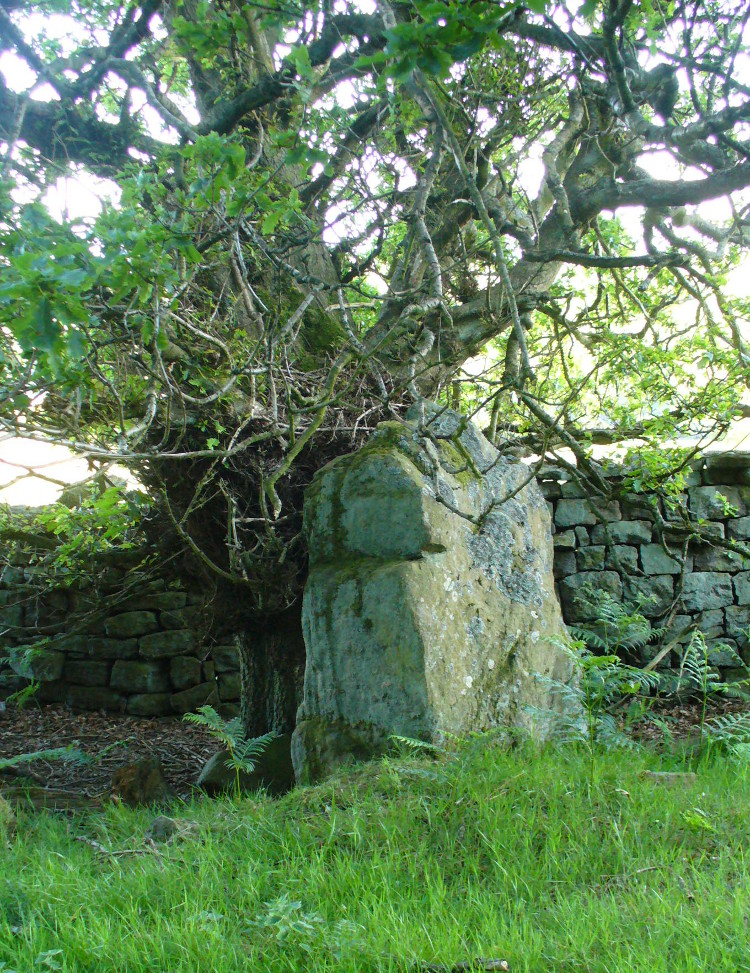
Take the same directions as if you’re visiting the multiple-ringed Agra Woods petroglyph (West Agra 8). From just below here, keep to the woodland side, and follow the line of tall drystone walling along to the east for a hundred yards or more, keeping your eyes peeled for the stone in question, just in front of a nice oak tree. You can’t really miss it!
Archaeology & History
Not too far away from the scattered cluster of West Agra’s cup-and-ring stones, can be found this very bulky six foot tall standing stone, near the edge of the old walling on the inner-side of the Agra Woods. It was rediscovered by Paul Hornby on a Northern Antiquarian outing in May 2011, who told it to be “quite a massive thing!” (I’ve yet to visit the site so can’t give my personal impressions of the site)
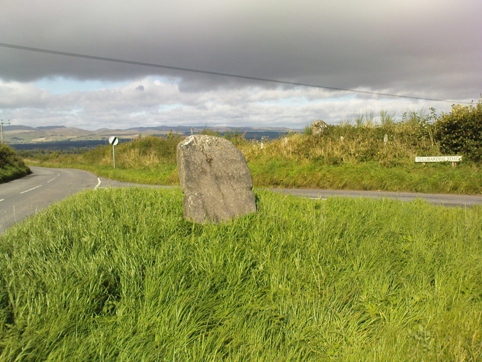
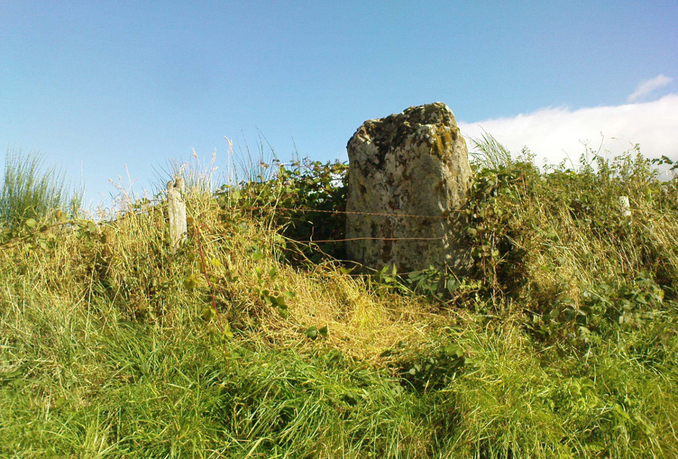
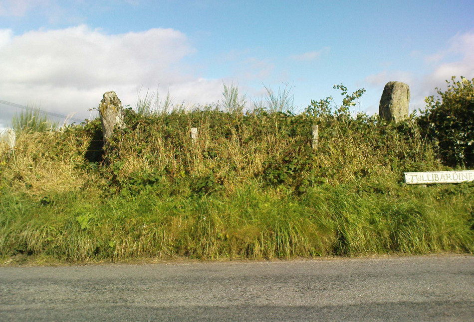
From Auchterarder’s A824 main street, going out towards the golf course take the Orchil Road on your right and then about fifty yards along, turn right again up Tullibardine Road. Park up somewhere about a hundred yards along, then just walk further down the road until you’ll see the standing stone right at the road junction. Look into the field on your right, above you, and another two are hiding in the brambles and grasses.
Archaeology & History
Included in Andy Finlayson’s (2010) fine local survey, this is an intriguing little group of three standing stones (and a fourth buried beneath the turf), all very close to each other. They are shown on the modern Ordnance Survey maps as “standing stones”, but have been catalogued by archaeologists as the denuded remains of a ‘Four Poster’ stone circle. Despite this, the circle wasn’t included in Aubrey Burl’s (1988) definitive work on the subject, nor his megalithic magnum opus. (Burl 2000)
Northern hedgerow stone…and two in the hedgerow
Of the two uprights above the roadside at the field edge, a faint carved hand can be found on the upright west-facing side of the southernmost of the two standing stones. Although faint, this doesn’t appear to be ancient. Written accounts of these stones are few and far between it seems. The earliest seems to be in the lengthy essay written by Mr Hutchison (1893), in which he gave an excellent account:
“Less than a mile to the west of (Auchterarder)…is a fine group of stones, two only of which are now standing. These stand on the summit of what has been a well-defined mound, and the stones now lying where the roads unite seem to have stood originally at the same height. The road has been driven through the group at a lower level than the summit of the mound, and the stones have been thrown down and laid in the waste space at the point of junction. The small mercy to be thankful for is that they have not been broken up altogether and used for road metaL This has probably been due to the circumstances that one of these stones has a curious encircling groove running round it, which perhaps impressed even the vandal roadmakers with the idea that it might be worthy of preservation. It would be interesting to know whether, when the circle or group of stones was cut through, any cist or interment was found. One would expect such to be the case, but I have not yet got any information on the point. There are several stones lying on the spot which may or may not be pieces of the original standing stones. Two considerable bits of old red sandstone, at least, look as if they were fragments of an original whole. Two great stones, however, are unmistakably prostrate standing-stones; and from the positions in which they lie, it seems to me as if the persons who had uprooted them had laid them down as nearly as possible on the sites they had occupied (at the original higher level, of course) when standing.
“The direction in which both of the standing stones point is 236º, and a line taken from each of the prostrate stones to the opposite standing one gives very nearly the same angle (240º). The prostrate stones are of metamorphic schist. The northerly one measures 7 feet in length by 3 feet in width, and is from 12 to 18 inches thick. A grove or furrow, 2 inches deep at its greatest depth, and from 2 to 4 inches wide, appears to run right round it, at a distance of 2 feet 10 inches from the end, which may have been about the middle height of the stone when erect. The lower side of the stone cannot be seen, but the appearance at the edges indicates that the furrow is carried all the way round. It looks just such a hollow as might be worn in stone by the long continued attrition of an iron chain. The more southerly prostrate stone is 6 feet in length, 4 feet wide, and has an average thickness of 18 inches. The two stones still standing are on the high bank above the road, just inside the hedge. These are both of old red sandstone, thinnish slabs, facing in the direction already mentioned. That to the south is 4 feet 10 inches in height, 2 feet 8 inch broad at the base, and 10 inches thick. The other is 5 ft. 3 in. at its greatest height, 3 feet 10 inches wide, and from 13 to 15 indies thick. On its northern face it shows a number of depressions or indentations curiously resembling prints of human feet. These Mr Kidston considers to be due to natural weathering.”
Southern carved stone
Yet the “prints of human feet” are very much man-made. A closer examination of these carvings is obviously needed.
Whether these stones originally played a part in an old tumulus, a cairn circle, or a typical stone circle, is hard to say with any certainty now. We are in a landscape where megalithic remains were once in great excess: with the standing stones of Blackford to the south; the lost circle of Gleneagles nearby; the megaliths near Muthill and many many more…
References:
Burl, Aubrey, Four Posters: Bronze Age Stone Circles of Western Europe, BAR 195: Oxford 1988.
Finlayson, Andrew, The Stones of Strathearn, One Tree Island: Comrie 2010.
Hutchison, A.F., “The Standing Stones of Stirling District,” in The Stirling Antiquary, volume 1, 1893.
Strachan, Favid (ed.), A History of Blackford, Blackford Historical Society 2010.
Along the A9 dual carriageway between Blackford and Auchterarder, take the A823 road south, up Glen Eagles as if you’re going towards Pool of Muckhart and Dunfermline. Less than 100 yards up the road, turn immediately to your right and park-up. On the overgrown grassy land on the right-hand side of the road, you’ll see this solid monolith calling for your attention. You can go through the gate. You can’t really miss it!
Archaeology & History
Looking south, to the fairy-haunted Ben Shee
Described by archaeologists as a Class 1 Pictish Symbol Stone (and shown on OS maps as such), this is a fine solid standing stone more than 5 feet tall, with a lovely view up Gleneagles to the fairy mountain of Ben Shee beckoning in the distance. Immediately north on the other side of the dual carriageway, the tree-lined mound 100 yards away is an ancient fort (which we’ll deal with in another entry); and of course we have the nearby companion of the Gleneagles A standing stone a coupla hundred yards west. Whether or not this stone and its western companion ever had anything to do with the lost stone circle of Gleneagles, we might never know.
Close-up of the carved designsCharles Calders drawing of the carvings
Although it seems consensus opinion that the standing stone here is prehistoric, the monolith was of some venerable importance to the Pictish people of the Ochils, who, according to the Royal Commission lads (1999) carved on this stone “the faint symbols of a goose and rectangle.” The rectangle, however, is in fact a parallelogram—as the images here clearly show. Archaeologist Richard Feachem (1977) thought the design was in fact “a double-sided comb.” I have my doubts (a much smaller and probably more recent parallelogram design was recently identified on the upright face of the large Dunruchan D standing stone, about 10 miles WNW of here). The ‘goose’ is carved above this geometric form and is much fainter, which may imply it was carved much earlier. In Elizabeth Sutherland’s (1997) survey, she suggests the bird may be an eagle. It is equally possible that it is a swan.
The earliest detaied account of this stone and its companion is in Mr Hutchison’s (1893) fine essay, where he wrote:
“On the south side of the road from Blackford to Auchterarder, about 150 yards west from Loaninghead where the line of the road is crossed by that from Gleneagles to Crieff, stands a fine stone of Highland grit. It measures 4ft. 10in. in height above ground, 10ft. in girth at the base, and 6ft. 9in. in circumference at top. It shows four sides of nearly equal measurement:— that facing north being 2ft 4in., south 2ft. 8in., west 2ft 5in., and east 3ft. On the north is an incised figure in the form of an parallelogram, 10in. broad by 9in. high, divided into three equal portions by two horizontal lines.”
Along the A915 coastal road from Leven to Largo, as you reach Lundin, look out for signs for the Lundin Ladies Golf Course on the left. Go there and then ask someone at the golf course if you need help; but from here you just walk west over the greens till you are ambling along the back of some houses. You can’t really miss the giant stones a couple of hundred yards ahead of you. If you somehow get lost in Lundin itself, ask a local the directions to the Lundin Ladies golf course. You can’t really go wrong.
Archaeology & History
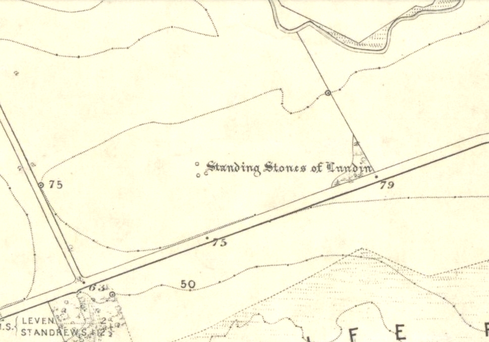
Lundin stones on 1855 OS-map
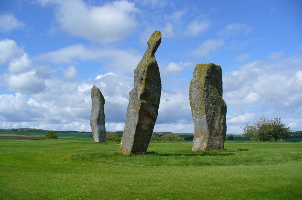
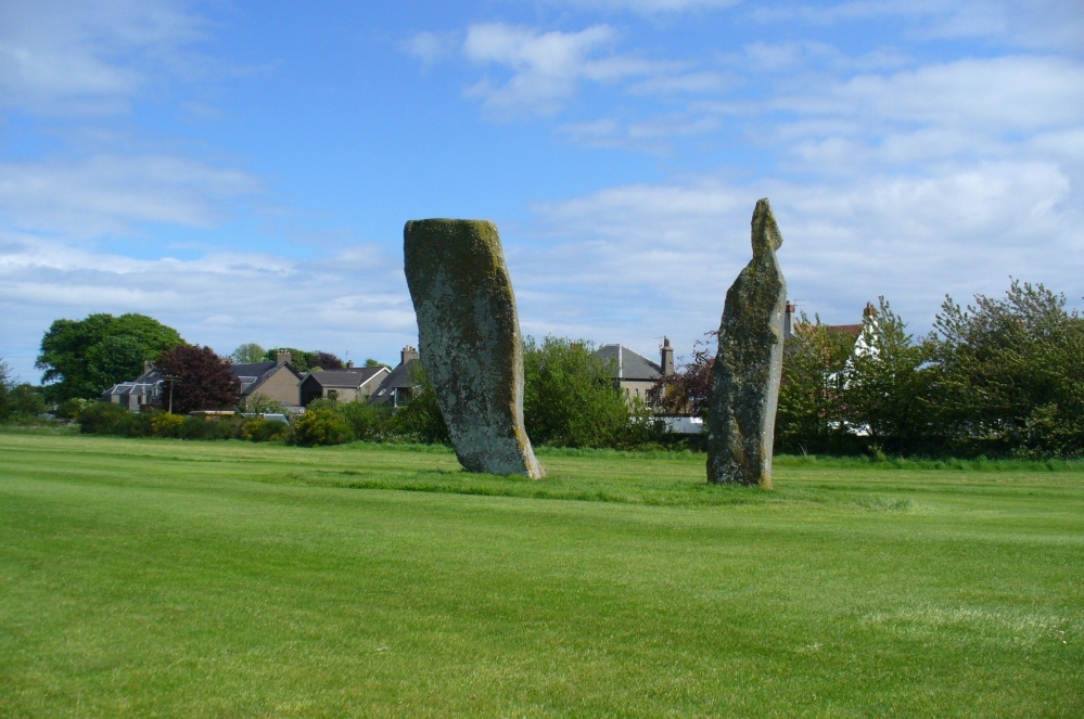
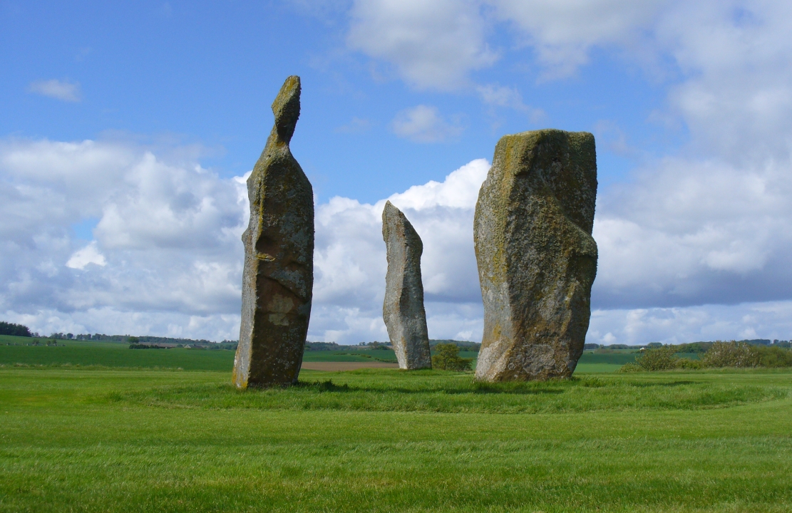
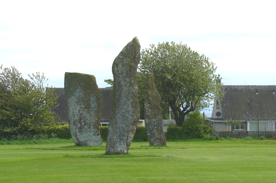
If you like your megaliths and you venture anywhere near here, make sure you come and visit these stones. They’ll blow you away! The only downfall we have is their location—stuck on the golf course; which, of course, means that meditating here is only possible between sunfall and sunrise (though I’ve usually found that’s the best time to be at stone circles anyway!), or perhaps in the pouring rain. Whichever is your preference, these stones need looking at!
The size of them is the first thing that hits you. They belong more to the Avebury complex than sitting out on their geographical limb near the southern Fife coast. But then, that presupposes other stones of this size didn’t used to be here—and as far as I’m concerned, other giant megaliths and associated monuments must once have stood nearby. But much of the landscape hereby has been taken over by traditional agriculture and any earlier megalithic remains have seemingly been lost.
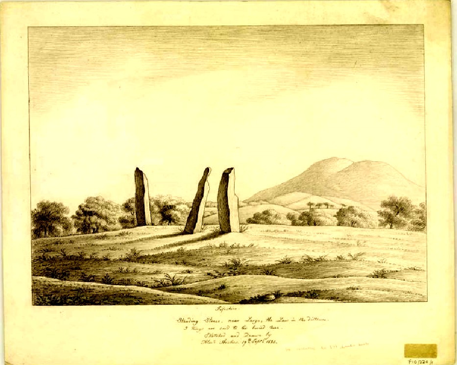
We know there were at least four stones here in the 18th century and that also, “ancient sepulchres are found near them” according to the New Statistical Account of 1837—but all remains of these burials seem to have been lost or destroyed. These facts are echoed in Leighton, Swan & Stewart’s (1840) gigantic survey. Thought by a variety of archaeological and historical sources to be the remains of a great stone circle “with a diameter of 54 feet”—it’s an assertion that I’m not too sure about myself. They are just as likely to be the remains of a great stone avenue, perhaps leading to a stone circle, long since gone, as much as any small circle of giant uprights.
In 1933, the Royal Commission survey described the size of these great red sandstone monoliths,
“Each of them has been packed at the base with a setting of small stones. Although it is not the highest, the one on the south-east, which stands with a slight inclination towards the north and the east, presents the most massive appearance. The girth at the base is 12 feet 8 inches, but measurements taken at 5 feet from the ground give the following dimensions: north face, 5 feet 2 inches; south face, 5 feet; east face, 1 foot 11 inches; west face, 2 feet 2 inches; girth, 14 feet 3 inches; and the stone becomes even wider as its height increases, until near the top where it again shrinks to a very slightly rounded extremity. The height is approximately 13 feet 6 inches. The surface is pitted by the action of the weather and shows greatest traces of decay on the east, where a crack has developed. The south stone is set with a decided inclination towards the south. It is of very irregular form with a girth at the base of 9 feet 4 inches, expanding to 10 feet at 5 feet higher up, and suddenly becoming gently attenuated at the top. The stone, which does not exhibit the same noticeable traces of weathering as the one first described, is approximately 17 feet high. The north stone, which is set with a slight inclination towards the west, appears to be still taller. It rises to a height estimated at 18 feet and has a sharply pointed top. It shows evidence of weathering at the northwest corner. Like the others, it increases in bulk from the base upwards to the middle of its height, the girth being 9 feet 6 inches at the base, and 10 feet 2 inches at 5 feet up.”
The trio, looking northThe 3 stones, looking south
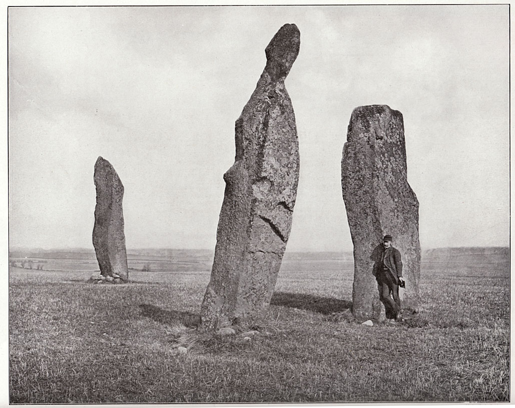
Big buggers by anyone’s estimation! Not mentioned here is the very distinct anthropomorphism, in one stone particularly—that at the southwest: a slim curvaceous body with neck and head at the top, frozen in stone no less. Surely this was intentional by the people who erected these giants? The southern pairing stand like man and wife, awaiting ceremony and customary servitude from us mere mortals. The single northern stone—whose partner was removed in the 19th century—has a similar slim stature and size, like its southwestern companion. Was its now dead partner a similar shape and stature like the southeastern stone? – another petrified pairing of man and woman? …Tis a curious feeling I have of this place…
Early 19th century drawingPhoto of stones, c.1900
Our megalithic magus Aubrey Burl (1988) did note the “writhing pillars” of stone here, but ventured no further with it. He did tentatively suggest (and include in his work on the subject) that the Lundin stones were one of his “four poster” circles, but thought it “impossible to prove.” He did however revise the Royal Commission measurements on the respective standing stones, informing us that,
“The NNE is the tallest, 16ft 8ins (5.1m) high, the leaning SSW stone is 15ft (4.6m) high, but the lowest, at the SSE, is also the biggest, 13ft 8ins (4.2m) tall and 6ft 5ins (2m) thick.”
He also told that there were little cairns “about 18ins (46cm) high” around the base of each standing stone when he was here in the 1980s. These were not visible when we visited in May 2013.
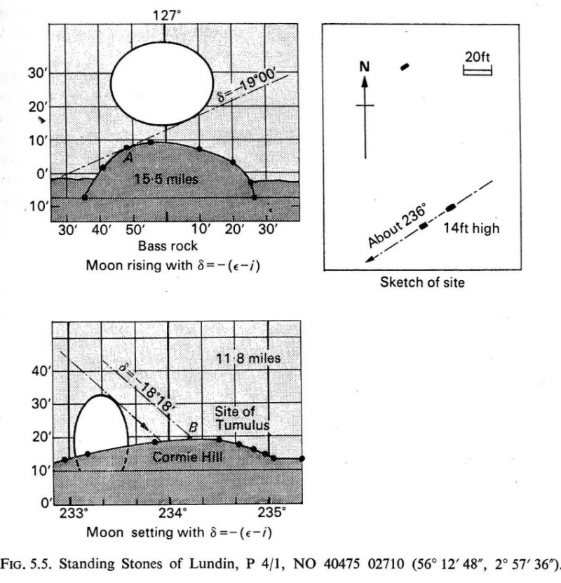
When the late great engineer and archaeoastronomer Alexander Thom (1971) came here, he found the layout of the stones to have astronomical meanings, telling:
“It was obviously an important site, so placed on flat ground that there was plenty of room for geometrical extrapolation. The alignment is seen to indicate the setting point of the Moon at the minor standstill. Trees and houses now block the view, but as the new large-scale OS maps are now available…it was possible to construct a reasonably accurate profile of Cormie Hill. In good seeing conditions, a large tumulus could have been seen on the Moon’s disc, and the tumulus shown on the Ordnance Survey happens to indicate the upper limb when the declination was -(ε-ι-Δ). When the Moon set on Cormie Hill it would rise on the Bass Rock, and we see how the stones were so placed that the lower limb just grazed the Rock when the declination was -(ε-ι).”
Thom’s lunar alignments
Thom reiterated his thoughts again in 1990, though pointed out that “the measurements should be checked” to see whether they were right. A few years earlier, Dr Douglas Heggie (1981) had done just such a thing and found the alignment seemed to be a poor one. And so it has turned out to be… Other megalithic sites however, have quite definite solar and lunar correlates in their architecture…but it seems our Lundin stones aren’t quite what Prof. Thom had hoped for.
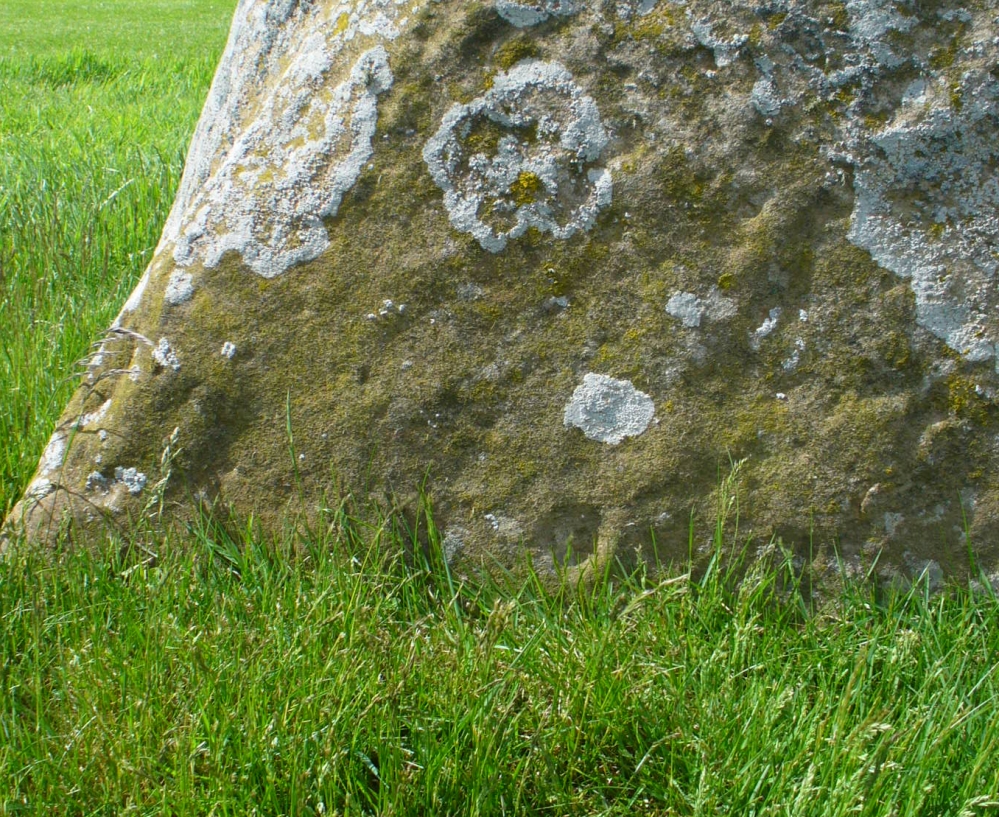
Cup-mark & outer ring/s?
Along the eastern face of the “fattest” stone we see a number of large cup-markings, but these are all Nature’s handiwork. They were mentioned in Sir James Simpson’s (1867) early survey on the subject. However, we did see, near the base of the stone, just above ground level on its southern-face, a very distinct cup-marking with what may be the remains of a broken-ring around it. You can make it out on the photo here, but I wouldn’t stake my reputation on its legitimacy!
Folklore
Described in the Royal Commission (1933) report “as the burial stone of Danish chiefs,” this is a common tale found at other remaining megaliths along the Forth. The earliest account of this fable I’ve found is in the Edinburgh Magazine of November, 1785, where it was written:
“Various have been the conjectures as to the origin of the erection of the (stones); they are commonly known by the name of the Standing Stanes of Lundy, a seat belonging to a very old family of the name of Lundin, now to Sir William Erskine, near Largo in Fife.
“Tradition tells us, they were placed there in memory of that victory gained by Constantine II over Hubba, one of the generals of the Danish invaders, about the year 874. It is certain that battle was fought near this spot; but whether these were in memory of the action or not, I cannot determine: it is more than probable they were of a much older date.”
Legend also told that there was treasure at the stones, which was one of the reasons Daniel Wilson (1863) told the northwestern stone was broken and left only as a stump in 1792.
References:
Burl, Aubrey, Four Posters: Bronze Age Stone Circles of Western Europe, BAR 195: Oxford 1988.
Burl, Aubrey, The Stone Circles of Britain, Ireland and Brittany, Yale University Press 2000.
Burl, Aubrey, A Guide to the Stone Circles of Britain, Ireland and Brittany, Yale University Press 2005.
Heggie, Douglas C., Megalithic Science: Ancient Mathematics and Astronomy in Northwest Europe, Thames & Hudson: London 1981.
Leighton, J.M., Swan, J. & Stewart, J., History of the County of Fife – volume 3, John Swan: Glasgow 1840.
Royal Commission on the Ancient & Historical Monuments, Scotland, Inventory of Monuments and Constructions in the Counties of Fife, Kinross and Clackmannan, HMSO: Edinburgh 1933.
Ruggles, Clive, Astronomy in Prehistoric Britain and Ireland, Yale University Press 1999.
Simpkins, John Ewart, Examples of Printed Folk-lore Concerning Fife, with some Notes on Clackmannan and Kinross-shires, Sidgwick & Jackson: London 1914.
Simpson, James, Archaic Sculpturings of Cups, Circles, etc., Upon Stones and Rocks in Scotland, England and other Countries, Edmonston & Douglas: Edinburgh 1867.
Thom, Alexander, Megalithic Lunar Observatories, Oxford University Press 1971.
Thom, A. & A.S., & Burl, Aubrey, Stone Rows and Standing Stones – volume 2, BAR 560(ii): Oxford 1990.
Wilson, Daniel, The Archaeology and Prehistoric Annals of Scotland, Sutherland & Knox: Edinburgh 1863
Acknowledgements: With huge thanks to Paul Hornby, for the photos and the journey! Also a big thanks to Gill Rutter for help in clarifying “Getting there.”
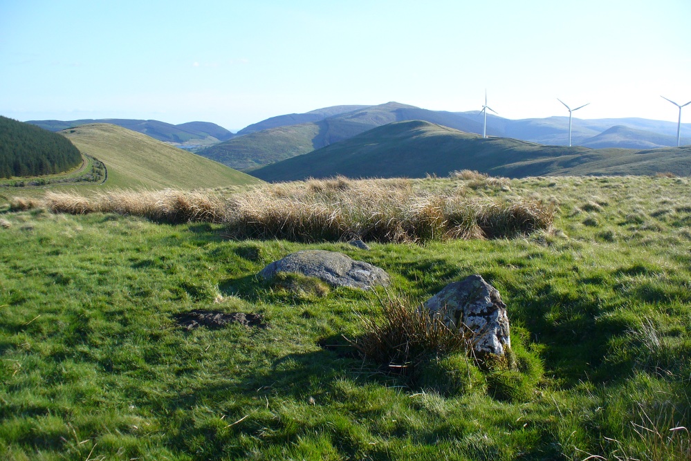
Takes a bitta finding this one. Best found by going along the gorgeous, little-known Dunning Glen in the eastern Ochils, till you reach Littlerig house. Cross the road from there and follow the line of the burn and forest till it veers sharp left. Keep along the fencing until the marshland levels out and streams fall away both east and west. From here, walk uphill until you reach level ground, then, looking down the Borland Glen, zigzag downhill for 100 yards. Keep your eyes peeled for stones emerging from the Juncus grasses.
Archaeology & History
This four-poster stone circle isn’t included in Aubrey Burl’s (1988) survey of that name, nor his 2000 AD magnum opus on megaliths. The site appears to have only recently been rediscovered. Shown on modern OS-maps in non-antiquated lettering, this may be due to verification being required to authenticate its prehistoric status. It’s certainly in a peculiar position in the landscape here — and seems more likely to have been built just 100 yards uphill on the level grassland plain where views east, south and west open up almost with the majesty of Castlerigg!
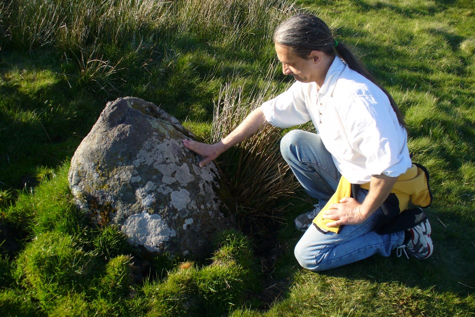
Fondling & puzzling over cup-marks on one of the stones
When Paul Hornby and I ventured here yesterday, we mistook the arc of three stones on the flat plain with the ring of stones that are down the Borland Glen slope ahead of us, so good was the position! But at least one thing came of this: of the arc of three stones shown in the photos here, one of the rocks possesses cup-markings, which you can make out here in one of the close-ups.
The dimensions of the four stones that make up the ‘circle’ down the slope was measured and described by the Scottish Royal Commission lads as follows:
It comprises four stones, which define a trapezium measuring 3.2m along its N and W sides, 2.7m along the S and 2.5m along the E. All the stones are set square at the corners with their long axes lying E and W, and they present a long flat face to the interior. The two on the N are markedly larger than the others, and that on the NW is also the tallest. The dimensions of the stones are as follows: NW – 1m by 0.5m and 0.65m high, NE – 0.8m by 0.4m and 0.3m high, SE – 0.73m by 0.43m and 0.2m high and SW – 0.73m by 0.38m and 0.4m high.
One of the most notable features a visitor to this site will find, is the utter silence as you walk up the slopes to reach the place. And then, once away in the opening landscape, a view of velvet Earth in all Her beautiful shades surrounds you – assuming you go here on a sunny day! Well worth the wander if quiet hidden megaliths are your pleasure…
References:
Burl, Aubrey, Four Posters: Bronze Age Stone Circles of Western Europe, BAR 195: Oxford 1988.
Burl, Aubrey, The Stone Circles of Britain, Ireland and Brittany, Yale University Press 2000.
Acknowledgements: Many thanks to Paul Hornby for use of his photos.
Along the A827 Loch Tay road between Morenish and Lawers, keep your eyes peeled for the Carie farmhouse on the mountain-side of the road (Tombreck is on the other side). The farmer here is very helpful and will let you walk up the land behind his abode if you ask. Go behind the trees round the back of his abode, following the small burn up for a couple of hundred yards until you see the stone in the long grasses on the right. It’s not too difficult to find.
Archaeology & History
Carie Stone, looking south
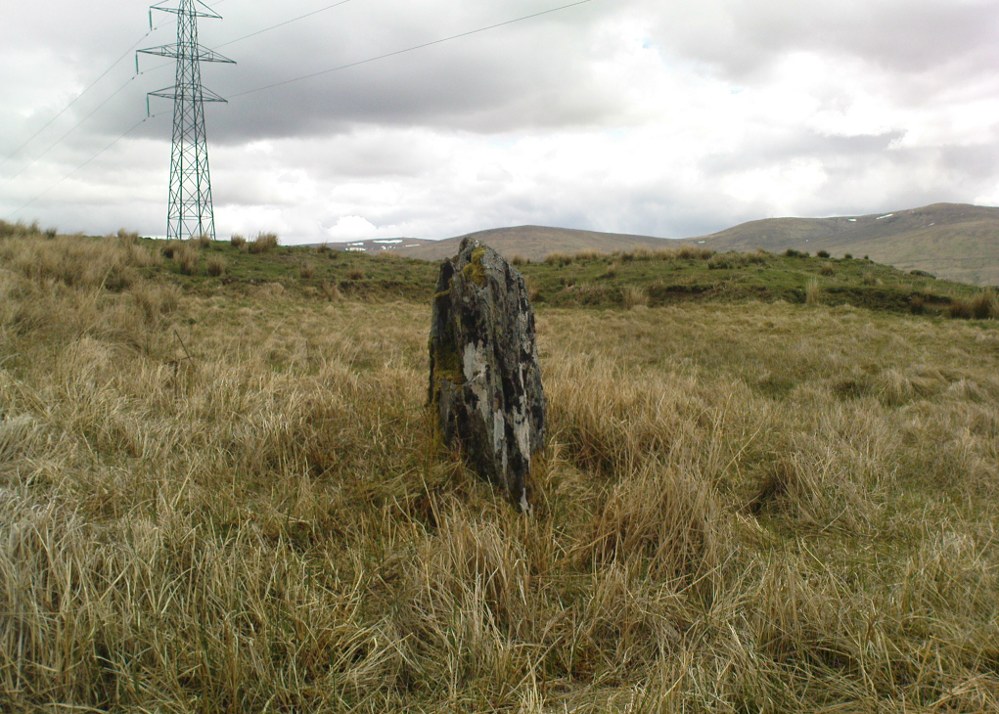
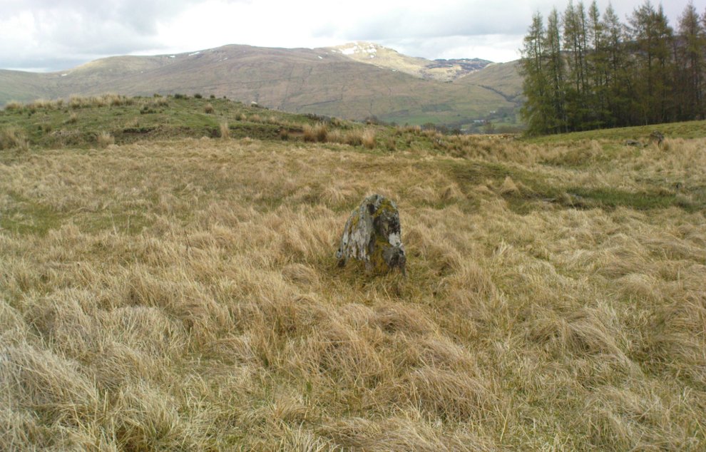
Nothing seems to have been written about this small standing stone, found close to the large cluster of cup-and-ring stones of Ben Lawers. It sits alone in now-boggy ground, in a small dip of land near the stream above Carie Farm. The stone is barely a foot thick, but stands 3½ feet tall and is more than 4 feet wide. Its isolation is curious and makes it difficult to contextualize; but the stone is worth visiting if you’re exploring the rock art on the slopes above.
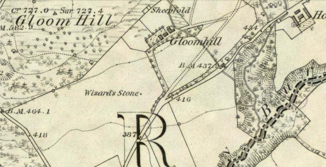
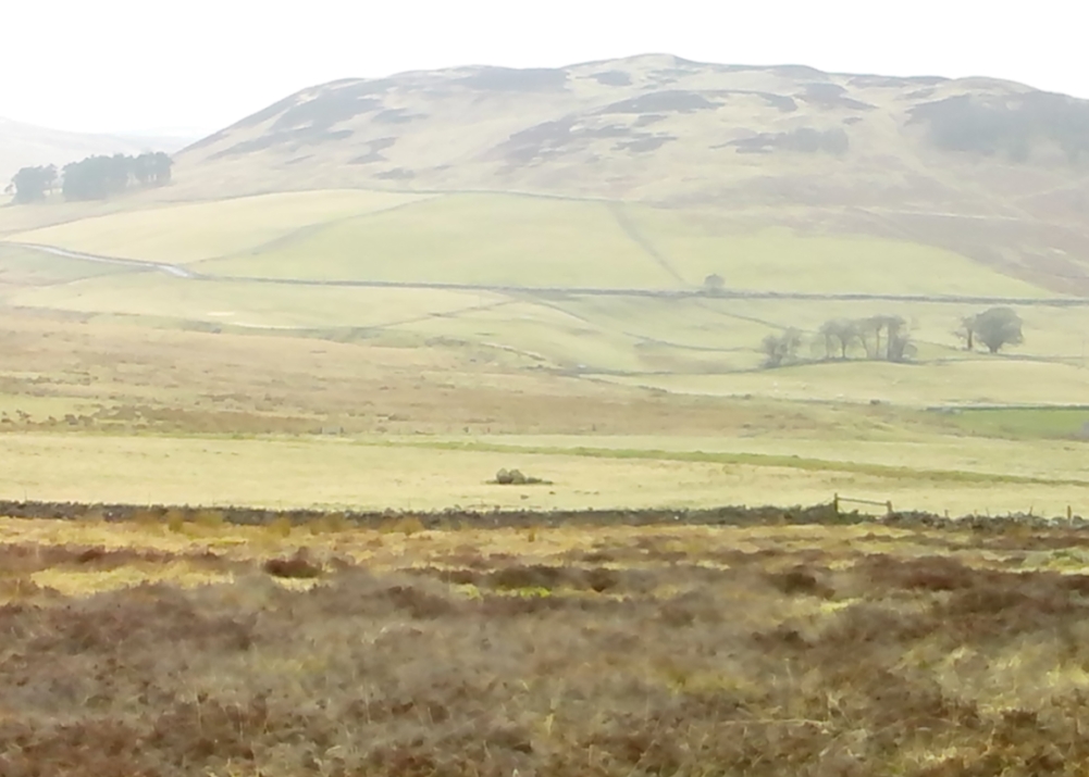
From Dollar town centre, take the road up to the gorgeous Castle Campbell, but instead of turning up towards the castle, keep on the road, uphill, for another quarter-mile. As the road begins to level out, a small field and driveway on your left heads up to Kiloran house. Stop here, and note the stone in the field, right by the fence alongside the footpath which runs uphill by the field-side up into the woods. That’s the Wizard’s Stone.
Archaeology & History
The Wizard’s Stone, Dollar
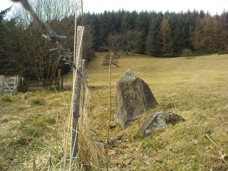
This site doesn’t seem to be the remains of an authentic prehistoric standing stone (unlike the one along the same ridge a mile east at Castleton), but is more of a memorial rock relating to some witch traisl that occurred here several centuries ago. By virtue of this, I felt it needed to be included on TNA.
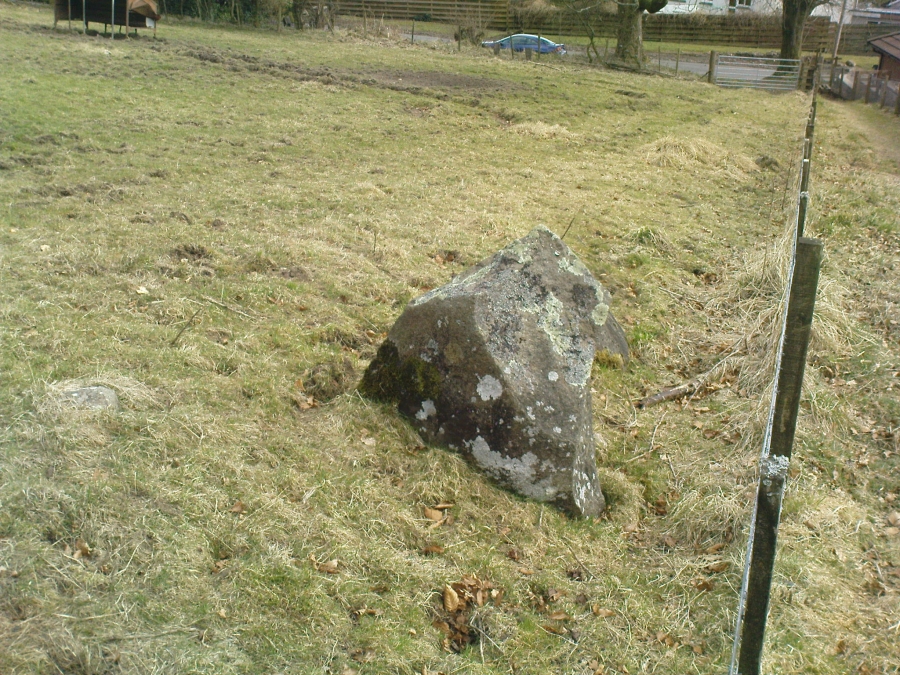
Not listed by Canmore, the stone is found in an area with a rich cluster of heathen place-names—most intriguing of which is the ‘Lochy Launds’ woodland, right above where this Wizard’s Stone now rests. The stone has been broken into smaller pieces in recent years—as the photos here show—and the small standing stone which remains is barely 3 feet tall at the edge of the field.
The local writer and historian Rennie McOwan (1989) told that it marked the spot where a warlock was burned in the 16th century. Years later, a local land-owner called John Moir erected the stone here as a memorial to the event. This was subsequently echoed by fellow local history writer Bruce Baillie (1998), when he wrote:
“A large whinstone in a field in a field is known as ‘The Wizard’s Stone’, having been set there by one of the Moirs to take the place of a rotting stake said to mark the spot where the last Dollar witch (and, naturally, the last Scots one), named Forrester, was burnt, though this is probably folk confusion with the vicar of Dollar, Thomas Forrest.”
Angus Watson (1995) could find no early references of this stone, other than it being mentioned in the 1860 Ordnance Survey Name Book. Further information on the site would be most welcome.
Folklore
Wizard’s Stone, looking down to the road
Reputedly one of the haunts and gathering places of the witches of the area, this spot was also known as Lochyfaulds, which the place-name giant W.J. Watson (1926) tell us means the ‘place of the Black Goddess,’ like the “Valley of the Black Goddess” of Glen Lochay, 40 miles to the northwest of here near Killin. Modern folklore ascribed the wizard here to have been Merlin—as highlighted in the adjacent place-name of “Merlin Park.”
References:
Baillie, Bruce, History of Dollar, DMT: Dollar 1998.
McOwan, Rennie, The Green Hills, CDL: Alloa 1989.
Watson, Angus, The Ochils: Placenames, History, Tradition, PKDL: Perth 1995.
Watson, W.J., The History of the Celtic Place-names of Scotland, Edinburgh 1926.
Landscape of Giants Knowe (photo by Marion Woolley)
Amidst the colourful and nurturing landscape close to the gigantic Dunruchan standing stones and just along the road from the solitary Craigneich stone, in the field across the road above Straid farmhouse could once be seen a fascinating-sounding prehistoric site that has sadly been destroyed. Some of the remains of this old monument can be found in the field-clearance of stones just over the fence, above the top of the field (many fields round here have scatterings of large stone clearings at the field edges), but we have no detailed accounts of the site. It was mentioned in early notes by the Ordnance Survey to have been,
“A large circular heap of small stone and gravel entirely removed in 1831. An urn filled with ashes and several stone coffins were found under it.”
The local historian John Shearer (1883) later told us that,
“A small mound of earth on the farm of Strayd, called Crock-nafion or the Giant’s Knowe, or the Fingalian’s Knowe, was cleared away several years ago. An urn containing burnt bones was discovered.”
Any additional information about this site and its folklore, would be greatly appreciated.
Folklore
To the west along Glen Artney whence our view takes us from here, old legend told that the valley was once the abode of a great giant who lived in a cave in one of the mountains thereby. In mythic lore, giants were the creation deities of hills, mountains and other geological forms, whose narratives were overturned and demonized by the incoming christian cult many centuries ago. It is likely that this once great tomb was deemed as the burial-place of our local giant – which would make this prehistoric site neolithic in age. But — logical though it is — this idea is pure speculation…
References:
Hunter, John, Chronicles of Strathearn, David Philips: Crieff 1896.
Shearer, John, Antiquities of Strathearn, David Philips: Crieff, 1883.
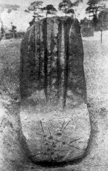
Similar in size and appearance to one of the cup-marked Tuilyies standing stones in Fife, Scotland, it was our old ley-hunter, Alfred Watkins, who described this stone in his Ley Hunter’s Manual (1927), along with giving us the old photograph taken by one of his mates here, which also showed the cup-and-ring carvings near the base of the stone. Are they still visible? (I’ve not been here, hence mi ignorance!) Watkins thought the cup-markings at the bottom represented some of the local leys—but unfortunately they don’t.
Folklore
Legend says that the deep grooves running down the stone were made by men sharpening arrow-heads on it (like a whetstone). There was also the usual christian Victorian fable that the stone was used by the druids and that the grooves on the stone were where the blood of their human sacrifices was channelled to the ground! The stone was also said to have some relationship with the nearby Calder Stones (which seems probable).
References:
Cowell, Ron, The Calderstones – A Prehistoric Tomb in Liverpool, Merseyside Archaeological Trust 1984.
Watkins, Alfred, The Ley Hunter’s Manual, London 1927.
Go west out of Dunfermline on the A994 till you hit the Torryburn roundabout, taking the A985 Kincardine road. Barely a half-mile along, stop at the first parking lay-by at the roadside – and there, over the barbed wire fence, you’ll see your standing stones right in front of you.
Archaeology & History
The Tuilyies standing stones
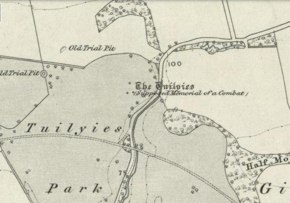
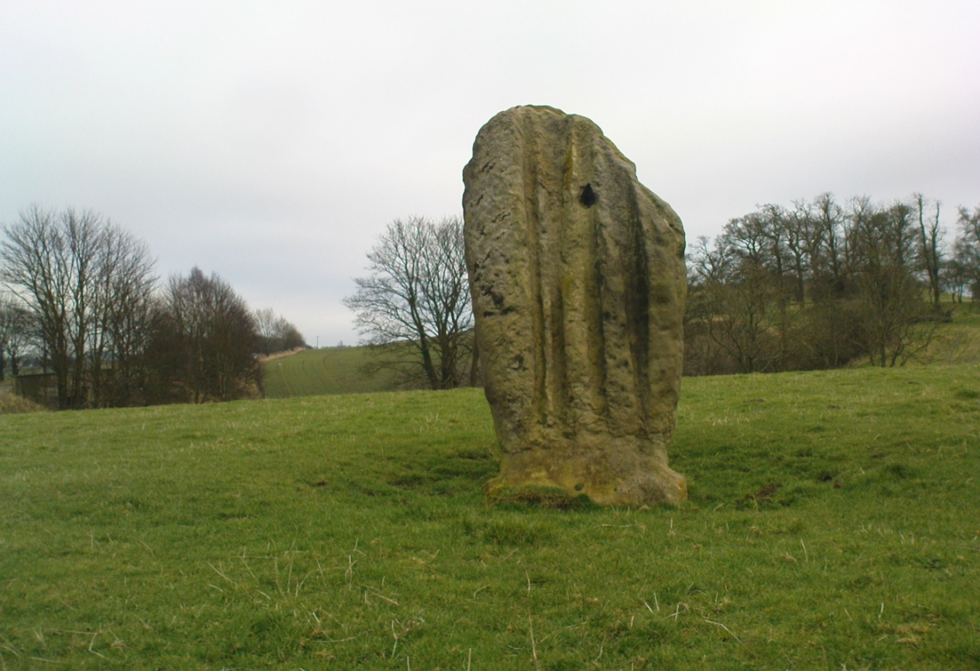
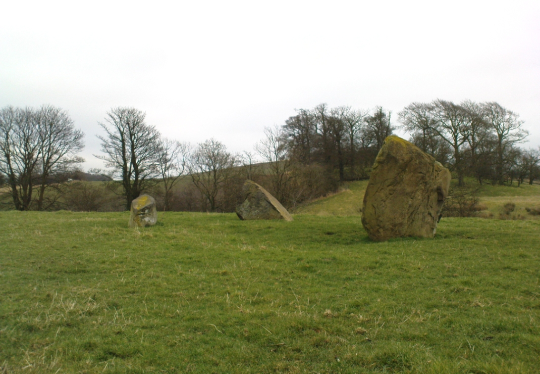
Overlooking the northern shores of the Firth of Forth is this fascinating group of standing stones which, old lore told, was once an old stone circle. You can see what they meant. The Tuilyies consists of a small group of three stones, between 3 and 7 feet tall, arranged in the form of a scalene triangle; and about 20 yards away stands the more impressive outlying 8 foot tall upright stone, somewhat akin to a petrified ancestor, with both natural and man-made cup-markings on at least two sides of its slim body. This outlying stone is of a very different character to that of its close neighbours—and a different type of stone as well—and is very similar in both size and appearance to the Robin Hood Stone at Allerton, near Liverpool. Curious…
The east-facing cup-marked Tuilyies stoneNatural ridges on its west-face
Whether the stones here were part of a stone circle we don’t know for sure. It was suggested as such in 1793 and Aubrey Burl (2000) includes them in his primary survey, but we have little evidence to prove as such nowadays. The parish of Torryburn not only had to contend with industrial agriculture knocking down any stones that may once have stood here, but in the 17th century the village also had to tolerate the psychiatric delusions of one reverend Allan Logan: one of the many deranged priests who saw witchcraft and demons in everything natural or animistic, persecuting local people for their old traditions, herbalism and peasant-lore. (Beveridge 1885; Cunningham 1902; Webster 1820, etc) These old stones were unlikely not to have received his depraved attention. But thankfully, some remain standing…
The Tuilyies seem to have been described first of all in the 1793 Old Statistical Account of Scotland—and in that narrative we find one of the earliest descriptions of cup-markings. It told that,
“In a pretty extensive plain field NE of the village of Torryburn, there is a flat stone, raised upon one end, of a shape nearly oblong and measuring, from the surface to the top, about 8 feet, and about 4½ in breadth, Round the edge of it there is a deep circle, and on each of the sides a number of ridges, all of which wear the appearance of art and antiquity. At about 18 or 20 paces from this stone, there is a number of smaller ones, which, from their present position, seemed to have formed part of a circle.”
Many years were to pass before these old stones heard from the men of words again. This time it was the renaissance of cup-and-ring designs that brought them back to light, when Sir James Simpson (1866), in his massive precursory essay to British Archaic Sculpturings (1867) talked about them:
“The stone at Torrie, Fifeshire…is a flattened sandstone flag, deeply guttered in longitudinal lines, and presenting cup- markings on its eastern side. It has been attempted to be made “a holed stone,” like (the) this block at Ballymeanoch (Argyll), but the artificially splayed perforations from the opposite sides do not meet in the middle. About fifty paces from it are the remains of a small circle of stones.”
The triangle of standing stones
Unusually, J. Romilly Allen only mentioned the stones in passing, simply repeating Simpson’s earlier words. Even local historians gave the site scant attention. In David Beveridge’s (1885) magnum opus he gave only a brief mention of the stones; and A.S. Cunningham (1902) did likewise. Thankfully after a visit to the stones by the Royal Commission lads in May 1925, a more detailed description was given. They wrote:
“The site of the cup-marked standing stone…is a plateau, 150 feet above sea level, in a field on Torrie Estate about half a mile to the northeast of the village of Torryburn, and on the north side of the drive to Torrie House. At a distance of 60 feet from it are three huge boulders, and the four are said to be the remains of a circle, although that idea is not borne out by their present disposition.
“The cup-marked stone rises to a height of 8 feet above the ground and has its narrow faces to the north-east and south-west. It is of irregular form, narrowing somewhat at 7 inches from the base, expanding outwards at the middle, and contracting again to a roughly convex top. On the east face the lower portion is covered with cup-marks. which vary from 1½ to 5 inches in diameter and from 1½ to 2 inches in depth. At a height of 6 feet from ground level, in the south-west angle of the stone, is a cavity 7 inches in depth, while there is a similar cavity of like depth opposite to it on the west face. The stone is also marked on the east and west faces, as well as on the top and down the narrow sides, with a series of perpendicular grooves of varying depth, but all these channels are due to weathering. Its measurements are: north face, 1 foot 3 inches; south face, 1 foot 4 inches; east face, 4 feet 4 inches; west face, 4 feet 3 inches; girth at base, 10 feet 8 inches; at 7 inches up, 8 feet 10 inches; at middle, 10 feet 5 inches.
“The three other boulders are set in the form of a triangle immediately to the south of this cup-marked stone, at intervals of 12, 15 and 16 feet apart. One has evidently fallen from an upright position and now lies with its major axis north and south. None of the three shows any markings. They are of whinstone, while the cup-marked standing stone is of grey sandstone.”
But as for the lack of cup-markings on the outlying smaller stones, when Ron Morris (1973) examined the site in the ’70s, he found what seemed to be some cup-marks on the largest of the group of three stones, as shown in the photos. On this he reported,
“25yds S of the well-known cup-marked standing stone are 3 large boulders. The W of these, measuring 7′ x 4½’ x 3½’ high, bears on its slightly W-sloping top surface 7 cups cup to 2″ diameter and ½” deep.”
When I visited the site the other day, these were difficult to see—cos as the photos here show, Nature gave us a bittova dark grey day and such carvings are notoriously temperamental when weather conditions aren’t to the stone’s liking!
Folklore
The Old Statistical Account of 1793 told that the stones were supposed to have “been the scene of a battle in some former period, and these stones…mark the graves of some of the chiefs, who had fallen in the engagement.” The lore was echoed in David Beveridge’s (1885) huge local history work, where he informed the reader that many standing stones along the Forth,
“are all connected with the Danish incursions. One specially may be mentioned, standing near Torryburn, the parish adjoining Culross, in a field which is still known by the name of the Tuilzie, or Battle Park.”
Morris, Ronald W.B., “Torryburn, Torry – Cup-Marked Rock’, in Discovery & Excavation in Scotland, 1973.
Royal Commission on the Ancient & Historical Monuments, Scotland, Inventory of Monuments and Constructions in the Counties of Fife, Kinross and Clackmannan, HMSO: Edinburgh 1933.
Simpson, James, Archaic Sculpturings of Cups, Circles, etc., Upon Stones and Rocks in Scotland, England and other Countries, Edmonston & Douglas: Edinburgh 1867.
Webster, David, A Collection of Rare and Curious Tracts on Witchcraft and Second Sight, D. Webster: Edinburgh 1820.