Take the same directions as if you’re visiting the Great Skirtful of Stones giant cairn on the boundary of Burley and Hawksworth. Cross the wire fence on its southern-side and, cross the (usually overgrown) prehistoric trackway 50-60 yards away. Keep in the same direction onto the pathless moor for about the same distance again, zigzagging back and forth, keeping your eyes peeled for some small overgrown rocky rises. You’ll find ’em.
Archaeology & History
Not to be confused with the much larger Bronze Age graveyard further south on the same moorland, this little-known prehistoric cemetery has had little of any worth written about it since the 19th century and—like many sites on these moors—has received no modern archaeological attention.
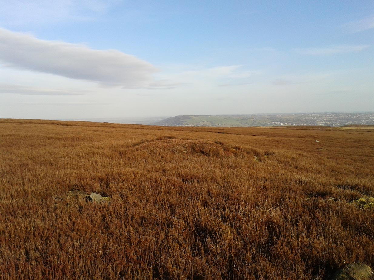
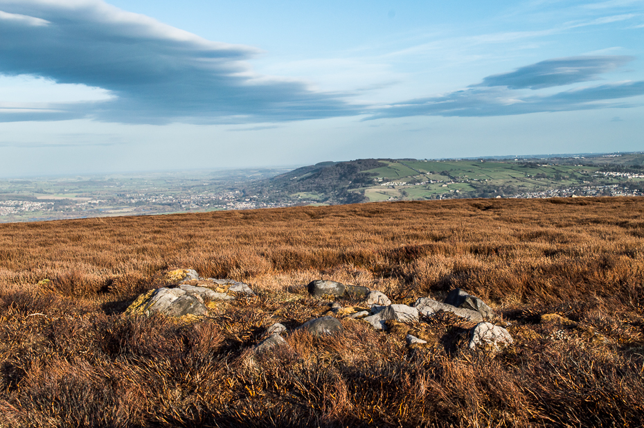
Close-up of one of the cairnsTwo of the cairns, looking NW
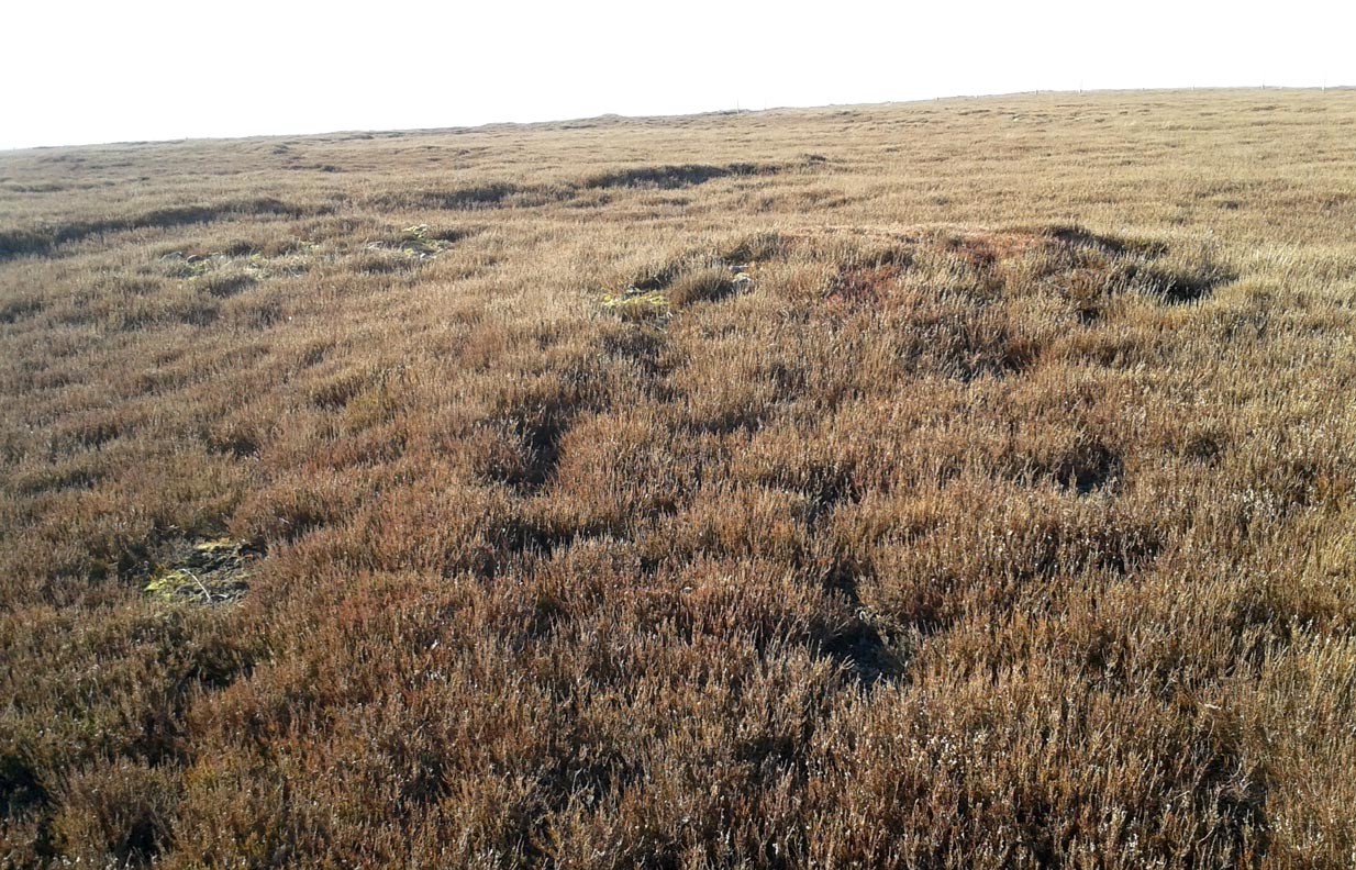
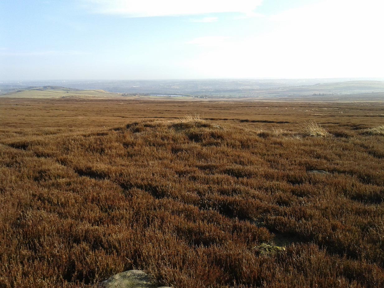
On my last visit to this site with James Elkington in 2015, only four of the heather-clad cairns were visible; but if you explore here after the heather has been burned away, a half-dozen such tombs are found in relatively close attendance to each other. They are each about the same size, being roughly circular and measuring between 3-4 yards across, 10-12 yards in circumference and a yard high at the most. As you can see in the attached images, they are quiet visible even when the heather has grown on them.
Another cairn in this group
This small cairnfield may stretch across and link up with the secondary cairnfield a half-mile to the southwest. More survey work is required up here.
As with the circle of Roms Law and the Great Skirtful of Stones, this relatively small cluster of cairns seems to have had a prehistoric trackway approaching it, running roughly east-west. A short distance west are the much-denuded waters of the Skirtful Spring.
References:
Bennett, Paul, The Old Stones of Elmet, Capall Bann: Milverton 2001.
Faull, M.L. & Moorhouse, S.A. (eds.), West Yorkshire: An Archaeological Guide to AD 1500 (4 volumes), WYMCC: Wakefield 1981.
Wardell, James, Historical Notes of Ilkley, Rombald’s Moor, Baildon Common, and other Matters of the British and Roman Periods, Joseph Dodgson: Leeds 1869. (2nd edition 1881).
Acknowledgements: Huge thanks to James Elkington for use of his photo in this site profile.
Of at least 26 prehistoric barrows or tumuli in close proximity on the grasslands immediately west of the Badbury hillfort, this particular ‘Badbury Barrow’ as it’s generally called, was the most intriguing of the bunch. Intriguing as it was found to possess a very rare carved stone near its centre, and had the elements of the dead laid out in a quite fascinating manner, with a large inner wall that surrounded the dead. Grinsell (1959) posited that this site may be the same one described on the 1826 Greenwood Map of the region as the ‘Straw Barrow’ – in which case I’d love to know if there are earlier place-name references to the site and see what its name is thought to mean. (Mills’ PNs Dorset, 2, could be helpful – though it could be just ‘straw’!) However, the Straw Barrow is some distance to the west of here.
The first lengthy description of the site was done very soon after the near destruction of the place in 1845. A local man called John Austen visited and described the old tumulus in some considerable detail, and I make no apologies for adding his complete description of the barrow, as he found it, just before the land-owner levelled the place. He wrote:
“On Nov. 1, 1845, I accidentally ascertained that a barrow situated about five miles from Wimborne, Dorset, upon the road leading to Blandford, and in the immediate neighbourhood of Badbury camp, was in progress of being levelled. The circumstance which chiefly attracted my notice was the vast quantities of large sandstones and flints which had been taken from it. Unfortunately nearly two-thirds of the tumulus were already removed. From the remainder, however, I have obtained a tolerably accurate idea of its interior arrangement, which, with perhaps the exception of the ‘Deverill barrow’, opened by W. Miles, Esq., in 1825, is more highly interesting than any yet examined. The labourer employed could give me but little information respecting the part already destroyed, further than that he had thrown up many pieces of pottery, and found one urn in a perfect state, but in removal he had broken it; sufficient however remained to enable me to ascertain its form and dimensions. It measured 8 inches in height, 6¾ inches at the mouth, and at the bottom 3½ inches. The colour of the outer side was more red than is usual, and within it had a black hard ash adhering to the side, It was inverted, and contained only a few white ashes. It was ornamented with lines of from nine to fourteen fine pricked dots, as if made with a portion of a small tooth comb. Such an instrument was discovered a few years since by some workmen, whilst lowering a hill midway betwixt Badbury camp and the village of Shapwicke, having at one end a small circular hole, and at the other eight short teeth like those of a comb. It was four inches long and one inch wide, and was part of the rib of a deer…
“The barrow was circular, measuring about eighty yards in circumference, the diameter sixty-two feet, and the height nine feet; it had however been considerably reduced by the plough. Upon clearing a section across the centre, the following formation presented itself. The outside circle or foot of the barrow was of chalk, occupying a space of fifteen feet towards the centre. There was then a wall extending completely round, and enclosing an area of about thirty feet in diameter, composed of large masses of sandstone brought from some part of the heath, probably from Lytchett, a distance of not less than five miles, and across the river Stour. These stones were well packed together as in the foundations of a building, and the interstices tightly filled with flints. Within this wall, for the space of three or four feet, was a bed of flints, without any mixture of earth or chalk, packed together from the floor to the surface of the barrow, having only a few inches of earth above. The remainder of the interior was occupied by large sandstones, serving to protect the various interments.
Urn found in one cist
“About the centre I found six deposits. The most northern of these was the skeleton of a young child, by the side of which, proceeding west, there was a cist containing a deposit of ashes and burnt bones; and near it another, rather above the floor, containing burnt wood. Immediately beneath this was a cist containing an urn, placed with its mouth downwards, and filled with burnt bones, which were perfectly dry and white. It was without any ornament, and measured in height ten and a quarter inches; the diameter at the mouth, which turned outwards, was eight and three-quarter inches, and at the bottom four inches. The other cists contained burnt bones and ashes. Sandstones had been placed over them, but were removed without my having an opportunity of ascertaining their position. A short distance south of these deposits there was a cist containing the bones and skull of a young child, over which had been placed a flat sandstone, and about a foot from it appeared a deposit of small bones, occupying a space of only two feet ; these were apparently the remains of a woman. Immediately above was a row of sandstones, resting, as was usual throughout the barrow, upon a thin layer of burnt wood. At this spot the barrow appeared to have been opened after its final formation, as if for the purpose of a subsequent interment, and filled up, not with the earth of which the remainder was formed, but with loose chalk, there being no stones or flints above those which lay immediately upon the deposit. At the extreme south of these cists was a large sandstone, three feet in diameter by sixteen inches in thickness, placed edgeways. The above-mentioned cists were circular.
Upright urn outside of cists
“A few inches west of the cist described as containing an urn, was the lower half of another, measuring in diameter five and a half inches, inverted, and placed upon the floor of the barrow, without any protection, merely surrounded by a thin layer of ashes and then the solid earth. It was filled with ashes and burnt bones, and rested upon the parts of a broken skull. Near this was an urn, also unprotected, and consequently much injured by the spade. It was placed upright, and measured in diameter nine and a half inches, by about ten inches in height. In form it resembled the urn first described, marked with impressed dots, but it was without any ornament. A short distance from these was a deposit of burnt wood at the west side of a large flat stone, placed edgeways, which measured three feet four inches by two feet ten inches, and thirteen inches in thickness. From its appearance it would seem that the fire had been lighted by its side. Immediately beneath the edge of this cist, and resting upon the chalk, was a small urn inverted, and by its side some small human bones. It was wholly unprotected, and unfortunately destroyed. South-east of this was a cist sixteen by twelve inches in diameter, and eighteen inches in depth, containing ashes and a few burnt bones, with a large-sized human tooth. Close to the edge of this cist, upon its western side, was placed in an upright position, a large stone measuring in diameter three by two and a half feet; and leaning against it another of still larger dimensions, inclining towards the north. This measured six and a half by four feet, and fifteen inches in thickness. About three feet further east were two large stones set edgeways, and meeting at their tops. Beneath them was the skeleton of a small child with the legs drawn up, lying from west to east. At the north-west side of the barrow, about five feet within the wall, was a cist cut in the solid chalk, measuring sixteen inches in diameter by sixteen in depth; it contained an urn inverted, and filled with burnt bones. Though carefully bandaged, it fell to pieces upon removal, being of more brittle material than any previously discovered. The clay of which it is formed is mixed with a quantity of very small white particles, having the appearance of pounded quartz. It measured in height nine inches by nine and a half in diameter, and is ornamented by six rows of circular impressions made with the end of a round stick or bone of a quarter of an inch in diameter. The cist was filled up with ashes.
Small cup-like urn
“A few inches from this was a cist differing in form, being wider at the top than beneath, in diameter eighteen inches by eighteen in depth; a flat stone was placed over it. It contained the skeleton of a young child, laid across, with the legs bent downwards. Lying close to the ribs was a small elegantly-shaped urn, measuring four inches in height by four in diameter, and made of rather a dark clay. It is ornamented with a row of small circular impressions, similar to those mentioned in the last instance, close to the lip, which turns rather out: beneath is a row of perpendicular scratches, and then two rows of chevrons, also perpendicular. At the feet of the skeleton was a peculiarly small cup, measuring in height one and a half inches by two and a quarter in diameter. It is ornamented with two rows of pricked holes near the top, beneath which is a row of impressions, made probably with an instrument of flat bone, three-eighths of an inch in width, slightly grooved across the end. The same pattern is at the bottom and upon the rim.
Another cup-like vessel
“Near this, towards the south-west, was a deposit of burnt wood, situated above the floor of the barrow, and immediately beneath it were two cists. In one of these, which measured two feet in diameter by one and a half in depth, were a few unburnt bones and several pieces of broken pottery, with a small cup, ornamented with three rows of the zigzag pattern, betwixt each of which, as well as upon the edge, is a row of pricked holes, and at the bottom a row of scratches. It measured in height two and a half inches by three in diameter, and had two small handles pierced horizontally: there appeared to have been originally four. In the other, which measured two feet in diameter by one in depth, were a few unburnt bones and a small urn placed with the mouth upwards, measuring four and three-quarter inches in height by the same in diameter. The lip, which turned very much out, is ornamented with a row of scratches, both within and upon its edge, a similar row also passes round near its centre. Close upon the edge of this cist was another urn of similar dimensions, inverted, and embedded in the solid earth without any protection. It is of much ruder workmanship than any of the others, and wholly unornamented, measuring five inches in height by five in diameter. Both these urns inclined equally towards the south-east. These last cists were partly, if not quite, surrounded by large sandstones set edgeways, and smaller ones built upon them, forming as it would seem a dome over the interments, filled with earth, and reaching to the surface of the barrow, where these stones have been occasionally ploughed out. From this circumstance, as well as the general appearance of the excavation, added to the description given by the labourer of the other part of the barrow, I am induced to suspect such to have been the case throughout… I found many pieces of broken pottery, and a part of a highly-ornamented urn. There was a total absence of any kind of arms or ornaments. The labourer however shewed me a round piece of thin brass, which he had found amongst the flints within the wall, measuring an inch and five-eighths in diameter. It had two minute holes near the circumference. It was probably attached to some part of the dress as an ornament. Teeth of horses and sheep were of frequent occurrence; I also found some large vertebrae and the tusk of a boar. Upon one of the large stones was a quantity of a white substance like cement, of so hard a nature that it was with difficulty I could break off a portion with an iron bar.
“If I offered a conjecture upon its formation, I should say that the wall, and foot of the barrow, which is of chalk, were first made, and the area kept as a family burying-place. The interments, as above described, were placed at different intervals of time, covered with earth (not chalk) or flints, and protected by stones. And over the whole, at a later period, the barrow itself was probably formed. My reason for this opinion is, first, that all these deposits, including, as they do, the skeletons of three or four infants, could scarcely have been made at the same time. And in the second place there was not the slightest appearance (with one exception) of displacement of the stones or flints in any way. As these circumstances then would suggest that the interments were formed at various periods, so the general appearance leaves no doubt as to the superstructure of flints, and surface or form of the barrow itself having been made at the same time and not piecemeal.
“I have met with no instance of a British barrow containing any appearance of a wall having surrounded the interments. Pausanias, in speaking of a monument of Auge, the daughter of Aleus king of Arcadia, in Pergamus, which is above the river Caicus, says, ‘ this tomb is a heap of earth surrounded with a wall of stone.’ And in the Saxon poem, ‘Beowulf,’ mention is made of a similar wall as surrounding the tomb of a warrior.”
One of the stones inside here was later found to possess “carvings of five cupmarks, two bronze daggers and two flat, triangular axes of early Breton type,” (Burl 1987) which Austen didn’t seem to notice at the time of his investigation. A profile of the Badbury Barrow carving can be found here.
Folklore
In Peter Knight’s (1996) survey of megalithic sites around Dorset, he includes the Badbury Barrow along a ley line that begins at the tumulus just below (south) Buzbury Rings and then travels ESE for about 5 miles until ending at another tumulus at ST 006 996.
References:
Austen, John H., “Archaeological Intelligence,” in Archaeological Journal, volume 3, 1846.
Burl, Aubrey, The Stonehenge People, Guild: London 1987.
Grinsell, Leslie V., Dorset Barrows, Dorset Natural History & Archaeological Society 1959.
Knight, Peter, Ancient Stones of Dorset, Power: Ferndown 1996.
Piggott, Stuart, “The Badbury Barrow, Dorset, and its Carved Stone,” in The Antiquaries, volume 19, 1939.
Royal Commission on Historical Monuments, England, An Inventory of the Historical Monuments in the County of Dorset – Volume 5: East Dorset, HMSO: London 1975.
Stone, J.F.S., Wessex Before the Celts, Thames & Hudson: London 1958.
Warne, Charles, The Celtic Tumuli of Dorset, John Russell Smith: London 1866.
From the Askwith Moor Road parking spot, walk up the road for about 500 yards and head to your right (east) onto the moor. Walk past the upper side of the disused quarry and through the heather for about 200 yards until the moorland slopes down and you’re on another flat moorland ridge. You should now be stood on the edge of the Snowden Crags Necropolis or cairnfield. There’s a large patch of bracken near the top of Snowden Crags in the middle of the prehistoric cemetery. That’s the spot!
Archaeology & History
Very little has been written of this site and for years several of us have wondered whether or not a stone circle was the antiquity that was being described in the only singular reference of the place, mentioned almost in passing in Mr Cowling’s (1946) fine survey of this area more than fifty years back, where he reported:
“A large circle of heavy material, some thirty feet in diameter, is isolated on the shelf above Snowden Crags to the west.”
But despite the various explorations of me and a number of other students on these moors over the last 20-30 years, Cowling’s curious singular reference (which some have taken as an error of judgement on his behalf) has remained a mystery. Until now!
South & west portion of the ring (photo credit: Geoff Watson)The complete circle, looking NW (photo credit: Geoff Watson)
Thankfully, with the help and attention of the hardworking Keighley volunteer Michala Potts on Thursday, 20 May, 2010, this large and very well-defined antiquity has been relocated — and a damn fine find it is indeed! It would appear (unless someone has notes to the contrary) that when Cowling did his extensive walkabouts on these and adjacent moors, this Snowden Crags Circle was much overgrown in heather and bracken; and I think we can safely assume this due to him making no further remarks regarding the site. Indeed, it would seem that Cowling’s consequent silence on the matter would lend us to think he never caught good sight of this “large circle” ever again. And upon these moors, that’s easily done when the heather gets deep up here! (numerous cup-and-ring stones on these and other northern moors still lay hidden amidst moorland undergrowth, awaiting rediscovery as a consequence of the deep vegetation) But thankfully now we have a good view of the place.
Wrongly ascribed by Neil Redfern of English Heritage to be a part of Scheduled Monument Record number 28065: Cairnfield, Enclosures, Boulder Walling, Hollow Way and Carved Rocks (it’s actually a short distance north of SMR 28065), the site here was relocated during one of The Northern Antiquarian exploratory walks, assessing the extensive walling, settlement pattern and prehistoric graveyard that scatters the central and northwestern section of the moors here. Michala Potts stopped and shouted for Dave Hazell and I to come and have a look at something she’d found whilst we were carefully peeling turf back from a previously unrecorded site about 100 yards away.
“What is it?” I asked; expecting just another small tomb or new cup-and-ring stone. But her tone of voice was different this time.
“I think you’d better take a look at this,” she emphasized.
As we walked through the shallow heather towards her, it became obvious she was standing in a rough circle of dead bracken, unbroken by the lack of rain over the previous months. We’d actually walked past it a couple of times the previous week and gave it no attention due to the depth of the dead vegetation covering the area. But this time it was different. I got within 50 yards of where Mikki was stood and my footsteps slowed; a couple more steps perhaps; then I stopped dead in my track. My arms lifted up and I held my head gazing at what she appeared to be stood in.
“Aww my god….” I said — transfixed at what was in front of me (I’m easily pleased aswell!).
Snowden Crags circle, looking west (photo credit: Geoff Watson)
I’m not quite sure how long I stood there with my head in my hands. Ten seconds or so. I couldn’t really say. I think it was when Dave caught up to where I stood, rooted, and appeared at my side. We walked a bit closer to make sure that what we could see wasn’t just another one of those curious shapes in the landscape that you find when seeking out prehistoric sites and turn out to be bugger all — but it wasn’t. Instead, Mikki Potts had stumbled upon an average-sized ring of stones, between 1-3 feet tall, and about 13 yards across, with what seemed like an entrance on its southern side, seemingly untouched in the middle of the mass of decaying bracken! It was an exciting find — as it’s not everyday that you come across a previously unrecorded stone circle. But, once we’d calmed down and walked round and round the site to make sure that something man-made was under our feet, we decided to make our way home (we’d been on the moors all day) and get back up to have a more detailed look at the place in a few days time. On Tuesday, May 25, we went back up for a second time and had a better look at the place…
It was another lucky day. For before we even reached Askwith Moor, Mikki pointed out what looked like a small cup-marking on a stone yards from the edge of the River Wharfe. We brushed off a bit of the dusty earth and were greeted the single cup-marked stone we’ve named the Riverbank Stone. It sat there all alone and dusty and we were very tempted to look for more potential carvings along the riverbank, but the Snowden Crags site was calling for attention and so up the hill we walked.
The ring of stones was still covered in a carpet of dead bracken and also had the new shoots of Spring emerging from the Earth, so we spent the next few hours picking up much of the dead bracken and carrying it beyond the outskirts of the circle, hence enabling us to see with greater clarity the monument Mikki had found a few days previously. The hot sun shone down on us all day and it took longer than we expected to shift all the bracken; but eventually, once we’d done it, we were looking at a very distinct man-made circular monument, measuring 13 yards by 12 yards across and, at its highest point, not even three feet above the present ground level. But today’s ground level is certainly much higher than it was when these stones were first placed here — at least 12 inches higher.
Rubble bank, NE-SE section (photo credit: Geoff Watson)
When Mikki first clapped eyes on the place, only a few small upright stones were sticking up amidst the mass of compacted bracken, but once all this had been brushed off we could see the stony earthworks averaging 18 inches high around the edges; and in places this outer ring is nearly 6 feet across. The ring consists mainly of smaller packing stones (perhaps thousands of them) between a number of larger upright stones — a dozen of them — making up the perimeter; but much of this perimeter is still considerably overgrown in compacted vegetation that’s prevented us seeing the ring in its proper glory: what archaeologists in the past have called a rubble bank. On its southern side is what appears to be an entrance, i.e., in this part of the circle there are no larger stones at all and only a handful of small stones have been noticed; but we must take into account the fact that we’ve done no excavation work here and this “entrance” may in fact be illusory, as the centuries of compacted vegetation (in all probability at least 12 inches deep) could be overlaying an unseen portion of the ring. This “entrance” is about 2 yards across.
The circle has similarities in size and design to the better-known site of Roms Law on Ilkley Moor. The difference between the two however is Roms Law has been robbed, whilst the Snowden Crags circle hasn’t even been catalogued. Yet there is a distinct anomaly here.
As we walked through the southern “entrance” and into the circle, we noticed what seemed to be some form of internal walling running roughly north-to-south. This “walling” started about three yards between the southern “entrance” and the inside of the ring, but then it ran roughly through the centre and all the way to the northern perimeter. This was indicated by a distinct rise in the ground which, as you walked over and stomped your feet, proved to be a mass of numerous small stones seemingly a few inches under the ground, some of which were poking through the Earth’s surface. This ingredient alone made me stop and wonder about the nature of the site. Had we come across a cairn circle of some sort? Or were we in fact stood in the middle of a small walled enclosure, which itself sits in the middle of this prehistoric graveyard? Indeed, was this walled enclosure a potential living quarter: some sort of large hut circle with a wall through the centre splitting it in two? It was hard to say for sure. On another visit to this site a couple of weeks later, in the company of Geoff Watson, Paul Hornby and Dave Hazell, this potential internal walling was given a bit more scrutiny.
We were dying to get our hands and feet digging at the heart of this ring of stones but — as yet! — we’ve managed to restrain ourselves. Although carrying off the mass of dead bracken has dislodged a couple of the small fist-sized stones at the edge of the ring (we carefully placed ’em back into position; yet it was only as much as you’d unintentionally disturb if you walked over the place a few times), we needed to use a couple of small brushes to have a look at this apparent internal walling running through the middle of the ring. But after carefully brushing off the dry dead earth, we found this “walling” was nothing of the sort! Instead, it seemed, someone at some time in the past had beaten us to this place! The central walling was, in fact, where someone had dug into the central region of the circle — probably looking for treasure or other wealthy valuables — and in doing so had dislodged a great number of the small stones that were initially in the middle of the ring, and in doing so pushed them up into small piles of stones, away from their original central position, creating an obvious long line of rocks which, once covered with dead vegetation, gave the impression of it being a length of walling. We also found that the mass of rocks that were around the centre of the ring also spread outwards covering all of the ground inside the outer kerb of stones — probably thousands of them. Geoff called this trench in the middle, the Robber’s Trench!
This begged the question: who the hell had been here, dug out a trench in the middle of this cairn circle (possibly taking out whatever remains were in the middle) centuries before the site had even been catalogued? It didn’t seem like it could have been Mr Cowling, as the covering vegetation was much more than a mere 50 years of age; and Cowling would very likely have reported any finds that he might have made here. So it is a mystery that needs solving.* Again, an accurate archaeological excavation would be invaluable here — but I wouldn’t hold your breath. Archaeological officials don’t seem interested in helping here. I was informed by Neil Redfern of the archaeology department of English Heritage for North Yorkshire that they are unable to support any funding that might help towards any decent analysis of this important archaeological arena (probably spent all their cash on prawn sandwiches and tedious autocrats, as usual).
So what we have so far is this: a large flattened circle consisting of at least a dozen upright stones that define the edges. Between these uprights are hundreds, perhaps thousands of smaller stones, making a rubble bank of a near unbroken circle, apart from where there seems a small entrance on its southern side. Inside the circle is a scattered mass of many small stones, typical of cairn material, filling the entirety of the monument; but the central region has been dug into at some time in the past, by persons unknown. It sits on a flat plain of moorland amidst the Snowden Crags Necropolis with around 30 other small cairns. But this particular site is several times larger than all the others, probably indicating that whoever was buried/cremated here was of some considerable importance in the tribal group: a local king, queen, tribal elder or shaman. Whoever it was that this monument was made for, the landscape reaching northwards from here looks across to the giant morphic temples of Brimham Rocks and the heavenly landscape beyond and above them. It is very likely that the Lands of the Ancestors this way beckoned…
References:
Cowling, Eric T., Rombald’s Way: A Prehistory of mid-Wharfedale, William Walker: Otley 1946.
Huge thanks for the help, assistance and photographs of this newly discovered site — and others nearby — to Michala Potts, Dave Hazell, Paul Hornby and Geoff Watson.
* There is a legend that tells of gold and treasure found at a nearby pre-christian well, but this site is a mile to the north of here. Another nearby treasure legend is that of a chap called “Robinson”, who came upon tons of wealth from an unknown source, enabling him to build the eloquent Swinsty Hall a mile northwest of here (though such a chap didn’t actually build Swinsty!). Perhaps there’s some grain of truth somewhere down the line about someone finding some treasure hereby…perhaps here…perhaps not!
AN APPEAL TO SOME DECENT RICH CHAP FOR SOME MONEY TO ENABLE EXCAVATION HERE!
This site and the surrounding monuments have received no archaeological attention of any worth. If it wasn’t for the fact that us amateurs had explored these (and adjacent) moors, this cairn circle would remain unknown, many of the cup-and-rings upon these moors would remain unknown, the extensive enclosures and walling (of indeterminate age and function) would remain unknown, many prehistoric tombs would remain unknown, etc. It is clearly evident that we have quite extensive domestic and ritual remains covering this small moorland region, from the neolithic period onwards. In the event that anyone reading this with a healthy financial backing behind them could work out a financial strategy enabling us to accurately excavate this and the adjacent monuments, please get in touch. We need an archaeologist to be paid for in order that we can do the duties correctly, but there is a group of a dozen volunteers willing to put a lotta work in to do the right job in this and the surrounding sites. Is there anyone out there who has the finance to enable this? I’m serious! Or are these important sites merely going to be left alone for the elements to consume and disappear over time? Surely there are one or two rich antiquarians left in this country who, as in times of old, are willing to help in the investigation of our country’s ancient monuments? Does anyone out there know how we can get the ball rolling?
From the large parking spot by the roadside along Askwith Moor Road, walk up (north) 250 yards until you reach the gate with the path leading onto Askwith Moor. Follow this along, past the triangulation pillar until you reach the Warden’s Hut near the top of the ridge and overlooking the moors ahead. Naathen — look due south onto the moor and walk straight down the slope till the land levels out. If you’re lucky and the heather aint fully grown, you’ll see a cluster of stones about 500 yards away. That’s where you’re heading. If you end up reaching the Woman Stone carving, you’ve walked 100 yards past where you should be!
Archaeology & History
Discovered on the afternoon of May 13, 2010, amidst another exploratory ramble in the company of Dave Hazell. We were out looking for the Woman Stone carving and a few others on Askwith Moor, and hoping we might be lucky and come across another carving or two in our meanderings. We did find a previously unrecorded cup-marked stone (I’ll add that a bit later) — and a decent one at that! — but a new cairn-field was one helluva surprise. And in very good nick!
Cairn A, looking northwestCairn A, looking east
There are several cairns sitting just above the brow of the hill, looking into the western moors. Most of these are typical-looking single cairns, akin to those found on the moors above Ilkley, Bingley and Earby, being about 3 yards across and a couple of feet high amidst the peat and heather covering. But two of them here are notably different in structure and size (and please forgive my lengthy description of them here).
We found these tombs after noticing a large section of deep heather had been burnt back, and a large mass of rocks were made visible as a result. Past ventures onto these moors when seeking for cup-and-ring carvings hadn’t highlighted this cluster, so we thought it might be a good idea to check them out! As I approached them from the south from the Woman Stone carving (where we’d sat for a drink and some food, admiring the moors and being shouted at by a large gathering of geese who did not want us here), it became obvious, the closer I got, that something decidedly man-made was in evidence here.
Cairn A, looking south
Walking roughly northwards out of the heather and onto the burnt ground, a cairn-like feature (hereafter known as “Cairn A”) was right in front of me; though this seemed to have a ring of small stones — some earthfast, others placed there by people — surrounding the stone heap. And, as I walked around the edge of this large-ish cairn (about 9 yards in diameter and 2-3 feet tall), it was obvious that a couple of these outlying stones were stuck there by humans in bygone millenia. The most notable feature was the outlying northernmost upright: a small standing stone, coloured white and distinctly brighter than the common millstone grit rock from which this monument is primarily comprised. As I walked round it — adrenaline running and effing expletives emerging the more I saw — it became obvious that this outlying northern stone had long lines of thick quartz (or some crystalline vein) running across it, making it shine very brightly in the sunlight. Other brighter stones were around the edge of the cairn. It seemed obvious that this shining stone was of some importance to the folks who stuck it here. And this was confirmed when I ambled into another prehistoric tomb about 50 yards north, at “Cairn B.”
Cairn B, looking northCairn B, looking east
Cairn B was 11 yards in diameter, north-south, and 10 yards east-west. At its tallest height of only 2-3 feet, it was larger than cairn A. This reasonably well-preserved tomb had a very distinct outlying “wall” running around the edges of the stone heap, along the edge of the hillside and around onto the flat moorland. Here we found there were many more stones piled up in the centre of the tomb, but again, on its northern edge, was the tallest of the surrounding upright stones, white in colour (with perhaps a very worn cup-marking on top – but this is debatable…), erected here for some obviously important reason which remains, as yet, unknown to us. Although looking through the centre of the cairn and onto the white upright stone, aligning northwest on the distant skyline behind it, just peeping through a dip, seems to be the great rocky outcrop of Simon’s Seat and its companion the Lord’s Seat: very important ritual sites in pre-christian days in this part of the world. Near the centre of this cairn was another distinctly coloured rock, as you can see in the photo, almost yellow! Intriguing…
The smaller “Cairn C”
Within a hundred yards or so scattered on the same moorland plain we found other tombs: Cairns C, D, E, F, G and H — but cairns A and B were distinctly the most impressive. An outlying single cairn, C, typical of those found on Ilkley Moor, Bingley Moor, Bleara Moor, etc, was just five yards southwest of Cairn A, with a possible single cup-marked stone laying on the ground by its side.
Just to make sure that what we’d come across up here hadn’t already been catalogued, I contacted Gail Falkingham, Historic Environment team leader and North Yorkshire archaeological consultant, asking if they knew owt about these tombs. Gail helpfully passed on information relating to a couple of “clearance cairns” (as they’re called) — monument numbers MNY22161 and MNY 22162 — which are scattered at the bottom of the slope below here. We’d come across these on the same day and recognised them as 16th-19th century remains. The cairnfield on top of the slope is of a completely different character and from a much earlier historical period.
We know that human beings have been on these moors since mesolithic times from the excess of flints, blades and scrapers found here. Very near to these newly-discovered tombs, Mr Cowling (1946) told that:
“On the western slope of the highest part of Askwith Moor is a very interesting flaking site. For some time flints have been found in this area, but denudation revealed the working place about August, 1935. There were found some twenty finished tools of widely different varieties of flint. A large scraper of red flint is beautifully worked and has a fine glaze, as has a steep-edged side-blow scraper of brown flint. A small round scraper of dull grey flint has the appearance of newly-worked flint, and has been protected by being embedded in the peat…One blade of grey flint has been worked along both edges to for an oblong tool… The flint-worker on this site appears to have combed the neighbourhood to supplement the small supply of good flint.”
All around here we found extensive remains of other prehistoric remains: hut circles, walling, cup-and-ring stones, more cairns, even a probable prehistoric trackway. More recently on another Northern Antiquarian outing, we discovered another previously unrecognised cairnfield on Blubberhouse Moor, two miles northwest of here.
References:
Cowling, Eric T., Rombald’s Way: A Prehistory of Mid-Wharfedale, William Walker: Otley 1946.
Jack, Jim, “Ancient Burial Ground and Bronze Age Finds on Moor,” in Wharfedale Observer, Thursday, May 27, 2010.
Follow the same directions to reach the Harden Moor circle. From here, walk down the footpath at its side down the slope for 100 yards and take the first little footpath on your left for 25 yards, then left again for 25 yards, watching for a small footpath on your right. Walk on here for another 100 yards or so, keeping your eyes peeled for the image in the photo just off-path on your left, almost overgrown with heather.
Archaeology & History
This is just one of several cairns in and around this area (I’ll probably add more and give ’em their own titles and profiles as time goes by), but it’s in a pretty good state of preservation. Nothing specific has previously been written about it, though it seems to have been recorded and given the National Monument number of 31489, with the comment “Cairn 330m north of Woodhead, Harden Moor.” (anyone able to confirm or correct this for me?)
It’s a good, seemingly undisturbed tomb, very overgrown on its north and eastern sides. Three pretty large upright stones, a couple of feet high, remain in position with an infill of smaller stones and overgrowth (apart from removing a little vegetation from the edges to see it clearer, we didn’t try disturbing it when we found it). It gives the impression of being a tomb for just one, perhaps two people and is more structured than the simple pile-of-stone cairns on the moors north of here above Ilkley and Bingley. Indeed, the upright stones initially gave the impression of it once being a small cromlech of sorts! Other cairns exist close by, but until we get heather-burning done up here, they’re difficult to find – or at least get any decent images of them!
There are several tumuli near the top of the hill here, but only one of them really stands out. Nick Thomas (1976) told it to be one “of the best preserved bowl barrows in Surrey.” A brief description of the relevant tombs, running north to south:
“the first is 75ft across and 6ft high; the second, which has a surrounding ditch 9ft wide, is also 75ft across, but is 8ft high. The third has a diameter of 42ft and a height of 4ft. The last is 54ft wide and 5½ft high. It has a surrounding ditch 8ft wide. ” (Thomas 1976)
None of the tombs had been excavated up to the early 1980s, but I’m not sure if anything has been found since then. There was also a potential “great stone” up here that was mentioned by John Aubrey in the late 17th century, but nothing has been seen of it since. In all probability this was a standing stone or the remains of some prehistoric tomb.
Folklore
Several hundred years ago the King’s antiquary, John Aubrey, told the curious tale of the great cauldron that was said to have been found here:
“In the vestry (of Frensham church, in Surrey), on the north side of the chancel, is an extraordinary great kettle or caldron, which the inhabitants say, by tradition, was brought hither by the fairies, time out of mind, from Borough-Hill, about a mile hence. To this place, if anyone went to borrow a yoke of oxen, money, etc., he might have it for a year or longer, so he kept his word to return it. There is a cave where some have fancied to hear music. On this Borough hill…is a great stone lying along, of the length of about six feet. They went to this stone and knocked at it, and declared what they could borrow, and when they would repay, and a voice would answer when they should come, and that they should find what they desired to borrow at that stone. This caldron, with the trivet, was borrowed here after the manner aforesaid, and not return’d according to promise; and though the caldron was afterwards carried to the stone, it could not be received, and ever since that time no borrowing there.”
In relation to the folklore that is generally attached to the tumulus on top of the hill here from which modern lore ascribes the cauldron to have originated, when A.G. Wade (1928) came to investigate the nature of the site and the folktale he found that,
“there are several folk-tales other than those given by Aubrey. One relates that it was dug up on Kettlebury Hill, south of Hankley Common, by the monks of Waverley Abbey, and that it was taken by them to Frensham for brewing ale. Another tale says that it was a loan from the fairies of Thursley — there are tumuli in this parish, south of Ockley Common — and that Mother Ludlam, a medieval witch who lived, according to tradition, in Ludlam’s Cave in Moor Park, was the owner and lender. The cave was dug by a monk of Waverley Abbey who, when the water supply of the Abbey failed, found that three springs joined here, and by enlarging their outlets and bringing them together he obtained a good supply of fresh drinking water…”
Mr Wade was also unable to satisfactorily show that the Borough Hill named in Aubrey’s survey and Frensham Common hilltop were one and the same.
References:
Aubrey, John, The Natural History and Antiquities of Surrey, E. Curll: London 1719.
Thomas, Nicholas, Guide to Prehistoric England, Batsford: London 1976.
Wade, A.G., “The Great Cauldron of Frensham,” in Antiquity, 2:6, June 1928.
Stone Circle (destroyed): OS Grid Reference – SE 138 403
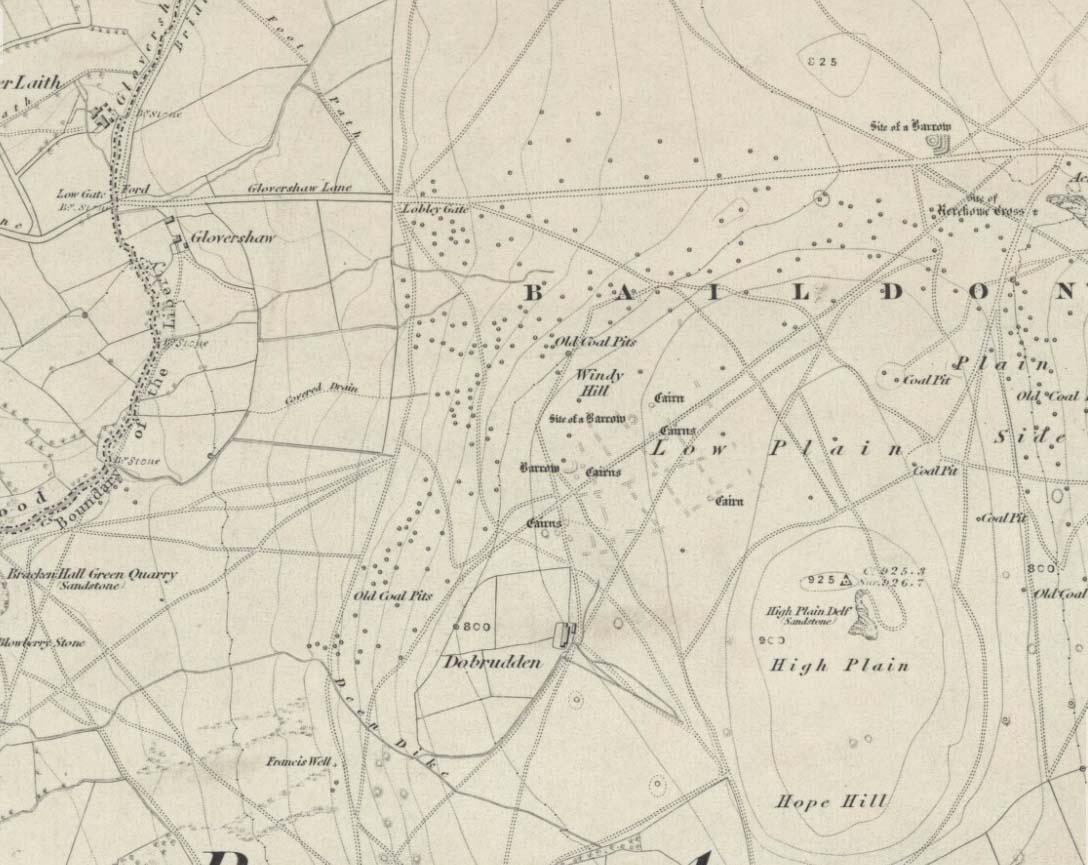
Windy Hill on 1852 map
Archaeology & History
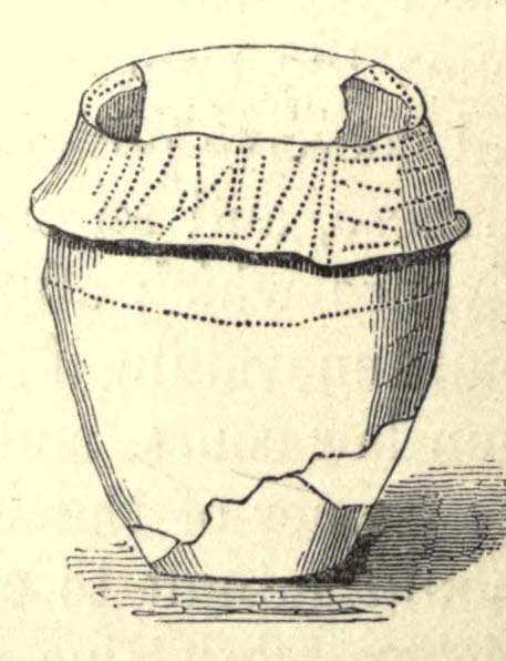
The early northern antiquarian, J.N.M. Colls (1846), described visiting a ‘druidical circle’ of stones due east of the Dobrudden prehistoric graveyard, but it seems to have been completely destroyed soon after he wrote his essay, with the stones taken away for use in road-building. He told that here was,
“a double circle of stones, the outer ring numbering eighteen, with six stones making up the inner circle.”
…and his illustration shows just that! It’s possible that this inner ring may have covered a burial. Harry Speight — aka, ‘Johnnie Gray’ (1891) — is the only other writer I’ve found that refers to the megalithic remains up here, although he gave no additional details.
Windy Hill Circle (after Colls, 1846)
The site was to be found across the High Plain and Windy Hill, on the western edge of Baildon Hill, where there was once a greater profusion of seemingly neolithic and Bronze Age remains. Another possible early reference to the site is in Collyer & Turner’s Ilkley (1885), where they talk of a circle “on the highest part of the eastern moor,” fifty-six feet across with a similar appearance to the Pennythorn Hill circle, although they describe it as overlooking the hamlet of Sconce, which is hardly possible from the Windy Hill side of Baildon Moor.
The site looked across the horizon from south, through west to north and if used astronomically would have been used to observe sun and moonset times. Although we find a number of cup-and-ring stones in the vicinity, it really does seem that this site has bit the dust!
References:
Bennett, Paul, The Old Stones of Elmet, Capall Bann: Chieveley 2001.
Colls, J.N.M., ‘Letter upon some Early Remains Discovered in Yorkshire,’ in Archaeologia 31, 1846.
Collyer, Robert & Turner, J. Horsfall, Ilkley, Ancient and Modern, William Walker: Otley 1885.
Gray, Johnnie, Through Airedale, from Goole to Malham, Elliot Stock: London 1891.
Follow the directions to reach the Great Skirtful of Stones giant cairn (very worryingly being encroached upon, illegally [it’s a protected monument], by employees of Bradford Council digging tracks into its edges). Walk less than 100 yards to the east, down the slight moorland slope (Leeds & Otley Chevin are in the distance). You’re here!
Archaeology & History
This is a very intriguing site. Intriguing because we don’t actually know what it is! It’s best seen at the end of winter, shortly after the heather-burning’s been done; but if there’s been no burning here, after a year or two it’s almost impossible to find!
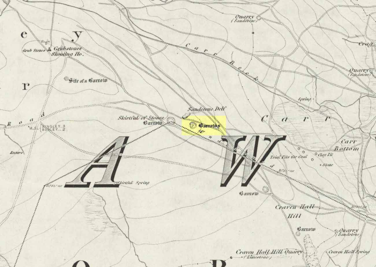
Great Skirtful Ring on 1851 mapColls’ 1846 plan
Despite it being only a short distance east of the Great Skirtful giant cairn, very little has been written about it (a surprise in itself!) – but this is down the failings of archaeological professionals in the area, who still neglect this incredible prehistoric arean. It was first described in Mr J.N.M. Colls’ (1846) survey of sites in the region, where he thought it to be a prehistoric camp. Several years later the Ordnance Survey lads visited here and deemed it to be prehistoric barrows, which doesn’t seem true. Nearly a hundred years later, the great northern antiquarian Eric Cowling (1946) who saw fit to describe it as an “enclosure” — so I’m copying his idea so I don’t get into too much trouble! Thinking it to be a Bronze Age monument, he wrote:
“On the main ridge of Rombald’s Moor and about eighty yards to the east of the Great Skirtful barrow, is a small circular enclosure with a diameter of twenty yards. There appears to have been an entrance on the eastern side, which is protected by a short length of banking to the east.”
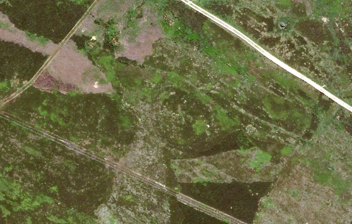
Aerial image, 2002Aerial image, 2009
The “length of banking” he described didn’t seem apparent when we visited the site yesterday (23.3.09), but we intend a further exploration of this and the adjacent monuments in the coming weeks and hope to locate it!
Interestingly, the archaeologists Faull & Moorhouse (1981:1:103), in their otherwise fine survey, actually doubted this place as having any prehistoric status, without giving any reason why—which was a big mistake. No doubt they spent too much time in offices and board meetings instead of getting out a bit more! Unless evidence to the contrary can be strongly presented, this site must be classed as undoubtedly prehistoric in nature (Bronze Age or Iron Age certainly) and almost certainly had something to do with rituals of the dead.
Great Skirtful Ring embankmentSouthern edge of the ring
From outer edge to outer edge the ‘ring’ measures 102 feet across, N-S, and with a rough maximum 101 feet E-W, being diameter, being some 300 feet in circumference. When you look at the site at ground level it appears to be an almost perfect ring, consisting of an embankment little more than 2 feet high at the most, with entrances both east and west. However, as the aerial images show, the perfect circle aint quite so perfect! But at ground level, there’s a certain uniformity about it. The embankment is in very good condition around much of the ring, with only slight damage in certain parts. The western opening strongly implies a direct relationship with the Great Skirtful cairn — which would infer this monument to have more of a ritual nature rather than the simple domestic enclosure, inferred by Colls and Cowling. Adding to this we find a tumulus 100 yards east and the remains of several other cairns nearby, making the site almost hemmed in by death-sites. A prehistoric cemetery is a short distance further down the moorland slopes to the east. Add also the fact that the Burley Moor stone avenue runs immediately south and the death-motif has to be increased.
What do I think it is? Not sure! The thought that it’s a previously unrecognized henge has crossed my mind…but henge monuments aren’t things that I’m very clued-up on, so wouldn’t like to say for sure. If there are any university archaeology students out there who are into getting their feet dirty, give this site a look-over. It’s intriguing, in very good condition, and could do with an accurate ID!
References:
Bennett, Paul, The Old Stones of Elmet, Capall Bann: Chieveley 2001.
Colls, J.N.M., ‘Letter upon some Early Remains Discovered in Yorkshire,’ in Archaeologia, volume 31, 1846.
Cowling, Eric T., Rombald’s Way, William Walker: Otley 1946.
Faull, M.L. & Moorhouse, S.A. (eds), West Yorkshire: An Archaeological Survey – volume 1, WYMCC: Wakefield 1981.