Balnabroich, Kirkmichael, Perthshire

Standing Stone:  OS Grid Reference – NO 09175 56752

Also Known as:

  1. Canmore ID 27267

Getting Here

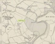
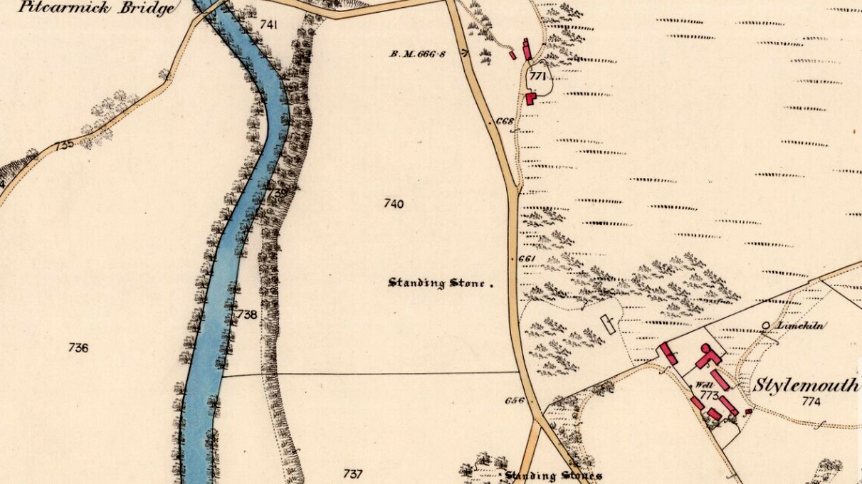
Stone shown on 1867 map

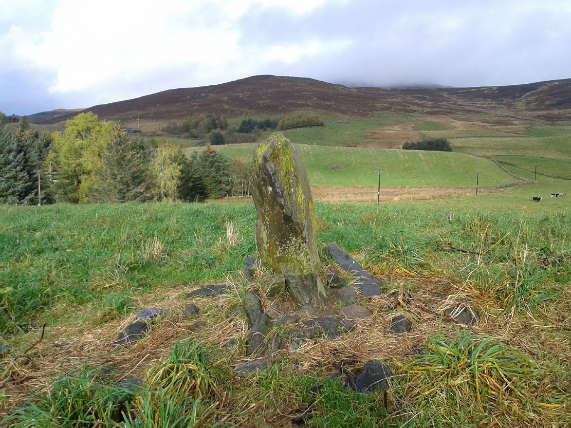
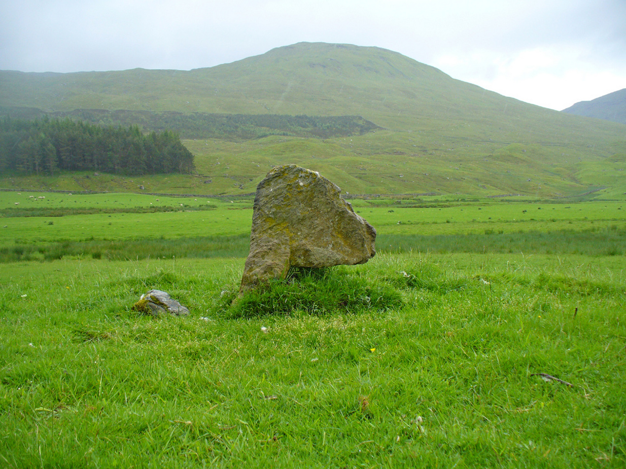
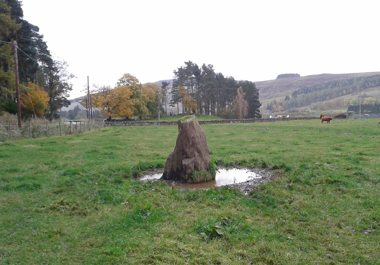
Take the A924 road north of Blairgowrie, between Pitlochry and Bridge of Cally and, about 4.6 miles (7.5km) along, roughly halfway between Ballintuim and Kirkmichael, in the field by the roadside immediately west, you’ll see this conspicuous upright stone standing all alone – unless the cattle are meandering slowly around it! Y’ can’t really miss it.

Archaeology & History

This single monolith that stands today as a cattle rubbing post, may at one time in its distant past have been related to the present pair of standing stones hiding in the small remain of trees 148 yards (135.5m) to the south; although neither Aubrey Burl (1993) nor Alexander Thom (1990) ascribe the stone such an association in their relative tomes on aligned stone rows.

When the great standing stone lover Fred Coles (1908) came here, he was as reliable as ever in his subsequent exposition of the place – and despite getting his measurements slightly out he told us, almost liltingly, like an antiquarian Uncle Monty stroking his megaliths, that

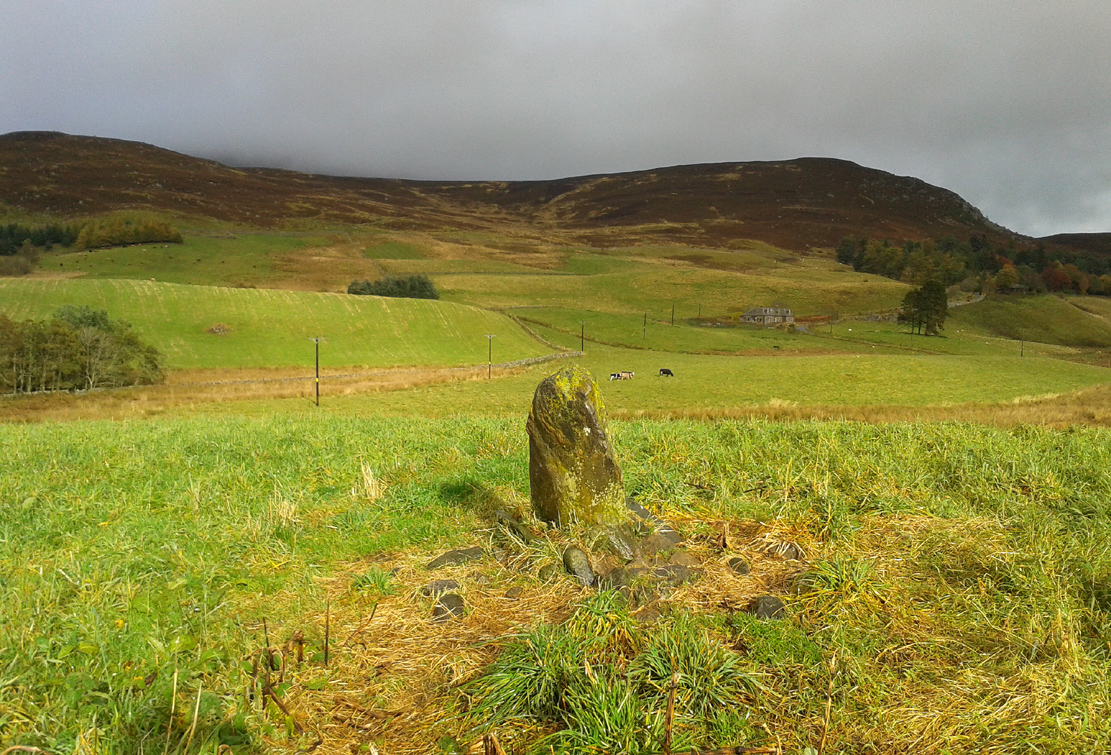
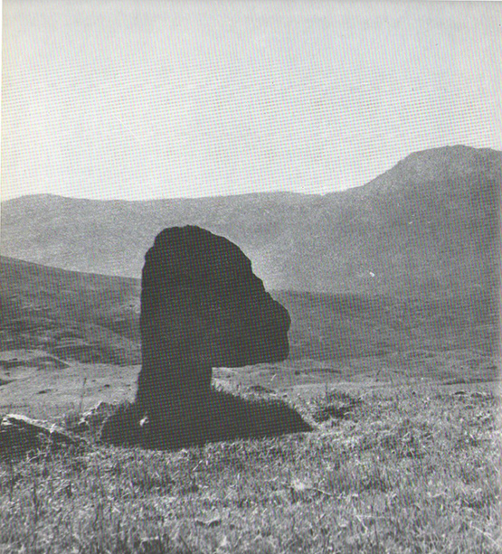
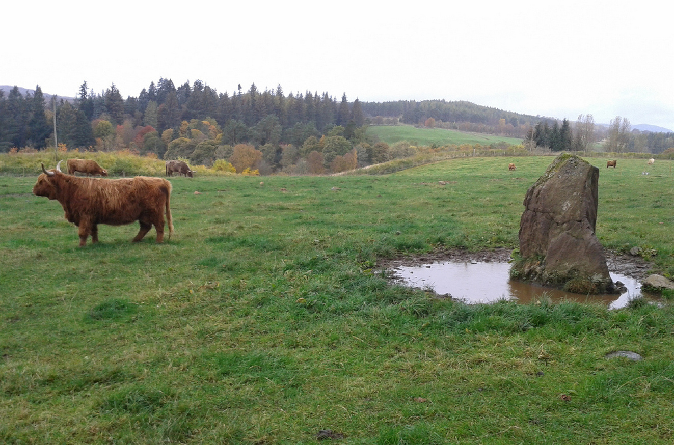
Balnabroich stone, looking S
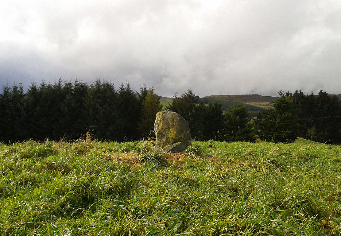
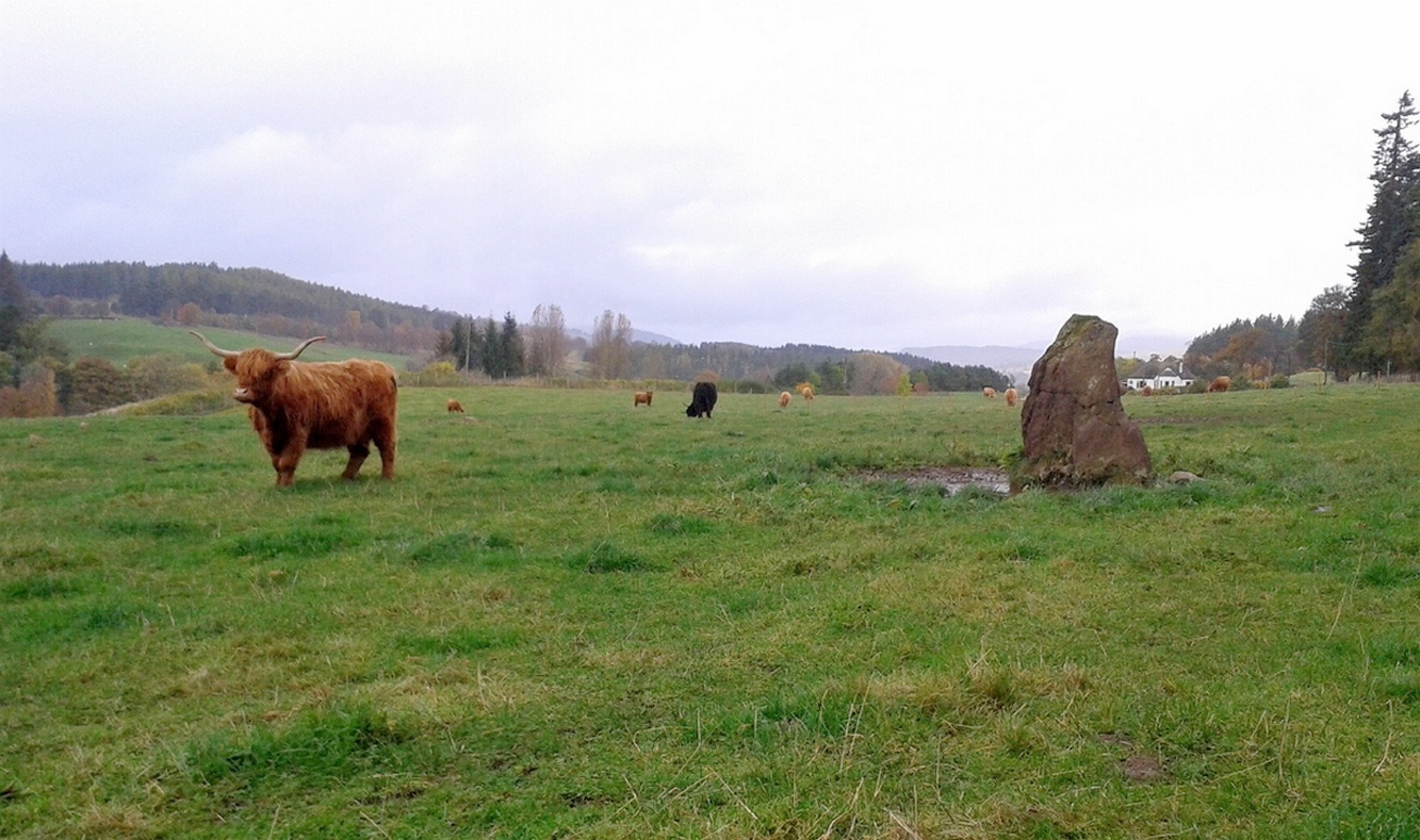
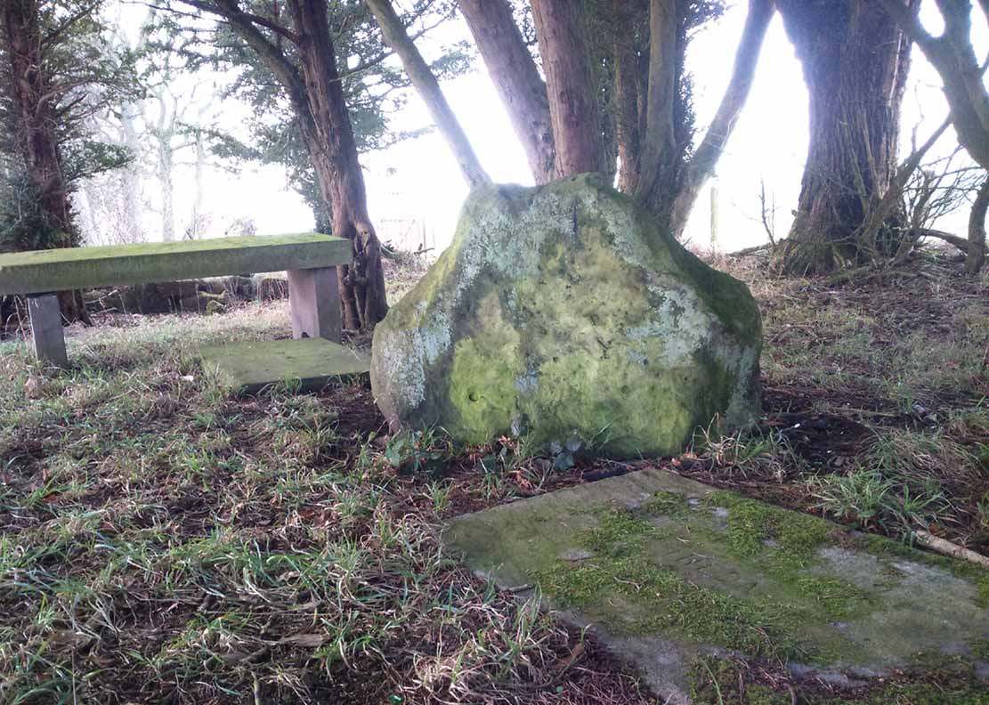
The old stone, looking NW

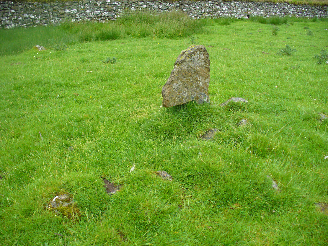
“At a point almost 176 yards due north of (the) two stones is a tallish and unshapely monolith standing but a few yards west of the main road.  Its most notable feature is the extreme irregularity of its shape.  If any proof were needed to show how uncritical were the people who raised such stones, how totally devoid of any regard for symmetry or neatness of contour in the monoliths they set up, surely the ground-plan of this block of rent and riven quartz-veined whinstone, fissured and uncouth in all its parts, would supply it.

“The contour here shown was measured by laying down an irregular rhomboidal figure, and from each of its sides measuring by offsets to the depths 0f the curves which are so prominent on the north, the northwest and the southeast sides.  The ground-plan this obtained shows that, taken between their prominent angles, the four sides measure almost exactly 3 feet each, and the main long axis of the stone which lies due east and west and measures 4 feet 6 inches.  The monolith stands 5 feet 8 inches above the ground and…appear to have been unconnected with circles, so far at least as it was possible to glean any information.”

References:

  1. Coles, Fred, “Report on Stone Circles Surveyed in Perthshire – Northeastern Section,” in Proceedings of the Society of Antiquaries of Scotland, volume 42, 1908.
  2. Royal Commission on the Ancient & Historical Monuments of Scotland, North-East Perth: An Archaeological Landscape, HMSO: Edinburgh 1990.

Acknowledgements:  Huge thanks for use of the Ordnance Survey map in this site profile, reproduced with the kind permission of the National Library of Scotland

© Paul BennettThe Northern Antiquarian


Auchnafree, Glen Almond, Perthshire

Standing Stone:  OS Grid Reference – NN 8225 3336 

Getting Here

Auchnafree Stones, looking east

Auchnafree Stones, looking E

Walk up the long track of beautiful Glen Almond, past the East Conichan circle and past the giant tomb of Clach na Tiompan.  After about 4.2 miles (6.8km), the track diverges: take the one directly west, over the old bridge, and less than 100 yards past here, note the gate on your right.  Go into the field and start walking uphill until you’re at the highest point a few hundred yards up.  You’ll find the stones in front of you.

Archaeology & History

Auchnafree Stones, looking NW

Auchnafree Stones, looking NW

Somewhat reminiscent in style and form to the standing stones at Dumgoyach, north of Glasgow, this one upright monolith and its seemingly fallen companion have not previously been recorded by archaeologists—but it is quite a distance away from anywhere. The upright stone is about one metre tall and its lumbered companion about four feet long.  The remains of a small stone, probably broken from the larger mass, extended beyond the long stone.  Another unrecorded standing stone can be found on another hillock a few hundred yards from here.

© Paul BennettThe Northern Antiquarian


Auchingarroch, Muthill, Perthshire

Standing Stone:  OS Grid Reference – NN 78732 19579

Also Known as:

  1. Canmore ID 24795
  2. Roman Stone

Getting Here

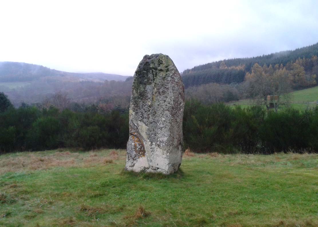
Auchingarroch stone

The Auchingarroch stone

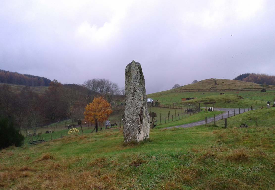
Take the B827 road south out of Comrie as if you’re heading towards Braco, and after a mile or so, as you start going uphill, turn left to go to the Wildlife Centre.  Go along the track and park up at the buildings.  The monolith is round the back of the first building (ask at the Centre, where the people there are very helpful).

Archaeology & History

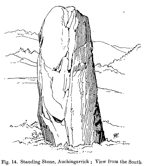
F. Coles 19l1 sketch

F. Coles 19l1 sketch

Shown on the earliest Ordnance Survey map of the region as one of several ‘Roman Stone’ sites, this prehistoric upright is similar in size and feel to the other standing stones in the highly impressive Dunruchan complex close by.  The big fella stands on a raised piece of ground more than 8½ feet tall and, said Fred Coles (1911) has “a basal girth of 12ft 8ins.”  Quite a big stone!  A dubious large cup-mark is visible on the thin western face and three faint ones on its east.

The monolith is surrounded all along the southern landscape arc with forested moorland and low mountains, with the primary extended views reaching mainly into the north and western arc.  Although a rounded hillock immediately southwest of the stone looks promising, no calendrical or astronomical alignments have been found here.

Folklore

Auchingarroch, looking SW

Auchingarroch, looking SW

As with the other standing stones in this region, legend ascribes it as marking the resting place of a Roman soldier who fell in a great battle close by with our local heathens, in what was known as “battle of Mons Grampius.”

References:

  1. Coles, F.R., “Report on stone circles in Perthshire principally Strathearn,” in Proceedings of the Society of Antiquaries, Scotland, volume 45, 1911.
  2. Finlayson, Andrew, The Stones of Strathearn, One Tree Island: Comrie 2010.
  3. Hunter, John, Chronicles of Strathearn, David Phillips: Crieff 1896.

Acknowledgements:  Thanks to Paul Hornby for the journey here; and more especially a different sorta thanks to Linzi Mitchell for her influence whilst the site profile of this megalithic erection was being written. Who sez that men can’t do two things at the same time?!

© Paul BennettThe Northern Antiquarian


Ravenswood Avenue, Liberton, Edinburgh, Midlothian

Standing Stone:  OS Grid Reference – NT 28282 70502

Also Known as:

  1. Canmore ID 52108
  2. Craigend
  3. Greenend

Getting Here

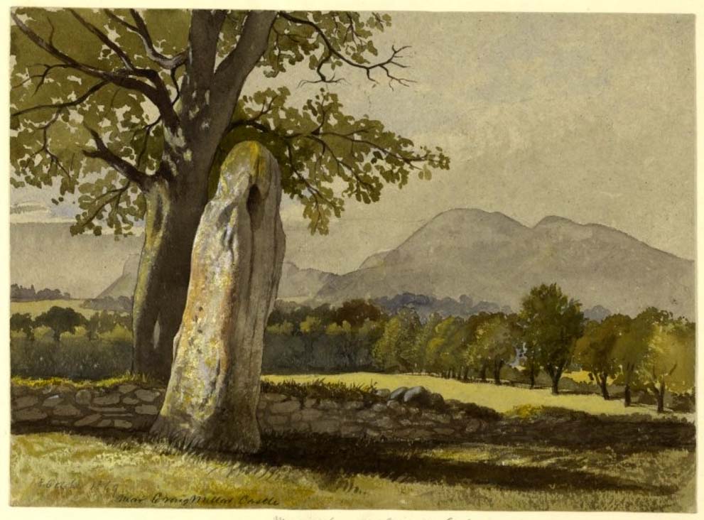
The stone in the 19th century

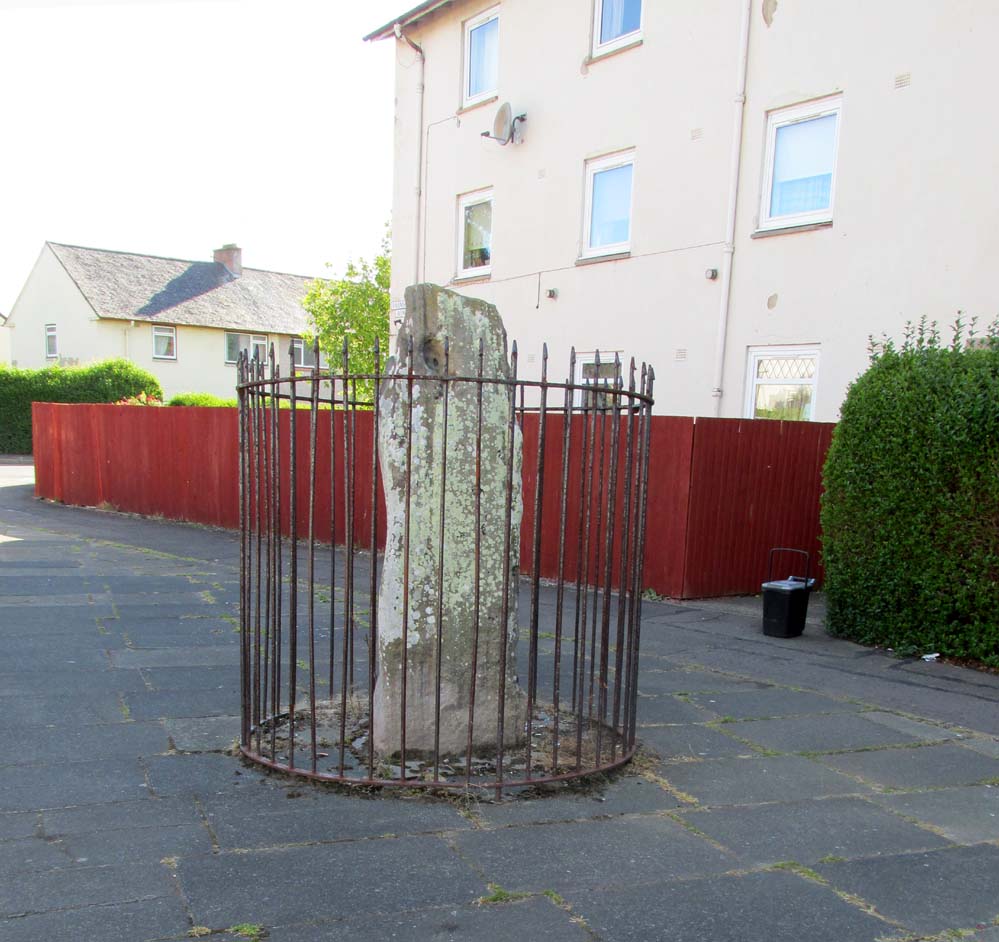
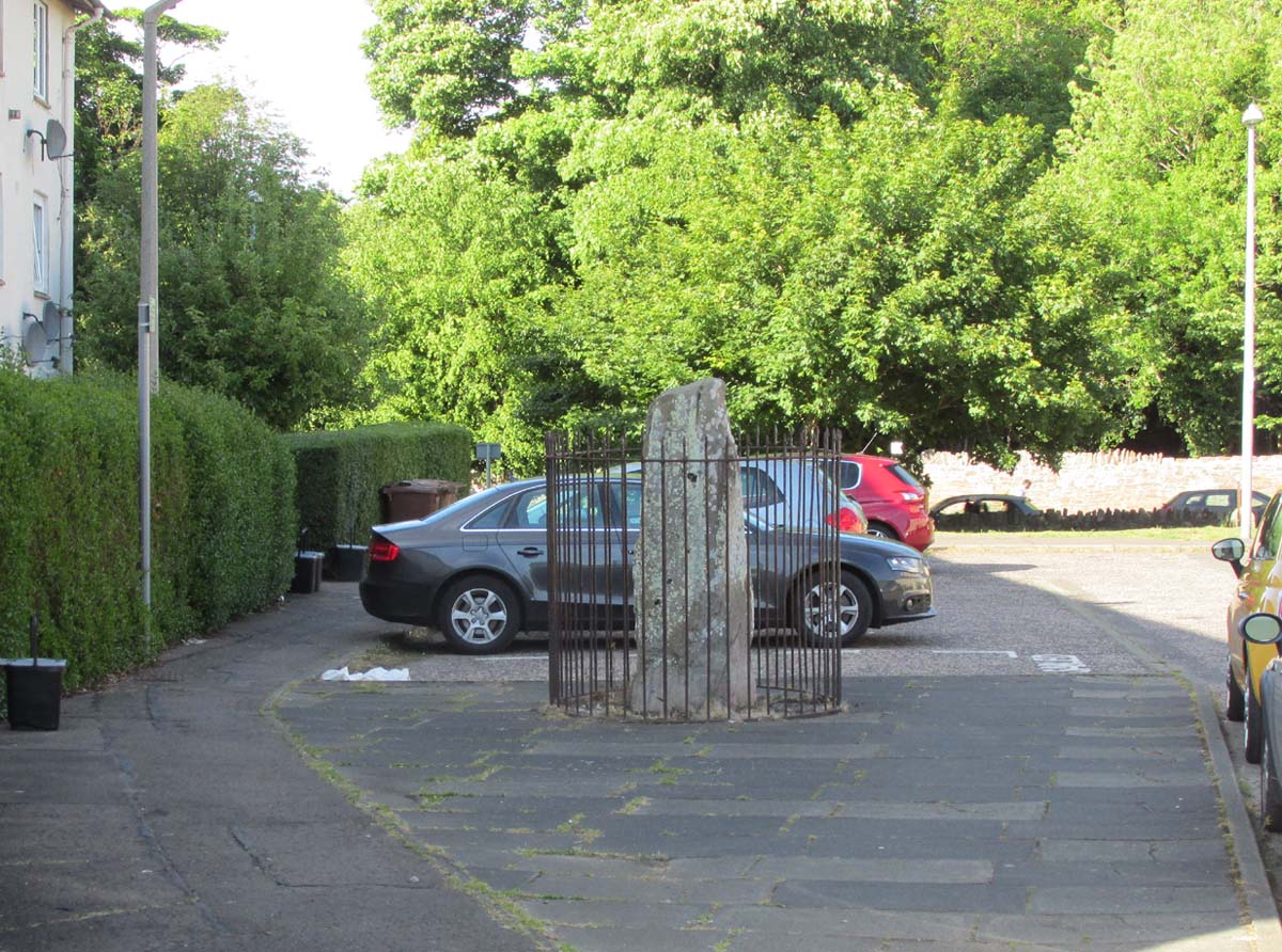
Take the A7 road south from Edinburgh central (off Princes Street) for several miles.  It becomes known as the Old Dalkeith Road eventually, just as it passes the huge wooded ground of Craigmillar Castle on your left (east) and the Inch estate on your right. Walk along here, keeping your eyes peeled for the small path that takes you onto Ravenswood Avenue.  Barely 30-40 yards from the main A7 road, the standing stone is there surrounded by railings.

Archaeology & History

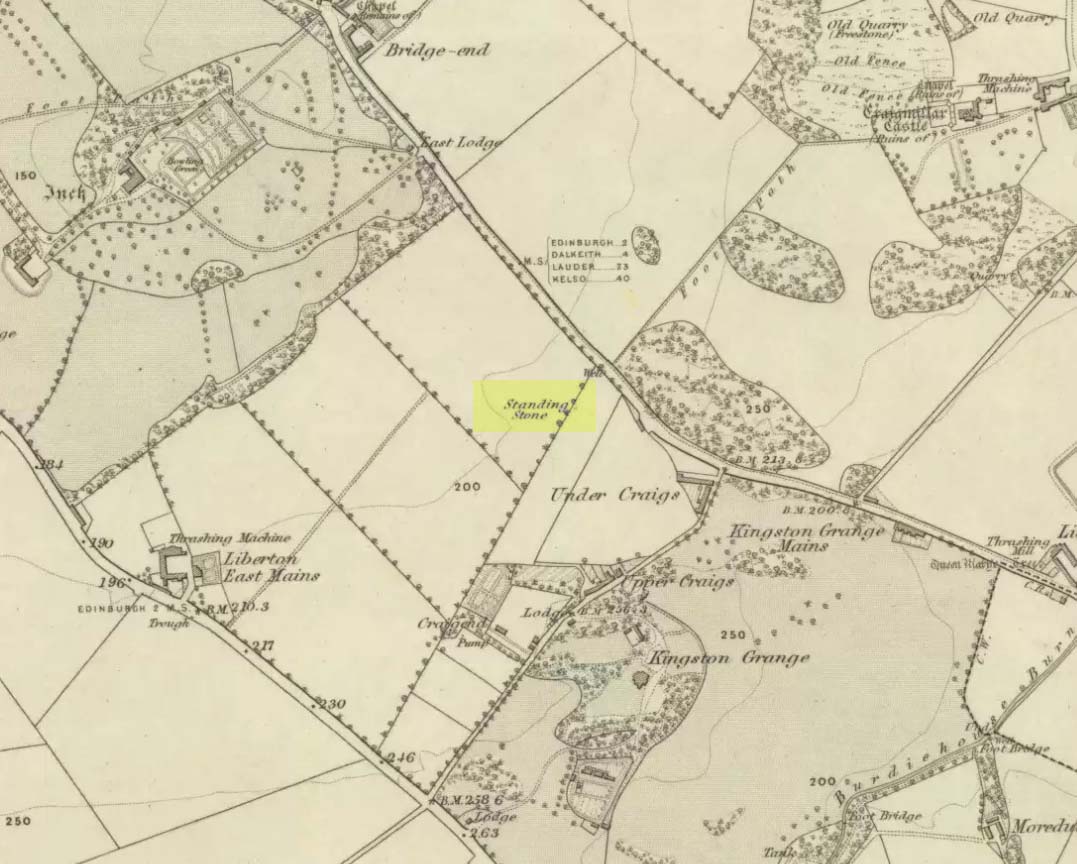
A curious place to find a standing stone – especially one that’s still alive!  But that’s what we find on the Inch housing estate, thankfully.  Highlighted on the 1855 Ordnance Survey map, it was one of a number of standing stones described in George Good’s (1893) fine survey on Liberton parish, which he thought commemorated ancient battles.  When he wrote about it, the monolith was “built into the wall on the public road to Greenend”, just as shown on the OS-map.  He told how the

“stone was taken down in the beginning of the present century (c.1801), when the road was widened, and it long lay in the field opposite, but was restored to its original place in 1891.”

When the Royal Commission (1929) lads came here many years later, they gave their own archaeocentric description, telling:

Site shown on 1855 map
The old stone in its cage

“About 40 yards from the main road near Little France…is a standing stone, which is set up without packing, with its main axis almost due north and south, but with a slight inclination towards the east. It stands 6¾ feet above ground, and has a girth of 6 feet 5 inches at 3 feet from the base.  It is of grey sandstone, badly weathered on two sides and without traces of any artificial markings or design.”

The monolith was included in Adam McLean’s (1977) megalithic survey of the area, where he rightly said how the iron fence that surrounds the stone destroys any atmosphere that might once be had here.  Still, at least it’s still standing and is worth checking out if you’re in the area.

Folklore

The Ravenswood Stone

An old footpath that runs dead straight from Craigmillar Castle towards the stone was long ago said to be the pathway taken by the ghost of a white lady.

In days prior to the housing estate being built, local folk had annual bonfires here between Samhain (Halloween) and Guy Fawkes Night (Oct 31 – Nov 5).

References:

  1. Good, George, Liberton in Ancient and Modern Times, Andrew Elliot: Edinburgh 1893.
  2. McLean, Adam, The Standing Stones of the Lothians, Megalithic Research Publications: Edinburgh 1977.
  3. Royal Commission on the Ancient & Historical Monuments of Scotland, Inventory of Monuments and Constructions in the Counties of Midlothian and West Lothian, HMSO: Edinburgh 1929.

© Paul BennettThe Northern Antiquarian


Bell Stane, Queensferry, Midlothian

Legendary Stone (destroyed):  OS Grid Reference – NT 1292 7840

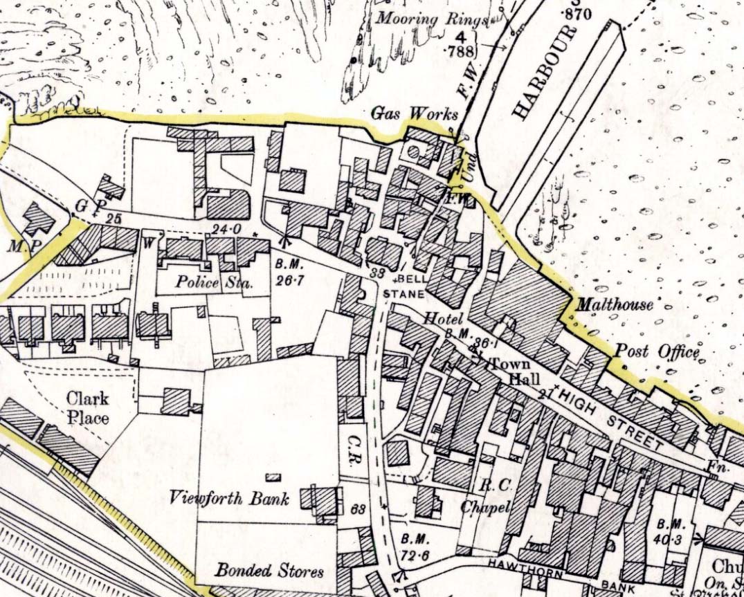
Bell Stane on 1896 map

Bell Stane on 1896 map

Archaeology & History

An intriguing site that needs adding to the Northern Antiquarian due to the foraging research of the Edinburgh historian Stuart Harris (1996).  Although the Bell Stane has been ascribed by the Canmore researchers to be just,

“a stone near the Mercat Cross on which the hand bell was set (rung to herald the opening of the weekly market or annual fair),”

Mr Harris dug deeper and found other references which led him to think that the site was “a conspicuous boulder or standing stone.”  I have to agree with him.  In his outstanding work on the historical place-names of Edinburgh and district, Harris wrote:

“The Bellstane…is noted on Ordnance Survey 1854 as the name of an object just outwith the burgh boundary and in the southwest corner of the little square that now bears the name.  Whilst it has been surmised that it was a stone named for a handbell rung beside it on market days, in point of fact a burgh council meeting of 1642 (quoted in Morison’s Queensferry, p.131) records that a piece of ground hitherto waste and unused, within the burgh but near the bellstane, was to be set aside for markets and fairs in times coming; and the clear inference is that the name belonged to the stone before any markets were held near it.  In absence of a reliable description of the stone or of early forms of its name, the origin of the name can only be guessed at.  Similar names (of sites) in Kirknewton and Whitburn are no better documented, but the early forms of Belstane in Lanarkshire (BellitstaneBellistaneBelstane and Bellstane prior to 1329 and Beldstanein 1452) suggest that its first part may be Anglian ballede or early Scots bellit (from a Celtic root, ball, white), making the name ‘the stone with a white or pale patch or stripe on it’ — such as one with a band of quartz running through it.  A conspicuous boulder or standing stone of this sort on this spur of higher ground above the shore would have been a useful meith or landing mark for boats making for the narrow landing place at the Binks.”

If anyone uncovers additional evidence about this Bell Stane that can affirm it as a standing stone (or otherwise), we will amend its status.

References:

  1. Harris, Stuart, The Place-Names of Edinburgh: Their Origins and History, Gordon Wright: Edinburgh 1996.
  2. Morison, Alexander, Historical Notes on the Ancient and Royal Burgh of Queensferry, West Lothian Courier: Bathgate 1927.
  3. Orrock, Thomas, Fortha’s Lyrics and other Poems, privately printed: Edinburgh 1880.

© Paul Bennett,  The Northern Antiquarian 2016


Gormyre, Torphichen, West Lothian

Standing Stone (destroyed):  OS Grid Reference – NS 9836 7315

Also Known as:

  1. Canmore ID 47916

Archaeology & History

A couple of fields east of one of Torphichen’s Refuge Stones (a prehistoric thing by the look of it!), another standing stone could once be seen.  It wasn’t a particularly big fella, and its existence may have completely fallen out of history were it not for the Scottish Royal Commission (1929) lads who visited and described the place thus:

“In the fourth field north-east of Gormyre Farm is a narrow, upright, pointed boulder of schist, 3 feet 10 inches high and 1 foot 6 inches wide at base, which is roughly pentagonal.  The greatest width on the east face is 20 inches, on the west face 8 inches; but the faces die into each other at the upper part till the section becomes triangular.”

A few years after the Royal Commission boys had been here, the land-owner saw fit to uproot the stone and dump it at the side of the field.  In the 1980s, when the Royal Commission lads came to visit the site again, they reported that the “standing stone no longer exists”—probably meaning that the land-owner had destroyed it.  Some idiotic land-owners do this sort of thing.

When we visited the arena a few weeks ago, Frank Mercer and I found a couple of stones at the side of the adjacent field which may have once stood upright, but if the early accounts of its position are correct, we were looking in the wrong place.  Another visit is required to see if we can find it in the undergrowth along the field edges.  If not, another one has bit the dust, as they say…

References:

  1. Mackay, P.H.R., Sanctuary and the Privilige of St. John, WLHAS: Edinburgh n.d. (1976?).
  2. Royal Commission Ancient & Historical Monuments Scotland, Inventory of Monuments & Constructions in the Counties of Midlothian and West Lothian, HMSO: Edinburgh 1929.

© Paul BennettThe Northern Antiquarian


Glesart Stanes, Glassford, Lanarkshire

Standing Stones:  OS Grid Reference – NS 73609 46916

Also Known as:

  1. Avonholm
  2. Canmore ID 45595
  3. Glesart Stones
  4. Struthers Burial Ground
  5. Three Stones

Getting Here

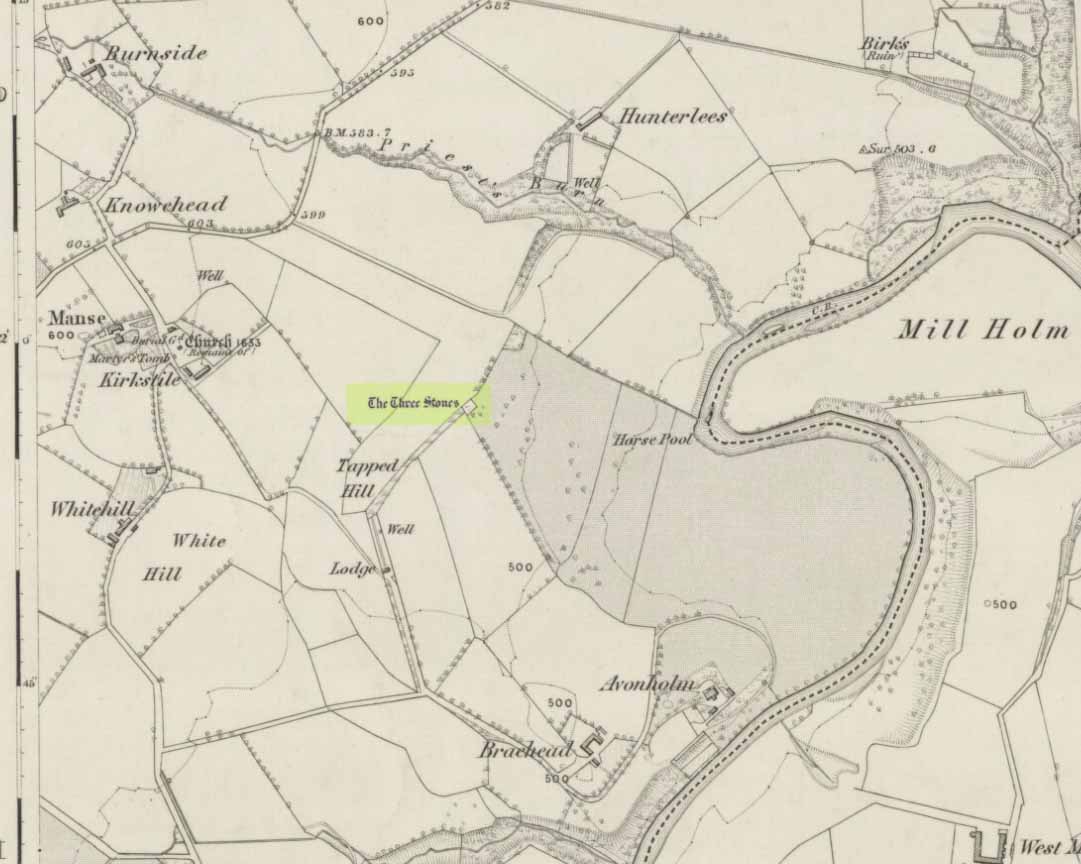
Glesart Stones on 1864 map

From the roundabout in Glassford village, head west down Jackson Street along the country lane of Hunterlees Road.  About 600 yards on, turn right at the small crossroads (passing the cemetery on yer left) for about half-a-mile, before turning left along a small track that head to some trees 400 yards along.  Once you’ve reached the trees, walk uphill and follow the footpath to the right, keeping to the tree-line.  It eventually runs to a small private graveyard. You’re there!

Archaeology & History
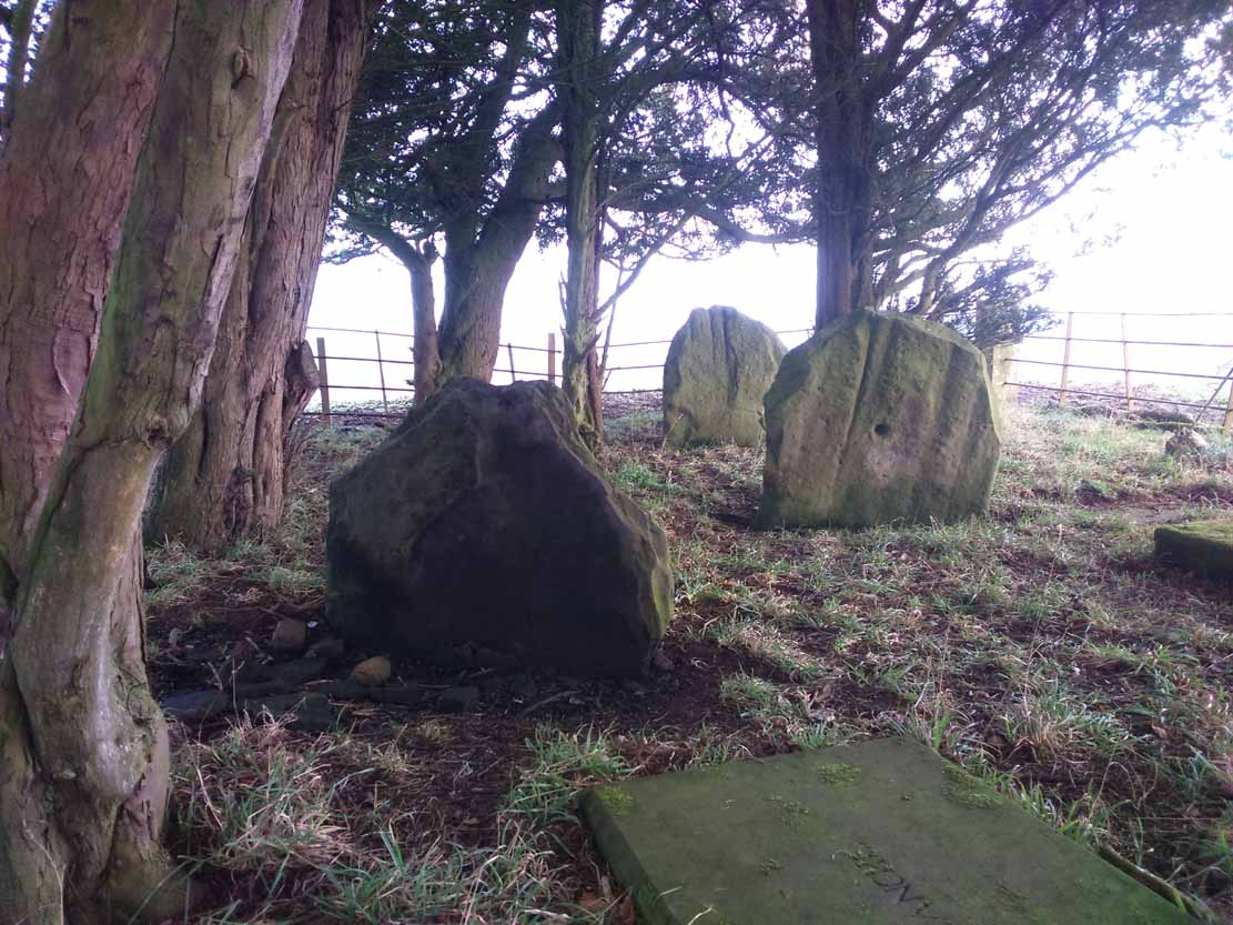
Glesart Stones,
looking west

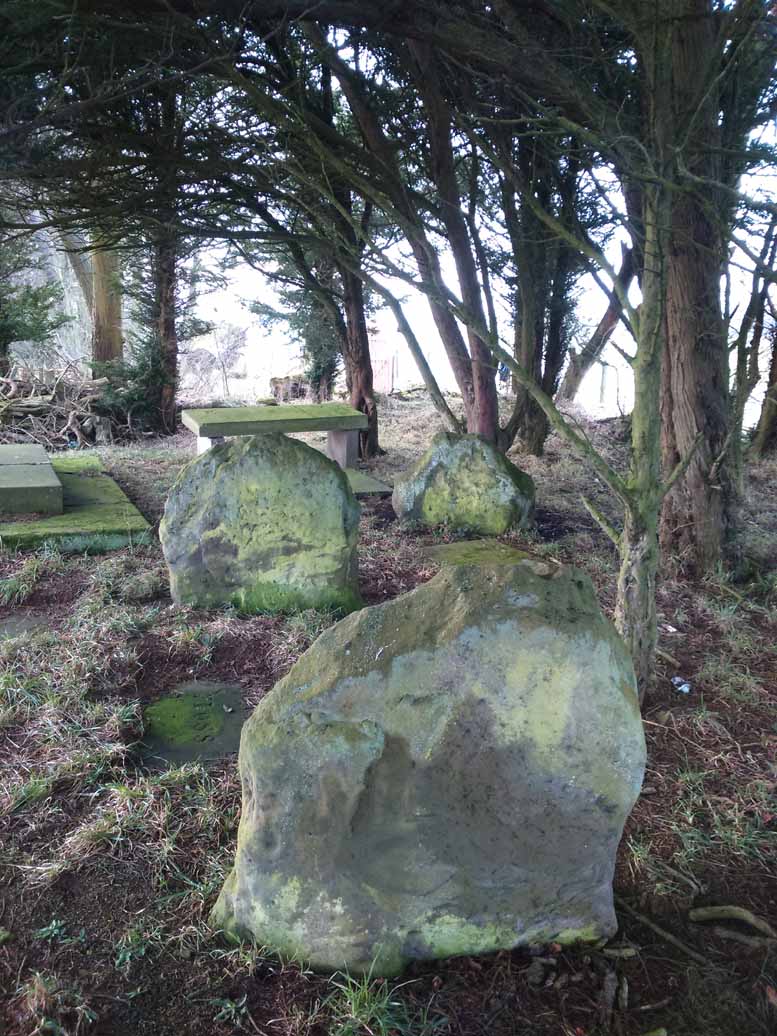
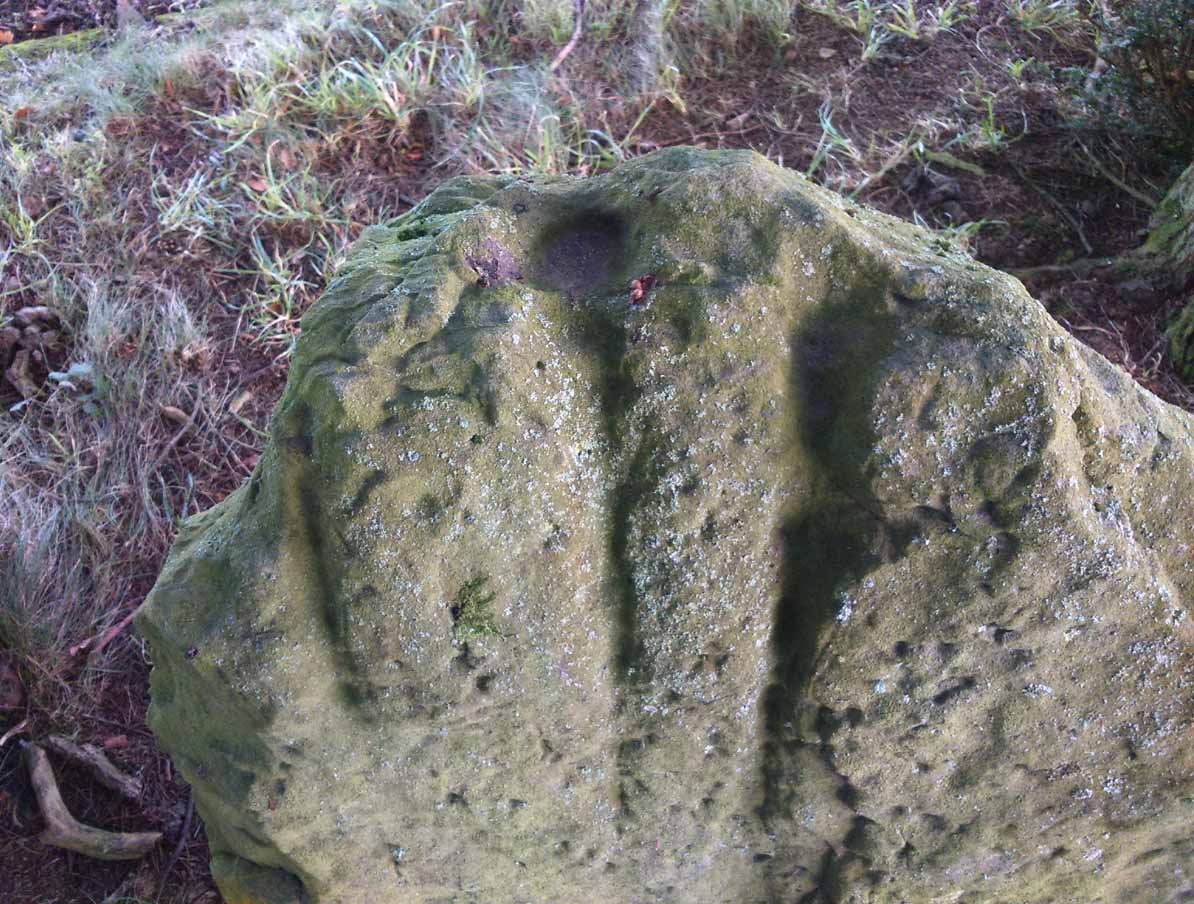
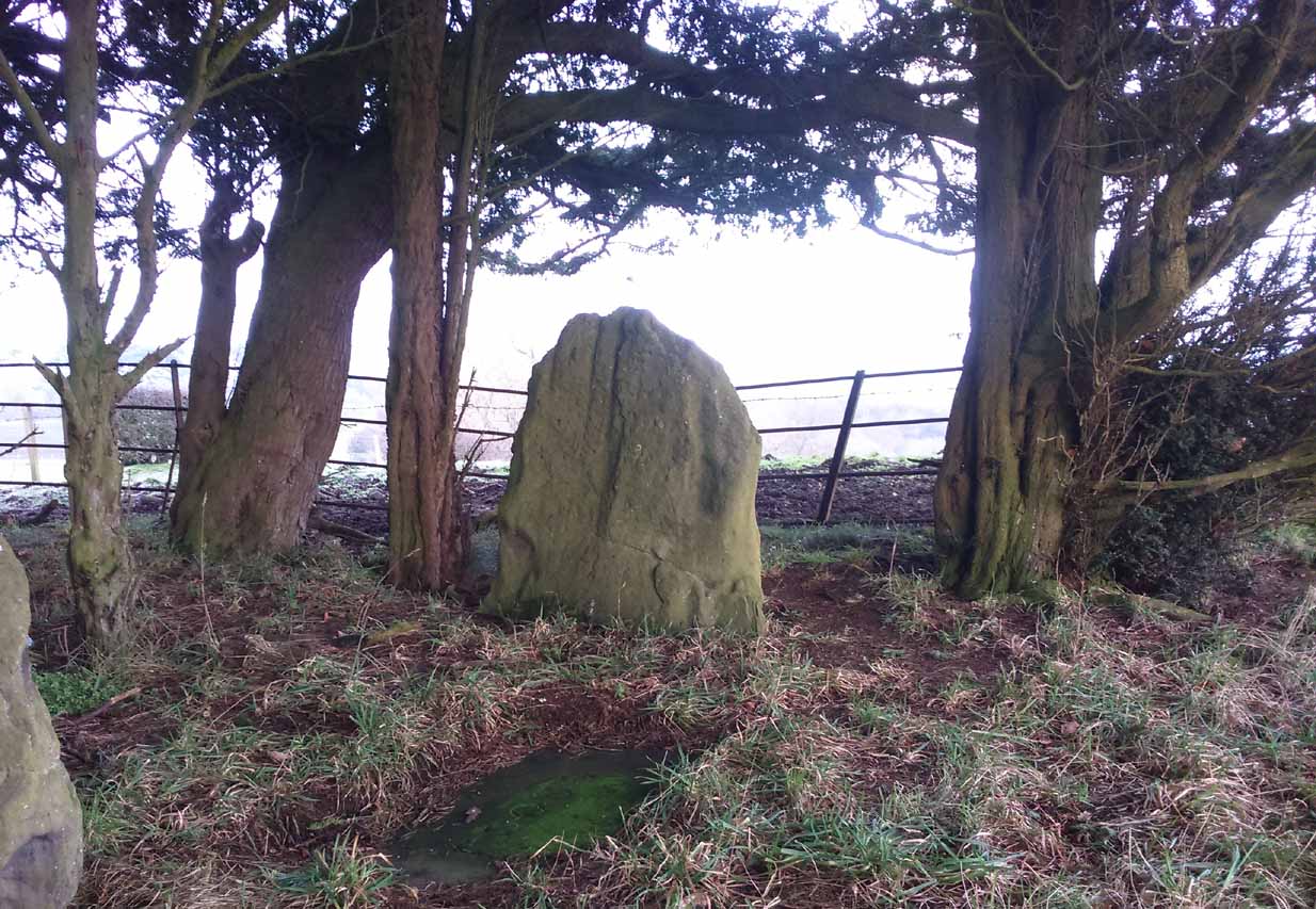
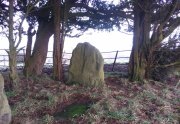
In the little-known private graveyard of the Struthers family on the crest of the ridge overlooking the River Avon and gazing across landscape stretching for miles into the distance, nearly a mile east of Glassford village, several hundred yards away from the Commonwealth graveyard, a cluster of yew trees hides, not only the 19th century tombstones, but remnants of some thing much more archaic.  Three small standing stones, between 2½ and 4 feet in height, hide unseen under cover of the yews, at the end of a much overgrown ancient trackway which terminates at the site.  They’re odd, inasmuch as they don’t seem to be in their original position.  Yet some form of archaic veracity seems confirmed by the weathered fluting: eroded lines stretching down the faces of two of the taller stones and, more importantly, what seem to be cup-markings on each of the monoliths.
Cup-mark atop of east stone
Easternmost stone

The tallest stone at the eastern end of the graveyard has a deep cup on its crown.  This may be the result of weathering; but we must exercise caution with our scepticism here.  Certainly the eroded lines that run down this stone are due to weathering – and many centuries of it; but the peculiarity is that the weathering occurs only on one side.  This implies that only one side of the stone was open to the elements.
Central cup-marked stone
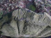
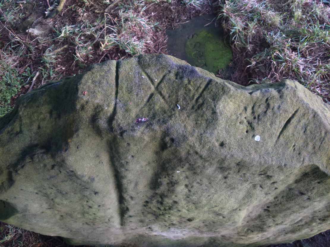
‘X’ carved atop of central stone

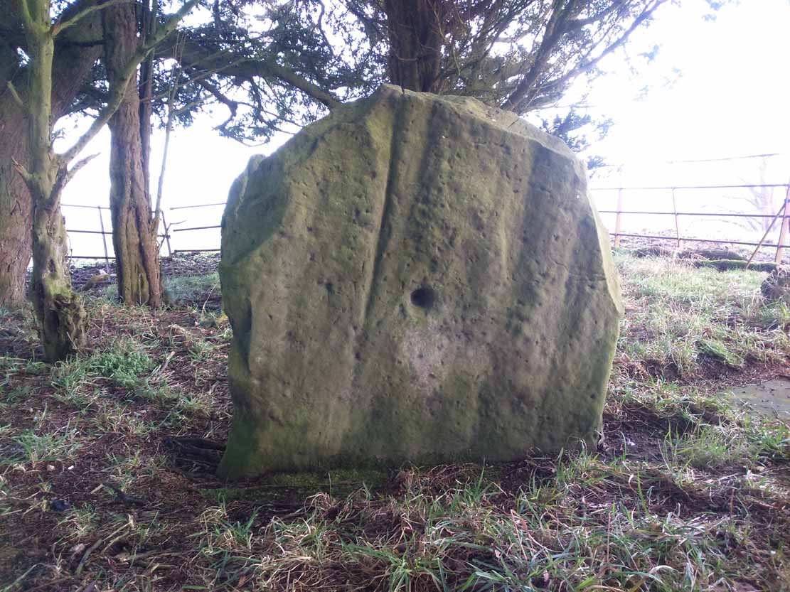
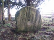
The second, central stone of the three, is slightly smaller than the first.  Unlike the eastern stone, its crown has been snapped off at some time in the past century or so, as evidenced in the flat smooth top.  But along the top are a series of small incised marks, one of which includes a notable ‘X’, which may have been surrounded by a circle.  A second fainter ‘X’ can be seen to its side, and small metal-cut lines are at each side of these figures.  Another small section of this stone on its southern edge has also been snapped off at some time in the past.  The most notable element on this monolith is the reasonably large cup-mark on its central west-face.  It is distinctly eroded, measuring 2-3 inches across and an inch or more deep.  Its nature and form is just like the one in the middle of the tallest of the standing stones at Tuilyies, nearly 31 miles to the northeast.
Western smallest stone
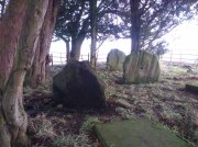
The Three Stones

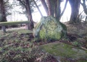
The smallest of the three stones is just a few feet away from the central stone.  To me, it seemed oddly-placed (not sure why) and had seen the attention of a fire at its base not too long ago.  On its vertical face near the top-centre of the stone, another cup-marking seems in evidence, some 2 inches across and half-an-inch deep—but this may be natural.  The Glasgow archaeologist Kenneth Brophy reported that on a recent visit, computer photogrammetry was undertaken here, so we’ll hopefully see what they found soon enough.

There is some degree of caution amongst some archaeologists regarding the prehistoric authenticity of the Glesart Stanes – and not without good cause.  Yet despite this, the seeming cup-marks and, particularly, the positioning of the stones in the landscape suggest something ancient this way stood.  The stones here are more likely to be the remains of a once-larger monument: perhaps a cairn; perhaps a ring of stones; or perhaps even an early christian site.  At the bottom of the hill for example, just 350 yards below, is a large curve in the River Avon on the other side of which we find the remains of an early church dedicated to that heathen figure of St. Ninian (his holy well close by); and 300 yards north is the wooded Priest’s Burn, whose history and folklore seem lost.

The Glesart Stanes were the subject of an extended article by M.T. M’Whirter in the Hamilton Advertiser in 1929 (for which I must thank Ewan Allinson for putting it on-line).  He wrote:

“Situated on the highest hill-top on the estate of Avonholm, north to the house of that name, is the private burial ground of James Young Struthers… Situated within the burial ground are three upright flagstones of a dark brown colour, rough and unhewn,  Each stone is facing the east, and placed one behind the other, though not in a straight line, and the space between the eastern and the middle stone is eight feet, and the space between the middle and the western stone is seven feet.  The stone flags vary in measurement, the eastern stone being the greater, standing four feet three inches high, three feet eight inches broad, and one foot thick.  The middle stone is three feet high, three feet ten inches broad, and nine inches thick; and the western stone is three feet high, four feet broad and ten inches thick.  The two outer stones bear no letters, figures or marks, but the centre stone has rudely sculptured on the top-edge the Roman numerals IX, and on the western side of the stone there is a cup-shaped indentation about two inches in diameter.  A groove 26 inches in length extends from the top of the stone to below the level of the cup indentation.  The groove is deeper at the top, but gradually loses in depth towards the bottom end.  I have seen grooves similar to above by the friction of a wire rope passing over a rocky surface.  The numerals, cup indentation and groove do not appear to be part of the original placing of the stones and, if a cromlech, then in the centuries that have gone, the stones becoming exposed to view by the removal of the mound, would invariably have led to a search for stone coffins or urns, yet no discovery of either has ever been recorded.”

Indeed, Mr M’Whirter was sceptical of them being part of a prehistoric burial site, preferring instead to think that a megalithic ring once stood here.  He continued:

“From an examination of the three stones, I am convinced that they form a segment of a circle, and assuming that nine additional stones complete the circle, it would enclose a space of roughly one hundred feet in circumference, with each stone facing an easterly direction.”

But we might never know for certain…. The only other literary source I have come across which describes the site is that by the local vicar, William Stewart (1988), who told us that:

“The stones stand erect, six feet apart, three rough slabs of coarse-grained sandstone, three feet high, three feet broad and six inches thick, free of any chisel marks.  Two have their back to the east, the third, oblique to the others, has its back to the south-east, thus there is no suggestion of a stone circle.  There are vertical grooves on two of the stones, while the centre stone has a cupmark, below which is a faint circle, one foot in diameter.  They stand at the end of a long narrow strip of land with low earthen walls on either side, perhaps an old agricultural field division, and they gave their name ‘Three Stanes’, to a now partly-lost road which eventually reached The Craggs and ended as Threestanes Road in Strathaven…”

The Three Stones

The “faint circle” described by Mr Stewart is barely visible now.  And the idea that these “three stones” gave their name to the farmhouse and road of the same name at the other side of Strathaven, three miles west, seems to be stretching credulity to the limits.  Surely?

Folklore

In 1845, Gavin Laing in the New Statistical Account for Lanarkshire told that:

“These stones are known simply as the “Three Stones”. There is a tradition in the neighbourhood that three Lords were buried here, after being killed while looking on at a Battle. The stones are about 3½ feet high and about as thick as flag stones. They stand upright being firmly fixed in the ground.”

The stones and their traditional origin were also mentioned in Francis Groome’s Ordnance Gazetteer (1884), where he echoed the 1845 NSA account, but also added:

“Three tall upright stones are here, and have been variously regarded as Caledonian remains, as monuments of ancient noblemen, and as monuments of martyrs.”

Then at the end of the 1850s, when the Ordnance Survey lads came here, they reported,

“Three high stones stand upright on a small eminence upon the lands of Avonholm, respecting their origin there are various opinions. They are probably the remnants of Druidical superstition.”

References:

  1. Groome, Francis H., Ordnance Gazetteer of Scotland – volume 1, Thomas C. Jack: Edinburgh 1884.
  2. M’Whirter, M.T., “The Standing Stones at Glassford,” in Hamilton Advertiser, 1929.
  3. Stewart, William T., Glasford – The Kirk and the Kingdom, Mainsprint: Hamilton 1988.
  4. Wilson, James Alexander, A Contribution to the History of Lanarkshire – volume 2, J. Wylie: Glasgow 1937.

© Paul BennettThe Northern Antiquarian

Three Stanes, Strathaven, Lanarkshire

Standing Stones (destroyed):  OS Grid Reference – NS 6957 4524

Archaeology & History

Threestanes on the 1864 OS-map

Threestanes on the 1864 OS-map

It seems that nothing remains of the three standing stones that gave rise to the place-name of Threestane Farm, at the top of Threestane Lane, on the northwestern outskirts of Strathaven.  We have no details on the size and form of the stones, nor when they were destroyed, but can presume that it was sometime prior to the Ordnance Survey lads coming here in 1858.

One local antiquarian, Maggie Overett, told that, “Slightly to the north east of Threestanes farm and near to the A726 Strathaven to East Kilbride road used to stand a farm called Westfield(still currently shown on my Google Earth) it was demolished over a year ago. Just behind what was the farm is a slight incline with what appears to be a standing stone. I have not been able to gain access to the site because of barriers put up by whoever owns the plot…… But it’s close enough to tie in the Threestanes estate…….and only a short distance from the known Strathaven Stane.”

Any further information about these lost monoliths would be greatly appreciated.

References:

  1. Bryson, J.M., Handbook to Strathaven and Vicinity, Townehead: Strathaven n.d.

© Paul BennettThe Northern Antiquarian

Braidwood, Carluke, Lanarkshire

Standing Stone (destroyed):  OS Grid Reference – NS 8435 4799

Also Known as:

  1. Canmore ID 46543

Archaeology & History

1864 OS-map, showing the stone

1864 OS-map, showing the stone

Illustrated on the 1864 Ordnance Survey map, right by the roadside a hundred yards or so east of Braidwood House, once stood a proud standing stone – but sadly there are no remains of the monument today.  It was said by Mr Groom (1882), in his encyclopaedic Gazetteer of Scotland, that the stone was “supposed to have been a milestone on Watling Street,” but we have no way of verifying this with any certainty.  However, a similar association was conferred upon the stone by local people when the site was visited by the reverend John Wylie in 1839, when it was still standing.  Writing in the Statistical Account of Carluke, Wylie told,

“It is supposed to have stood at the side of a Roman Road, passing from Lanark, across the bridge of the Mouse beneath Cartland Crags, through Lee Valley, across Fiddler’s Burn at Chapel, and thence by Braidwood into the main street.”

The last record we have of the stone still being in position is from the 1898 OS-map, but sometime thereafter it was uprooted and destroyed.  Any further information about the stone would be gratefully welcomed.

References:

  1. Groom, Francis H. (ed.), Ordnance Gazetteer of Scotland – volume 1, Thomas C. Jack: Edinburgh 1882. 
  2. Royal Commission on the Ancient & Historic Monuments of Scotland, Lanarkshire: An Inventory of the Prehistoric and Roman Monuments, HMSO: Edinburgh 1978.

© Paul BennettThe Northern Antiquarian

Orwell, Milnathort, Kinross

Standing Stones:  OS Grid Reference – NO 1494 0432

Also Known as:

  1. Canmore ID 27912
  2. Mawcloych

Getting Here

The Orwell standing stones

The Orwell standing stones

Drive from Milnathort SE down the A911 road towards Balgedie and Scotlandwell.  About a mile out of the village, keep your eyes peeled on the farmed fields on your left.  You’ll notice the standing stones a few hundred yards ahead and, if you, see them in time, will be able to park up by the track on your left a coupla hundred yards before Orwell Farm. Ensure you visit this site between October and March – otherwise the fields are in full crop.

Archaeology & History

Stones marked on the 1857 map

Stones marked on the 1857 map

These are impressive standing stones by anybody’s standards.  Although we have two impressive uprights today on the highest point in the potato fields, in the 19th century the place-name writer Liddall (1896) told that “in this district are still three large pillar stones known as the Standing Stones of Orwell.” (my italics)  Their existence was recorded, he said, in early topographical accounts in an obsolete place-name Mawcloych, or “place of the stones.”  But if there were three standing stones here, they must have stood prior to the article written by the pseudonymous “W.H.”, who described them in the October edition of The Scottish Journal in 1847, saying:

“About half-a-mile above the old (Orwell) churchyard, in a field by the roadside, are two large upright stones, known as “the Standing Stones of Orwell.”  They are placed east and west of each other about fifteen yards apart—that to the west is flat, and about six feet in height—the one to the east is of a round form, tapering slightly to the ground, and stands nine feet high.  The latter, although still of considerable size, has lost somewhat of its circumference within the last ten years, and, at the present moment, there is a large crack down one side, which, by the action of the weather, will lead to a further diminution of its bulk. It has not been ascertained to what depth these stones are embedded in the earth, but it must be considerable, in order to retain them in the position they occupy.

“The common belief is, that these stones are of Danish origin, erected in commemoration of a victory, or to mark the spot where those who had fallen in battle were interred. This supposition is so far countenanced by the fact that a stone coffin, of large size, was found on digging up the space between the stones. Similar coffins have also been turned up in the same field, and, ten or twelve years ago, the ground was dug up in several places by a neighbouring proprietor, when large quantities of bones, much decomposed and mixed with charcoal, were discovered.”

Fred Coles 1906 ground-plan

Fred Coles 1906 ground-plan

Orwell Stones, looking north

Orwell Stones, looking north

This early description telling of the poor condition of one of the stones presaged its eventual fall in the late 1960s; but this thankfully led to an archaeological evaluation which gave us more information about the site.  Before this however, the great northern antiquarian Fred Coles (1906) visited the stones in August 1904, describing them with his usual meritorious detail, telling:
“They stand on a very gently rising ground, the space between them and for some distance to the south being somewhat higher than the surrounding field.  In ground plan they are related as shown (attached).  The east stone is the higher, standing 9 feet 8 inches clear of theground, smooth-sided and hexagonal. At the base its girth is 9 feet 9 inches, swelling up at the 5-foot level into 10 feet 8 inches. The West Stone, very rugged and angular, is 7 feet 5 inches in height, girths at the base 11 feet 1 inch, and at about 3 feet upwards, 10 feet 5 inches, its broadest side facing the East Stone. Both are of whinstone. The shortest distance between the two Stones is in a line nearly north-west, and measures 46 feet 10 inches.

“Mr R. Kilgour, one of the oldest residents of Kinross, showed me a fine partially flattened oval pebble of dark reddish quartzite, measuring 5 inches by 2⅞ inches, which he found in the ground between these two Stones. The abrasion at each end clearly shows that this pebble has been used as a pounder.

“In a book which to some extent deals with local antiquities, occurs the following passage with reference to these two Standing Stones: ‘In the same field stone coffins have occasionally been turned up by the plough; and, about the beginning of the 19th century, the ground was in many places dug up by the neighbouring proprietor, when quantities of bones much decomposed and mixed with charcoal were discovered.’”

But after the west stone fell down, J.N.G. Ritchie (1972) and his team turned up to resurrect it—and also check out what might be underneath it.  His initial notes of the findings were published in Discovery & Excavation Scotland, which said:

“Excavation at the bases of these two standing stones…was undertaken prior to the re-erection of the W stone and to the embedding of both stones in cement.  The original position of the fallen stone could be detected only as a slight hollow in the natural gravel, but as this corresponded with the position of the stone on Coles’ plan…the stone could be re-positioned comparatively accurately.

“A cremation deposit was found in an insubstantial stone setting in a scoop in the natural gravel some 0.5m S of the stone.  The E stone, which is an impressive whinstone 3.8m in total height, had been set up in a hole 1.5m x 1.4m and 0.75m in depth.  Within the pit on the SW side of the stone there was an unusual two-storeyed cremation deposit; the lower cremation was contained within a rough setting of stones with one side formed by the standing stone itself, and was covered by a flat slab.  On this slab and again surrounded by a setting of small stones was the upper cremation.  It seems most likely that these were inserted into the stone hole at the time of the erection of the stone. Another cremation was found at the lip of the stone hole on the SE side.  The discovery of cists and cremation patches in the same field in the early 19th century suggests that the stones have acted as a focus for such burials.”

The southeasterly stone

The southeasterly stone

The northwesterly stone

The northwesterly stone

Ritchie (1982) later wrote how they had found “burnt dog and pig bones with the lower cremation deposit,” implying “rituals” at the site.  He even posited how such deposits at standing stones “may have a bearing on their postulated use  as astonomical markers,” although Alexander Thom’s (1990) exploration of the Orwell stones indicated no archaeoastronomy here.  So it seems very obvious that these giant monoliths were markers for a neolithic and/or Bronze Age cemetery or necropolis in prehistoric times.  Aubrey Burl (1993) defined the stones here as having “an Irish setting, with the east emphasized, as alway, by the taller stone.”

Fred Coles' 1906 drawing

Fred Coles’ 1906 drawing

Unmentioned by the archaeologists in all of the references I have at hand, is the probable relationship the Orwell stones had with the rising background of the Lomond Hills to the east, with its archaic legends of cailleach, neolithic tomb creations and other geomantic indicators.  These elements (and more) need to be explored more diligently by forthcoming students.  It’s a remarkable setting as far as I’m concerned!

References:

  1. Burl, Aubrey, “Pi in the Sky”, in Douglas C. Heggie’s Archaeoastronomy in the Old World, Cambridge University Press 1982.
  2. Burl, Aubrey, From Carnac to Callanish, Yale University Press 1993.
  3. Coles, Fred, “Notices of Standing Stones, Cists and Hitherto Unrecorded Cup-and-Ring Marks in Various Localities,” in Proceedings of the Society of Antiquaries, Scotland, volume 40, Edinburgh 1906.
  4. Day, J.P., Clackmannan and Kinross, Cambridge University Press 1915.
  5. Feacham, Richard, Guide to Prehistoric Scotland, Batsford: London 1977.
  6. Jack, James W., Glenfarg and District – Past and Present, Miller & Smail: Perth 1903.
  7. Liddall, W.J.N., The Place Names of Fife and Kinross, William Green: Edinburgh 1896.
  8. Ritchie, J.N.G.,”Orwell Standing Stones,” in Discovery & Excavation in Scotland, 1972.
  9. Ritchie, J.N.G., “Archaeology and Astronomy: An Archaeological View”, in Douglas C. Heggie’s Archaeoastronomy in the Old World, Cambridge University Press 1982.
  10. Royal Commission on the Ancient & Historical Monuments of Scotland, Fife, Kinross and Clackmannan, HMSO: Edinburgh 1933.
  11. Simpkins, John Ewart, County Folklore – volume VII: Examples of Printed Folk-Lore Concerning Fife, with some Notes on Clackmannan and Kinross-Shires, Folk-Lore Society: London 1914.
  12. Thom, A., Thom, A.S. & Burl, Aubrey, Stone Rows and Standing Stones – volume 2, BAR: Oxford 1990.
  13. “W.H.”, “A Ramble in Kinross-shire,” in The Scottish Journal of Topography, Antiquities, Traditions, volume 1, 1848.

© Paul BennettThe Northern Antiquarian