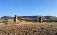
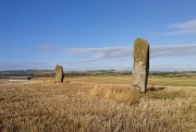
Firbhreige, North Uist, Outer Hebrides

Standing Stones:  OS Grid Reference – NF 7700 7031

Also known as:

  1. Canmore ID 10079
  2. Toroghas

Getting Here

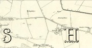
This is nice n’ far north indeed – north-west Uist in fact!  Hit the A865 road northwest to the village of Ceann a’ Bhaigh.  By the little church at the little crossroad, take the track on your right which leads you into the hills.  Go all the way to the end of this track and walk straight north for a couple of hundred yards, as if you’re heading up the hill, Toroghas, in front of you.

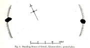
Thom’s drawing of the Stones & possible alignments


Archaeology & History

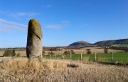
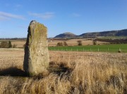
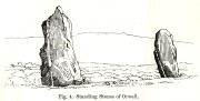
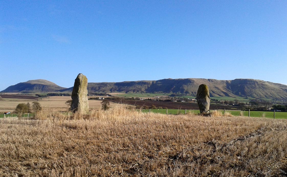
Here are two small standing stones, each not much more than three-feet tall, about 40 yards apart.  Alexander Thom (1984) looked for astronomical alignments here, but found very little, merely commenting:  “From here a number of sites are visible, but the (easternmost) stone might be said to indicate Craig Hasten or Deaskeir Islet.”  In his own analysis of the site, Clive Ruggles (UI23 – 1984) also found such astronomy lacking here.

Folklore

In Thom, Thom & Burl’s (1990) description of these two small stones, Aubrey Burl mentioned how “their name is similar to the stones on Skye called ‘Na Fir Bhreige’, or ‘the false men’. This has been variously interpreted as meaning men who were turned to stone for being unfaithful to their wives or, alternatively, to stones that from a distance resembled men.”  Which is apparently the tale here. (see Grinsell 1976)

Comparative religious studies clearly indicate that legends of petrified beings are representative of the spirits of the ancestors residing in the said stones or other artifact.  If there’s any validity to this ingredient, it would imply that some prehistoric burials can be found nearby — though my archaeo-records show nothing (but that doesn’t mean they’re not there).  If there anyone goes wandering hereabouts in the near future, see if you can find any tombs in the locale.

References:

  1. Beveridge, Erskine, North Uist: Archaeology and Topography, William Brown: Edinburgh 1911.
  2. Ruggle, C.L.N., Megalithic Astronomy, BAR: Oxford 1984.
  3. Thom, A., Thom, A.S. & Burl, A., Stone Rows and Standing Stones, vol.1, BAR: Oxford 1990.

© Paul BennettThe Northern Antiquarian


Carra Bhroin, Lochboisdale, South Uist

Standing Stone:  OS Grid Reference – NF 8117 2248

Also Known as:

  1. Canmore ID 10138
  2. Carragh broin

Archaeology & History

The nature of this site seems a little disputed.  Shown on modern OS-maps and cited as being visited and seen in April 1967, the Canmore website also describes it in the present tense — but when I.A. Crawford (1965) wrote of this site he told that, “this standing stone…has been destroyed in fencing operations” — i.e., building a fence or wall, not some doods having a fencing fight!

Equally curious would be the stature of the site; as in the Royal Commission report (1928), the stone was told to be only 2-feet tall — which would mean that if this site is included as an authentic archaeological site, then we’re gonna have to double or treble the number of standing stone sites nationally!  There are masses of ‘monoliths’ two-feet tall and above which are in the ‘natural’ category.  But this stone, for whatever reason (the folklore probably), has been granted the providence as an authentic standing stone.

Folklore

Tradition told that this old stone was “alleged to mark a battle site” in ancient days.  The variation on this theme tells that the stone marked the grave of a man who was slewn in battle here.  Seems likely that there will be prehistoric tombs nearby…

References:

  1. Crawford, I.A., ‘Carra Bhroin, S.Uist,’ in Discovery & Excavation in Scotland, 1965, SRG & CBA 1965.
  2. Royal Commission on the Ancient & Historical Monuments & Constructions of Scotland, Inventory of Monuments and Constructions in the Outer Hebrides, Skye and the Small Isles, HMSO: Edinburgh 1928.

© Paul BennettThe Northern Antiquarian


Raven’s Stone, Elgol, Strathaird, Skye

Standing Stone (destroyed):  OS Grid Reference – NG 520 144

Folklore

This once-famous standing stone appears to have gone.  It was described in Otta Swire’s (1961) superb book on the folklore of Skye, where she wrote:

“Overlooking Elgol is Bidein an Fhithich. Near here once stood the famous Raven’s Stone, about which the Brahn Seer prophesied. It is believed that this prophecy, however, can never be fulfilled, as seventy or eighty years ago the stone was broken up and the main portion of it is now incorporated in one wall of the Glendale church, according to the Rev. A. R. Forbes’ Place Names of Skye. The stone was believed to have had some connexion with old pagan religious ceremonies.”

The Brahn Seer (more commonly known as the Brahan Seer) was Coinneach Odhar, a 16th century prophet who is said to have foretold the Battle of Culloden and other events.

References:

  1. Swire, Otta F., Skye: The Island and its Legends, Blackie & Sons: Glasgow 1961.

© Paul BennettThe Northern Antiquarian


Croc-tigh-goil, Ribigill, Tongue, Sutherland

Standing Stones (destroyed):  OS Grid Reference –  NC 582 541

Also Known as:

  1. Canmore ID 5349

Archaeology & History

Large stones in field to the north

When I visited this place last year, I had a good look all around for any trace of what James Horsburgh (1870) told us about 150 years earlier, i.e., monoliths that had been broken up and used in the making of the road.  Sadly I found nothing.  When I enquired about the stones amongst local people, they were unaware of any such site and it had fallen out of oral tradition amongst them.  Mr Horsburgh told us simply:

“Near Ribegal there used to be three upright stones, called by the old people a Teampul.  They were broken up by Mr Mitchell, the late farmer, and are now built into the dyke at the road side; the hillock on which they stood is still called Croc-tigh-goil, the ‘hillock of the school-house’.”

However, in the fields 300 yards to the north, three large stones are visible—almost in a straight line—but they seem to be Nature’s handiwork; although the southernmost stone looks like it might once have stood upright.  But I think I’m being more hopeful than realistic!

References:

  1. Horsburgh, James, Notes of Cromlechs, Duns, Hut-circles, Chambered Cairns and other Remains, in the County of Sutherland“, in Proceedings Society of Antiquaries, Scotland, volume 7, 1870.

© Paul BennettThe Northern Antiquarian


Glenshervie Burn, Glen Almond, Perthshire

Ring Cairn:  OS Grid Reference – NN 82614 32996

Also Known as:

  1. Canmore ID 25565
  2. River Almond

Getting Here

The ruins of Glenshervie Circle

The ruins of Glenshervie Circle

Take the dirt-track, off-road, up to the start of Glen Almond, for more than 4 miles — past the curious Conichan Ring, and past the standing stone of Clach an Tiompan, until you see the large modern walled circle in the field on your left.  Go into that field and you’ll notice a ruined pile and small standing stones 56 yards (51m) WSW.  Y’ can’t really miss it!

Archaeology & History

Sitting upon a flat grassland plateau close to the confluence of the Glenshervie Burn with the River Almond, the visitor here will notice an overgrown ovoid mass of old worn stones in the form of a prehistoric cairn, with two upright standing stones on the western edges of the pile.  This is the remains of what the megalithic magus Aubrey Burl (1988) called the Glenshervie “four poster” stone circle.

Glenshervie stones, looking N

Glenshervie stones, looking N

Glenshervie stones, looking W

Glenshervie stones, looking W

Structurally similar to the neighbouring four-poster of Clach an Tiompan 470 yards (427m) to the ESE, and less damaged than the remaining megaliths of Auchnafree 568 yards (520m) to the northwest, this megalithic ruin was first mentioned in passing by Audrey Henshall (1956) in her survey of the giant Clach an Tiompan tomb and its adjacent ring.  She told that,

“In meadowland beside the Almond, a small circle of standing stones, hitherto unrecorded, protrude through the water-worn material of a low cairn.  This is a similar type of monument to the ruined site at Clach na Tiompan.”

Close-up of cairn & stones

Close-up of cairn & stones

Glenshervie ruins, looking S

Glenshervie ruins, looking S

Indeed it is!  Sadly however, it remains unexcavated — so we know not what its precise nature and function may have been.  When Burl included the site in his 1988 survey, he could add nothing more than I can; but curiously described the two standing stones here as being only “about 1 ft (30cm) high.”  They’re between two and three feet tall respectively, and the remaining cairn is between 5 and 6 yards in diameter, with the central rubble rising between 1 and 2 feet above the natural ground level.

The landscape at the point where this circle was built enables you to look up and down the glens of Almond and Shervie in three different directions.  Whether or not this was deliberate, we cannot know for sure.  But the setting on the whole, in the middle of where the glen widens out and hold this and the nearby monuments, is a beautiful setting indeed…

References:

  1. Burl, Aubrey, Four Posters: Bronze Age Stone Circles of Western Europe, BAR 195: Oxford 1988.
  2. Henshall, Audrey & Stewart, M.E.C., “Excavations at Clach na Tiompan, Wester Glen Almond, Perthshire,” in Proceedings of the Society of Antiquaries, Scotland, volume 88, 1955.

© Paul BennettThe Northern Antiquarian


Market Cross, Halesowen, Worcestershire

Cross:  OS Grid Reference – SO 9666 8356

Archaeology & History

Halesowen Cross, when it stood in the village

Halesowen Cross, when it stood in the village

The history of this probable late-medieval monument is fragmentary.  It presently stands in the southeast corner of St John the Baptist churchyard, but used to be in the middle of the old village (when the town actually was a village!).  First erected in 1540 CE, the Victoria County History survey suggested that it may have marked an old boundary.  David Eades (1999) gives the most decent account of the monument, which stands more than nine-feet high and has been re-positioned onto stone steps.  He told:

“It marked the town’s market and fair and may once have come originally from Halesowen Abbey.  It was once possibly more ornate, but religious symbols may have been removed during the Reformation.  After a gale on 22 February, 1908, during which the cross blew down, it was dumped on a rubbish tip.  A local solicitor and clerk to the justices, Mr Alfred Homfrey, rescued it, and Mr Job Garratt, the owner of New Hawne Colliery, paid for its recovery and resurrection in the churchyard.”

References:

  1. Eades, David L., Halesowen, Sutton: London 1999.
  2. Frederick W. Hackwood, Oldbury and Round About in the Worcestershire Corner of the Black Country, Cornish Brothers 1915.

© Paul BennettThe Northern Antiquarian 2016


Gough’s Barrow, Long Compton, Warwickshire

Tumulus (destroyed):  OS Grid Reference – SP 2946 3090

Archaeology & History

Only known drawing of Gough’s Barrow

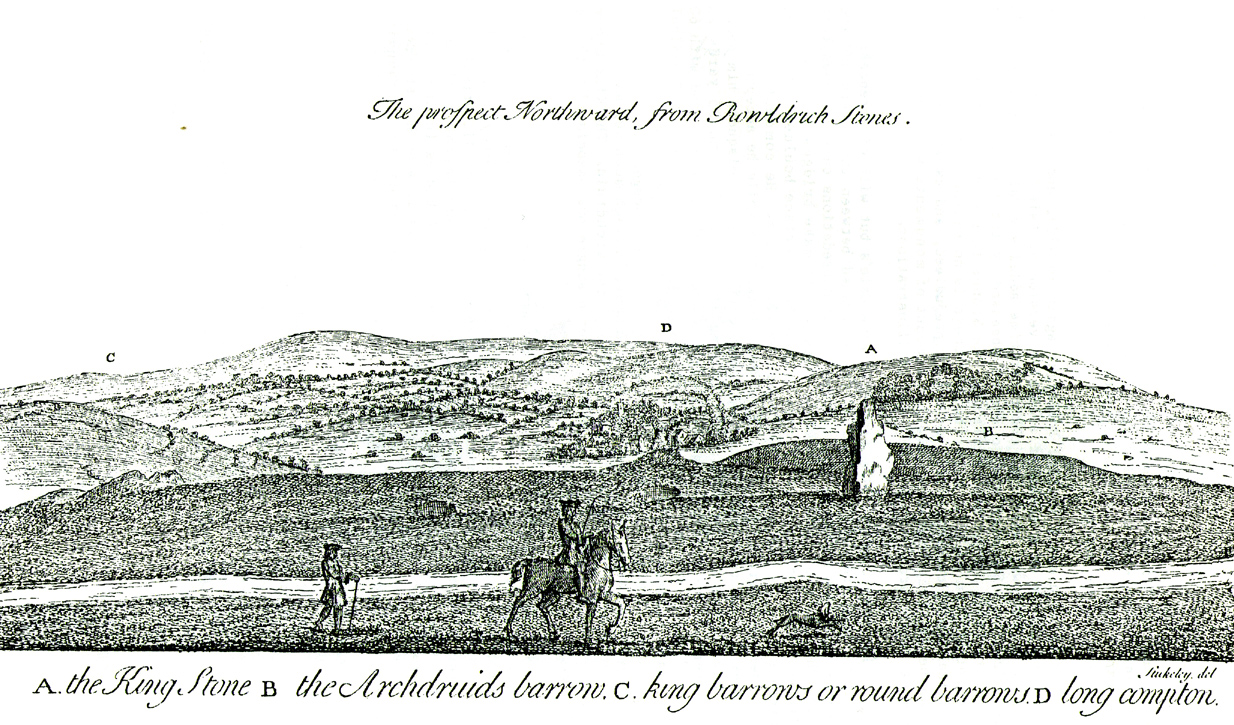
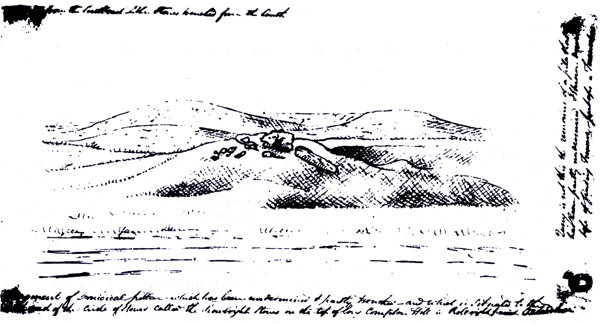
In days of olde there were heathen sites around the edges of the beautiful Rollright Stones complex that have sadly fallen prey to the intensive agriculture of more modern ‘civilized’ times.  It’s become the way of things….. One site of importance in this geomythic  pantheon was the ‘Gough’s Barrow’—so named after a drawing was done of the site by Richard Gough, editor of the 1789 edition of Camden’s Britannia.  As far as I’m aware, it is the only one ever done of this monument.  The Oxford archaeologist George Lambrick (1988) saw “every reason to accept the position and details of the barrow”, upon which stood at least two large stones—one of which gained the description of a ‘druidical pillar.’

Stukeley's 1743 drawing

Stukeley’s 1743 drawing

The same barrow may have been recorded in one of drawings of the great William Stukeley, who visited the Rollright Stones in 1710 and then again in 1723.  On the left-side of the adjacent drawing you can see a denuded mound close to the edge of the picture, similar in shape and form to that drawn by Richard Gough.  It is probably the same tumulus or barrow.  Trial excavations at the site in 1983 looked for any remains of the old tomb, but nothing significant was uncovered.  Lambrick estimated that the site probably measured “about 18m wide and 20m long east-west,” and “was a megalithic barrow and was therefore probably Neolithic in origin.” 

References:

  1. Bennett, Paul & Chanter, James, The Complete Rollright Stones, forthcoming
  2. Bennett, Paul & Wilson, Tom, The Old Stones of Rollright and District, Cockley Press: Chipping Norton 1999.
  3. Burl, Aubrey, Great Stone Circles, Yale University Press 1999.
  4. Lambrick, George, The Rollright Stones, English Heritage 1988.
  5. Peters, Frances, “An Antiquarian Visit to the Rollright Stones,” in Wiltshire Archaeological & Natural History Magazine, volume 94, 2001.
  6. Stukeley, Willliam, Abury – A Temple to the British Druids, London 1743.

© Paul Bennett, The Northern Antiquarian


Stone of Mannan, Clackmannan, Clackmannanshire

Legendary Stone:  OD Grid Reference – NS 91114 91891

Also Known as:

  1. Canmore ID 48321
  2. Clackmannan Stone
  3. King Robert’s Stone

Getting Here

The Stone of Mannan

The Stone of Mannan

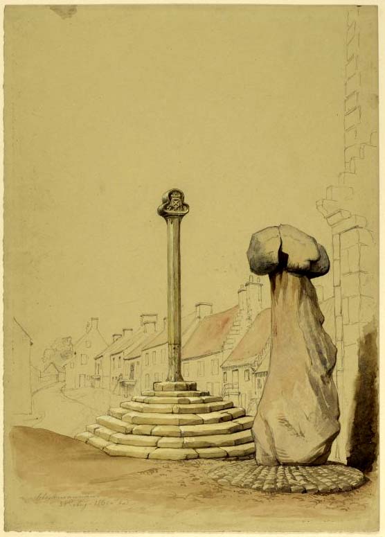
Take the A907 road between Alloa and Kincardine, and up the B910 into Clackmannan.  To get into the village, depending on which route you’re coming in, go up the Kirk Wynd or the Cattle Market—both of which lead you to the Main Street where, beneath the old clock tower, you’ll see the Market Cross and its companion erection just to the side. You can’t really miss it!

Archaeology & History

The phallic upright!

The phallic upright!

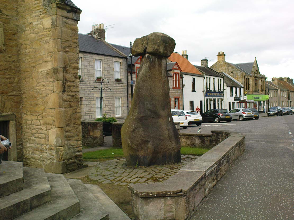
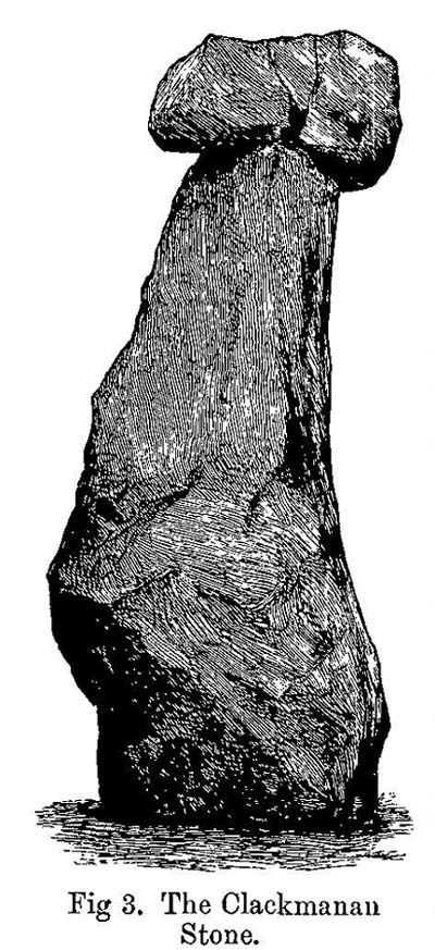
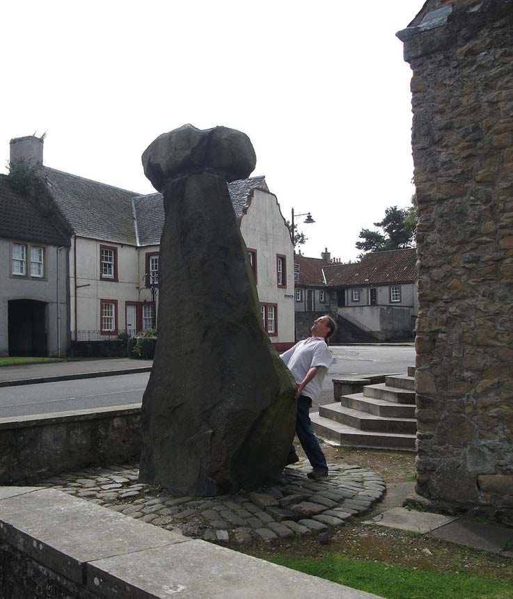
The history of this curious-looking giant phallic stone, sat quietly on the Main Street of sleepy Clackmannan village, isn’t as heathen as you’d expect when first seeing the huge upright—but there are mysteries and myths gathered about it.  The county of Clackmannan itself takes its name from this stone—but not the entire stone that we see today; merely the rounded, smaller element on top.  For it’s this that’s the real Mannan Stone. The rest of it, the tall upright pillar, was only attached to the smaller rounded stone—the Stone of Mannan— in the first-half of the 19th century.

First mentioned as a place-name in 12th century writings, the story of the stone was best told by Peter Miller (1889), who wrote:

“The old ‘clack’ or stone that forms the prefix to the name-word Clackmananmust be of considerable antiquity.  Its form and appearance have nothing to excite remark. The two larger portions of the stone are battened together with iron, and the portion forming the cleft appears to be detached from the larger one.  It is only the legend or tradition respecting its history and its association with the name-word Clackmanan that makes it interesting to the antiquary. Its dimensions are as follows: —It is over 3 feet in length, 2 in breadth, and about the same in thickness.  Its form is oval, and it has a deep cleft on its upper side.  The stone has nothing peculiar about it to indicate what it may have been originally, or the uses it was made to serve in early times.  There is no appearance of its ever having had an inscription or any ornamentation upon it.  It is simply a boulder-stone stone of whinstone, such as are found in abundance at the Abbey Craig near Cambuskenneth.  It was placed on the tall boulder slab on which it now stands, brought from the Abbey Craig in the year 1833 by the late Robert Bruce of Kennet, and the late Professor Fleming, who was then minister of the parish.  Previous to that time it lay on the ground alongside of the old jail and court-house of Clackmannan, close by the old cross of the town…”

Clackmannan Stone (after Miller)

Clackmannan Stone (after Miller)

The old stone & its upright

The old stone & its upright

Mr Miller then went on at some length to show the derivation of ‘Clackmannan’ to be from the old Irish, meaning “the stone of the monks.”  It seems a plausible theory too.  Despite this, Watson (1926) deemed it to be the ‘Stone of Manau’, being deemed vaguely as the people of the land north of the Forth.  The great Celtic scholar John Rhys (1888) declared Clackmannan to derive from the Irish deity or hero-figure, Manannan, as have other academic authorities since then.  But it’s all just a bit vague if we’re wanting ‘certainty’…

When T.C. Crouther (1936) wrote about this, he said how the Stone of Mannan had originally come from a position only a few hundred yards south of its present spot, at a place known as Lookabootye Brae  (NS 912 911), just above where the land begins to drop down closer to sea level.  This doesn’t seems too improbable.  Close to this spot could once be seen the sacred site of the Lady Well.

At the turn of the 21st century the stone was caged by the local council as it was beginning to crumble and was in danger of collapse; and so, the local council repaired the great upright and its sacred top-stone—albeit at the staggering cost of £160,000!!!  As the local people and other masons know to this day, the job could have been done for a fraction of that cost with equal efficiency.

Folklore

Said by T.C. Crouther (1936), the local council, and others to have got its name from the sea god Mannan, other legends have grown around this fascinating old rock.  When Edwin Adams (1863) wrote about it, these were the tales that local people gave him:

“Its legendary history is curious. When King Robert Bruce was residing in Clackmannan tower, and before there was a town attached to that regal mansion, he happened, in passing one day near this way on a journey, to stop awhile at the stone and, on going away, left his glove upon it.  Not discovering his loss till he had proceeded about half-a-mile towards the south, he desired his servant to go back to the clack (for King Robert seems to have usually spoken his native Carrick Gaelic), and bring his mannan, or glove. The servant said, ‘If ye’ll just look about ye here, I’ll be back wi’t directly,’ and accordingly soon returned with the missing article.

£From this trivial circumstance arose the name of the town which was subsequently reared about the stone, as also that of a farm at which the King stopped, about half-a-mile from the south, on the way to Kincardine, which took its name from what the servant said, namely, ‘Look about ye,’ and is so called to this day.”

But as the various dates in this tale simply don’t add up, it seems that the writer had been easily fooled.

References:

  1. Adams, Edwin, Geography Classified, Chapman Hall: London 1863.
  2. Drummond, James, Scottish Market-Crosses, Neill & Co.: Edinburgh 1861.
  3. Drummond, James,”Notice of Some Stone Crosses, with Especial Reference to the Market Crosses of Scotland,” in Proceedings Society of Antiquaries, Scotland, volume 4, 1862.
  4. Gordon, T Crouther, The History of Clackmannan, Civic Press: Glasgow 1936.
  5. Miller, Peter, “Notices of the Standing Stones of Alloa and Clackmannan,” in Proceedings of the Society of Antiquaries, Scotland, volume 23, 1889.
  6. Rhys, John, Lectures on the Origin and Growth of Religion as Illustrated by Celtic Heathendom, Williams & Norgate London 1888.
  7. Royal Commission on the Ancient & Historical Monuments, Scotland, Inventory of Monuments and Constructions in the Counties of Fife, Kinross and Clackmannan, HMSO: Edinburgh 1933.
  8. Royal Commission on the Ancient & Historical Monuments, Scotland, The Archaeological Sites and Monuments of Clackmannan District and Falkirk District, Society of Antiquaries of Scotland 1978.
  9. Simpkins, John Ewart, County Folklore – volume VII: Examples of Printed Folk-Lore Concerning Fife, with some Notes on Clackmannan and Kinross-Shires, Folk-Lore Society: London 1914.
  10. Small, John W., Scottish Market Crosses, Eneas Mackay: Stirling 1900.
  11. Watson, W.J., The History of the Celtic Place-names of Scotland, Edinburgh 1926.

Links:

  1. Nataraja’s Foot – Skullduggery

Acknowledgements:  Big thanks to author Marion Grace Woolley for use of her photo in this site profile. 🙂

© Paul BennettThe Northern Antiquarian

Mercat Cross, Clackmannan, Clackmannanshire

Cross:  OS Grid Reference – NS 91109 91890

Also Known as:

  1. Burgh Cross
  2. Canmore ID 48318
  3. Clackmannan Cross
  4. Market Cross
Cross on the 1886 map

Getting Here

Take the A907 road between Alloa and Kincardine, and up the B910 into Clackmannan.  To get into the village, depending on which route you’re heading in, go up the Kirk Wynd or the Cattle Market—both of which lead you to the Main Street where, right next to the huge erection known as the Stone of Mannan you’ll see the old Cross on its steps.Getting Here

Archaeology & History

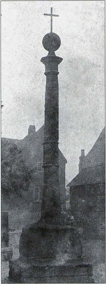
When the Royal Commission (1933) lads wrote about the site in their early survey, they called it the Burgh Cross, telling:Found in association with the village Tolbooth and the more famous Stone of Mannan, this probable 16th century cross stands at the meeting of the four lanes at the centre of the village in the heart of Clackmannanshire.  It was the focal point of an annual market fair which, said Craig Mair (1988), “could last up to eight days”.  It was the meeting place of local villagers where legal issues were called and settled, where bonds and deeds were made and, in all probability, replaced an earlier non-christian monument.

The Mercat Cross
Millers 1889 sketch

“Although the stepped base has been renewed, the shaft is original.  It is 9 feet 6 inches in height and is octagonal in section, measuring 11 inches in diameter.  The capital is moulded and has on the east side a shield enclosed by swags and bearing a saltire and chief, for Bruce.  A second shield, carved on the west side, has apparently been similarly charged, but is now very weatherworn.  The ball finial on the capital was removed in 1857, but replaced in 1897.”

The reference to the chief, Bruce, is said by tradition to be that of Robert the Bruce.  This element in the cross’ history has been transposed mistakenly by early english writers onto the adjacent Stone of Mannan.

Cross & Mannan’s Stone

In recent times both the cross and the Stone of Mannan were repaired, at a staggering cost of £160,000.  How the hell it cost that much is anybody’s guess – but it certainly sounds as if someone’s pockets would have been bulging!

References:

  1. Mair, Craig, Mercat Cross and Tolbooth, John Donald: Edinburgh 1988.
  2. Royal Commission on the Ancient & Historical Monuments, Scotland, Inventory of Monuments and Constructions in the Counties of Fife, Kinross and Clackmannan, HMSO: Edinburgh 1933.
  3. Royal Commission on the Ancient & Historical Monuments, Scotland, The Archaeological Sites and Monuments of Clackmannan District and Falkirk District, Society of Antiquaries of Scotland 1978.
  4. Simpkins, John Ewart, County Folklore – volume VII: Examples of Printed Folk-Lore Concerning Fife, with some Notes on Clackmannan and Kinross-Shires, Folk-Lore Society: London 1914.
  5. Small, John W., Scottish Market Crosses, Eneas Mackay: Stirling 1900.

© Paul BennettThe Northern Antiquarian

Tods Stone, Monifieth, Angus

Standing Stone (destroyed):  OS Grid Reference – NO 486 339?

Archaeology & History

The only reference I can find about this site is in A.J. Warden’s (1880) massive survey of the county of Angus—previously called ‘Forfarshire’—where, in his discussion of the hillforts of the area, he told us that,

“About a quarter of a mile distant from The Laws is the Gallow Hill of Ethiebeaton.  In a field, a little to the south, there formerly stood a large upright stone called Tods Stone.”

All trace of it disappeared when quarrying operations were undertaken there, also destroying a number of prehistoric tombs close by.  The monolith may have had some association with the tombs, but we cannot be certain.

The name of the stone, tods, probably derives from the word ‘foxes’, although we cannot be certain of this either, as there are a variety of other Scottish dialect words relating to ‘tod’that may have had bearing on the name.

If anyone has any further information about this long lost site, we would gladly welcome it.

References:

  1. Grant, William (ed.), The Scottish National Dictionary – volume 9, SNDA: Edinburgh 1973.
  2. Warden, Alex J., Angus or Forfarshire – volume 1, Charles Alexander: Dundee 1880.

© Paul BennettThe Northern Antiquarian