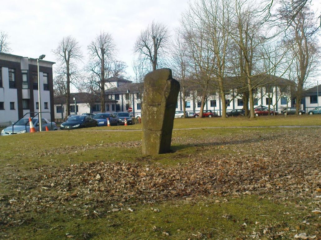
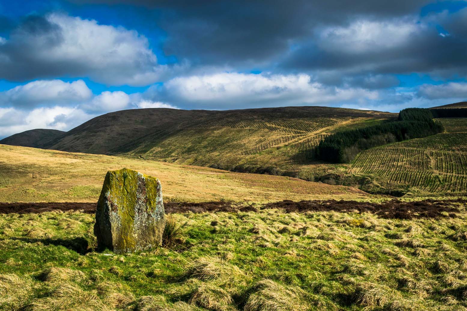
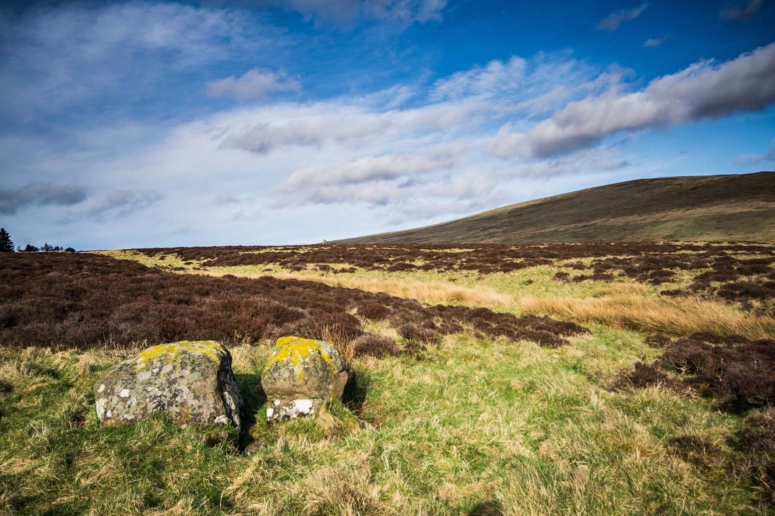
Sheriffmuir Carving, Dunblane, Stirlingshire

Cup-Marked Stone:  OS Grid Reference – NN 83074 02143

Getting Here

From Dunblane, head up the Glen Road for nearly a mile, turning left up the Sheriffmuir Road and all the wya on till you reach the pub near the T-junction another couple of miles on.  OK – get thru the gate and onto the moor, roughly in a straight line with the pub behind you for about 400 yards.  You’re damn close! (if you find the nice standing stone known as the Wallace Stone, walk  250 yards southwest from here).

Archaeology & History

Almost nothing has been written of this cup-marked stone, found at the southern end of what’s alleged to be an authentic megalithic stone row alignment, running northeast to southwest — although this alignment isn’t included in either Aubrey Burl’s (1993) or Alexander Thom’s (1990) textbooks dealing with such matters.

Cup-marks highlighted in ice!
Cup-marked rock with the Wallace Stone in the distance

When we came here last winter in temperatures of around -6°C (one helluva good day!), curiously only this and the other stones along this “stone row” were actually uncovered on the moorland.  Quite bizarre to be honest!  Many of the other rocks scattering this small moorland edge were covered in several feet of snow.  We were lucky I s’ppose…though I’ve gotta get back up here again shortly and see the site in summertime (midges up mi crotch, cleggs-a-biting – oh such joy!) cos I can’t believe this is the only cup-marked stone hereby.

The rock itself is more than seven-feet long and has at least twenty archetypal cups carved into its slightly-slanting face — although when we visited the stone, several of these were difficult to see and, as the images show, even more difficult to photograph (of the 20 I took of this stone alone, only one was of any value in highlight the cups) .  The stone gave the impression that it may have stood upright in the not-too-distant past — which would of course give the notion of this as part of megalithic avenue a considerably more potent status.

Some dood alleged that this potential stone row, with this cup-marked stone at its southwestern end, marked an astronomical alignment — but for the life of me I can’t remember who it was! (it’s my age creeping up on me at last!)

References:

  1. Burl, Aubrey, From Carnac to Callanish: The Prehistoric Stone Rows and Avenues of Britain, Ireland and Brittany, Yale University Press 1993.
  2. Heggie, Douglas C., Megalithic science: ancient mathematics and astronomy in north-west Europe, Thames & Hudson: London 1981.
  3. Thom, A., Thom, A.S. & Burl, Aubrey, Stone Rows and Standing Stones – 2 volumes, B.A.R.: Oxford 1990.

© Paul Bennett, The Northern Antiquarian

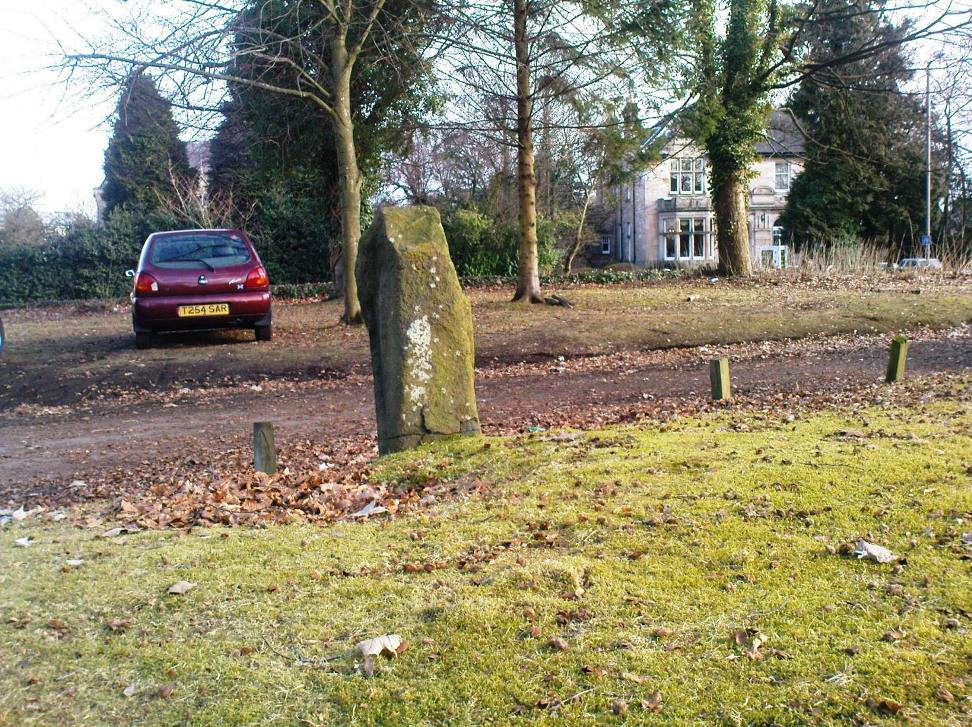
Lyneham Barrow, Ascot-under-Wychwood, Oxfordshire

Long Barrow:  OS Grid Reference – SP 2975 2107

Getting Here

Lyneham Barrow stone

Pretty easy really.  From Shipton-under-Wychwood take the A361 road north (to Chipping Norton) for just over 2 miles.  You’ll pass the TV mast on your right and then a small country lane sign-posted to Ascott-under-Wychwood.  Go past this and then stop at the next right-turn a half-mile further up the road.  The barrow is about 100 yards before this turning, in the hedgerow, on the left-hand side of the road!

Archaeology & History

This once great and proud neolithic monument is today but a shadow of its former self.  Described by various antiquarians and archaeologists over the years, O.G.S. Crawford (1925) included it in his fine survey, telling:

“The barrow is between 160 and 170 feet long and stands in two fields on the west side of the Chipping Norton and Burford main road… In the northern field, at the NE end of the barrow, stands a single upright stone, 6 feet high, 5 feet broad and 1 foot 6 inches thick.  This stone is stated to be buried three feet deep in the ground and its height is given by Conder as 10 feet 6 inches.  When visited October 18, 1922, a large piece of the top had been broken off, but replaced in position.”

This damage was reported around the same time and described in the early “Notes” of The Antiquaries Journal by a Mr A.D. Passmore (1925), who wrote:

“About 30ft from the north-east end of this long barrow stands a large monolith now nearly 6ft above ground…and roughly 6ft wide and just under 2ft thick, of local stone.  At the top is an ancient and natural fissure extending right across the stone and penetrating some way downwards obliquely.  Early in 1923, either by foul play or natural decay, another crack appeared spreading towards the first about a right-angle, the result being that a large piece at the top of the monolith became detached.  Such an opportunity of mischief was speedily taken advantage of and the piece of stone, weighing over 4 cwt, was pushed off and fell to the ground.  In August 1924 the owner of the land, his man, and the writer spread a bed of cement and hoisted up the large broken mass and relaid it in its bed.”

But even in their day, the tomb had already been opened up and checked out, by a Lord Moreton and a Mr Edward Conder, in 1894 no less!  Conder’s account (1895) of the inside of this ancient tomb told:

“There were found (1) a chamber at right angles to the long axis of the barrow; on the south-eastern side of the barrow were two uprights, 4 feet 2 inches by 2 feet 1o inches, and 1 foot 9 inches by 2 feet 8 inches.  At the north-western end of the chamber were two uprights set with their long faces (edges?) abutting.  On the surface-line at the level of the base of the barrow were traces of paving and fragments of bone, pottery and charcoal.  (2) Chamber, a little south of the south-east corner of No.1,  slightly above the ground level.  It was formed of three uprights, on the north, east and west sides respectively, and a paving slab with a perforation 4 inches in diameter.  At the north-eastern end of the barrow was a ridge of large ‘rug’ stones up to 8 feet long, 5 feet wide, and 2½ feet thick, terminating in a standing stone…10 feet 6 inches high…buried 3 feet below ground level.  At the southwest end was a standing stone, 4½ feet by 3 feet by 11 inches thick, in a horizontal position lying east and west, 2 feet below the surface. At various points were found skulls and human and animal bones and hearths, with no indications of date, and (as secondary interments) two Saxon graves.”

Today, poor old Lyneham Barrow is much overgrown and could do with a bittova face-lift to bring it back to life.  But I wouldn’t hold y’ breath…..

Folklore

At the crossroads just above this old tomb, the ghost of a white lady is said to roam.  And at the old quarry on the other side of the road a decidedly shamanistic tale speaks of an old lady who lived in a cave and guarded great treasure!  Her spirit is sometimes seen wandering about in and around the fields hereby.

References:

  1. Bennett, Paul & Wilson, Tom, The Old Stones of Rollright and District, Cockley: London 1999.
  2. Brooks, J.A., Ghosts and Witches of the Cotswolds, Jarrold: Norwich 1992.
  3. Conder, Edward, “An Account of the Exploration of Lyneham Barrow, Oxon,” in Proceedings of the Society of Antiquaries, volume 15, 1895.
  4. Crawford, O.G.S., Long Barrows of the Cotswolds, John Bellows: Oxford 1925.
  5. Dyer, James, Discovering Regional Archaeology: The Cotswolds and the Upper Thames, Shire: Tring 1970.
  6. L.V. Grinsell’s Ancient Burial Mounds of England, Methuen: London 1936.
  7. James, Dave, “A Brief Foray into Oxfordshire,” in Gloucestershire Earth Mysteries 14, 1992.
  8. Passmore, A.D., “Lyneham Barrow, Oxfordshire,” in Antiquaries Journal, 5:2, April 1925.
  9. Turner, Mark, Folklore and mysteries of the Cotswolds, Hale: London 1993.

© Paul Bennett, The Northern Antiquarian

Long Stone, Adel, Leeds, West Yorkshire

Standing Stone (destroyed?):  OS Grid Reference – SE 2501 4119

Also Known as:

  1. Long Stoop

Archaeology & History

Sadly gone, this looked to be one helluvan impressive standing stone.  Described just once by the christian fruitbat Henry Simpson (1879), who told us:

“In a hedge-row, or rather stone row…is a remarkable, ancient monolith, it is thirteen feet in height; from its slender character, it does not appear to have formed one of a trilithon, but rather to have constituted a memorial of some sort, or as a beacon of some usefulness.  I can discover no barrow or earthwork near the spot.  There are remnants of a quarry close by, with a mound of earth arising therefrom, but no indications to give a clue to the meaning or use of this single pillar.  It is composed, moreover, of millstone grit, which is not to be found in the immediate neighbourhood, so it must have been brought from a distance and placed in its present position.

“Some suppose this to be a Roman stoup or pillar, designed for a landmark; but it bears no mark of Roman worksmanship.  It is crude in the extreme.”

Simpson’s 1879 drawing

There is no available folklore known to the Long Stoop, although a long straight path terminated where the monolith stood.  This path was one of many in an intricate geometric lay-out of perfect circular and dead straight tracks in the woodland immediately south of here [now built over], with four-, eight- and twelve-fold lines intersecting each other over a very large area.  It may be that this large, seemingly lost standing stone, could have been a part of the ornate grounds that were laid out here in bygone centuries, perhaps erected by the architects behind the project.

It would be damn good if locals in and around Adel could relocate this monolith — which is as likely propping up some old walling somewhere nearby — so we can make a healthy assessment as to its authenticity.  Are there any Leeds pagans who might be able to rediscover this lost standing stone?

References:

  1. Bennett, Paul, The Old Stones of Elmet, Capall Bann: Milverton 2001.
  2. Simpson, Henry Trail, Archaeologia Adelensis; or a History of the Parish of Adel, W.H. Allen: London 1879.

© Paul Bennett, The Northern Antiquarian

Low Snaygill Stone, Skipton, North Yorkshire

Cup-and-Ring Stone:  OS Grid Reference – SD 9940 4973

Also Known as:

  1. Carving SK1 (Hedges)
  2. Carving no.16 (Boughey & Vickerman)
  3. Snaygill Farm Stone

Getting Here

Stone by the roadside

Not too far from the High Laithe cup-and-ring stone.  Along the A6131 out of Skipton, park up at the Rendezvous hotel and go up the road on your left, over the canal.  As you approach the second house up, note the rock on the right-hand side of the tiny road, perched on the edge above the stream, with ivy creeping up one side of it.  That’s it!

Archaeology & History

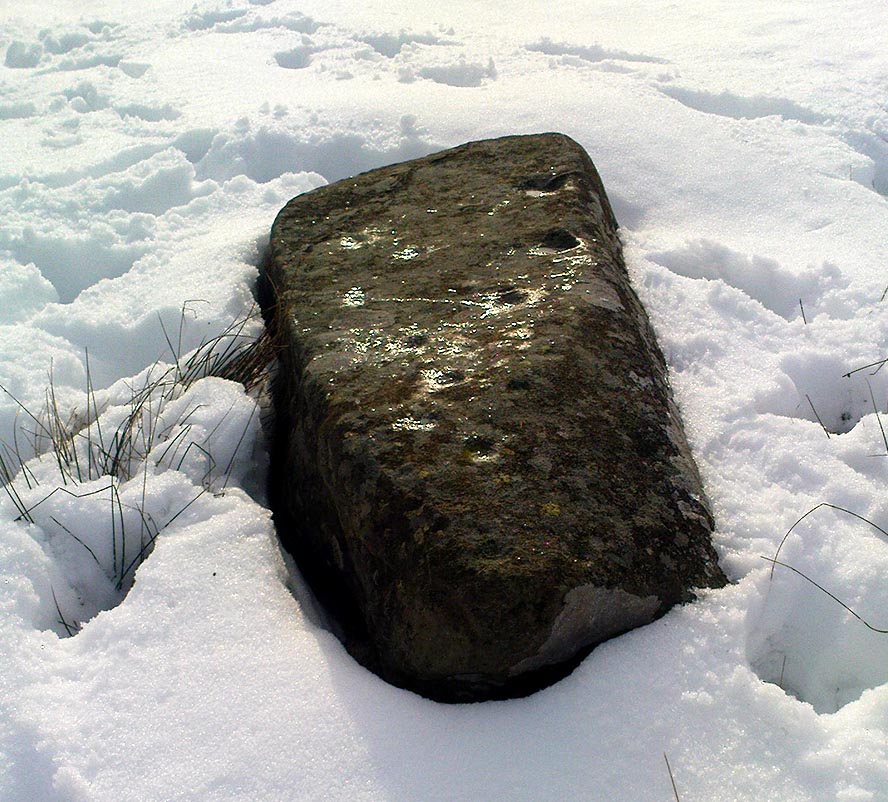
This stone was moved to its present position a few decades back, sometime before Hedges (1986) first recorded it in his Carved Rocks work.  It’s a reasonably large boulder, resting on the slope above the drop to the stream below, and will probably drop into the waters in the not-too-distant future.  Whether the stream had any initial relationship with the cup-markings etched on its surface, we’ll probably never know (a number of rock art students love the water-stone relationship — and this one is no doubt in their listings!).  Its first literary appearance by Hedges described it thus:

“Large fairly smooth grit rock sloping down to stream at E and into ground and grass at W.  Eleven cups, circle of nine very small cups at one end, groove from depression, one other groove and possible cup.”

Lower half of CR-016

Which just about does it justice.  When we visited the place yesterday, the cluster of small cups at the top of the rock were difficult to see clearly in the grey daylight; but what seems to be another 2 cups (not in Hedges, nor Boughey & Vickerman’s [1986] survey) may be on the lower-half of the stone, and can be seen in the photo here.  We need to go back again on a bright day and catch the stone in a different mood to suss out whether we were just seeing things.

References:

  1. Boughey, Keith & Vickerman, E.A., Prehistoric Rock Art of the West Riding, WYAS: Leeds 2003.
  2. Hedges, John (ed.), The Carved Rocks on Rombald’s Moor, WYMCC: Wakefield 1986.

© Paul Bennett, The Northern Antiquarian

High Laithe Stone, Skipton, North Yorkshire

Cup-and-Ring Stone:  OS Grid Reference – SD 9952 4991

Also Known as:

  1. Carving SK2 (Hedges)
  2. Carving no.17 (Boughey & Vickerman)

Getting Here

High Laithe cup-and-ring stone

Worth the short trek if you like your cup&rings!  On the Aire Valley Keighley-to-Skipton road (A629), as you approach the southern outskirts of Skipton, take the turning at the roundabout as if you’re going into the town up the A6131. Go over the next roundabout a coupla hundred yards on, then 200 yards further on note the right-turn up over the canal (big hotel just here, where you could park up).  Walk over the canal up the tiny country lane. Ignore the first left turn and walk up, bearing next left uphill and onto the footpath. Walk up the hillocky quarried bit until you reach the stile in the wall.  Once on the other side, look in the walling 20 yards uphill.  You can’t miss it!

Archaeology & History

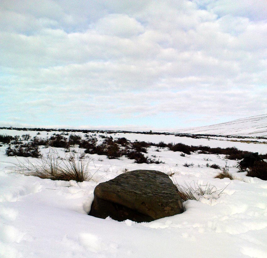
First described by Messrs Hartley and Radley in the Yorkshire Archaeological Register of 1968, this small “standing stone”, less than three-feet tall, has a distinct cup-and-double- ring carved onto its upright north-facing edge.  The outline of the carving is visible even in bad light, though you might wanna rest and gaze for a minute or two for yourself and the lighting to adjust if it’s a grey day.  There’s another cup-marking below the bottom right of the double-ring, with another ‘possible’ just above ground-level.

References:

  1. Boughey, Keith & Vickerman, E.A., Prehistoric Rock Art of the West Riding, WYAS: Leeds 2003.
  2. Hedges, John (ed.), The Carved Rocks on Rombald’s Moor, WYMCC: Wakefield 1986.

© Paul Bennett, The Northern Antiquarian

Boydstone Road, Eastwood, Glasgow, Renfrewshire

Standing Stone (destroyed):  OS Grid Reference – NS 540 607

Also Known as:

  1. Canmore ID 44370 
  2. Kennishead

Archaeology & History

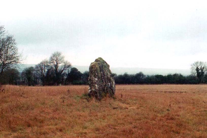
There is very little known of this once proud standing stone, said by one writer to have been about 12 feet long: six-feet of it in the ground and the other six-feet above ground.  A decent monolith by anyone’s standard!  But some dickheads forty years or more ago thought it a good idea to destroy the site, or as it was diplomatically put, “was removed in advance of road widening.”  Vandalism no less – though it’s demise was recorded by the Department of the Environment  “on behalf of the Inspectorate of Ancient Monuments.” (DES, 1973)

A local journalist called Andrew McCallum described the site in his unpublished manuscript on the history of the parish of Mansewood, telling it to be near Cowglen:

“near Boydstone Road, midway between Kennishead and Barrhead Road.  6 feet above the ground, and at least as many below.  Age and purpose are unknown.”

Some thirty years later, Miss Adamson (1973) told us that,

“The straight-sided block had its base set on yellow sandstone. Immediately above the bedrock small stones and earth had been packed against the W and N faces of the standing stone. On top of the packing were two boulders set at right angles to wedge the sides of the stone. No burials or cremations were found.”

Though on this latter remark we have to consider the possibility that the standing stone may once have accompanied a burial, as the nearby place-name ‘Carnwadric’ indicates a cairn, or burial site.  A field-name survey of the immediate region may prove valuable.

References:

  1. Adamson, H., “Glasgow: Boydstone Road – Standing Stone,” in Discovery & Excavation in Scotland, 1973.

© Paul Bennett, The Northern Antiquarian

Airthrey Stone, Stirling University, Stirlingshire

Standing Stone:  OS Grid Reference – NS 81410 96489

Also Known as:

  1. Airthrey Castle Stone
  2. Canmore ID 47115
  3. Stirling University Stone

Getting Here

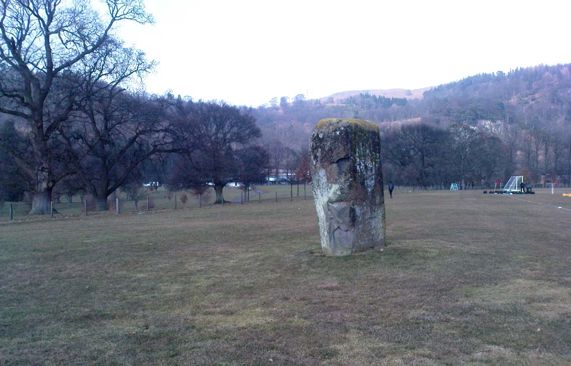
Airthrey stone, looking north

Dead easy to find!  From Stirling head out on the A9 road towards Bridge of Allan and Stirling Uni.  You’ll hit a small roundabout a mile out of Stirling – go straight across and up the little bendy road.  Follow this round the bottom side of the Uni for a half-mile, watching out for the left-turn as the tree-line ends, taking you up to the factory behind the trees (if you hit the roundabout a bit further on, you’ve gone too far!).  Go up the slope and onto the level sports playing fields – where this old beauty will catch your eye!  If you somehow miss it, just get to the Uni and ask some of the students where it is!

Archaeology & History

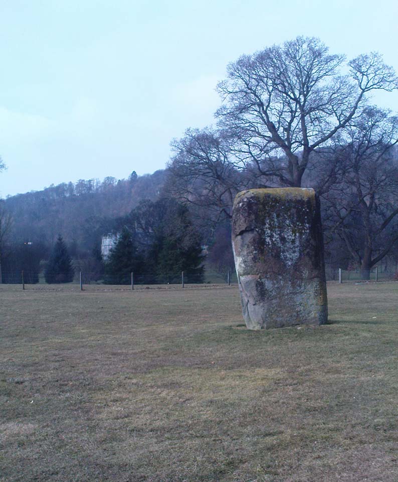
Airthrey Stone, looking NW

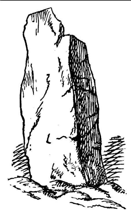
This single standing stone is a beauty!  It’s big – it’s hard – and it’s bound to get you going! (assuming you’re into megaliths that is)  Standing proud and upright on the eastern fields of the Stirling University campus, A.F. Hutchinson (1893) measured it as being “9ft 1in in height.  Its greatest breadth is 4ft 10in, and its circumference 14ft.”  A bittova big lad!  More than fifty years later when the Royal Commission (1963) lads got round to measuring its vital statistics, only an inch of the upright had been eaten by the ground.  The stone was highlighted on the earliest OS-maps of the area.

Folklore

Of the potential folklore here, most pens and voices seem quiet; although Mr Hutchinson (1897) told of William Nimmo’s early thoughts, linking the history of this stone with the others nearby, saying:

“Of what events these stones are monuments can not with certainty be determined.  In the ninth century, Kenneth II, assembled the Scottish army in the neighbourhood of Stirling, in order to avenge the death of Alpin his father, taken prisoner and murdered by the Picts.  Before they had time to march from the place of rendezvous, they were attacked by the Picts… As the castle and town of Stirling were at that date in the hands of the Picts, the rendezvous of Kenneth’s army and the battle must have been on the north side of the river; and as every circumstance of that action leads us to conclude that it happened near the spot where these stones stand, we are strongly inclined to consider them as monuments of it.  The conjecture, too, is further confirmed from a tract of ground in the neighbourhood which, from time immemorial, hath gone by the name of Cambuskenneth: that is, the field or creek of Kenneth.”

And although this hypothesis is somewhat improbable, it was reiterated in the new Statistical Account of 1845, which also suggested that this and the other Pathfoot Stone were “intended probably to commemorate some battle or event long since forgotten.”

References:

  1. Hutchinson, A.F., “The Standing Stones of Stirling District,” in The Stirling Antiquary, volume 1, 1893.
  2. Royal Commission on the Ancient & Historical Monuments Scotland, Stirling – volume 1, HMSO: Edinburgh 1963.

© Paul Bennett, The Northern Antiquarian
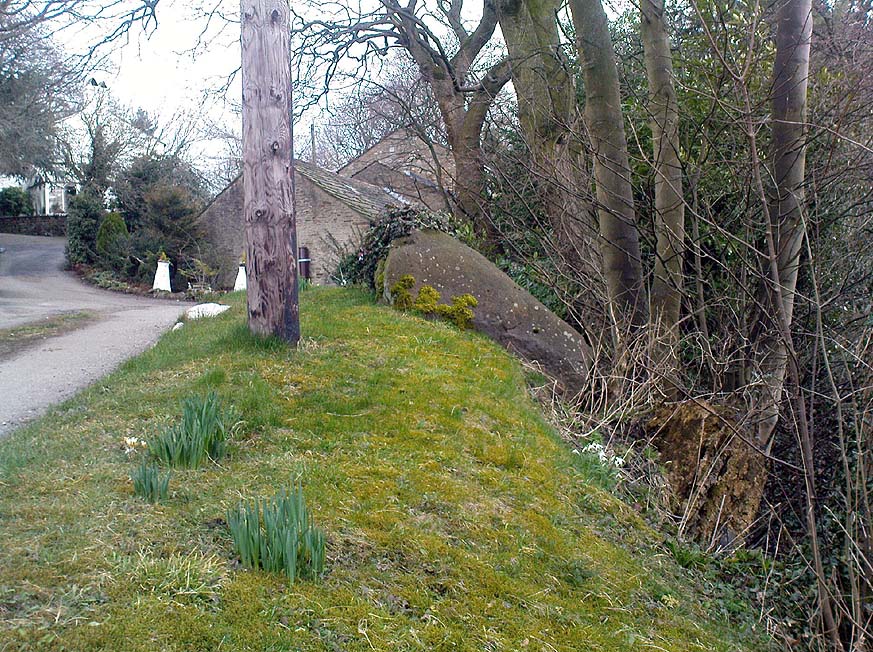

Randolphfield, Stirling, Stirlingshire

Standing Stones:  OS Grid Reference – NS 7945 9246

Also Known as:

  1. Canmore ID 46226
  2. Randolph Field Stones
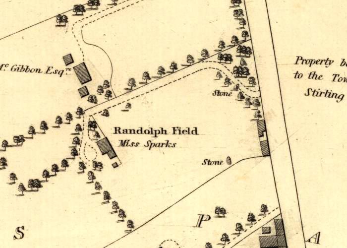
Randolphfield stones shown on 1820 map

Getting Here

Pretty easy to find.  Head down the B8051 road south, out of Stirling, for a ¼-mile.  Keep your eyes peeled for the central police station on your right as you come out of town.  The stones are on the grassy forecourt in front of the police station!

Archaeology & History

It’s amazing that these stones are still standing!  Jut out of the city centre, very close to the main road and right outside the central police station: if these standing stones would have stood anywhere in England, they’d have been destroyed.  Thankfully, the Scots have more about them regarding their history, traditions and antiquities.

Randolphfield stone SW
NE Randolphfield stone

Of the two stones that remain here, they stand in (just about) the same position that they were shown as on an 1820 map of Stirling.  The northernmost of the two is about 3½-feet tall and rests upright against the edge of the track and lawn; whilst its taller companion — knocking close on to six-feet tall — stands proudly near the middle of a well-kept lawn less than 50 yards away.  Once you’ve found one, the other’s easy to spot!

It’s obvious that the larger of the two stones was cut down at some time in the recent past, as there are several blatant cuts where the standing stone had been snapped into at least three portions — but whoever did the damage was given a bittova bollocking, as the stone was cemented back into its near-original form and stood back upright again.  To this day, as one of the female officers coming out of the station indignantly told me, “they’re protected!”  Long may they stay that way!

In Mr A.F. Hutchinson’s (1893) early description of these stones he told that they stood “in a line from SW to NE — the line of direction making an angle of 235° with the magnetic north.

“The southwest stone stands 4ft above the ground.  The portion underground measures 2ft 5in; so that in all it measures 6ft 5in.  Its girth is 6ft 6in.  It is four-sided in shape—nearly square—three of the faces measuring each 21 inches, and the fourth 15 inches.  The northeast stone is smaller and less regular in form.  Its height above ground is 3ft 6in, and its girth 4ft 6in.  Both stones are pillars of dolerite, of the same material as the pillar stones of the Castle rock, from which place they have apparently been brought.  The larger stones shows some marks on it, which have been supposed to be artificial.  They are , however, merely the natural joints characteristic of these blocks…”

Folklore

Like many standing stones scattering our isles, this site possesses the old tradition of them marking a battle — in this case, the Battle of Bannockburn.  Once again, Mr Hutchinson (1893) wrote:

“The local tradition as to the origin and meaning of these stones is well-known.  It is thus stated by (William) Nimmo in his History of Stirlingshire, p.84…: ‘Two stones stand to this day in the field near Stirling, where Randolph, Earl of Murray, and Lord Clifford, the english general, had a sharp encounter, the evening before the great battle of Bannockburn.’  Again, p.193:- ‘To perpetuate the memory of this victory…two stones were reared up in that field and are still to be seen there.’ …The Old Statistical Account of St. Ninians (Rev. Mr Sheriff, 1796), makes the same statement, p.406-8:- ‘In a garden at Newhouse, two large stones still standing were erected in memory of the battle fought on the evening before the battle of Bannockburn, between Randolph and Clifford.'”

Yet the name ‘Randolphfield’ is apparently no older (in literary records) than the end of the 17th century and the thoughts of Hutchinson and other local historians is that the two stones here, whilst perhaps having some relevance to an encounter between the Scots and the invading english, were probably erected in more ancient times.

References:

  1. Hutchinson, A.F., “The Standing Stones of Stirling District,” in The Stirling Antiquary, volume 1, 1893.
  2. Royal Commission on the Ancient & Historical Monuments Scotland, Stirling – volume 1, HMSO: Edinburgh 1963.

© Paul Bennett, The Northern Antiquarian
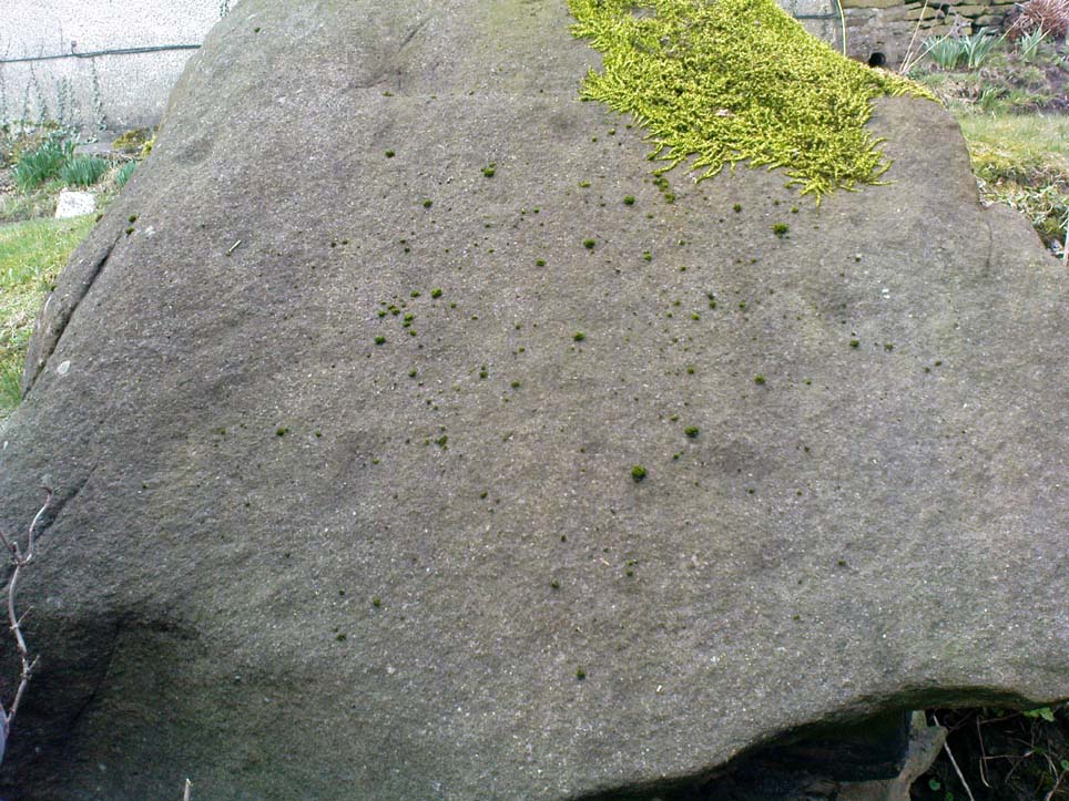

Ardfernal, Jura, Argyll

Standing Stone:  OS Grid Reference – NR 56009 71718

Also Known as:

  1. Canmore ID 38262

Getting Here

Go up Jura’s only road until it becomes a dirt-track and head along the track to the east to the natural hillock on the coast.  You’ll pass the three standing stones of Knockrome before you get to this one, right by the end house.

Archaeology & History

Found in a beautiful setting, this is a thick little stone but is less than four feet tall and it may have had some shapely relationship with one of the hills (Corra Bheinn) on Jura.  The Royal Commission (1984) described it merely as, “an erratic boulder measuring 3.1m in girth at the base, and 1.2m in height with its longer axis aligned roughly east and west.”  Several other stones can be found nearby.

References:

  1. Royal Commission on the Ancient & Historical Monuments of Scotland, Argyll – volume 5: Islay, Jura, Colonsay and Oronsay, HMSO: Edinburgh 1984.

© Paul Bennett, The Northern Antiquarian
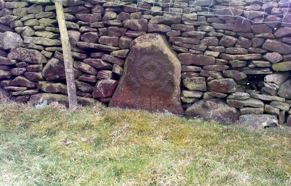

Harden Moor Stone Row, Bingley, West Yorkshire

Standing Stones (lost):  OS Grid Reference – SE 07 38

Getting Here

This site hasn’t been located. However, if it hasn’t been destroyed by the quarrying on the SW side of the moor, remains of it should still be found amidst the heather and would be a good discovery for any enthusiast.

Archaeology & History

The first notes I found about this place were those by archaeologist Sydney Jackson in 1956, who wrote:

“It would be interesting to know what Dr Richard Richardson, of Bierley Hall, Bradford meant when, writing about 1709, he said that Mr Benjamin Ferrand show him a ‘skirt of stones’ on Harden Moor, near to a row of stones placed in a line nigh two hundred paces in length some two feet above the heath, others hidden beneath it.” (my italics)

The undoubted man-made nature of this row of stones was emphasized by Dr Richardson when he wrote,

“That these stones were placed here by design, no person can doubt; but for what I end cannot conjecture, having never seen anything of this kind before.”

The great Yorkshire historian Harry Speight (1898) also came across the same antiquarian notes many years before and speculated how,

“it may be inferred from this that it had been a double row of stones, like the avenue of Maiden Castle in Swaledale.”

The ‘skirt of stones’ that were described here may be the well-preserved Harden Moor Circle.  However in recently finding the short essay of Peter Craik (1907) of Keighley, this idea may need re-assessing, as Craik clearly shows in his survey of the the nearby Catstones Ring earthwork, what he described as the “remains of a cairn” on the northern edge of that ring, giving us a different location for this lost stone row.

However, another potential position for our lost stone row that needs exploring is the one described by Butler Wood following an exploratory visit here with the Bradford historian, William E. Preston, at the beginning of the 20th century.  Mr Wood (1905) told of them both coming across some sort of earth-and-stone line “half-a-mile north of” the Catstones Ring, telling:

“Mr W.E. Preston and myself traced a short time ago on Harden Moor, remains of an entrenchment for a distance of 80 or 90 yards.  It faces south, and lies near Spring Head Heights.  The wall consisting of boulder and earth rising three feet above the soil, but there is no trace of a ditch.”

This is obviously half the length described by Richardson and Ferrand in 1709, but nearly two centuries separate the two accounts (the position of Mr Woods’ line is roughly SE 072 387; whilst that nearer to the Catstones Ring would be nearer SE 069 383).

I’ve searched the tops of this moorland a number of times hoping to locate this seemingly important megalithic stone row, obviously without success.  Further searches on the moor are needed after the heather’s been burnt back.

References:

  1. Craik, Peter, “Catstones Ring,” in C.F. Forshaw’s Yorkshire Notes & Queries, volume 3 (H.C. Derwent: Bradford 1907).
  2. Jackson, Sidney, “Harden Circle Found,” in Cartwright Hall Archaeology Group Bulletin, 2:1, July 1956.
  3. Speight, Harry, Chronicles and Stories of Old Bingley, Elliott Stock: London 1898.
  4. Wood, Butler, ‘Prehistoric Antiquities of the Bradford District,’ in Bradford Antiquary, volume 2, 1905.

© Paul Bennett, The Northern Antiquarian