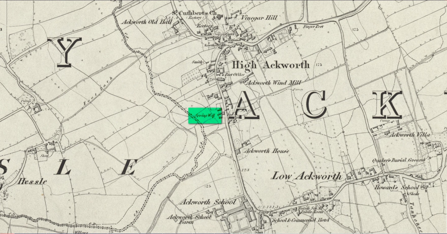
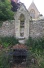
Somewhere close to the aptly-named Ladywell House (now a beauty salon) on the south-side of High Ackworth (just as you’re going into the village on your left) there was once a holy well, seemingly no longer with us. It was described in Saywell’s (1894) history of the town as one of the “antiquities” in the area. He told that,
Spring Well – Lady Well?
“This very ancient well is one of the several public wells, which has in recent years somehow become enclosed. From what it derived its name is not known, but from the fact of its being the oldest, it is not unlikely that it was originally set apart by some religious service, and dedicated to ‘Our Lady’ for the use of the inhabitants of the village. In pre-reformation times this custom was common, some wells having miraculous powers ascribed to their waters by the superstitious, like the well of St. Keyne, and in modern times, the ‘Holy Wells’ in Ireland; but nothing of the sort attaches to the well of ‘Our Lady’ at Ackworth.”
To the rear of the old cottages was once a ‘Spring Well’, as shown on the 1852 Ordnance Survey map. It’s possible that this was our Lady Well, dedicated in ancient times to St. Mary. Does anyone know? And is it still there?
References:
Saywell, Joseph L., The Parochial History of Ackworth, James Atkinson: Pontefract 1894.
Acknowledgements:Huge thanks for use of the Ordnance Survey map in this site profile, reproduced with the kind permission of the National Library of Scotland.
Holy Well (destroyed): OS Grid Reference – NN 9397 5770
Archaeology & History
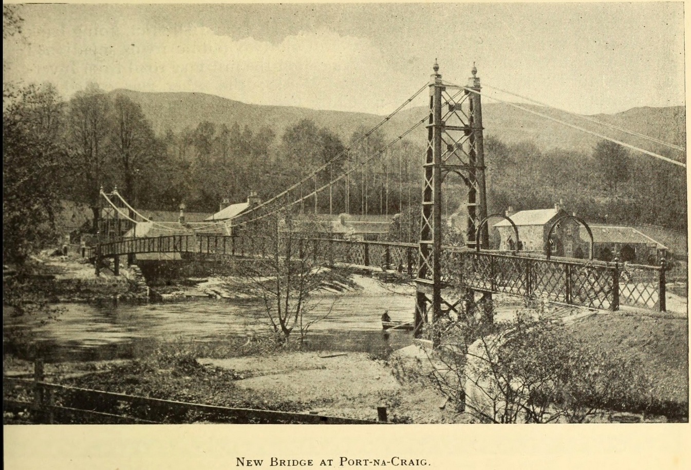
It was more than a hundred years ago that the waters of this sacred well fell back to Earth. They emerged above the eastern side of the River Tummel, close to the bridge where previous there had been a local ferry at the site known as Port-na-Craig. The mythic history of the ferry and the holy well went hand-in-hand, according to local tradition. Its lore was was spelled out by the local author and historian Hugh Mitchell in a speech he gave when a new bridge was opened here in 1913. He said:
The Well was on the far side of the bridge
“The ferry at Port-na-Craig, though not as old as many ferries in Scotland, bears the respectable antiquity of something like eight hundred years. It was established by the monks of Coupar Angus when they got a gift of the lands of Fonab, and as Coupar Angus lay on the north side of the river Tummel, they established the ferry in order to have communication. In those days the ferry boat was made of skins stretched on branches or twigs, so it was somewhat dangerous to cross in, and the monks thought that they would improve the occasion by dedicating the well near the old ferry to St. Bride, so that people, when they ventured across the ferry, might propitiate the saint. It was customary for people to drop either a small coin or a brass pin into the well. He was afraid that brass pins rather prevailed, and no doubt, St. Bride, being a lady, would find them more useful. The well remained until recent times, when it had, unfortunately, to be filled up, on account of being contaminated by neighbouring fields.”
For “fields”, read sewage—for that was the actual reason it was closed. Mr Mitchell (1923) told as much in his subsequent history of Pitlochry, saying that “sewage was percolating into it.” John Dixon (1925) echoed the same thing a few years later.
The curative and magickal properties of St Bride’s Well had considerable renown for local people. Mitchell told that:
“It had a great reputation at one time for cases of lung disease… Pins and coins were dropped into the well as votive offerings, and the bushes above it were hung with rags to call the attention of the saint to the sufferer.”
A few miles north from here, at the back of Blair Castle, an old church is dedicated to St. Bride, whose celebration date is February 1. “The day was known as Candlemas in the Highlands,” wrote Mrs Banks, saying, in commemoration of the Celtic Brigit, “Feill Bride, the festival of Bride, displaced the festival of Mary.”
References:
Dixon, John H., Pitlochry, Past and Present, L. Mackay: Pitlochry 1925.
MacKay, L., Atholl Illustrated, L. MacKay: Pitlochry 1912.
Mitchell, Hugh, Pitlochry District: Its Topography, Archaeology and History, L. Mackay: Pitlochry 1923.
Holy Well (destroyed): OS Grid Reference – SW 7202 5073
Archaeology & History
Not to be confused with another St. Agnes’ Well near the coast just 1½ miles southwest of here, this ‘holy well’ was found in the middle of the town itself. It was first described sometime between 1710 and 1720 by a certain Thomas Tonkin who penned lengthy notes about the history of the parish of St Agnes and, therein, mentioned this Well which was, he said, located “by the Cross before the Church.” But it had already been drained and “cut off”, as he put it, some years prior to him writing his notes.
More than two hundred years later, on 3 December 1931, the West Briton & Cornwall Advertiser reported on an excavation that took place of the nave of St Agnes church. The vicar, a Rev W.H. Browne, said that,
“On the west side there was evidence of water, which might have been a spring and possibly the holy well. We shall have to preserve it if it turns out to be what we anticipate it is. How this is to be done, I do not know, but we cannot allow it to be covered in again without doing something. It is creating tremendous interest, and will cause a great fight among the experts.”
Several years later, the great Cornish hagiographer Gilbert Dobie (1940) also mentioned the excavation, noting the wet area which they believed was the location of the well, also noting, “at the same time…the finding of remains of an earlier chapel.”
References:
Doble, Gilbert H., History of St Piran, 1940.
Tonkin, Thomas, “The Parish of St Agnes,” in Journal royal Institute Cornwall (eds. P.A.S. Pool & H.S Douch), volume 7 (2nd series), 1975.
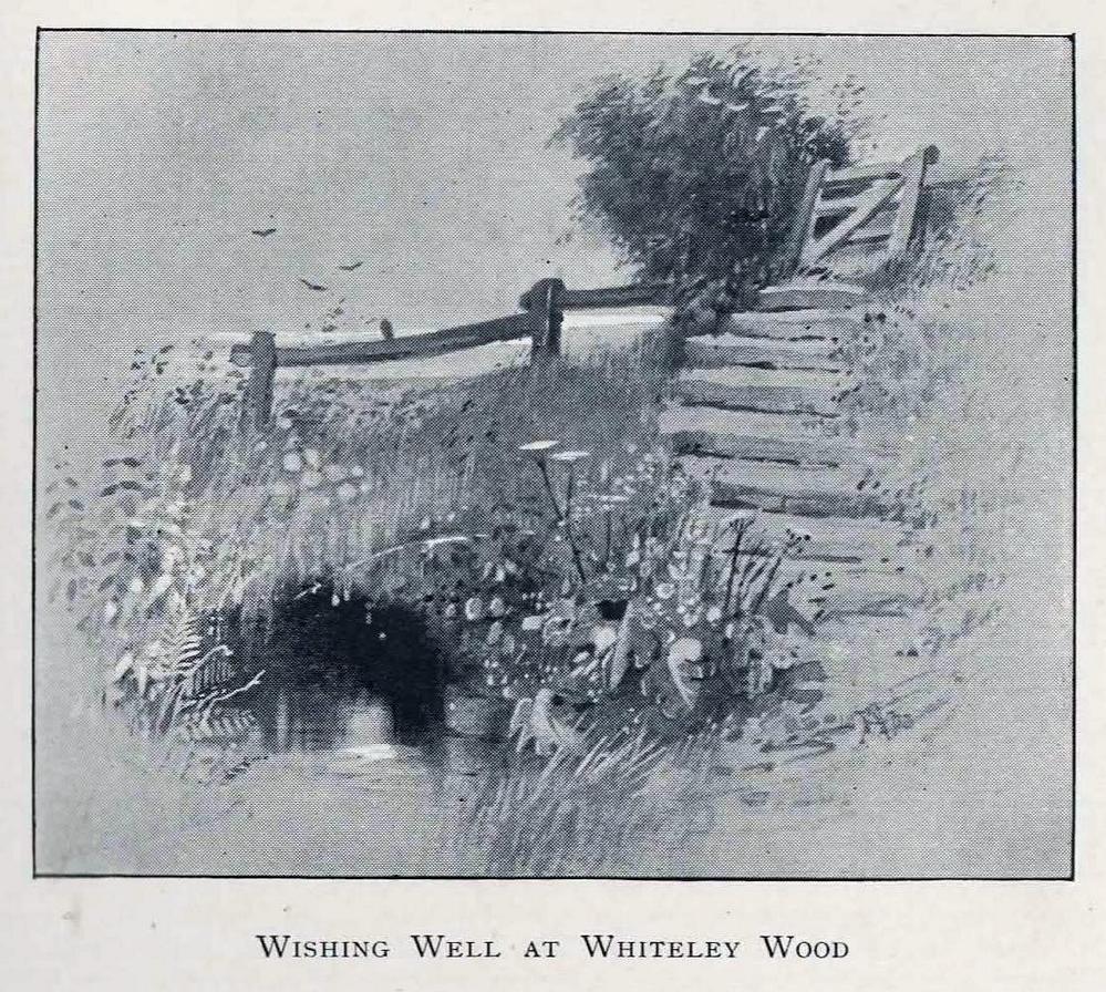
The location of this site has proved troublesome. Even when Rob Wilson (1991) did his local survey of holy wells he was unable to locate it—but it looks as if it shouldn’t be too troublesome to find, as the area in which it flowed is still very much a mix of open countryside and maintained landscapes. Described briefly as the “Wishing Well near Whiteley Wood” in Sidney Addy’s (1893) fine work, he makes a rather hopeful attempt to derive the word ‘wishing’ from German mythology, where “one of the names of the god Wuotan or Odin was Wunsch or Wish.” But – well – you just never know…..
In the landscape at Whiteley Wood there is a Priest’s Hill, so if this Well was found there, it may indeed have had an authentic ‘holy’ designation. But there were a couple of ponds in the area too, which may be fed by this spring. So, first, we need to find the well!
References:
Addy, Sidney Oldall, The Hall of Waltheof, William Townsend: Sheffield 1893.
Wilson, Rob, Holy Wells and Spas of South Yorkshire, Northern Arts: Sheffield 1991.
On the west-side of the River Spey from Fochabers, follow the road-signs taking you south on the B9015, and near Inchberry is a tiny road on your right (careful not to miss it). Go along here to the end of the long straight road and turn right, down the track. When you reach the trees, bear left along the track to St Mary’s, Orton, marked “Private road”. 🙂 Parking is limited to one car only but very quiet.
Archaeology & History
St Mary’s Well, Inchberry (21st Century Pict)
Set in a stunning location next to the river Spey with a magnificent view of Ben Aigan to the south, St Mary’s Holy Well and Pool is easy to find behind the Chapel / Mausoleum wall, dedicated to the Duff Family. There is a small stone basin in the wall which may have been the Chapel font. At the time of my visit the weather has been dry and sunny for some time. The pool below the iron grate has been recently cleared of leaves before my visit, with no standing water but the stones on the bottom of the pool looked damp. And with the cemetery above and behind the wall, perhaps it was for the better.
It was clear and running, said J.F.S. Gordon (1880) at the end of the 1700s, but when he came to write about it the flow “has ceased for many years, and is now only a feeble, filthy, stagnant Driblet for the use of cattle.” Pilgrimages were made here on the first Sunday in May, and water collected from the site was kept for a year, in return for an offering (usually a stone or other inanimate object) that enabled the magickal spirit of the well to enact cures.
Folklore
A site described by Watson (1868) as being “long held in superstitious reverence”, the well was said to cure whooping cough, eye problems and joint conditions. It had thoroughly un-christian shennanigans practised here by local folk, much to the consternation of the usual culprits! Visited extensively by people from far and wide, Mr & Mrs Morris (1981) told,
(21st Century Pict)
“The visits displeased the Kirk and there were various summonses to the Session for “going supersticiously to a Vell at Speyside” and of persons who “kneillit about the chappell and drank the water.” The minister at Ruthven reported that a large number had gone to the chapel well “thrie Saturdays before Lambas and thrie efter called the six silie Saturdayes, and that the conventions wer on the night or before day in the morning.” And “quhairas zierlie about Lambnes, the ignorantes repaired to ane wel at this kirk, called Our Ladie Wel, superstitiouslie, and kneeled about the said kirk, it is reportit that the evil is removed.” This may be the well associated with the White Witch, Dame Aliset, who cured a fairy child with simples and the well water.”
References:
Bord, Janet, Holy Wells in Britain – A Guide, HOAP: Wymeswold 2008.
Watson, J.& W., Morayshire Described, Russell & Watson: Elgin 1868.
Acknowledgements:Huge thanks for use of the Ordnance Survey map in this site profile, reproduced with the kind permission of the National Library of Scotland.
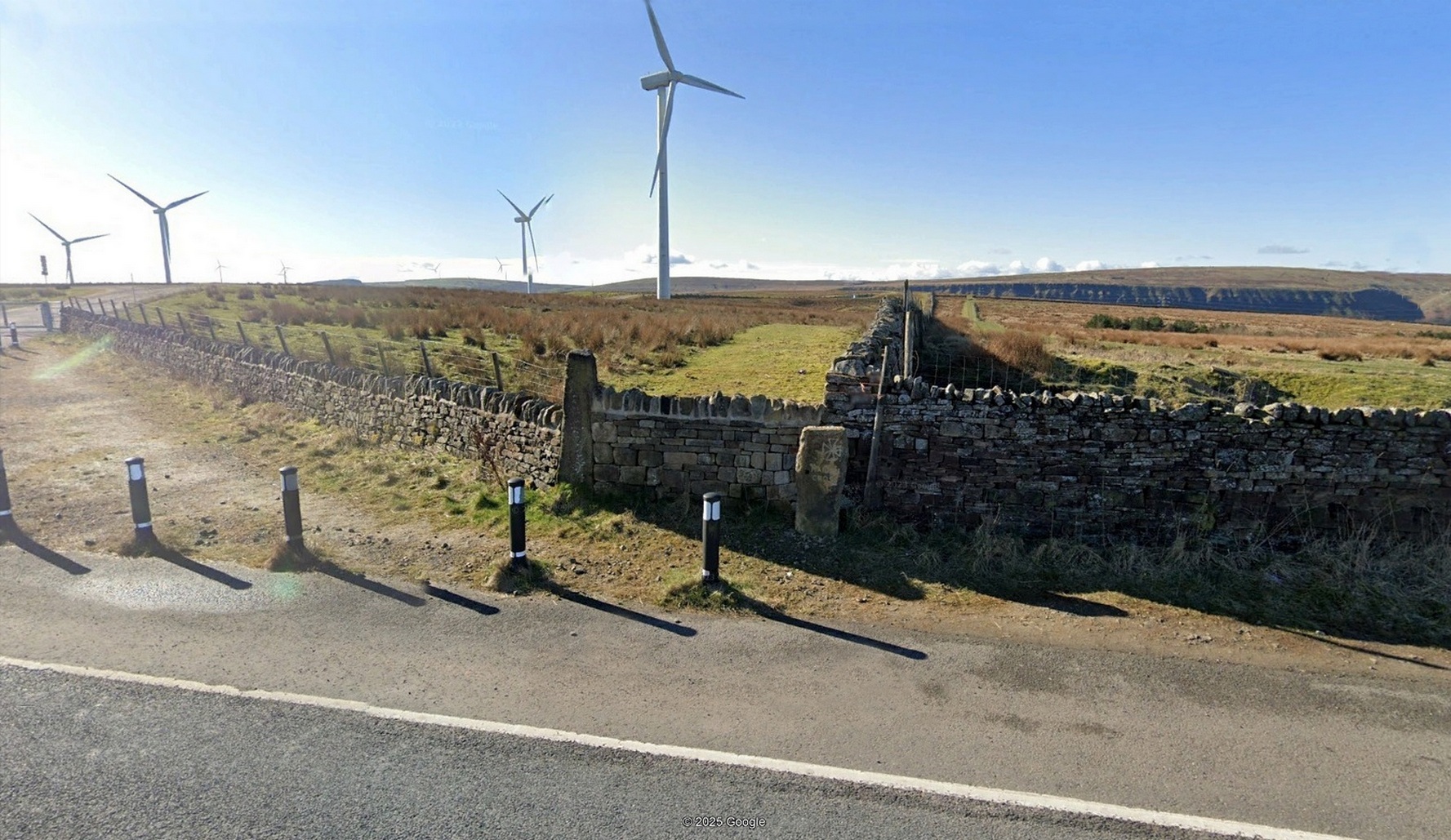
Cross (replaced): OS Grid Reference – SD 8936 2883
Archaeology & History
“Maiden Cross” stone
Highlighted on the 1848 Ordnance Survey map, the original stone ‘cross’ has apparently been moved from its location up against the walling 30-40 yards away and placed by the roadside, just as you’re going into where the windmills are, right at the very crown of the hill, across from the car-park. I’m not so sure it’s the original one to be honest—but I may be wrong. Clifford Byrne (1974) certainly thought this is the original stone. He may be wright. Byrne told that “the Marquis of Colne had a photograph of the stump of the cross in situ,” which would be good to compare. It’s nowt special to look at, but at least the site has been remembered, so to speak.
Site shown on 1848 map
The Maiden Cross was one in a series of wayside crosses along this ancient high road—known as the Long Causeway—not only marking it out when the snows covered it in the old Winters that we used to get, but also possessing religious importance to travellers. It was first moved sometime in the 19th century and “utilised as a gatepost into Maiden Cross colliery”—itself long gone.
Folklore
The name given to the ‘cross’ comes from a story that’s found at a number of other ‘maiden’ place-names. There may be an element of truth in it. It was told to the great historian and folklorist T.T. Wilkinson by his grandfather in 1766 and, according to him, his grandfather before that! J.A. Waddington (1884) subsequently wrote down the tale that Wilkinson told him:
“During the time of the great rebellion, this was the trysting-place of a young shepherd with his lady love. Often did they meet to pledge their simple vows at this lonely place, until one day a messenger came from Towneley to collect as many young men as he could get to swell the ranks of Rupert when he passed through this part to join the Royal forces at York, a march which ended with the disastrous fight at Marston Moor, on whose bloody sod lay stretched the chivalrous Towneley, and a many of his followers, including this young man, the victims of a tyrannical and ambitious king. For many a long year after this tragical event the poor demented maiden would repair to this hallowed spot, repeating with a sorrowful voice his promise to return.”
This was curiously described by Ormerod (1906) as “a pathetic tradition”! He much preferred the simple idea of this (and the other crosses along the road) as merely serving “the capacity of guideposts to the traveller (overtaken in a mist or by the swiftly lowering shades of light) who might be traversing these lonely roads”, as Waddington put it. Ormerod cited a conversation he had with “an old road mender” which for him confirmed the idea:
“Asked if he had heard what was the object of these crosses, he said, that “Joonas Lee said as they were put up 250 yer sin, for guideposts for’t pack horses, between Halifax and Brunshaw” (Burnley), adding, as if to give more weight to the authority he had quoted: “An he wur a far larned chap wur Joonas—he wur a preycher.”’
Walter Bennett (1941) meanwhile, thought its name derived from the Virgin Mary and this cross, at least, possessed religious importance.
References:
Bennett, W., The History of Burnley – volume 1, Burnley County Council 1946.
Byrne, Clifford, A Survey of the Ancient Wayside Crosses in North-East Lancashire, privately printed 1974.
Holden, Joshua, A History of Todmorden, Manchester University Press 1912.
Waddington, J. Arthur, ‘The Crosses in and Around Burnley’, in Transactions Burnley Literary & Scientific Club, volume 1, 1884.
Acknowledgements:Huge thanks for use of the Ordnance Survey map in this site profile, reproduced with the kind permission of the National Library of Scotland.
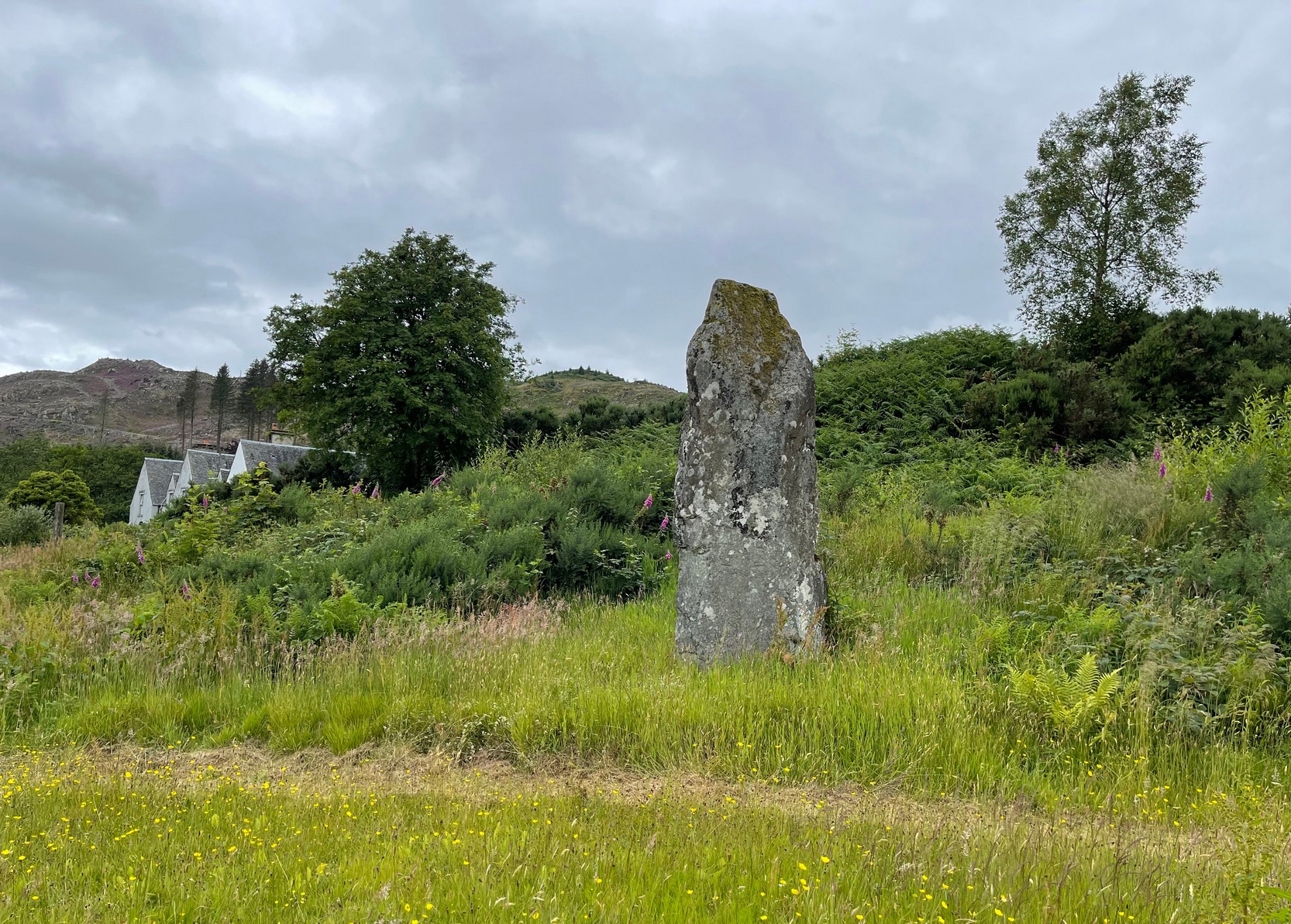
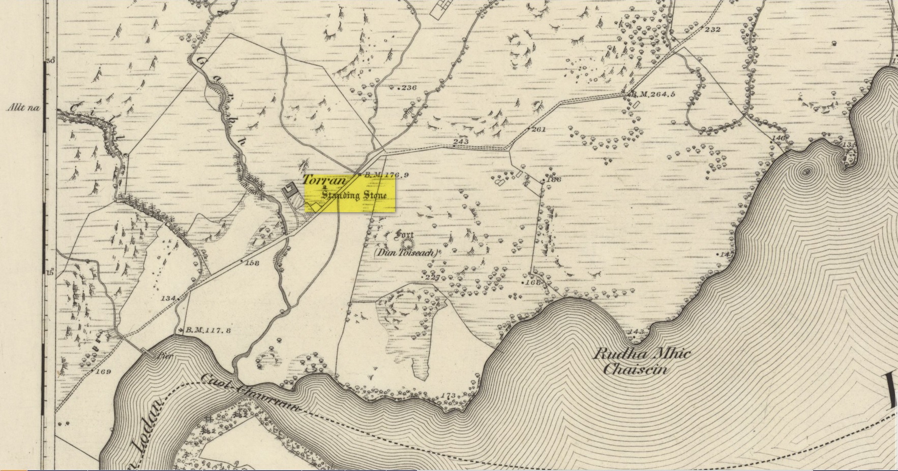
On the A816 road, a mile-and-a-bit north of Kilmartin, take the small road (east) to Ford—passing the Creagantairbh stone on your right, then a bit further on the Auchinellan stone on your left. Go through Ford village, making sure to stick to the road that goes along the north side of Loch Awe — as if you’re heading to Dalavich. Just fractionally over a mile out of Ford village, just where the road begins to swerve into a large bend, there’s a small left-turn that takes you to some houses. Just 60-70 yards along this little road, take the trivial little path on your right that takes you straight to a piece of manicured scrubland. If you walk into it, and bear left, you’ll see what you’re looking for. It’s unmissable!
Archaeology & History
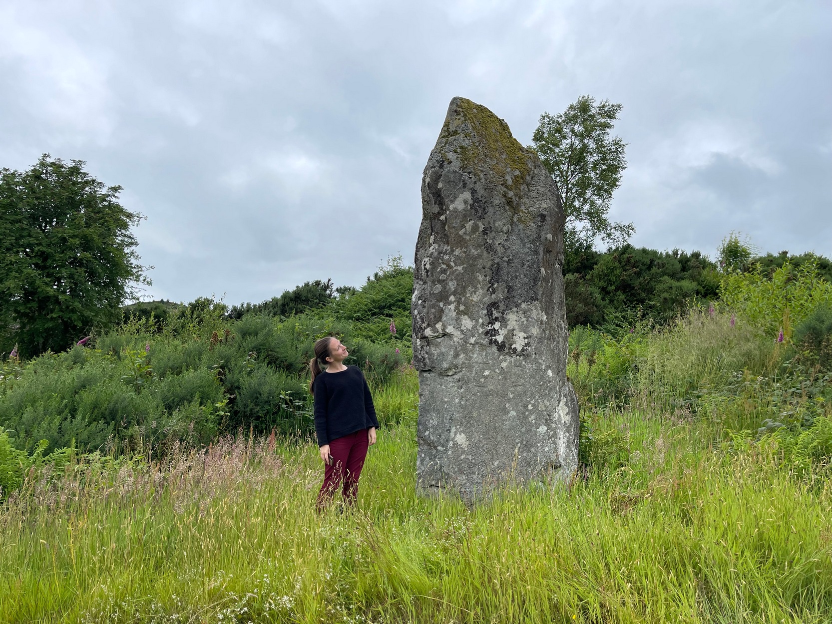
When I first visited here in the 1990s, a farm building stood by this huge standing stone and there were no other houses nearby. How things change—but thankfully our old sentinel stone is still living here.
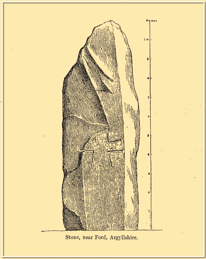
Site shown on 1875 mapRomilly Allen’s 1880 sketch
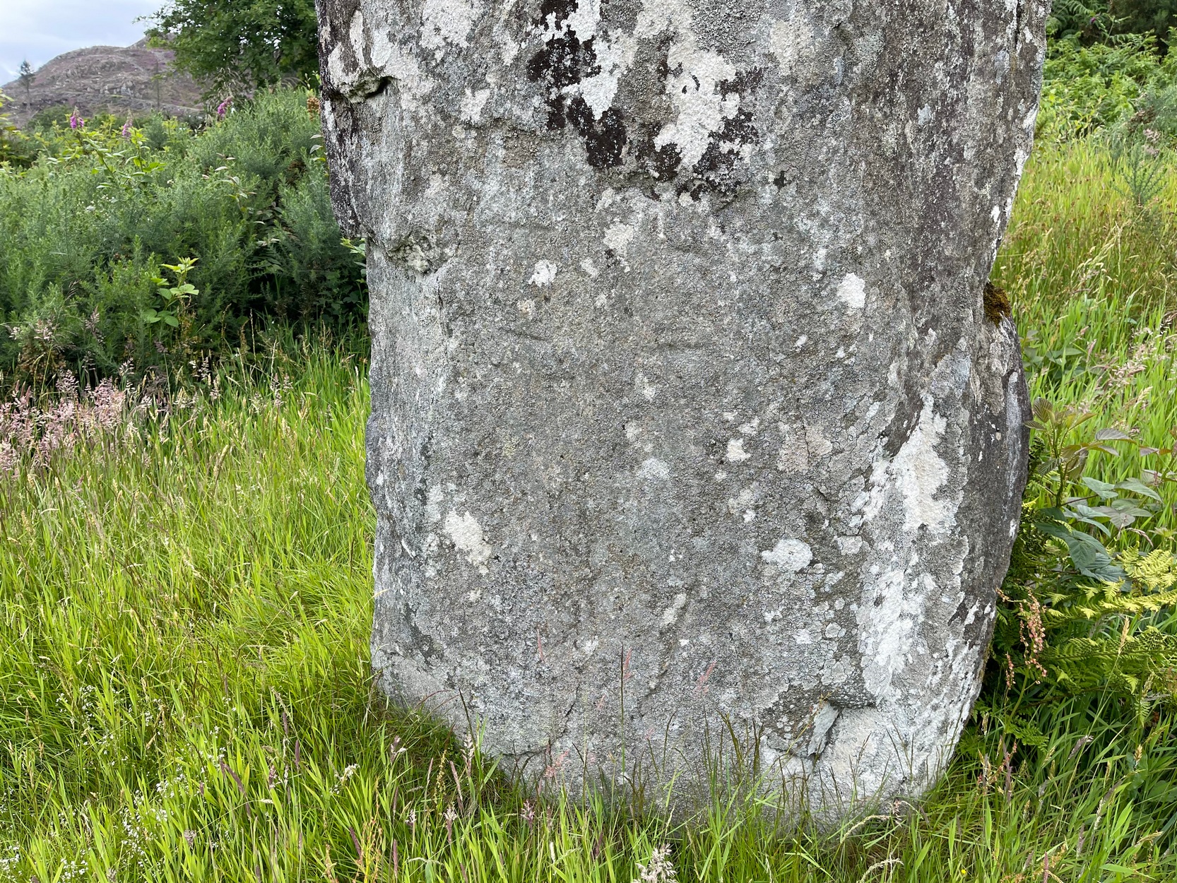
It was highlighted by the Ordnance Survey lads on their early map of the area, and visited a few years later by the great petroglyphic pioneer J. Romilly Allen. (1880) Standing eleven feet tall and more than four feet across at the base, Allen noticed that, about four feet above ground-level, someone had carved an old cross onto the northeast face of the stone (you can just make it out in the attached photos). It had obviously been carved many centuries ago, by a wandering christian no doubt—although it was incomplete and never finished. Perhaps the person who carved it was chased away by local folk, who would have obviously and rightly seen such an act as outright vandalism. The cross was deemed by Ian Fisher (2001) and the Royal Commission (1992) to be medieval in nature. Apparently there’s another, much fainter cross that was first mentioned by Marion Campbell etched on the other side of the stone, but in all the times I came here I was never able to make it out.
Old faint cross carvingSmall person, big stone!
But even further back in time someone had carved a cup-marking on the stone—and the cross was etched onto the same spot, enclosing the cup-mark. When I lived nearby, I made a sketch (long since lost) of what seemed to be two other faint cup-marks at one end of the extended arms of the cross, but on our recent visit here these were very hard to make out. When Ron Morris (1981) mentioned the stone in his survey, he mentioned its proximity to other cup-and-ring carvings immediately to the southeast and a hillock thereby, wondering whether there was “an astronomical complex” going on here. I doubt it—but I like the idea!
But it’s the size of the stone that’s most impressive here and keeps up with the tradition of similar megaliths in and around the Kilmartin area. Check the place out when you’re hunting the other stones nearby. You won’t be disappointed!
Folklore
Local tradition ascribed this great stone as marking the grave of an ancient warrior. The full folk tale seems to have been lost.
Fisher, Ian, Early Medieval Sculpture in the West Highlands and Islands, RCAHMS: Edinburgh 2001.
Morris, Ronald W.B., The Prehistoric Rock Art of Southern Scotland, BAR: Oxford 1981.
Royal Commission on the Ancient & Historical Monuments of Scotland, Argyll – Volume 6: Mid-Argyll and Cowal, HMSO: Edinburgh 1988.
Royal Commission on the Ancient & Historical Monuments of Scotland, Argyll – Volume 7: Mid-Argyll and Cowal: Medieval and Later Monuments, HMSO: Edinburgh 1992.
Ruggles, Clive, Megalithic Astronomy, BAR: Oxford 1984.
Swarbrick, Olaf, A Gazetteer of Prehistoric Standing Stones in Great Britain, BAR: Oxford 2012.
Acknowledgements:Huge thanks for use of the Ordnance Survey map in this site profile, reproduced with the kind permission of the National Library of Scotland.
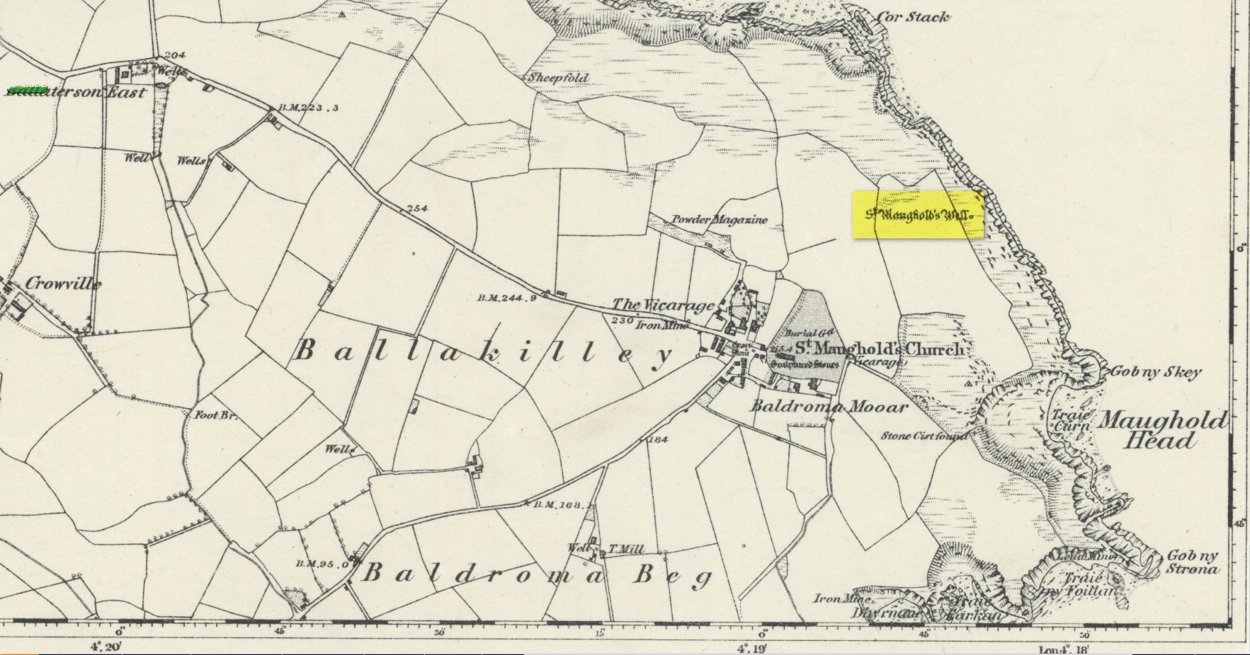
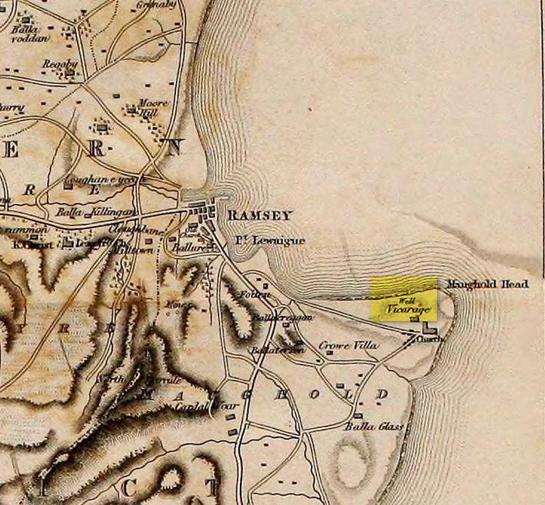
St. Maughold’s Well—also called Chibbyr Vaghal—is found on the northeast side of the headland on the cliff face about a hundred feet above the sea, a quarter mile from the St. Maughold’s church. It was a pilgrimage site which people visited on the dates of November 15 and July 31.
“…Beneath the head, under some moss clad rocks, is a deep spring, formerly much celebrated for its supposed medicinal virtues.” – George Jefferson, 1840
St Maughold’s on 1870 map‘Well’ on the 1836 map
Its medicinal properties are of great repute and was resorted to by many on account of its sanctity by crowds of pilgrims. The well was traditionally visited on the first Sunday in August, being the first Sunday after the Saint ‘s principal feast day, July 31 (significant in the Celtic calendar), but the devotions here have their origins in pre-christian times. The principal benefit at the well was a cure for sore eyes. After bathing the eyes or drinking the water it was/is customary to drop a coin, pin or button into it. Alternatively, a piece of cloth which had been used for bathing the eyes would be left by the well or on a nearby bush. As the cloth rotted, the ailment would be cured; while anyone who picked up the rags would himself receive the complaint associated with the offering; and to receive the full benefit of the well’s curative powers it should be visited on that first Sunday in August, and “while books were open in the church” — or in pre-reformation days, whilst Mass was being offered.
“…Where the spring gushes forth the rock has been hollowed into a small basin, and over it has been erected a simple shed of rough unhewn blocks of the rock immediately at hand. Hither the Saint is said to have resorted; nor is it altogether improbable that nearly fourteen hundred years ago at this very font he administered the baptismal rite. Certainly it was for many ages in great repute for its medicinal properties, and was resorted to on account of its sanctity by crowds of pilgrims from all parts. Nor is it yet forgotten.” – J.G. Cumming, 1848
“…A drink of its water, taken after resting in the saint’s chair close by, is supposed to be an unfailing cure for barrenness in women.” – A.W. Moore, 1890
Folklore
At Maughold churchyard above the well, ghostly whispers are said to be heard by the steps in the churchyard. This is interesting as when excavations were done here, the labourers found bones buried beneath the same steps. They were dug and exposed during the day and one worker who stayed in the church heard distant sounds, whispers and murmuring all around the church. When the bones were reinterred, the haunting stopped. (Bord & Bord 1985)
References:
Bord, Janet & Colin, Sacred Waters: Holy Wells and Water Lore in Britain and Ireland, Granada: London 1985.
Cumming, J.G., The Isle of Man: Its History, Physical and Ecclesiastical, J. van Voorst: London 1848.
Hall, John, “Earth Mysteries of the Isle of Man,” in Earth, no.17, 1990.
Moore, A.W., The Surnames and Place-Names of the Isle of Man, Elliot Stock: London 1890.
Jefferson, George, Jefferson’s Isle of Man, G. Jefferson: Douglas 1840.
Radcliffe, William & Constance, A History of Kirk Maughold, Manx Museum: Douglas 1979.
Acknowledgements:Huge thanks for use of the Ordnance Survey map in this site profile, reproduced with the kind permission of the National Library of Scotland.
If you’re coming up to Oxenhope from Keighley, up the A6033 road, when you reach the school on the right-hand side of the road, a one-way street (Cross Lane) is where you need to walk down, for 200 yards, and keep your eyes peeled in the walling just before Cross Farm Court. Alternatively, via Haworth, go along Marsh Lane for a few hundred yards until your reach Moorhouse Lane on your left. Go down here for ⅓-mile (0.5km) and then go up Cross Lane on your right. About 120 yards up, in the walling just past the entrance into Cross Farm Court is where you’ll find it.
Archaeology & History
Very little seems to be known about the remains of this cross, embedded into the old walling. When it was described by Brigg & Villy (1914), they could find no information about it, and surmised that it marked the original track or road to Oxenhope from both Haworth and Halifax, “on the line of the old road by Withens.” Ostensibly it would seem to have been a wayside cross, marking old trackways (ley hunters take note!).
Visitors looking at it today can see that it’s barely noticeable. It looked no different even in Brigg & Villy’s days. It simply consists of only part of the original head of the cross, “the shaft having been broken off flush with the horizontal limb.” Some of the other stones that make up the bottom of this very poor-looking excuse of a cross were probably not part of the original, but were assembled into the wall to at least leave of memory of what it used to look like. It’s in a sorry state to be honest. A historic plaque should be placed here.
References:
Brigg, J.J. & Villy, F., “Three Ancient Crosses near Keighley,” in Bradford Antiquary, New Series 6, 1921.
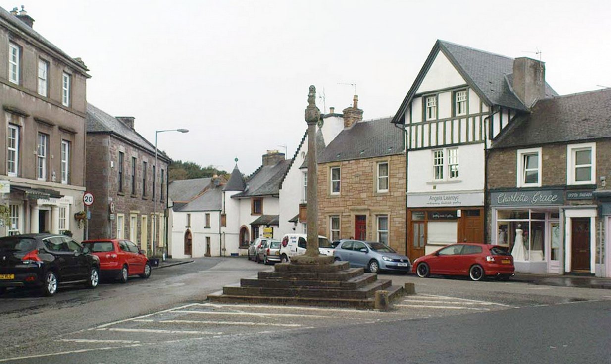
Easy to find: get into the middle of the village where the shops are in the main street and where another road veers off, the cross sits there in the middle in the traffic island. The photo here shows its location clearly.
Archaeology & History
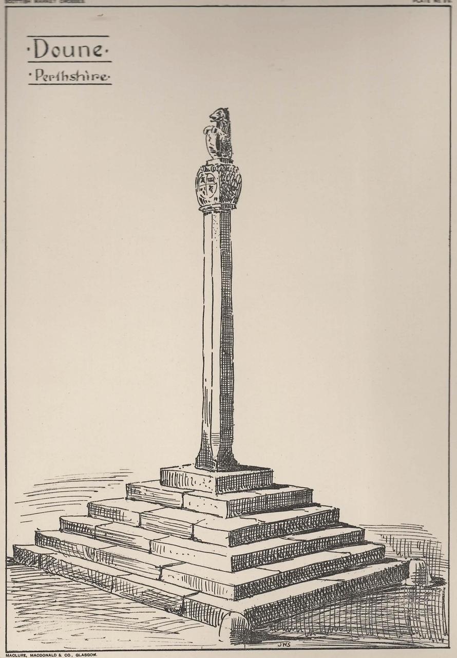
Doune’s Mercat Cross
Found at the meeting of the roads in the centre of this old lovely village, the Mercat Cross in its present state was, according to Act of Parliament, erected a few years prior to 1696. Set on a square base of six steps in traditional pyramidal fashion, near the top of the 12-foot tall shaft are carvings on the sides of the stone. On the east-face was carved the Moray arms, and on the west face were carved sundials. John Small (1900) told how the top of the cross is crowned by the figure of a lion, “holding in its paws a circular shield or escutcheon, surrounded by a ribbon enclosing he Moray crest, and bearing the motto, ‘Salus per Christum.’
John Small’s 1900 sketch
It has been damaged a few times over the years. Sometime around 1800, Moray Mackay (1953) told that “the lion fell of and was damaged”, but was repaired shortly afterwards by a local man. He also told, with considerable indignation, how the local authorities were responsible for damaging what used to be “four short pillars which stood at the corners of the base,” when they were “smashed off and removed , impairing the balance of the whole (cross) for the sake of six inches more traffic room”! There are two such short pillars at the edges, but these aren’t the original stones. There used to be a water pump in front of the cross, but this was removed many years ago.