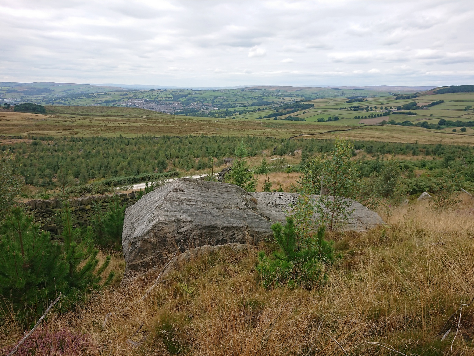
Numerous ways to get here, it’s probably the easiest (direction wise) to reach here starting from Dick Hudson’s public house on the southern road surrounding Rombalds Moor. From the pub, head left (east) along Otley Road (passing Weecher reservoir) for 1.9 miles (3.1km) until you reach Reva reservoir where a track leads you to the waters. A small parking spot is on the left-side of the road. From here, go through the gate and up the footpath (north) for about 200 yards then turn right and go up the field towards the wall where, about 20 yards before it, you’ll see find the stone in question.
Archaeology & History
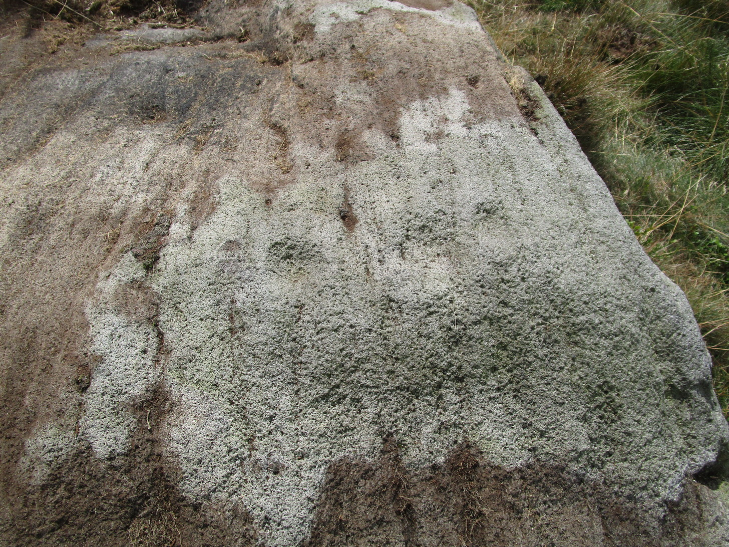
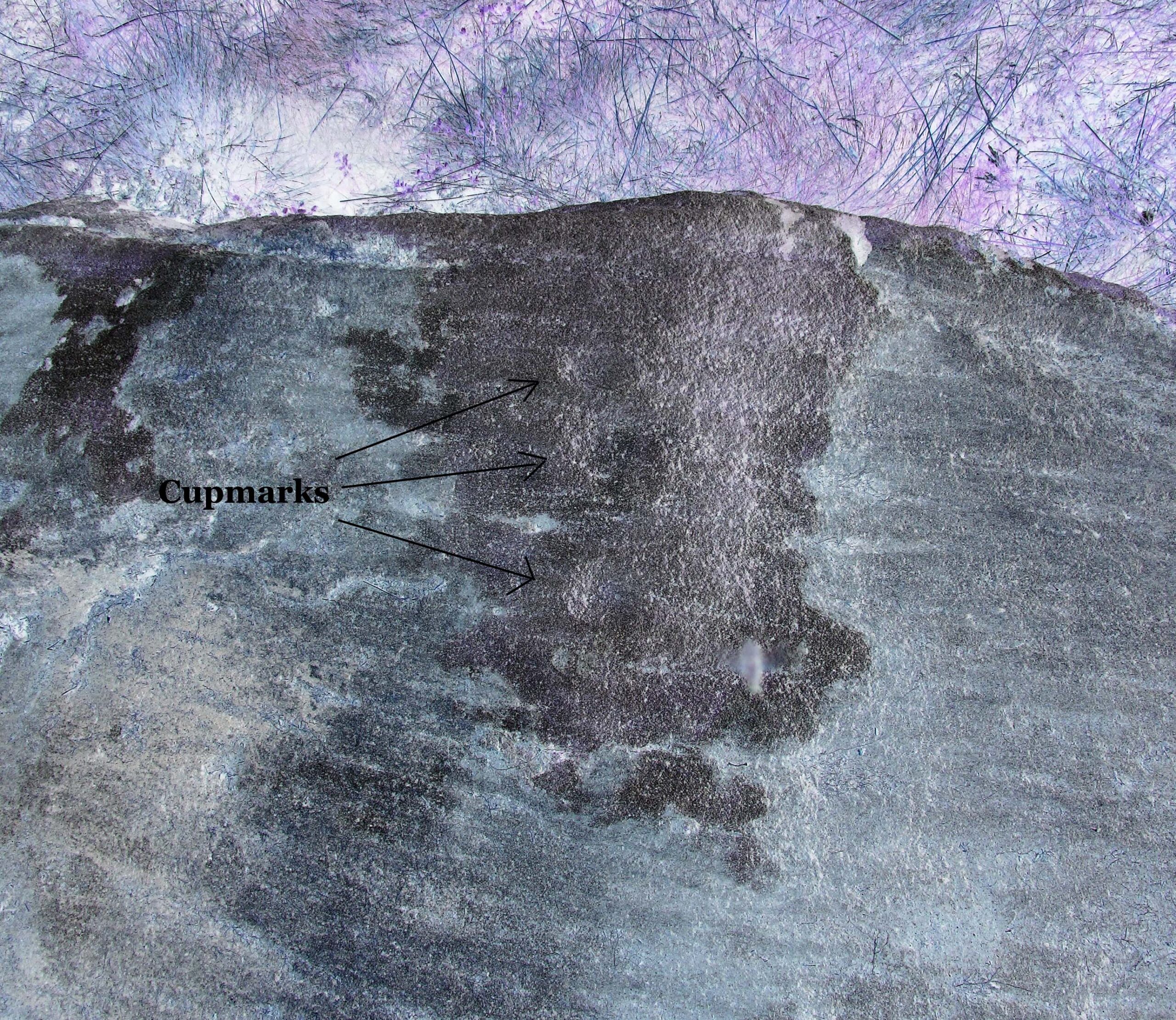
This long earthfast stone has two distinct cup-markings: one near its northern upper end, and the other near the lower southern end, as highlighted on the above photo. (forgive the poor image, but we took it when the sun was pretty high in the sky) It seems as if there are two or three other very faint cup-marks on the upper end of the stone, close to the most distinct one, but none of our photos show them with any clarity.
Acknowledgements: Huge thanks to Sarah Walker and Thomas Cleland for help with location and imagery for this stone.
Cup-and-Ring Stone (lost): OS Grid Reference – SE 0965 4797
Archaeology & History
In Ronald Morris’ (1989) gazetteer of British petroglyphs, he included this curious entry but gave no real details regarding its appearance or history. Listed by the Royal Commission lads, it would seem to have been located immediately south of the dismantled railway where it used to cross the Addingham-Ilkley road, but no one seems to have seen it either before or since Morris’ description. Any help regarding its whereabouts would be appreciated.
References:
Boughey, Keith & Vickerman, E.A., Prehistoric Rock Art of the West Riding, WYAS: Wakefield 2003.
Morris, Ronald W.B., “The Prehistoric Rock Art of Great Britain: A Survey of All Sites Bearing Motifs more Complex than Simple Cup-marks,” in Proceedings of the Prehistoric Society, volume 55, 1989.
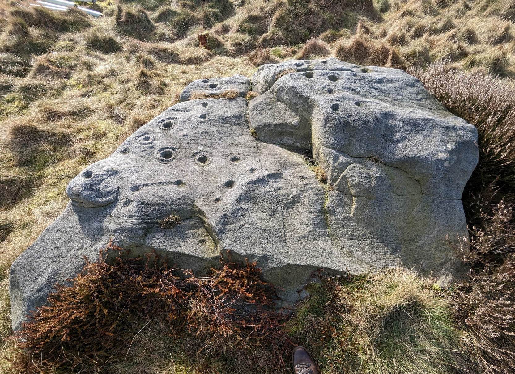
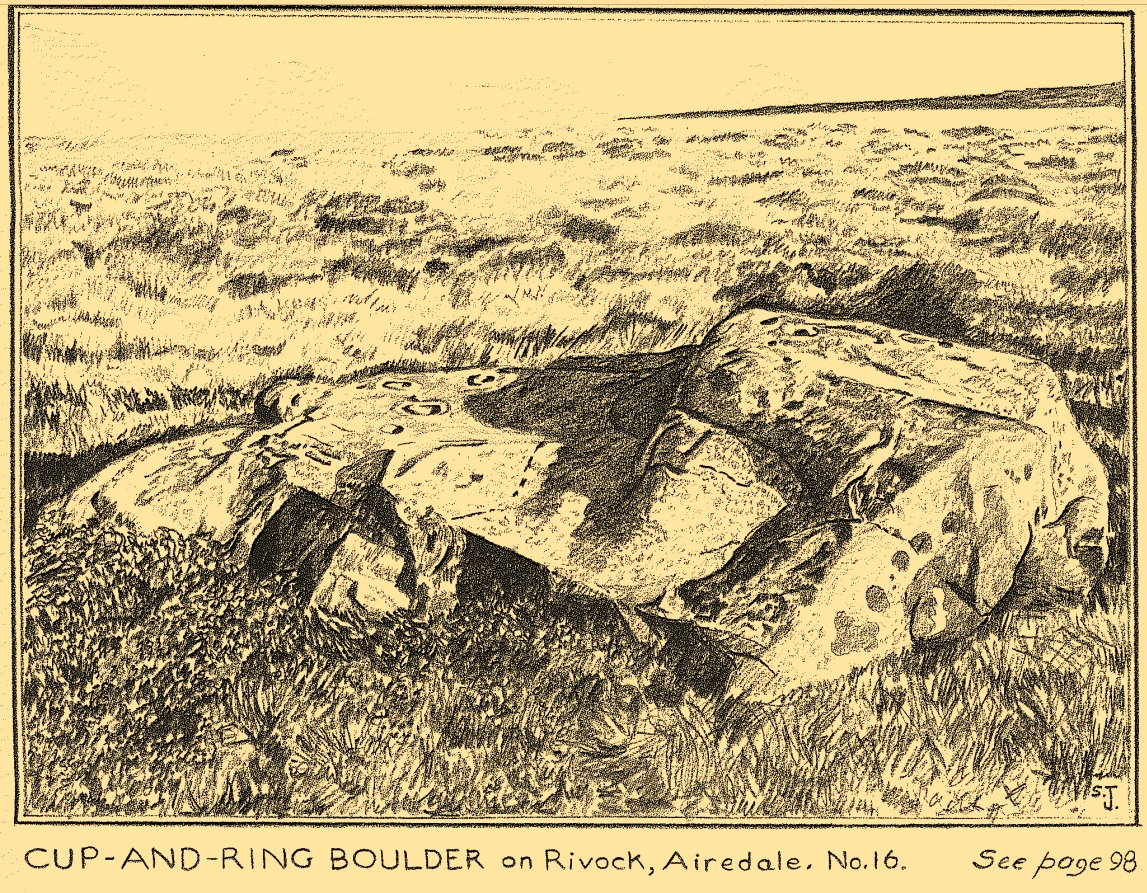
The best/easiest way to approach this and the Rivock carvings as a whole is to reach the Silsden Road that curves round the southern edge of Rombalds Moor (whether it’s via East Morton, Riddlesden, Keighley or Silsden) and keep your eyes peeled for the singular large windmill. About 200 yards east of this is a small parking spot, big enough for a half-dozen vehicles. From here walk 450 yards east along the road till you hit the dirt-track/footpath up towards the moor. Follow the track up for about 400 yards and you’ll see the crags a half-mile ahead of you. Get up there to the Wondjina Stone and follow the walling east for about 175 yards where you’ll see a track-cum-clearing in the woods. Walk along and the first large stone on your left is what you’re after.
Archaeology & History
I first visited this carving in my teenage years in the 1970s, before the intrusive so-called “private” forest covered this landscape and when its petroglyphic compatriots were easier to find. Thankfully this one’s still pretty accessible and possesses a damn good clear design. It was rediscovered in the 1960s by Stuart Feather and his gang, zigzagging their way across the open moors, pulling back the heather to see what they might find. His description of it told how the stone,
“has two roughly level areas, one 18ins and the other 2 feet above ground level. Both (levels) have several well-preserved cup-and-ring markings on them. There are eight single cup-and-rings and 18 cups, two of the latter being joined by a clear channel seven inches long and 1½ inches wide. Nearly all the markings are unusually well preserved and the pocking marks are very clear.”
Note the line running down
He also had “the impression that all the markings on this stone and possibly one other similar stone in the Rivock area have been carved by the same hand, as all the symbols are nearly identical in in type, size and execution.” (this other carving he’s referring to seems to be one about 170 yards to the north, where occasionally “offerings” have been found)
The design from E-W
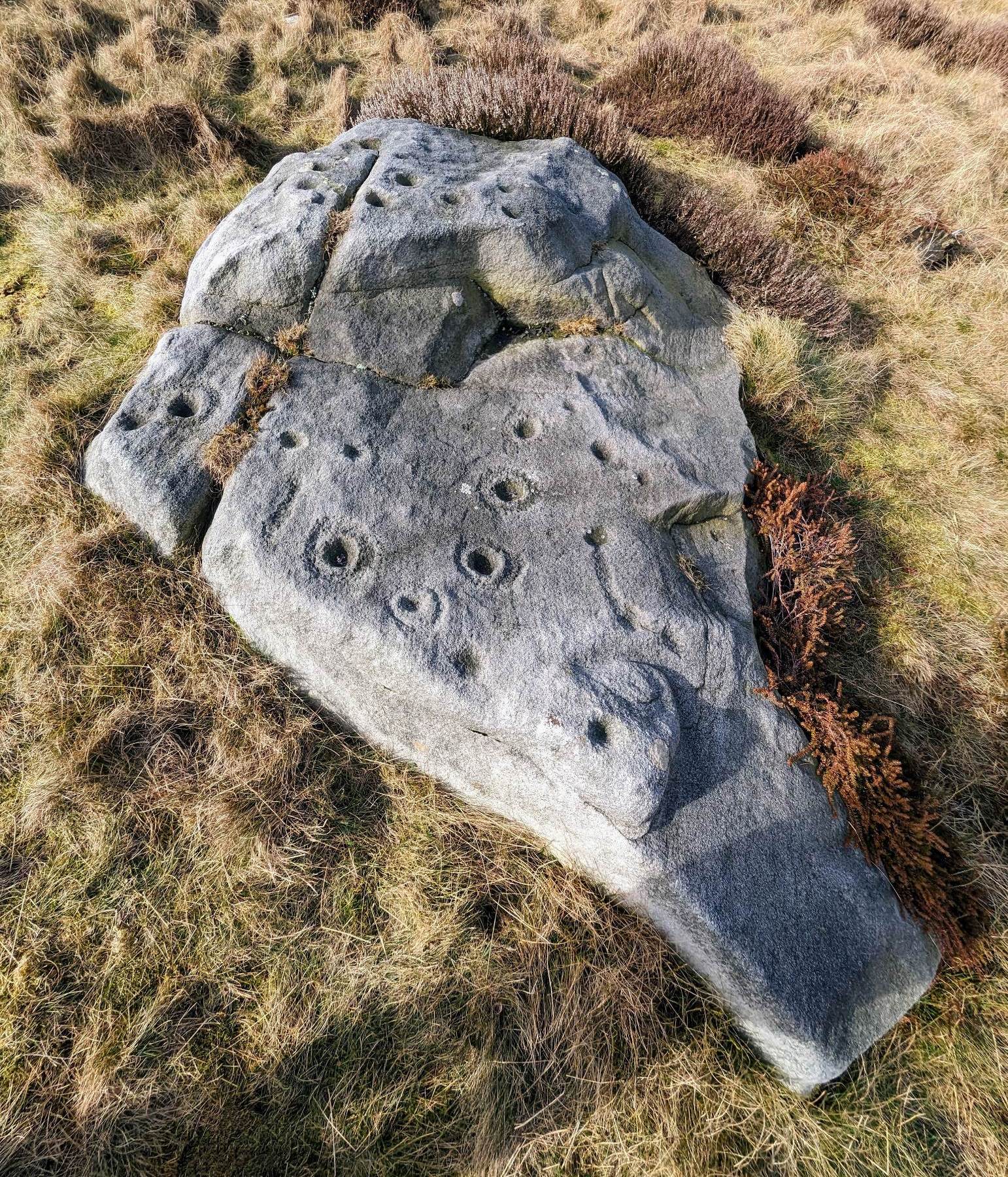
When John Hedges (1986) and his team checked the stone out he could only make out “seven cups with single rings, twenty two other cups”; whilst the ever descriptive Boughey & Vickerman (2003) saw “twenty-nine cups, eight with single rings.” Eight cup-and-rings is what most people see when the light’s right. There’s also a long, bent carved line on the lower level of the rock, running from near the middle of the stone out to the very edge. It seems to be man-made (although I may be wrong) – and I draw attention to it as this same feature exists on at least three of the other large and very ornamental cup-and-rings hereby within 300 yards of each other – and on these other carvings the long “line” is definitely artificial. Tis an intriguing characteristic…
Stuart Feather’s old sketch
When visiting this petroglyph you’ll notice how some of the carved elements on top of the stone are more eroded than those on the lower section. This is due to the fact that the lower section was only revealed by Feather and his team in the mid-20th century, after it had been covered in soil for countless centuries. As a result you can still see the peck-marks left by the implements that were used to make the carving, perhaps 5000 years ago!
The name of the stone was inspired by a local lady who saw an astronomical function in the design (I quite like it as well). Examples of petroglyphs representing myths of heavenly bodies have been described first-hand in some tribal cultures and, nowadays, even a number of archaeologists are making allusions about potential celestial features in some carvings in the British Isles. That doesn’t mean to say that it’s correct, but the idea’s far from unreasonable…
Anyhow – check this one out when you’re next up here. You’ll like it!
References:
Bennett, Paul, “The Prehistoric Rock Art and Megalithic Remains of Rivock & District (parts 1 & 2),” in Earth, 3-4, 1986.
Boughey, Keith & Vickerman, E.A., Prehistoric Rock Art of the West Riding, WYAS 2003.
Deacon, Vivien, The Rock Art Landscapes of Rombalds Moor, West Yorkshire, ArchaeoPress: Oxford 2020.
Feather, Stuart, “Mid-Wharfedale Cup-and-Ring Markings – no.16 – Rivock,” in Cartwright Hall Archaeology Group Bulletin, volume 8, no.10, 1963.
Hedges, John (ed.), The Carved Rocks on Rombalds Moor, WYMCC: Wakefield 1986.
Morris, Ronald W.B., “The Prehistoric Rock Art of Great Britain: A Survey of All Sites Bearing Motifs more Complex than Simple Cup-marks,” in Proceedings of the Prehistoric Society, volume 55, 1989.
Acknowledgments: Huge thanks to Collette Walsh for use of her photos.
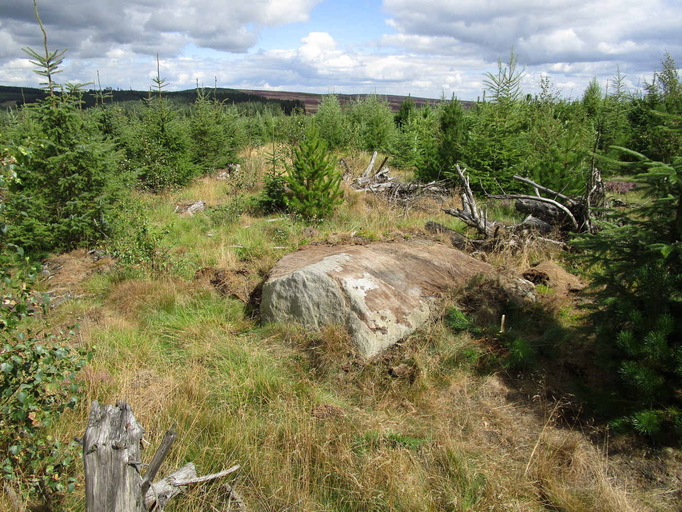
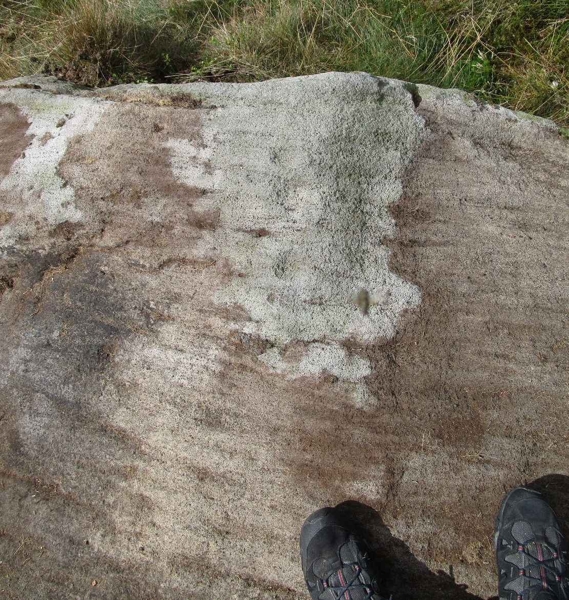
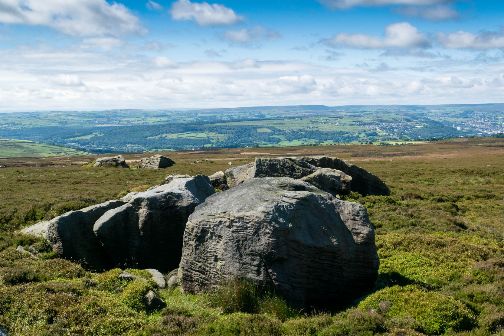
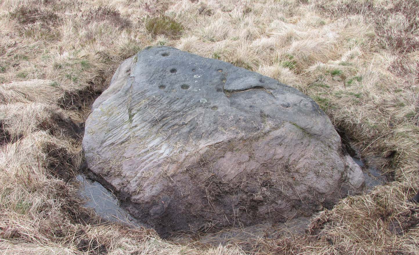
If you’re coming via the Keighley-Bingley (Airedale) road, go up to Riddlesden and then up the winding Banks Lane until it meets the edge of the moors. At the T-junction, turn left and about 330 yards along on your right there’s a dirt-track. Walk up here, sticking to the track (not the footpath) towards the cliffs of Rivock ahead of you, going through the gate and into the Rivock woods area. About 450 yards on from the gate on your right-hand side you’ll see the long straight length of walling that runs uphill—and about 60 yards up here, on the left-hand side of the wall you’ll see a very large boulder. Y’ can’t really miss it!
Archaeology & History
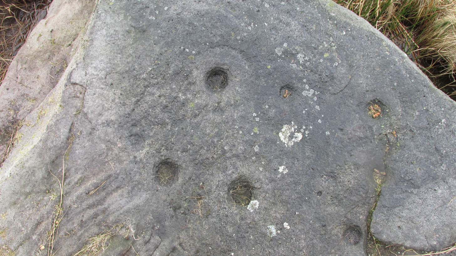
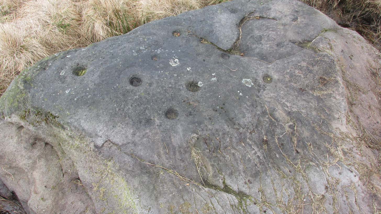
2 of the several cups here
This large natural block, embedded into the hillside about 80 yards below the Wondjina Stone and its companions, is nothing much in the petroglyphic visual scale of things, but is worth checking out for a break if you’re checking out the other good designs in the Rivock cluster. Upon its sloping flat two-tiered surface there are just a small number of randomly spaced cup-marks of varying sizes: six at least, but perhaps as many as nine altogether. In times gone by (many years ago) we thought one of them might have had a very faint ring around it, but on my last couple of visits here I couldn’t see anything.
References:
Boughey, Keith & Vickerman, E.A., Prehistoric Rock Art of the West Riding, WYAS: Wakefield 2003.
Hedges, John (ed.), The Carved Rocks on Rombalds Moor, WYMCC: Wakefield 1986.
Cup-Marked Stone: OS Grid Reference – SE 0745 4470
Getting Here
Rivock Top stone
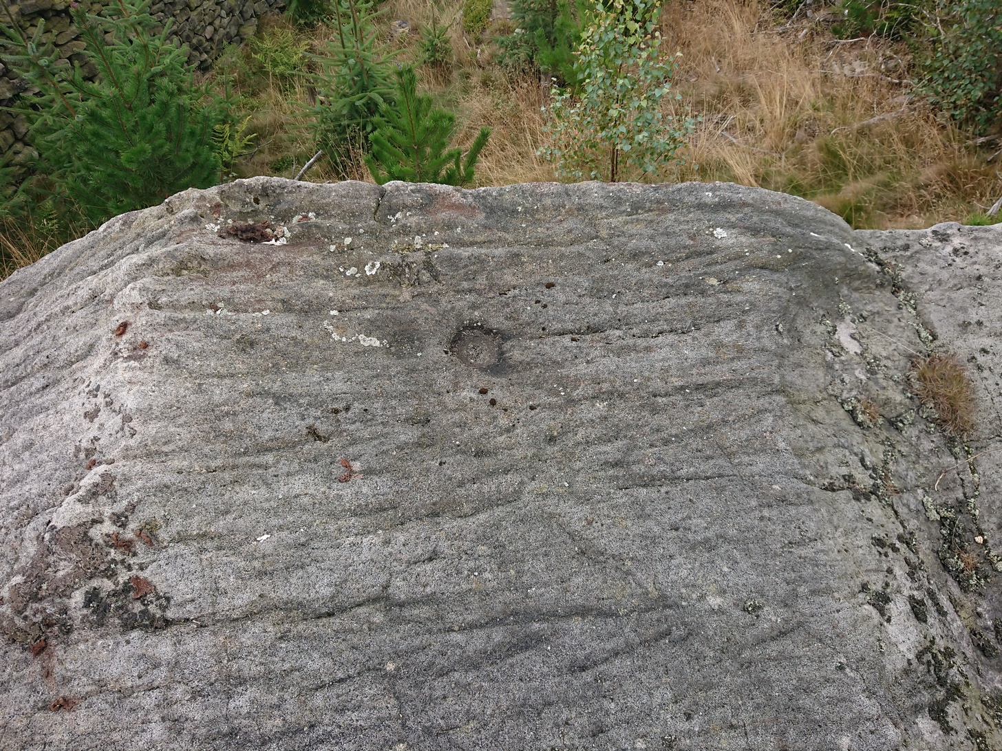
Best approached via the Wondjina Stone, then over the wall and follow the geological ridge that bends into the trees. It’s difficult to find amidst the dense forest and is another one of those carvings that’s probably only for the purists amongst you.
Archaeology & History
If you’re doing the Rivock rock art tour, you might as well give this a go once you’ve checked ou the decent ones nearby. Here, on a rather large stone we find, on its uppermost ridge, three faint cup-marks next to each other in a very slight curve. The cup-mark in the middle is slightly larger than its two compatriots and might be natural. If you were to wet the rock when the sunlight is just right, you’ll probably get a better idea of its real appearance—otherwise we’ll have to let the computer-gadget lads suss it out!
Make your way to the Black Beck tomb and walk west for some 50 yards. If the heather has grown any more than a foot tall, it’s impossible to see.
Archaeology & History
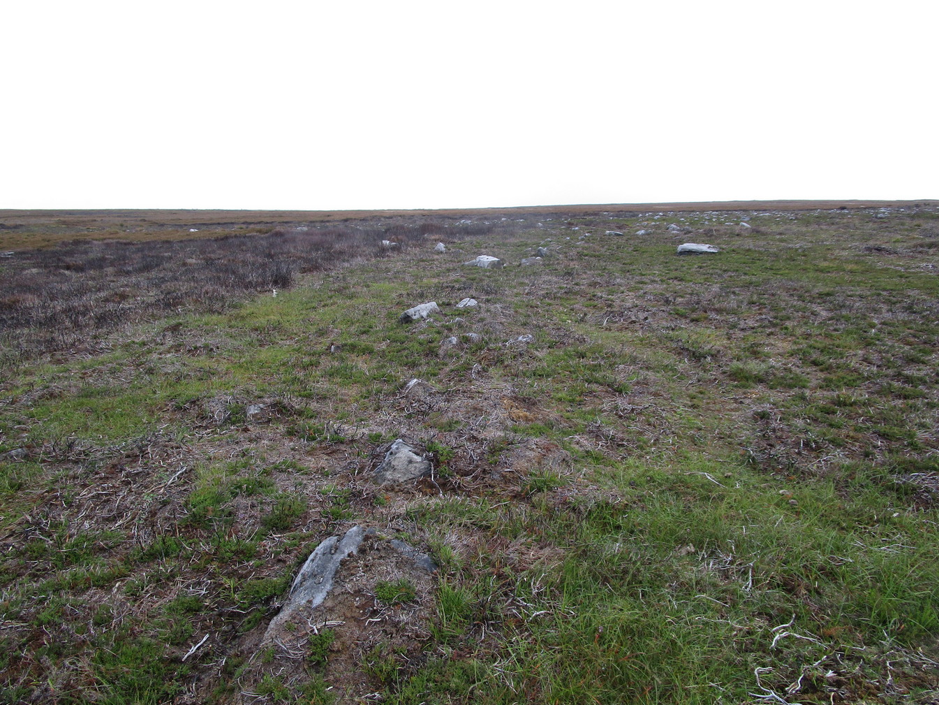
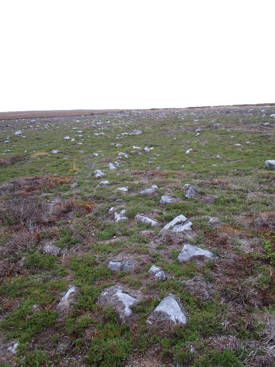
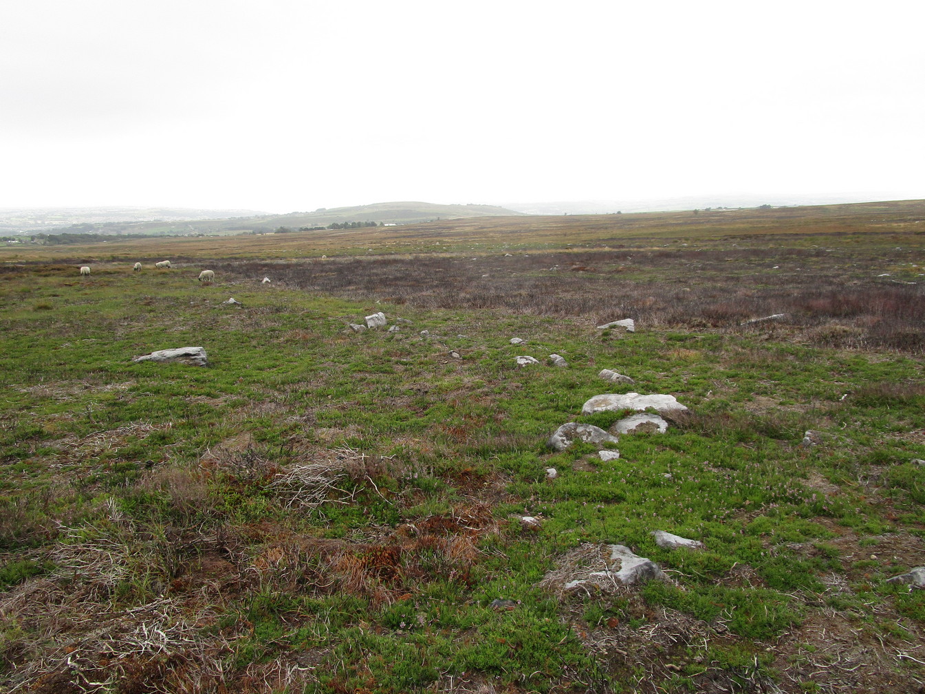
Near the northernmost section of the Hawksworth Shaw prehistoric graveyard, some 50 yards west of the Black Beck cairn, exists the remains of a small prehistoric enclosure whose walling is deeply embedded in the peat. Although I describe the place as an ‘enclosure’, we don’t know for certain whether it is a ruined settlement or large hut circles (although this latter idea is the more improbable).
Walling, looking N
Arc of walling, looking S
Two large open arcs of walling—like large letter “C’s”—with their open sides to the east, have been constructed next to each other, virtually coming together in the shape of an inverted number “3”. The walling in the southern arc—measuring some 33 yards in length and barely higher than 1 foot above ground level—consists of standard stones and rubble, similar to some of the hut circles that are found in greater abundance on the north-side of Ilkley Moor. The smaller, less visible arc of stones—some 18 yards of it—is lower in the earth. Both lines of walling may have been robbed in part to construct some of the extensive cairns close by, as neither of the two arcs were very high and it was very difficult to work out even what sort of structure they might have been.
Like many other prehistoric sites on Rombalds Moor, only an excavation is going to tell us precisely what was going on here…
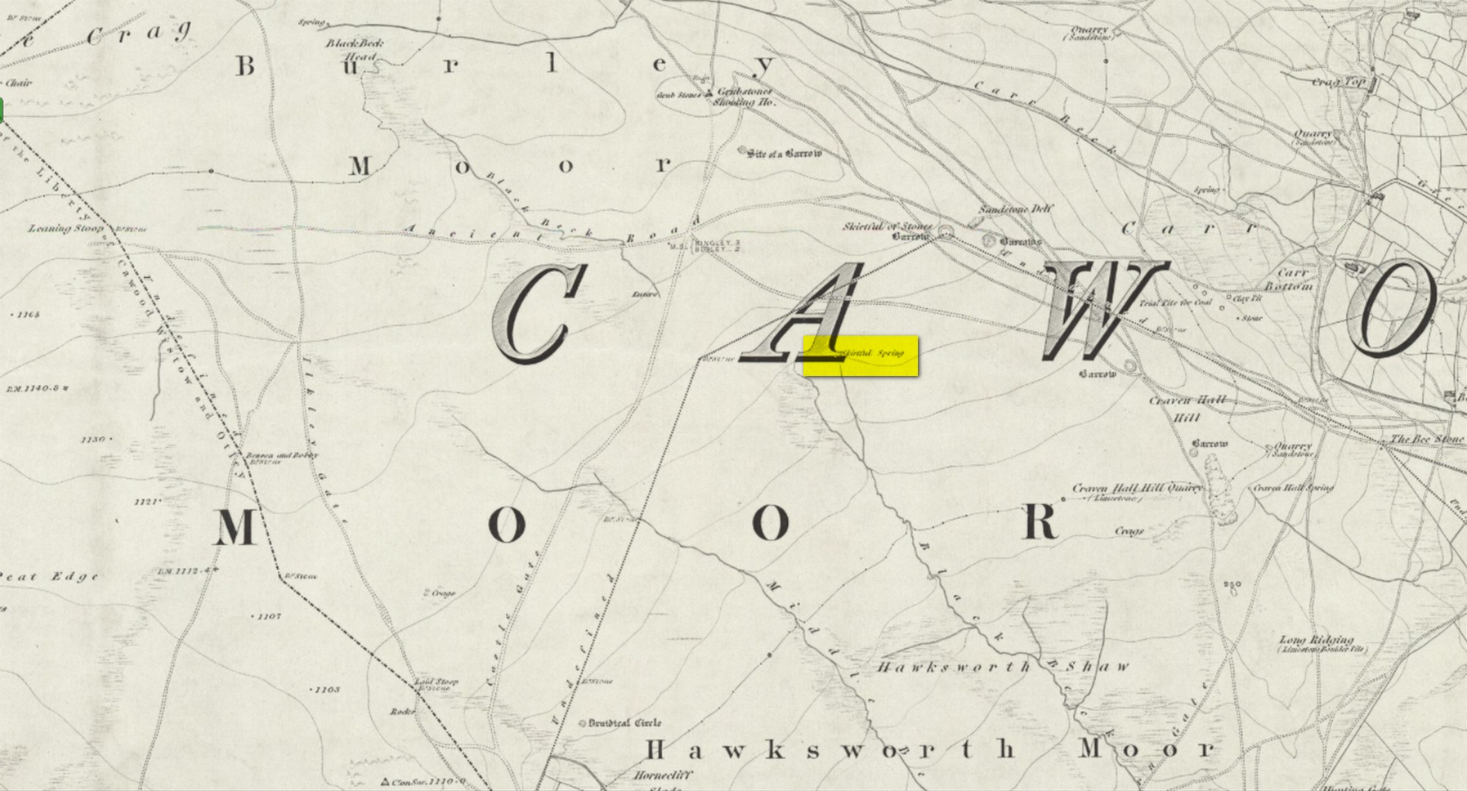
Easiest way to find this is from the Great Skirtful of Stones. From here, follow the line of the fence 250 yards south, then climb over and walk dead straight south onto Hawksworth Moor for 150 yards. You can clearly see the mass of reeds and marshy ground way before you reach it; just be very careful not to walk straight into the reeds or you’ll get sucked down into the waters—and it’s pretty dodgy if you walk into the wrong spot, with good old Jenny Greenteeth lurking beneath the surface!
Archaeology & History
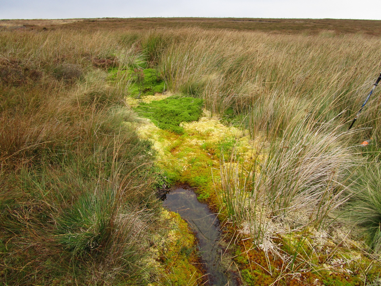
The Skirtful Spring
Highlighted on the 1851 OS-map of the area, this all-but-forgotten clear spring emerges a short distance south of the Great Skirtful of Stones and adjacent to the Hawksworth Moor cairnfield—a proximity that was probably not without meaning in prehistoric times. Curious though it may sound, in traditional cultures across the world, water is as much an important ingredient in the cosmologies of the dead as it is in the land of the living. In earlier centuries this water-source was much more fast-flowing and wider than it is today and it would obviously have been vital for our prehistoric ancestors. Its virtues and folklore have long since been forgotten.
Unless the heather’s been burnt back, this takes a bitta finding. Direction-wise, the easiest is from the moorland road above Menston. Go up Moor Lane and then turn right along Hillings Lane. 350 yards on is a dirt-track on your right marked as Public Footpath. Walk up here for two-thirds of a mile—going past where the track goes left to the Shooting Range—to where the track splits. Bear left and after 250 yards you reach a fence on your left where the moorland proper begins. Follow this fence SW for 300 yards until it does a right angle turn. Just before this, you’ll see a large worn overgrown trackway or path running north into the moorland. Walk up here for nearly 100 yards and look around. Best o’ luck!
Archaeology & History
Western arc of earth & stone
Shown on the 1851 OS-map adjacent to the long prehistoric trackway that runs past Roms Law, the Great Skirtful and other prehistoric sites, the antiquarian wanderings of Forrest & Grainge (1868) came past here and, although didn’t mention the Craven Hall cairns directly, they did write of “a group of barrows” hereabouts, and this may have been one of them. James Wardell (1869) gave an even more fleeting skip, only mentioning “pit dwellings” hereby. A little closer to certainty was the literary attention Collyer & Turner’s (1885) pen gave, where they described, “near the adjoining old trackway, which runs from East to West, will be seen a small barrow”—but this could be either of the Craven Hill sites. And the usually brilliant Harry Speight (1900) gave the place only more brevity….
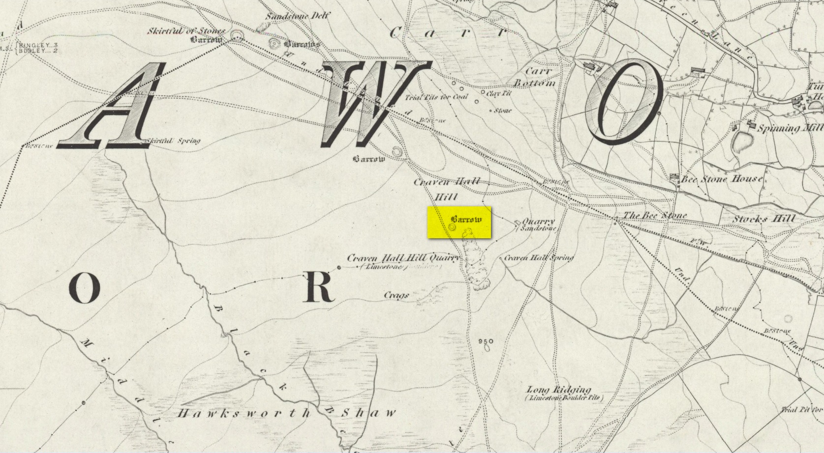
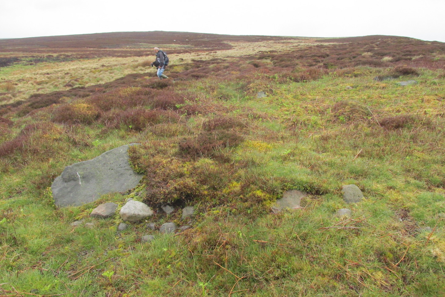
Structurally similar to Roms Law nearly ¾-mile northwest of here, this little-known and much denuded prehistoric tomb has seen better days. It is barely visible even when the heather’s low—and when we visited recently, the heather was indeed low but, as the photos here indicate, it’s troublesome to see. It’s better, of course, with the naked eye.
Highlighted ring cairn, looking NE
Highlighted ring cairn, looking SE
It’s the most easterly cairn in the large Bronze Age necropolis (burial ground) on Hawksworth Moor. Measuring some 12 yards across and roughly circular in form, the ring is comprised mainly of many small stones compacted with peat, creating a raised embankment barely two feet high above the heath and about a yard across on average. A number of larger stones can be seen when you walk around the ring, but they don’t appear to have any uniformity in layout such as found at the more traditional stone circles. However, only an excavation will tell us if there was ever any deliberate positioning of these larger stones. It would also tell us if there was ever a burial or cremation here, but the interior of the ring has been dug out, seemingly a century or two ago…
References:
Collyer, Robert & Turner, J.H., Ilkley: Ancient and Modern, William Walker: Otley 1885.
Faull, M.L. & Moorhouse, S.A. (eds.), West Yorkshire: An Archaeological Guide to AD 1500 – volume 1, WYMCC: Wakefield 1981.
Forrest, C. & Grainge, William, A Ramble on Rumbald’s Moor, among the Rocks, Idols and Altars of the Ancient Druids in the Spring of 1869, H. Kelly: Wakefield 1868.
Speight, Harry, Upper Wharfedale, Elliott Stock: London 1900.
Wardell, James, Historical Notes of Ilkley, Rombald’s Moor, Baildon Common, and other Matters of the British and Roman Periods, Joseph Dodgson: Leeds 1869.
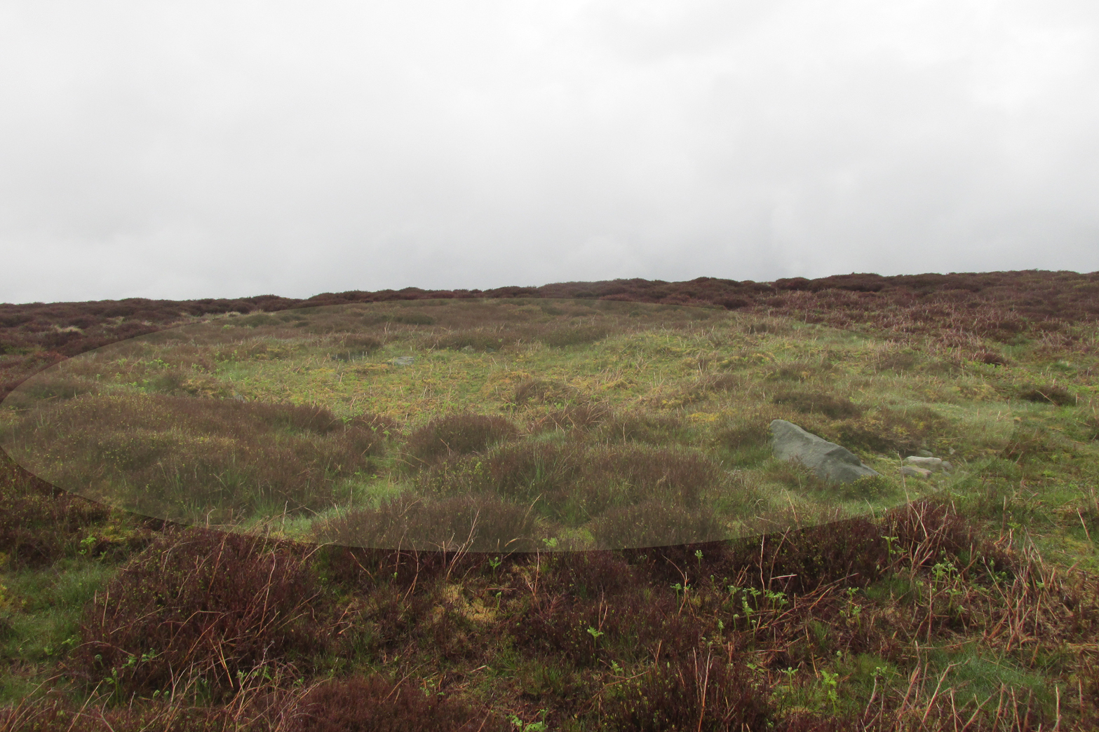
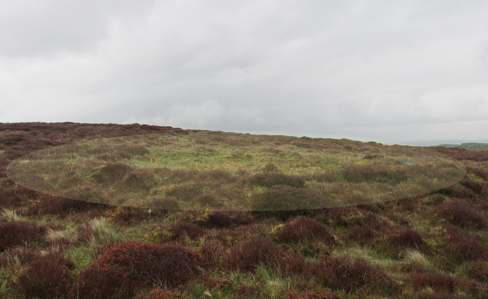
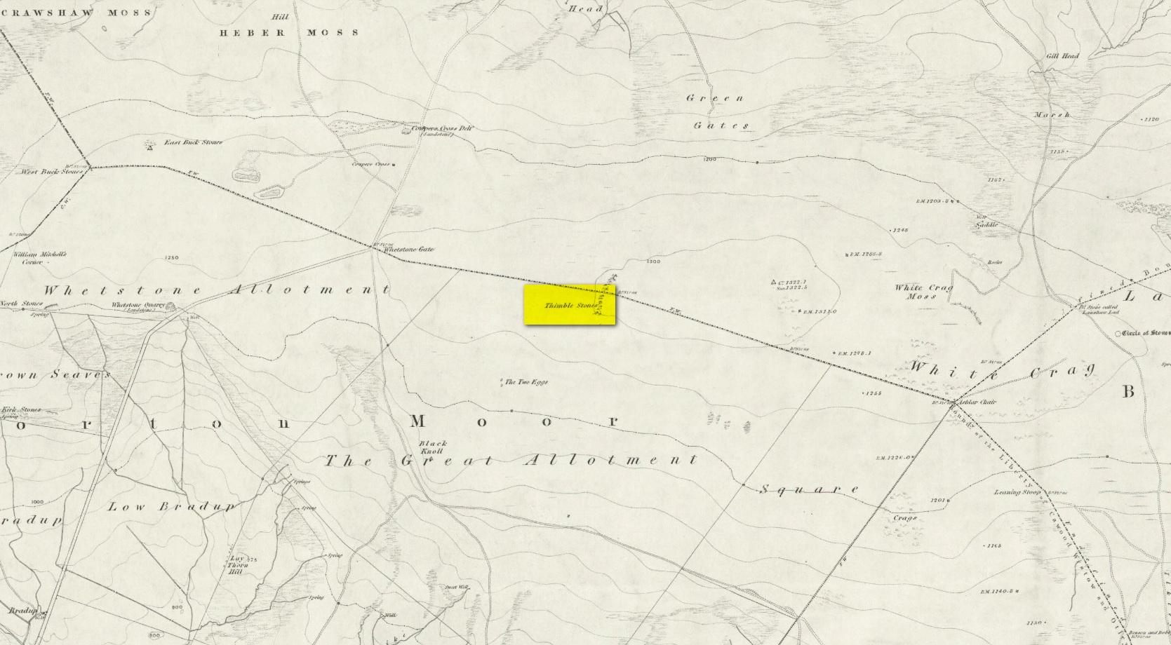
You can either head up to the Twelve Apostles stone circle, then a short distance west to the Ashlar Chair and head just head west along the moorland footpath that runs parallel with the old walling for ¾-mile (1.2km). This is the boggier route, beloved of real walkers! The other route is from the top of the Roman Road that bisects the moor at Whetstone Gate. From here, where the normal ‘road’ meets up with the dirt-track at the very top of the moors, take the footpath east for ½-mile (0.75km) until you reach the large cluster of rocks, just over the wall on your right-hand side. The carving is on top of one of them there stones.
Archaeology & History
Without doubt there’s one helluva spirit to this cluster of large weather-worn rocks whose bodies gaze in every cardinal direction—and it’s a place where me and a number of earlier historians thought cup-and-rings could be found. The first petroglyphic context of the rocks was made in the 1860s by the grand 19th century historians Forrest & Grainge (2012) where they gave it the usual druidic associations, so beloved of academics and antiquarians alike at the time. They wrote:
Very faint cup-and-3-rings
Thimble Stones gazing south
“The Thimble Stones are a ½-mile north of the Two Eggs, with which they are nearly in line. They are of the same outcrop of stratification and appear as though they had been pushed upwards by some force acting from beneath, breaking them up with a vertical fracture, and separating them so as to leave wide spaces between the blocks. They are about a furlong in length and in front about 10ft in height, diminishing eastward to the level of the ground. Two of them a few feet apart are 7ft high, and bear on their eastern angles the cups and channels which we designate the marks of Druidic consecration.”
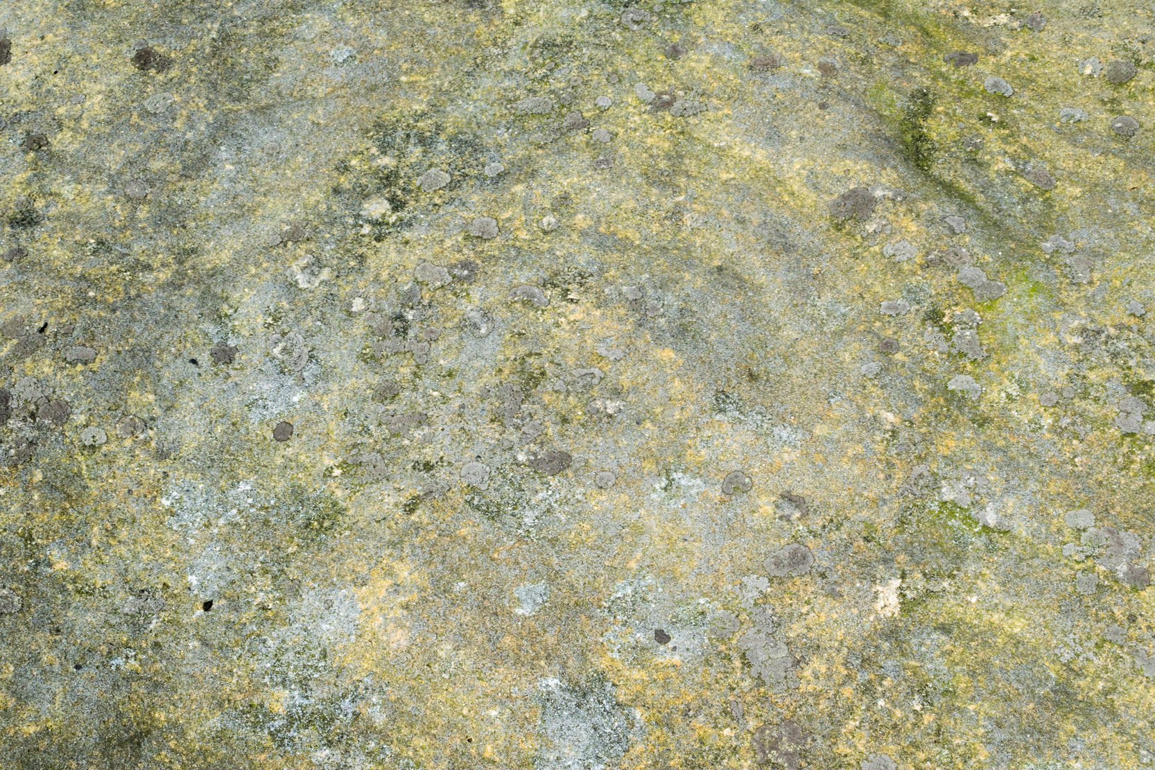
Subsequently, in Collyer & Turner’s (1885) work they told that the rocks “bear cups on two margins”; and when the great Harry Speight (1900) came here, he found they were “bearing cups and grooves.” Yet no-one reported any rings. And in the countless visits I’ve made here—thinking that there must have been cup-and-rings!—no such symbols have ever cried out. The various large ‘bowls’ and lines that Nature has carved here—some of which may have been important in ancient days—are all that the casual eyes can see. Until now…
The local rambler and photographer James Elkington and James Turner were up here a couple of years ago. The light was falling through a clear bright sky and so, as James likes to do at such times, he clicked his camera a few times to catch the landscape. Clambering onto the rocks, Mr Turner unknowingly stood upon the carved rings, and when he moved his foot Mr Elkington spotted them! And as we can see on the image above, only just, there’s a single cup-mark surrounded by a concentric triple ring. Incredibly faint, it is without doubt the real McCoy—and the highest of all petroglyphs on these moors. In the photo it seems that there may be other elements to the carving, but until conditions allow for a further examination, we won’t know for sure.
James is hoping to get back up there when conditions are just right so he can get clearer photos. But if you hardcore antiquarians and petroglyph seekers wanna get up there y’selves to get some photos of your own, please send us whatever you might find.
Folklore
On the esoteric side, the Thimble Stones was a place favoured by the progenitors of the ritual magickal Order, the Illuminates of Thanateros, in years gone by.
References:
Allen, J. Romilly, ‘Cup and Ring Sculptures on Ilkley Moor,’ in Reliquary & Illustrated Archaeology, volume 2, 1896.
Bennett, Paul, The Old Stones of Elmet, Capall Bann: Milverton 2001.
Boughey, Keith & Vickerman, E.A., Prehistoric Rock Art of the West Riding, WYAS: Wakefield 2003.
Collyer, Robert & Turner, J. Horsfall, Ilkley, Ancient and Modern, William Walker: Otley 1885.
Feather, Stuart, “Mid-Wharfedale Cup-and-Ring Markings,” in Bradford Cartwright Hall Archaeology Group Bulletin, 6:3, 1961.
Forrest, Charles & Grainge, William, A Ramble on Rombald’s Moor, Northern Antiquarian: Bradford 2012 (1st published 1867-69).
Hedges, John (ed.), The Carved Rocks on Rombalds Moor, WYMCC: Wakefield 1986.
Speight, Harry, Upper Wharfedale, Elliott Stock: London 1900.
Acknowledgements: Huge thanks as always to James Elkington for use of his photos.
From Ilkley town centre take the road up to White Wells (ask any local if y’ can’t find it), but instead of heading up the track to the wells, keep on the road and, after just over 200 yards, turn left up the Keighley Road. Half-a-mile up there’s a dirt-track on your right which leads to Silver Well Farm. Walk along here for about 150 yards, keeping your eyes peeled for a large rock in the heather about 50 yards up onto the moor. You’ll find it.
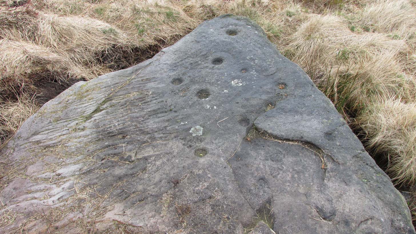
Archaeology & History
Located just 100 yards west of the old Roman road that effectively runs north-south through the middle of Rombalds Moor and which, when this carving was executed, was a prehistoric trackway, this is an impressive carving, all but unknown by many. On my last visit to this stone—maybe 10 years ago or more—it was a cloudy day. I know this from the fact that the design on the stone was difficult to see in its entirety. But not anymore! When the northern antiquarian Dave Whittaker came a-wandering this way a few years back, the stone so overgrown in vegetation that the design was very difficult to appreciate and, like any healthy curious antiquarian, he wanted to know what the full carving would look like. He enquired whether or not it was OK to uncover the stone from beneath its mass of heather to see the full image and, as far as we were concerned the idea was a good one. And so, following in the footsteps of Beckensall, Currie, Chappell, me and a few others, he got stuck in!
Cup-and-rings from above (photo by Dave Whittaker)
Looking across the stone (photo by Dave Whittaker)
As you can see in Dave’s fine photos, the petroglyph is indeed a fine one. It comprises mainly of four cup-and-rings, two of which are incomplete The rings, as you can see, are very faint, whilst the cups, both in the rings and those outside of them, are notably deep; perhaps indicating that they were carved into many times over a long period.
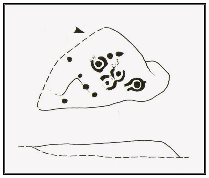
One of the great petroglyphic pioneers, J.Romilly Allen (1882) seems to have been the earliest to record this carving. Allen’s early sketch (below) was obviously drawn on a shady day, as it misses several of of the rings that are clear to see when the the daylight is just right. It’s an easy mistake to make. He wrote:
J.R. Allen’s 1882 sketch
Hedge’s 1986 sketch
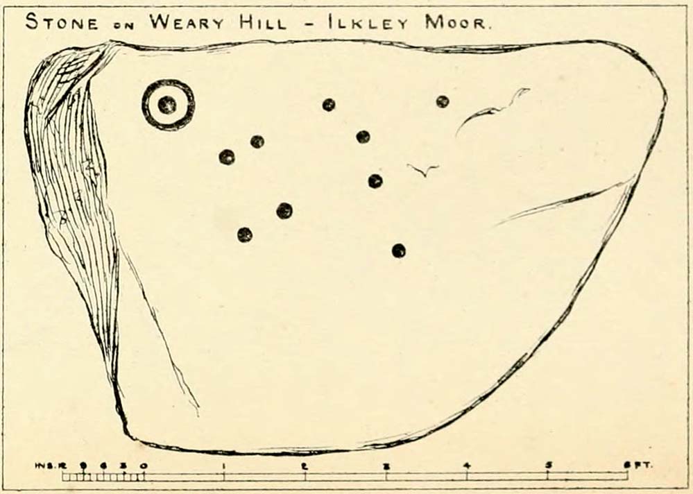
“One mile south-west of Ilkley is a road leading over the top of the Moor…very appropriately as Weary Hill. To the west of the road, and between it and the boundary-wall of Silver Well Farm, is a small boulder of gritstone with cup-markings on it. It lies at a level of 900 ft. above the sea, and it measures 8ft by 5ft. On its upper surface, which is nearly level, are carved ten cups, varying in diameter from 2 to 3 ins., one of them being surrounded by a single ring.”
The pseudonymous “A. Reader” (1891) also included the stone in his international overview of prehistoric carvings, but merely copied the notes of his predecessors. Nearly a hundred years later when archaeologist John Hedges (1986) did his survey of these moors, he described this carving simply as:
“Medium seized rock…in grass, heather and crowberry with c.ten cups, four with rings, two with grooves from rings, three depressions and series of probably natural lines running down to bottom edge.”
And as with the pseudonymous A. Reader (1891), Boughey & Vickerman’s (2003) also just copied Hedges’ earlier description.
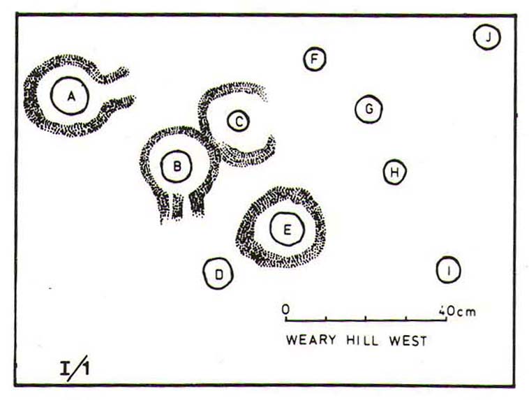
Seeking numeracy in Alan Davis 1988 sketch
And from another angle (photo by Dave Whittaker)
The greatest analysis of this carving to date is by physicist and mathematician Alan Davis. He set out in 1983 to explore the possibility of there being a universal measurement used in neolithic times that was coded into our cup-and-rings—a theory first espoused by the great archaeo-astronomer Alexander Thom. (1968) He selected carvings from Rombalds Moor and Northumberland, including this one at Weary Hill (calling it the I/1 carving) to see if a ‘megalithic inch’ (MI) that was propounded by Thom had any foundation in fact. As a mathematician he was ideally qualified to examine this proposition. His 1983 paper found there to be “substantial support” for this prehistoric megalithic inch. However, in a subsequent 30-page analysis of the same carvings Davis (1988) found that some criteria in his initial investigation needed re-examining. In his updated report he told that “many of these deficiencies have now been remedied.”
His initial 1983 report concluded the Weary Hill carving possessed a deliberate mathematical code in accordance with Thom’s MI. However in the subsequent 1988 report, Davis found that the measurements were based on 5MI and 3 MI, but only in the cup-and-rings and not the single cups. Despite this, there remained an overall scepticism in terms of any deliberate universal use of the MI. My own take on this is a simple one: there was no deliberate use of any MI at carvings. Where we do find precise MIs, this is due simply to the average size of human hands, meaning that some obvious figurative correspondences will occur upon investigation. The more you think about it, the more obvious it becomes.
Anyhow, all this intriguing geometry aside: to those of you who take the time to check this out, have a bimble in the heather barely 100 yards west and you’ll find a few other carvings sleeping quietly, whose site profiles I’ve yet to do…
References:
Allen, J. Romilly, “Notice of Sculptured Rocks near Ilkley,” in Journal of the British Archaeological Association, volume 38, 1882.
Anonymous, Walks Around Cup and Ring Stones, ITIC: Bradford n.d. (1995)
Boughey, K.J.S. & Vickerman, E.A., Prehistoric Rock Art of the West Riding, WYAS: Leeds 2003.
Collyer, Robert & Turner, J. Horsfall, Ilkley, Ancient and Modern, William Walker: Otley 1885.
Davis, Alan, ‘The Metrology of Cup and Ring Carvings near Ilkley in Yorkshire,’ in Science and Archaeology, 25, 1983.
Davies, Alan, ‘The Metrology of Cup and Ring Carvings,’ in Ruggles, C., Records in Stone, Cambridge 1988.
Hedges, John (ed.), The Carved Rocks of Rombald’s Moor, WYMCC: Wakefield 1986.
Reader, A., Archaic Rock Inscriptions, privately printed: London 1891.
Thom, Alexander, “The Metrology and Geometry of Cup and Ring Marks,” in Systematics, volume 6, 1968.
Turner, J. Horsfall, Historical Notices of Shipley, Saltaire, Idle, Windhill, Wrose, Baildon, Hawksworth, Eccleshill, Calverley, Rawdon and Horsforth, Shipley Express: Idle 1901.
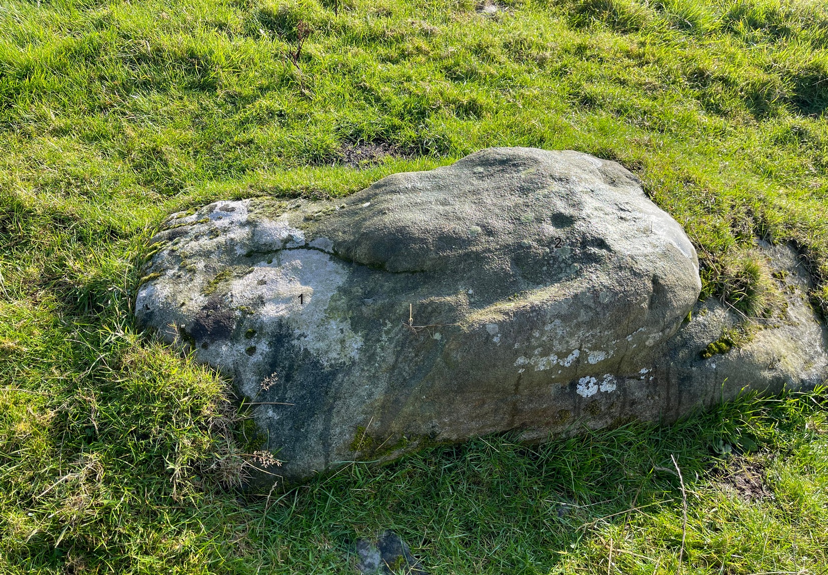
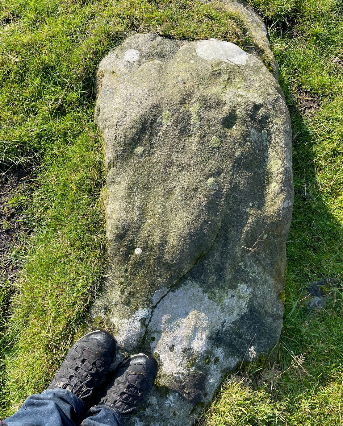 This long earthfast stone has two distinct cup-markings: one near its northern upper end, and the other near the lower southern end, as highlighted on the above photo. (forgive the poor image, but we took it when the sun was pretty high in the sky) It seems as if there are two or three other very faint cup-marks on the upper end of the stone, close to the most distinct one, but none of our photos show them with any clarity.