Cup-Marked Stone (lost): OS Grid Reference – SD 950 488
Archaeology & History
When the archaeology assistant Stuart Feather ventured over to look at the prehistoric enclosure on the northwest slope of Raygate Hill, a mile or so south-west of Carleton, like any good petroglyph explorer he looked out for any rock art and—like y’ do sometimes—came across a cup-marked stone that hadn’t been recorded before. He wrote down his finds at home and, following his death, those records were thankfully sent to the Manor House Museum in Ilkley, from where these brief notes are taken. There was at the time of his visit, he said, a
“Rock outcrop with two cup-marks, on August 6th 1960 this outcrop was intact. On a second visit the top layer of the rock had become detached and split into two. The pieces were then removed for preservation.”
By “removed for preservation”, he meant that he took it home to Fernbank Avenue in Keighley (he did this with a few of our old cup-and-rings). However, this one has not been found since and it may simply have been buried in his garden. Does anyone know more about it?
He described another less likely contender of a carving a little closer to the enclosure, telling briefly: “Cup-marked rock, cups only possibly man-made. In close proximity, 75 yards, to (the) earthwork marked on the 6” O.S. map.”
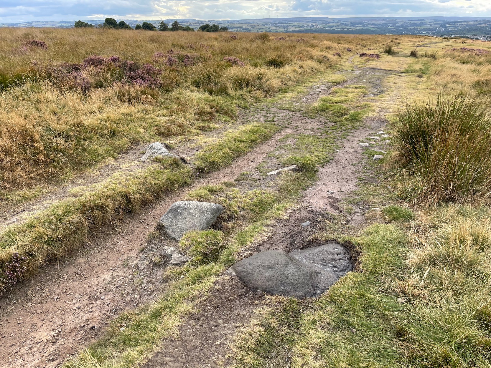
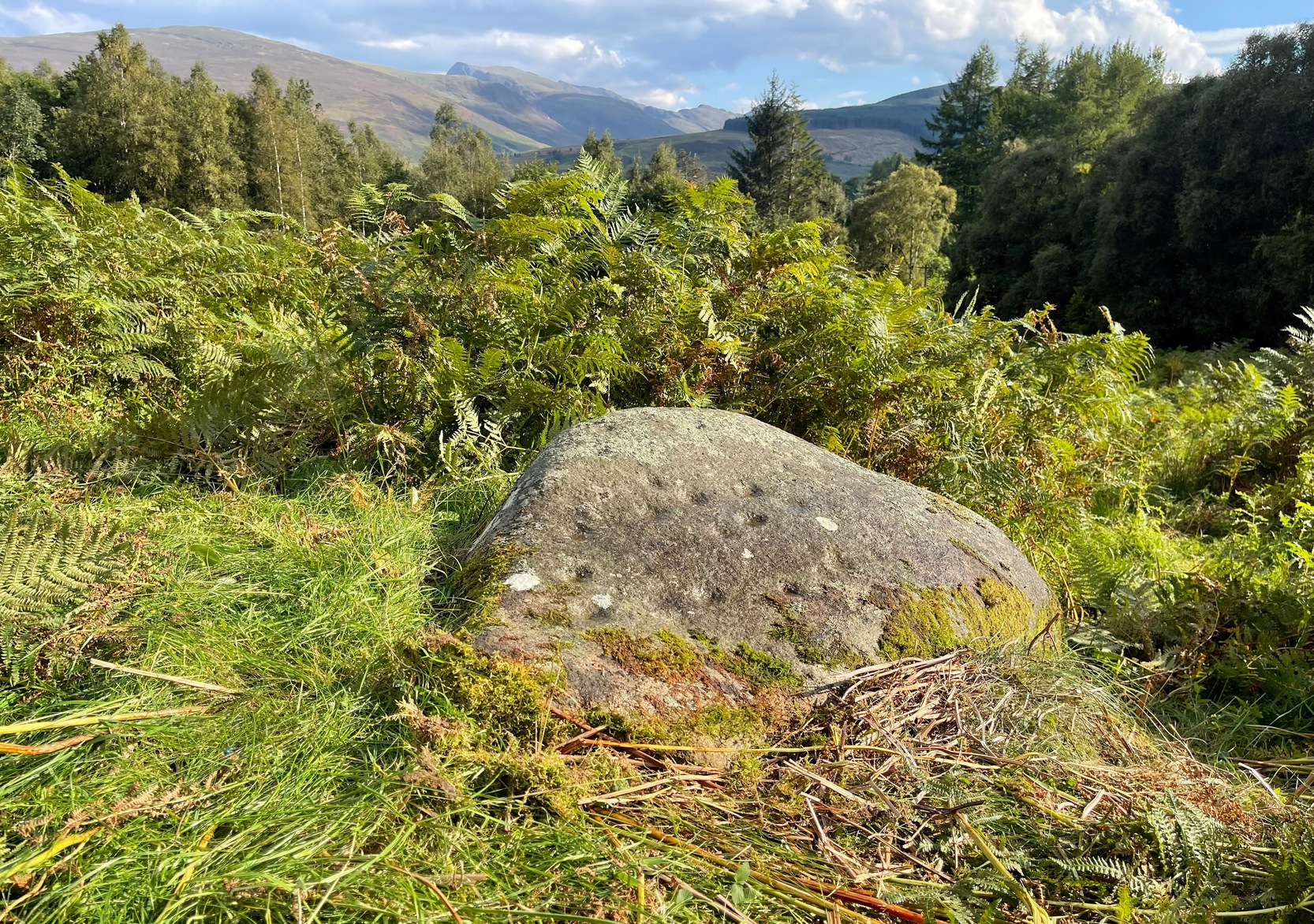
Probably best if you start from the car-parking spot at Acrehowe, by taking the road up through Baildon village, across at the roundabout up Northgate and up onto the moor, then after a few hundred yards turn left on the Bingley Road. The Acrehowe parking spot is a half-mile up on your right. From here, cross the road and bear right to take the footpath that follows the contour at the edge of the hillside, walking past the Baildon Moor (184) carving on the way. About 250 yards past this carving, on the right-side of the track as you’re heading to Dobrudden, is this low-lying almost innocuous stone. Keep your eyes peeled and you’ll see it.
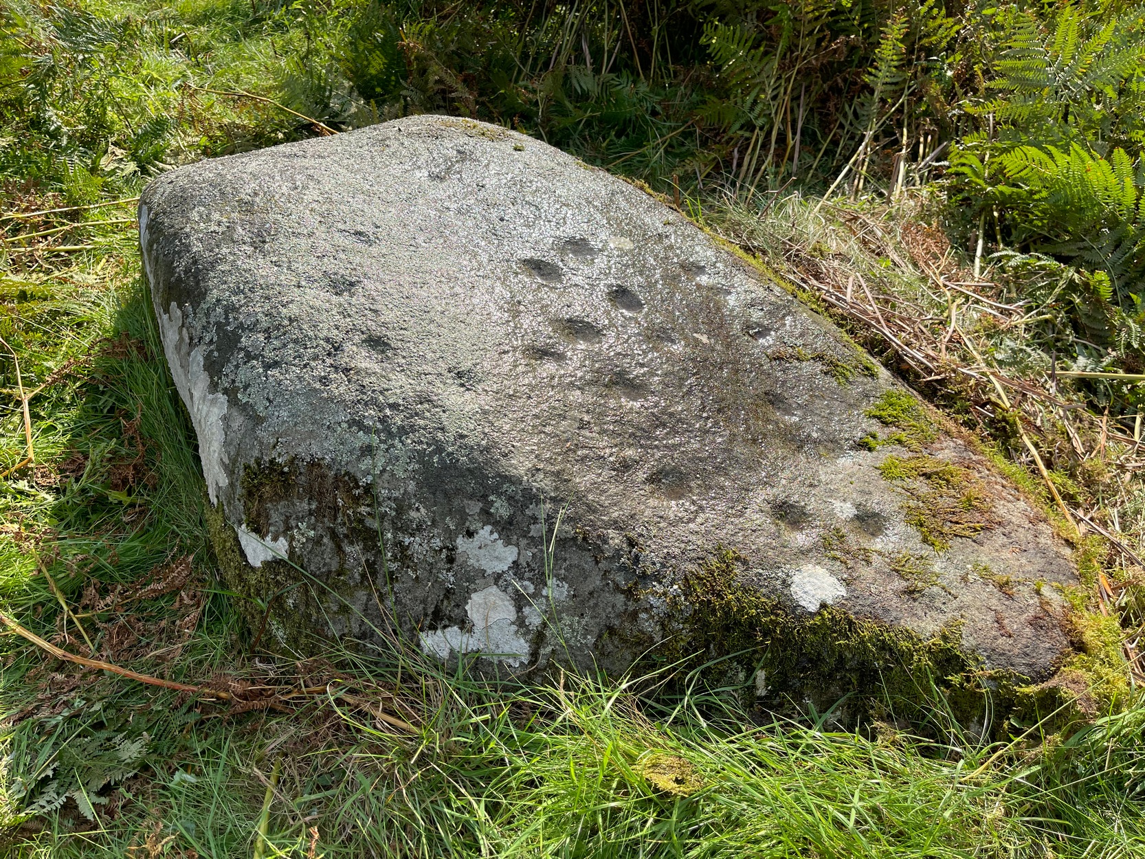
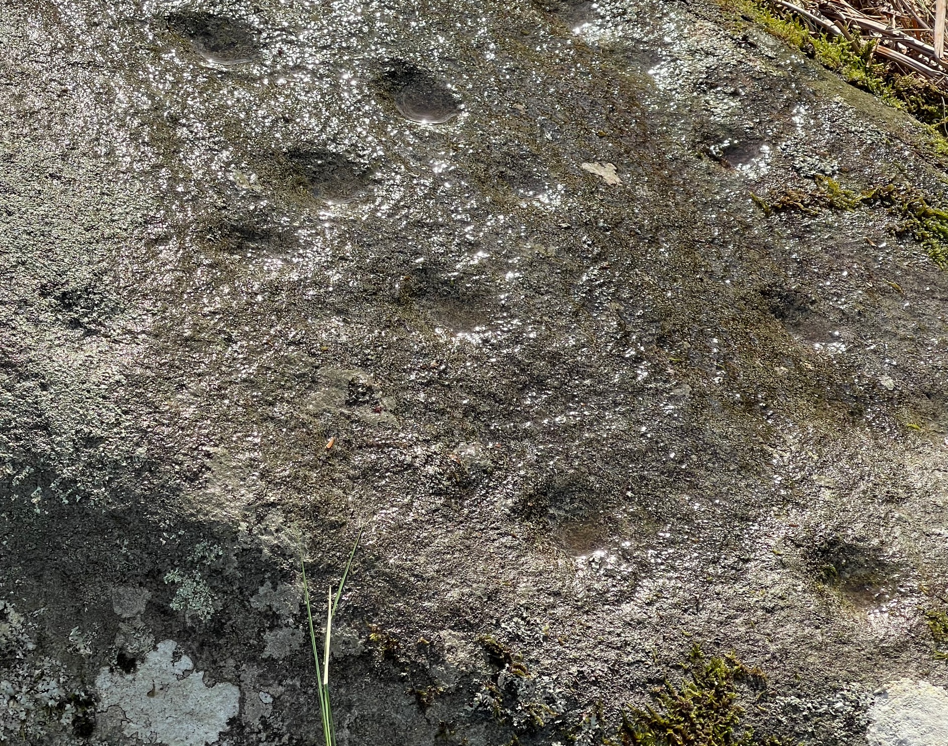
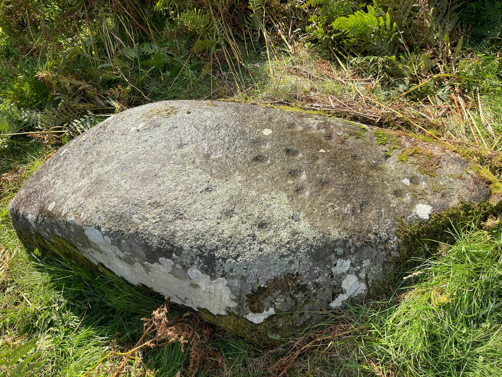
Archaeology & History
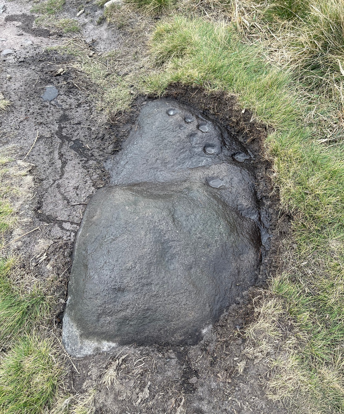
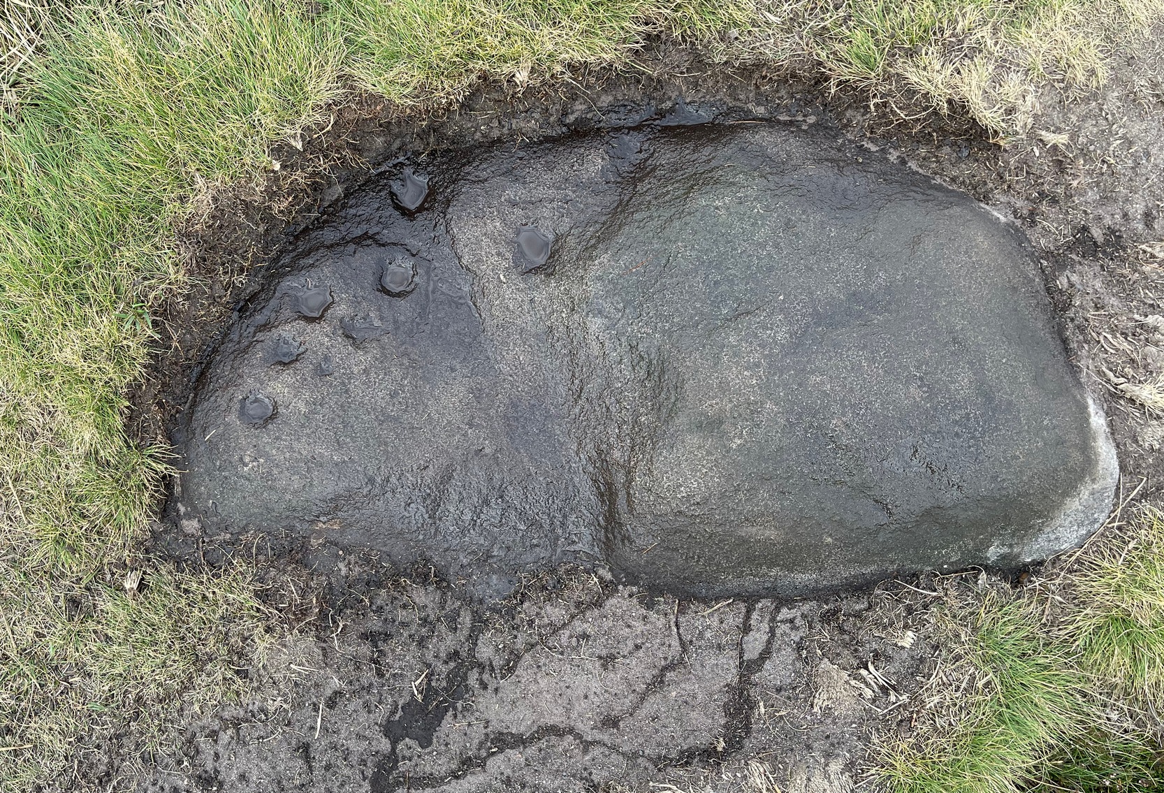
The carving looking WCup-marks clearly visible
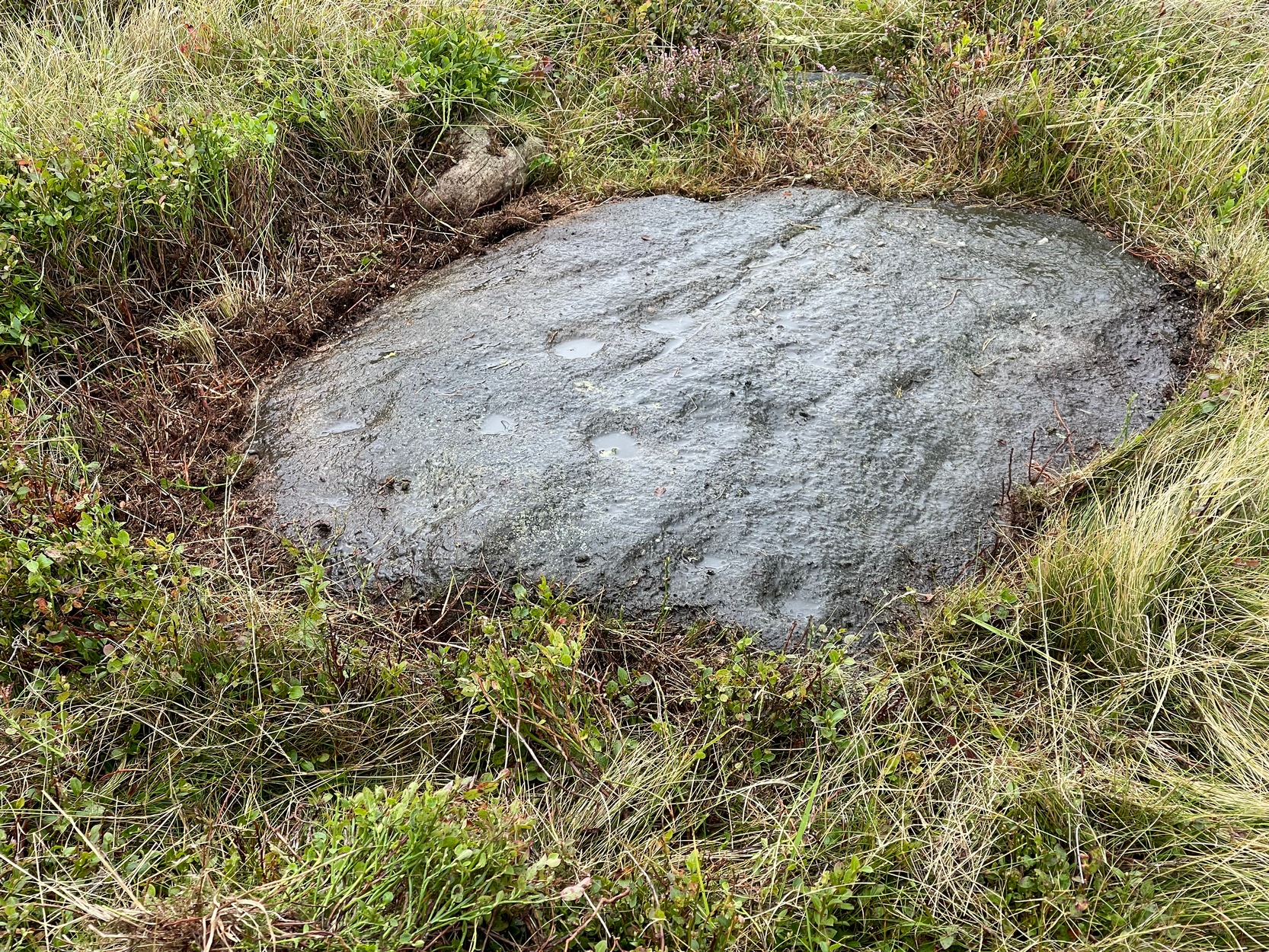
This cup-marked stone was first unearthed by fellow rock art explorers Mike Short and Dave Spencer in 2012 after they’d been looking at some of the other carvings hereby. In peeling back the turf on the stone, otherwise hidden cups—perhaps nine in all—were uncovered that had been hidden for centuries. Most of them are quite distinct, but it seems that a couple of the cups may have been left unfinished, as their size isn’t consistent with the others on this and other carvings close by.
The carved stone—located on the northern edge of the Low Plain prehistoric cemetery—is one in a line of several low earthfast rocks that crosses the track hereby and it’s possible that it was part of some prehistoric walling. Linear remains of walls and ditches were reported here in the 19th century and some of them can still be seen in some places on this part of the hill, but much of it has been destroyed.
Cup-Marked Stone (lost): OS Grid Reference – NH 814 503
Archaeology & History
Somewhere on the outskirts of Kilravock Castle grounds sat (or still sits, hopefully) one of our country’s legendary healing stones bound within the animistic veil of a cup-marked stone. It seems to have fallen off the archaeological registers (if it was ever included!) and so I add it here in the hope that someone can locate it and let us know of its present condition.
Described during a meeting of the Inverness Scientific Society by a Dr Grigor in a short presentation on cup-marked stones at Nairn in July 1884, the matter of some faint traditions concerning a tiny number of cup and ring stones in Scotland was mentioned, and,
“Dr Grigor said he would be able, next day, at the roadside on the Kilravock property, to point out a large rounded stone of gneiss, in the centre of which is a large cut cup-mark of a diameter of six or seven inches which, fifty years ago, was resorted to by many, and water was taken from it long distances. The water was believed to cure skin diseases, but it was principally used for washing warts on the human subject, which it was believed the water quickly removed. It was also particularly in repute for removing warts from cow’s teats.”
The custom described here sounds very similar to others found at so-called ‘Wart Stones’ in England and Scotland (there was one that existed a short distance from where I grew up near Eccleshill, West Yorkshire). Several miles west of here is the cluster of prehistoric carvings in the Clava complex, but this one at Kilravock seems to have fallen off the radar. Does anyone know if it can still be seen? (the grid-reference given to this site is an approximation)
References:
Grigor, Dr, “Cup Marked Stones,” in Transactions Inverness Scientific Society Field Club, volume 3, 1884.
Acknowledgements:Huge thanks for use of the Ordnance Survey map in this site profile, reproduced with the kind permission of the National Library of Scotland.
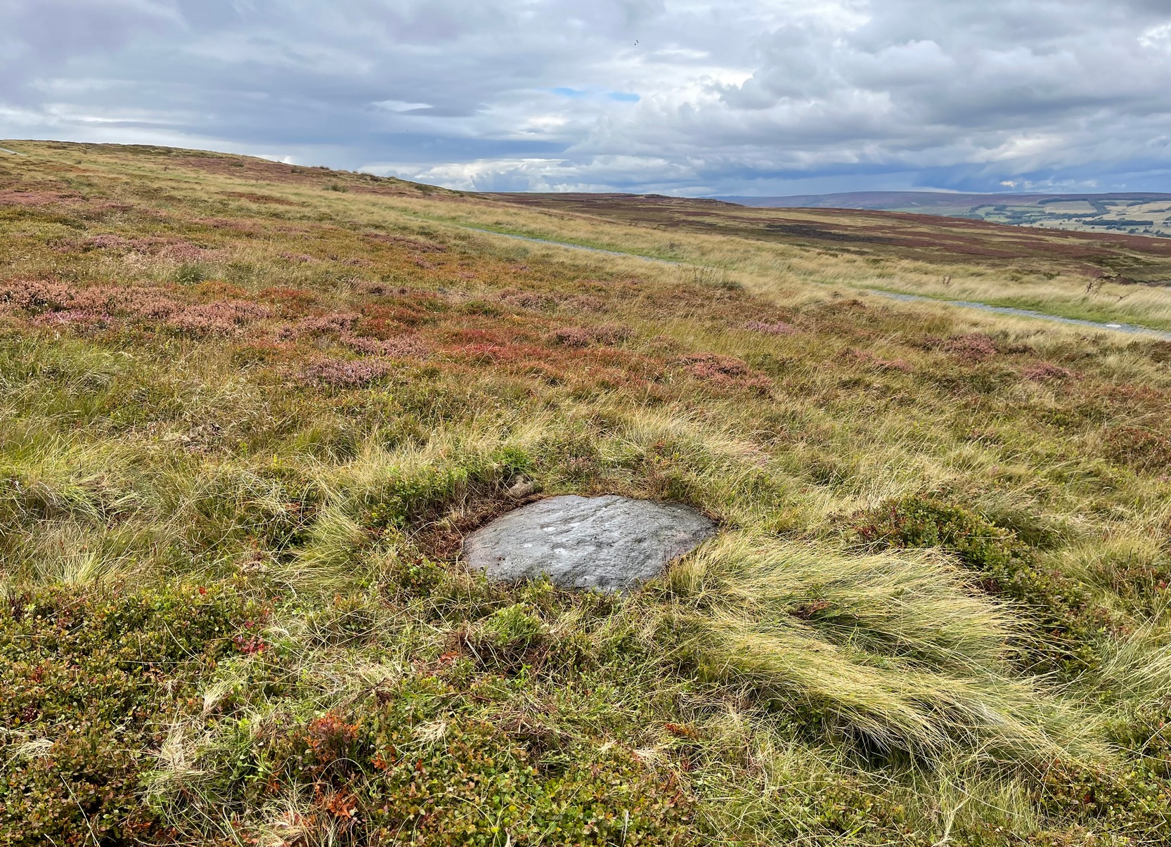
You can walk up from Menston, up Moor Lane north-west towards the moor, then turning left when you hit the moorland road of Hillings Lane. Nearly 350 yards along, turn right up the track known as Occupation lane onto the moor. More than half-a-mile up, past the gate at the Bee Stone, where the track splits, keep to the left and head further uphill, roughly parallel with the fence on your left. Literally ¼-mile (0.4 km) up from the split, you’re looking almost straight down at the reservoir; but to your left, walk towards the fence. Zigzag about! You can also approach it from the Grubstones and Great Skirtful area, by following the Occupation Lane track eastwards down the slope until you’re roughly level with the same reservoir.
Archaeology & History
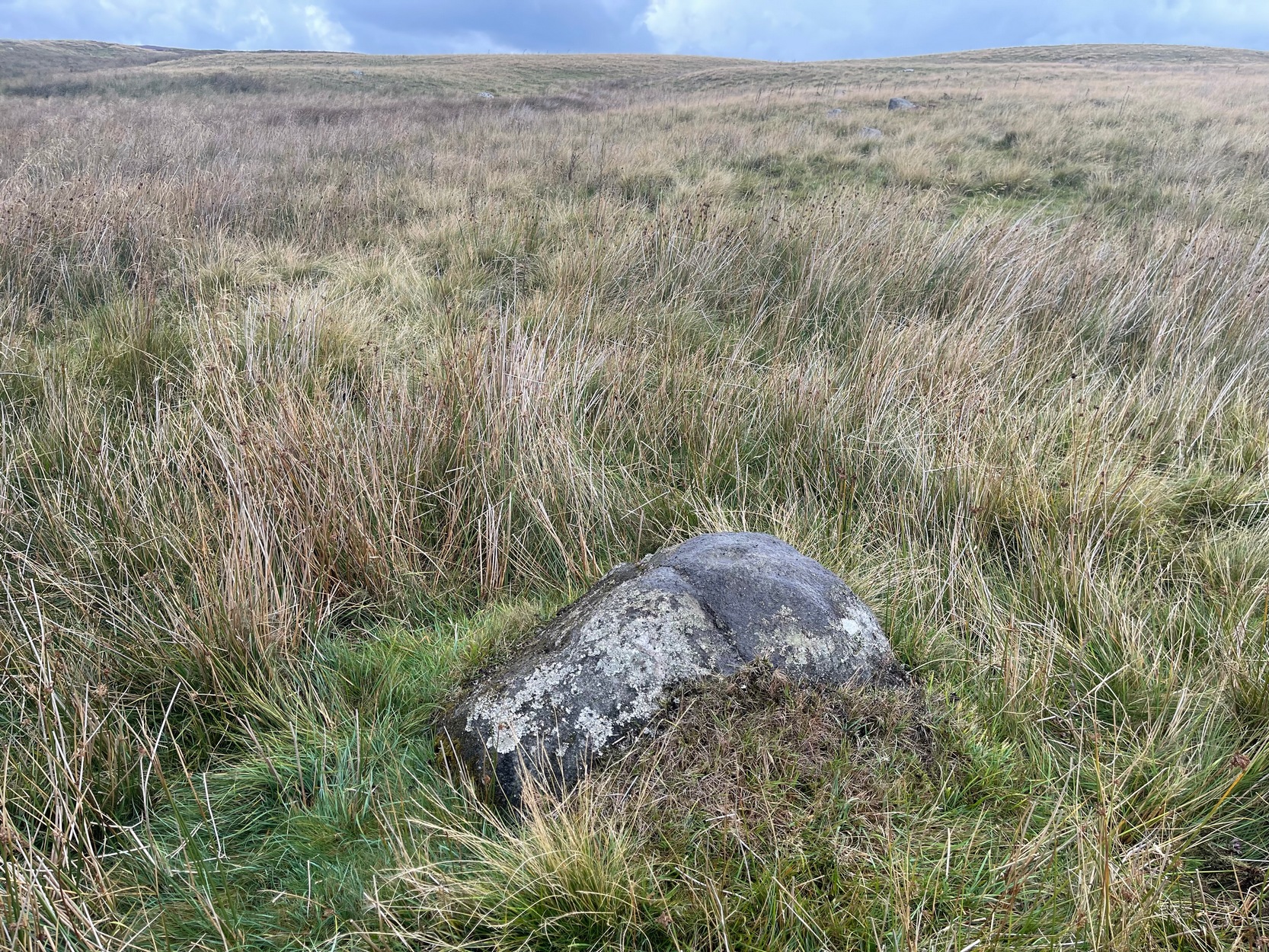
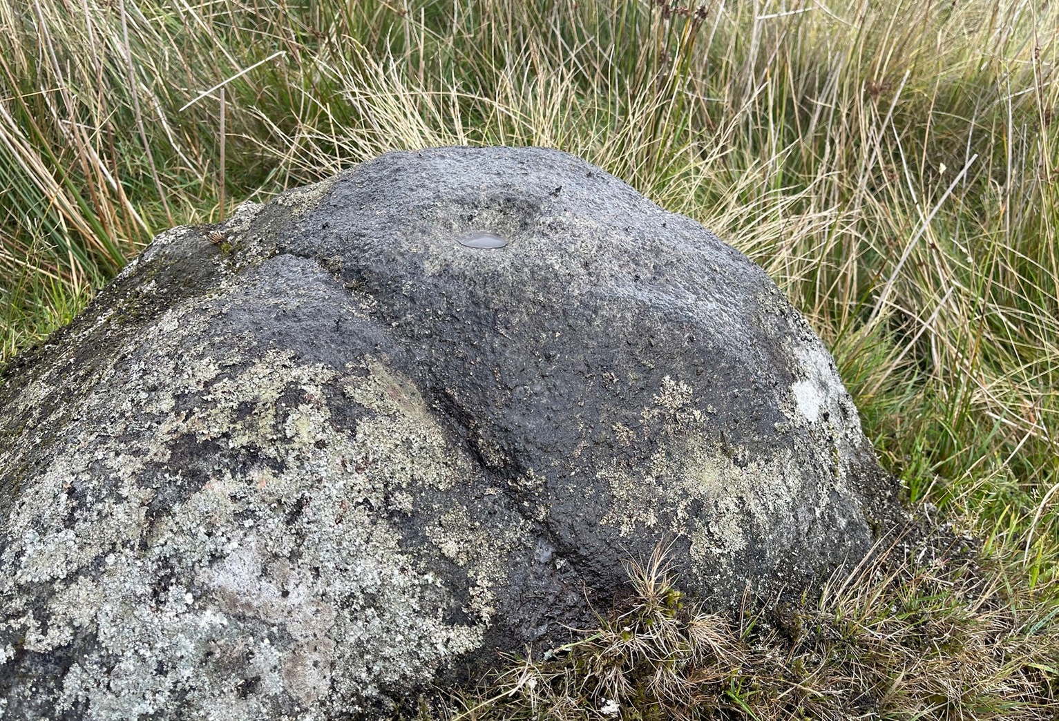
On this somewhat isolated stone on the northern sloping edge of Craven Hall Hill we find a small cluster of shallow cup-marks, first noted in the 1980s and eventually mentioned in a survey by Boughey & Vickerman (2003) where they described it as a,
“Low, medium striated rock lying in slope of hill. SE end carries possibly up to eleven cups, possibly two sets grouped in arcs running into natural striations of rock, one of which may have been artificially enhanced by pecking.”
Shallow cup-marks
The view from here is quite something: gazing east to the heathen hilltop of Otley Chevin (Beltane rites and rock art — albeit not much), north-east to the far uplands of the White Horse of Kilburn, then across the northern panoramas of Askwith and Denton Moors, and beyond. Some archaeologists have started to believe that such vistas may have had relevance with such carvings, sometimes. They’ve caught up at last! 🙂 Anyhow, the carving itself is pretty simplistic and probably only of interest to the real petroglyph nuts amongst you – although it’s mebbe worth checking out if you’re visiting the Great Skirtful giant cairn and its very impressive hengi-form neighbour.
References:
Boughey, Keith & Vickerman, E.A., Prehistoric Rock Art of the West Riding, WYAS: Wakefield 2003.
Boughey, Keith & Vickerman, E.A., Prehistoric Rock Art of the West Riding – Supplement, YAS 2018.
Acknowledgements: With thanks to Tom Cleland for help in relocating the site on a recent visit.
Numerous ways to get here: probably the easiest (direction wise) is if you’re coming from Dick Hudson’s public house on the southern road surrounding Rombalds Moor. From the pub, head left (east) along Otley Road (passing Weecher reservoir) for 1.9 miles (3.1km) until you reach Reva reservoir where a track leads you to the waters. A small parking spot is on the left-side of the road. From here, go through the gate and along the footpath across the field for nearly 300 yards to the next gate. Go through here and immediately follow the walling down to your left for about 135 yards to the edge of the rushes. It’s there!
Archaeology & History
Single cupmark nr the top
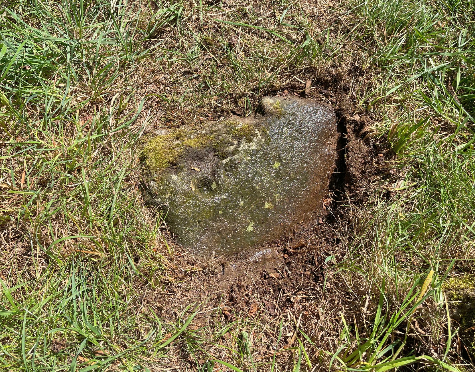
On a recent visit to the Fraggle Rock carving, Tom Cleland foraged about at the edge of what was, in centuries gone by, a good flowing stream below the west slope of Reva Hill. An old pathway cut across one section of it near where the walling now runs, covered these days in the mass of Juncus reeds, typical of mashy grounds. And here, just where folk would cross the waters, Tom found a good sized stone with a single deep cup-mark on its crown, calling through a feast of lichens to be seen once more. There may be a second cup-mark by its side, but the light wasn’t good when we were here, so that’ll be worked out some other day. Anyhow, this one’s probably only for the crazy petroglyph hunters out there. It’s the Fraggle Rock and its companios that you’re gonna be looking for, nearby….
Found barely 12 inches east of the Tormain (7) carving, this ‘cup-marked stone’ is another somewhat dubious design in the Tormain cluster, but which I’m adding here for the sake of completeness. It’s designated as authentic by the Scottish Rock Art Project—but I’m not convinced. Consisting of just two cup-marks, Romilly Allen (1882) was the first to notice them and described them respectively as, “one 1 inch in diameter and the other 1½ inch across.” The smaller of the two, I’m pretty sure, is geophysical in nature.
In Lochearnhead village start walking up the Glen Ogle road and, just past the last house on the right, a dirt-track bends down to an old building. Just before the building, keep your eyes peeled for the small footpath that runs down to the river. Walk along here and cross the river-bridge, then bear diagonally to your left and walk up the singular footpath. It snakes through the trees for a few hundred yards then opens out into a field. About 75 yards along the path in the field the land levels out. From here, walk through the grasses to your right about 20 yards. Zigzag about – you’ll find it.
Archaeology & History
Main cluster + v.faint ring
The setting of this carving is, like many of Perthshire’s petroglyphs, quite beautiful. It was made when the ‘artist’ carving the stone was crouched or sat on the ground, gazing at the southern landscape and heights around Ben Vorlich, whose mythic nature may have been part of the design.
Comprising of a cluster of typical cup-marks, there are two, perhaps three very faint rings in the design, which seems to have been described for the first time in George Currie’s (2012) typically short minimalist way. He told that in the field,
“50m E of the Ogle Burn is a boulder 2.1 x 0.9 x 0.5m, which bears 21 cup marks, 2 of which have single rings.”
Cup and faint ringFaint cups on the crown
Much of the original design is difficult to see in full unless the lighting is good. We spent several hours here and counted 25 cup-marks and found rings around three of them—but these proved difficult to photograph and some more visits are needed to capture them. “Officially” at least, there are no other carvings close to this one. But that’s obviously not going to be the case. Well worth checking out when you’re in the area.
References:
Currie, George, “Stirling: Balquhidder, Glen Ogle – Cup-and ring-marked rock”, in Discovery & Excavation Scotland, volume 13 (New Series), 2012.
Your best starting point is from the Great Skirtful of Stones giant cairn. From here follow the fencing that runs down the slope to your left (south-east) for roughly 160 yards (148m) – past the Great Skirtful Ring – until you reach the gate. Go through it and keep walking down the same fence-line for 300 yards then walk south onto the moorland proper (there are no paths here). You’ll pass over several undulations in the heather (some of these are the edges of ancient trackways) and 55-60 yards south from the fencing you’ll walk over and into this overgrown prehistoric ring. It’s very difficult to see when the vegetation is deep, so persevere!
Archaeology & History
Site shown on 1851 map
This is an interesting site. Marked on the 1851 Ordnance Survey map as a “barrow” (right), it is shown with trackways on either side of it to the north and south, and with an opening or entrance on its northwestern side. Yet since that date, very little archaeological attention has been given to it and the site remains unexcavated, despite its location being repeated on all subsequent maps since then. The designation of the site as a barrow or burial site, without being excavated, was educated guesswork at the time as the place seems to be what we today define as a ring cairn. And whilst this seems likely, there are some oddities here.
Measuring roughly 25 yards (SE – NW) by 21 yards (NE – SW), this overgrown oval ‘ring’ is a similar architectural structure to the more famous Roms Law circle more than half-a-mile northwest of here—but bigger! And, unlilke Roms Law, this overgrown circle seems to have been untouched for many centuries. The oval surrounding ‘ring’ itself is composed of thousands of small packing stones between, seemingly, a number of much larger upright stones, reaching a maximum height of more than three feet high at the northernmost edge. The ‘ring’ ostensibly looks like a wide surrounding wall which measures two yards across all round the structure.
Track running into the ringRaised line into the ring
Internally, there seems little evidence of a burial — although our recent visits here, as the photos indicate, took place when the moorland vegetation was deep and covered almost the entire site. The outline of the site is obviously visible, even in deep heather, but the smaller details remain hidden. But in addition to the main ring, another very distinct ingredient here is the existence of an extended length of man-made parallel walling, probably a trackway, that runs into the circle from the southeast all the way through the circle and out the other side and then continuing northwest heading roughly towards the Great Skirtful giant cairn on the horizon 500 yards to the northwest.
Stone at NE arc of walling
Due to the landscape being so overgrown, it’s difficult to ascertain where this ‘trackway’ begins and ends. Added to this, we find that there are additional ‘trackways’ that run roughly parallel to the one that runs through the circle—and these ‘trackways’ are very old indeed, some of them likely have their origins way back in prehistory. The one that runs through the middle of this ring cairn may be a ceremonial pathway along which, perhaps, our ancestors carried their dead. If we follow it out from here and keep walking along the track 300 yards to the southeast, we eventually run right to the edge of the Craven Hall (3) circle. Parallel to this is another ancient trackway that runs northwest to the edge of the Roms Law circle. It seems very much as if we have ceremonial trackways linking sites to each other: ancestral pathways, so to speak.
Have a gander at this when you’re next in the area. There are many other sites nearby that are off the archaeological radar. In recent years, a number of northern antiquarians wandering over this landscape are finding more and more ancient remains: walling, circles, cairns, trackways. It’s a superb arena—but sadly, most of it is hidden beneath deep moorland vegetation.
References:
Faull, M.L. & Moorhouse, S.A. (eds.), West Yorkshire: An Archaeological Guide to AD 1500– volume 1, WYMCC: Wakefield 1981.
Acknowledgements:Huge thanks for use of the Ordnance Survey map in this site profile, reproduced with the kind permission of the National Library of Scotland.
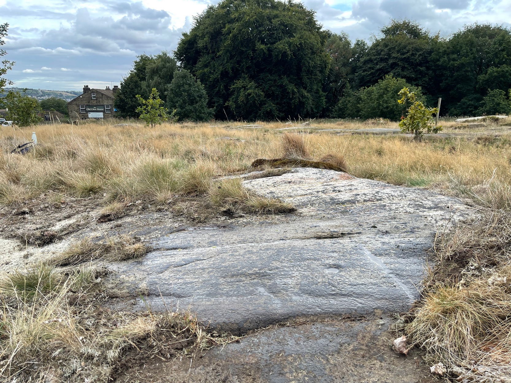
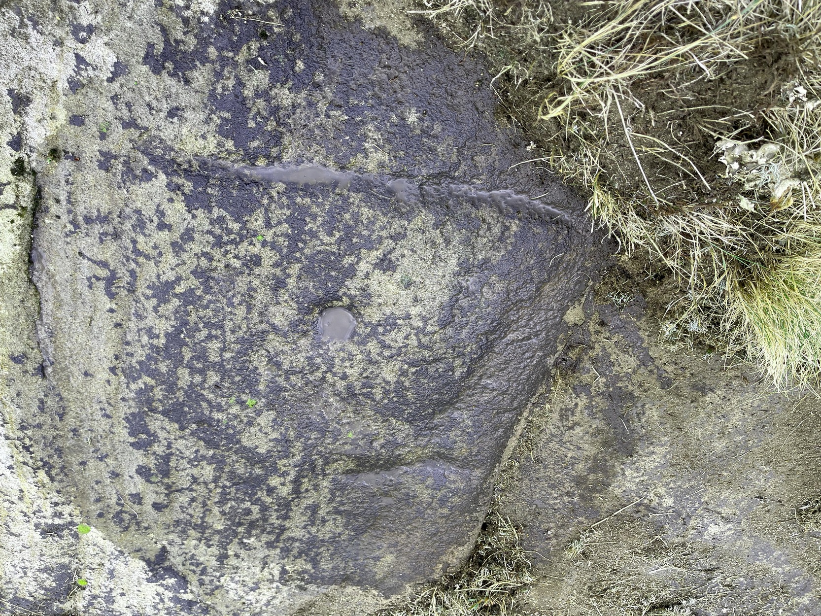
Once you’ve got yourself to the start of Shipley Glen, from the Old Glen House pub, from the car-park outside walk up the road for 60 yards (if you reach the next small car-parking spot, you’ve gone too far) then step off-road into the vegetation on your left and you’ll see the large flat fractured section of earthfast rock. Get low down and seek out the cup-mark first!
Archaeology & History
This is a very faded and quite basic design and unless you get decent low sunlight, it can be very difficult to discern. On my most recent visit here, conditions weren’t too good, as the photos here indicate.
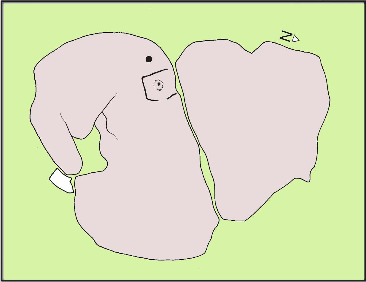
The main feature is a single cup-mark surrounded by a very wide ‘square’ ring (if y’ get mi drift). It was first mentioned and illustrated in John Hedges (1986) survey, who described it simply:
“Striated, pitted bedrock with crack down centre, in grass and amongst other rocks and bedrock. Carving, centre and W end: enclosure type angular grooves and two cups.”
John Hedges 1986 sketchCup & surrounding lines
One of the two cups is presently beneath some shallow vegetation (easily removed if anyone’s passing), but the main feature of the large enclosing square and its central cup is presently exposed and can be seen when your eyes eventually adjust. Interestingly, Hedges shows the existence of a faint ring around the central cup inside of the larger square enclosure. If someone is able to capture a photo of this, please add it on our Facebook page. 🙂
I must point out that somewhere, not too far from this carving, was once found a very similar design known as the Brackenhall Green carving that possessed the same curious squared-ring feature that we find on this stone.
References:
Boughey, Keith & Vickerman, E.A., Prehistoric Rock Art of the West Riding, WYAS: Wakefield 2003.
Hedges, John (ed.), The Carved Rocks on Rombalds Moor, WYMCC: Wakefield 1986.
Cup-and-Ring Stone (destroyed): OS Grid Reference – SE 133 389
Archaeology & History
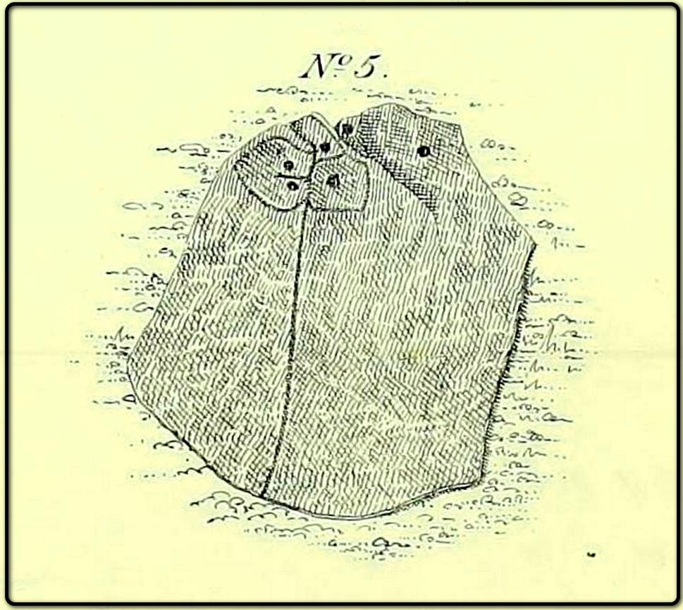
The lost carving of Brackenhall, in 1888
I first came across a description of this lovely-looking cup-and-ring carving during some research I was doing in the archives at Bradford Central Library in the 1980s—and decided there and then that I had to find it! It was described and illustrated for the first time by William Glossop (1888) when he made a short survey of some of the prehistoric sites on Baildon Hill and Shipley Glen. He told that it was one amidst “a cluster of rocks on Bracken Hall Green”—but was seemingly destroyed not too long after he wrote about it. There was some discussion in the late-1980s that it may have been a petroglyph that was cataloged by John Hedges as carving ‘BM14’ (at SE 13272 38924), due to it possessing a similar ‘artistic’ element (or motif, as some like to call it) and which is also along the Brackenhall plateau by the roadside about 160 yards below the entrance to the Brackenhall centre—but it turned out not to be the case.
A few years after Mr Glossop uncovered this carving, a short note by J.H. Turner (1894) described two cup-marked stones, “both now destroyed” that could be seen in the same area just as you entered “the plateau where the Easter fair is now held”. And his description closely fitted Glossop’s sketch. Turner wrote:
“The cups were three inches in diameter, and one inch deep, in an oblong 18 by 12 inches, with line 6 feet long towards the east. The second oblong, same size, had also an eastern pointer and one cup in the centre. These have both disappeared since June, 1889; I fear by wanton mischief.”
This would seem to be the same carving illustrated by Glossop, although it’s still difficult to say with any accuracy where it was located. The great historian W.Paley Baildon (1913) thought it may have been the same carving which Harry Speight (aka Johnnie Gray) described at the Glen Gate—and it does sound similar, but until we are able to ascertain (i) where Glen Gate was; and (ii) whether it coincided with the location of “where the Easter fair” was held, we must err on the side of caution. Tis an intriguing mystery… (Note: the grid-reference given for this site profile is an educated guesstimate!)
References:
Baildon, W. Paley, Baildon and the Baildons – volume 1, Adelphi: London 1913.
Glossop, William, ‘Ancient British Remains on Baildon Moor,’ in Bradford Antiquary, no.1, 1888.
Gray, Johnnie, Through Airedale from Goole to Malham, Walker & Laycock: Leeds 1891.
Turner, J. Horsfall, ‘Cup Marks, Shipley Glen,’ in Yorkshire County Magazine – volume 4, J.E. Watmough: Idel 1894.