Stone Circle (destroyed): OS Grid Reference – SP 470 464?
Also Known as:
Ringstone Well
Archaeology & History
In 1239 CE we find records of a field-name site called “Ringstoneswelle.” Although the place-name writer Margaret Gelling (1954) initially ascribed this as the watering-place of some dood called Hringstan, it is in fact the only record that I’ve found of a “stone circle by a well” in the village. This etymological root is confirmed in A.H. Smith’s English Place-Name Elements (vol.1, p.265) as a probable stone circle.
Folklore
There is also the curious field-name legend of a place in Cropredy called Kirk or Church Piece, where a christian church was being built, but in the morning all the stones had been uprooted & moved back from whence they came. This happened several times according to the folktale – a story that has with all the hallmarks of a megalithic site. (see Grinsell’s Folklore) To me it seems likely that the nearby Cup and Saucer Stone also had something to do with this lost stone circle.
In the same area we have another intriguing bit of folklore that was reported in an early edition of the Banbury Guardian (1932) which told that,
“on one of the top stones of a wall in front of one of the farmhouses is what is supposed to be the Devil’s footprint and there are nail-marks in the stone, but how it gots it name is a puzzle. At the back of the vicarage gardens is a small jetty called HellHole, the old ‘Old Man’ must have visited this village a time or two.”
Are there any local antiquarians or historians who can throw further light on this seemingly lost megalithic ring?
References:
Anonymous, ‘Cropredy and its Legends,’ in Banbury Guardian, December 29, 1932.
Bennett, Paul & Wilson, Tom, The Old Stones of Rollright and District, Cockley: London 1999.
Gelling, Margaret, The Place-Names of Oxfordshire – volume 2, Cambridge University Press 1954.
Grinsell, Leslie V., Folklore of Prehistoric Sites in Britain, David & Charles: London 1976.
Smith, A.H., English Place-Name Elements – Part 1, Cambridge University Press 1954.
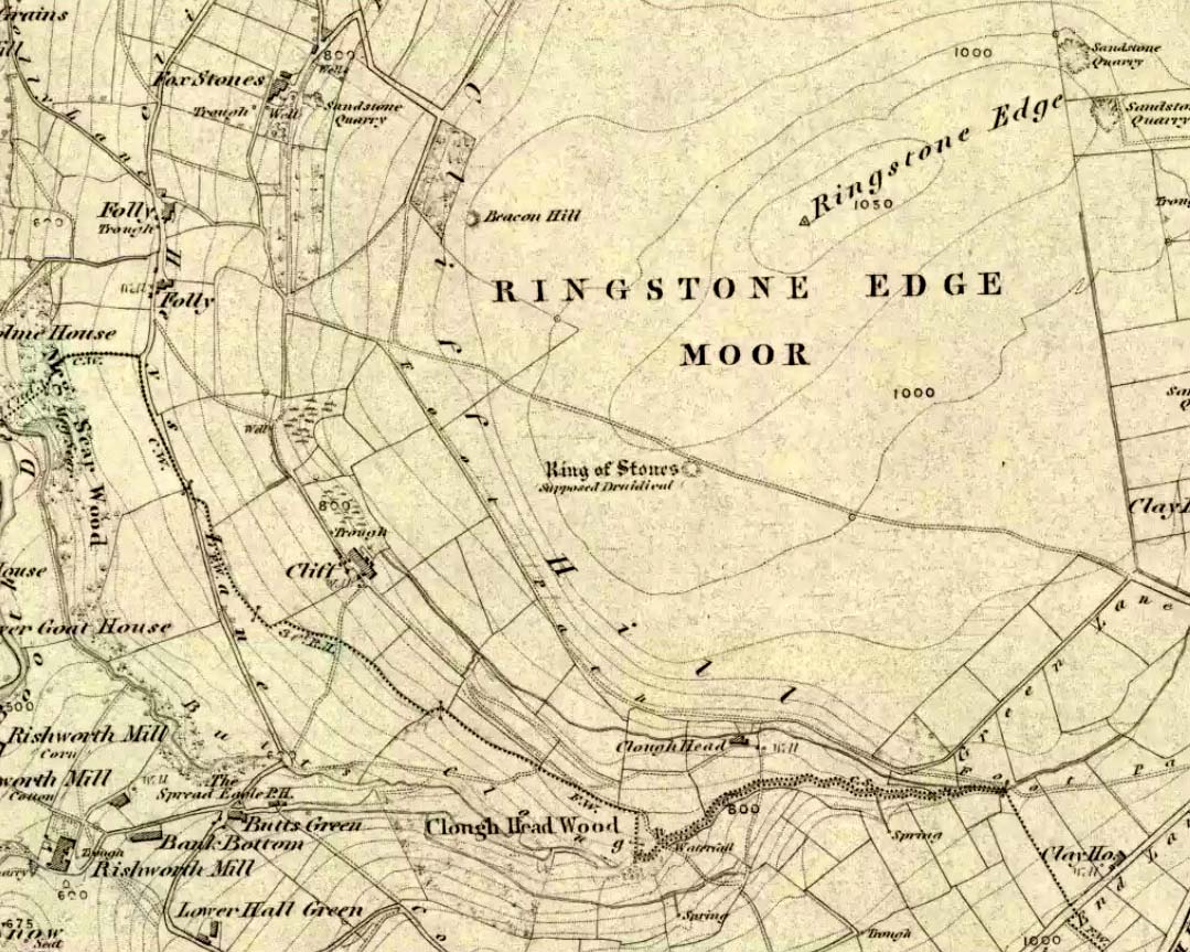
From Ripponden, taken the steep road up to Barkisland, but at the crossroads just before the village, turn right (south) and keep going for a mile till you reach the reservoir. At the far-end of the reservoir, take the track down by its side and follow the footpath that bends round the edge of the grasslands. Go up onto this small moorland and, once you’re on the level, head towards where you’ll see a large pile of stones a coupla hundred yards away. That’s it!
Archaeology & History
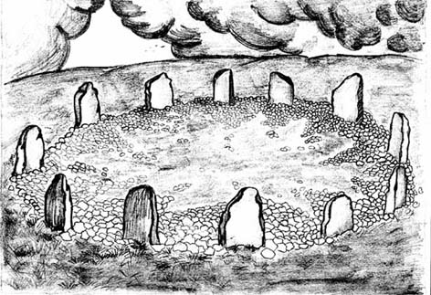
If we visit this site today, all we are left with is a scattered mass (or perhaps that should that be ‘mess’) of many hundreds of stones: the last remnants of what once would have been a proud circle of one form or another upon this small moorland plain. Its significance was such that the very moor on which its remains are scattered, was named after it: the Ringstone Edge Moor. But as with many sites from our megalithic period, this old place is but a shadow of its former self.
Gone are the upright monoliths which, tradition relates, once surrounded this low scattered circle of small loose stones (which would have made it look not unlike the wonderful stone circle of Temple Wood, Argyll). These standing stones were, so the folk record tells, removed near the end of the 18th century for use in some walling.
Described variously as a stone circle, ring cairn, cairn circle, an enclosure, and more, the site first seems to have been written about in 1775 by the great historian John Watson. When he was vicar of the local parish in Halifax (not far from here) this “ring of stones” as he called them, was “called the Wolf-fold.” Nearly one hundred years later, in F.A. Leyland’s superb commentary to Watson’s work, he wrote,
“The stones which constituted the circle at the time of their removal stood upwards of three feet…and the remain formed a striking object on the moor. The original number of stones of which the circle was formed is unknown, having long been in ruin and reduced in quantity before being finally removed. This was effected about twelve years since by the present tenant of the dam.” – that is, around 1859.
However, when Crabtree (1836) described the circle a decade or two earlier, he made no mention of such standing stones — although we must consider that Crabtree was very much like many modern academic archaeologists who tended to copy the works of others, much less than getting out in the field to see for himself.
At the beginning of the 20th century, the lore telling of the standing stones’ demise was repeated by local historian John Priestley (1903), when he said that: “all the large stones…were carted away about forty years ago” — that is, around 1863.
So it would seem that the very final destruction of the standing stones here, occurred sometime during the four year gap which Messrs. Leyland and Priestley describe.
More than fifty years later, Huddersfield historian James Petch (1924) came here to explore whatever remains he could find, and told:
“On top of a flat plateau on this moor, with an extensive view on all sides save on the north, where there is a gentle slope for some hundreds of yards up to the summit of the hill, there are distinct traces of a circular ring of small stones. Pygmie flints have been picked up within a yard or two, but the only other fact to be noted about this earthwork is that there is a tradition to the effect that much earth has been removed from this site. It is not altogether impossible that this is a scanty remnant of a round barrow.”
This latter remark of Mr Petch seems most probable. The excessive scatter of small stones typifies the remains of many of the Pennine giant cairns, from the Little Skirtful on Burley Moor and giant tombs of the Black Hills near Skipton, to the similar monuments of our Devil’s Apronful, Pendle, etc, etc.
Close to this cairn circle, wrote Sidney Jackson (1968), there used to be the remains of an Iron Age settlement, “marked by wall foundations (but) is now covered by the waters of Ringstone Reservoir.”
Folklore
There is very little folklore that I’ve found here. Watson (1775) throws the usual idea that the place was a site of druidical worship; but other than that we only have a local Ripponden writer’s account, which told that there was once the ghost of a white lady that was once said to walk along the path somewhere between here and the Beacon Hill tumulus, a short distance to the north.
Takes a bitta finding – especially if some dood’s knocked it down again (as happens up here). Best thing to do is get to the Miller’s Grave prehistoric cairn, which is only a few hundred yards away. From Miller’s Grave, walk due west for 200 yards till you hit once a ditched footpaths, where you should turn right. A short distance along you’ll hit a 5-foot-tall boundary stone called the Greenwood Stone with ‘1775’ carved on one side. From here, walk due south into the heather for 75 yards. You’re very close!
Archaeology & History
We resurrected this old standing stone in 1996, several years after first discovering it laid amidst the heather in the early 1990s. It appeared to mark an old boundary line (no longer used) betwixt Wadsworth Moor and Midgley Moor, but its nature is distinctly prehistoric. The remains of a small hut circle (seemingly Bronze Age, though excavation is needed) can be found a short distance to the west, though this is hard to find when the heather has grown. Other seemingly prehistoric remains scatter the ground nearby, none of which have received the attention of archaeologists.
Greenwood ‘B’ on a grey day
As you can see from these grey, rain-swept images, this upright stone is well-weathered (though we need to visit here again soon and get some better photos). It stands some 4-feet tall and may have accompanied one or two other monoliths close by. The suggestion by one Peter Evans that the Greenwood B stone stood “possibly at the centre of a stone circle” is sadly untrue (soz Peter); though it probably had some relationship with the Millers Grave cairn site, a few hundred yards equinox east.
References:
Bennett, Paul, The Old Stones of Elmet, Capall Bann: Milverton 2001.
Easy to find if you go at the right time of year — very troublesome to find if you go at the wrong time! Check the place out at the end of winter, beginning of Spring. It’s at the top end of Shipley Glen, just past where the road bends round and goes uphill. About 50 yards up, on the left side of the road walk into the grasslands for less than 100 yards. Look around!
Archaeology & History
An intriguing site this one. Intriguing as it wasn’t in the archaeological registers when I first came across it — and I’m really unsure whether it’s in there now. It probably has, as John Barnatt came here with some earth-mystery folk in 1982! But when I first visited this site in 1975 it seemed no one knew about it — and little has changed since then.
It is an enclosed ring of stones less than 30 feet across with an earth embankment separating it from what seems like a secondary ring on its outer edge, a foot or two away. This didn’t appear to surround the complete ring and may have been damaged. It had an appearance similar in size, shape and form to the Roms Law and Harden Moor sites, and thankfully in reasonable condition. I don’t think any excavation has yet been performed here though.
There are a number of other small standing stones on the outskirts of this ring that may have some relationship with the site, but we need excavation to prove one way or the other. Several very well-preserved cup-marked stones are close by.
Folklore
Intriguing to those of you who are fascinated by alignments between sites, or ‘leys’, as an impressive lines runs through this site. Starting at the little known Hirst Woods Circle and terminating at the giant Great Skirtful of Stones cairn, once passing over the now destroyed Weecher circle and the Brackenhall Green ring on its way.
References:
Bennett, Paul, The Old Stones of Elmet, Capall Bann: Chieveley 2001.
From the Askwith Moor dusty parking spot, walk up the road for 160 yards where, on each side of the road, you’ll see a straight line running across the moors. On the left-side (west) walk onto the moor for 50-60 yards along this line, then dead straight west into the heather for another 50-60 yards and look around. It’s hard to see if the heather’s grown.
Archaeology & History
Found by Richard Stroud on July 20, 2004, this single hut circle is in faint evidence. About twenty feet across with a section of the low walling either missing, or more probably buried in the peat. Although no other hut-circles were immediately visible, this was probably because of the excessive heather-growth. I have little doubt that others will be close to this one, as the area is littered with prehistoric sites. The petroglyph catalogued as Askwith Moor 529 is very close to this hut circle.
The great Huddersfield historian, Philip Ahier (1948), in describing the lack of documentary evidence for several crosses in the neighbouring region, “at Deighton, Cowcliffe, Marsh and Golcar,” found out that,
“One did exist at Slaithwaite in front of the Manor House in the early past of the last century. In March 1931, the base of this cross, commonly known as the Dial Stone, was removed to Doughlas in the Isle of Man, where it rested in the garden of Mr Harry Wood; in August 1939, it was brought back to Slaithwaite and now stands in the Recreation Park.”
However, this site differs from another two that I’ve found records for on the outskirts of this township. Does anyone know what became of this old stone cross? Izzit still about? Its folk-name of the Dial Stone may make it a little easier to locate — but at the same time it does bring up the query, Why was it called that?
References:
Ahier, Philip, The Story of the Three Parish Churches of St. Peter the Apostle, Huddersfield – volume 1, Advertiser Press: Huddersfield 1948.
In the midst of the great henge monuments at Thornborough — specifically, the central henge — archaeologist Ian Longworth (1965) said there “was built …a still earlier structure known as a cursus.” This giant monument was one of the earlier such sites located in Britain. Longworth continued, saying:
“This was a ceremonial avenue, running for nearly a mile in a northeast / southwesterly direction. The avenue is defined by ditches 144 feet apart with a bank running along the inside of each ditch. The ditches are now completely filled with plough soil and, as with other cursus monuments in the county, were discovered from the air as two dark lines in the cereal crop… Probably used for ritual ceremonies, no clues remain to show what actually took place.”
Thornborough Cursus (& henges)
This cursus runs almost at right angles to the alignment of the three Thornborough Henges, on the southern side of the central henge, and was first found through the aerial photography of J.K. St. Joseph between 1945 and 1952. When excavation work was carried out, “a crouched burial was found in a stone cist within the southwest end” of the cursus. This end of the monument is rounded, like the Stonehenge Cursus; whilst the northeast end of the monument has not been located. The southwest end of the cursus begins at OS grid-reference SE 2799 7906 and its northeasterly end is roughly at SE 2881 7954. The middle of the known cursus is roughly in Thornborough’s central henge.
Paul Devereux (1989) said that the monument, “which had become silted-up and grass-covered by the time the henge was built, had two main orientations, with a curvilinear, irregular section just to the east of the henge.” Although Norris Ward (1969) thought that the cursus actually went all the way down the River Ure, it stops some distance beforehand, though may obviously have had some important relationship with the waters.
References:
Longworth, Ian H., Regional Archaeologies: Yorkshire, Cory, Adams & Mackay: London 1965.
Pennick, N. & Devereux, P., Lines on the Landscape, Hale: London 1989.
Thomas, Charles, ‘Folklore from a Northern Henge Monument,’ in Folklore Journal, volume 64:3, 1953.
Ward, Norrie, Yorkshire’s Mine, J.M. Dent: London 1969.
Follow the directions to reach the giant Haystack Rock, then follow the footpath west along the moor-edge, round where it bends keeping along the edge of the stream (Backstone Beck) below. A couple of hundred yards after the bend, right by the side of the path. You’ll see it! (if you hit the clearly defined ‘enclosure’ walling, you’ve gone too far)
Archaeology & History
No — not the Rosetta Stone; but it is a lovely carved rock this one. Best seen (as usual) when the rock’s wet and the sun’s heading for (or just emerged from) the horizon — but much of this image is visible even when She’s cloudy.
Close-up of ‘rosette’ design & and other CnRsThe Rosette Stone carving
First mentioned in literary terms (surprisingly) by M.J. Walker (1956), in a short write-up following one of the Bradford Archaeology Group’s moorland walks up here. Nearly six-feet along its longest axis, there are more than 30 cup-marks on this stone, at least three with rings; plus a variety of lines linking some cups to others. At its northern tip is the lovely little ‘rosette’ design, as archaeologists have called it. Others have seen this part of the design as a solar image; a flower; the Pleiades; a ring — take your pick! It is a lovely carving though (if you’re a sad person like me, who’s into these sorta things!). What relevance – if any – it may have had to the ‘enclosure’ within whose edges it sits, is anyone’s guess!
Excavations done close by (focusing mainly on the prehistoric ‘enclosure’ within whose domain this and other carvings occur) uncovered remains of old grooved ware pottery and the remains of flints. (Edwards & Bradley 1999)
The one thing we realise from looking at this design is the difference seen between the ‘accurate’ illustration drawn by archaeologists, and the flesh and blood of the stone itself, in situ. The living rock has much greater form and expression than anything which our desire for accuracy possesses. This aint knocking any attempt to portray the cups, rings and lines on paper correctly to show what the design originally looked like; merely that there’s a world of difference between the experiential vision of the carving and that done with graphic accuracy. But we all know that anyway – so please forgive my little sojourn into speaking the bleedin’ obvious!
References:
Boughey, Keith & Vickerman, E.A., Prehistoric Rock Art of the West Riding, WYAS 2003.
Edwards, Gavin & Bradley, Richard, ‘Rock Carvings and Neolithic Artefacts on Ilkley Moor, West Yorkshire,’ in Grooved Ware in Britain and Ireland (edited by Cleal, R. & MacSween, A.), Oxbow: Oxford 1999.
Hedges, John (ed.), The Carved Rocks on Rombald’s Moor, WYMCC: Wakefield 1986.
Walker, M.J., ‘Ilkley Boulders Tour,’ in Bradford’s Cartwright Hall Archaeology Group Bulletin, 2, 1956.
Pretty easy to find. Follow directions to reach the great cup-and-ring marked Haystack Rock, then follow the footpath west and drop down the slope, crossing the stream of the Backstone Beck below you, the up the steepish slope and turn sharp left when you hit the footpath before the top of this slope. Walk onto the moor! You’ll walk right past the cup-and-ring marked ‘carving 283’ on this path, then the ruinous Backstone Circle a bit further along (50 yds to your right), but keep walking for another 100 yards until you see a large boulder a few yeards to the left of the footpath. That’s it!
Archaeology & History
I first came across this as a kid, sometime in my early to mid-teens, pottering about, looking at any old rock that caught my eye. And this one isn’t hard to miss really. One of the best memories I’ve got of this stone was when a bunch of us came walkabout up here, sometime in the autumn, when the heavens poured all day long to saturation-point — even for those in all their protective gear, such good as it was in the late ’80s to early ’90s. There started out a fair bunch of us—between 20-30 folk—with numbers dwindling sharply when we reached the Apostles. But this stone was visited way before that! Along with Bob Trubshaw, Graeme Chappell, Kaledon Naddair, Edna Whelan and a troop of other mad-folk, we stopped for a while to consider this old rock, with only three cups really visible that day. The others (those cited by the archaeo’s) weren’t picked out, as I remember. But She was pissing-it-down and the wind was really giving-it-some, so we didn’t stop here for long! We all agreed though: it was a nice, worn cup-marked stone.
Gill Head rock carvingGill Head carving (after Hedges 1986)
John Hedges and the Ilkley Archaeology bunch had cited it as ‘cup-and-ring’ in their fine work — the first time this old carving had been in print since it was first etched! A few years later when Messrs Boughey & Vickerman (2003) checked it for their survey, no new features had been noted and they just copied Hedge’s earlier notes. Indeed, it’s just a large boulder with a few archetypal cupmarks on it when it first greets the eyes. Nowt special—and with no companions either.
This is another one mainly for the mad-folk and purists amongst us.
References:
Boughey, Keith & Vickerman, E.A., Prehistoric Rock Art of the West Riding, WYAS 2003.
Hedges, John (ed.), The Carved Rocks on Rombald’s Moor, WYMCC: Wakefield 1986.
Dead easy! Near the western end of Caton village, right on the edge of the main road (A683) running through the village (south-side of the road), enclosed by railings, you’ll see the remains of this ancient tree, just by the side of the stream. Keep your eyes peeled!
Archaeology & History
The small scruffy-looking remnant of an oak standing here by the roadside in Caton village, surrounded by protective railings, is the dying remnants of the old tree, standing upon the sandstone steps which were known as the Fish Stones: a curious monument that has been listed as a protected monument by the Dept of National Heritage. A small plaque on the side tells:
“The three semi-circular sandstone steps, shaded by the oak tree, were used in medieval times by the monks of Cockersand Abbey to display and sell fish caught from the River Lune. The ancient oak tree, reputed to date back to the time of the druids, and the Fish Stones, have become a landmark and Symbol of Caton.”
Druid’s Oak, Caton
This was probably the local moot spot for villagers and those living in outlying farms and hills in medieval times. No doubt a market of some sort was also once here; perhaps even an old cross, as the Fish Stones have all the appearance of some village cross steps. I’ve found little else about this old tree, nor any folklore (but aint looked too hard if truth be had!). There’s surely more to be said about this once sacred tree.