Fyfield Down, Avebury, Wiltshire

Cup-Marked Stone:  OS Grid Reference – SU 1343 7152

Getting Here

‘X’ roughly marks the spot

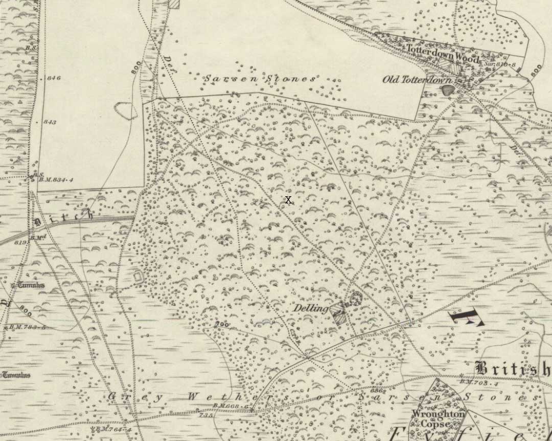
We were fortunate and taken here by the renowned local megalith authority, Pete Glastonbury – but without Pete’s help you might be ambling here and there for quite a while.  It’s on the eastern side of The Ridgeway, down the slope past the stone known as The Polisher, across the flatland sea of many rocks until it begins rising again a few hundred yards east.  Where a long straight embankment rises up a few feet (a boundary line), the rock’s just a few yards above it.  Walk back and forth around here and you’ll eventually find it!

Archaeology & History

Lacaille’s 1962 sketch of the carving

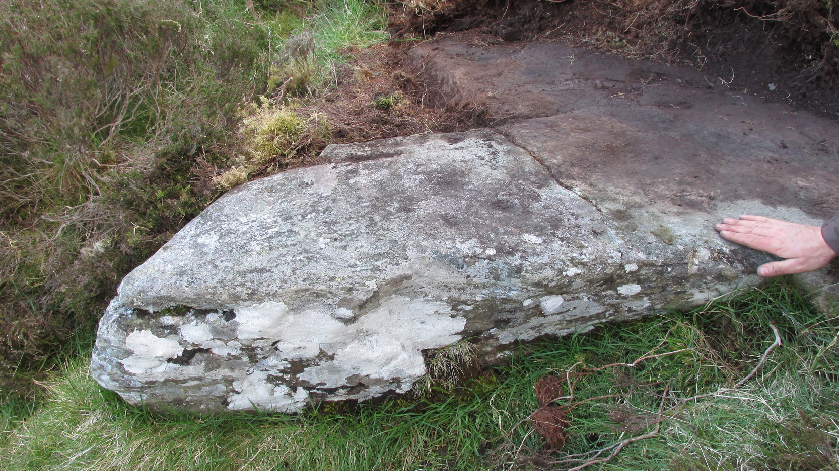
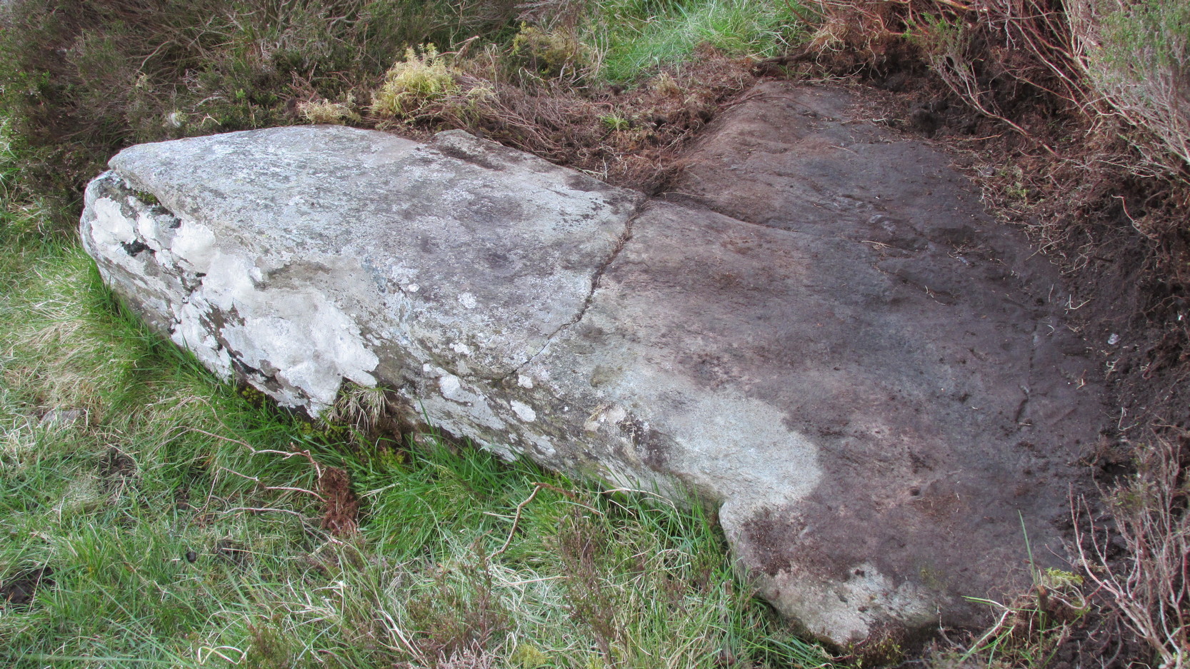
Archaeologist A.D. Lacaille (1962) appears to have been the first person to have written about this little-known site, describing it as being “between the south-western corner of Totterdown Wood and Delling Cottage.”  Here is what he described as, “a cluster of unmistakably artificial and mostly well-preserved cup-markings on the smooth south-easterly sloping surface of a recumbent sarsen.”

Fyfield cup-markings (© Pete Glastonbury)

And from the photos accompanying Lacaille’s article, it obviously looked a decent carving as well — and so it has transpired.  Lacaille (1963) briefly mentioned the carving again a year later in his lengthier essay on the nearby Polisher Stone up the slope a few hundred yards away.  But then Wiltshire’s only known cup-marked stone was all-but ignored by archaeologists and left in the literary wilderness until, years later when rock art became a fad in such circles, regional archaeologists Pete Fowler & Ian Blackwell (1998) described the carving as “a cluster of several round depressions…each about two inches across”; though incorrectly ascribed it as the “southernmost example” of cup-marked stones outside of Cornwall.¹  Another rock-art student known as Mr Hobson, following his excursion to the site with the regional authority Pete Glastonbury, wrote:

“The cups themselves are very smoothed out, and fit the bill from the drawing. The horseshoe is very evident, as is the ‘slug’ mark, possibly a half-finished groove from one of the cups near the horseshoe. There are also some angular, yet serpentine (?) grooves at turf level on the south side of the stone. These look like they might be enhanced natural marks in places.”

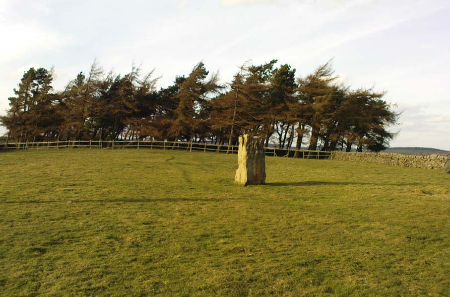
The rock itself isn’t in its original position, having been moved from another point very close by (probably only yards away).  It is sited on the edge of an old boundary line — which made me wonder whether the ‘U’- or ‘C’-shaped ingredient in the carving was a later addition, perhaps of one of the old land-owners hereabouts.  The cups however, seem typical of the thousands that we find in northern Britain.

and from another angle (© Pete Glastonbury)
Primitive man & stone (© Pete Glastonbury)

The isolation of this carving is rather anomalous.  Others should be in the area but archaeo-records are silent (though the majority of Wessex archaeologists are academically illiterate when it comes to identifying such carvings).  The carving may simply be the product of nomadic northerners, showing what their tribes do ‘up North’, so to speak.  However, considering the tough nature of southern sarsen stones, it’d have taken ages to etch just this one stone.  You can visualise it quite easily: southern tribal folk looking on, somewhat perplexed, as a northern traveller tried to convey what they etch on their stones in the northern lands, only to struggle like hell with cup-marks they’d do with ease on the softer rocks of their homelands.  Wessex tribes-folk may have watched, seen the trouble their traveller had over such inane and (perhaps) meaningless carvings, and didn’t see the mythic point s/he was trying to convey…

Curious ‘U’ or ‘C’-shaped feature

Or maybe not!

The lesson with rock-art tends to be simple: where there’s one carving, others are nearby.  The rule aint 100% of course — but when we were here the other day I was wanting to dart here, there and everywhere to check the many thousands of outcrop rocks that scatter this entire area.  Us rock-art nuts tend to do things like that.  It’s a madness that afflicts…

There were one or two stones with ‘possible’ single cup-markings on them, but I wasn’t going to start adding them to any catalogues.  They were far too questionable.  I was wanting something a bit more decent than that.  And then, when Mikki, June, Pete, Geoff and I got to the collapsed long barrow known as the Devil’s Den a few hundred yards further down this rock-strewn sea of a valley, there was something with a bit more potential that we came across…

Folklore

In recent years this cup-marked stone has already attracted imaginative notions, with little foundation.  Archaeologists Fowler & Blackwell (1998), in their otherwise fine book, think this carving was related to goddess worship, describing how,

“On Dillion Down…the Great Mother’s help was permanently invoked by patiently indenting a special stone with symbols of her potency.”

Adding that this “was a new idea brought in from the North, and Fyfield was the only place to have such a stone.”  Weird!  I could’ve sworn there were plenty of other rocks between here and there!

References:

  1. Fowler, Peter J., Landscape Plotted and Pieced: Landscape History and Local Archaeology in Fyfield and Overton, Society of Antiquaries London 2000.
  2. Fowler, Peter & Blackwell, Ian, The Landscape of Lettice Sweetapple, Tempus: Stroud 1998.
  3. Lacaille, A.D., ‘A Cup-Marked Sarsen near Marlborough, Wiltshire,’ in Archaeological Newsletter 7:6, 1962.
  4. Lacaille, A.D., ‘Three Grinding Stones,’ in Antiquity Journal, volume 43, 1963.

¹ Along with the cup-markings atop of Devil’s Den a few hundred yards to the south, across in Somerset we had the Pool Farm example; there are a number of examples in Dorset, including the Badbury Rings carving; plus others in Devon, etc.

* Pete Glastonbury is a Wiltshire-based photographer specialising in Landscapes, Astronomy, Archaeology, Infra-Red, Experimental Digital Photography and High Dynamic Range Panoramic photography.

© Paul Bennett, The Northern Antiquarian


Hartwith Moor, Summerbridge, North Yorkshire

Standing Stone:  OS Grid Reference – SE 21233 62737

Also Known as:

  1. Standing Stone Hill

Getting Here

Hartwith Moor stone

A half-mile south of the superb Brimham Rocks complex, take the straight road south until you hit the second farmhouse (and accompanying caravans).  Go up the public footpath past Highfield Farm and just check with the landowner’s permission to wander his land if you want to see the stone.  They’re OK about it if you ask.  The lady there is very amiable and will tell you what’s what, giving directions right to it, telling us it was off the footpath in the middle of one of his fields.

Archaeology & History

Archaeology texts are, once more, silent about this stone (and other monuments in the region), making you wonder just what the hell some of them are paid for!  The stone appears to have given its name to the land upon which it stands which, as the locals tell, “has always been known as standing stone hill.”  And no wonder — it’s a bloody decent standing stone!  On its northern face we find well-eroded lines running down the stone, similar to the weathering found on the Devil’s Arrows a few miles to the east.

Standing Stone Hill stone
Looking south

Although just over 6-feet tall, this is a solid bulky old fella.  But the spot he presently occupies isn’t his original standing place.  He was found knocked over and lying on the ground in the middle of the 20th century, slightly out of position.  But he was thankfully stood back upright by the local land-owners sometime in the 1960s, where he’s been stood ever since.  It must have been one helluva job!  And making it more difficult was the intriguing geological nature of the Earth right beneath this field.  As the lady who now own the land told us,

“When the fields were tilled we found that all of them were easy to turn over, except the one with the stone in it!  There’s virtually no soil of any depth to write home about,” she said.  “It stands on only a few inches of soil and then you hit solid rock right underneath it.  All the other fields are OK – but this one’s the odd one out.”

And before the fields were farmed, just over a hundred years ago, all this land was covered in moorland heather.  Then the land was enclosed, the Earth’s heathland stripped out of existence and turned over to agriculture.  But thankfully the standing stone was left here.  It makes you wonder what else was destroyed when the moorlands were industrialised…

The stone does get a brief mention in Boughey & Vickerman’s (2003) Prehistoric Rock Art of the West Riding, where they mention there being “three possible cups in (a) line on one side” of the standing stone, but these are little more than Nature’s handiwork and nowt else.  There are a couple of other cup-and-rings nearby which are the real thing – but the ‘cups’ on this stone aint man-made.

© Paul Bennett, The Northern Antiquarian


Fairy Stone, Cottingley, Bingley, West Yorkshire

Cup-and-Ring Stone:  OS Grid Reference – SE 09816 37862

Also Known as: 

  1. Black Hills Carving 01
  2. Cottingley Woods (01) carving

Getting Here

To get here, start from Bingley centre, go through Myrtle Park, across the river bridge and turn right at the dirt-track. Walk on & go over the old bridge/ford of Harden Beck, keeping with the track until the next set of buildings and be aware of a footpath left here. Take this and cross the golf-course, bearing SE until you reach the edge of Cottingley Woods. Take the distinct footpath into the trees & walk up the vivid moss-coloured path until you reach the level at the top where the woods become more deciduous. Here, turn left for 100 yards into the bit of woodland which has been fenced-off and walk about. You’ll find it!

Archaeology & History

Cottingley Woods Fairy Stone

This is a truly superb cup-and-ring stone which anyone into the subject must take a look at!  It was first found by the old forester here, Ronald Bennett, in 1966 — ten years before the rock art student Keith Boughey (2005) mistakenly reported it to have been found “by Valerie Parkinson…in 1976.”  Everything about it’s excellent — but I think the setting in woodland is what really brings it out.

The first published account and photograph of this superb carved stone seems to have been in Joe Cooper’s (1982) precursory essay on the Cottingley Fairies in an article he wrote for The Unexplained magazine in the 1980s.  A few years later I included the stone in a short article on local folklore (Bennett 1988), then again much later in The Old Stones of Elmet (2001).  It was curiously omitted from Boughey & Vickerman’s (2003) survey, as were the other carvings that are found very close by.  Not sure why…  But of the small cluster here (I’ll add the others later), this carving stands out as the best of the bunch by far!  Its name has nothing to do with the Cottingley Fairy folk down town: it simply originates from my own teenage thoughts and the true ambience of the setting. Check it out!

Joe Cooper’s 1982 photo
Fairy Stone carving

The rock is typical millstone grit and its carved upper surface measures roughly 3 yards east-west and 2 yards north-south, sloping gently into the ground.  As the photo shows, this is an elaborate design seemingly centred around two large and another smaller circular form, each enclosing a number of internal cups, ring and lines.  The next time we’re over there, we’ll try get some clearly images and make a detailed drawing of the old fella!  In the event that you visit here, check out the other three carvings close to this primary design — and try work out which one of the three was carved by the scouts in more modern times!  Another simple cup-marked stone was recently found in the undergrowth a short distant east of this group.

Sketch of the design in 1981

Recently the carving was given attention with what’s known as photogrammetry software: this enables a more complete image of the 3-dimensional nature of objects scrutinized.  In the resulting photos (which I’m unable to reproduce here due to copyright restrictions), a previously unseen long carved line was detected that runs across the middle of the larger of the two enclosing rings.  Hopefully in the coming months, those with the software (can’t remember whether it’s English Heritage or Pennine Prospects who won’t allow it) might allow us to reproduce one or two of their images to enable the rest of the world to see what their images have uncovered.  After all, considering that we peasants brought this carving to their attention, you’d at least hope they could repay the finds.  Some of these larger organizations, despite what they may say, simply don’t swing both ways!

Folklore

In an early edition of my old Fortean archaeology rag of the 1980s, I narrated the tale of one Anne Freeman, who was walking through the woods here.  When she reached the top of the woods, near some stones she heard a loud chattering and allegedly saw two tiny figures barely one-foot tall wearing red outfits and green hats in “medieval peasant dress”.  Andy Roberts (1992) later repeated the tale and illustrated the carving in his Yorkshire folklore work.

In the 1960s, the old ranger Ronnie Bennett (no relative of mine) who first found these carvings, also reported that he saw little people here: “not one, but three,” as he said.  Not fairies with wings, but more gnome-like.

References:

  1. Bennett, Paul, Of Cups and Rings and Things, unpublished: Shipley 1981.
  2. Bennett, Paul, ‘Tales of Yorkshire Faeries,’ in Earth 9, 1988.
  3. Bennett, Paul, The Old Stones of Elmet, Capall Bann: Milverton 2001.
  4. Boughey, Keith, “A Group of Four Cup-and-Ring-Marked Rocks at Black Hills, Cottingley Woods,” in Prehistory Research Section Bulletin, no.42, 2005.
  5. Cooper, Joe, ‘Cottingley: At Last the Truth,’ in The Unexplained 117, 1982
  6. Roberts, Andy, Ghosts and Legends of Yorkshire, Jarrold 1992.

© Paul Bennett, The Northern Antiquarian

Ellers Wood (614), Washburn Valley, North Yorkshire

Cup-and-Ring Carving:  OS Grid Reference – SE 1895 5099

Ellers Wood carving 614 (after Boughey & Vickerman)

Getting Here

Ellers Wood is at the very northern edge of the beautiful parish of Askwith and has a very particular ambience of its own. The small cluster of at least 5 cup-and-ring stones in this lovely little woodland gives you the impression that they stood out on their own, living here representing the genius loci of this luscious watery vale, all-but-hidden from all but the lucky few.  It’s very likely that there are still more carvings hidden away nearby.

The best way to check them out is simply to walk down past the haunted Dobpark Lodge, where it turns into a footpath and where it crosses the lovely old packhorse bridge at the valley bottom, walk a few hundred yards up the river-side (at the bottom of the fields) until you reach Ellers Wood. Once there, look around.  This one’s on the west side of the main stream, close by where it meets up with another small burn coming down from the western wooded slopes.


Archaeology & History

First sketch of the carving, c.1994

In the same region as the Ellers Wood 618 and other carvings and very close to the river, somehow this heavily cup-marked stone evaded the prying eyes of such notaries as Cowling, Stuart Feather and Sidney Jackson – all of whom ventured to look at the other petroglyphs in Ellers Wood.  But with good fortune, Graeme Chappell and I re-discovered this fine-looking carving in our explorations in 1993-94 and gave it back the attention it truly deserves.

The main feature here is the clustering of cups into sections, as the drawing indicates.  It is listed as “stone 614” in Boughey & Vickerman’s (2003) survey.

References:

  1. Boughey, K.J.S. & Vickerman, E.A., Prehistoric Rock Art of the West Riding, WYAS: Exeter 2003.
  2. Cowling, E.T., ‘A Classification of West Yorkshire Cup and Ring Stones,’ in Yorks. Arch. Journal 1940.
  3. Cowling, Eric T., Rombald’s Way, William Walker: Otley 1946.
  4. Cowling, E.T. & Hartley, C.A., ‘Cup and Ring Markings to the North of Otley,’ in Yorks. Arch. Journal 33, 1937.
  5. Grainge, William, The History and Topography of the Forest of Knareborough, J.R. Smith: London 1871.
  6. Grainge, William, History and Topography of the Townships of Little Timble, Great Timble and the Hamlet of Snowden, William Walker: Otley 1895.

© Paul Bennett, The Northern Antiquarian 


Ellers Wood (619), Washburn Valley, North Yorkshire

Cup-and-Ring Carving:  OS Grid Reference – SE 1902 5102

Also Known as:

  1. Airship Carving

Getting Here

Old photo of CR-619

Follow the same directions for the Ellers Wood 614 and 618 carvings, as it’s nearby. The best way to check them out is simply to walk down past the haunted Dobpark Lodge, where it turns into a footpath and then when you reach the lovely old packhorse bridge at the valley bottom, walk upstream for 3-400 yards until you reach the next small wooded region.  Once there, look around…..

Archaeology & History

Ellers Wood is at the very northern edge of the beautiful parish of Askwith and has a very particular ambience of its own. The small cluster of at least 5 cup-and-ring stones in this lovely little woodland gives you the impression that they stood out on their own, living here respresenting the genius loci of this luscious watery vale, all-but-hidden from all but the lucky few.

Cowling’s 1937 sketch
1991 sketch of CR-619

Beautifully preserved, this carving was first described in an article by Cowling & Hartley (1937), then included in Cowling’s Rombald’s Way (1946).  As with the other cup-and-rings close by, the characteristic grouping of certain cups is here focused into three sections by enclosing rings.  This was something I used to call ‘central design’ features, which occur in different locales with their own individual geographical patterns/structures.  These central designs are non-numeric in nature, though have a tendency to cluster in patterns of 2, 3 and 4.  (I need to write a decent essay on this to outline what I’m on about with greater clarity!)

References:

  1. Boughey, K.J.S. & Vickerman, E.A., Prehistoric Rock Art of the West Riding, WYAS: Exeter 2003.
  2. Cowling, E.T., ‘A Classification of West Yorkshire Cup and Ring Stones,’ in Yorks. Arch. Journal 1940.
  3. Cowling, Eric T., Rombald’s Way, William Walker: Otley 1946.
  4. Cowling, E.T. & Hartley, C.A., ‘Cup and Ring Markings to the North of Otley,’ in Yorks. Arch. Journal 33, 1937.
  5. Grainge, William, The History and Topography of the Forest of Knareborough, J.R. Smith: London 1871.
  6. Grainge, William, History and Topography of the Townships of Little Timble, Great Timble and the Hamlet of Snowden, William Walker: Otley 1895.

© Paul BennettThe Northern Antiquarian


Ellers Wood (618), Washburn Valley, North Yorkshire

Cup-and-Ring Carving:  OS Grid Reference – SE 1901 5101

Getting Here

Sketch of CR-618, c.1990

Follow the same directions to reach the other Ellers Woods carvings, staying on the western-side of the river close to where it meets with Snowden Beck, just north of the footpath. Check it out in winter and early Spring — any later in the year and it might be a little overgrown.

Archaeology & History

A truly lovely, lichen enriched carved rock in a lovely little part of the Fewston valley.  The place has a distinct genius loci that’s very different from its carved rock companions on the moorland hills a short distance away.  As I’ve said elsewhere: the surroundings of trees and richer fertile growth is something we must remember to ascribe to these carvings when we encounter them, as the landscape in places such as Ellers Wood is much closer to the scattered forested landscape that profused when first these stones were inscribed.

Section of CR-618

First described by Cowling & Hartley in 1937, it was later included in Cowling’s (1946) more extensive prehistoric survey of mid-Wharfedale.  There may be as many as 38 cup-markings cut onto the rock here, along with several lines and grooves.  A meditative dreaming site indeed…

References:

  1. Boughey, K.J.S. & Vickerman, E.A., Prehistoric Rock Art of the West Riding, WYAS: Exeter 2003.
  2. Cowling, E.T., ‘A Classification of West Yorkshire Cup and Ring Stones,’ in Yorks. Arch. Journal 1940.
  3. Cowling, Eric T., Rombald’s Way, William Walker: Otley 1946.
  4. Cowling, E.T. & Hartley, C.A., ‘Cup and Ring Markings to the North of Otley,’ in Yorks. Arch. Journal 33, 1937.
  5. Grainge, William, The History and Topography of the Forest of Knareborough, J.R. Smith: London 1871.
  6. Grainge, William, History and Topography of the Townships of Little Timble, Great Timble and the Hamlet of Snowden, William Walker: Otley 1895

© Paul BennettThe Northern Antiquarian


Drumderg (3), Tullymurdoch, Perthshire

Cup-Maked Stone:  OS Grid Reference – NO 18488 55054

Getting Here

Drumderg (3) petroglyph

Go up the A93 road from Blairgowrie, after 5 miles turn right at the Bridge of Cally and up Glen Shee.  After another 3½ miles, keep your eyes peeled for the iny road on the right signposted to the Drumturk Cheese farmshop.  Go up this long tiny winding road, a mile up past the cheese place (which are gorgeous btw!) and onto the open moors.  Keep on this road for another 2¼ miles where you can park up near the entrance to the huge wind-farm.  Walk up the track to the windmills, bearing right at the first junction, then right again at the next one.  From here, walk to the second windmill and from its base walk down, east, into the heather for about 80 yards. You’re damn close!

Archaeology & History

Drumderg (3) carving

On this T-square-shaped earthfast stone, a hundred-and-twenty yards north of the impressive Drumberg (2) petroglyph and just 10 yards below the remains of an impressive hut circle, we find this somewhat plain cup-marked design.  It was covered pretty deeply beneath the heather when we came here and it took some time before we could see what we were looking at.  The grey skies and poor daylight didn’t help matters either, as the cups were difficult to make out at first, but, thankfully, you can just about see them in the photos.

There are between five and seven shallow but distinct cup-markings on the flat surface, one of which may have a faint ring around it.  In truth, this carving’s only gonna be for the real geeks amongst you.

© Paul BennettThe Northern Antiquarian

Dove Stones, Thornton Rust Moor, North Yorkshire

Cup-Marked Stone:  OS Grid Reference – SD 96634 87493

Also Known as:

  1. DS3 Carving (Brown & Brown, 2008)

Getting Here

Takes a bitta finding and aint too accessible for those of you who need footpaths!  Below the eastern slopes of Addlebrough Hill, by the present source of the Gill Beck right beneath the Dove Stones (the water tastes gorgeous), are the ruinous remains of an old sheepfold. In the field immediately behind (south) of here are a number of small rocks.  Look around and you’ll find the stone in question!

Archaeology & History

Unless you’re a real rock-art-freak, I can’t imagine too many of you checking this one out!  When Richard Stroud and I visited this spot a few years back (2006), it was a mixture of love and madness that brought us here!

Dove Stones Carving
Dove Stones Carving

Amidst the many stones scattered hereabouts, one of them possesses two clear cup-marks on a stone measuring roughly 3ft by 2ft, along the line of a much ruined ancient wall.  This might be the one that Beckensall and Laurie (1998) described in their Prehistoric Rock Art of County Durham, Swaledale and Wensleydale, as “a rock with several cups (which) has recently been noticed on Thornton Rust Moor, near the Dovestones” — though it seemed blatantly apparent to us that there were only two cups here, not “several”.  However, Brown (2008) appears to list the site, citing it as having “two cups”, just like the one we found, and being “found in prehistoric low field settlement wall,” which fits the picture perfectly — although Brown gives a slight difference in grid-reference to the one Richard Stroud took.  It looks a good area to scout around and, I reckon, find previously unrecorded sites.

References:

  1. Beckensall, Stan & Laurie, T., The Prehistoric Rock Art of County Durham, Swaledale and Wensleydale, County Durham Books 1998.
  2. Brown, Paul & Barbara, Prehistoric Rock Art in the Northern Dales, Tempus: Stroud 2008.

© Paul Bennett, The Northern Antiquarian


Dobrudden Necropolis, Baildon Moor, West Yorkshire

Cairns:  OS Grid Reference – SE 138 402

Getting Here

Easy one this!  Go up thru Baildon, on towards Baildon Moor over the cattle-grid.  Take your first left and go up for several hundred yards past the reservoir until you reach the track on the left which takes you onto the Low Plain, Baildon Moor.

Archaeology & History

1845 plan of Cairns & Earthworks on Baildon Moor (after J.N.M. Colls)

In the year 1845, on the Low Plain on the western side of Baildon Hill, an intrepid archaeologist and historian, Mr. J.N.M. Colls, came across extensive earthworks and a number of prehistoric tombs in a very small area. Upon excavation, the ‘earthworks’ were found to be what sounds like neolithic walling running parallel to each other in a roughly north-south direction (north is the traditional direction for death).  Scattered amidst these lines he found more than a dozen cairns and barrows, along with remains of “a circle, or ring.”  Although the majority of what Colls wrote about has been destroyed, leaving only scanty remains of a once considerable archaeological arena, his lengthy description deserves being reprinted in full.  He wrote:

“This level (the Low Plain) bears numerous traces of earthworks or other embankments running in many cases parallel with one another, at distances varying from 50 to 80 yards apart, and intersected by other works of similar construction.  These earthworks can be remembered to have been from four to five feet in height; their bases nearly invariably appear to have been eight feet in diameter, composed of loose blocks of calliard, or close-grained sandstone, and earth.  The greater part of the stone has been torn away to make and repair the roads of the neighbouring district; and the surface of the earth has been so nearly levelled that it is only by the scattered and disfigured remains, carefully delineated upon my plan, that any idea can be formed of their original character.

“In connection with these earthworks, and upon the north side of them, immediately above a steep fall to the next lower level (approx SE 1372 4020, Ed.), is a circle, or ring, formed originally of earthworks of precisely similar character, size and construction to those I have just described.  The diameter of this ring is about fifty feet; its interior area is perfectly level; but the earthwork forming its circumference has been defaced and torn up for a considerable extent for the stone it contained.  Circles of this nature have generally been termed druidical, from their presumed use as places of worship or sacrifice.  I therefore opened its centre, in the hope of finding some trace of fire confirmatory of its character; and commenced clearing away a layer of peat earth, of from 10-11 inches in depth.  I then found a layer of calliard boulders one-and-a-half feet in depth, the lower ones slightly burned, and resting upon a deposit of peat-ashes three inches in depth and from 2-3 feet in diameter (see Barrow No.8 in plan, Ed.).  This I should have concluded to be the remains of a beacon fire, but, upon continuing the excavations, I found about three feet SSE of this deposit of ashes (at point b on the plan) a rude urn standing in an upright position, at a depth of two feet from the surface, a layer of calliard stones having been removed from above it, one of which appeared to have covered it.  This urn was 12 inches in diameter and 9-10 inches in depth, of a circular or bowl shape, the upper stage of it being rudely ornamented by incised lines crossing each other at acute angles: it was filled with calcined bones (some remaining tolerably perfect), ashes and charcoal; and I selected some half-dozen of them as specimens, which Mr Keyworth, surgeon and lecturer on anatomy at York, has examined… He is of the opinion that they belonged to a very young subject, perhaps from 9-12 or 13 years of age; he thinks it possible however, that they may all have belonged to the same subject… The urn in which the were placed appears to have been rudely formed by the hand, without the assistance of a lathe; in substance about half-an-inch…it appears pretty evident that this urn has been formed of the black earth of the mountain and coal measures of which Baildon Hill is formed…

“A little to the west by south of the circle…are the almost obliterated remains of another circle (fig.9 on the plan), which I had not an opportunity of thoroughly examining; the slight traces remaining bear strong testimony of its character being similar to that of fig.8.

“Scattered over the surface of the Plain, and at irregular distances, cairns or heaps of stones, composed of bare sandstone and calliards (and not mixed with earth), frequently occur; they are generally about twenty feet in diameter and appear to have been originally 4 or 5 feet in height: these remains still require examination.  In passing over them, I remarked that some of the stones of which they and the earthworks near them were constructed, had marks, or characters, but so rude that a doubt remains whether they may not have been caused by the action of the atmosphere on the softer portions of the stone.”

Urns found near Dobrudden

This final remark seems to be the very first written intimation of the cup-and-ring marked stones which can still be found amidst the grasses in the very area Mr Colls described.  Sadly, much of the other remains shown in the drawing have been all but obliterated, or grown over.  However, the decent concentration of cup-and-ring stones in this small area (see other Baildon Moor entries), highlights once again an associated prevalence of these carvings with our ancestor’s notions of death.

Sadly, year by year, the important neolithic and Bronze Age english heritage remains across this upland ridge are slowly being destroyed.  The lack of attention and concern by regional archaeologists and local councillors, and the gradual encroachment of human erosion are the primary causative factors.  Hopefully there are some sincere archaeologists in the West Yorkshire region who will have the strength to correctly address this issue. Under previous archaeological administrators, Bradford Council have allowed for the complete destruction of giant tombs, stone circles and other important prehistoric remains in their region—a habit that seems not to be curtailed as they maintain a program of footpath “improvements” on local moors without any hands-on assessment of the archaeology on the ground.

…to be continued…

References:

  1. Baildon, W. Paley, Baildon and the Baildons – volume 1, St. Catherine Press: Adelphi 1913.
  2. Barnes, Bernard, Man and the Changing Landscape, Eaton Press: Wallasey 1982.
  3. Colls, J.N.M., ‘Letter upon some Early Remains Discovered in Yorkshire,’  in Archaeologia, volume 31, 1846.

© Paul Bennett, The Northern Antiquarian


Crooked Stane, Elvanfoot, Lanarkshire

Standing Stone:  OS grid reference – NS 96590 15333

Also Known as:

  1. Canmore ID 47316

Archaeology & History

Described by Tam Ward and Douglas Graham (1989) as “the only surviving standing stone in Clydesdale” (which isn’t quite true), this lovely looking monolith, leaning to one side, appears to have several cup-markings on its surface, but they’re actually Nature’s handiwork. The stone aligns to the hill a short distance north, Bodsbury Hill, upon which a fortress was later built sometime in the Iron Age.

I must have a wander round this region sometime: there’s some very attractive place-names nearby crying out for archaeo-attention to rub myself up and down upon!

References:

  1. Royal Commission on the Ancient & Historic Monuments of Scotland, Lanarkshire: An Inventory of the Prehistoric and Roman Monuments, HMSO: Edinburgh 1978.
  2. Ward, Tam & Graham, Douglas, Ancient Monuments of Clydesdale, CDC: Lanark 1989.

© Paul Bennett, The Northern Antiquarian