Cup-and-Ring Stone: OS Grid Reference – SE 1154 5202

To find this, follow exactly the same directions as that of the Middleton Moor Carving 001, which is just a few yards away. Both of these stones may take some finding when the heather’s deep — but when we first discovered them, the heather had recently been burnt back.
Archaeology & History
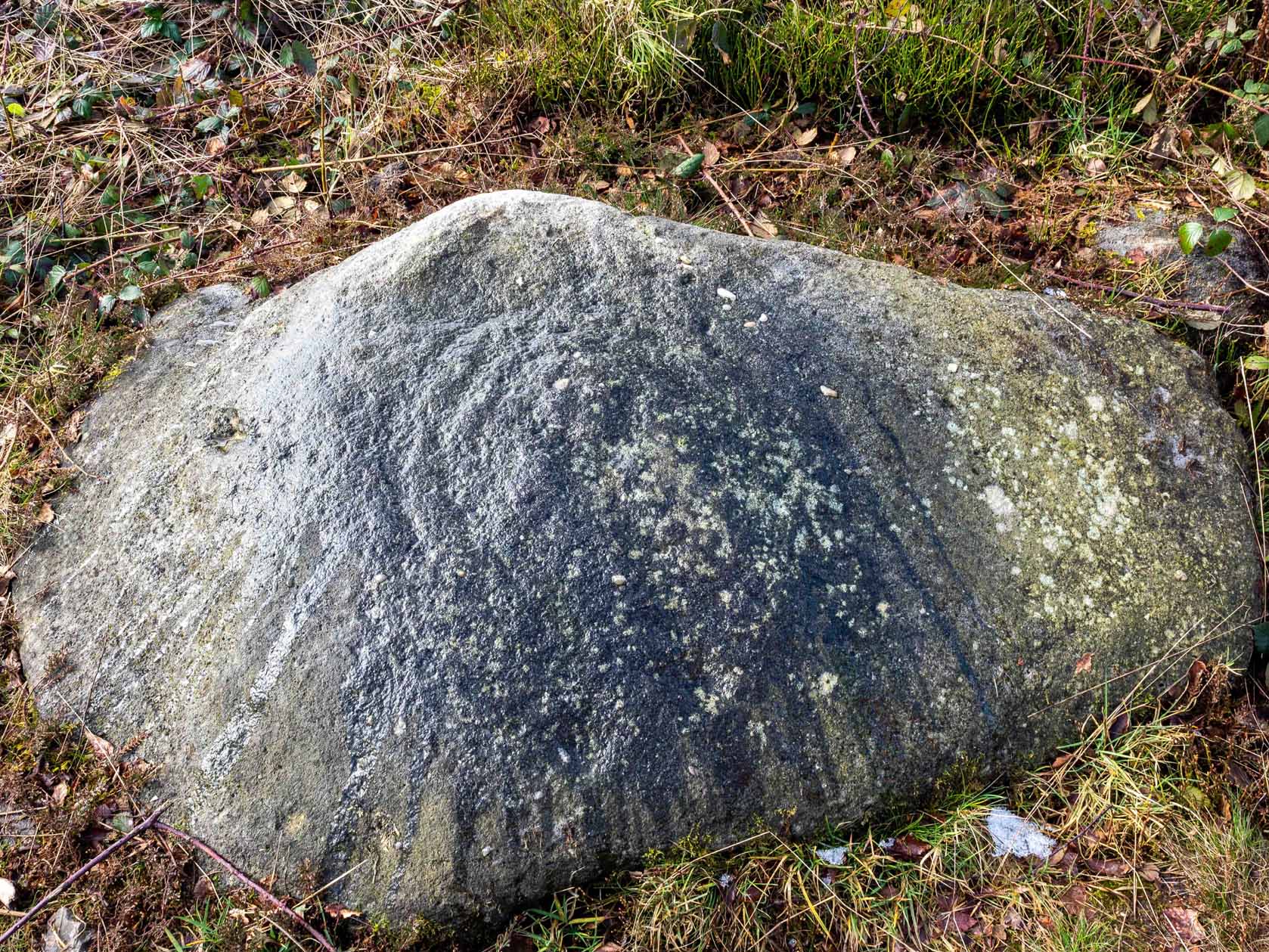
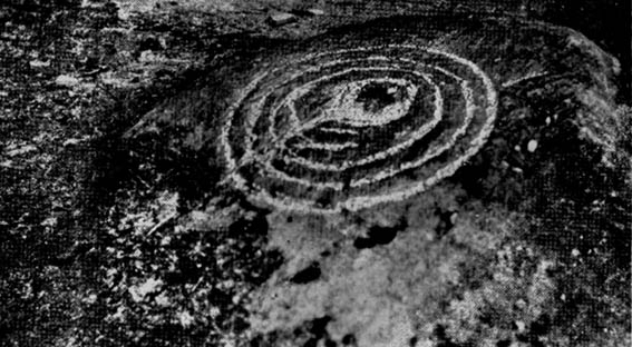
This small rounded stone had a covering of vegetation on it when Richard Stroud and I first discovered it in April 2005, with just a couple of cups visible, but once the heather’d been carefully rolled back, another fine carving greeted our keen-eyed petroglyphic senses!


At least eight cups seem apparent here, though once Richard had the photos processed there appeared to be a couple of things on the stone which we hadn’t noticed when in the field (a common cup&ring dilemma). One of the most curious parts of the stone seems to be the winding line near the bottom of the stone. Make of it what you will!
Just a couple of yards east of this carving we find the rounded remains of a single burial cairn, probably for just one person, just like as with Middleton Moor 001. This site could do with excavating, as we may have a small neolithic or Bronze-Age cemetery hiding under the heath.
© Paul Bennett, The Northern Antiquarian


")


