Rivock Enclosure, Riddlesden, Keighley, West Yorkshire

Enclosure:  OS Grid Reference – SE 0768 4414
Getting Here

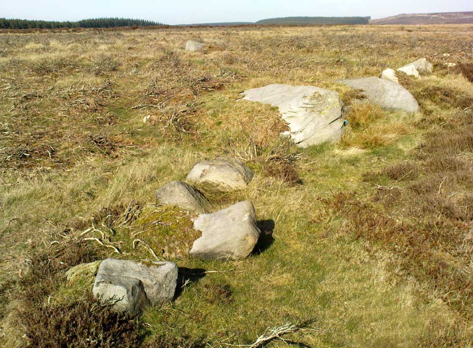
Rivock Enclosure walling, looking north

Follow the directions to reach the small Rivock East Carving just on the level of the small moorland.  From here, walk less than 100 yards east, staying just on the edge of the moor, keeping your eyes peeled for the irregular shaped rocks running in lines roughly parallel with the footpath above the edge of the crags.

Archaeology & History

Recent explorations in and around the Rivock Edge area found, not only a number of undiscovered cup-and-ring stones, but the overgrown remains of an undoubted prehistoric enclosure on the ridge of moorland above the rock escarpment which has not previously been reported in archaeological surveys.  Much of the time the area is covered in deep heather, but thanks to this small section of moor being burnt back a short while ago, the lines of walling that mark the enclosure are there for all to see. It’s obvious that some sections of the old walls have been removed in the not-too-distant past for use in more modern walling and, nearby, old quarries and farming have probably been responsible for other destructive elements.
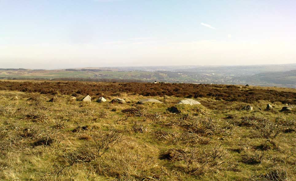
Easternmost line of Rivock enclosure walling

This enclosure is of a rough, rounded, scalene triangular formation, with the main piece of extant walling running roughly northeast-southwest.  The walling is typical of other settlements and enclosures in the region, probably Bronze Age in nature, Iron Age at the latest, with some natural earthfast boulders marking parts of the outline and many smaller pieces of rock and packing stones being added to build up the structure.  The same layout is found at other nearby prehistoric enclosures at Crow Well, Dumpit Hill, Snowden Moor, Woofa Bank and many others.

Of the larger upright stones in the Rivock Enclosure, several of them stand about three feet high, with some of them having been knocked down.  The longest line of walling, running roughly east-west, is less than 50 yards long; whilst the enclosure wall running roughly north-south on its eastern side is 30 yards long.  Much of the walling along its northern side appears overgrown and sections of it are missing.

For a long time I puzzled as to whether there had been any settlements on this part of Rombald’s Moor, rich in cup-and-rings stones — and at last we find that there was at least one such site.  Forays back and forth across the level ground all around here failed to locate any other similar enclosure remains; but it may be that some have been covered (or were destroyed) in the adjacent forestry plantation to the west.  Further explorations by fellow antiquarians may prove worthwhile when the forest is cut down in the next few years.

© Paul Bennett, The Northern Antiquarian

Leaston House, Humbie, East Lothian

Cup-and-Ring Stone (lost):  OS Grid Reference – NT 483 634

Also Known as:

  1. Canmore ID 54771

Archaeology & History

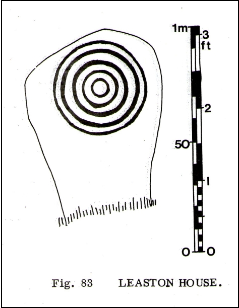
The lost Leaston carving

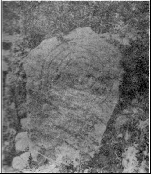
The concentric ring carving shown here was found on the north side of the large gardens at Leaston House early in the 20th century.  It was first reported by the Royal Commission (1924) boys, who told us that the small free standing stone measured 2½ feet long and was 1¾ feet wide, consisting of 5 concentric rings about 15 inches across.  No central cup-marking existed in the middle of this carving — like the Grey Stone at Harewood and a small number of other multiple-ringed petroglyphs. No other notes were made about any other associated monuments.  The carving was included in Ron Morris’ (1981) survey, with no real additional material.   Although the Canmore report told that the carving could be found “in a rockery bordering the lawn north of Leaston House,” its present whereabouts remains a mystery.

Only known photo of the stone

This is one of a number of cup-and-ring stones that have been ‘lost’, either through destruction or through some dood simply taking it for their own private collection (a practice even the modern rock art student, Paul Brown, has openly admitted in one of his books).  Not good.  This lost Leaston Hall carving was probably “acquired” by some local and probably rests either in their garden or hall somewhere.  If anyone knows where it hides, please tell us — as this is an important carving.

References:

  1. Morris, Ronald W.B., “The cup-and-ring marks and similar sculptures of Scotland: a survey of the southern Counties – part 2,” in Proceedings of the Society of Antiquaries, Scotland, volume 100, 1969.
  2. Morris, Ronald W.B., “The Cup-and-Ring and Similar Early Sculptures of Scotland; Part 2 – The Rest of Scotland except Kintyre,” in Transactions of the Ancient Monuments Society, volume 16, 1969.
  3. Morris, Ronald W.B., The Prehistoric Rock Art of Southern Scotland, BAR: Oxford 1981.
  4. Royal Commission on the Ancient & Historical Monuments of Scotland, Inventory of Monuments and Constructions in East Lothian, HMSO: Edinburgh 1924.

Acknowledgements:

With thanks to Janet Donaldson-Elder for the place-name correction!

© Paul Bennett, The Northern Antiquarian

Fortingall Churchyard, Perthshire

Cup-Marked Stone:  OS Grid Reference – NN 7417 4703

Also Known as:

  1. Canmore ID 25003
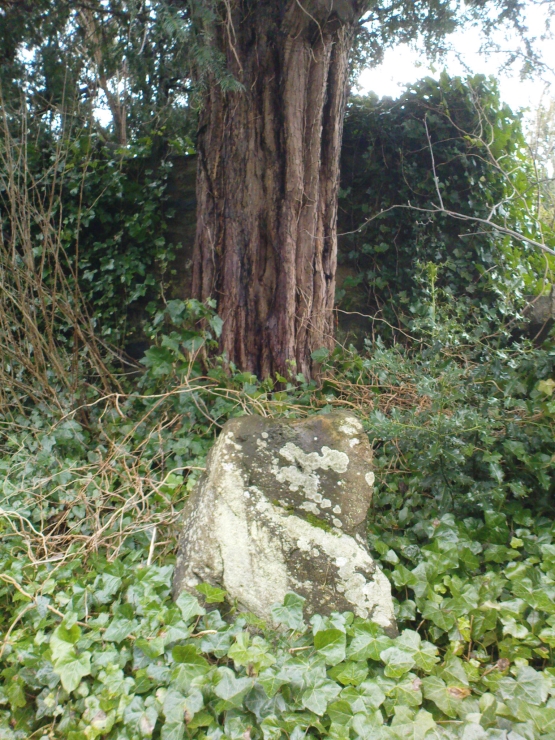
The stone & the yew
The stone & the yew

Getting Here

Go into the Fortingall churchyard, turning left through the gates (walking across in front of the enclosed sacred yew tree), towards the dip in the walling past the graves.  Go over this wall, turning left and through another small gate.  Immediately through the gate, note the small upright stone on your right, below an offspring of the old yew tree.  That’s the spot!

Archaeology & History

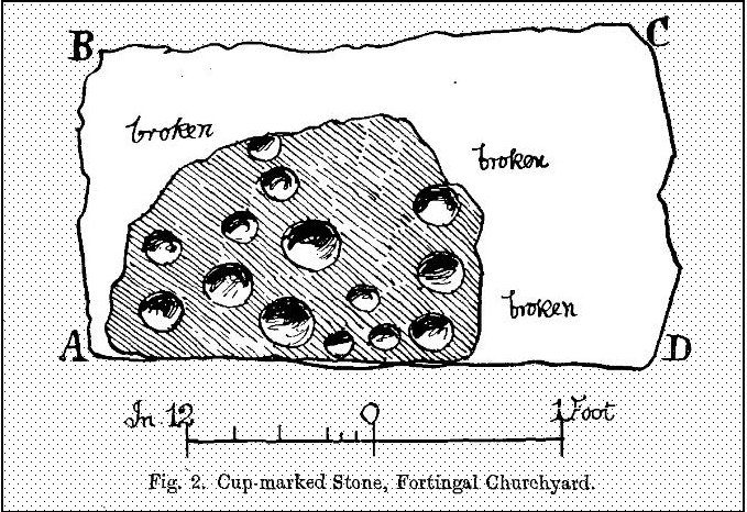
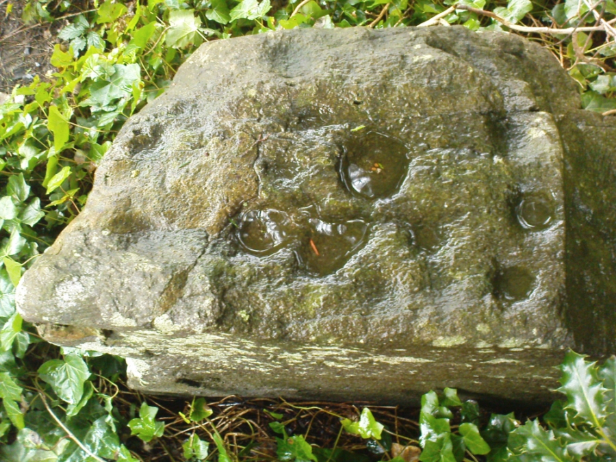
In the legendary churchyard at Fortingall — home to remains from a panoply of beliefs — below the sacred yew tree we find the remains of this hewn piece of stone, recovered from the Earth beneath the roots of the old tree more than 100 years ago.  Upon its crown we see a cluster of cup-markings: Fred Coles (1910) counted 14, I counted 13, the Ordnance Survey boys counted 9, and other surveyors are somewhere in between.

Fred Cole's sketch of the stone
Fred Cole’s sketch of the stone
Photo of the cup-markings

Described and illustrated in the Strathtay rock art survey of Sonia Yellowlees (2004), it seems that the earliest mention of the stone was by our Perthshire megalith hunter Fred Coles (1910).  When he wrote about it, the site had only recently been rediscovered.  He told that he was,

“informed by Rev. W. Camphell, minister of the parish, that in 1903, when some alterations were being made in that portion of the burying-ground belonging to the late Sir Donald Currie of Garth, the workmen came upon this Stone lying at a depth of 8 feet, at a point not many feet distant from the stem of the famous Yew-tree. Noticing the cup-marks on the Stone, the workmen raised it and set it up erect on the site it now occupies, close to the western wall of the Garth burial-ground — about 25 feet from the spot where it was unearthed: In the plan annexed (fig.2) the oblong bounded by the letters A B C D shows the dimensions of the base, and the small cup-marked surface, evidently much broken, and 2 feet 10 inches above ground, shows all that now remains of the work of the prehistoric artificer. There are no rings or grooves, and the cups, except for clearness and neatness of finish, do not present any special features.”

...and another angle.
…and another angle.

Mr Coles then made some intriguing suggestive remarks regarding the position of the carving beneath the ancient yew tree (which to those of you who aren’t aware, is believed to be the oldest yew tree in Europe and has a pagan altar next to it), wondering whether the animistic tradition of the tree had anything to do with the carving itself.  It would certainly make sense.  But there is also the possibility that the carving was brought from elsewhere and placed by the tree at a later date.  We simply don’t know.

References:

  1. Coles, Fred, “Report on Stone Circles Surveyed in Perthshire,” in Proceedings of the Society of Antiquaries, Scotland, volume 44, 1910.
  2. Yellowlees, Walter, Cupmarked Stones in Strathtay, Scotland Magazine: Edinburgh 2004.

© Paul Bennett, The Northern Antiquarian 

Giant’s Knowe, Culloch, Muthill, Perthshire

Cairn (destroyed):  OS Grid Reference – NN 7848 1762

Also Known as:

  1. Canmore ID 24797
  2. Crock-nafion
  3. Fingalian’s Knowe

Archaeology & History

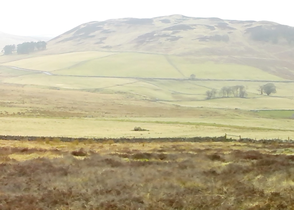
Landscape of the Giant's Knowe (image credit, Marion Woolley)
Landscape of Giants Knowe (photo by Marion Woolley)

Amidst the colourful and nurturing landscape close to the gigantic Dunruchan standing stones and just along the road from the solitary Craigneich stone, in the field across the road above Straid farmhouse could once be seen a fascinating-sounding prehistoric site that has sadly been destroyed.  Some of the remains of this old monument can be found in the field-clearance of stones just over the fence, above the top of the field (many fields round here have scatterings of large stone clearings at the field edges), but we have no detailed accounts of the site.  It was mentioned in early notes by the Ordnance Survey to have been,

“A large circular heap of small stone and gravel entirely removed in 1831. An urn filled with ashes and several stone coffins were found under it.”

The local historian John Shearer (1883) later told us that,

“A small mound of earth on the farm of Strayd, called Crock-nafion or the Giant’s Knowe, or the Fingalian’s Knowe, was cleared away several years ago.  An urn containing burnt bones was discovered.”

Any additional information about this site and its folklore, would be greatly appreciated.

Folklore

To the west along Glen Artney whence our view takes us from here, old legend told that the valley was once the abode of a great giant who lived in a cave in one of the mountains thereby.  In mythic lore, giants were the creation deities of hills, mountains and other geological forms, whose narratives were overturned and demonized by the incoming christian cult many centuries ago.  It is likely that this once great tomb was deemed as the burial-place of our local giant – which would make this prehistoric site neolithic in age.  But — logical though it is — this idea is pure speculation…

References:

  1. Hunter, John, Chronicles of Strathearn, David Philips: Crieff 1896.
  2. Shearer, John, Antiquities of Strathearn, David Philips: Crieff, 1883.

© Paul Bennett, The Northern Antiquarian

Lentran, Bridge of Allan, Stirlingshire

Cist (destroyed):  OS Grid Reference – NS 798 973

Also Known as:

  1. Annfield
  2. Canmore ID 47129

Archaeology & History

On the level ground a half-mile south of the large Fairy Knowe prehistoric tomb, Bridge of Allan had a site of its own up until being destroyed sometime in the 19th century.  Nothing much is known about the tomb – or “cist containing a skeleton”, as the Royal Commission (1963) lads called it – apart from the notes given in J.E. Alexander’s (1868) essay on the Fairy Knowe, where he told:

“It is right, however, to mention, that a few years ago, in digging the foundations of the house of Annfield, Bridge of Allan, at nine feet from the surface, there was found in the sand, and apparently undisturbed, a fine cist, containing the skeleton of a young female; and under the right arm was a small clay urn, corroborating the opinion of Professor Innes, that in many cases the so-called urn was simply a domestic jar to contain food for the deceased.”

A Mr R. Swift from Bridge of Allan told that the cist was located at the newly-named Lentran, along Kenilworth Road.  Does anyone know anything more about it?

References:

  1. Alexander, J.E., “Opening of the Fairy Knowe of Pendreich, Bridge of Allan,” in Proceedings of the Society of Antiquaries, Scotland, volume 7, 1868.
  2. Royal Commission on the Ancient & Historical Monuments Scotland, Stirlingshire: An Inventory of the Ancient Monuments – volume 1, HMSO: Edinburgh 1963.

© Paul Bennett, The Northern Antiquarian

Fraggle Rock, Hawksworth Moor, West Yorkshire

Cup-and-Ring Stone:  OS Grid Reference — SE 15094 43502

Getting Here

Fraggle Rock, Reva Hill

Probably the easiest (direction wise) is if you’re coming from Dick Hudson’s public house on the southern road surrounding Rombalds Moor. From the pub, head left (east) along Otley Road (passing Weecher reservoir) for 1.9 miles (3.1km) until you reach Reva reservoir where a track leads you to the waters.  A small parking spot is on the left-side of the road. From here, go through the gate and along the footpath across the field for nearly 300 yards to the next gate; go through here and walk to your right for about 60 yards where uyou’ll reach a small straight dyke (keep your eyes peeled!) running NW (to your left): walk along here for nearly 200 yards until it hits another shallow dyke bearing right; follow this dead straight for 35 yards after which it changes direction, but you need to keep walking straight on forward for another 60 yards or so.  Look around!

Archaeology & History

Early photo of the carving
First photo of the carving

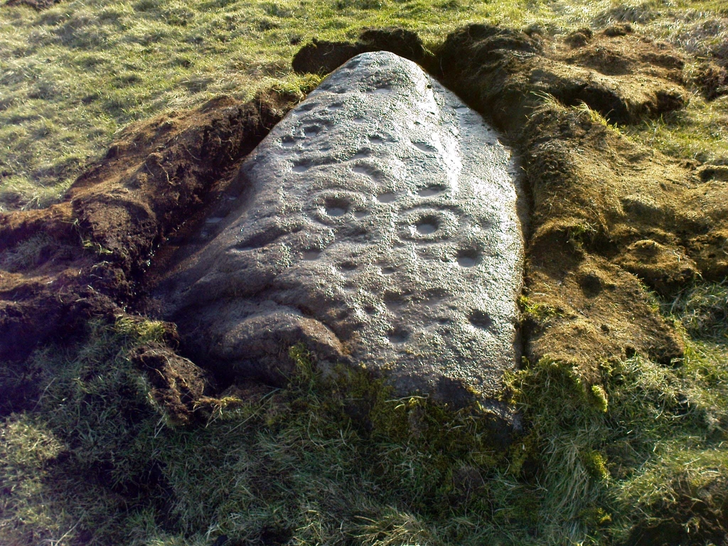
This carving is one in a cluster of previously unrecorded petroglyphs, uncovered in the summer of 2011 during a Northern Antiquarian bimble on the northern edge of Rombald’s Moor.  The carvings were found as a bi-product of uncovering a previously undiscovered cairn circle, close to the Twelve Apostles stone circle.  In assessing and exploring the newly-found circle, it was noticed that a small opening in the near horizon highlighted a rise in the landscape barely a mile away.  This ‘opening’ in the land was not visible if you walked 25 yards either side of the cairn circle – but was very notable at the circle itself.

“We need to have a look at that site,” I said.  “It’s position looks to have been relevant to this circle.” (or words to that effect) And a couple of weeks later we met up and walked to the place in question.

Fraggle Rock carving, looking west
Fraggle Rock carving, looking south

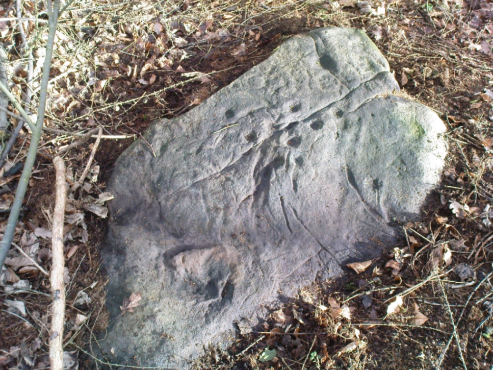
Within five minutes we came across a couple of previously unrecorded cup-marked stones, of simple design, right in line with the cairn circle.  As we walked around this spot, then headed back in the direction of the circle, a cluster of small stones were noticed on the slope.  One had what looked like a single cup-marking near its edge, but the rest of the rock was completely covered in vegetation.  Paul Hornby and Michala Potts had, by now, already found several other previously unrecorded cup-marked stones close by; but as I carefully rolled back the vegetation at the edge of this particular rock, cups-and-rings and carved lines seemed to be covering most of its surface.  It was a good one!

Face on the Fraggle Rock

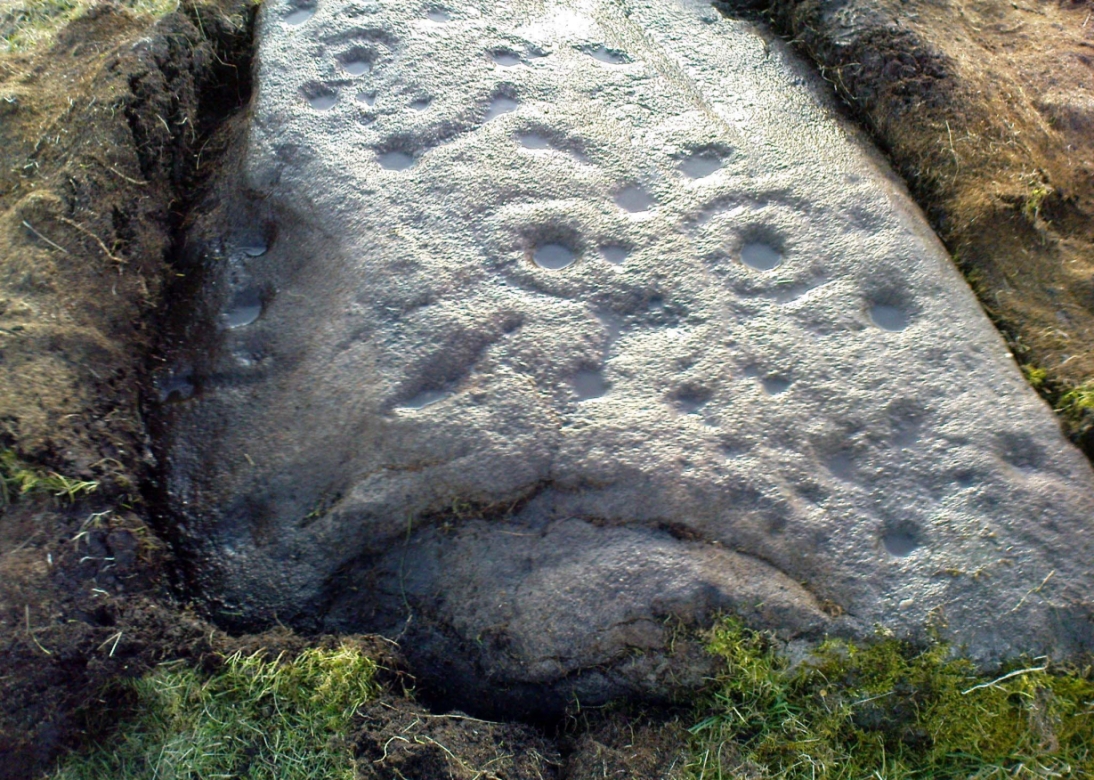
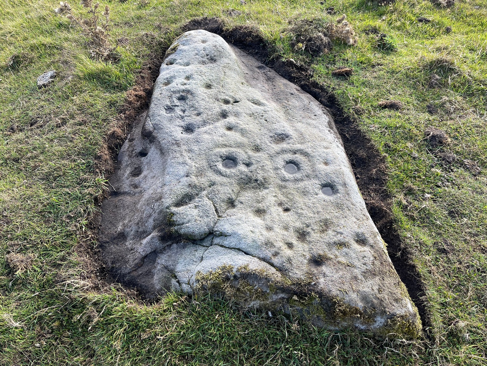
We called it the Fraggle Rock after noticing that when you look at the stone from one end, the two main cup-and-rings are likes two large eyes carved above a large natural down-turning ‘mouth’ feature, similar to some of the creatures’ faces on the muppets or the similar kid’s TV show, Fraggle Rock! (sad aren’t we!?)  The photo here shows you what we mean.

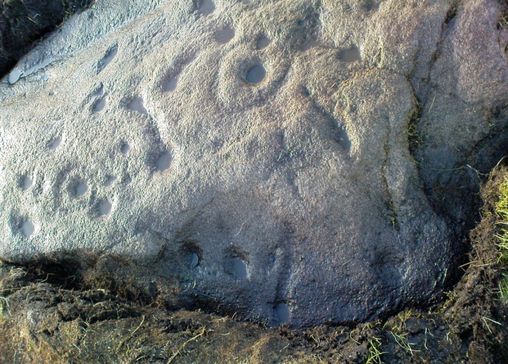
The primary design consists of at least 3 cup-and-rings, 2 partial cup-and-rings, 28 cups and several carved lines along which some cup-markings are linked to others.  The most notable of the carved lines is the longest (barely visible in the photos), running from a single cup-mark at the southernmost rounded end of the stone, almost straight and parallel with a natural ridge or dip along the rock, until it meets the largest of the cup-and-rings (one of the eyes on the Fraggle’s face!).  Don’t ask me why, but for some reason this long faint line seemed the most perplexing element of the carving.

Eastern edge, with cups at ground level
Eastern edge with low cups
Cup-marks on rock edge

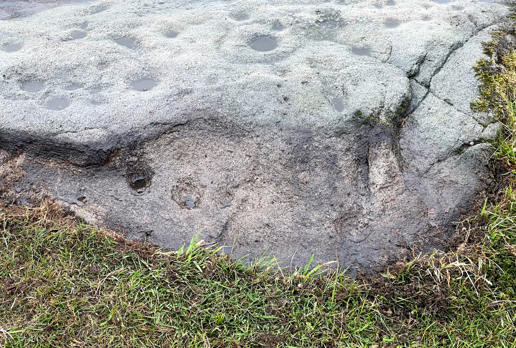
Most of the design is carved on the upper face of the stone, but a small part of the rock dips into the ground on its eastern side and a small group of cups and a single carved line, in a very good state of preservation, are etched right at the edge of the stone.  Unusual.  Another faint cup-and-ring is less than 100 yards west; and a fascinating cup-and-lines stone, with at least four long carved ridges running like hair from the top of the stone into the Earth, is a short distance to the north.  A number of others are in this and adjacent fields.

References:

  1. Jack, Jim, “Old Fraggle Rock is Found on Burley Moor,” in Ilkley Gazette, March 4, 2013.

© Paul Bennett, The Northern Antiquarian 


Tree Stone, Ilkley, West Yorkshire

Cup-Marked Stone:  OS Grid-Reference – SE 1043 4702  

Archaeology & History

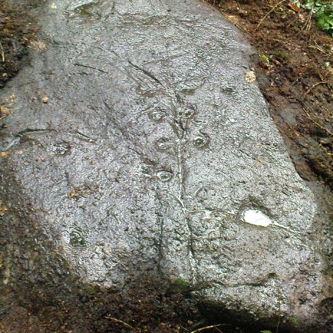
One of the first photos, just as the mud had been cleared

This carved stone was rediscovered by Michala Potts on the rainy afternoon of August 26, 2011, on a Northern Antiquarian excursion to explore some of the cup-and-rings on Ilkley Moor.  The entire stone was totally covered in soil and leaves, and Michala spent some considerable time carefully clearing the dead vegetation to unveil the carvings beneath.

Close-up of cups & scars

This carving has at least 12 cup-marks on its slightly inclined surface, with several artificial carved lines and some that are obviously geophysical in origin. (we really could do with a geologist with a cup-and-ring fetish to accompany us on some of our outings!)  But the main feature of this carving — as the photos here illustrate — appears to be the natural crack that runs up through the middle of the stone, either side of which have been etched a number of cup-markings attached by small lines or ‘branches’, giving the distinct impression of a tree.  Whether this was a deliberate artistic feature (a tree), or just another Rorscharch response to non-linear systems on our behalf (more probable), we’ll never know.  On the moors northeast of here on the other side of the Wharfe valley, the Tree of Life Stone acquired a similar association due to its design; but this Ilkley design, sadly, aint quite as good as the one on Askwith Moor.

Tree Stone, showing modern industrial scars

There are some puzzles on this stone aswell.  Other lines scar the rock which are definitely man-made, but they are of a different nature and age.  The marks have been scarred by more modern metal tools, or were caused by heavy metal machinery that have rested on the rock at some time in the not-too-distant past.  You can see the curved deep scratches in the photo here to the right.  It seems likely that when the modern houses were built straight across and above here, this cup-marking was damaged by the workers — although they didn’t know it was here as the stone had not been catalogued by the Ilkley archaeologists.  But there’s also another peculiar feature on this stone.  Someone a century or two ago also carved other fainter features into the stone, seemingly lettering, on the northeast edge of the rock.  They can be seen faintly on the second photo, above.

© Paul Bennett, The Northern Antiquarian 

Tir Artair, Killin, Perthshire

Standing Stone:  OS Grid Reference – NN 58870 34720

Also Known as:

  1. Canmore ID 24205

Getting Here

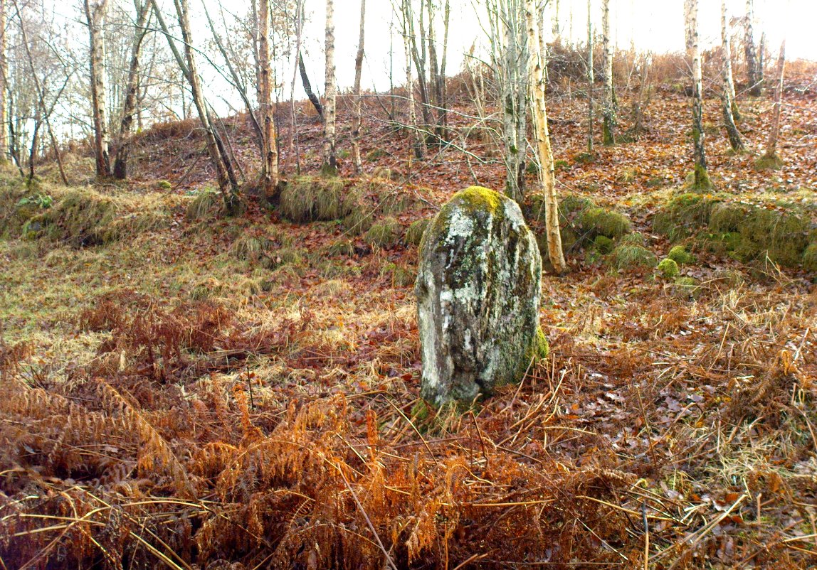
Standing stone of Tir Artair
The standing stone of Tir Artair

This lovely standing stone can be a pain-in-the arse to get to!  Unless you wanna clamber over the excess of increasingly stupid deer fences that are appearing all over the place (old locals aint happy), follow the directions to the Tir Artair cup-marking, then walk across to the fencing and follow it all the way down into the fields until you reach the stream on your right, running in front of the fenced woodland. There’s a large gate here into the trees. Go thru it. In front of you is some overgrown walling into the trees: follow this along, slowly, keeping your eyes peeled for the upright stone about 100 yards in.  Good luck!

Archaeology & History

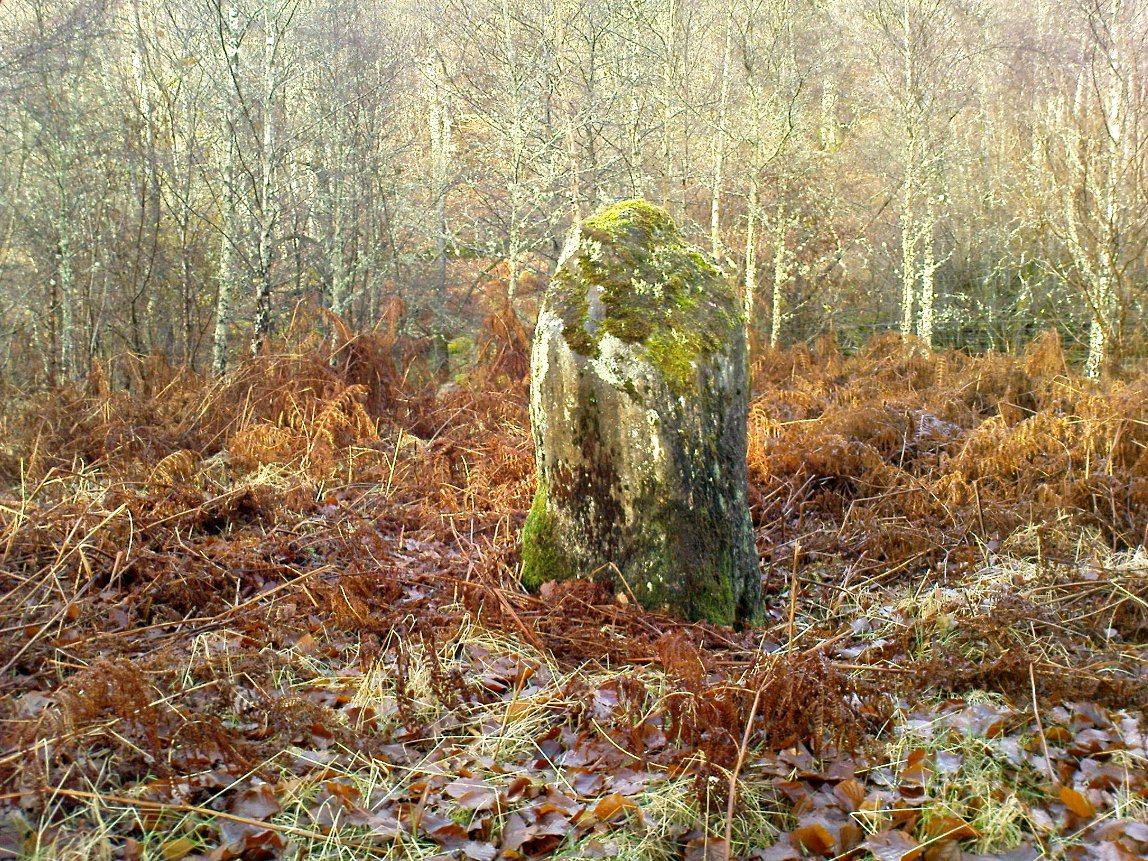
The old mossy stone
The old mossy stone

In this “land of Arthur”—as the place-name means—we find this beautiful moss and lichen-encrusted standing stone, living alone in remains of mainly birch woodland.  It stands less than 5 feet tall, just in front of some old walling encircling one of the many rounded knolls in this area.  The stone may have had some megalithic partners in bygone days, as we find, about 25 yards away sleeping amidst overgrown vegetation beside an old oak, a couple of other old stones laid on the ground that seem to have been placed here by human hands.  Their antiquarian nature is unknown.

References:

  1. Gillies, William A., In Famed Breadalbane, Munro Press: Perth 1938.

© Paul Bennett, The Northern Antiquarian

Tir Artair (01), Killin, Perthshire

Cup-Marked Stone:  OS Grid Reference – NN 59063 34807

Also Known as:

  1. Canmore ID 289905

Getting Here

Single cup-marked stone
Solitary cup-mark

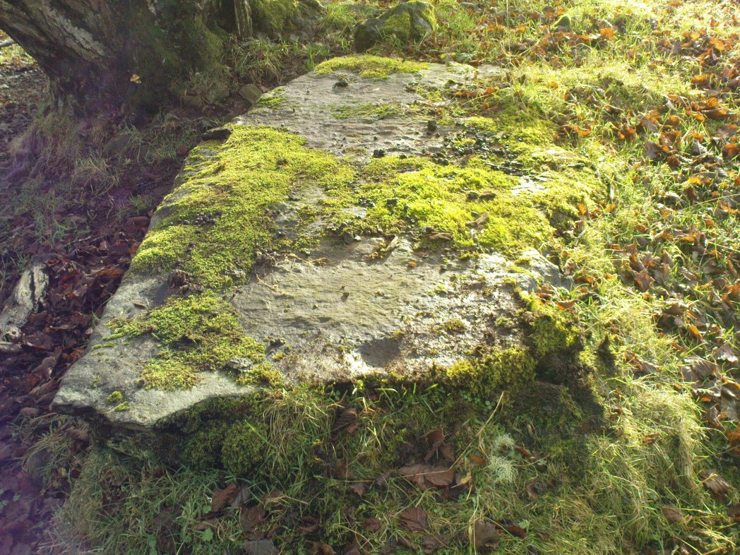
Take the A827 road out of Killin to Fearnan and Kenmore.  A mile or so out of Killin, keep going go past the entrance to the Finlarig Power Station for just another 2-300 yards, keeping your eyes peeled for the small track on your right.  Go down here.   About 100 yards down the track bends, then another 50 yards it bends again – and just here there’s a small clump of trees, right by the bend.  You’re looking for the large flat rock therein.  You’ll see it!

Archaeology & History

Tir ArtairCR1b sm
Close-up of cupmark

Although listed by the lads at Canmore, I can find no previous literary reference to this stone — which is a simple thing to be honest: probably of little value to anyone unless you’re a real petroglyph fanatic!  The large flat rock has a single large cup-marking on its northern edge, 3 inches across and nearly an inch deep.  If you’re gonna visit here, you may as well check out the standing stone further down, in the trees on your right.

© Paul Bennett, The Northern Antiquarian


Clach na h’ Iobairte, Kinloch Rannoch, Perthshire

Standing Stone:  OS Grid Reference – NN 61702 58975

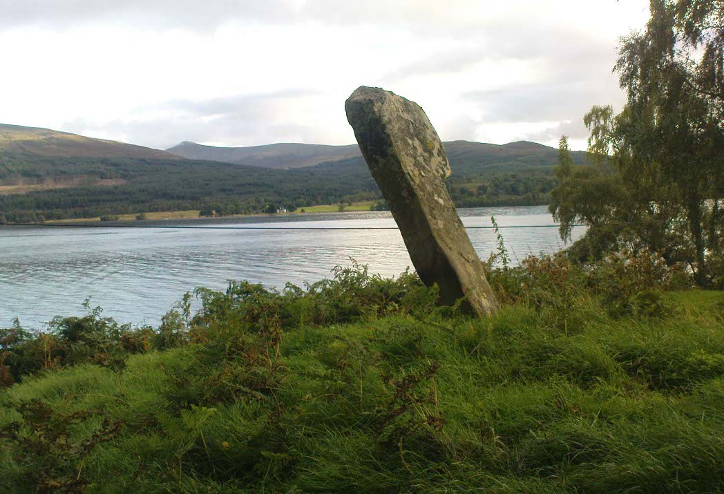
Clach na h-Iobairte, looking south

Also Known as:

  1. Canmore ID 24576
  2. Chieftain’s Grave
  3. Clach na h-Iobairte
  4. Clach na h-Jobairte
  5. Craiganour Stone
  6. Craig-na-Odhar
  7. Stone of Sacrifice
  8. Stone of the Offering

Getting Here

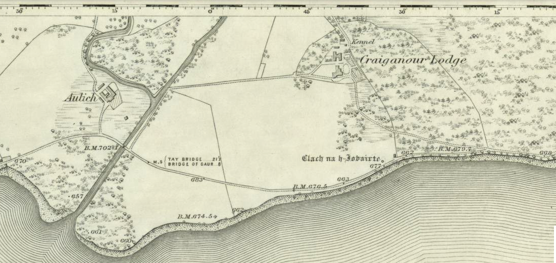
Standing stone shown on the 1867 OS-map

From the gorgeous village of Kinloch Rannoch, take the road along the north side of Loch Rannoch for about 2½ miles.  As you go along the road, for a good mile or so it is wooded. Where the woods stop and the first field appears on your right, stop!  You’ll see the standing stone perched erotically at an angle above you.

Archaeology & History

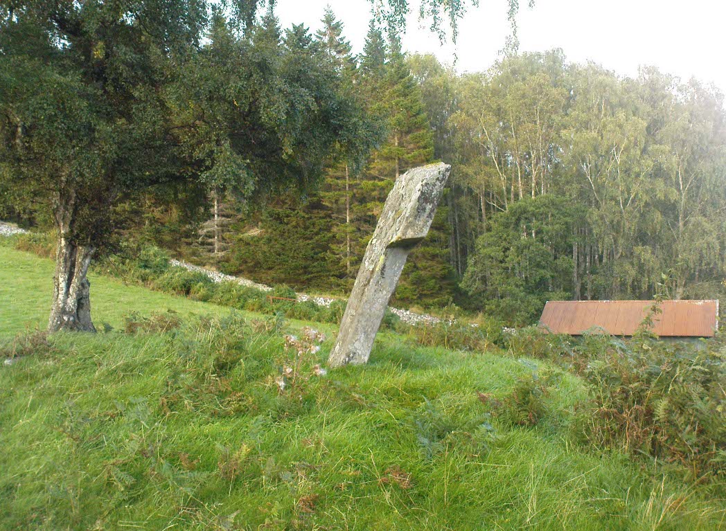
Clach na h-Iobairte, looking east

A fascinating site in a quite beautiful setting, typical of the Highlands.  This stone of many names is a curiously-shaped monolith: like an erect stone penis at the edge of the field when seen from the roadside, calling out to christians and pagans alike, to be castigated or rubbed—whatever the religious preference of the surveyor!  Leaning over at a slight angle, the stone is still nearly six feet tall and lives upon a large and equally prehistoric stone cairn about 30 feet across.  This cairn, it is said, has been added to by locals when the field was cleared of stone and piled on top of the old tomb.  No excavations have been done here, nor at the large ‘hut circle’ in the same field about 50 yards away.

Folklore

So far I have only found a short narrative of this stone in the pages of T.R. Barnett’s (1944) loving account of the Perthshire hills, where he tells that, close by the stone at Aulich, was once

“a famous smith, said to be in league with the devil, and he made the finest claymores in Rannoch.”

References:

  1. Barnett, T. Ratcliffe, The Road to Rannoch and the Summer Isles, John Grant: Edinburgh 1944.
  2. Cunningham, A.D., A History of Rannoch, privately printed 2004.

© Paul Bennett, The Northern Antiquarian