Hillhead, Forgue, Aberdeenshire

Stone Circle (destroyed):  OS Grid Reference – NJ 638 367

Also Known as:

  1. Canmore ID 18237 
  2. Hillhead of Bogfouton
  3. Wether Hill

Archaeology & History

Described by the early 20th century antiquarian and megalithomaniac Fred Coles (1903) as being situated “about 1¼ mile SE from the church at Ythan Wells,” all trace of this stone circle has long gone, and had already disappeared when Coles was surveying the region, telling merely that it had been here “in open fields.”  All subsequent explorations looking for remains of the site has proven fruitless.

References:

  1. Barnatt, John, Stone Circles of Britain – volume 2, British Archaeological Report: Oxford 1989.
  2. Cole, Fred, “Report on the stone circles of North-Eastern Scotland, chiefly in Auchterless and Forgue,” in Proceedings of the Society of Antiquaries, Scotland, volume 37, 1903.

© Paul BennettThe Northern Antiquarian


Barrow Hill Stone, Chastleton, Oxfordshire

Standing Stone (destroyed):  OS Grid Reference – SP 257 282

Archaeology & History

We have found only one reference to this lost standing stone that could once be seen adjacent to the very well-preserved Chastleton Barrow Camp to the east of the village. In her scarce little work on the history of Chastleton House, Margaret Dickins (1900) told that,

“the oldest thing to be seen at Chastleton is the prehistoric stone, which till lately served as a field gate post on the Barrow Hill.”

This monolith was one in a series of megalithic sites in and around the village that have been destroyed due to the actions of ill-informed land-owners. In this case, the standing stone was in close association with the subsequent Iron Age encampment (this missing stone should not be confused with the nearby Goose Stones, greatly damaged).

References:

  1. Bennett, P. & Chanter, James, The Complete Rollright Stones, forthcoming
  2. Dickins, Margaret, Chastleton House, Walker: Stratford 1900.

© Paul Bennett, The Northern Antiquarian


Power Station Road, Sheerness, Isle of Sheppey, Kent

Settlement (destroyed):  OS Grid Reference – TQ 932 733

Archaeology & History

An extensive site that was uncovered when a housing estate was being built on the south-side of Power Station Road at the end of the 20th century.  During the Spring and Summer of 1998, the Canterbury Archaeological Trust began cutting trenches across the land and did some minor excavation work on the west side of the area, finding some traces of early human activity.

A second series of investigations was then undertaken by the Hertfordshire Archaeological Trust  over the Autumn and Winter months of 1998-99, with the Kent Archaeological Rescue Unit then taking over for the rest of the year.  Their team split the land into eight large sections and began a more detailed analysis and uncovered a huge number of finds.  Amidst this, wrote Brian Philp (2002), there

“included an important collection of Bronze Age material, including large clay-weights, perforated baked-clay slabs and a good range of pottery types.  Of special interest was the spinal bone of a large whale, perhaps washed up on the nearby shore.

“The picture now emerging is that of a substantial Bronze Age settlement site, spread across several acres and probably farming the adjacent land… It seems likely that three large ponds and…eight stone-lined pits were primarily for water-storage, both for watering cattle and for other agricultural or semi-industrial purposes… All this seemed to be happening about 900-400 BC on what still appears to be the largest Bronze Age settlement so far discovered on this important island.”

The archaeocentric place-name of Barrows Hill rises a mile to the southwest.

References:

  1. Philp, Brian, Archaeology in the Front Line, KARU: Dover 2002.
  2. Schuster, Jorn, “The Neolithic to Post-Medieval Archaeology of Kingsborough, Eastchurch, Isle of Sheppey: From Monuments to Fields,” in Archaeologia Cantiana, volume 130, 2010.

Links:

  1. Kent Archaeological Review

© Paul BennettThe Northern Antiquarian 2016


Dumpton Park, Ramsgate, Kent

Tumulus (destroyed):  OS Grid Reference – TR 389 661

Archaeology & History

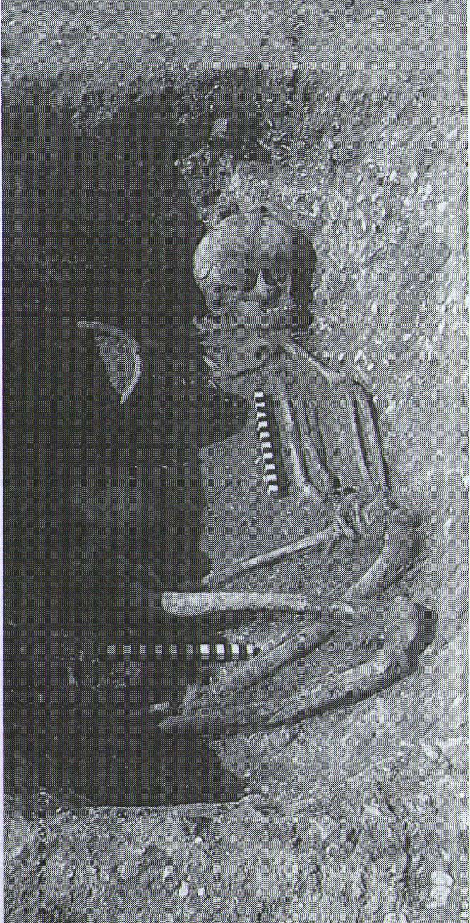
A little-known site which archaeologist Brian Philp (2002) called “a Bronze Age barrow”.  When the old Greyhound Stadium at Ramsgate was being demolished for a new housing estate, planning conditions required an archaeological evaluation and so Philps and his team set out to explore the area in February 2000.  They weren’t to be disappointed!  Unearthing a ring ditch nearly 20 yards (18m) across, they found that it had been cut into the local chalk some three feet deep.  Although there was no obvious entrance, the northeast section of the ancient monument,

“was found to be covered by a compact layer of flint metalling.  This was a wide and well-made surface or platform, perhaps of Iron Age date, which clearly covered the silted ring-ditch,  Nearby was a large male skeleton in a very shallow grave and with head missing due to later disturbances.”

The excavated ring ditch (after Philp 2002)

The excavated ring ditch (after Philp 2002)

The crouched skeleton (after Philp 2002)

The crouched skeleton (after Philp 2002)

But the best was yet to come!  In another section of the circular monument, cut into the chalk itself, they found a complete male skeleton laid in typical foetus position, on its left side, with a large beaker pot positioned in front of it.  These beakers are pretty common and tend to be seen as once holding food enabling the dead to eat in their journey into the Land of the Dead.  It makes sense.  The entire monument has since been completely destroyed.

References:

  1. Philp, Brian, Archaeology in the Front Line, KARU: Dover 2002.

Links:

  1. Kent Archaeological Review

© Paul BennettThe Northern Antiquarian 2016


Baston Manor, Hayes, Kent

Settlement:  OS Grid Reference – TQ 407 649

Archaeology & History

This settlement site was found thanks to the good work of the Bromley & West Kent Archaeology Group in the 1960s, when they decided to do follow-up work to what Brian Philp (2002) described as “doubtful sites reported mainly in the 19th century.”  Time and again these “doubtful sites” at least turn into something of value — and such was the case here!  The group commenced digging selective trenches in July 1964 in a small wooded area near to Baston Manor and they soon came across “a stratified deposit of late-Neolithic (2500 BC) pottery and flint.”

In successive returns to the site over two years, 5630 items—primarily fire-cracked stones, flints and more than 200 pieces of pottery, some of which was highly decorative—were unearthed and the site was recognised as an important settlement arena many thousands of years ago.  In Kent, this was a rarity!  Philps’ resumé of the site and its many remains told,

“Sometime about 2500 BC, a group of late-Stone Age farmers had selected this quiet hillside (now just in Hayes) to settle and live.  Here they must have farmed  small cultivated areas close to their huts and herded sheep and cattle to fresh areas and nearby streams.  These were the first occupants of the West Wickham valley over 4000 years ago…”

References:

  1. Philp, Brian, “The Discovery of a Secondary Neolithic Site at Hayes,” in Kent Archaeological Review, no.5, 1966.
  2. Philp, Brian, Archaeology in the Front Line, KARU: Dover 2002.
  3. Smith, Isobel, “Prehistoric Pottery from Baston Manor, Hayes,” in Kent Archaeological Review, no.18, 1969.

Links:

  1. Kent Archaeological Review

© Paul BennettThe Northern Antiquarian


Down Farm, Basingstoke, Hampshire

Barrow (destroyed):  OS Grid Reference – SU 6018 5013

Archaeology & History

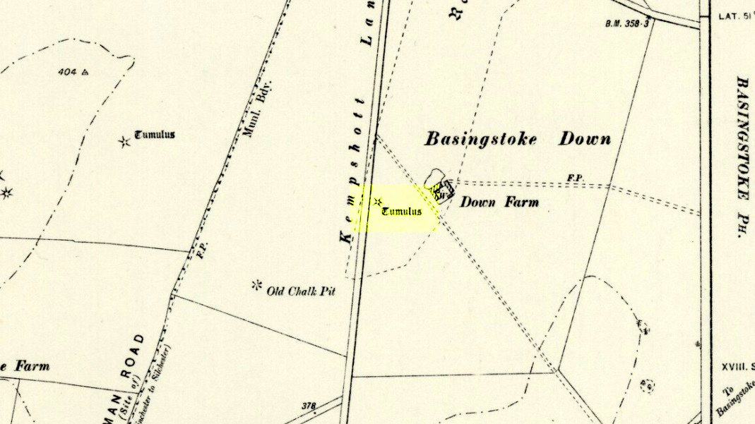
Downs Farm tumulus on 1897 map

Downs Farm tumulus on 1897 map

On the western edges of Basingstoke, at Kempshott, could once be found this ancient site—destroyed many decades ago.  It was one of number of similar prehistoric burial mounds in the area.  First described in a listing of tumuli by Mr Andrews (1898) who told us that it was “oval” in shape, the monument was completely destroyed in 1939 and according to the Royal Commission (1979) lads,

“its site now lies beneath a house at the southwest corner of Kempshott Lane and Homesteads Lane.”

When the house where it once stood was being constructed, a collared urn was recovered from the tomb, which the Royal Commission thought indicated “that the monument (was) likely to have been of early Bronze Age date”—but obviously we cannot be sure.  The site was listed in Leslie Grinsell’s (1979) extensive survey of prehistoric tombs in the area, in which he suggested it may have been a long barrow.

References:

  1. Andrews, S., “A Short List of Some Tumuli in North Hampshire,” in Proceedings of the Hampshire Field Club & Archaeological Society, volume 4, 1898.
  2. Grinsell, Leslie V., “Hampshire Barrows – part 3,” in Proceedings of the Hampshire Field Club & Archaeological Society, volume 14, 1940.
  3. Royal Commission on Historic Monuments, England, Long Barrows in Hampshire and the Isle of Wight, HMSO: London 1979.
  4. Willis, G.W., “Bronze Age Burials round Basingstoke,” in Proceedings of the Hampshire Field Club & Archaeological Society, volume 18, 1953.

© Paul Bennett, The Northern Antiquarian


Hickford Hill, Belchamp St Paul, Essex

Enclosure:  OS Grid Reference – TL 7872 4537

Archaeology & History

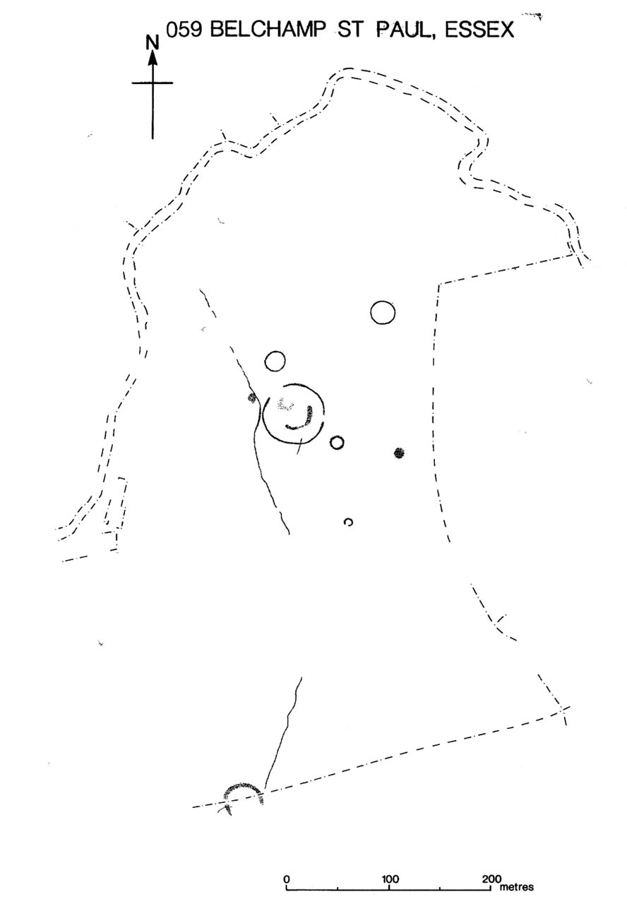
Ground-plan of enclosure & surrounding barrows

Plan of enclosure & surrounding barrows

Several hundred yards northeast from Hickford Hill, a cluster of prehistoric sites could once be seen close to each other just south of the River Stour below line of the Essex-Suffolk county boundary.  Several of these were tombs and are accounted for in Priddy’s (1981) essay on the prehistoric Barrows of Essex; but adjacent to them were also found faint traces of a large circular enclosure of some sort, which Harding & Lee (1987) included in their definitive survey of British henge monuments. Their account of it was brief and simple, saying:

“Enclosure defined by the cropmark of a sub-circular rather narrow ditch broken by two entrances.  No trace of a bank.  Internal traces of a concentric innner ditch in part of the circuit… Internal diameter range 56-57m…; width of outer ditch c.1.5-2.5m; width of entrances, c.7m (E) and 16m (NW); width of inner ditch c.2.5-5m.”

Although this large ringed enclosure was thought by the Haverhill & District Archaeology Group to “be a henge-type monument,” Harding & Lee (1987) thought it unlikely that these remains “belong to the henge class” of monuments.  A brief archaeological dig into one of the trenches here in 1997 showed the site to be Bronze Age; but finds by the local archaeology team have also come across finds in the fields hereby dating from the Mesolithic and Neolithic periods.

References:

  1. Harding, A.F. & Lee, G.E., Henge Monuments and Related Sites of Great Britain, BAR 175: Oxford 1987.
  2. Priddy, D., “The Barrows of Essex,” in A.J. Lawson’s The Barrows of East Anglia, Norfolk Museums Service 1981.

© Paul Bennett, The Northern Antiquarian


Boxted Cross Henge, Colchester, Essex

Henge Monument:  OS Grid Reference – TM 0093 3277

Archaeology & History
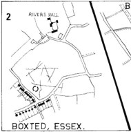
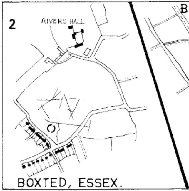
Boxted Henge plan (Colchester Archaeology Group)

Boxted Henge plan (Colchester Archaeology Group)

As with many sites in Southern England, intensive agriculture has taken its toll on the archaic monuments.  The Boxted Cross henge is no exception and hardly any elements of it remains today.  But it seems that it was an impressive fella in our more ancient heathen past.

The site was only rediscovered in the 1970s and was first described in Mrs Ida McMaster’s (1975) survey of crop-marks that had been revealed by aerial surveying in Essex and Suffolk counties.  Her brief account of the monument told it to be,

“A Class II henge with a wide somewhat ploughed out ditch. Various linear ditches are near, together with prolific variegated ‘field outlines’ of glacial subsoil cracking which extends into the next field southwards. The ditch terminals of the southwest entrance to the henge appear to be wider than the general run of the ditch, say 4-5 metres.”

When Harding & Lee (1987) examined the site, they were a little more cautious in their interpretation of it being a definite henge, citing that there was “insufficient information, but cannot be ruled out as henge-related,” adding that it “could also be a mill.”  This latter element seems unlikely, though a windmill may have been built onto the site at a later date.

More recently however the site has been categorized by Historic England as “a Late Neolithic henge.”  The monument itself was defined by a broad circular ditch with two large opposing entrances to the north and south.  The total diameter of the enclosure is 44 yards (40m) across; but with the surrounding ditch measuring 5½ yards (5m) across all around, the inner level of the henge was about 33 yards (30m) in diameter.  Plenty of room for partying old-style!

References:

  1. Harding, A.F. & Lee, G.E., Henge Monuments and Related Sites of Great Britain, BAR 175: Oxford 1987.
  2. McMaster, Ida, “Crop Marks Selected and Plotted,” in Colchester Archaeological Group Bulletin, volume 18, 1975.

© Paul Bennett, The Northern Antiquarian

Galley Hill, Streatley, Bedfordshire

Long Barrow (destroyed):  OS Grid Reference – TL 086 268

Archaeology & History

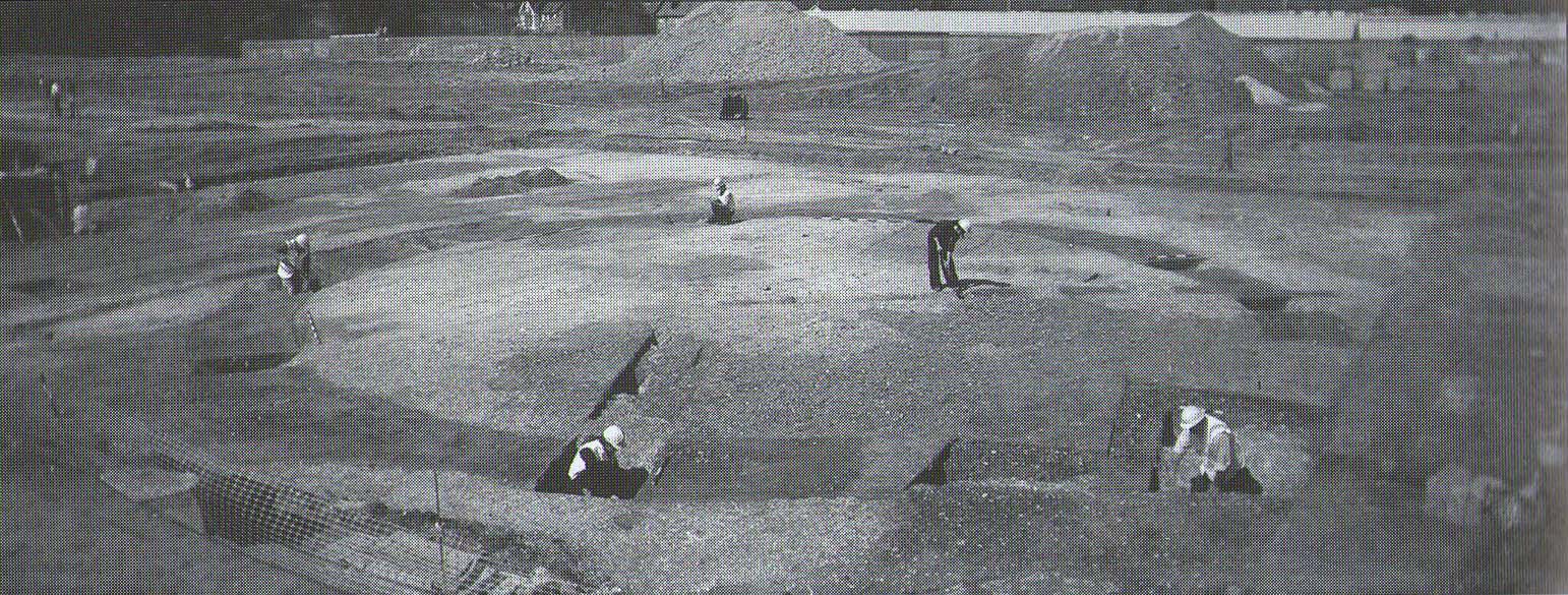
Aligned east-west, a large neolithic long barrow could once be seen to the west of Galley Hill, on where now we find a golf course.  It was sadly destroyed sometime around 1900 AD and its demolition was witnessed by a Mr A. Cumberland of the Dartford Antiquarian Society, who reported there being no archaeological finds of note in the tomb.  Curious…

Equally curious was the view of archaeologist James Dyer (1964) in his assessment of the site, who wrote how

“Air photographs suggest that the barrow was 300 ft long, but this is much larger than normal in the Chilterns, and 150 ft is more reasonable.”

The neolithic and Bronze Age burial specialist Paul Ashbee (1984) maintained the “300 feet” measurement.

Other tumuli can still be seen on the slopes either side of Galley Hill a few hundred yards to the east; and a henge monument has also be found in the area.

References:

  1. Ashbee, Paul, The Earthen Long Barrow in Britain, Geo: Norwich 1984.
  2. Dyer, J.F., “A Secondary Neolithic Camp at Waulud’s Bank, Leagrave,” in Bedfordshire Archaeological Journal 2, 1964.

© Paul BennettThe Northern Antiquarian 2016


Old Lane Carving, Cowling, North Yorkshire

Cup-and-Ring Stone:  OS Grid Reference – SD 97300 42625

Getting Here

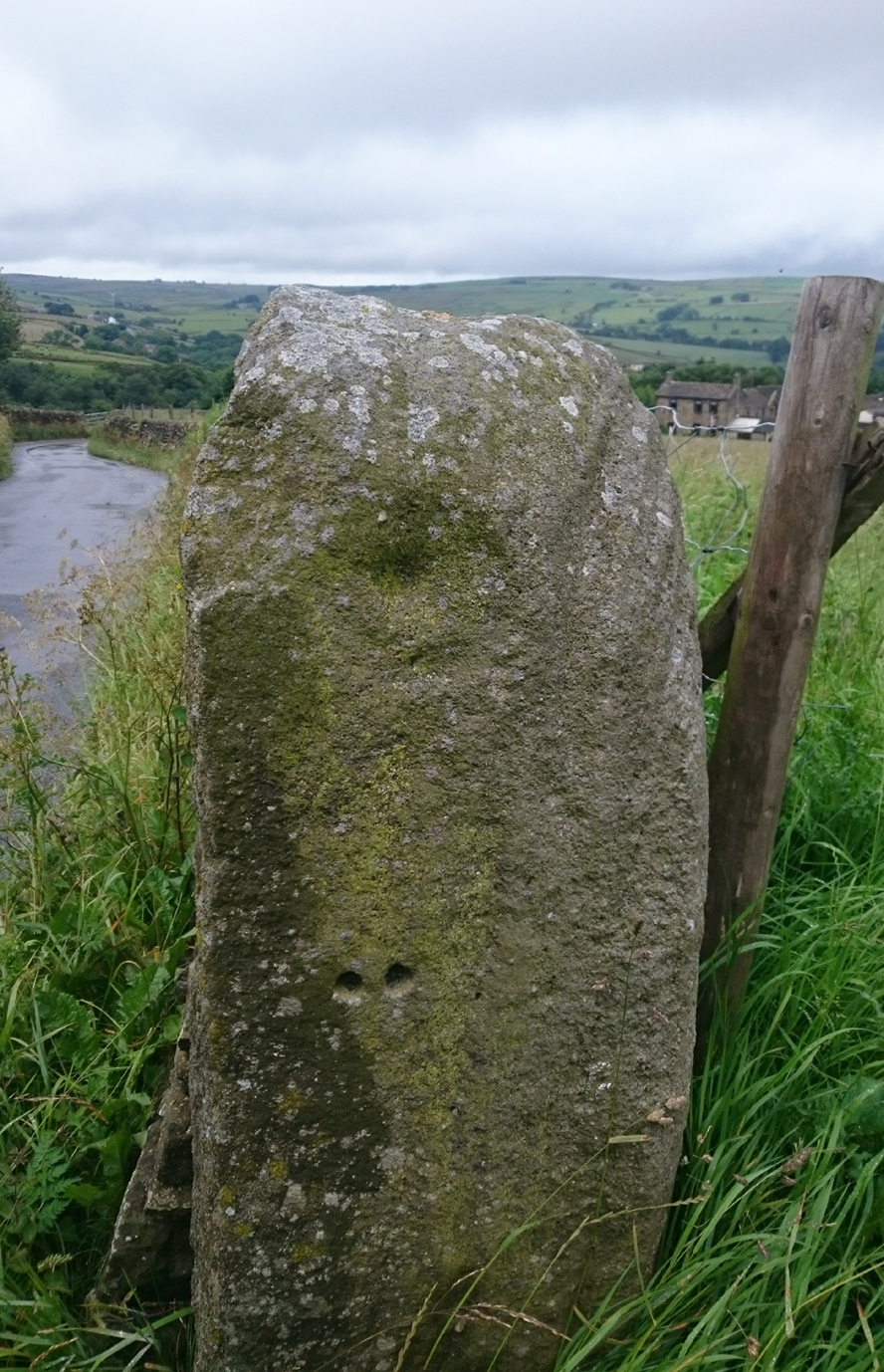
Old Lane Cup-and-Ring, Cowling

Old Lane Cup-and-Ring

This Stone is situated on Old Lane, Cowling, North Yorkshire. To get here coming from Crosshills, you come straight through the village and past the shops.  About 250 yards after the shops you will come to a sharp left hand bend, and once you have gone round this corner you will see a sign pointing to Oakworth (Old Lane).  You need to turn left here (up by the cemetery) and continue for about half a mile up that lane until you come to a sharp left-hand bend. Once you have gone round that left-hand bend you will see a driveway on the right, the stone is situated opposite, in the gateway.  Hope you can find it and enjoy it like I do every time I pass it.

Archaeology & History

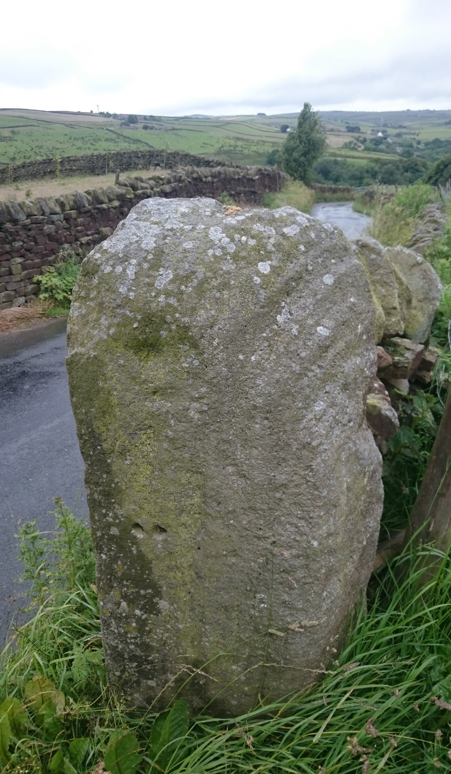
...and from another angle

…and from another angle

I’ve driven past this stone many times, almost every day and never previously noticed any markings.  Then, one particular day, the weather was a bit miserable but the lighting was just right to illuminate this little gem.  Was this lump of rock a standing stone, or have modern day folk took advantage and moved it here to be used as a gatepost? I don’t think we ever will know.

(Editor’s Note – When Chris first informed us of this carving, I wondered whether or not it had anything to do with a cup-and-ring found on a gatepost in the 1950s or ’60s by Stuart Feather or Sidney Jackson, but this was not the case.  This petroglyph therefore, is yet another one that our users have discovered and it has to be classified as a new find. Keep up the good work sir!  PB)

© Chris Swales, The Northern Antiquarian