ON the A59 Harrogate to Skipton road, right on top where it crosses the barren moors, get to the parking spot right near where the road levels out at the highest point. Walk up the footpath from here onto the moors (south) for about 200 yards till you notice a small black pool ahead of you. From here, walk left (east) offpath and into the heather, roughly along the ridge for about another 150-200 yards. Zigzag about and keep looking. You’re damn close!
Archaeology & History
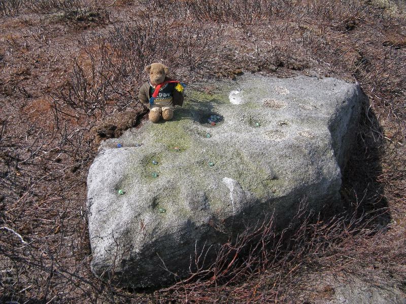
Close-up of some of the cups
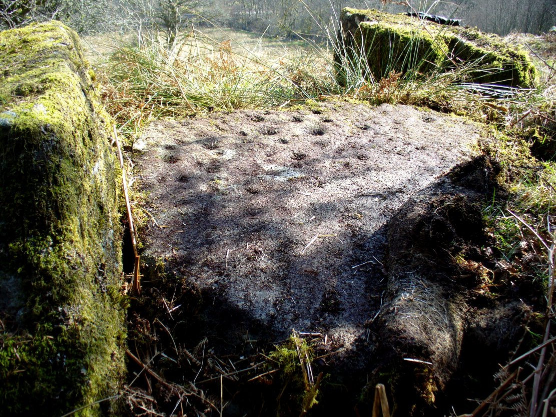
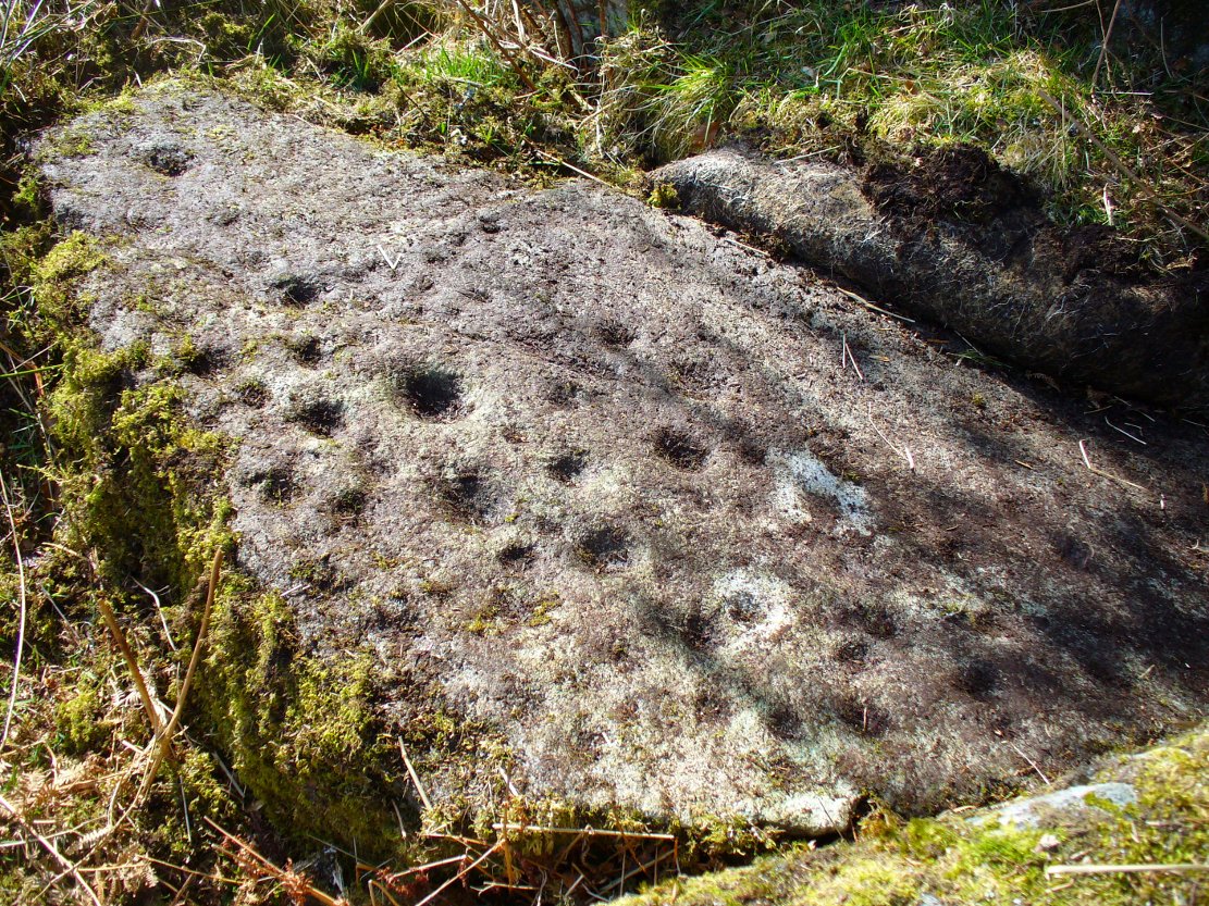
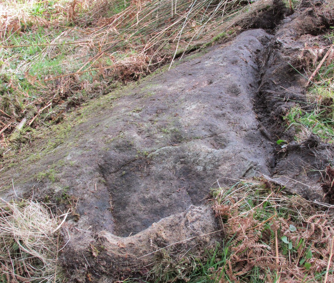
Not far from the Gill Head stone and walling, another previously unrecorded cup-marked rock was discovered on the afternoon of Saturday, May 3, 2014, by Danny Tiernan and his famous teddy bear! The stone seems to have been previously well-covered, but was made visible thanks to the annual heather-burning on this part of the moor. He came across it during an exploratory Northern Antiquarian wander to examine a cluster of other neolithic remains hidden on this moor. The carving consists of a series of plain cup-markings, between eight and twelve in number, running along the middle of the rock and outwards nearer to the edges. The cups are between 1-2 inches across and a half-inch deep at the most. The design was first highlighted on Danny’s walking blog, Teddy Tour Teas — and is gonna be difficult to find once the heather’s grown back.
Follow the same directions described to reach the Druidsfield 1 and 2 carvings. This one is the larger upright block right next to them!
Archaeology & History
Several of the faint cups visible
Contextually relevant to the two adjacent carvings, this is the largest of the three stones and comprises of a number of natural deep marks associated with between eight or ten man-made cup-markings. They’re not all immediately apparent, but stand out more as and when natural lighting conditions change. All of them are on the north and northwestern section of the stone, and measure between 1-3 inches across. This is the least visually impressive of the stones in this petroglyph cluster.
Folklore
The carvings here were said by one of the locals to have been part of a “druid’s circle, which we played in as children, and were always told had been a special place of the druids in ancient times.”
Haggart, D., “Notice of the discovery of a stone cup and cup-marked stones at Lochearnhead,” in Proceedings of the Society of Antiquaries, Scotland, volume 22, 1888.
Acknowledgements – Huge thanks to Paul Hornby for help and use of his photos.
The best way here is to walk a mile to find it. All the way up the road from Gleneagles Standing Stones to Glendevon, right at the very top where the two glens meet, there’s a small road heading to the Fishery. 100 yards along, park up. Then take the old green road back down the Glen, north towards Gleneagles, parallel with the new road. A mile or so down you’ll reach the farmhouse, but a coupla hundred yards before this, in a wooden gap in the electric fence, you can walk straight downhill to the large pool below you. Y’ can’t really miss it!
Archaeology & History
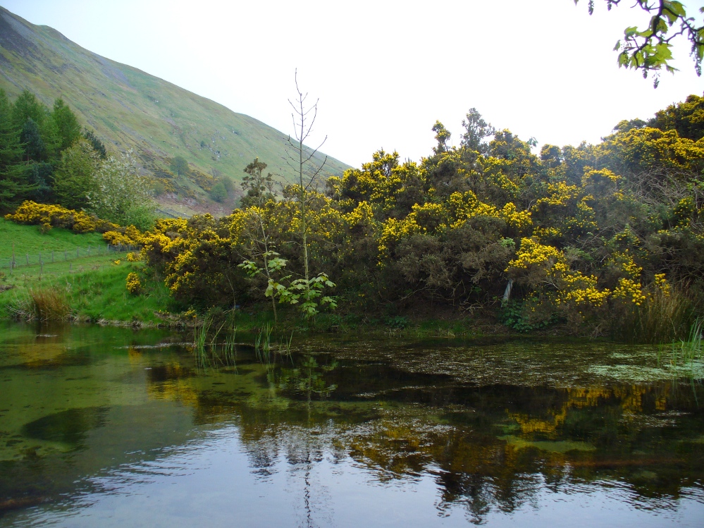
The strong cold spring of water known as St Mungo’s Well, now gathers into a large crystal clear pool and is gorgeous to drink and very refreshing! All around the edges are the brilliant yellow masses of gorse, held amidst widespread vivid hues of green in this most rocky of landscapes. Tis a gorgeous setting here….
St Mungo’s Well, 1860 map
Unfortunately there is no literary information that tells us why this spring of water, amongst the many others all around these hills, gained the ‘blessing’ of one of those roaming christians and was deemed to be ‘holy’. The greatest likelihood, as usual, is that the waters had some important heathen association which our peasant ancestors would have been able to tell us about if their animistic tales hadn’t been outlawed and demonized by the incoming cult — but we’ll probably never know for sure. As a result, we know nothing now of its medicinal qualities or old stories.
The transference of its old name (whatever it may have been) to their ‘St. Mungo’ may date from when the character was wandering with his christians in the 7th century, but we have no literary account proving as such. The name ‘St Mungo’ was an alternative name (a nickname if y’ like) of St. Kentigern — or at least that’s what the church historians tell us. There is no history of Kentigern or St Mungo up the glen, but we do have a more prosaic account that tells of a Mr Mungo Haldane of Gleneagles, a member of the Scottish parliament in 1673 onwards; he was succeeded by another Mungo Haldane MP in 1755. However, it’s highly unlikely that these political characters gave their name to the well.
The clear waters, looking southCrystal clear perfect drinking water
Even the Scottish holy wells surveys are pretty silent on this beautiful site. It was mentioned in Morris’ (1981) survey, but with no real information. The earliest account seems to come from an article written in the Perthshire Advertiser in 1856, and thankfully reproduced in the otherwise tedious genealogical history of the Haldane (1880) family; but even here, the narrative simply mentions the presence of the well and no more. Described in a walk up Gleneagles, it told:
“Journeying westward along the desolate moor…we soon came in front of Gleneagles, a narrow picturesque glen in the Ochils, through which the old road from Crieff leads into Kinross-shire. The hills here, as throughout the whole range, are strictly pastoral, but in no place more so than Gleneagles. Crowning the heights on both sides of the glen, we have craigs ragged and bare enough; but their show of beetling hard sterility is as nothing to the winding receding mass of grassy heights that bound the view. In looking on that quiet, sunny, Sabbath-like retreat, one would be apt to deem the name a misnomer, and yet it is not much above a hundred years since the monarch of birds had a home among its cliffs. There, too, the Ruthven Water that dashes past Auchterarder has its rise — not in a scarcely seen bubbling spring almost covered with moss, but issuing at once into daylight at the bottom of yonder steep in volume sufficient to drive a mill. In ancient times, as now, it must have been an object of mark, as it is called St. Mungo’s Well; but who this St. Mungo or St. Magnus was — whether the ghostly patron of Glasgow, Auchterarder old chapel, or the guardian saint of this particular spot, we cannot tell. But he seems to have relished cold water; and it is satisfactory to know that he must have got his fill of it there, if his cell happened to be in the vicinity.”
The well was mentioned in passing in the Object Name Book in 1860 and shown on the earliest Ordnance Survey maps.
Folklore
Apart from the fact that the waters here never run dry, we have no other folklore. However it should be noted that St. Mungo’s Day was January 14th — which may have been when the qualities of the spring were deemed most efficacious, or when olde rites were enacted here. However, a hundred yards down we pass the stream known as Bride’s Burn, probably in honour of the heathen Queen St. Brigit, whose name and myths are integral to our great Earth goddess, the Cailleach and whose celebration date is only two weeks later than that of Mungo. Hmmmmmmm…..
References:
Attwater, Donald, Penguin Dictionary of Saints, Penguin: Harmondsworth 1965.
Haldane, Alexander, Memoranda Relating to the Family of Haldane of Gleneagles, C.A. MacKintosh: London 1880.
MacKinlay, James M., Folklore of Scottish Lochs and Springs, William Hodge: Glasgow 1893.
A variety of ways to get here, all depending on which directions you’re coming from, obviously! Simply get to the sleepy old hamlet of Brunton, SW of Creich Castle ruins, and at the north end of the village where the road hits a T-junction, turn left and stop at the next house (hidden amongst trees) a coupla hundred yards along on the right-hand side. Knock on the door of The Manse (marked as such on the OS-maps) and ask. The fella who we met here, Liam, was very helpful and guided us to the site up the far end of his garden.
Archaeology & History
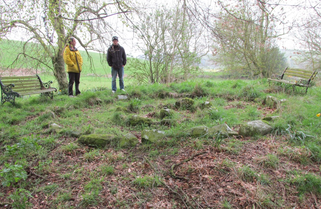
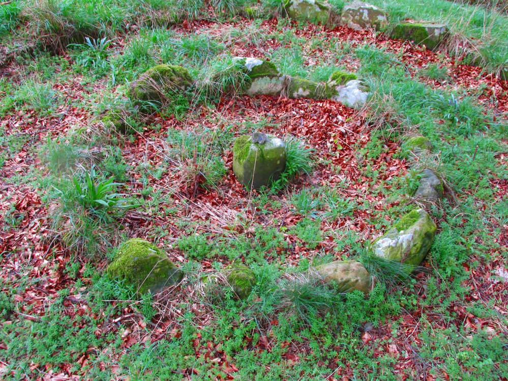
The small central ring
A truly fascinating and enigmatic arena for a host of reasons. The small and well-preserved ring of stones up the slope behind Creich Manse — looked after and recently cleared of covering vegetation by the present tenant — wasn’t born here, but originally lived more than a mile to the southwest, on the grounds of Luthrie House near the OS grid-reference NO 313 195. They were apparently under threat of being damaged and so, as James Taylor (1875) told, a “Mr Lawson got them removed, and placed them in a wood behind his manse in the very form in which they were found.”
Curiously omitted from the giant surveys of Aubrey Burl (2000) and other modern academics, the place was first mentioned in the New Statistical Account of the parish by Alexander Lawson. It told that in 1816 “trenching operations” were being undertaken in Luthrie village when, at some point, the men came across a curious group of stones that seemed to have faint carvings upon them — in the centre of a ring of stones! The land-owner and parish minister were called to the site and they found that a double stone circle had been unearthed. The account told:
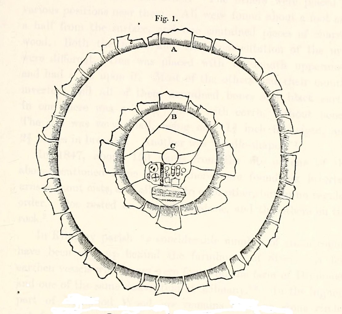
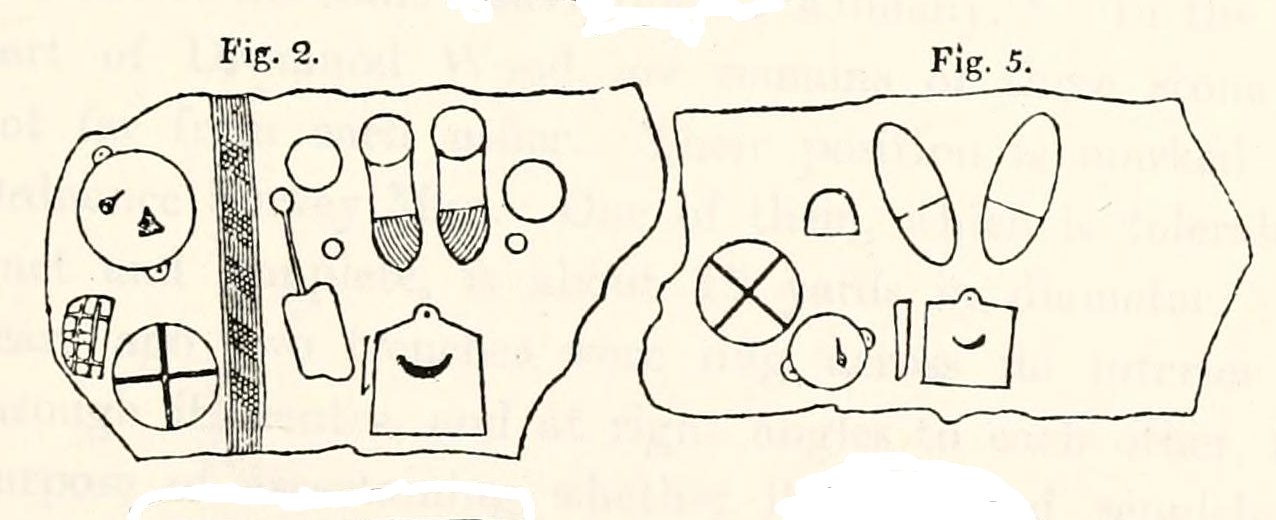
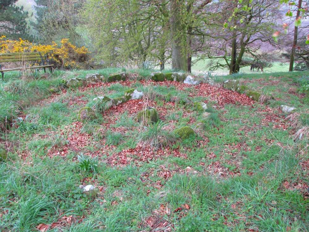
“In the centre was placed, in an upright position, a cylindrical sandstone, one foot two inches high, and having the diameter of its base one foot. Around this stone, as a centre, at the distance of three feet, were sixteen other stones, placed also in an upright position, and in the form of a circle. The stones of which it was composed were of various sizes, from fifteen to twenty inches in height; from eight to eighteen in breadth, and from four to nine in thickness. Due south of the centre, and between it and the inner circle, there were placed in a horizontal position, two stones containing hieroglyphics in alto relievo, very entire. The remaining space between the centre and the circle was laid with pavement. At the distance of seven feet and a half from the same central pillar, there was another circle of stones, thirty-two in number, placed in an upright position, and very much resembling those of the inner circle. The stones in both circles were placed close together. Between the circles there was neither pavement nor stone of any description. Neither were perfect circles, the diameter of one from north to south, being fifteen feet one inch, while its diameter from east to west was only fourteen feet nine inches; in the same manner, the diameter of the other, from east to west, was five feet ten inches, while from north to south it was it was six feet one inch.”
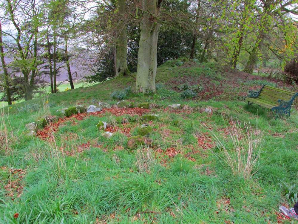
Ground-plan of the circleCreich ring, looking west
The account went on to describe there being a deposit of “burned human bones and charcoal” at the centre, below the larger of the two petroglyphs. Additionally, in one of those peculiarly common traits found at a number of megalithic remains, the Royal Commission (1933) lads pointed out that “it is remarkable that all the stones of the inner circle were of sandstone, which is not found nearer than Cupar, seven miles away, while those of the outer circle were of the local whinstone.”
Another description of the site was given in James Campbell’s (1899) updated and revised magnum opus on the parish of Balmerino, where some additional remarks were made about the petroglyphs. He told:
“Under one of the sculptured stones were found small burnt human bones and ashes. They were not enclosed in a cist, nor was there any building under the surface. Certain of the figures cut on one of the slabs of this monument are very similar to the figures on the sculptured slab of the one already mentioned. There are what appear to be representations of the soles of a pair of shoes, a circle with a cross within it — the limbs of the cross being: at right angles to each other — which may be intended to represent a wheel. On one of the stones is the figure of a spade. What the other figures represent is more uncertain. The sculptures raise difficult questions in regard to the time of the erection of these monuments. It is evident that cremation had been then practised at Creich, though the degree of culture and art indicated by the sculptures seems to point to a time subsequent to the abolition of this pagan custom elsewhere.”
Creich Circle petroglyphsCreich Ring, looking east
The carvings illustrated here are pretty unique in terms of them being standard prehistoric petroglyphs, as they seem to comprise more of a mix of Iron Age and Romano-British designs – though potentially we must take into account that they could be a form of Pictish. This region is littered with the remains of Picts, in place-names, folklore and archaeology. As such, it would be very helpful if someone qualified in Pictish studies could examine these designs. We do find petroglyphs of similar forms to this in Bronze Age Scandinavia and Iberia − but not Fife!
Folklore
In the only account of any folklore relating to this site, James Campbell (1867) told that local people said the place was “supposed to have marked the tombs of distinguished chiefs.”
References:
Burl, Aubrey, The Stone Circles of Britain, Ireland and Brittany, Yale University Press 2000.
Campbell, James, Balmerino and its Abbey – Volume 1, William Blackwood: Edinburgh 1899.
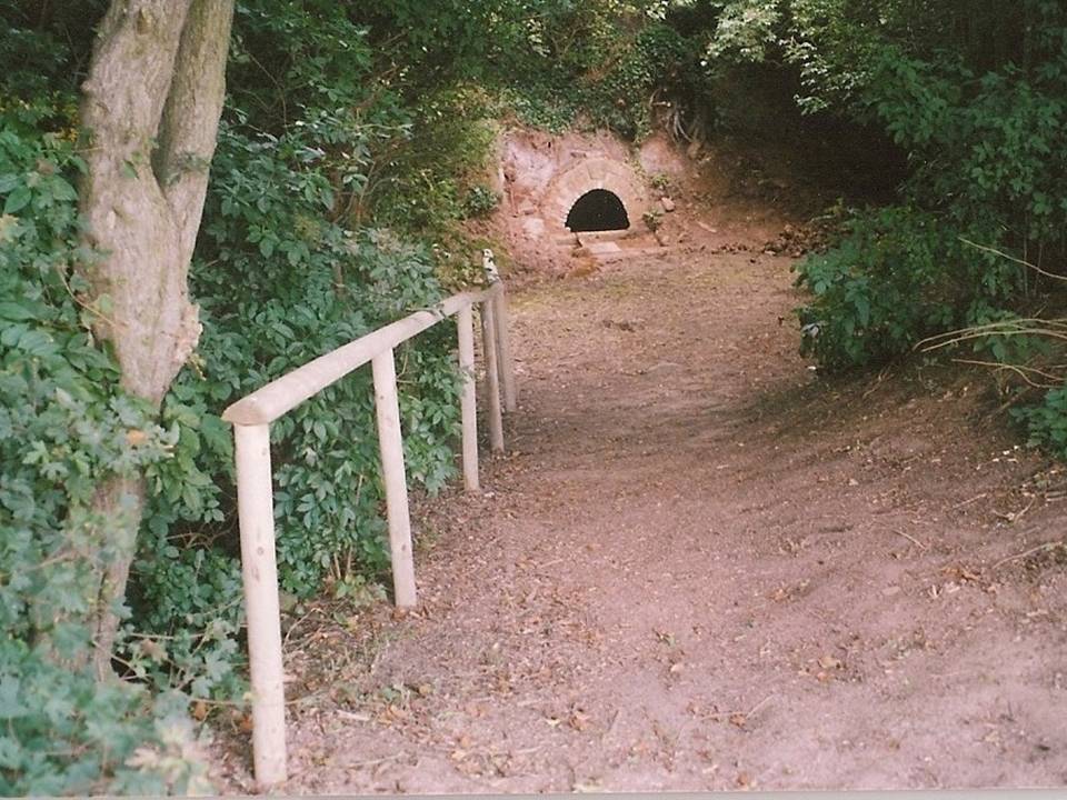
Follow the road around from Headon village to the Ladywell estate and on the left hand side is a small copse and footpath. It is near the junction of Greenspotts Lane and Lady Well Lane. Park carefully near here and walk down the small ravine to the well.
History & Archaeology
Close-up of the well
Only two dates can be confirmed of this site. One a reference in County records of mending a bridge to a ‘Ladyewell‘ in the nearby Markham parish, but this could easily be another site. A better date is that 1718 which is carved on its arch. It was used as a source of water until the 1930s. One of the most atmospheric and pleasantly situated sites, the spring is located in a small wooded dell and arises from the rock in a small alcove or cave. This is fronted by a red brick arch, and the water fills a trough set partly into the ground with a small overflow lip and a channel to fill it, presumably this was for animals. On the key stone of the arch are the initials ‘HW’ and a date which possibly reads 1718.
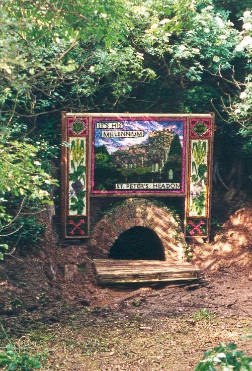
Dressed for 2000AD
Folklore
I have found no traditions of healing or other folk belief. However, the site was one of the few Nottinghamshire well dressing sites. This began in 1981 and continued until 1991, and there was a one-off occurred in 2000 AD. It was done on the weekend of the churches Patronal festival—St. Peter’s—and was used to use to pay for the church repairs. The well dressing boards were of a Derbyshire tradition, as can be seen here to the right.
Follow the same directions as if you’re going to the much overgrown, earthfast Druidsfield 01 carving. Adjacent is an upstanding block of large rock, right next to which is the flat surface of this Druidsfield 2 carving. If it’s overgrown, rummage around. You can’t miss it!
Archaeology & History
This carving and its compatriots have almost been forgotten about it seems. Buried beneath rolls of vegetation, this long flat rock covered in cup-markings seems to have played a part in some larger megalithic structure—but whatever it was is difficult to work out. As you walk around the place it gives the distinct impression that some form of tomb was once in evidence, which may have been the case. The Scottish archaeology giant Audrey Henshall is said to have found no evidence of a chambered tomb, but this may have been something smaller, less impressive.
When Mr Haggart (1888) wrote about this carving, he too thought that the carvings had been part of a tomb—this being the horizontal surface at the bottom. He wrote that,
“the one forming the floor area of the dolmen being a square-shaped boulder of diorite, having fifty cups, varying from three and a half inches to an inch in diameter, the outlines of which look as fresh as if chiselled a year or two ago.”
The main cluster of cups
This indicates it had only recently been uncovered. There are lots of other archaeological remains scattered all round here, from different periods of history; but the other Druidsfield 1 and 3 carvings are found right next to each other, indicating this very spot was some site of neolithic or Bronze Age importance. An accurate excavation of the site and the adjacent Druids Circle would be worthwhile. I counted at least 44 cups on this rock when we visited last week, many of which are still quite clear.
The most recent Royal Commission (1979) briefing of the stone added nothing of relevance. They listed the site but it seems they never visited the place.
The portable bullaun-like deep-cut rock known as the Druid’s Stone is kept in private grounds nearby. When members of Scottish heritage came to visit an adjacent site a few years ago, the lady of the house told how they walked right past it without giving it any notice. “They didn’t even see it under their noses,” she said. Nowt new there!
Folklore
The carvings here were said by one of the locals to have been part of a “druid’s circle, which we played in as children, and were always told had been a special place of the druids in ancient times.”
References:
Coles, F.R., “Report on stone circles in Perthshire principally Strathearn,” in Proceedings of the Society of Antiquaries, Scotland, volume 45, 1911.
Royal Commission on the Ancient & Historical Monuments of Scotland, Archaeological Sites and Monuments of Stirling District, Central Region, Society of Antiquaries of Scotland 1979.
Acknowledgements – Huge thanks to Messr Paul Hornby for help and use of his photos.
From Lochearnhead village going south along the main A84 road to Callander or Stirling, take the very last road on the right just as you’re going out of the village, up o Craggan and park up by St. Angus’ Church. Walk back down onto the A84, turning right and walk along for 100 yards. Then go back up into a boggy field, where you’ll notice some walling above you. Head to the top right of this, up to the edge of a garden. Hereby is a cluster of rocks in a jumble. That’s your spot!
Archaeology & History
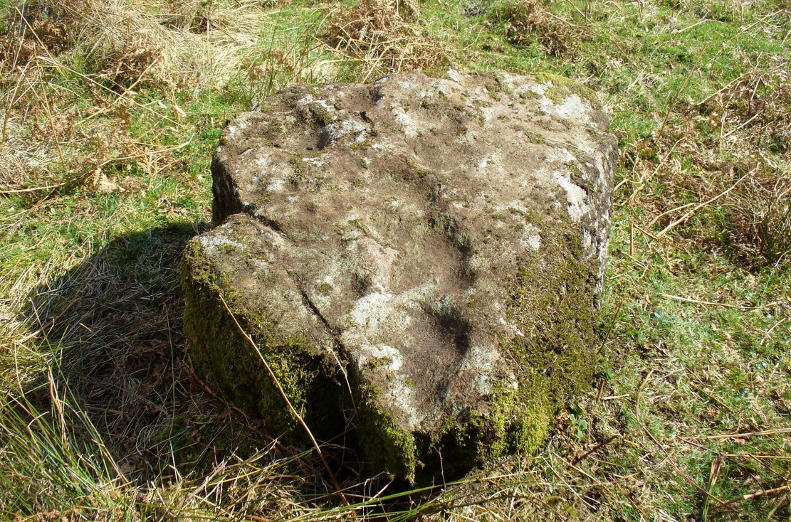
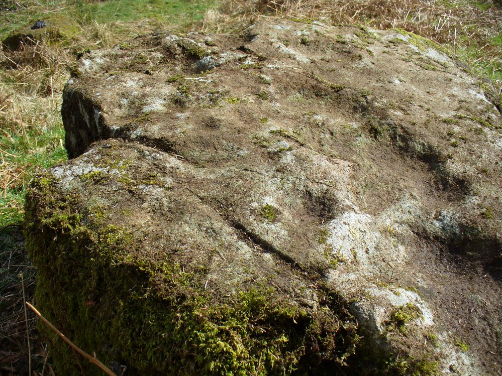
Cup-marks along the edge and bottom of the stone
This takes a bit of finding in the undergrowth and is best checked out at the end of Winter. Once overgrown it truly takes some finding. But beneath the vegetation is a slender earthfast rock with a long ridge, a little bit like a spine, running from one end of the stone to the other. Along this topmost spinal column we find a cluster of ten cup-markings, getting smaller in size the further along the spine we travel. It’s a curious feature. At the widest end of the rock where the widest and deepest cup-marks occur, another four cups have been etched into the northeastern sloping face below the largest cups.
When we came here, the sunlight was blocked by the surrounding trees, so we were unable to see if other elements had been carved onto the stone. It is found in conjunction with two other rocks—Druidsfield 2 and 3 carvings—right next to each other, with designs of quite different visual structures, seemingly unconnected in any linear sense. There also seemed to be a possibility that this was once part of a prehistoric tomb. Later we found that both D. Haggart (1888) and Fred Coles (1911) had made similar comments, with Haggart specifically telling there to have been a collapsed tomb here in the 19th century. He may have been right. Extensive walled structures abound hereby−including one which old locals told us were remains of a Druid’s Circle, which we found close by.
Folklore
The carvings here were said by one of the locals to have been part of a “druid’s circle, which we played in as children, and were always told had been a special place of the druids in ancient times.”
Haggart, D., “Notice of the discovery of a stone cup and cup-marked stones at Lochearnhead,” in Proceedings of the Society of Antiquaries, Scotland, volume 22, 1888.
Acknowledgements – Huge thanks to Messr Paul Hornby for help and use of his photos.
Along the A822 road between Crieff and Muthill, take the small western country lane just as you’re coming out of Muthill. Nearly 2 miles on, take the turn to the right, and then 100 yards or so from there turn sharp left. Keep along this country lane for about a mile till you reach the third track on your left. Walk down the track and you’ll see the standing stones in the field on your left. A gate into the field is by the house.
Archaeology & History
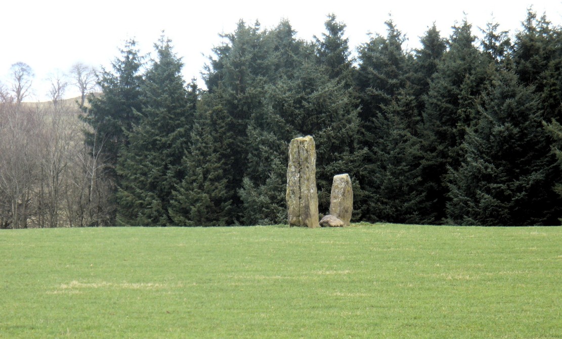
A fascinating pair of relatively large standing stones 317 yards (289.5m) SSE of the tall singular monolith of Dalchira North in the adjacent field. Traditionally said to have once been part of s stone circle, it was marked as such when the Ordnance Survey lads came here in 1863, but there is very little evidence of such a megalithic ring today—and even the small stone lying in between the two uprights is probably a more recent addition to the site. It certainly wasn’t mentioned by Fred Coles (1911) when he came here, who gave only a brief description of the place.
Dalchira East & the skyline notch of Lurgan HillDalchira, looking east
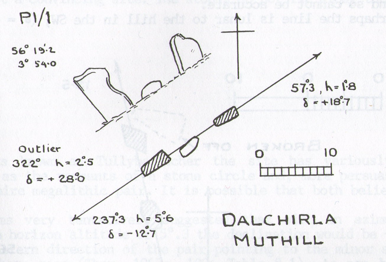
The stones were included in Margaret Stewart’s (1968) list of megalithic pairings as measuring 7ft 6in x 4ft 3in x 2ft and 4ft 3in x 3ft 6in x 1ft respectively, and 8ft apart. There is a small stone laid down in between them which has cup-marks on it, but these indentations are natural nodules in conglomerate rock. But the measurements and angles of Dalchira East were examined by the late great Alexander Thom (1967; 1990) who thought they had been positioned specifically to observe and predict lunar movements across the sky, saying that the alignment of these stones “shows the declination of the Moon rising at the minor standstill.” He may have been right.
Thom’s geometry of Dalchirla
In Aubrey Burl’s notes to Thom (1990) he told that the size and shapes of these stones, “have been interpreted as anthropomorphic, the taller, or alternatively the more pointed , usually at the west, being the male, the lower or flat-topped he female.” He subsequently included this site in his own work on megalithic stone rows (Burl 1993), without further comment.
Tis a peculiar site inasmuch there doesn’t seem to be much ‘feeling’ to the place. I’m sure the site is gonna have its days, but more than likely the neat and tidy farmed theatre has subsumed the genius loci to all but the most auspicious of times—most likely generated when the pull of the Moon still tugs at any geomagnetic background memory… Still, it’s definitely worth looking at.
References:
Burl, Aubrey, From Carnac to Callanish, Yale University Press 1993.
Coles, Fred, “Report on Stone Circles Surveyed in Perthshire, Principally Strathearn” in Proceedings of the Society of Antiquaries, Scotland, volume 45, 1911.
Heggie, Douglas C., Megalithic Science: Ancient Mathematics and Astronomy in Northwest Europe, Thames & Hudson: London 1981.
Stewart, Margaret E.C., “Excavation of a Setting of Standing Stones at Lundin Farm near Aberfedly, Perthshire,” in Proceedings of the Society of Antiquaries, Scotland, volume 98, 1966.
Thom, Alexander, Megalithic Sites in Britain, Oxford University Press 1967.
Thom, A., Thom, A.S. & Burl, Aubrey, Stone Rows and Standing Stones – 2 volumes, BAR: Oxford 1990.
Often noted under Lower Burnham, although this is a hamlet and not strictly the parish, is in Haxey. The spring can be found by taking the footpath after Starkey’s farm, top of Holy Well lane, with Holy Well House the nearest dwelling.
Archaeology & History
Holy Well, Haxey
Potentially if Hunt (1923) quoted in Hills (1967) is to be believed, this is the most famed holy well in the county, as he believes that this was the site where King Oswald—later St Oswald—was slain and here the well was St Oswald’s Well rather than at Oswestry. He notes that:
“The Holy Well at Lower Burnham in the parish of Haxey is supposed to mark the site where King Oswald fell. People took away the soil until a deep hole was formed which filled with water…It has been known for 1300 years as the Holy Well, and annual feasts were held near it until recent years. This confirms the Ven. Bede’s statement about the sanctity of the soil in the eyes of the people.”
According to Garner (1991) by the early 19th century the well’s popularity had waned and the spring fell into private ownership and the water was used to run two water mills, and as such a gully of considerable depth constructed. However the spring did not produce enough continuous water and the scheme failed. A similar attempt was made by Rev. Thomas Skipworth Rector of Belton was more successful but only because a dam was constructed although still the power was not great enough. Interest in the well had not completely disappeared, and an announcement in 1875, in the Epworth Bells stated:
“Firmly believing in the efficacy of the Burnham water in the cure of some outward bodily complaints, we sometime since urged the importance of making that water once more available to the public, and at the same time we urged the desirability of the public availing themselves of the water.”
Responding to this plea, a group of local men, Cooper, Starkey, Ducker, Skelton, Meggitt and Templerton came together to ‘re-open the well’ It had been for years only a dry, roughly rectangular, hollow but ‘within minutes of digging, water gushed out, and the hollow filled.’ No evidence of constructional material was seen but the landowner, Mr. Lockwood, agreed to allow the well to be kept open and the water to be freely available when he did not have cattle in the field, as such the well was fenced in probably as local people reported in the Crowle Advertiser (1960) with white railings. Indeed, up until the 1940s the well remained fenced off with barbed wire as a cattle water place and at some point it was filled in.
This meant that the well had again fallen into disused and its exact location was perhaps becoming unclear, when in the 1960s when three Epworth men, Frank and David Lindley with Jack Warriner. A report in the Crowle Advertiser of 1960 noted that:
“At a spit depth, what seem to be known locally as water stones began to be turned up; at about two feet six there was a promising slab, followed by another, at a little deeper level; and after discovery of several hand-made bricks had dispirited the diggers somewhat, three more irregular shaped stones of considerable size were scraped clean of the mud that overlaid them. By now there was bared to view what could have been the stepped entrance to the well which from visual testimony of old residents, the explorers hoped to find.”
This stepped entrance consisted of eight steps according to local people. The group then discovered at about four feet timber was found and on this two corner stones were found rested. This was thought to have been the remains of the enclosure which went around the well.
In March 1961 another attempt was made to open the well in view of a pilgrimage by the Lincoln Diocesan Youth Pilgrimage, this time the excavators had gone twice as deep and the strata of waterstone was hit, but no evidence of a constructed well. This was not a concern of the Vicar of Owston Ferry, Canon L. D. Ravins who was of the opinion that an actual construction would have been unlikely if the above description by Hunt was to have happened. This time according to the Crowle Advertiser:
“Both he and Canon Ravins feel that the water may well have medicinal qualities (they noticed they say an unmistakably sulphurous smell from it during the excavations) and they are intending to have the chemical analysis made.”
However, the analysis did not reveal any sulphur but it did have Magnesium and Calcium sulphates and Calcium bicarbonate all linked to spa waters and hence verifying its medicinal role. The well was visited by the pilgrimage and Garner (1991) recollects that a white timber enclosure was placed around the site with a sign proclaiming ‘The Holy Well’ according to him the ‘whole site now barely discernible save for a lone willow sentinel-like over the place revered by myriad generations in days long since past.’
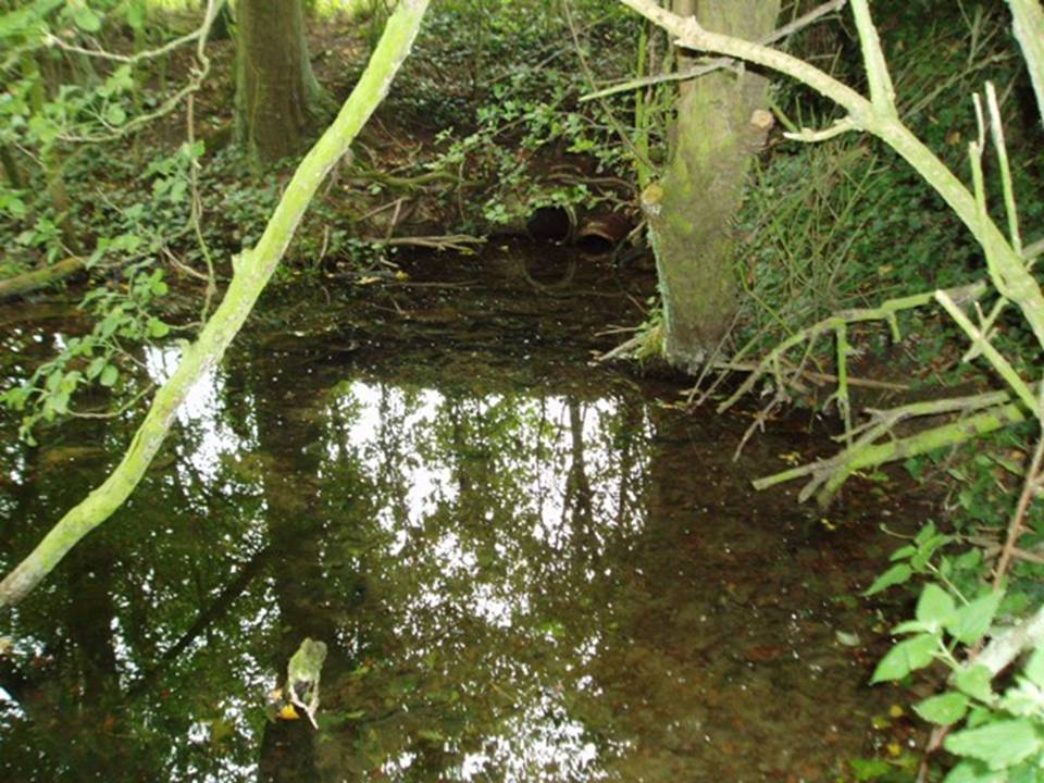
However, this was not the case when I visited the site and found a large pool with a pipe at one end, from which a channel appeared to flow. Although Garner (1991) noted a ‘few elder citizens of Burnham strongly favour its position a few metres south of the spot popularly referred to”.
Folklore
However this name has not been recorded and the site is best known simply as the holy well. This site was, according to Gutch & Peacock (1908),
“ …dedicated to the ever-blessed Redeemer, and on the festival of His Ascension was supposed to possess the power of healing all sorts of deformities, weaknesses, and cutaneous diseases in children, numbers of which were brought from all parts to be dipped in it on that day.”
The earliest mention appears to be Peck (1809) who stated:
“a Spring called the Alley Well of very cold water which was very much resorted to by the people in their neighbourhood, being very proper for those of a weakly habit.”
Stonehouse (1839) notes:
“about one hundred and twenty years ago, the concourse of visitors was so great that a Village Feast was held at the same time… and at a much later period conveniences were annually made for the use of the bathers, and gingerbread-stalls and other slight reflections were provided on the spot. This practice has, however, of late years fallen altogether into disuse… The spring now appears in a dirty and neglected state.”
The fame of the spring led to it being immortalised in Hamilton’s novel Captain John Lister where the titular hero watches during the early morning of Haxey Fair, a melancholy procession through the main street of women, accompanied by diseased and deformed children. In the book, the innkeeper explains by saying:
‘They are going to the Holy Well at Nether Burnham. ‘Tis a famous spring, and has been many ages, and on this day there is virtue in the water to cure almost any disease or sickness in a child, if be dipped before noon…out of Nottinghamshire and Yorkshire and I don’t know where all.’
(Essay taken from R.B. Parish Holy Wells and healing springs of Lincolnshire)
References:
Garner, J. R. (1991) Burnham – the story of an Axholme village.
Gutch, E. & Peacock, M. (1908) Country Folklore Vol. VI: Folklore of Lincolnshire
Hills, P.J. (1967) The Holy Well of Burnham the site of the Battle of Maserfield-the identification re-examined.
Stonehouse, W.B. (1839), The History and Topography of the Isle of Axholme.
Various anonymous cuttings from Crowle Advertiser (1960)
Along the A822 road between Crieff and Muthill, take the small western country lane just as you’re coming out of Muthill. Nearly 2 miles on, take the turn to the right, and then 100 yards or so from there turn sharp left. Keep along this gorgeous country lane for about a mile till you reach the third track on your left and park up. Walk down the track and you’ll see the standingh stone in the field on your right. Go all the way to the bottom where the farm is and go through the gate into the field.
Archaeology & History
The slim end of the wedge
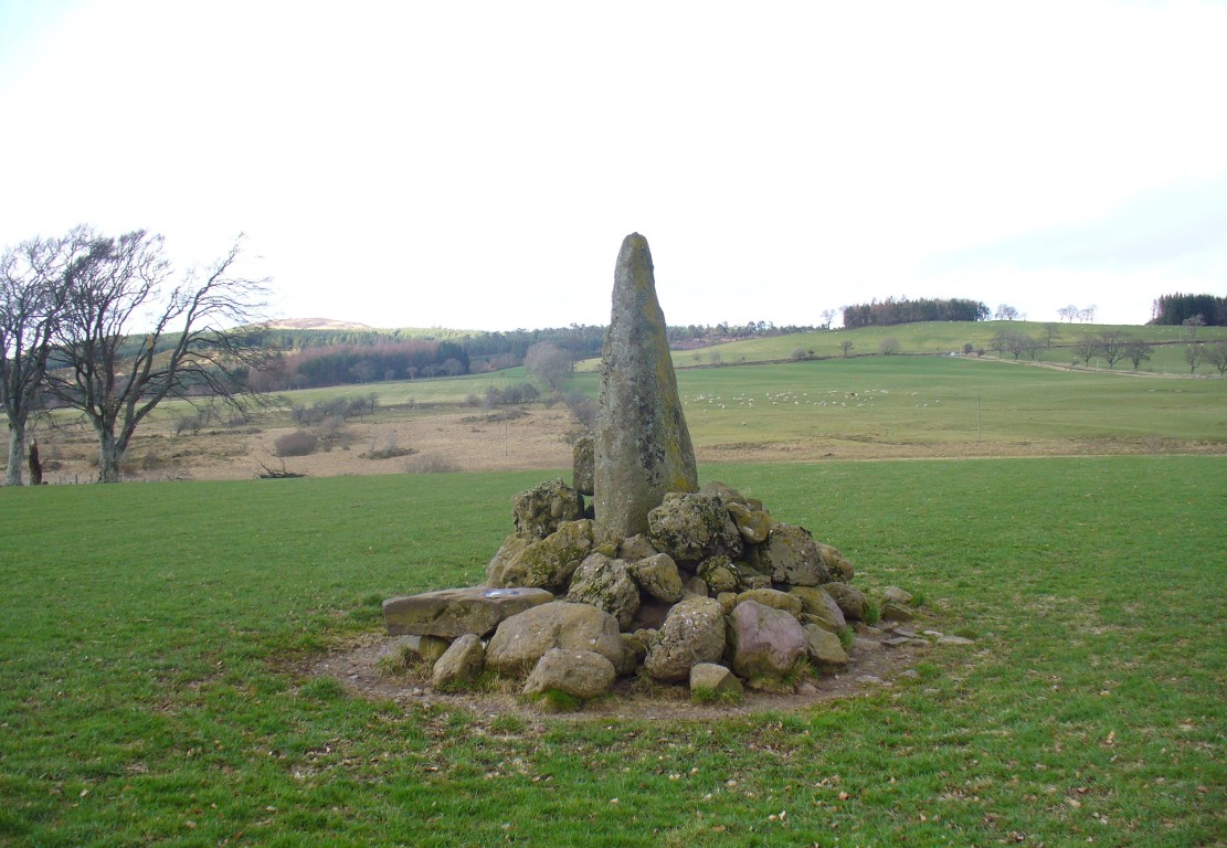
Less than 2 miles southeast of the megalithic titan of Dunruchan A, we find a slightly smaller monolith positioned on lower ground and humbled by a more manicured landscape close to the farmhouse. But it’s still a big fella, albeit hemmed in by a mass of field clearance rocks piled up and around the base (two of which have odd carvings on them). The stone is about ten-feet tell, being very slim on its north-south side and much wider on its east-west face. For some reason I got the impression that the stone wasn’t standing in its original position; though in searching through my megalith library for further information on the site, l found that very little has been written about it. The earliest literary evidence comes, as usual, from Fred Coles (1911), who simply told us:
“In a field south of Machany Water and NE of Dalchirla farm-steading 260 yards, there stands this tall and striking monolith… In essential features this stone much resembles most of the great schistose blocks which characterize the main portion of the Strathearn area; but it tapers upwards to a very thin and narrow summit that rather distinguishes it from its fellows. It stands 9 feet 4 inches above ground, and girths at the base 7 feet 11 inches. It is set with its longer axis due north and south. Around its base there are several large masses of stone—not earthfast—amid a conglomeration of smaller pieces evidently cleared off the field.”
Fred Coles’ 1911 drawing
The prehistoric cairn of Torlum to the north may have had some significance to the setting of the stone, but without excavation and details of its original site, we’re just grasping at straws when it comes to evaluating any potential geomancy or landscape relationships—with the megalithic stone row in the next field perhaps being an exception!
The moorlands above here, stretching for many a mile, is apparently lacking in any prehistoric remains if you listen to the official records. But with the Dunruchan megalithic complex only two miles away and the once-giant tomb of Cairnwochel over the southeastern horizon, we know that cannot be possible… Watch this space!
References:
Coles, Fred, “Report on Stone Circles Surveyed in Perthshire, Principally Strathearn” in Proceedings of the Society of Antiquaries, Scotland, volume 45, 1911.