Ellers Wood (618), Washburn Valley, North Yorkshire

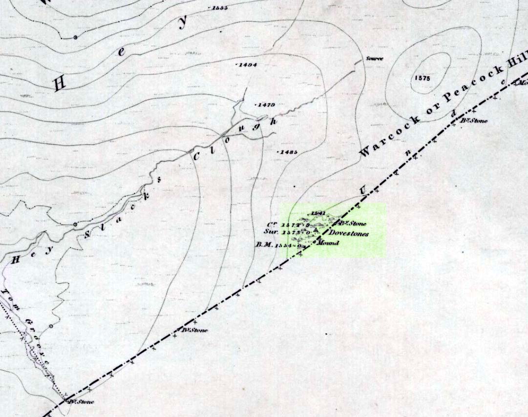
Cup-and-Ring Carving:  OS Grid Reference – SE 1901 5101

Getting Here

Sketch of CR-618, c.1990

Follow the same directions to reach the other Ellers Woods carvings, staying on the western-side of the river close to where it meets with Snowden Beck, just north of the footpath. Check it out in winter and early Spring — any later in the year and it might be a little overgrown.

Archaeology & History

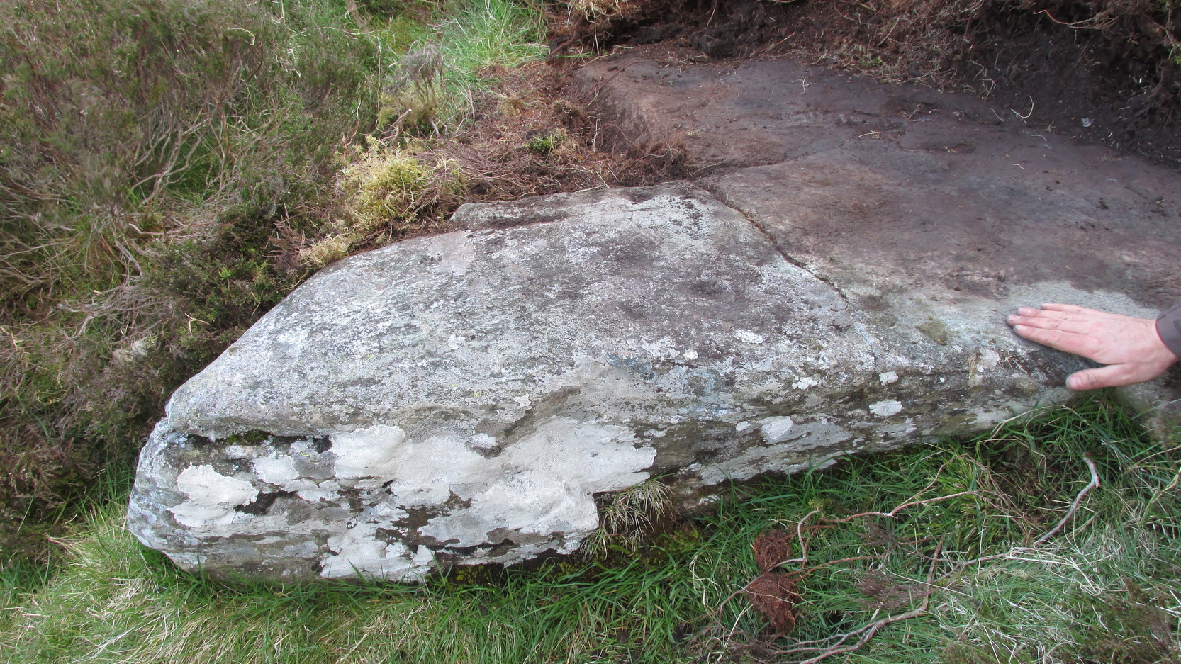
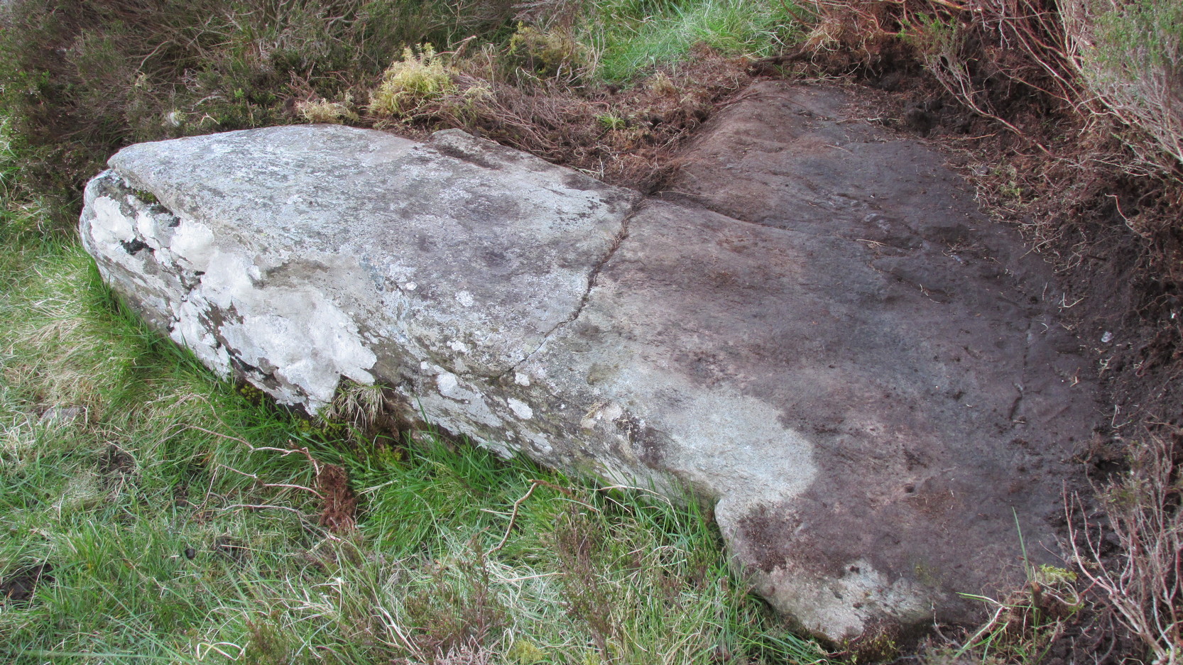
A truly lovely, lichen enriched carved rock in a lovely little part of the Fewston valley.  The place has a distinct genius loci that’s very different from its carved rock companions on the moorland hills a short distance away.  As I’ve said elsewhere: the surroundings of trees and richer fertile growth is something we must remember to ascribe to these carvings when we encounter them, as the landscape in places such as Ellers Wood is much closer to the scattered forested landscape that profused when first these stones were inscribed.

Section of CR-618

First described by Cowling & Hartley in 1937, it was later included in Cowling’s (1946) more extensive prehistoric survey of mid-Wharfedale.  There may be as many as 38 cup-markings cut onto the rock here, along with several lines and grooves.  A meditative dreaming site indeed…

References:

  1. Boughey, K.J.S. & Vickerman, E.A., Prehistoric Rock Art of the West Riding, WYAS: Exeter 2003.
  2. Cowling, E.T., ‘A Classification of West Yorkshire Cup and Ring Stones,’ in Yorks. Arch. Journal 1940.
  3. Cowling, Eric T., Rombald’s Way, William Walker: Otley 1946.
  4. Cowling, E.T. & Hartley, C.A., ‘Cup and Ring Markings to the North of Otley,’ in Yorks. Arch. Journal 33, 1937.
  5. Grainge, William, The History and Topography of the Forest of Knareborough, J.R. Smith: London 1871.
  6. Grainge, William, History and Topography of the Townships of Little Timble, Great Timble and the Hamlet of Snowden, William Walker: Otley 1895

© Paul BennettThe Northern Antiquarian


East Adderbury Cursus, Banbury, Oxfordshire

Cursus: OS Grid Reference – SP 473 372

Also known as:

  1. Bodicote Cursus

Found a few miles south of Banbury and running in a southeast to northwest alignment, Paul Devereux wrote that,

“the crop marks of this cursus fragment were first photographed by James Pickering in 1972…between the villages of East Adderbury and Bodicote…close to the River Cherwell.  The southeast end is square; the other terminus is unknown.”

References:

  1. Pennick, Nigel, & Devereux, Paul, Lines on the Landscape, Hale: London 1989.

© Paul BennettThe Northern Antiquarian 2016


Dun Mac Sniachan, Benderloch, Argyll

Hillfort:  OS Grid Reference – NM 9032 3822

Also Known as:

  1. Dun mac Uisneachan
  2. Dun Uisnach
  3. Beregonium

Early plan of the Fort, 1885

Archaeology & History

This is a fine-looking monument amidst a fine piece of landscape!  The site was constructed over various centuries, beginning in the Iron Age, with the earliest parts being the traces of walling on the outer edges.  This first section of the fort “measures about 245m in length by a maximum of 50m in width internally,” and much of it can still be traced all along the full length and breath of the geological ridge upon which it sits.  However, the timber-laced walls that stood all round the edges have, obviously, all but disintegrated.  This earlier part of the fort, wrote Richard Feacham (1977),

“was superceded by a small subrectangular, now vitrified fort, about 170 feet long by 60 feet wide, and by a circular and probably vitrified dun measuring about 60 feet in diameter.”

View of the Dun (Smith 1885)
Looking out from the dun

There was ample water supply for the people who may have lived on this ridged fortress, as there is still a fresh water spring on the southeast edge of the hill.  And it seems pretty obvious that this fort was occupied for some considerable time into the Common Era, as material remains found amidst excavation work here at the end of the 19th century, “including metalwork of Roman date…suggests an occupation in the early first millenium AD.” (Harding 1997)

Folklore

The folklore and legends of this site (aswell as the surrounding district) are considerable, and for now I must refrain from writing all there is (it’d take me ages!). Needless to say, R. Angus Smith’s (1885) fine old history and folklore work  is the source of much material.  Smith told us that,

“There are many stories about it.  It has been called the beginning of the kingdom of Scotland, the palace of a long race of kings; also the Halls of Selma, in which Fingal lived; the stately capital of of a Queen Hynde, having towers and halls and much civilization, with a christianity before Ireland; whilst it has also been considered to be that which the native name implies, simply the fort of the sons of Uisnach, who came from Ireland, and whose names are found all over the district, and who in the legend are reported to have come to a wild part of Alban.”

References:

  1. Feacham, Richard, Guide to Prehistoric Scotland, Batsford: London 1977.
  2. Harding, D.W., “Forts, Duns, Brochs and Crannogs,” in The Archaeology of Argyll (edited by Graham Ritchie[Edinburgh University Press 1997]).
  3. Royal Commission on the Ancient & Historical Monuments, Scotland, Argyll- volume 2, HMSO: 1974.
  4. Smith, R. Angus, Loch Etive and the Sons of Uisnach, Alexander Gardner: London & Paisley 1885.

Links:

  1. PSAS: Dun mac Sniachan & other Local Antiquities

© Paul Bennett, The Northern Antiquarian

Drumderg (3), Tullymurdoch, Perthshire

Cup-Maked Stone:  OS Grid Reference – NO 18488 55054

Getting Here

Drumderg (3) petroglyph

Go up the A93 road from Blairgowrie, after 5 miles turn right at the Bridge of Cally and up Glen Shee.  After another 3½ miles, keep your eyes peeled for the iny road on the right signposted to the Drumturk Cheese farmshop.  Go up this long tiny winding road, a mile up past the cheese place (which are gorgeous btw!) and onto the open moors.  Keep on this road for another 2¼ miles where you can park up near the entrance to the huge wind-farm.  Walk up the track to the windmills, bearing right at the first junction, then right again at the next one.  From here, walk to the second windmill and from its base walk down, east, into the heather for about 80 yards. You’re damn close!

Archaeology & History

Drumderg (3) carving

On this T-square-shaped earthfast stone, a hundred-and-twenty yards north of the impressive Drumberg (2) petroglyph and just 10 yards below the remains of an impressive hut circle, we find this somewhat plain cup-marked design.  It was covered pretty deeply beneath the heather when we came here and it took some time before we could see what we were looking at.  The grey skies and poor daylight didn’t help matters either, as the cups were difficult to make out at first, but, thankfully, you can just about see them in the photos.

There are between five and seven shallow but distinct cup-markings on the flat surface, one of which may have a faint ring around it.  In truth, this carving’s only gonna be for the real geeks amongst you.

© Paul BennettThe Northern Antiquarian

Druid’s Stone, Bungay, Suffolk

Legendary Rock:  OS Grid Reference – TM 337 898

Folklore

Described in 1926 by local antiquarian and early ley-hunter, W.A.  (1926), as “a fallen monolith” — this old stone is probably just a glacial erratic.  Found in the churchyard of St. Mary’s, tradition tells that in ages past young girls danced twelve times around this old stone, then placed their ears upon it to hear the answers to their questions and wishes. A similar legend tells how children danced around the stone seven times on a certain day of the year to conjure up the devil.  Mr Dutt thought the great rock may have been “a ley or direction stone.”

References:

  1. Dutt, W.A., The Ancient Mark-Stones of East Anglia, Flood & Sons: Lowestoft 1926.

© Paul Bennett, The Northern Antiquarian


Druid’s Altar, Bingley, West Yorkshire

Legendary Rocks: OS Grid Reference – SE 0924 3994

Getting There

Druid’s Altar, sitting with mist

Pretty easy to get to. Best thing to do really, is ask a local and they’ll send you in the right direction. From Bingley, take the Harden road (B6429) across the river. As it bends sharply left, note there’s a track going up into the woods to the right. Walk up it! Keep going and, unless you take a detour, you’ll end up at the rock outcrop eventually (where the woods come to an end, Druid’s Altar appears before you with the track running along its top-side).

Archaeology & History

Mentioned in the Tithe Awards of 1849, this lovely outcrop of rocks looking down the Aire Valley on the southern edge of Bingley has “an immemorial tradition” of druidic worship, said Harry Speight in 1898 – though quite when it first acquired such repute is outside of any literary record.  In Sidney Greenbank’s (1929) rare book on this place, he could find little by way of archaeological data to affirm the old tradition, save the odd prehistoric find of flints here and there; though it is said that Beltane fires were burned upon the crags here in bygone centuries.

1894 photo of Druid's Altar (courtesy Clive Hardy)
1894 photo of Druid’s Altar (courtesy Clive Hardy)

There was a 19th century account from the Ilkley Scientific Club where a member described there being a cup-and-ring carving “near the so-called Druid’s Altar, at Bingley,” but I’m unaware of the whereabouts of this carving and Boughey & Vickerman’s (2003) said nothing about it in their survey; though a possible cup-marking can be seen on one rock less than 100 yards west, which might account for the report. (a bit dodgy though!)

Folklore

Harry Speight (1898) makes what sounds like a rare flight of fancy when he described faerie being seen atop of the many oaks beneath the Druid’s Altar.  In Clive Hardy’s (2002) work (from whence the old photo of the Altar is taken), he tells how “local antiquarians say that the cobbled way running from the Brown Cow Inn towards the site, is an old processional route walked by the druids.”

One, possibly two wells, each beneath the Altar rocks, are also reputed to have been associated with the old pagan priests, as their names tell: the Altar Well and the Druid’s Well – though the Altar Well has seemingly fallen back to Earth in recent years.

References:

  1. Greenbank, Sidney, The Druid’s Altar, Bingley, R.G. Preston: Bingley 1929.
  2. Hardy, Clive, Around Bradford, Frith Book Ltd: Salisbury 2002.
  3. Moores, Les, Ancient Monuments and Stone Circles, Francis Frith Collection: Salisbury 2005.
  4. Speight, Harry, Chronicles and Stories of Bingley and District, Elliott Stock: London 1898.
  5. Turner, J. Horsfall, Ancient Bingley, Thomas Harrison: Bingley 1897.

© Paul Bennett, The Northern Antiquarian


Machuim, Lawers, Loch Tay, Perthshire

Stone Circle:  OS Grid Reference – NN 68201 40156

Also Known as:

  • Lawer’s Mill

Getting Here

From the north-end of Loch Tay at Kenmore, follow the road (A827) round down the lochside, through the village of Fearnan and then another 4 miles down.  If you park up at the pub at Lawers, walk back up the road for ½-mile, keeping your eyes peeled up the slope on the left where you’ll see the circle visible from the road.

Archaeology & History

Much has been said of this fine old place – also known as Lawer’s Mill – which seems to have been first described by Thomas Pennant in his rambling Tour in Scotland (1772).  The local writer William A. Gillies (1938) told that after

“a recent examination of the ground around the circle…suggests that at one time there was an outer circle of stones concentric with the existing one. Most of the stones were removed in order to make more of the field available for cultivation, but there are still large stones buried within a few inches of the surface.”

Folklore

In J. McDiarmid’s Folklore of Breadalbane (1910) he tells of a man from Killin who, on passing by this old circle, heard haunting fairy music.  Being inquisitive, he walked up to see what was going on and walked into the circle where the little people were playing.  He was obviously lucky and the faerie-folk enjoyed his company, for when he left he was given the gift of a strong, fast, white steed.

Solar folklore may be…?

References:

  1. Gillies, William A., In Famed Breadalbane, Munro Press: Perth 1938.

© Paul Bennett, The Northern Antiquarian


Drayton Cursus (north), Abingdon, Oxfordshire

Cursus Monument:  OS Grid Reference – SU 490 941SU 492 950

Drayton Cursus alignment (courtesy Paul Devereux)

Archaeology & History

This minor cursus monument was etched into the landscape in neolithic times.  Found to the south of Abingdon and close to the River Thames, one report showed finds from the site dating from 2900 BC.  There is also a neolithic henge monument very close to its northern terminus and a plethora of other Bronze Age remains all round.  Paul Devereux (1989) described how crop marks revealed,

“a substantial former cursus immediately to the east of Drayton: its crop marks extend southwest to northeast for a little over a mile, and are 225 feet (68 metres) wide. The cursus has a squared south end, but the northern terminus has not been found. The crop marks are not evident in the middle portion of the cursus, as it was formerly overlaid by a Saxon village. There is a plethora of other crop marks within and around the cursus… The northern section…which has a slightly different orientation to the southern segment, points squarely to the ancient heart of Abingdon.”

References:

  1. Ainslie, R. & Wallis, J., ‘Excavations on the Cursus at Drayton, Oxon’, in Oxoniensis 52, 1987.
  2. Barclay, A., Lambrick, G., Moore, J. & Robinson, M., Lines in the Landscape, OAU: Oxford 2003.
  3. Loveday, Roy, Inscribed Across the Landscape, Tempus: Stroud 2006.
  4. Pennick, Nigel & Devereux, Paul, Lines on the Landscape, Hale: London 1989.

© Paul Bennett, The Northern Antiquarian


Dove Stones, Thornton Rust Moor, North Yorkshire

Cup-Marked Stone:  OS Grid Reference – SD 96634 87493

Also Known as:

  1. DS3 Carving (Brown & Brown, 2008)

Getting Here

Takes a bitta finding and aint too accessible for those of you who need footpaths!  Below the eastern slopes of Addlebrough Hill, by the present source of the Gill Beck right beneath the Dove Stones (the water tastes gorgeous), are the ruinous remains of an old sheepfold. In the field immediately behind (south) of here are a number of small rocks.  Look around and you’ll find the stone in question!

Archaeology & History

Unless you’re a real rock-art-freak, I can’t imagine too many of you checking this one out!  When Richard Stroud and I visited this spot a few years back (2006), it was a mixture of love and madness that brought us here!

Dove Stones Carving
Dove Stones Carving

Amidst the many stones scattered hereabouts, one of them possesses two clear cup-marks on a stone measuring roughly 3ft by 2ft, along the line of a much ruined ancient wall.  This might be the one that Beckensall and Laurie (1998) described in their Prehistoric Rock Art of County Durham, Swaledale and Wensleydale, as “a rock with several cups (which) has recently been noticed on Thornton Rust Moor, near the Dovestones” — though it seemed blatantly apparent to us that there were only two cups here, not “several”.  However, Brown (2008) appears to list the site, citing it as having “two cups”, just like the one we found, and being “found in prehistoric low field settlement wall,” which fits the picture perfectly — although Brown gives a slight difference in grid-reference to the one Richard Stroud took.  It looks a good area to scout around and, I reckon, find previously unrecorded sites.

References:

  1. Beckensall, Stan & Laurie, T., The Prehistoric Rock Art of County Durham, Swaledale and Wensleydale, County Durham Books 1998.
  2. Brown, Paul & Barbara, Prehistoric Rock Art in the Northern Dales, Tempus: Stroud 2008.

© Paul Bennett, The Northern Antiquarian


Dove Stones, Widdop Moor, West Yorkshire

Legendary Rocks:  OS Grid Reference – SD 9333 3479

Also Known as:

  1. Dew Stones

Getting Here

Dove Stones (after ‘QDanT’)

Get to Widdop reservoir in the hills west of Hebden Bridge and park up. The great rock faces to your right (north) is where you’re going. Clamber to the top until the moor levels out, making sure you head NNW for less than a mile. The moors you’re now on are supposed to be private – but folk like me pay no attention!  There are no footpaths to this great outcrop, only the heathlands and scattered stones – but keep walking for a half-mile north and you’ll get to them!

Archaeology & History

Erroneously ascribed by the place-name masters Eilert Ekwall and A.H. Smith (1961) as being ‘a place where doves gathered,’ this gigantic rock outcrop on the Yorkshire-Lancashire border — as shown on early maps — is actually the Dew or Black Stones (from the Gaelic, dubh).  It’s an awesome place!  Takes a bitta getting to, but it’s well worth the venture.

Dove Stones on 1848 map

This long geological ridge, rising higher as you walk along it to the north, has the occasional cup-mark on it, with the giant Dove Stone at the very end having a cup-and-half-ring on its crown (be careful not to fall off). From here, you look across a huge, desolate, U-shaped valley, the far side of which we rise to 1700 feet and the grand setting of the Lad Law.

Folklore

The folklorists Harland and Wilkinson (1882) included this in their survey of druidical sites, mentioning the several cup-markings, or druid basins as they called them. (though most of ’em on here are Nature’s handiwork)

For me, this is an incredible place – full of raw power and magick. It has a curious geomantic relationship with the Whinberry Stones, a couple of miles to the south, around which should be a ring of stones…though none can be found.

References:

  1. Bennett, Paul, The Old Stones of Elmet, Capall Bann: Chieveley 2001.
  2. Harland, John & Wilkinson, T.T., Lancashire Folk-lore, John Heywood: Manchester 1882.
  3. Smith, A.H., Place-Names of the West Riding of Yorkshire – volume 3, CUP 1961.

Links:

  1. More images of the Dove Stones

© Paul Bennett, The Northern Antiquarian