Green Crag Plain, Ilkley Moor, West Yorkshire

Standing Stone:  OS Grid Reference – SE 131 457
Getting Here

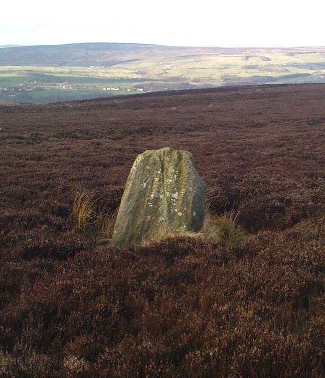
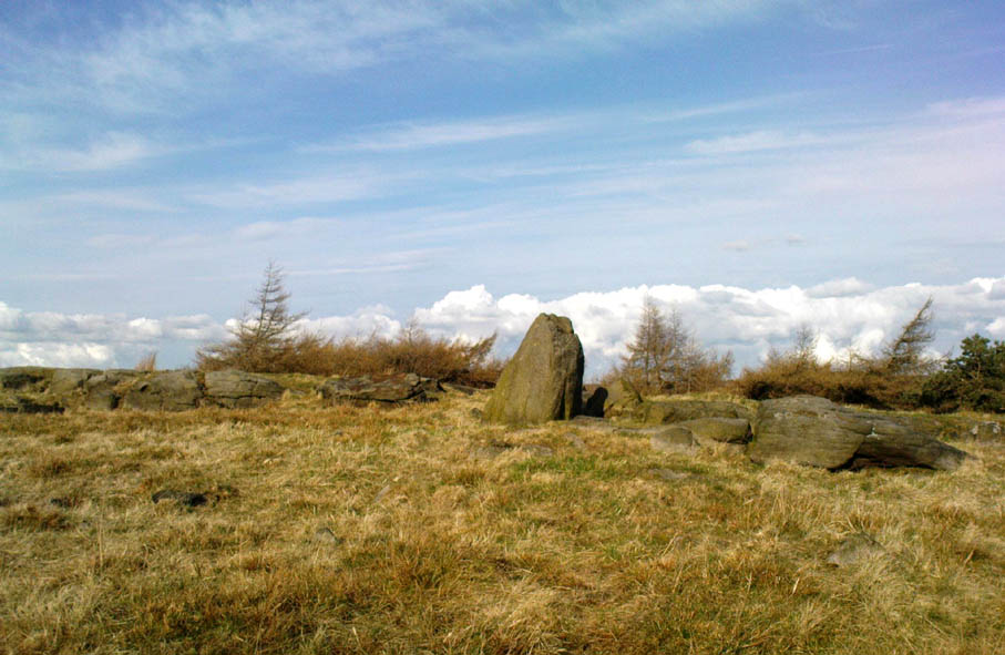
Standing Stone on Green Crag Plain, Ilkley Moor

The best way to get here it is to head from the Cow and Calf Hotel up the hillside to where the great rock is sticking out (the Pancake Stone).  From here, head straight onto the moor toward the Idol Stone — close to the Idol Rock which you can see 400 yards south in front of you.  From here, follow the footpath up the hill before you and keep on the path towards Lanshaw Lass.  About 100 yards on, turn straight west into the heather and keep your eye towards the south.  About 250 yards on, about 100 yards away from the Green Crag Top cup-marked boulder,  you’ll see it!

Archaeology & History

One of very few solitary standing stones on Ilkley Moor, and one which I relocated after The Old Stones of Elmet (2001) had gone to press — which was a great pity.  Nearly four feet tall, this is a good chunky monolith which stands close to being on line with the summer solstice alignment from the nearby Twelve Apostles stone circle. (I was gonna call it the Summer Stone, but thought better of it!)

There’s another recumbent stone, more than five feet tall when erected, 200 yards northwest of here. (This is also very close to being in line with with our chunky monolith, plus the Twelve Apostles. Anyone out there with a GPS who can check if this possible alignment is the last remnant of a summer solstice stone row? It probably isn’t, but it’d be good to find out.)  On the same moorland level, heading back down, when the heather’s burnt back you’ll find a number of prehistoric tombs along the edge of the ridge.  These don’t appear to be in the archaeological registers.

© Paul BennettThe Northern Antiquarian


Hartwith Moor, Summerbridge, North Yorkshire

Standing Stone:  OS Grid Reference – SE 21233 62737

Also Known as:

  1. Standing Stone Hill

Getting Here

Hartwith Moor stone

A half-mile south of the superb Brimham Rocks complex, take the straight road south until you hit the second farmhouse (and accompanying caravans).  Go up the public footpath past Highfield Farm and just check with the landowner’s permission to wander his land if you want to see the stone.  They’re OK about it if you ask.  The lady there is very amiable and will tell you what’s what, giving directions right to it, telling us it was off the footpath in the middle of one of his fields.

Archaeology & History

Archaeology texts are, once more, silent about this stone (and other monuments in the region), making you wonder just what the hell some of them are paid for!  The stone appears to have given its name to the land upon which it stands which, as the locals tell, “has always been known as standing stone hill.”  And no wonder — it’s a bloody decent standing stone!  On its northern face we find well-eroded lines running down the stone, similar to the weathering found on the Devil’s Arrows a few miles to the east.

Standing Stone Hill stone
Looking south

Although just over 6-feet tall, this is a solid bulky old fella.  But the spot he presently occupies isn’t his original standing place.  He was found knocked over and lying on the ground in the middle of the 20th century, slightly out of position.  But he was thankfully stood back upright by the local land-owners sometime in the 1960s, where he’s been stood ever since.  It must have been one helluva job!  And making it more difficult was the intriguing geological nature of the Earth right beneath this field.  As the lady who now own the land told us,

“When the fields were tilled we found that all of them were easy to turn over, except the one with the stone in it!  There’s virtually no soil of any depth to write home about,” she said.  “It stands on only a few inches of soil and then you hit solid rock right underneath it.  All the other fields are OK – but this one’s the odd one out.”

And before the fields were farmed, just over a hundred years ago, all this land was covered in moorland heather.  Then the land was enclosed, the Earth’s heathland stripped out of existence and turned over to agriculture.  But thankfully the standing stone was left here.  It makes you wonder what else was destroyed when the moorlands were industrialised…

The stone does get a brief mention in Boughey & Vickerman’s (2003) Prehistoric Rock Art of the West Riding, where they mention there being “three possible cups in (a) line on one side” of the standing stone, but these are little more than Nature’s handiwork and nowt else.  There are a couple of other cup-and-rings nearby which are the real thing – but the ‘cups’ on this stone aint man-made.

© Paul Bennett, The Northern Antiquarian

Eilean Musdile, Lismore, Argyll

Standing Stone (destroyed):  OS Grid Reference – NM 778 351

Also Known as:

  1. Canmore ID 22659

Archaeology & History

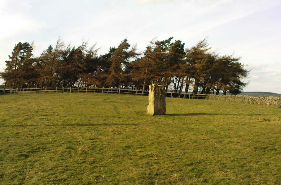
Once to be seen on the highest point of the island, this impressive 9-foot tall standing stone is thought to have been removed during construction of the old lighthouse around 1833.  First described by a traveller here in 1784, it was mentioned just once again during survey work in 1829. The monolith appears to have recorded the midwinter sunset.

References:

  1. Royal Commission on the Ancient & Historical Monuments of Scotland, Argyll – volume 2: Lorn, HMSO: Edinburgh 1975.

© Paul Bennett, The Northern Antiquarian

Yoni Stone, Utley, Keighley, West Yorkshire

Standing Stone:  OS grid reference – SE 0390 4333

Also known as:

  1. Cunt Stone

Getting Here

From Keighley town centre, head north towards Cliffe Castle, but turn left beforehand and along Hollins Lane.  Go past Hollins Hall for a few hundred yards and then through the gate on your left, then straight up the steep hill to the small woodland at the top.  On the OS-map it’s shown as ‘Great Snowden.’  You’re here!

Archaeology & History

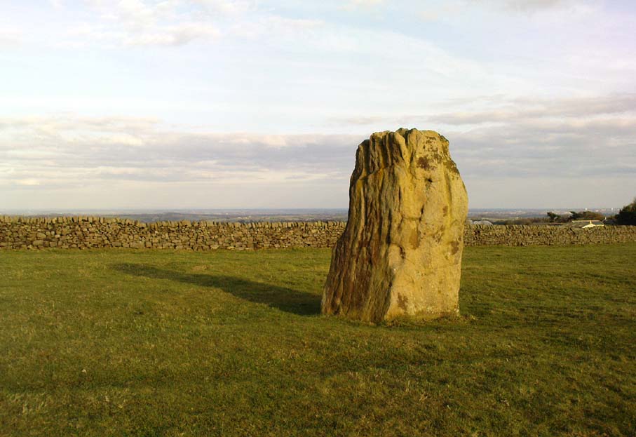
A standing stone found recently by Lindsay Lockwood to the west of Keighley, albeit on supposedly private—ahem!—land (a number of old locals tell you, quite rightly, to ignore this selfishness; but be careful of the land-owners here, who can be quite miserable).  Tis less than four-feet tall but with a very noticeable female genital carving on its top western face.  This carving however, is perhaps 200 years old at the very most.  It’s in a quite beautiful setting aswell…

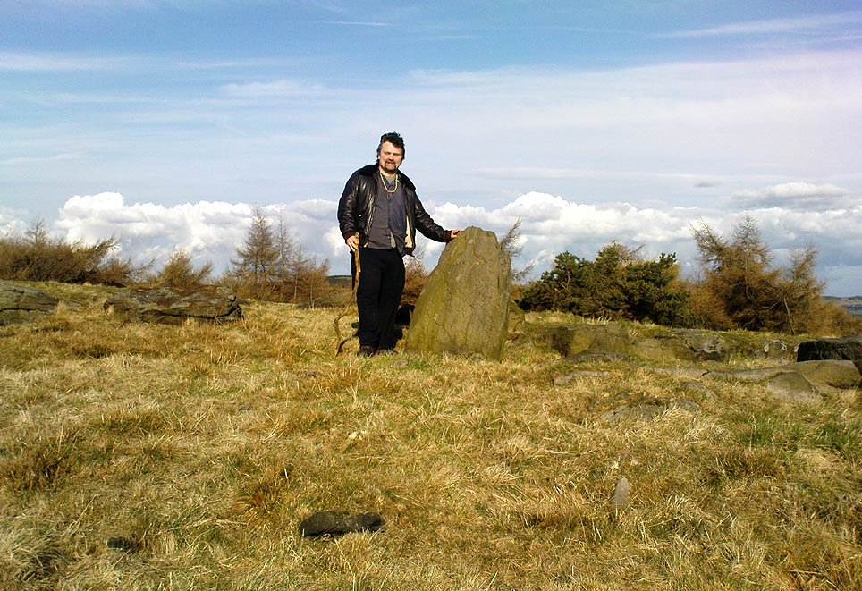
The Yoni or Cunt Stone, Utley
Buddhist scholar Steve Hart fondling the stone

What may be the remains of an old hut circle, or an old  drained-out pond (a big difference, I know!), can be found about 100 yards northwest, and one – possibly two – ‘cairns’ can also be found in the scattered trees immediately to the northeast. An old ‘druid’s bowl’ (natural cup-marking into which rain-water collects) can also be seen on an adjacent earthfast boulder.  Some folk might wanna allege a bullaun, but it’d be pushing it a bit I think. More recent walling and what appears to be stonework from more recent centuries (medieval) appears evident close by.  Whilst below the hill we have the recently discovered Dragon Stone cup-and-ring carving just a few hundred yards away.

The setting is not unlike the beautiful little standing stone of Tirai on the slopes of Glen Lochay, where amidst the recently deserted village the short squat standing stone is found. You get the same sorta feeling of more recent going-on with this site aswell.

The carved ‘cunt’ gives an even more intriguing thought as to what the stone was used for, around Beltane perhaps, by folk like misself and other straightforward doods!

I wasn’t sure exactly what to call the stone after Lindsay had found it.  However, due to the carved minge near the top, it seemed right to give the stone a name relative to the carving — and as we have a Devil’s Cunt in the Netherlands, I opted to call it something similar.*  Although ‘cunt’ is an old European word for ladies’ lovely parts, the word ‘Yoni’ is an eastern title, which has become very acceptable in Western parlance.  In recent years there has emerged a distinct aversion to using our own, old word for female genitals (indicating how detached people have become from even their own roots).

* of the name ‘cunt stone’: the word cunt itself, as explored eloquently in the fine study by Peter Fryer, Mrs Grundy: Studies in English Prudery (Corgi: London 1965), was the acceptable term for ladies’ genitals in the days when this carving was evidently done, so thought it a most applicable title.

© Paul Bennett, The Northern Antiquarian 

Crooked Stane, Elvanfoot, Lanarkshire

Standing Stone:  OS grid reference – NS 96590 15333

Also Known as:

  1. Canmore ID 47316

Archaeology & History

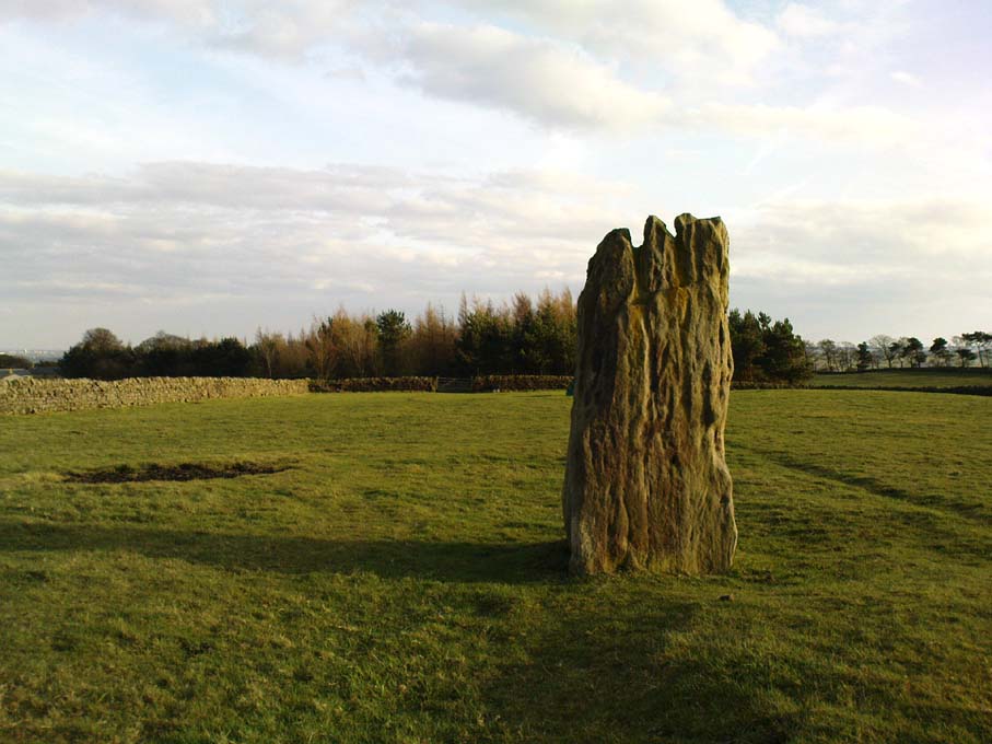
Described by Tam Ward and Douglas Graham (1989) as “the only surviving standing stone in Clydesdale” (which isn’t quite true), this lovely looking monolith, leaning to one side, appears to have several cup-markings on its surface, but they’re actually Nature’s handiwork. The stone aligns to the hill a short distance north, Bodsbury Hill, upon which a fortress was later built sometime in the Iron Age.

I must have a wander round this region sometime: there’s some very attractive place-names nearby crying out for archaeo-attention to rub myself up and down upon!

References:

  1. Royal Commission on the Ancient & Historic Monuments of Scotland, Lanarkshire: An Inventory of the Prehistoric and Roman Monuments, HMSO: Edinburgh 1978.
  2. Ward, Tam & Graham, Douglas, Ancient Monuments of Clydesdale, CDC: Lanark 1989.

© Paul Bennett, The Northern Antiquarian

Connel, Oban, Argyll

Standing Stone (destroyed):  OS Grid Reference – NM 9169 3408

Also Known as:

  1. Canmore ID 23281

Archaeology & History

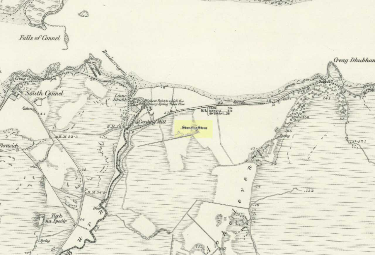
Connel stone on 1871 map

The Royal Commission for Historic Scotland (1974) recorded this “stone that formerly stood within the area now occupied by Connel Station,” which was thought to have been destroyed shortly before construction of the said building.  Thankfully the Ordnance Survey lads recorded its position on their cartographic ventures here in 1871.  Mr R.A. Smith (1874) also mentioned the site, albeit briefly, in his fine series of essays on the antiquities of Loch Etive, telling us:

“Above Connell Ferry we come to a small brook called Lusragan, and a few houses with a mill called Clachaleven. To the east, in a  field above the road, is a large standing stone, and around it marks where others, well remembered, lately stood.”

But sadly it seems, these have all gone.

References:

  1. Royal Commission for Ancient & Historical Monuments, Scotland, Argyll – volume 2: Lorn, HMSO: Edinburgh 1974.
  2. Smith, R. Angus, “Descriptive List of Antiquities near Loch Etive, part 3,” in PSAS, 10, 1874.

© Paul Bennett, The Northern Antiquarian

Cnoc na Carraigh, Gigha, Argyll

Standing Stone (destroyed): OS grid reference – NR 6426 4817

Also Known as:

  1. Canmore ID 38540

Archaeology & History

The Scottish Royal Commission (1971) reported a very large

“standing stone that stood 185m NNW of Achmore House (that) was removed at the beginning of the 19th century. It was reported that is measured 4.9m in height (16ft), 1.2m in breadth and 0.2m in thickness.”

A prehistoric cairn seemed to have accompanied this monolith—as reported by Thomas Pennant in 1772—but it too has been destroyed.  Pennant told us how the monolith was,

“a great rude column, sixteen feet high, four broad and eight inches thick.”

Not bad at all!  It was still extant, although leaning to the southwest in the year 1790 (OSA 1791-9); appearing to have been removed about 1800.  No trace of it remained when the Ordnance Survey lads looked here in 1869.

References:

  1. Royal Commission for Ancient & Historical Monuments of Scotland, Argyll – volume 1: Kintyre, HMSO 1971.

© Paul Bennett, The Northern Antiquarian

Clachan Ceann Ile, Ardilistry, Islay

Standing Stones:  OS Grid Reference – NR 4368 4832

Also Known as:

  1. Canmore ID 38030
  2. Stones of Islay

Getting Here

Also known as the ‘Stones of Islay,’ these two old stones can be found on the west side of the road between Port Ellen and Ardtalla, up the steepish wood-covered slope, just south of the conical fairy hill of Cnoc Rhaonastil.

Archaeology & History

In recent years, the Scottish Royal Commission commented that “they do not appear to be of prehistoric date,” yet include it in the Argyll survey (vol.5:65), just in case!  The larger of the two monoliths is nearly 6 feet long (it was on the floor when I came here, many years back), and its smaller companion about 3 feet long (also on the deck!).

Folklore

In 1794, in the Statistical Account of Scotland, it was said that these two curious standing stones marked the grave of Yla or Yula, “a daughter of one of the kings of Denmark,” which is most unlikely. Between these two stones, folklore tells, is known as the Tomb of Yla – a Danish princess whom legend tells gave Islay its name.

The hill above these old stones was long known to be the place of the faerie-folk. Indeed, the Queen of Faerie herself lived here. Otta Swire told a fascinating old folktale of this place, whose nature will be know to some:

“The Queen was much troubled by the stupidity of human women, for in the fairy world wisdom is chiefly possessed by the women, since it is they who hold the Cup. After much thought, She decided to try to improve matters, so she sent out an invitation to all the women of the world to visit Her in Her hall in the knoll on a certain date. The invitation spread over the wide Earth – it was carried by the winds and the sea waves, by birds and by fish, even the leaves of the trees whispered it. And the women of the world were very much interested and they talked eagerly together. Some laughed at it, some said they were wiser by far than the Little People, some held that the Little People were cleverer and more powerful than they and that this might be a trap. Indeed, the word of women ‘heaved like hive of bee or hill of ant or byke of wasp.’ Soon, women from all over the isles began to arrive in Islay. Some came to see, many more to be seen, and a few came truly seeking wisdom.

“When the day dawned the hill opened, and into the wonderful hall within streamed the women. And a very wonderful hall it was, hung with bright cloths woven from nettles and fairy lint and dyed with blood of shell-fish and sap of plants in such colours as only the Little People can achieve. Skins of beasts were spread on floors and seats, a banquet set on shells of pearl lay ready on the many tables of wood and stone, and for each guest there was placed ready a beautiful cup formed from a blue-eyed limpet’s shell. A soft green light pervaded the hall. When all were ready and the watchers saw no more coracles on the waters or maidens climbing the green slope, the doors to the outer world were closed and in walked the Queen Herself. She was smaller than any of Her guests but far, far more impressive. She wore a dress of long ago but it suited well Her gentle, kindly dignity and Her face shone with a strange and lovely light. She carried in Her two hands a wonderful flagon and after her came her maids, each holding a similar one. Other maids hastily distributed the cups of shell and then the Queen walked slowly by, pouring into the cup of each of those who, in her heart truly desired wisdom, a few drops of the precious fluid from Her flagon, which held the distilled wisdom of the world throughout the ages. And as each woman drank those few drops she suddenly grew wise and saw and understood much she had never known before. Some were able to see much, others but a little, yet all benefited in their degree. At last, all who sought wisdom had received it and the elixir was finished. Just as the ceremony ended there came a hammering on the walls and the doors. The Little People looked out and, behold!, their hill was covered with late-comers who had arrived after the doors were closed and so had been unable to enter and were now too late to receive the gift. There is still a saying in Gaelic about a stupid woman: ‘She was out on the knoll when wisdom was distributed.'”

A saying I remember my old grandad telling a few folk a few times when I was young!

References:

  1. Royal Commission on the Ancient & Historical Monuments of Scotland, Argyll – volume 5: Islay, Jura, Colonsay and Oronsay, HMSO: Edinburgh 1984.
  2. Swire, O.F., The Inner Hebrides and their Legends, Collins: London & Glasgow 1964.

© Paul Bennett, The Northern Antiquarian

Bride Stone, Farnley Moor, North Yorkshire

Standing Stone:  OS Grid Reference – SE 1991 4932

Getting Here

From Otley go north straight over the river and upwards into the countryside for nearly two miles (past the TV mast on the right).  As you reach near the top of the hill, there’s a turn to your right.  Go on here for a hundred yards or so, then walk along the footpath to your right.  After a few hundred yards, keep your eyes out for the stone just through the gate, in the walling on your left.

Archaeology & History

Although we see named on the 1853 Ordnance Survey map the respective place-names of Bride Cross House and Bride Cross Allotment, the first literary reference to any site here as a standing stone appears to be Eric Cowling (1946) who, when commenting on the pagan tradition and folklore of ancient sites, told that

“The name of Bride Cross Farm, Dob Park, is very significant, for at the meeting place of several tracks to the south-east is a squat standing stone built into a wall and marked as a boundary stone, which was probably Brides Cross.”

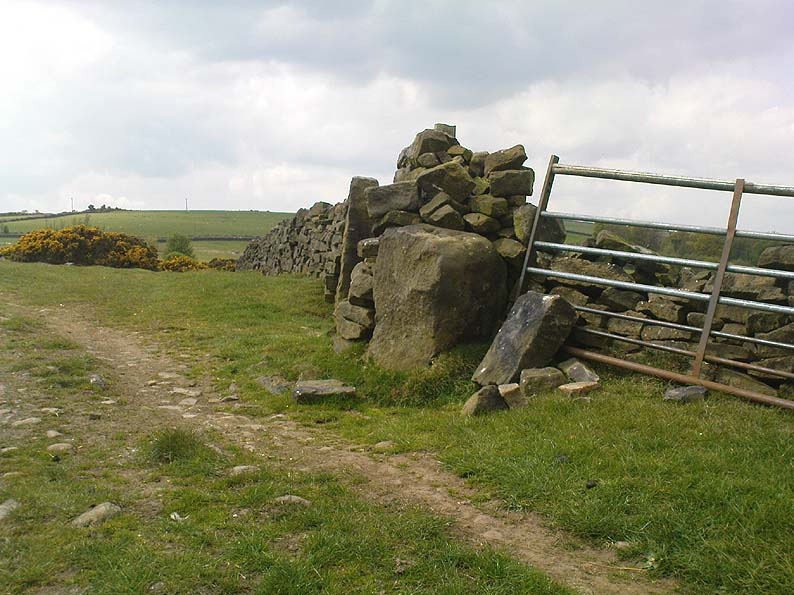
Bride Stone, Farnley Moor
Boundary markers on top

Although I’d read about this place as a kid, it was Graeme Chappell who first brought me here some twenty years back, in one of our many exploratory forays into the prehistory of this area.  It’s a nice fat squat standing stone, similar in stature to the more famous Bull Stone near Otley Chevin, a few miles to the south — though our Bride Stone here is about half as high.  Only about three-feet tall, it stands by the gate at the wall-side about 200 yards down the footpath from the Dob Park Lodge road and does seems to have been used as a boundary marker, as the letters “F.F.” are carved deeply on top of the upright (possibly denoting the Fawkes family of Farnley).

Cowling’s assertion that this old stone accounts for the ‘Bride Cross’ place-name is probably right, as the site is roughly midway between the respective place-names of the House and Allotment.  There is an old field-name of Crosse Close in the vicinity, from 1692, but I haven’t located it.  If such a cross ever existed nearby (most likely, it’s gotta be said), it’s obviously the relic which left the place-names — though the standing stone was certainly here first!  As yet, we’ve found no references to this place before 1853…which can’t be right…

Folklore

Seems to be a petrification legend in here somewhere. Although the short tale doesn’t say as much, it is supposed to have got its name through “the murder of a bride, rejected by a suitor, on her return from a wedding.”  Indeed, I’d go so far as to say ‘fertility’ as well!

Eric Cowling (1946) really stuck his neck out and reckoned sacrifices occurred here in the not too distant past. This may relate to the nearby Haddock Stones, a few hundred yards south, thought to derive its name from a cairn and ‘altar stones.’

References:

  1. Bennett, Paul, The Old Stones of Elmet, Capall Bann: Milverton 2001.
  2. Cowling, E.T., Rombald’s Way, William Walker: Otley 1946.
  3. Phillips, Guy Ragland, Brigantia — A Mysteriography, RKP: London 1976.
  4. Smith, A.H., The Place-Names of the West Riding of Yorkshire – volume 5, Cambridge University Press 1961.

© Paul Bennett, The Northern Antiquarian

Barrnacoilich, Ardmaddy Castle, Argyll

Standing Stone:  OS Grid Reference – NM 794 164

Getting here

This old stone is another one tucked away, but not too far south of Oban.  Take the Kilninver road and keep heading southwest, past Loch Seil.  Instead of following the road right, to Clachan and then onto Seil Island, bear left and towards Armaddy Castle.  Where the single-track road turns into the woodland towards the castle, the track keeps on into the rocky hills.  Keep going for about another 500 yards.  You’re nearly there!

Folklore

By the coast just north of Loch Melfort, near the hamlet of Degnish, is the grand old Armaddy Castle. On the other side of the trees from here, to the east, Scottish writer and folklorist A.A. MacGregor tells there to be an old standing stone. In his Ghost Book of 1955, he tells the tale of a local man called Donald MacDougal who, returning home after his day’s work at the castle, crossed over the old burn of Eas nan Caerdach where the standing stone can be found, just past the bend in the track.

On reaching it, Donald became aware of a strange light a short distance in front of him. Thinking at first it was the lamp of his co-worker making for the Home Farm, he walked past the stone – but it wasn’t until he got home himself and found he was alone that he questioned what on earth he’d seen! Upon asking other people in the neighbourhood, it was found that other locals had seen the same light, traversing the land from the old standing stone along the footpath to the farm.

References:

  1. MacGregor, Alasdair Alpin, The Ghost Book, Robert Hale: London 1955.

© Paul Bennett, The Northern Antiquarian