Chambered Cairn: OS Grid Reference – NC 73112 62604
Also Known as:
- Canmore ID 6445
- Carn Chaoile
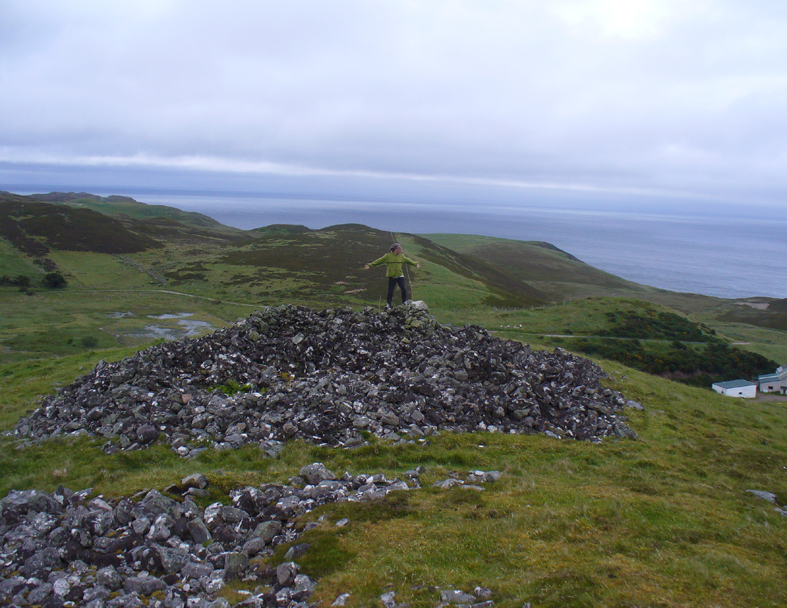
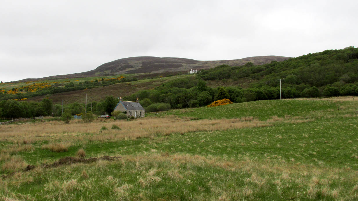
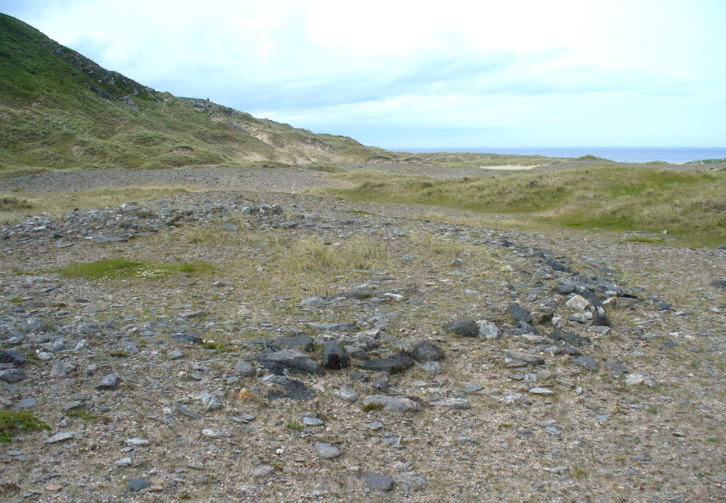
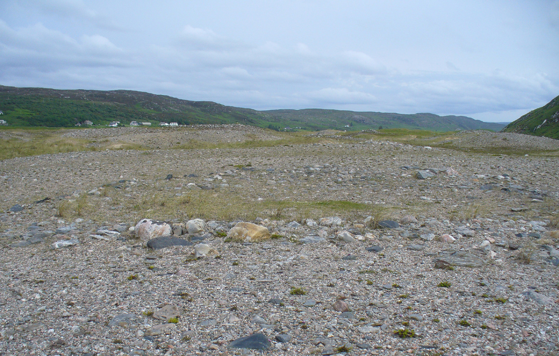
A mile east of Bettyhill along the A836 road, watch out for the large piles of rocks up on the hill on your left (north). Go through the gate, past the Fiscary 3 cairn and 150 yards northwest you’ll reach the crowning cairn on the hilltop itself – the Fiscary 2 cairn.
Archaeology & History
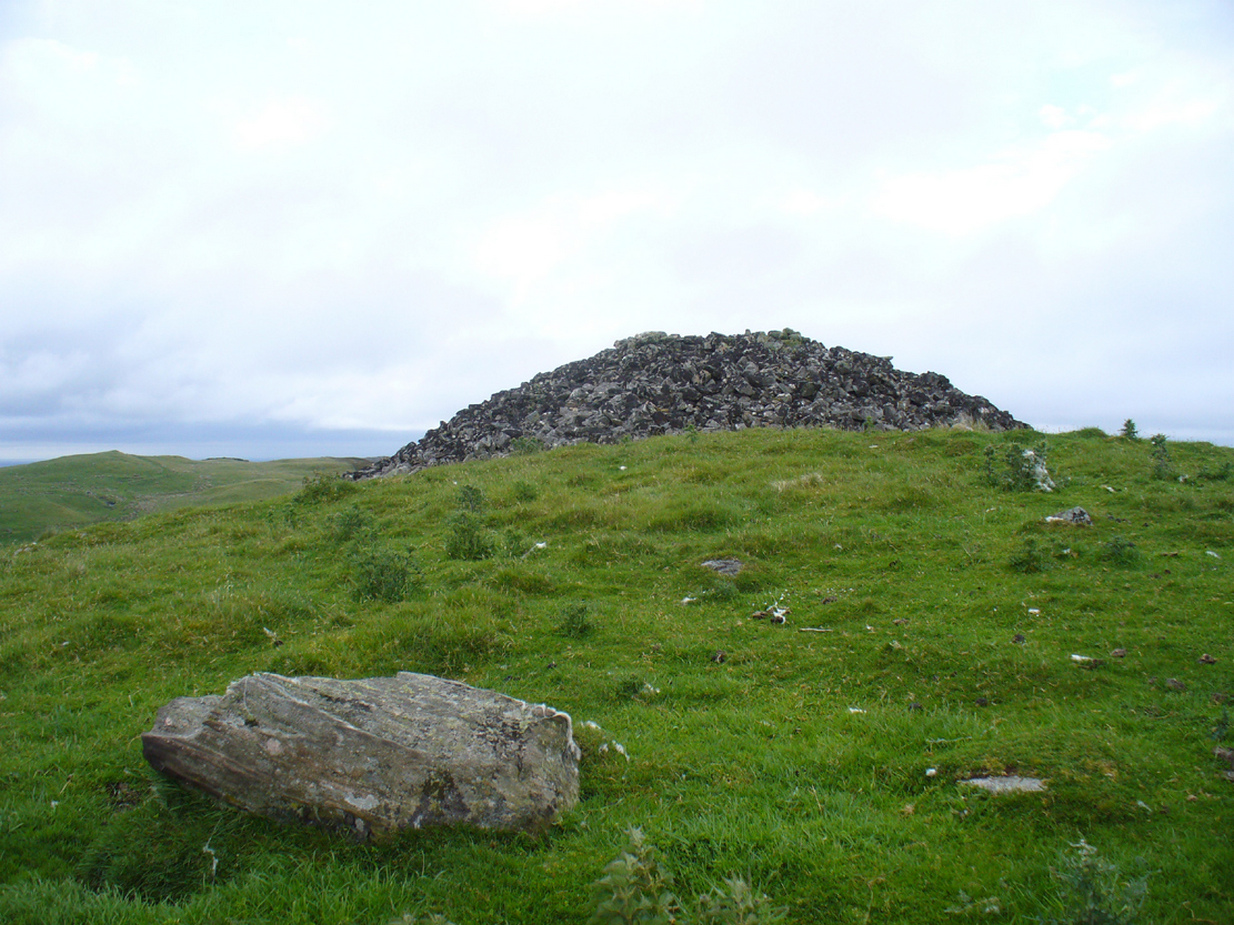
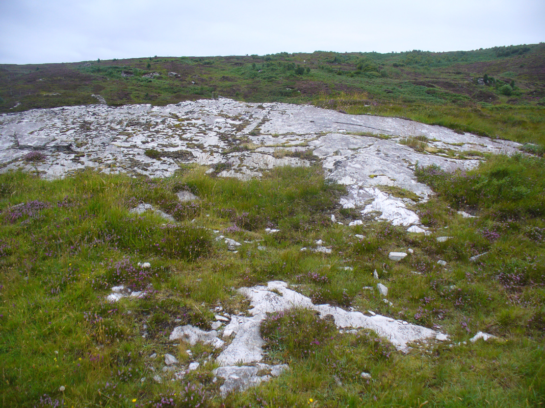
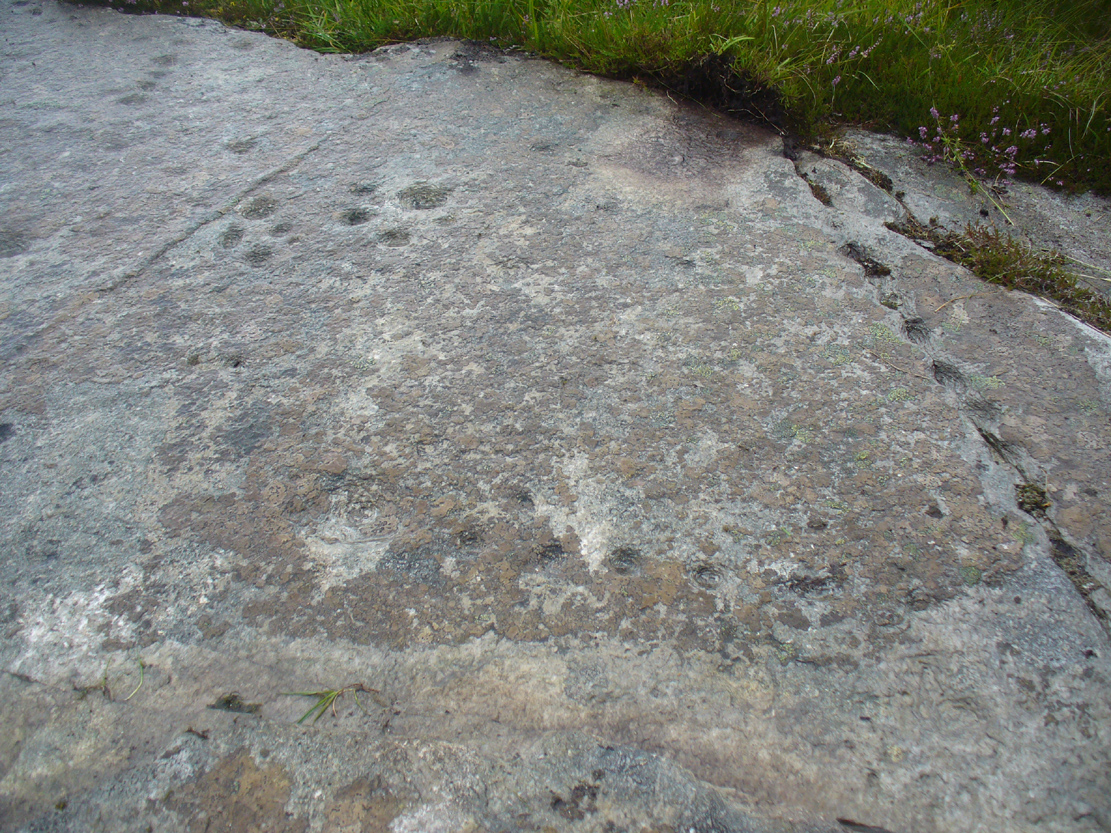
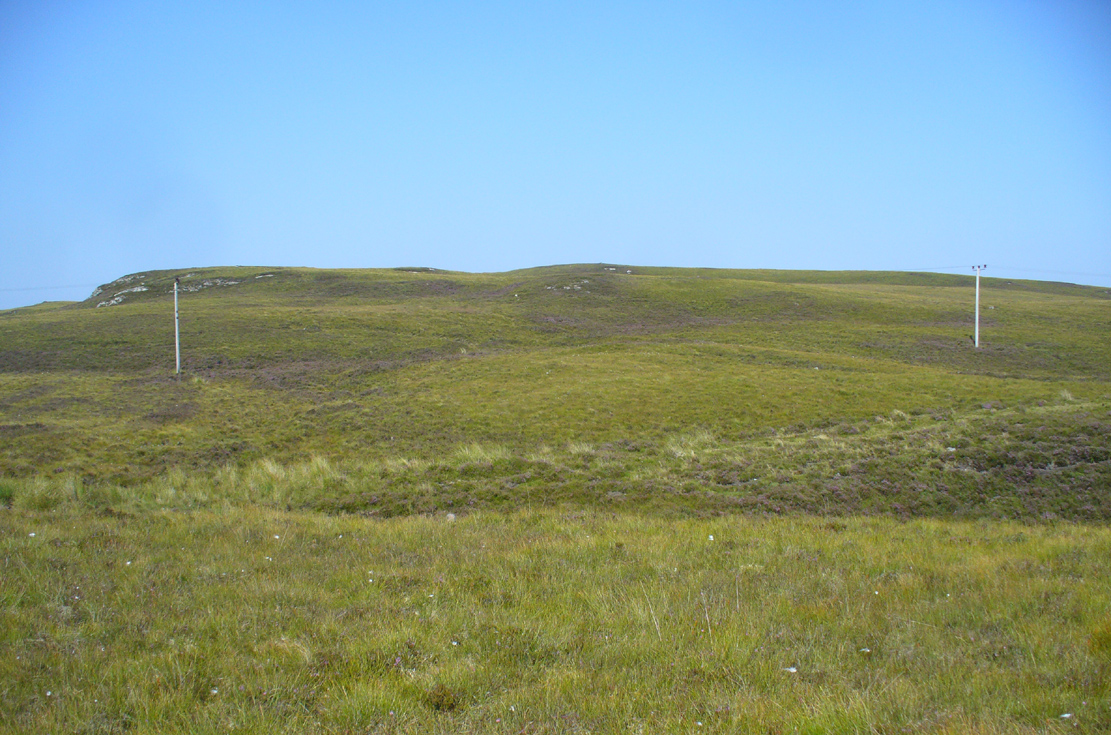
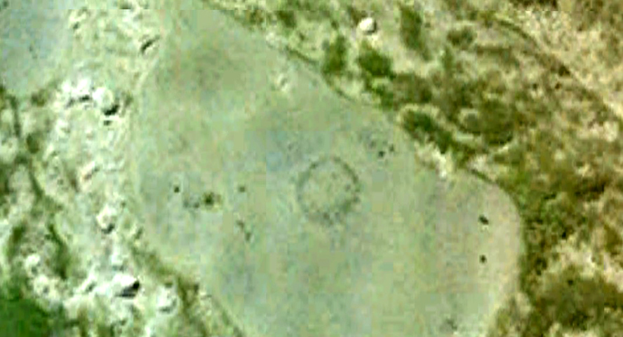
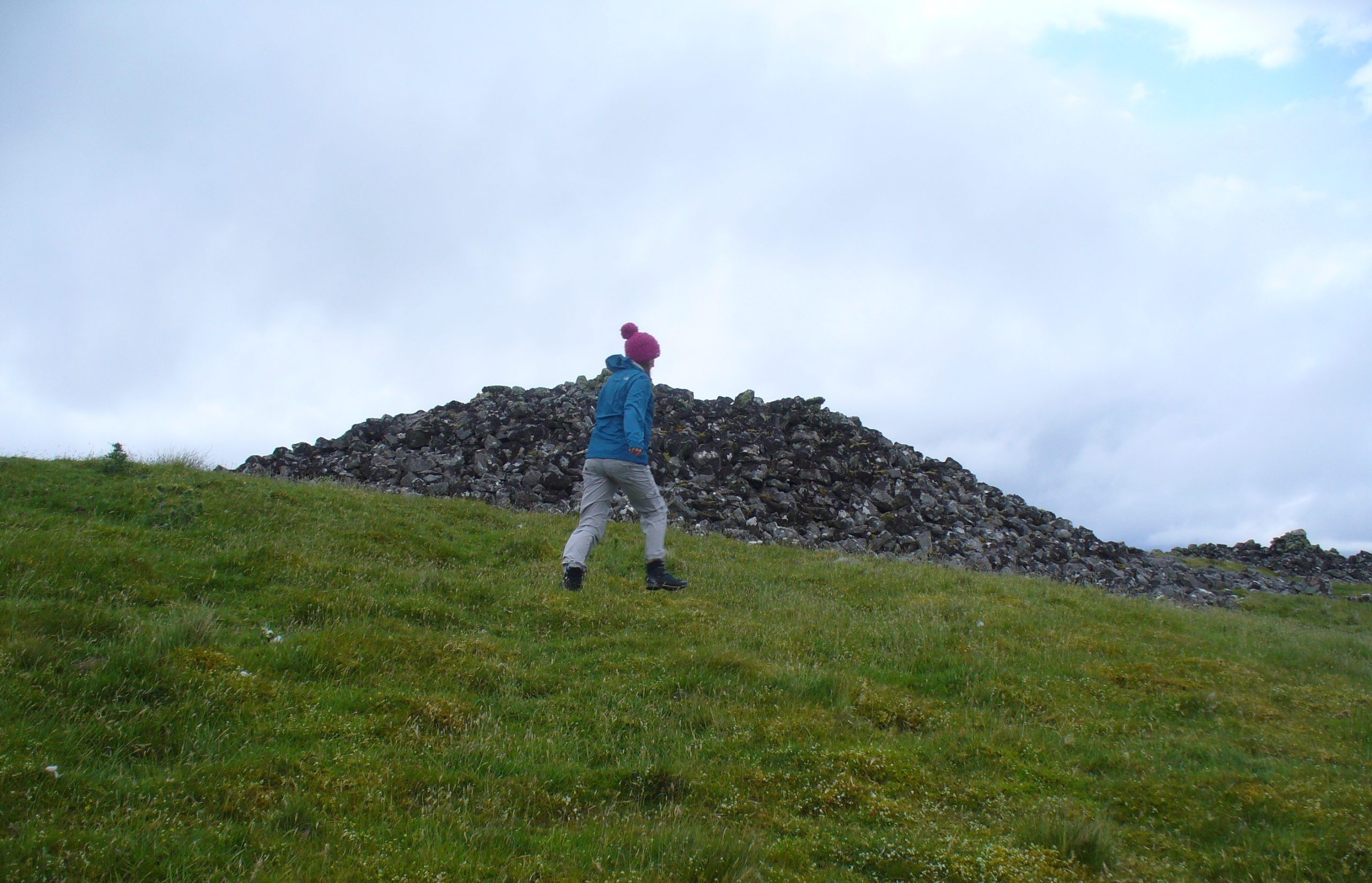
The second of the three giant chambered cairns on this moorland hillside is the largest (only just!) of them all. Positioned right on top of the small hill, this great mass of rocks stands out from the roadside a quarter-mile to the south quite blatantly, yet it somehow evaded the eyes of the early Ordnance Survey lads in their visit here in 1873 (though the nearby Fiscary 3 cairn was plotted). Odd…
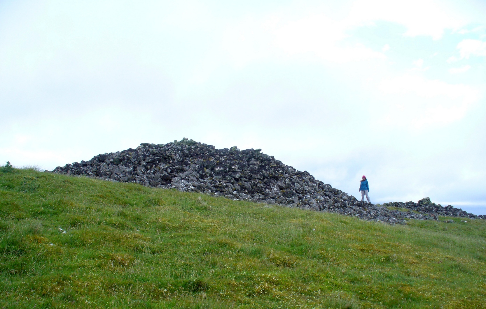
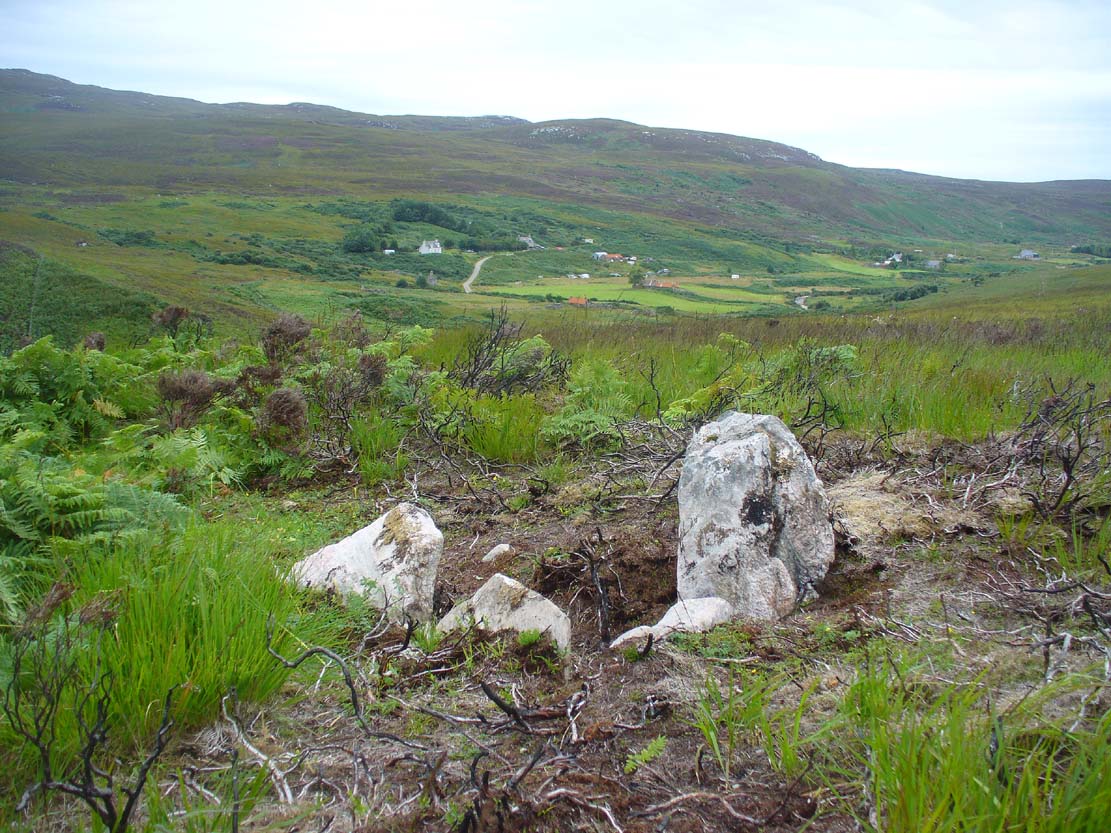
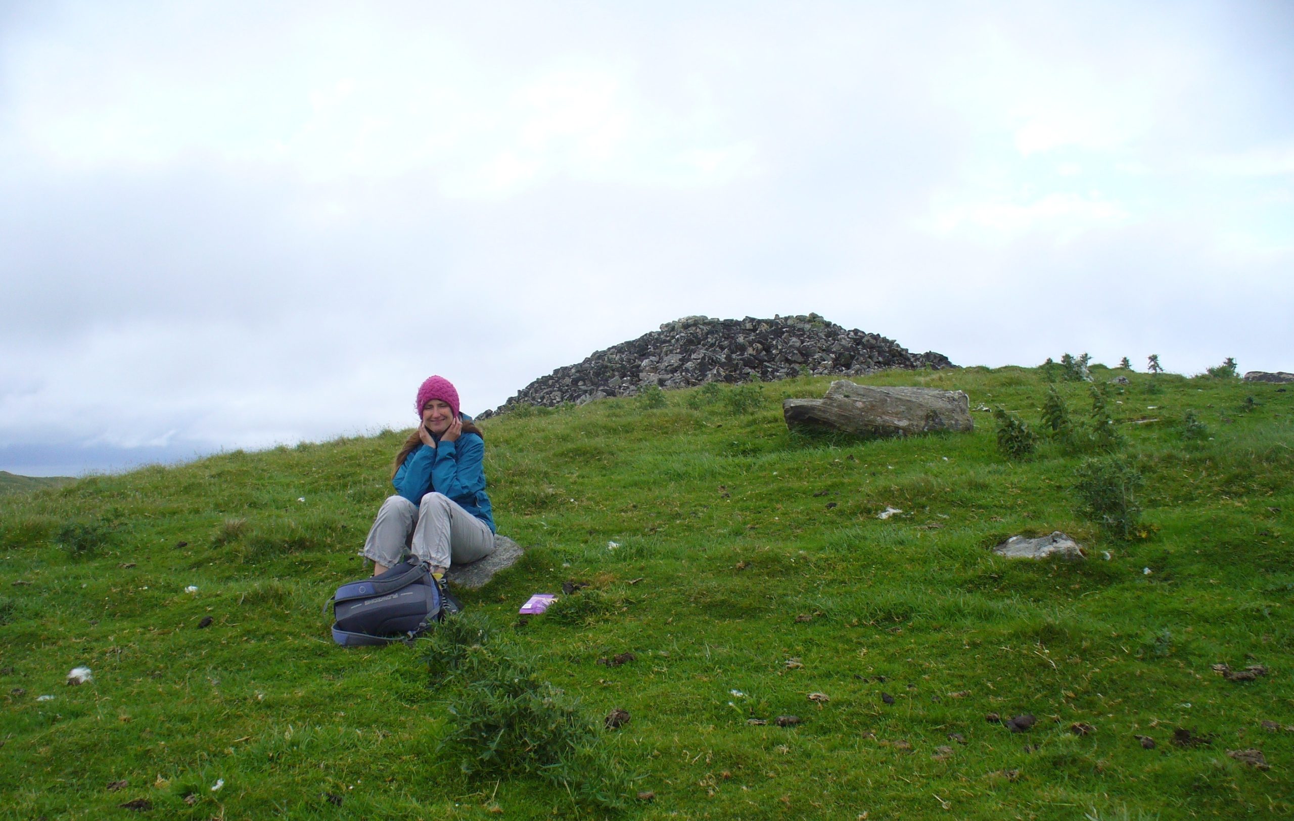
When I came here with Aisha and her clan a few weeks ago Nature was blasting us with full gales and so half her bunch returned after a short while, leaving us to get thrown about in the winds! Even just trying to stand upright on this and its associated tomb proved difficult. But despite this and the low grey clouds—typical of northern Scottish weather—it was obvious that the views from here would be superb, seeing far into the distance with a 360º view. I have little doubt that other important prehistoric sites would be speaking with this giant neolithic cairn, but there is nothing in the archaeology accounts to help us on such matters.
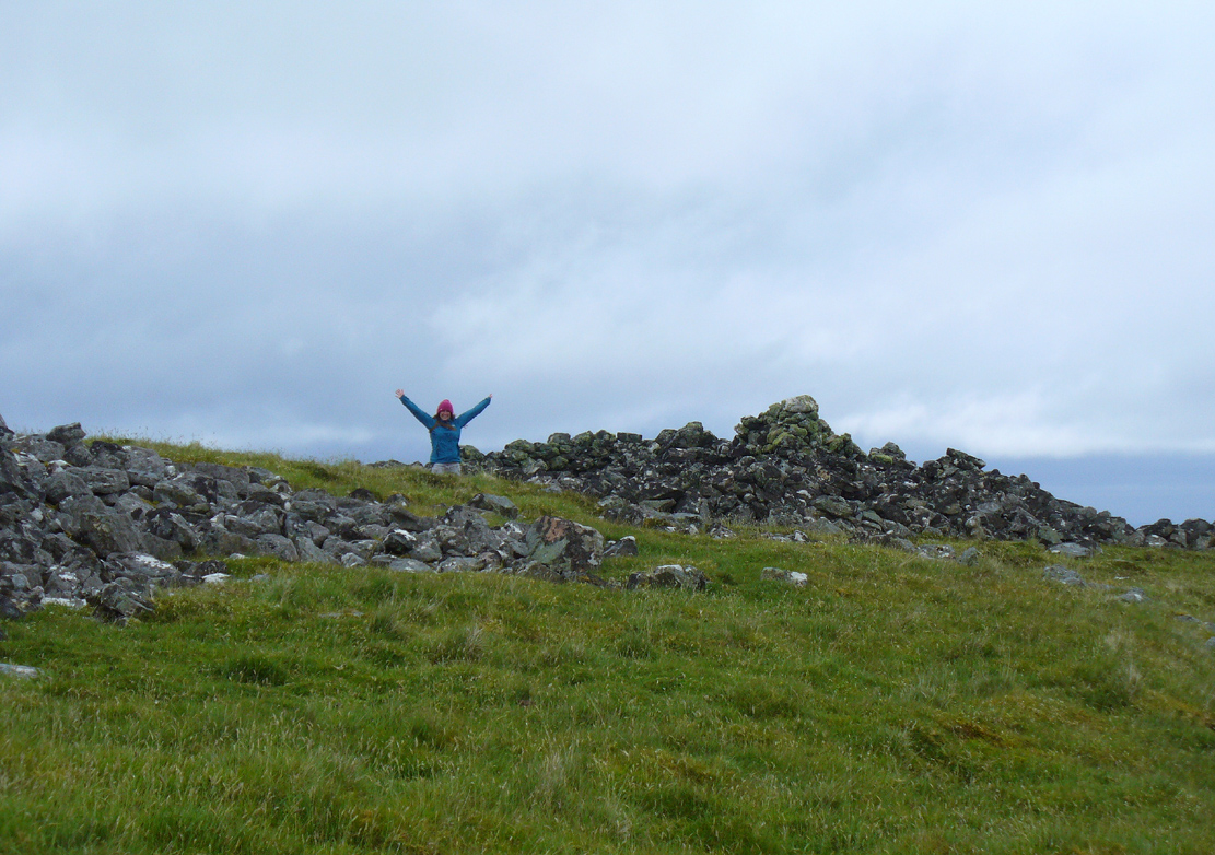
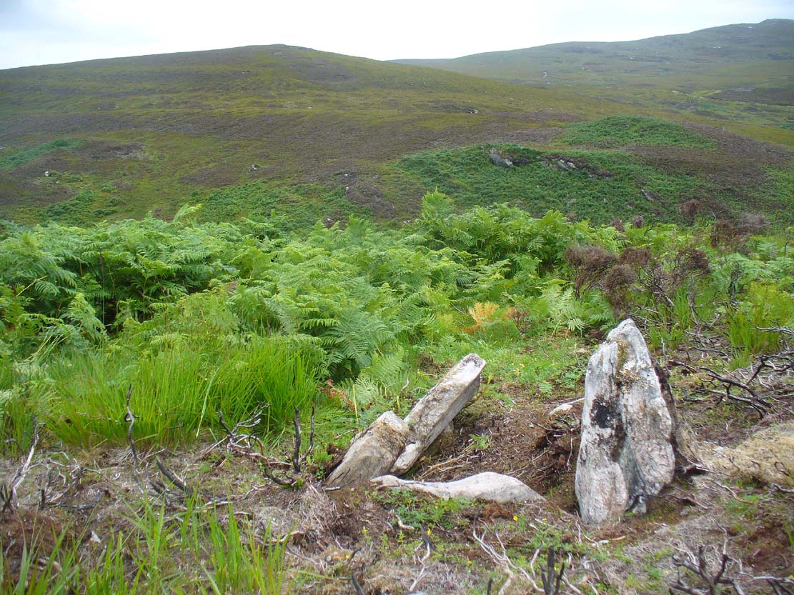
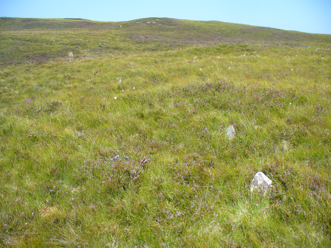
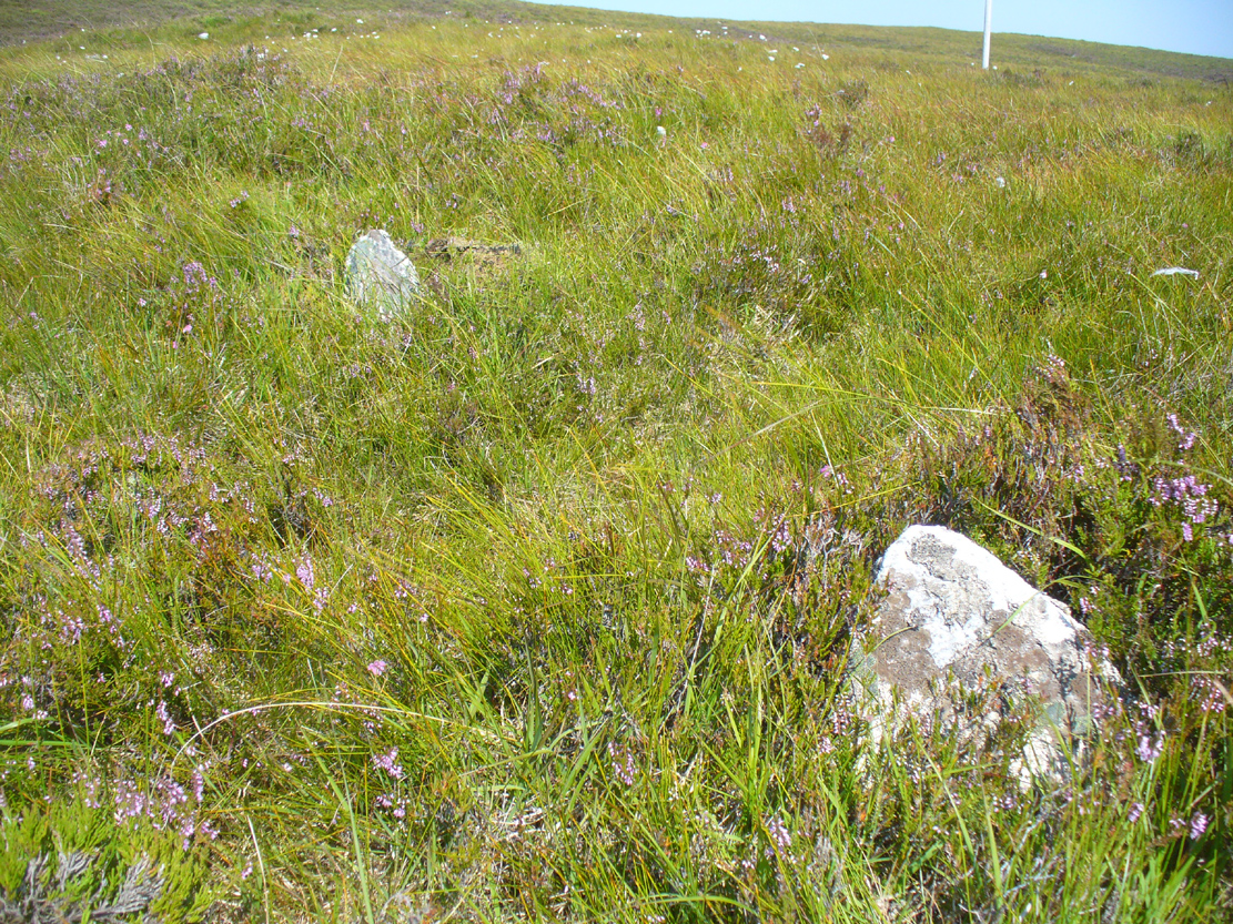
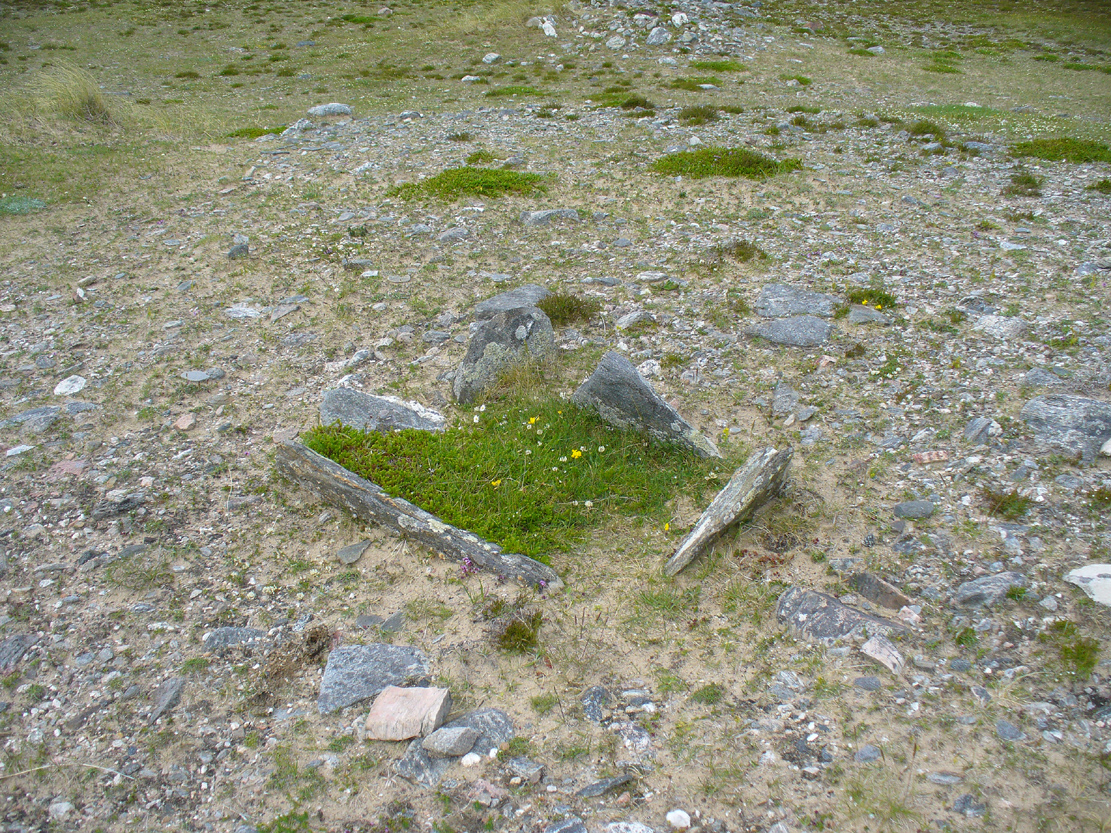
The giant tomb is almost linked to its companion—Fiscary 1—by a low scatter of rocks running between them, with only a yard or two separating their disturbed masses. Several archaeology students have posited that the two seemingly separate sites were, many thousands of years ago, perhaps one elongated chambered tomb, just like the ones found nearby at the Coille na borgie and Long Skelpick cairns; but it seems unlikely in this case…
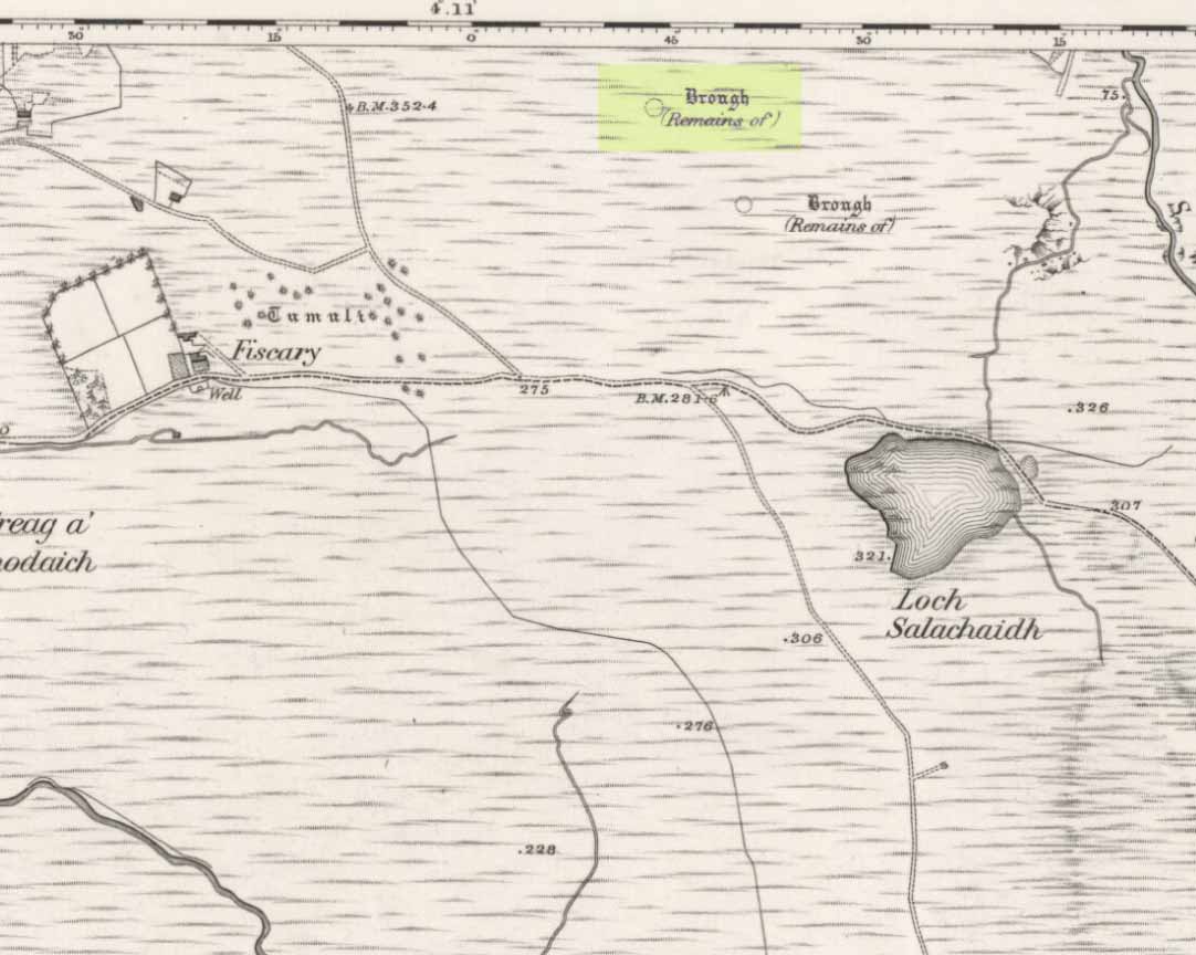
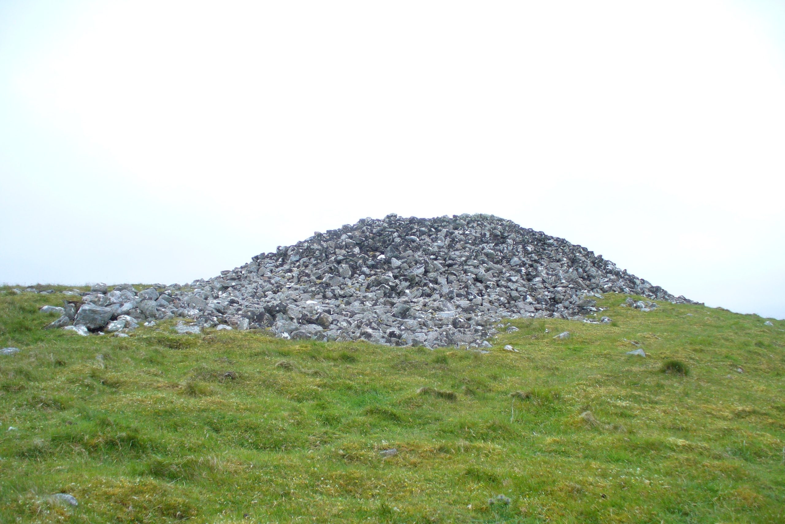
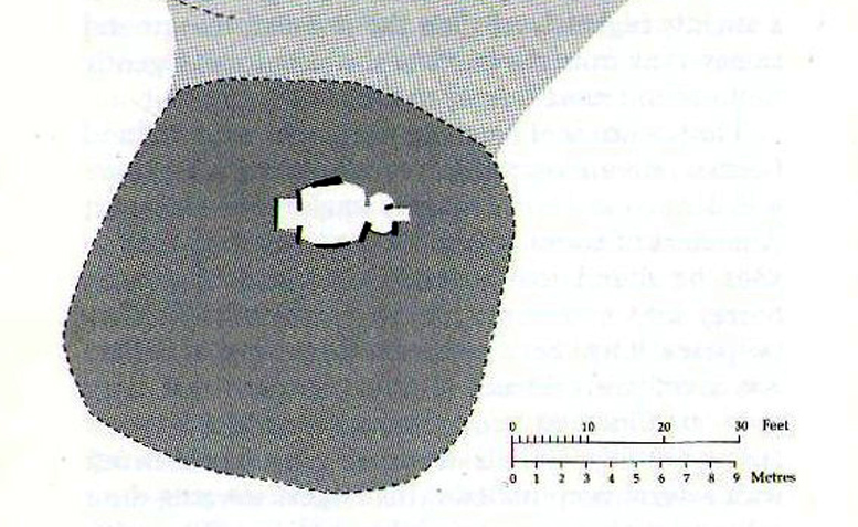
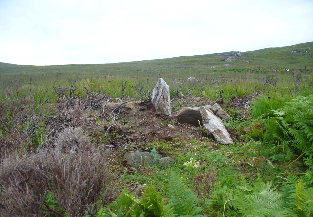
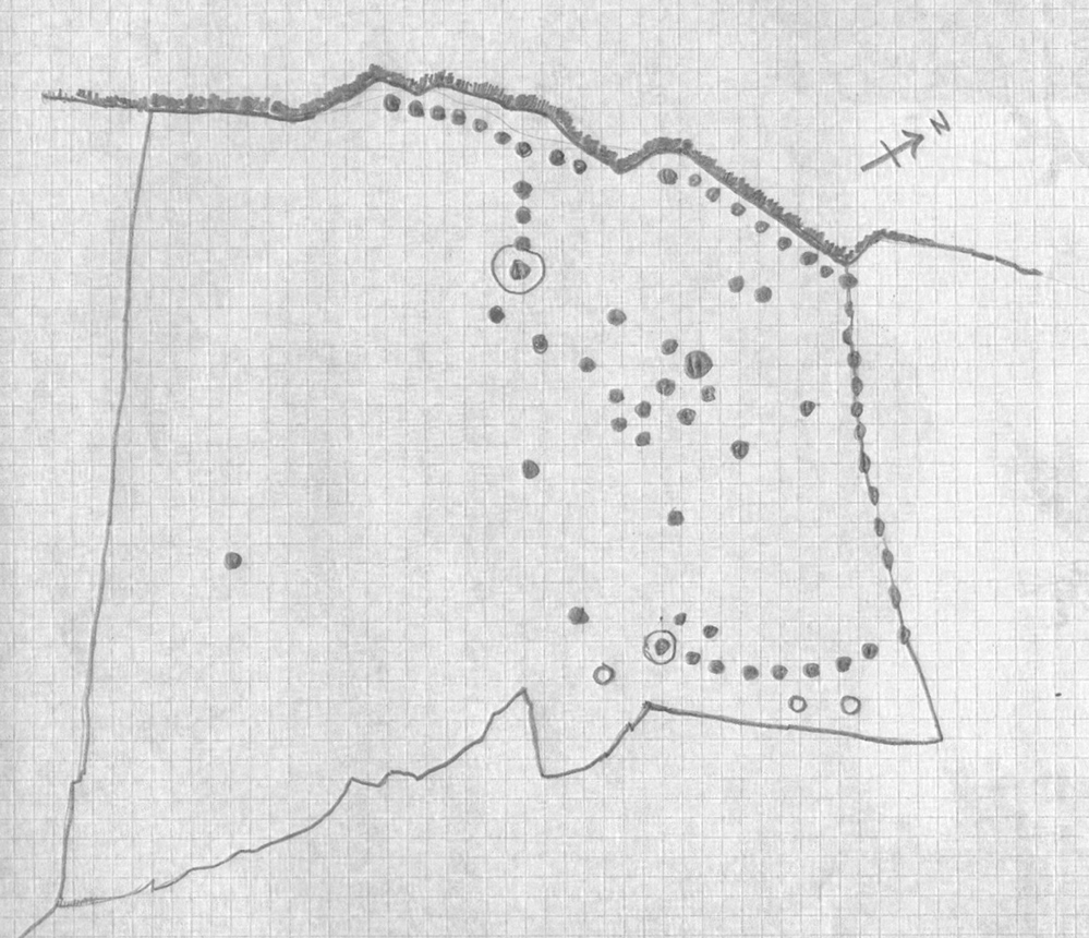
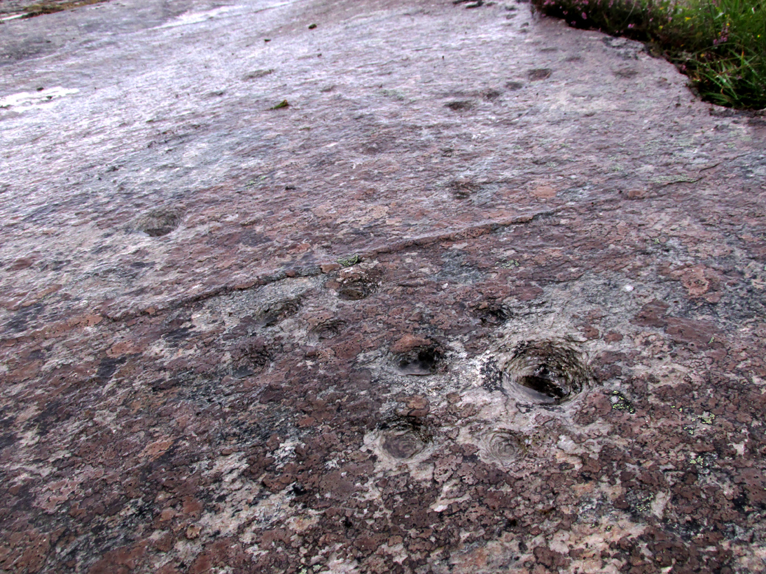
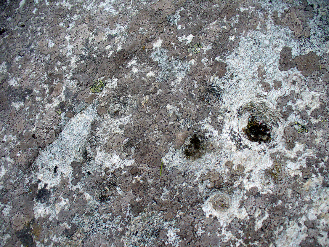
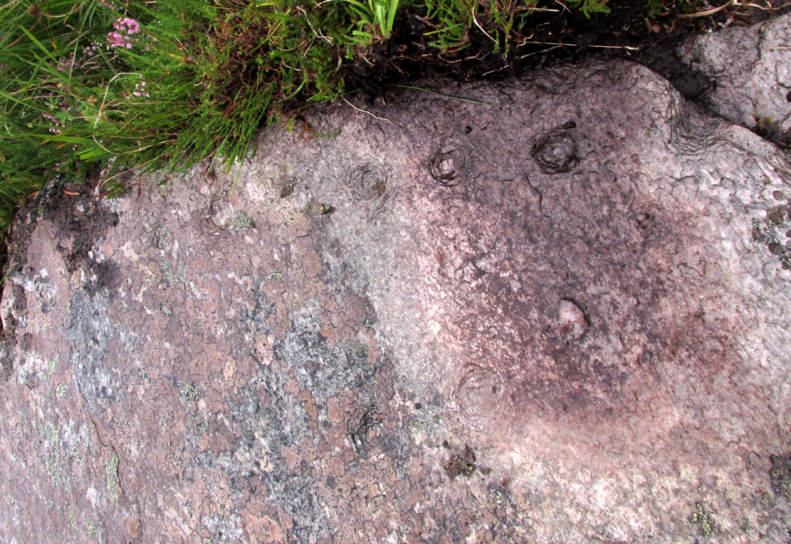
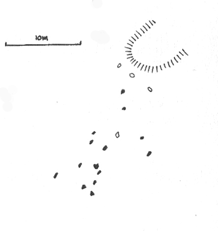
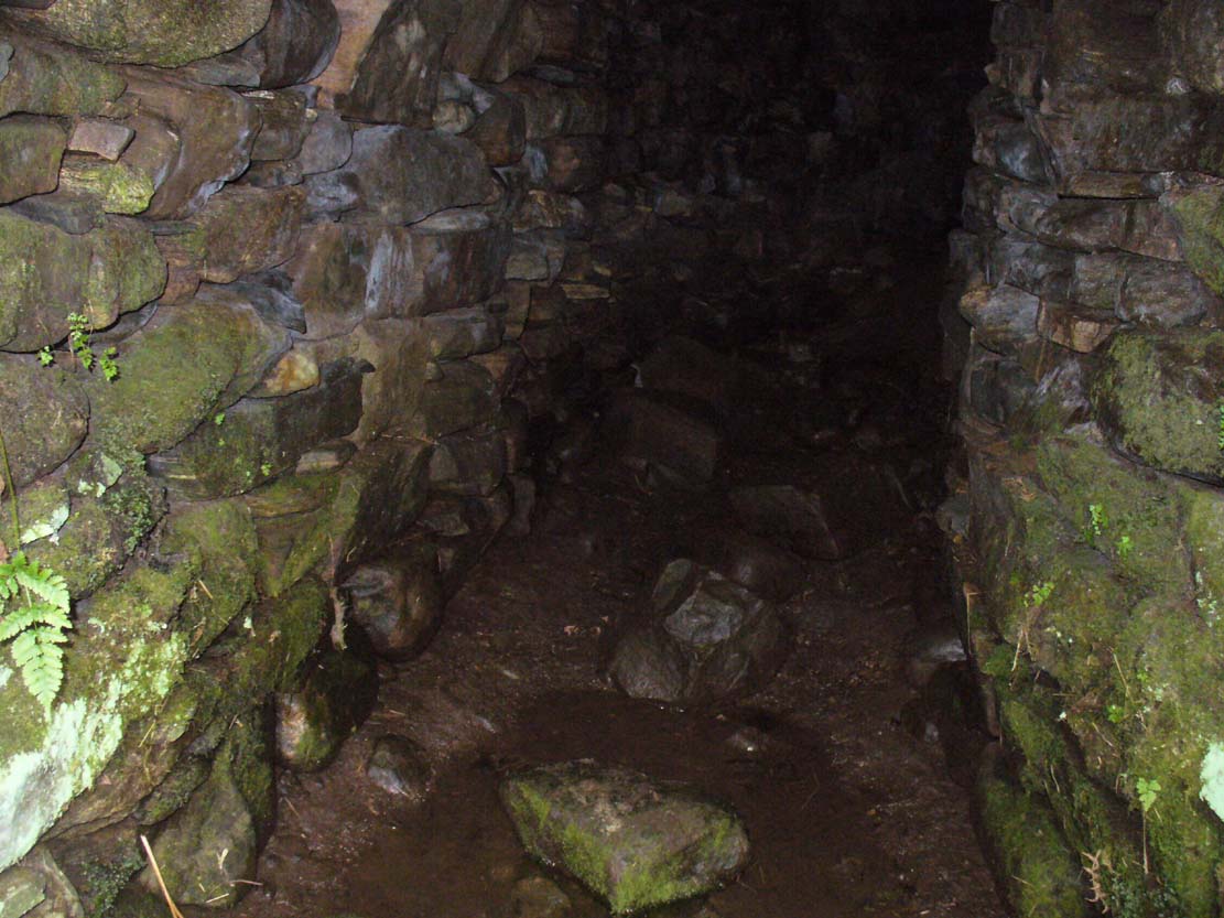
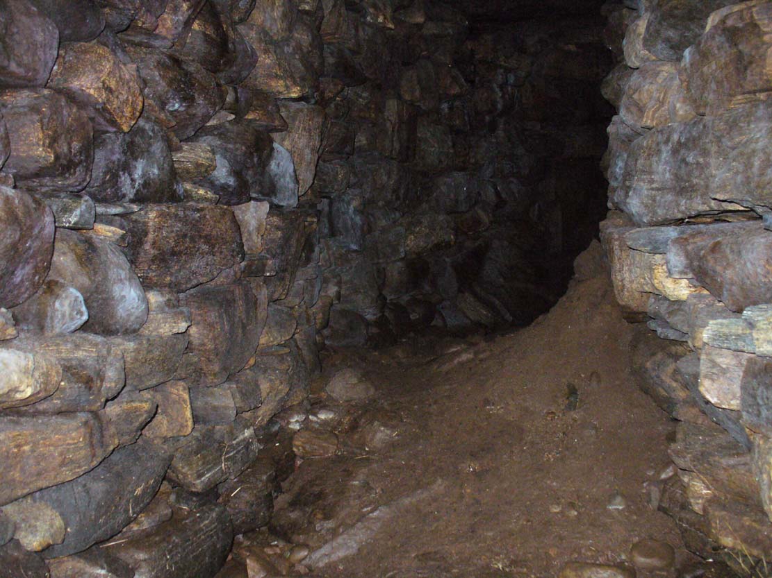
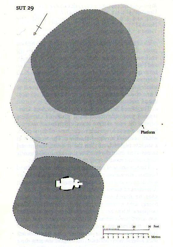
Although Adam Gunn (1893) mentioned the “four large cairns” at Fiscally (the fourth and smallest is 262 yards to the west), the first real description I can find of the place comes from an article by a local man called Cathel Kerr (1892) who told us it was “about 220 feet in circumference, and 15 or 16 in height”; but most of his article dealt with his excavation into the adjacent Fiscary 1 tomb, which he noticed was connected by a stone platform that ran between the two sites. This was the first mention of such a connecting platform—and a curious feature it is indeed. When the Royal Commission lads came here in May 1909 they also noted this connecting platform. They found that the cairn itself,
“does not appear to have been excavated. It is circular with a diameter of about 52ft and is some 10ft high to the top of the modern pile of stones on its apex. It presents a peculiar feature. At the north end is clearly visible a broad platform of stones extending to a distance of 25ft from the base of the cairn and, though largely overgrown with turf, traceable by the outline of stones almost entirely around it. This platform has been described as a neck connecting the two cairns (Fiscary 1 and 2, PB), but in reality it stops 7ft distant from the adjacent cairn.”
Indeed, this “platform” seems to have been either deliberately constructed with the hilltop cairn positioned on top of it, or has been set around the tomb. It’s difficult to say with any certainty without further excavation.
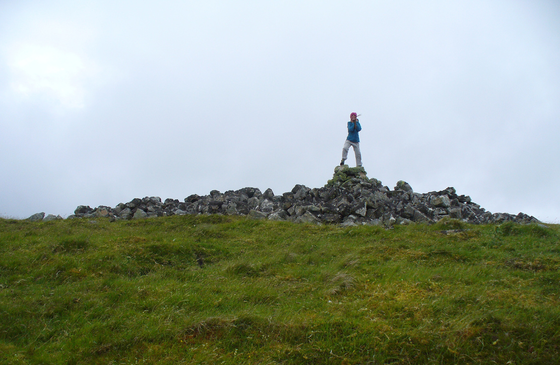
The great Audrey Henshall (1963; 1995) wrote extensively about this ancient monument in her works, finalizing her site entry in The Chambered Cairns of Sutherland (1995). After describing in some detail the obvious archaeological association this site has with Fiscary 1, she gave us a detailed description on this one and wrote:
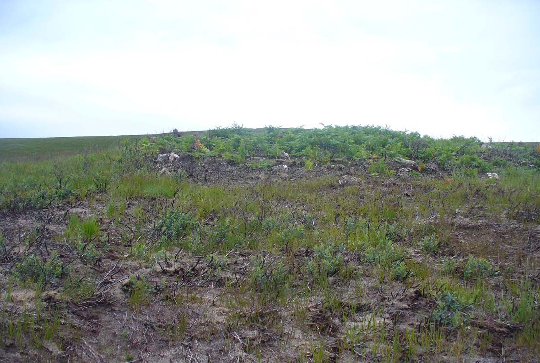
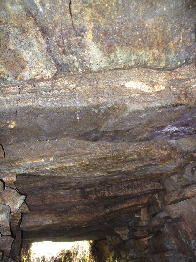
“The larger south cairn (Fiscary 2, PB) is bare, steep-sided, and has been little disturbed. The diameters are between 19.5 to 21.5m, and the height is 5.5m measured from the NW. The edge is clear for about half of the circuit. The surrounding platform is quite low and is partly covered with peat and deep heather which in places obscure the edge. The platform varies in width from 4.8 to 7.3m. On the SE side the cairn edge is clear and there is no sign of the platform. It appears on the NE side where it is largely free of heather, and the cairn material merges into its stones. This part of the platform is edged by a rough kerb which fades away westwards into the spread of stones which links the two cairns. In the area between the cairns the stones are mainly covered by peat on which grow turf and heather. The spread of stones appears to be thin, but on the NW side of the cairn, where there is evidently a drop in ground level, breaks in the peat cover show that here the stone spread has considerable depth. Round the W side the platform is heather-covered, and along the SW part, where the hill drops away steeply, there is a rough kerb at a lower level than elsewhere, within which the surface of the platform rises to the base of the cairn. The S end of the platform, which here is bare stones, seems to turn sharply towards the S edge of the cairn, though the actual edge of the platform is indefinite.”
The likelihood is that this cairn is the oldest of the cluster of three found here, most likely constructed in the neolithic period. Its position in the landscape would indicate that the site would have been built to commemorate the spirit of a local tribal elder, a King or Queen. It’s a superb site and I’ll be visiting it again very soon indeed!
Folklore
The folklorist Otta Swire (1963) told that this region was once peopled by giants who created the landscape itself around here (a common attribute of giants the world over), and they also played a part in the creation of this and other giant tombs in the area. The one time local school-teacher at Bettyhill, Alan Temperley (1977), also told us that the fairy folk lived close to the giant tombs of Fiscary.
References:
- Gourley, Robert, Sutherland: An Archaeological Guide, Birlinn: Edinburgh 1996.
- Gunn, Adam & Mackay, John, Sutherland and the Reay Country, John Mackay: Glasgow 1893.
- Henshall, Audrey S., The Chambered Tombs of Scotland – volume 1, Edinburgh University Press 1963.
- Henshall, Audrey S., “The Distant Past,” in The Sutherland Book (edited by Donald Omand), Northern Times: Golspie 1991.
- Henshall, Audrey S., The Chambered Cairns of Sutherland, Edinburgh University Press 1995.
- Kerr, Cathel, “Notice of the Excavation of a Chambered Cairn in the Parish of Farr, Sutherlandshire,” in Proceedings Society of Antiquaries, Scotland, volume 26, 1892.
- Lelong, Olivia C., “Writing People into the Landscape: Approaches to the Archaeology of Badenoch and Strathnaver,” University of Glasgow 2002.
- o’ Reilly, Kevin & Crockford, Ashley, What to See Around Bettyhill, privately printed 2009.
- Sutherland, George, Folk-lore Gleanings and Character Sketches from the Far North, John o’ Groats Journal: Wick 1937.
- Temperley, Alan, Tales of the North Coast, Research Publishing Company: London 1977.
Acknowledgments: To the beautiful Aisha Domleo, for her images, bounce, spirit and madness – as well as getting me up to see this cluster of sites. And a Huge thanks for use of the Ordnance Survey map in this site profile, reproduced with the kind permission of theNational Library of Scotland.
© Paul Bennett, The Northern Antiquarian