Weem Woods, Dull, Aberfeldy, Perthshire

‘Cup-and-Ring’ Stones:  OS Grid Reference – NN 841 499

Getting Here
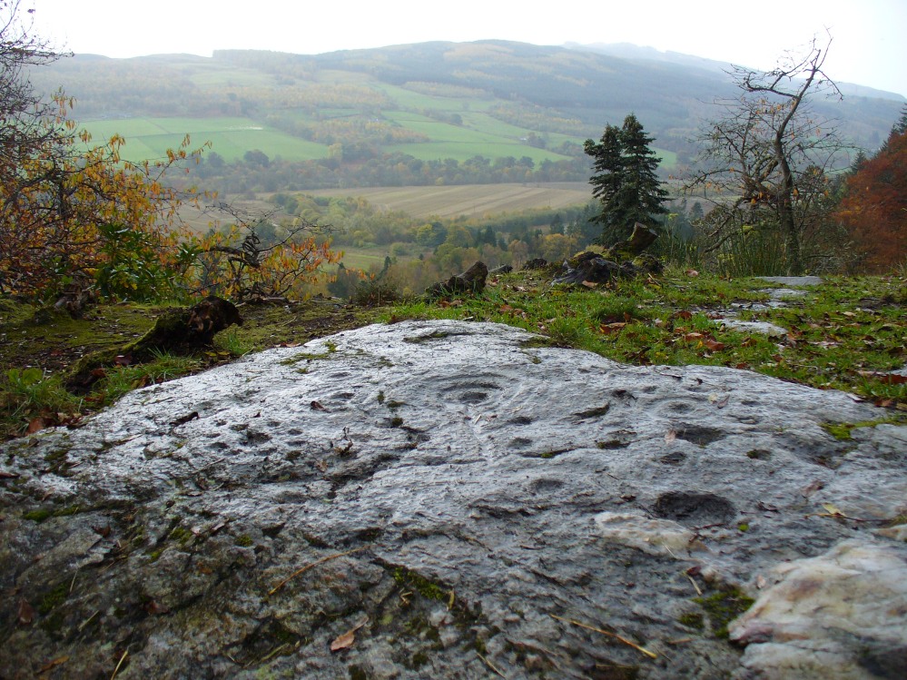
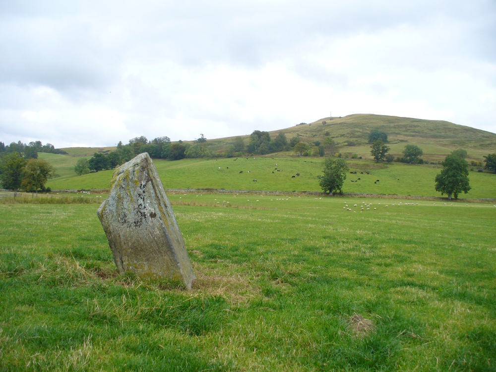
Looking out from the Weem Wood carved rocks

Take the B846 road out of Aberfeldy over the bridge towards Dull and Weem.  As you go through Weem, watch closely for the signpost directing you into the trees of Weem Rock and Woods on the right. Follow this tiny road up until you reach the parking circle in the edge of the trees.  Follow the directed footpath up into the woods & keep to the winding track, keeping your eyes peeled for the first large rocky crag above you, with a huge tree growing out of the edge. Once you get to the top of the steps and onto these crags, look right in front of you!

Archaeology & History

The nearest ‘officially recognised’ cup and ring carvings to the one we’re gonna see here, are those described by Kaledon Naddair (1990) in his brief descriptions of the Glassie Farm carvings a short distance northeast in the same woods.  Other than that, I can find no account of the carvings I’m about to describe – other than a couple of short local history walking guides, which tell that one of the carvings here is “modern.”  And that much is plainly evident.

Close-up of one section of the main design

There are at least seven carved stones here – all very close to each other on the top of an impressive crag with a large old tree growing out of the edge of the cliff.  But the carvings are located on the flat ground above the cliffs and, it would seem, may well be modern.  But I thought that since there are no accounts of the site on-line and no remarks in the Canmore registers, they should be mentioned as future students may mistake them as ancient.  There is the possibility (unless someone can show us otherwise) that one or two of them are prehistoric, but I think it’s best we surmise that they are all recent additions in the landscape for the time being.  And damn good designs they are too!

The triangular rock designs

The first and most notable of the group of seven (at least), is on the large earthfast triangular flat rock, pointing out to the cliff’s edge and the hills across the valley.  This is where the greatest cluster of multiple cup-and-rings can be seen.  Double- and triple rings surround several of the central cup-markings, with the traditional lines running out from the central cup.  There are a great number of single cups scattering the surface; and we also find a typical ‘rosette’ element, comprised of a central cup surrounded by eight singular cups, which some students have interpreted as solar and lunar symbols (amongst other things) when found on other carvings (there is a prehistoric Rosette Stone is known on Ilkley Moor; but similar examples are known in Ireland, Northumberland and elsewhere).

Below this triangular rock (perhaps attached beneath the) is another long piece of earthfast stone, with more carvings on. But when Lindsey Campbell and I came here yesterday, it was obvious that some elements along this section of stone were carved in recent years.  Two double-cup-and-rings are at the bottom-left of this section of rock, with a scattering of other cup-marks reaching across its surface. Several of these are obviously quite new.

Another multiple cup-and-ring

The third notable example is to the top-right of the triangular rock.  This stone is mainly of quartzite rock, apart from near the top-end, where another multiple cup-and-ring (four, with a possible fifth broken ring fading away) stand out very blatantly.  This carving also seems to be not that olde…

From this third quartz carving, look 10 yards (if that!) back towards the trees and there’s a large boulder.  On the surface of this is another multiple cup-and-ring that was very obviously new, and several other cup-markings, also quite new.  I presume that the other sections carved onto this stone have also been etched by the same modern artists.
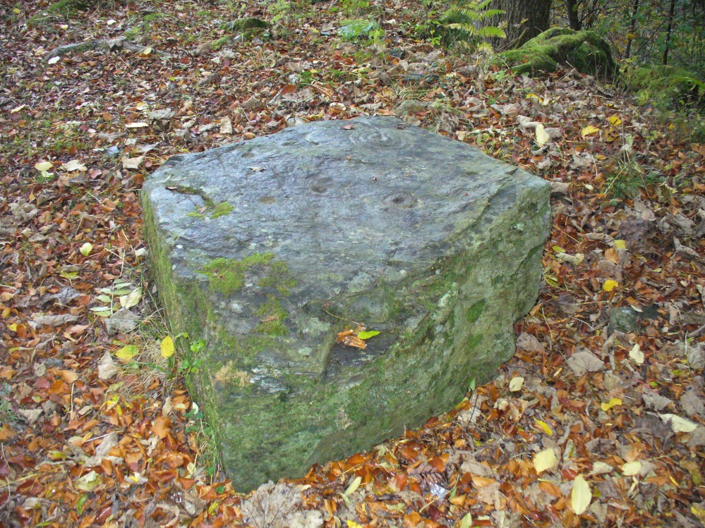
Another boulder with new carvings

As I looked back to the main triangular carved stone, I noticed other small pieces of stone peeking up from the ground and, upon closer inspection, found one small rounded triangular piece with another multiple cup-and-ring that just fit onto the rock.  And close by this was another long piece of stone which, when I rolled the turf gently back, found three simple cup-markings along the surface.

A seventh carving was found on one of the rocks that is falling slightly down the slope, close to the fourth ‘new’ carving that I described.  This was heavily covered in moss and autumn’s fallen leaves, and I wasn’t about to take the moss away just for the sake of my curiosity. But it was obvious that other cup-markings were on the sloping face of this large stone.

We’ll have to venture back here soon and get some better photos and, with any luck, find some old locals who can tell us when the carvings first appeared.  It’s quite a superb spot for a bimble, with the healing waters of St. David’s Well and his cave close by—and the woods were, so local legends tell, inhabited by dragons and good heathen creatures in centuries past.  But the proximity of the Druid school—formed by the Ionian druids no less—around the 6-7th century, may have thankfully preserved these old tales and relate to some of the many other monuments found in this area.  Although some of these carvings (possibly all) are of recent years, this is a gorgeous spot well worth exploring… And if anyone knows precisely when they were done – please let us know!

References:

  1. Naddair, Kaledon, “Rock Carvings (Weem Parish),” in Discovery & Excavation Scotland, 1994.

© Paul Bennett, The Northern Antiquarian

Dunmoid, Dalginross, Comrie, Perthshire

Stone Circle:  OS Grid Reference – NN 78030 21266

Dunmoid Circle, Comrie

Also Known as:

  1. Canmore ID 24857
  2. The Court Knoll
  3. Dalginross
  4. Dunmhoid
  5. Judgement Mound
  6. Muirend
  7. Roundel

Getting Here

From the main road running through lovely Comrie, take the south B827 road over the old river bridge.  Go dead straight for several hundred yards until the road bends right; but take the left turn here.  100 yards or so along note the trees on your right, and the road begins to swerve round here. Just round the corner in the trees, the stones are in the clearing right by the roadside. You can’t miss them! (if you hit the graveyard, you’ve gone past them)

Archaeology & History

This is a truly lovely, almost warming enclosed megalithic site—albeit damaged by the ruin of centuries; but on the occasions I’ve been here it feels quite nurturing and elicits a quite natural meditative state.  Whether or not this is due to the surround of trees, or the natural electromagnetic field, or just me, I dunno….

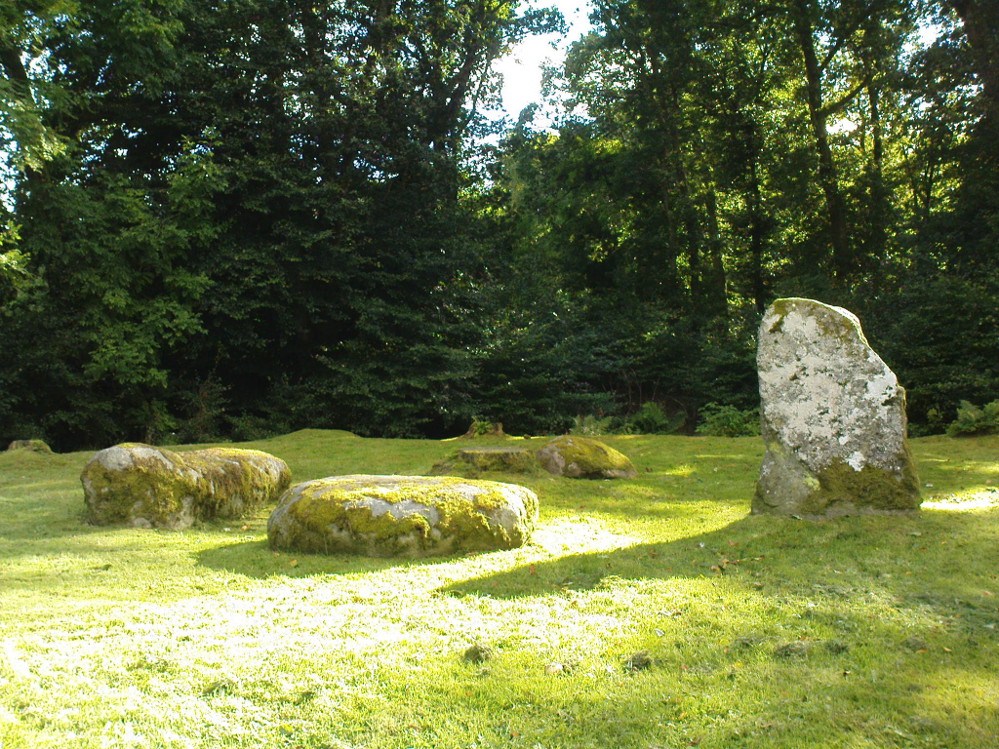
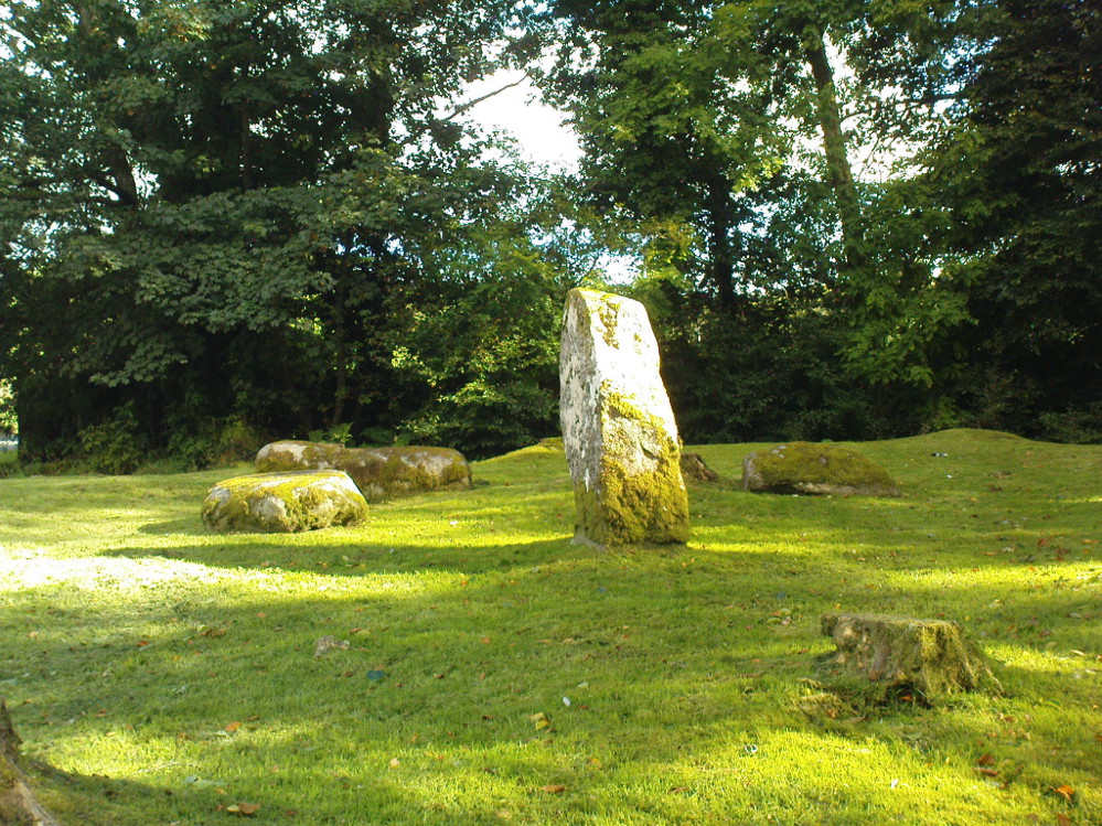
Dunmoid Circle, looking SE
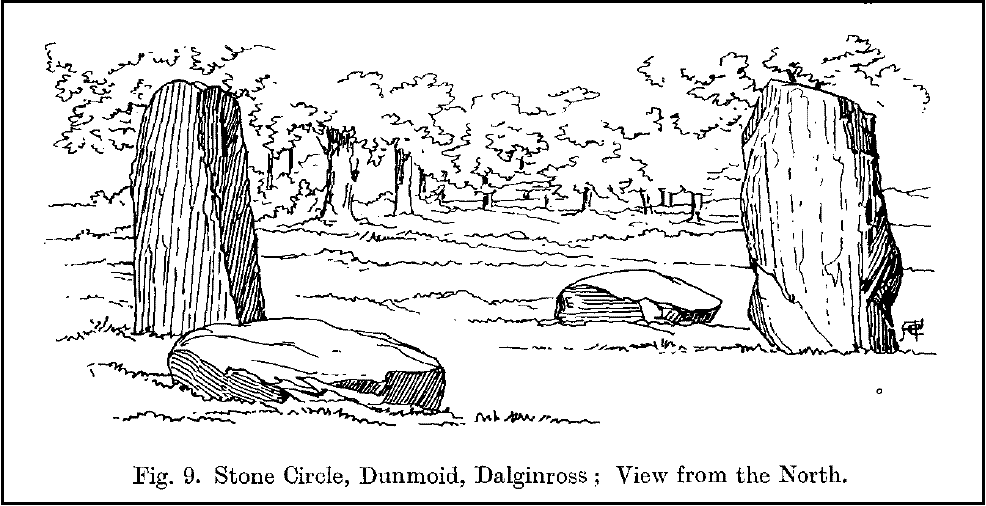
Dunmoid from the North (Coles 1911)

The ‘circle’ is constructed upon a flat rounded section of ground, surrounded by a ditch on two-thirds of its edges, very reminiscent of a typical henge monument—but there is no mention of this in modern surveys.  One of the earliest accounts of Dunmoid was written by John MacPherson (1896) who gave us as much of the known history of the site as is still known by any modern academic.  He wrote:

“At the west side of the new cemetery, close to the public road, there is a curious round knoll, which at one time must have been used as a place for the burial of the dead.  The attention of the writer of this was drawn to it about twenty years ago.  There were three large slabs of stone lying upon the ground, which apparently had been at some former period placed erect by some loving hands to mark the last resting-place of some departed friend or hero.  By the aid of some of the Comrie masons the stones were placed in a standing position.  Curious to know what lay beneath the surface, we dug up the earth in front of the largest slab, and came upon a stone cist placed north and south, 7 inches long, 1 foot 8 inches broad, and 1 foot 3 inches deep.  The only remains discovered was a thigh-bone, but whether it at one time formed a part of the leg of a Celt, a Roman, or a Saxon we could not tell. An old man who then lived in the village of Comrie told us that in his young days the same mound was dug up, when an urn filled with ashes was discovered.  This, perhaps, would indicate that it formed a place of burial for Romans rather than for Caledonians.  The spot is called Dunmoid, or ‘hill of judgment.'”

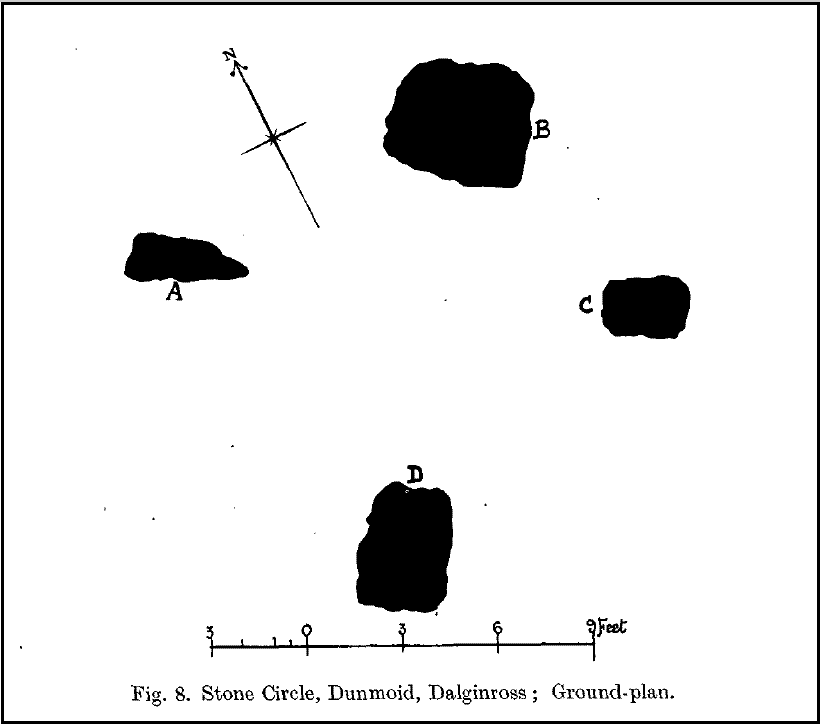
Fred Coles 1991 plan
Dunmoid from SE (Coles 1911)

The circle gained the attention of the prolific Fred Coles (1911) in his Perthshire surveys, whose drawings and measurements are still repeated in the modern textbooks more than a century later.  When he visited the site, two of the stones were still upright, but today only one still stands.  In Aubrey Burl’s (1988) survey on ‘four-poster’ stone circles, he reiterated Coles’ words, telling:

“Originally four stone stood at the corners of a rectangle on a mound some 75ft (23m) across and 2ft (60cm) high.  Coles’ plan showed the NW stone standing 5ft 4ins (1.6m) high and the SE, opposite, 5ft 2ins (1.6m), with the thick NW stone prostrate, 4ft 6ins (1.4m) long, with the more slender SW pillar also supine and 4ft (1.2m) long.  The longer SE and NW sides of the oblong were roughly 9ft 6ins (2.9m) long and the others 9ft (2.7m) in length.  The circle on which the stones had been placed had a diameter 13ft 2ins (4m), of which the Megalithic Yard is not an integer.”

The circle is included in Andrew Finlayson’s (2010) modern survey of the region.

References:

  1. Burl, Aubrey, Four Posters: Bronze Age Stone Circles of Western Europe, BAR 195: Oxford 1988.
  2. Finlayson, Andrew, The Stones of Strathearn, One Tree Island: Comrie 2010.
  3. Hunter, John (Ed.), Chronicles of Strathearn, David Philips: Crieff 1896.
  4. Hutchison, A.F., “The Standing Stones of Stirling District,” in The Stirling Antiquary, volume 1, 1893.
  5. MacPherson, John, “At the Head of Strathearn,” in Chronicles of Strathearn, Crieff 1896.

© Paul Bennett, The Northern Antiquarian

Witches Stone, Monzie, Crieff, Perthshire

Standing Stone:  OS Grid Reference – NN 87980 24321

Also Known as:

  1. Canmore ID 25448
  2. The Witches Stone & her crags to the rear
    The Witches Stone & her crags to the rear

    Kor Stone

Getting Here

Along the A822 road past Crieff and then Gilmerton, shortly past here is a small road to Monzie and the Glenturret Distillery or Famous Grouse Experience. Go on this road and after a just a coupla hundred yards you’ll see the large old gatehouse for Monzie Castle on the left. Ask at the gatehouse and they’ll point you to the stone—in the field about 300 yards past the Monzie stone circle, 200 yards past the gatehouse itself.  You can’t really miss it!

Archaeology & History

The southern flat face of the Witches Stone

This is a fascinating stone for a variety of reasons—not least of which it enabled us to identify an otherwise curious geological anomaly as an unerected standing stone some 16 miles SSW…but that’s a story for later!  The stone here leans at an angle in the field, as shown in the photo, but it still rises 5 feet tall and is a thick chunky fella, with one face very flat and smoothed indeed from top to bottom.  This side of the stone was obviously cut and dressed this way when first erected.  As Paul Hornby then noted, its western face is also quite flat and smoothed aswell, with the edge between the two sides almost squared at right-angles.  The eastern and southern sides of the stone are undressed, as the phrase goes.  These physical characteristics have just been found at a newly found pair of un-erected standing stones on the western edges of the Ochils, just below a newly found cairn circle.

Fred Coles 1911 drawing
Witches Stone, looking NE past Milquhanzie Hill fort

There were several early descriptions of this stone, two of which talked about an avenue or road along which the stone seemed to stand within.  This ‘avenue’ was in fact the very edge of what is probably an earlier prehistoric enclosure—but you can’t really see this anymore unless you’re in the air (check Google Earth, which shows it reasonably well).

In J. Romilly Allen’s (1882) account, he mentions the stone only in passing, telling it to be “a single standing stone measuring 4 feet by 3 feet and 5 feet high (with) no markings on it.”  It was later described in Fred Coles’ (1911) survey of the region where he told:

“This monolith is the westerly of the two prehistoric sites grouped on the O.M. as Standing Stones. It stands a few yards to the south of the avenue, almost half a mile from the East Lodge. The Stone has a slight lean towards the north. Its southern side is remarkably broad and smooth, measuring 4 feet across the base on that side, in girth 13 feet 1 inch and in vertical height 4 feet 9 inches.”

Alignment to Monzie stone circle, just visible in field

In Alexander Thom’s edited magnum opus (1980) he found that this standing stone—800 feet northwest of the superb Monzie cup-and-ring stone and associated megalithic ring—marks the midsummer sunset from the stone circle. We noted on our visit here, that this alignment runs to the distant cairn on the far northwest horizon, many miles away.

Folklore

In Joyce Miller’s (2010) excellent work on Scottish heathenism, she told the folowing tale of this stone:

“The standing stone is said to mark the site of Kate McNiven or MacNieven’s, sometimes known as the witch of Monzie, execution. The story goes that she was put in a barrel and rolled down what is now known as Kate MacNieven’s Craig on the north side of the Knock of Crieff before being burnt.  Kate had been the nurse to the Grahams of Inchbrackie, and was accused of witchcraft, including turning herself into a bee.  Graham of Inchbrackie tried to save her but to no avail, but as she was about to die it is said that she spat a bead from her necklace into his hand. The bead – a blue sapphire – was turned into a ring and it was believed that the ring would keep the family and lands secure.  She did, however, curse the laird of Monzie, although whether this worked or not is not known. MacNiven or Nic Niven was also believed to be the name of the Queen of Fairies.  Indeed it is not clear whether Kate MacNiven was a real person or is a conflation of stories. There do not appear to be any contemporary records of her execution at or near Crieff, and dates for her unpleasant death are variously given as 1563, 1615 and 1715.”

…to be continued…

References:

  1. Allen, J. Romilly, “Notes on some Undescribed Stones with Cup Markings in Scotland,” in Proceedings of the Society of Antiquaries Scotland, volume 16, 1882.
  2. Coles, F.R., “Report on stone circles in Perthshire principally Strathearn,” in Proceedings of the Society of Antiquaries, Scotland, volume 45, 1911.
  3. Finlayson, Andrew, The Stones of Strathearn, One Tree Island: Comrie 2010.
  4. Holder, Geoff, The Guide to Mysterious Perthshire, History Press 2006.
  5. Marshall, William, Historic Scenes in Perthshire, Oliphant: Edinburgh 1881.
  6. Miller, Joyce, Magic and Witchcraft in Scotland, Goblinshead 2010.
  7. Thom, Alexander, “Megalithic Astronomy: Indications in Standing Stones,” in Vistas in Astronomy, volume 7, 1966.
  8. Thom, A., Thom, A.S. & Burl, H.A.W., Megalithic Rings, BAR: Oxford 1980.
  9. Watson, David, A Simple Introduction to the Stone Circles and Standing Stones of Perthshire, 2006.

© Paul Bennett, The Northern Antiquarian

Tulloch, Doune, Perthshire

Tumulus:  OS Grid Reference – NN 71782 01194

Also Known as:

  1. Canmore ID 24771

Getting Here

Tulloch Knowe from the road

Head out of Doune village and take the A84 to Stirling. Just a few hundred yards along, over the old river bridge, take the first right along the B8032 (don’t head into Deanston).  Barely 500 yards along on the left-hand side, between the farmhouse and a small group of houses, note the large tree-lined mound in the middle, just over the fence.  It’s quite a big fella – you can’t really miss it.

Archaeology & History

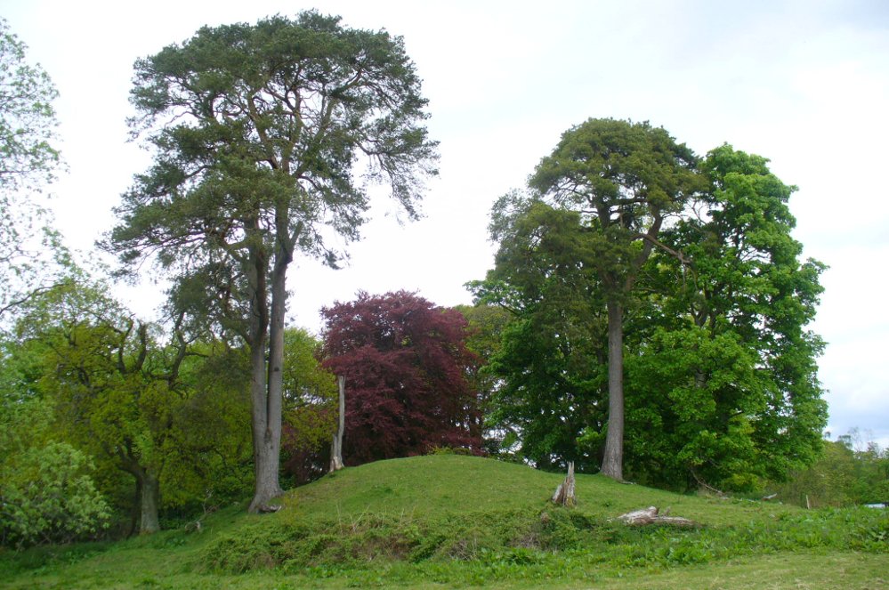
The mound and its trees

This is an almost archetypal fairy mound of a monument—and a mighty one at that!—living quietly in the field with its olde trees for company.  Despite its size, it has brought little by way of archaeological attention and has, to my knowledge, never been excavated.  Probably a Bronze Age burial mound, the tomb stands more than 15 feet high and is some 30 yards across east-west and 35 yards north-south.  The Royal Commission (1979) listing of the mound says simply that “this large cairn measures 34m in diameter and up to 5m high.”

References:

  1. Royal Commission on the Ancient & Historical Monuments of Scotland, Archaeological Sites and Monuments of Stirling District, Central Region, Society of Antiquaries of Scotland 1979.

© Paul Bennett, The Northern Antiquarian

Dargill, Crieff, Perthshire

Standing Stone:  OS Grid Reference – NN 85918 20054

Also Known as:

  1. Canmore ID 25443

Getting Here

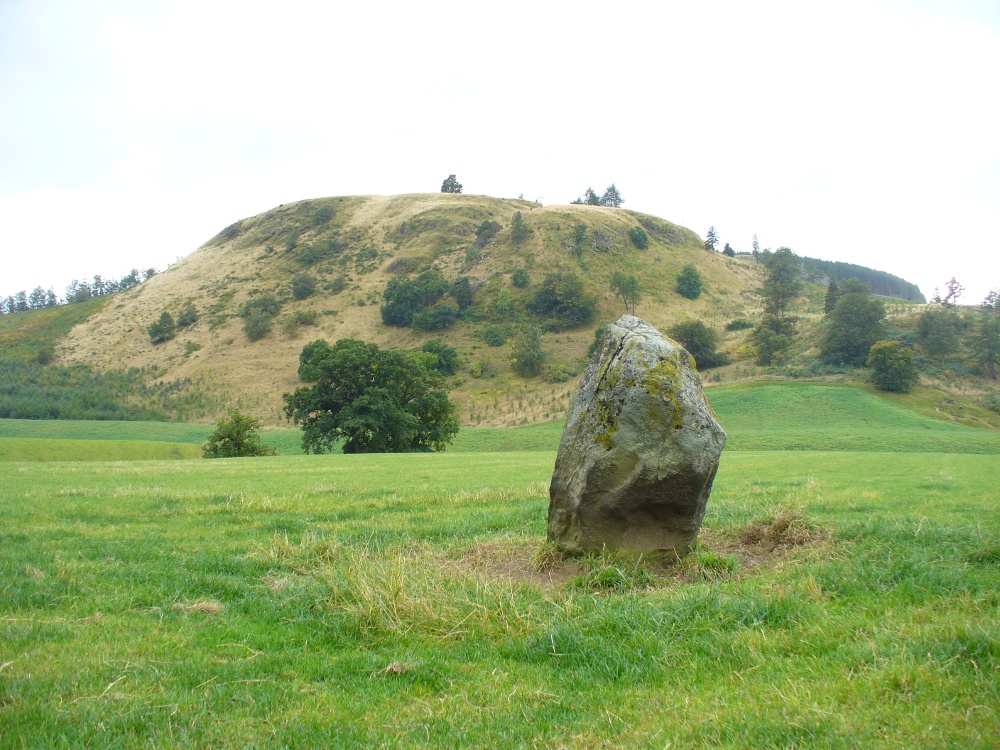
Dargill Standing Stone

Take the A822 straight road south out of Crieff and as you pass the garden centre on your right and the fields and trees begin either side of the road, you need to watch out in the field on your left-hand side.  Just a couple of hundred yards after passing beyond the garden centre, stop.  Look in the field there and you’ll see the object in question. You can’t really miss him!

Archaeology & History

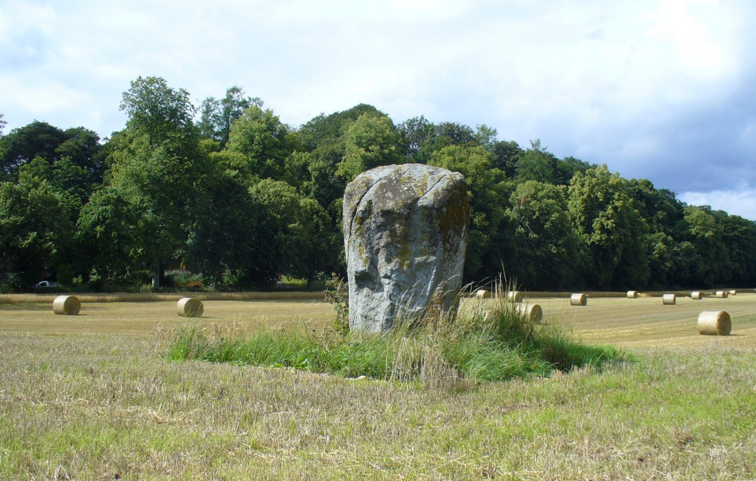
As you approach or leave Crieff along the A822 you can easily pass this stone by. Which would be a pity, as it’s quite a giant standing alone just above the slight ridge in the field.  And in times gone by, not only were there other standing stones here as companions, but a cluster of other prehistoric pits, enclosures and linear markings were all around this very spot.  Some of them are visible as faint crop-marks even today, but they remain unexcavated and we are left (presently) in the dark as to their nature.

Dargill stone, looking NW
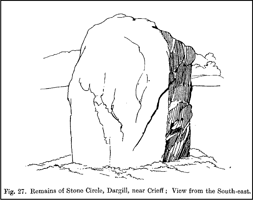
Old drawing by Fred Coles

The standing stone itself is a real beauty!  A huge fat fella, standing nearly eight feet tall, looking proudly across the field in all directions and gazing into the northern hills, where the wanderer’s eye naturally falls… In earlier years, the great megalithic explorer Fred Coles told of two other stones standing hereby—although they are not noted on the earliest OS-map of the area.  Nevertheless he wrote the following:

“This place-name deserves brief notice.  It is pronounced by persons in the locality as if it were spelt like the Irish name Dargle, having the stress on the first syllable.  The site is in a field between the main road from Crieff to Auchterarder and Dargill Island on the river Earn, at the height of 121 feet above sea-level…  There is here an indistinct mound, not now easily traceable, nor of any considerable height; but it is significant to have to report that up to 1909, when a new tenant entered the farm, two other great Stones were standing.  These were removed by the newcomer, much to the surprise and indignation (I was told) of the neighbours.  The remaining monolith is an unusually square and massive oblong block of schist, girthing over 16 feet, and standing clear of the ground 7 feet 8 inches in height.  Its eastern edge is rough and riven into long vertical hollows; but the other sides are, on the whole, smooth.  I append a view from the south-east.”

More recently the Dargill stone was described in Andy Finlayson’s (2010) excellent photo-history guide to the megaliths of the region.

Folklore

In recent years this great stone has received the attention of local ley hunter David Cowan, who dowsed here and found ‘earth energies.’ These are in fact water-lines: the primary dowsing response and not related to leys.

References:

  1. Coles, F.R., “Report on stone circles in Perthshire principally Strathearn,” in Proceedings of the Society of Antiquaries, Scotland, volume 45, 1911.
  2. Cowan, David, Ley Lines and Earth Energies, Adventures Unlimited 2003.
  3. Finlayson, Andrew, The Stones of Strathearn, One Tree Island: Comrie 2010.

© Paul Bennett, The Northern Antiquarian 


Hill of Ballunie, Kettins, Perthshire

Stone Circle (destroyed):  OS Grid Reference – NO 265 389

Also Known as:

  1. Canmore ID 30549

Archaeology & History

Looking dead straight from the Hill of Ballunie to Leys.

There seems to be nothing left of the stone circle described in Andrew Jervise’s (1879) immense work which, sadly, only described this stone circle in passing.  He told us simply that hereby, “are also the remains of stone circles upon the hill of Ballunie,” which is just a few hundred yards along the road from the magnificent Keillor Pictish symbol stone.  When we visited the place not long ago, no trace of any stones were visible hereby. The site is not listed in Burl’s (2000) magnum opus.

However, ley-hunters will love this place.  Not only was this lost circle located at the edge of a dead straight road, running from the Keillor standing stone a short distant east, but as it runs downhill it reaches, a couple of miles below, the hamlet called Leys.

References:

  1. Jervise, Andrew, Epitaphs and Inscriptions from Burial Grounds and Old Buildings in the North-East of Scotland – volume 2, Edmonston & Douglas: Edinburgh 1875.

© Paul Bennett, The Northern Antiquarian

Keillor, Kettins, Perthshire

Standing Stone:  OS Grid Reference – NO 27332 39760

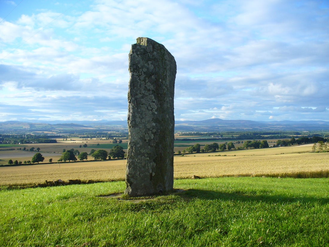
The tall carved stone at Keillor

Also Known as:

  1. Baldowrie
  2. Canmore ID 30545
  3. High Keillor
  4. Symbol Stone

Getting Here

Take the minor road that runs from the small town of Newtyle (in Angus) westwards to Kettins (in Perthshire). Less than a mile on, go up the first turn-off on your left to Kinpurnie Castle and continue (past the castle) for less than a mile. Keep your eyes peeled on the right-hand side of the road, opposite the drive to High Keillor – and you can’t really miss it!

Archaeology & History

Another feel of Keillor's Stone
Another feel of Keillor’s Stone

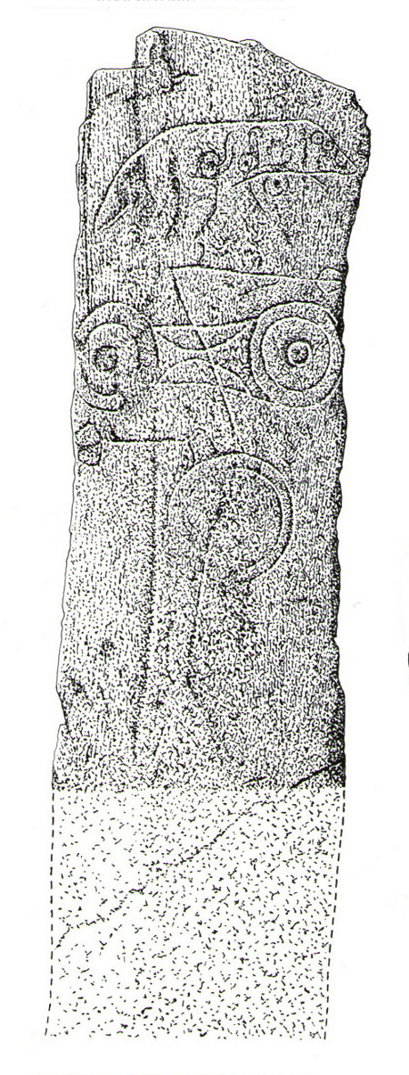
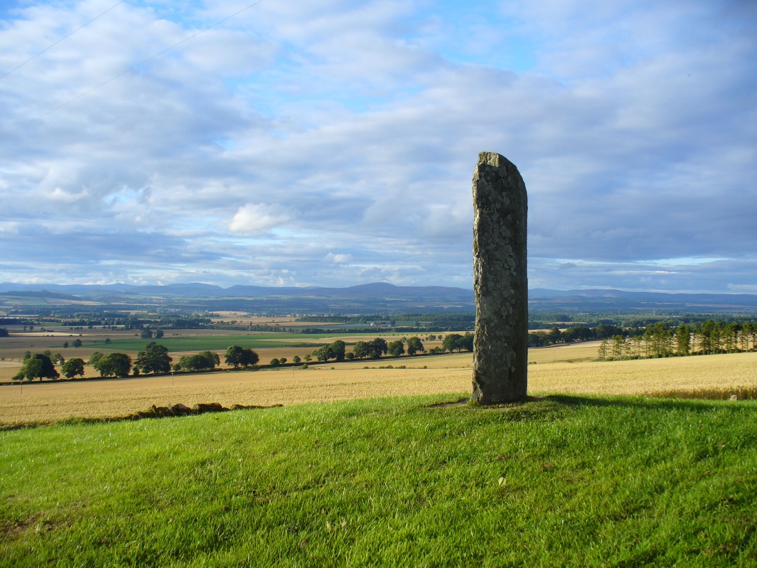
A fascinating site in an excellent setting.  Here we have a 6-7 foot tall standing stone living upon a what is most probably a Bronze Age tumulus (possibly neolithic, but we aint sure), on whose south-face were carved a series of Pictish symbols many many centuries ago.  In the surrounding district there is a vast wealth of similar sites (and many destroyed, like the lost Hill of Ballunie stone circle only a few hundred yards along the road), highlighting that this region was very important indeed to the prehistoric peoples of Strathmore and the Sidlaw Hills.

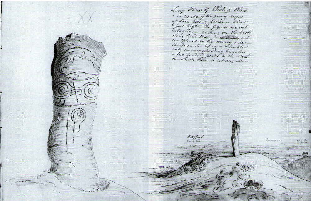
W.J. Skene's 1832 drawing
W.J. Skene’s 1832 drawing

The Keillor stone was described and illustrated by several of the giant Scottish antiquarians. When James Skene visited the site in the 1830s, the tumulus upon which the stone stands was still pretty complete, as his old drawing from 1832 clearly shows.  Since then the track beside the monument has widened and the road took away half of the burial mound.  But the place has lost little of its majesty.

Another 19th century historian, William Oliphant (1875), when describing the beauty and history of the Sidlaw Hills, below whose edges the old hamlet of Keillor stands, told of this,

“old and striking monument, making the spot on which it stands historical, though no syllable of the history has come down to us.  It is, one writer says, “one of those remarkable sculptured monuments of the ancient inhabitants of Scotland, embellished, in this instance, with the rude outline of the boar.”  Another writer says, “at Baldowrie there is an erect Danish monument six feet high.  It contains some figures, but they are almost entirely defaced.”

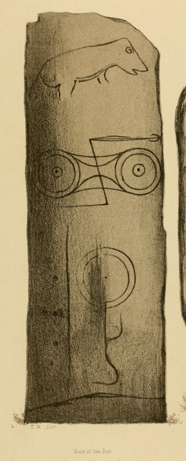
In John Stuart’s (1856) superb magnum opus he told that this carved pillar with “a boar” on it, standing on an ancient “tumulus of earth and stones” was found to have evidence of several burials inside when a dig at the site occurred which, he told, “I was present (at) in the autumn of 1854.” He described the site as follows:

Stone with carved symbols (after RCAHMS 1994)
Stuart's 1854 drawing of the carved stone
Stuart’s 1854 drawing of the carved stone

“The Stone at Keillor is placed on a tumulus on the north slope of the Hill of Keillor, in the Parish of Newtyle, and Shire of Forfar. It is a rough stone, formed of gneiss, convex in front, and rugged behind. The tumulus on which it is placed is formed of earth and stones, and several cists containing bones have been found in it. Ancient sepulchral remains have also been dug up in various parts of the adjoining field.

“The stone was broken across some years ago about a foot above the ground, but the parts have recently been clasped together, and the stone replaced in its original site by orders of Lord Wharncliffe. The present drawing was made with much care by Dr. Wise, and is more perfect than the copy in Mr. Chalmers’ volume.  The surface of the stone is so rough, that it is sometimes with difficulty that the incised lines can be satisfactorily distinguished from natural fissures, but having examined the stone in a variety of lights, and compared Dr. Wise’s sketch with the original, I am inclined to think that the drawing is as satisfactory as can now be obtained.  There is a rough sketch of the stone among Dr. Hibbcrt’s papers, with a supposed Gaelic inscription at the top, meaning “the burying place of the slain,” furnished to Dr. Hibbert by the late Mr. Donald Gregory.  Of such inscription 1 could see no trace.”

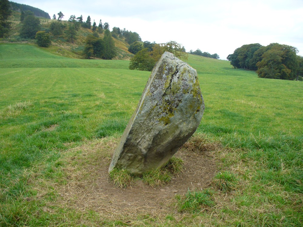
The old stone himself
Faint carvings just visible

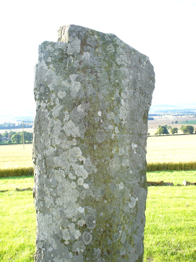
And as far as I am aware, this Gaelic inscription has not subsequently been recorded.  But considering the position of the stone in the landscape, it’s understandable if some of the carvings have eroded away by simple weathering.  Indeed, when Paul Hornby and I visited here only a couple of weeks ago, despite the weather conditions being excellent, the carvings were difficult to make out. Modern interpretations differ between the topmost animal carving being either a wolf or a boar. Below this we see the more common Pictish symbol described as a double disc and Z-rod symbol, for which academia still struggles to afford cogent explanations.

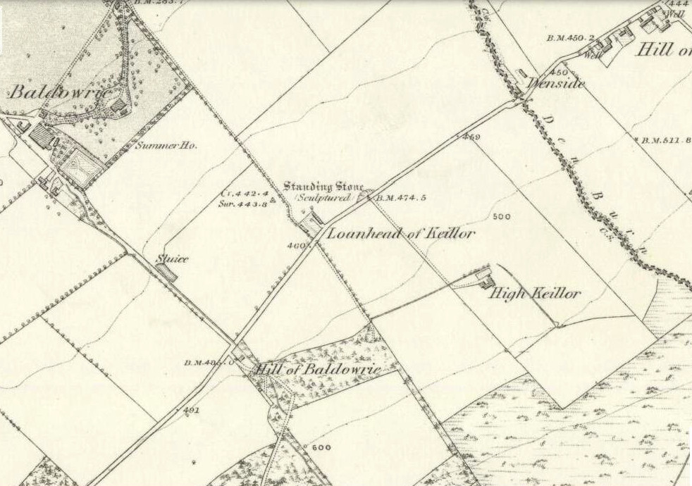
Keillor stone on 1865 map

Whilst the prehistoric age of the tumulus on which this stone stands is not in doubt, we don’t know exactly when this stone was first erected here.  Whilst some of the early accounts—including the Ordnance Survey team who first visited here in 1860—describe it in an upright position, when A.J. Warden (1880) wrote about it in his massive survey of the region, he noted that wasn’t always the case:

“On the north slope of the Hill of Keillor, in the parish of Newtyle, there is a rough stone composed of gneiss, somewhat convex in front but rugged behind. It is placed on a tumulus formed of earth and stones, and several cists containing bones were found in it; while, in the adjoining field, ancient sepulchral remains have also been found.  The stone was broken across about a foot from the ground, but the parts have been again united and the stone replaced on its original site. On the stone there is the figure of an animal, below which are the spectacle and other symbols, all incised.”

The stone presently stands on a modern plinth to protect it from the elements and such things.  It was erroneously described in the Royal Commission’s 1999 survey of Pictish monuments as being just “1.4m in height”, whereas it is in fact some 6½ feet tall, or around 1.98m.

The Great Pyramid to the northwest

The view from here, east, north and west is superb. The high rolling hills of Angus stretch into the north and eastern skies; whilst more westerly are the grand olde mountain ridges into deepest Perthshire. And looking northwestwards from our old standing stone, one shapely mountain in particular is notable, standing out upon the ridge of distant hills: a great pyramid which I initially thought may have been Ben Vorlich.  But thanks to the help of several local people, have found that it is in fact Schiehallion – the great Mountains of the Fairy Folk, about 50 miles away!  Some folk think that it may have had relevance in the animistic formula with this monument—and I’ll hazard that it did too…

…to be continued…

References:

  1. Allen, J. Romilly, Early Christian Monuments of Scotland, 1903.
  2. Coutts, Herbert, Ancient Monuments of Tayside, Dundee Museum 1970.
  3. Guthrie, James C., The Vale of Strathmore – Its Scenes and Legends, William Peterson: Edinburgh 1875.
  4. Jervise, Andrew, Epitaphs and Inscriptions from Burial Grounds and Old Buildings in the North-East of Scotland – volume 1, Edmonston & Douglas: Edinburgh 1875.
  5. Mack, Alastair L., Field guide to the Pictish symbol stones, Pinkfoot Press 1997.
  6. MacPherson, J.G., Strathmore: Past and Present, S. Cowan: Perth 1885.
  7. Marshall, William, Historic Scenes of Forfarshire, William Oliphant: Edinburgh 1875.
  8. Royal Commission on the Ancient & Historical Monuments of Scotland, South-East Perth: An Archaeological Landscape, HMSO: Edinburgh 1994.
  9. Royal Commission on the Ancient & Historical Monuments of Scotland, Pictish Symbol Stones: A Gazetteer, Edinburgh 1999.
  10. Stuart, John, Sculptured Stones of Scotland – volume 1, Spalding Club: Aberdeen & Edinburgh 1856.
  11. Sutherland, Elizabeth, A Guide to Pictish Stones, Birlinn: Edinburgh 1997.
  12. Warden, Alex J., Angus or Forfarshire: The Land and People – Descriptive and Historical – volumes 1, Charles Alexander: Dundee 1880.

© Paul Bennett, The Northern Antiquarian

Ninewells, Caputh, Perthshire

Ring Cairn:  OS Grid Reference – NO 0757 4360

Also Known as:

  1. Canmore ID 27115
  2. Nine Wells

Getting Here

Outer edge of the overgrown Ninewells circle

From Dunkeld, head out for a mile or so on the long and winding A923 road, taking your first road right along the Craigie and Caputh road, south of the Loch of Lowes.  Go along here for about 2 miles, watching out for the little road to Black Hill on your left, where you can park up (if you hit a road junction, you’ve gone too far). Across the road, note the copse of trees.  Go in there along the walling for about 50-70 yards, past the curious gathering of rounded stones, then walk into the trees where the giant fir trees stand. You’re damn close!

Archaeology & History

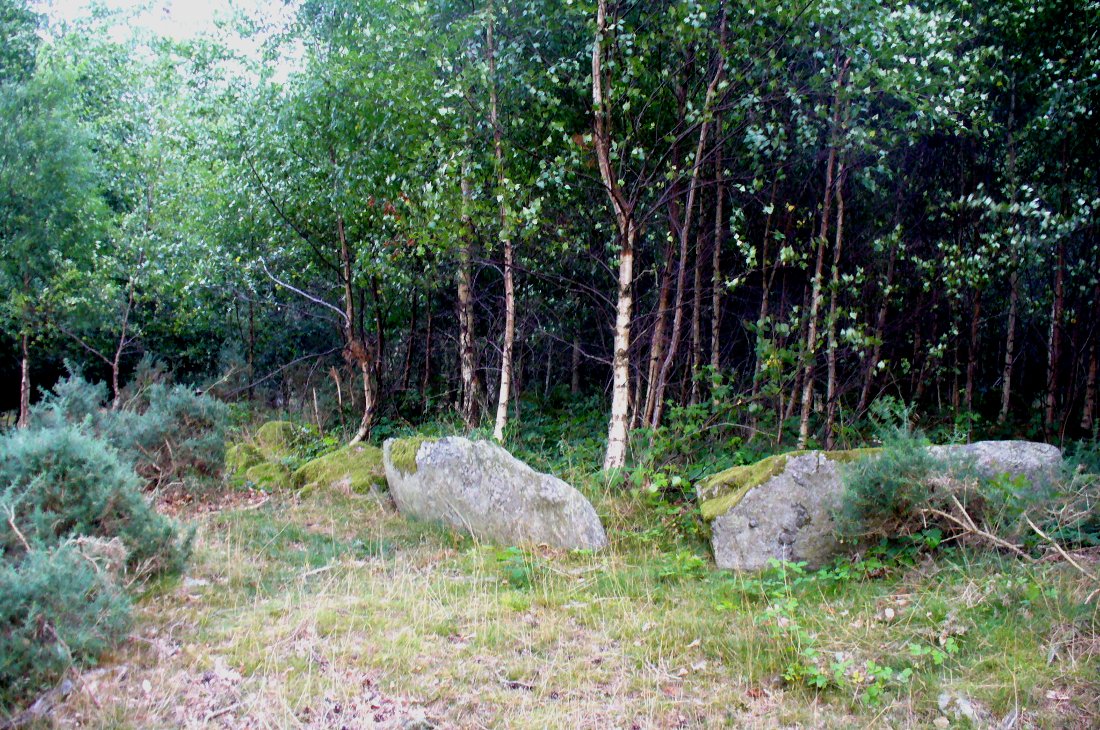
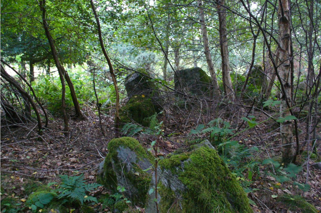
This is an excellent site, hiding away in a scattered copse of woodland, with young trees inside and very old ones in close proximity to its outer edge.  We visited the place for the first time in the middle of summer, not knowing anything about it, and found Nature had covered much of the place in Her usual clothes of fern, bramble, gorse and other vegetation.  Yet despite this, the site was superb!  In a very good state of preservation this ring of small stones is more than 30 feet across, though the stones making up the ring are only small.  Within the ring itself you’ll find many young birch trees growing over a mass of small rounded rocks, typical of cairn material such as found at other prehistoric sites of this nature up and down our northern counties, from the overgrown Roms Law, to Temple Wood and many others.  No evidence of internal burial or cist of any form was noted on our visit, nor mentioned in the Canmore survey.

Section of the Ninewells ring
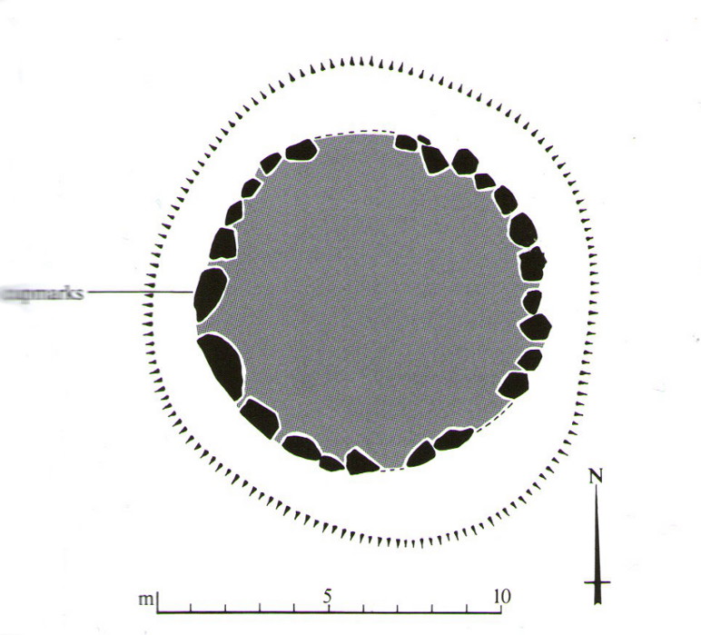
Plan of the Ninewells ring (after RCAHMS)

Although rightly classed as a cairn circle or ring-cairn, I’ve seen sites like this labelled as ‘stone circles’ in the past — and it’s easy to see why once you’re inside this!  If the internal scatter of cairn-material had been cleared in earlier centuries—as with many others—this site would be classed as a typical stone circle.  Curiously it hasn’t fared too well in archaeological surveys, but thankfully the Scottish Royal Commission (1994) lads included the site in theirs, telling us,

“This cairn measures 10m in diameter and 0.75m in height and has a near-complete kerb of large contiguous boulders and slabs set on edge.  The kerb is graded so that the largest, though not the tallest stones are situated in the southwestern quadrant, and one of the stones on the west bears four cupmarks.  Today the cairn material is roughly level with the top of the kerbstones, but there is no evidence to suggest that it has been heavily robbed and it was probably never much higher.  Concentric with the kerb there is an external platform about 0.2m high.  This type of feature is more usually associated with Clava ring-cairns and passage graves around Inverness, which are believed to be of late Neolithic date; but, despite the disturbance of the centre of the Ninewells cairn, there is no evidence of stones defining an internal court.”

Two of the largest stones

Some broken quartz stones were also found inside this ring.  The cup-marked stone on the west side of the circle has an entry of its own.  Whether or not the ‘opening’ or lack of stones in the north of the ring was intentional can only be known with certainty if an excavation happens here; suffice to say that North is the airt or direction most commonly representative of the Land of the Dead in many early northern cultures, which may explain this. A truly fascinating site…

The name ‘Ninewells’ derives from a cluster of healing springs of water that once flowed nearby.  Several legendary waters with this name can be found in this part of southern Perthshire.

References:

  1. Royal Commission on the Ancient & Historical Monuments of Scotland, South-East Perth: An Archaeological Landscape, HMSO: Edinburgh 1994.

© Paul Bennett, The Northern Antiquarian

Buttergask, Kirkton of Collace, Perthshire

Souterrain:  OS Grid Reference – NO 210 340

Archaeology & History

In seeking out some of the monuments in the area north of Collace village, we enquired upon one of the landowners for anything they might know of the sites we were looking at.  Whereupon (as happens occasionally), the gent concerned—a local man—after ascertaining that we weren’t from the National Trust or a similar group, informed us that many years ago he was ploughing the field over where a small subsidence had been, when his tractor fell into a large hole that appeared in the ground due to the weight of his vehicle!  It was a souterrain, he told us; but once he managed to retrieve his tractor from the hole in the ground by calling upon one of his neighbours, he completely covered it and filled it in again.

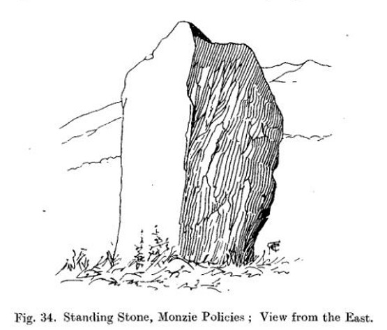
Despite him telling us to keep it to ourselves, it does appear that aerial photography from the 1990s seems to have uncovered the location of the site.  Indeed, by the look of things, there may be more than one!

© Paul BennettThe Northern Antiquarian
Dunkeld Park, Dunkeld, Perthshire

Standing Stone:  OS Grid Reference – NO 01426 42994

Also Known as:

  1. Canmore ID 27205
  2. Dunkeld House
  3. Pulney Lodge

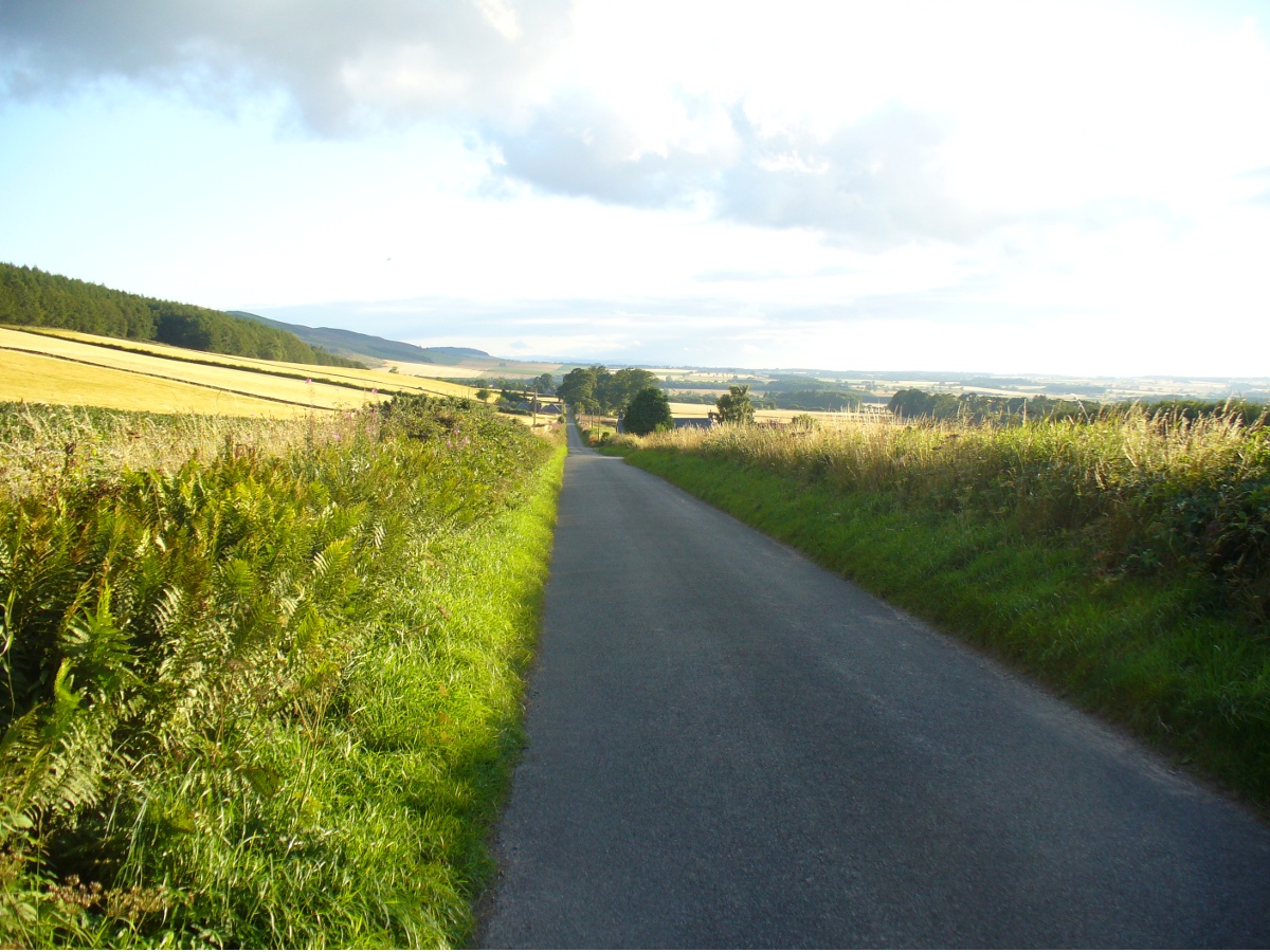
Getting Here

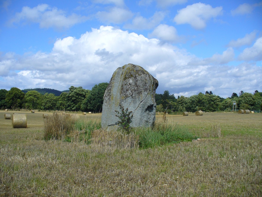
Dunkeld Park monolith

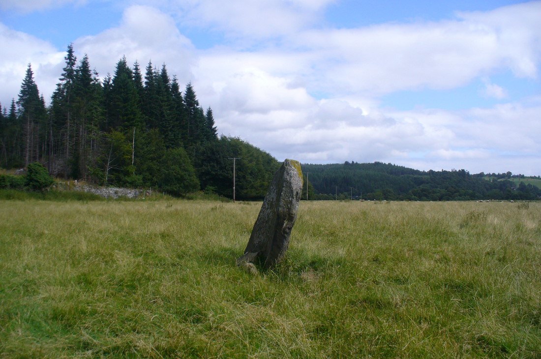
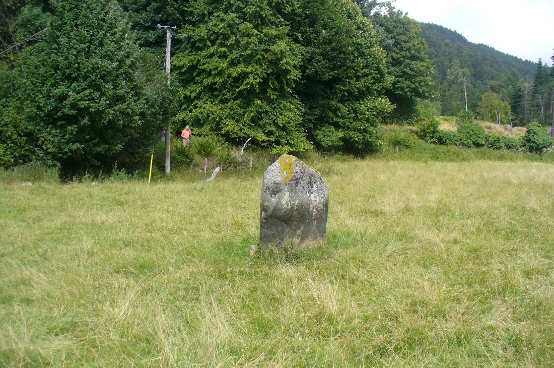
Take the A923 road through Dunkeld and across the river, making sure that where the road veers sharply to the right as you go out of town, you go the left as the road bends round.  100 yards along, past the trees on your left, fields open up. A few hundred yards along on the left, you’ll note the small standing stone about 50 yards in the field below the wall, getting close to some trees again. That’s the spot!

Archaeology & History

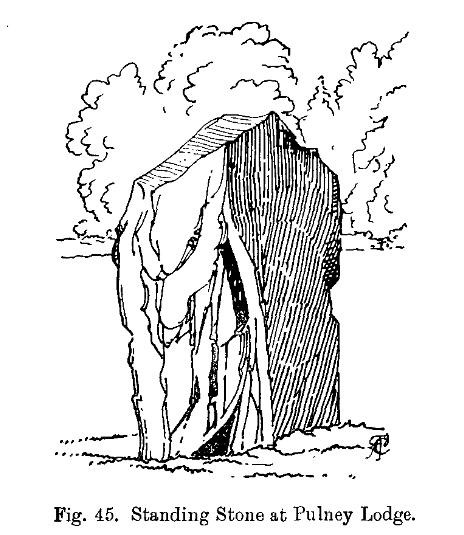
The stone is given only a passing mention in the Royal Commission’s (1994) poor work on the region, describing neither its height nor form and erroneously relating it to what is probably a much earlier series of pit alignments in the same field.  Thankfully we had a better description from the early 20th century antiquarian Fred Cole (1908) who visited and drew the site and who told us:
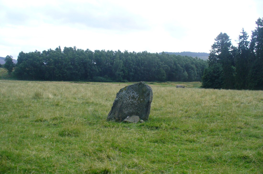
Standing stone, looking NE
Dunkeld Stone looking north

“This Stone is marked on the Ordnance Map in a field behind the Lodge, at a height above sea-level of 300 feet, and styled “sepulchral.”  In size and character it much resembles the Kilmoraich monolith, and seems to have stood solitary for ages.  It is a roughly oblong slab of schist, set with its longer axis nearly east and west, the north face measuring 4 feet and the south 4 feet 9 inches, and the basal girth about 10 feet 7 inches.  It is 4 feet 9 inches in height.  The grandly-timbered policies of the ducal estate enclose this site on all sides.  In the illustration…the Stone is drawn as seen from the east.”

Close to the walling on the WNW just a few yards away, we see a cluster of small rounded stones and a couple of larger stones, much overgrown, giving the impression that they were field clearance.  There is a possibility that they may have had something to do with the standing stone in earlier times; the small stones being very worn and perhaps being part of a cairn—although there seems little evidence of this in the on-line aerial surveys.  The stone was also mentioned in Elizabeth Stewart’s Dunkeld (1926), where she wrote:

“In the park near Polney Loch, one mile from Dunkeld, is a Standing Stone, quite noticeable from the Highland road. This monolith is one of those styled sepulchral, and is a rough oblong slab of schist, its basal girth being 10 feet 7 inches, and its height 4 feet 9 inches. Mr. Coles, who describes this stone in the “Proceedings of the Society of Antiquaries”, supposes it to have been part of a circle. It is not far from the ancient stronghold on King’s Seat.”

References:

  1. Coles, Fred, “Report on Stone Circles Surveyed in Perthshire – Northeastern Section,” in Proceedings of the Society of Antiquaries of Scotland, volume 42, 1908.
  2. Royal Commission on the Ancient & Historical Monuments of Scotland, South-East Perth: An Archaeological Landscape, HMSO: Edinburgh 1994.
  3. Stewart, Elizabeth, Dunkeld: An Ancient City, Munro Press 1926.

© Paul Bennett, The Northern Antiquarian