Ballachraggan, Callander, Perthshire

Chambered Cairn:  OS Grid Reference – NN 6805 0650

Also Known as:

  1. Canmore ID 73674

Getting Here

The mound of Ballachraggan tomb
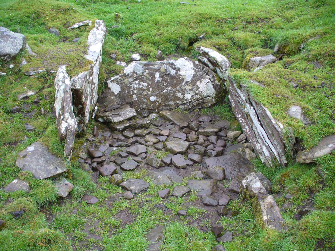
The Ballachraggan tomb

Along the A84 road between Doune and Callander, take the tiny country lane up to your right to Drumloist (if you’re coming from Doune) or up the tiny unmarked road past Keltie Bridge on your left (if you’re coming from Callander).  Uphill for several miles, you eventually emerge from the trees and are on the top of the tiny road. Once here, keep your eyes peeled for Drumloist farm.  Best thing to do is walk up the track and ask at the farm. The fella there is a superb old Highlander who’ll point you to the place on the hill above.

Archaeology & History

A site that was never explored by that giant of chambered tomb research, Audrey Henshall.  A pity, as it has a lot of potential and seems to have a lot more to say about itself than the meagre findings reported by the Scottish Royal Commission doods.
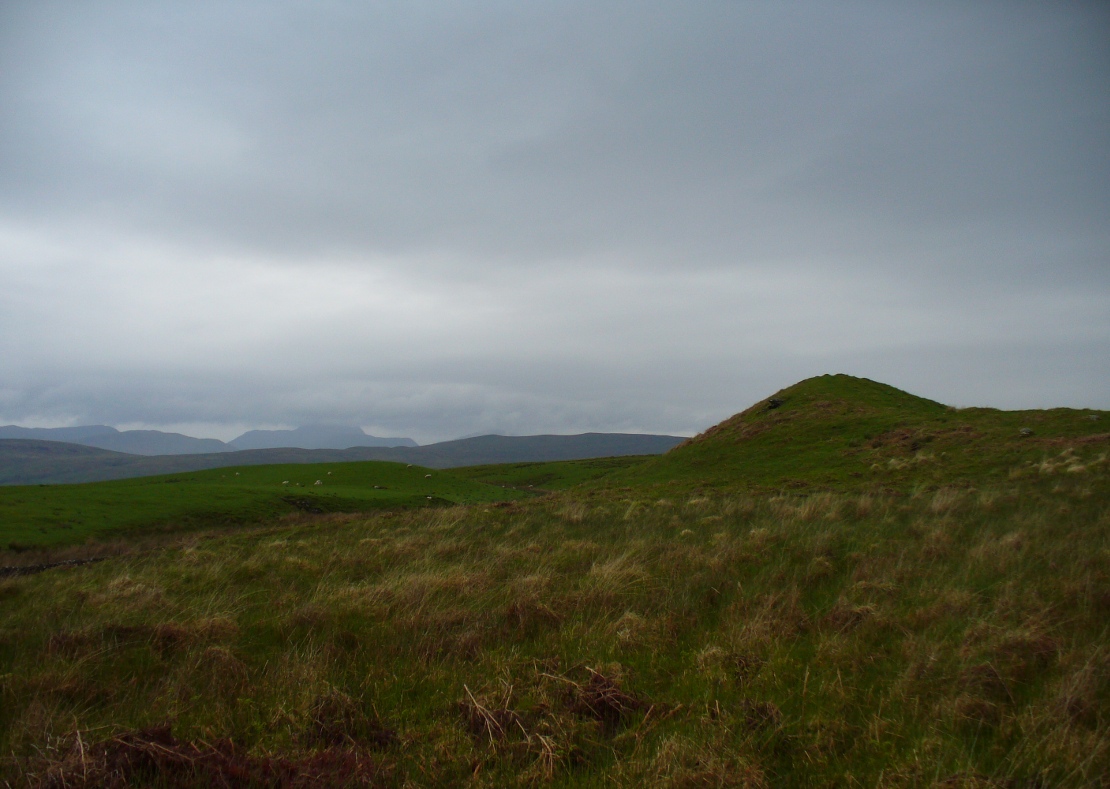
Curious fairy mound to rear
One of two main chambers

Although there’s a very notable “fairy hill” eminence close by which strongly draws your attention, the actual hillock upon which this chambered tomb was constructed is in front of this, closer to the farm.  A couple of rows of ancient walling—Iron Age by the look o’things—run up the hillside, with one of them running into the eastern sides of the huge mound which this tomb plays a part in. The mound itself is about a hundred feet across, although seems to have been damaged over the centuries.  Although it is probably neolithic in origin, sections of the monument seem to have been altered and re-used for other purposes, giving it that distinctly multi-period look.

The farmer informed us how some of the stones from the mound had been robbed and used in some of the walling in the past.  He also told us how there are so many other archaeological features upon the moors above here that remain to be “officially” recorded, despite the efforts of some who swept the region for remains a few decades ago.
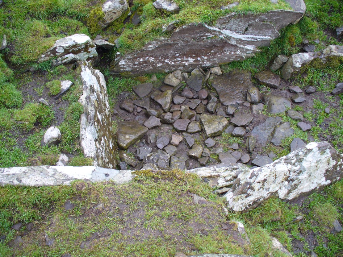
Looking into the main cist
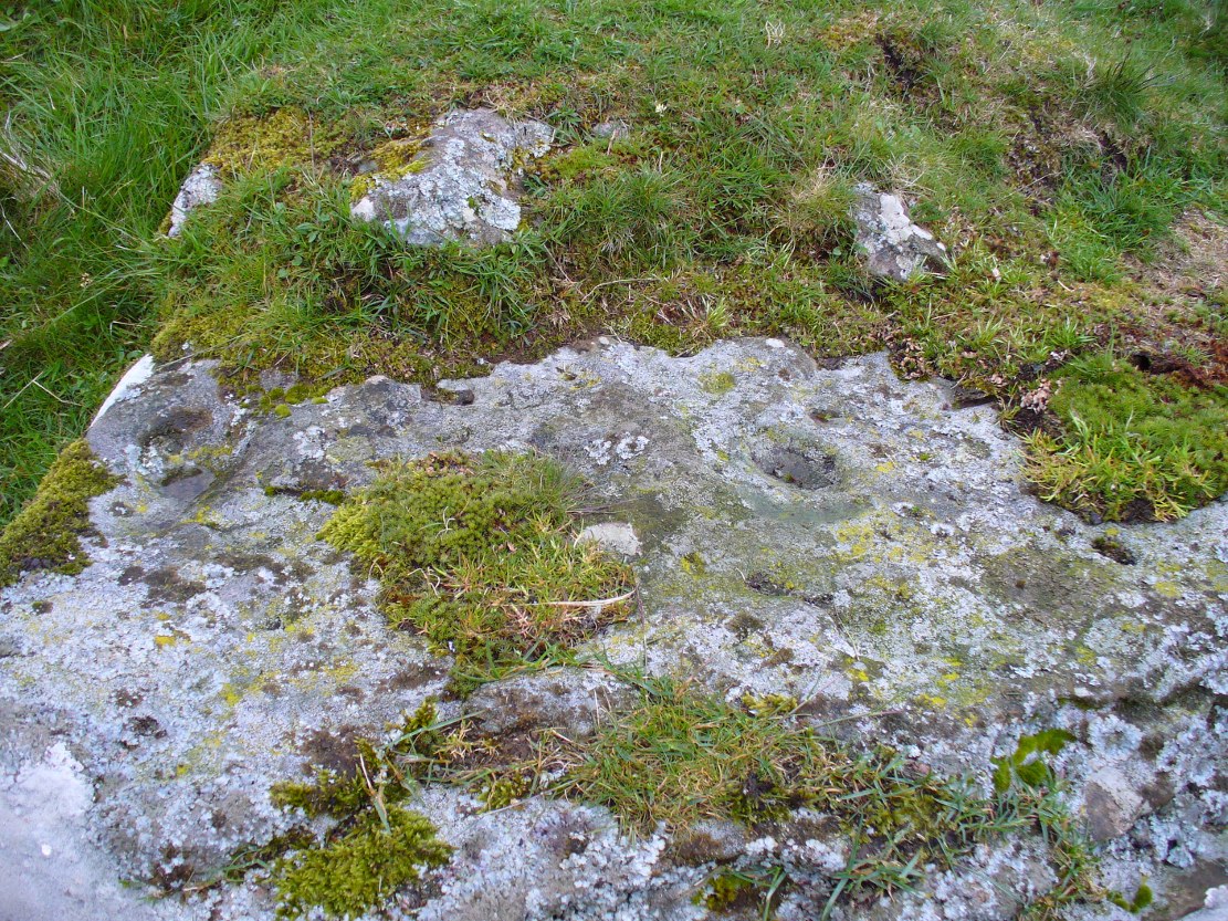
Nature’s faded cup&ring

The main prehistoric section of the tomb that can be seen are the two opened cists, or stone-lined graves, to the top north-western edges of the mound.  They align together, NE to SW, with a gap of about three yards between the two open tombs.  The more northerly of the two is much more overgrown; whilst the southwestern grave comprises of three large flat upright stones, forming a traditional ‘box’ with smaller flat stones lining the floor.  But these two separate tombs (if indeed they were originally separated) point directly to the large, very prominent “fairy mound” about 100 yards north-east, on the north side of the Drumloist Burn.  The alignment seems very deliberate.

Walking over the boggy ground to the (unnamed) fairy mound, a natural ‘platform’ of rocks sticks out on its south-easterly side, and upon this are what I initially thought were two cup-markings, with the more easterly one of the two seeming to have a carved arc along its edge; but subsequent visits here at different times of day has shown that they are Nature’s handiwork.  Anyhow, looking from this mound, back across to the Ballachraggan tomb, the open flat landscape heading south-west is held where the sunset falls.  Sadly on the day we visited, Nature greeted us with grey cloud and the drizzle of light rain all afternoon, so we couldn’t make out if there was something, far away, which the tomb was truly aligned with…  A damn good site though!

© Paul Bennett, The Northern Antiquarian

Four Stanes, Glendevon, Perthshire

Stone Circle (destroyed?):  OS Grid Reference – NN 95294 05196

Getting Here

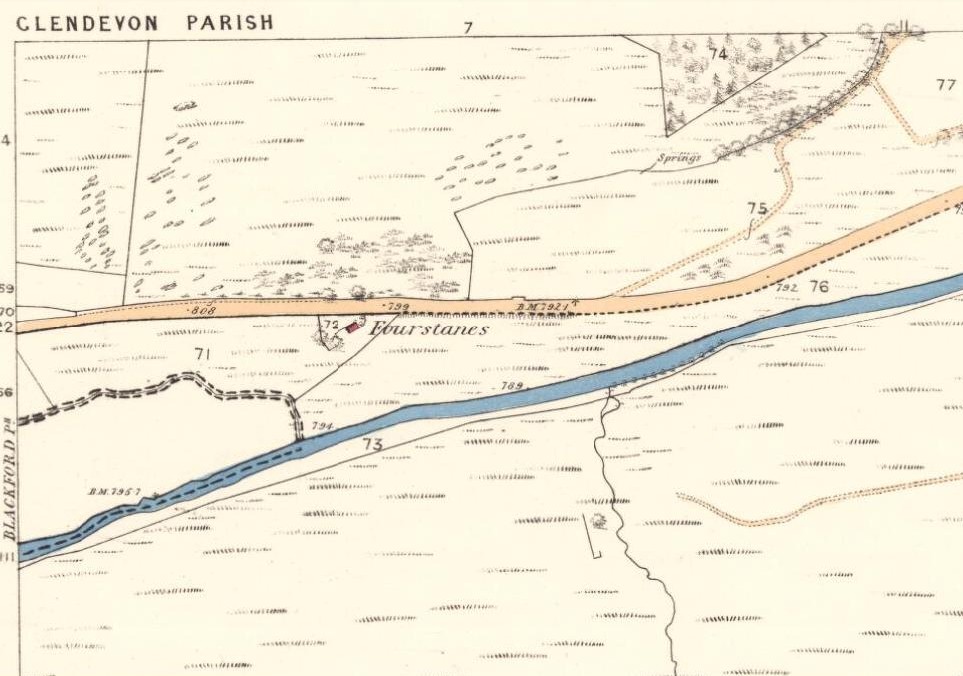
1860 OS-map of site location

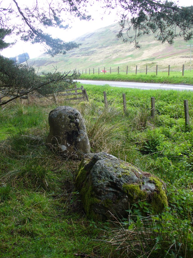
Take the A823 road up from Gleneagles to Glendevon and at the top of the long hill, where the road starts to level out and slightly drop, where the two glens meet up, take the right turn (west) and park up by the cattle-grid.  Walk back onto the A823 and walk about 200 yards south towards Glendevon, to the small copse of trees past the cottage.  As you get to the trees, look by the fencing and you’ll see one archetypal rounded standing stone, with another one next to it. You’re here!

Archaeology & History

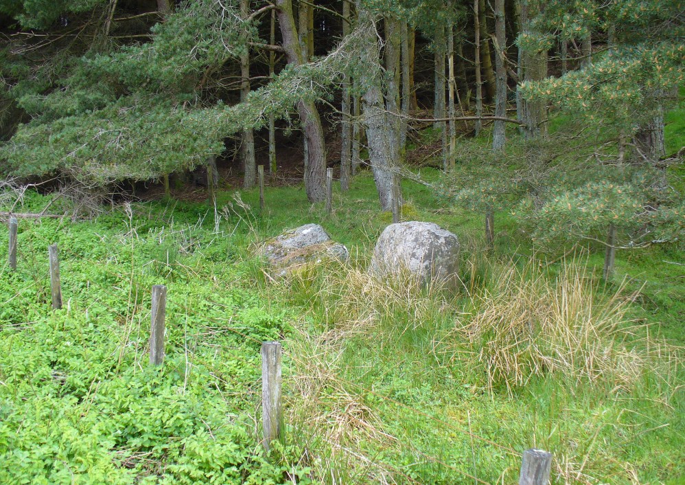
Remains of stones at Fourstanes
Stones by the roadside at Fourstanes

At long last my huge nose is twitching back to its authentic sniffing-out lost sites in the landscape.  During a visit to the St. Mungo’s Well a few days ago, on the way back to the car I kept saying to my fellow antiquarian Paul Hornby that “there’s something missing round here.”

“Wotcha mean?” he said.

“Summat missing Paul. It feels there should be a four-poster or summat like that here — where the two glens meet up.  I can smell it.  Summat should be here, or was here in the past.”

I said it several times as we walked back along the old track to the car.  We took the photos and he set off to give me a grateful lift back home.  But as we got back onto the road, we noticed a couple of upright stones just set back at the edge of a small copse of trees.  One was very rounded and about four-feet tall, with a smaller companion next to it.  But we didn’t stop to check them out as it was getting late.

A few days later Paul rang me to ask if I’d had a look at the old maps of the region where we’d visited and seen the old place-name where we’d been.

“No, why?”

“It’s known as the ‘Four Stanes’,” he said. “And right where those stones were standing by the trees!”

A few happy expletives came out, as usual for me.  So I sought out the map he was talking about and, as we can see above, the “Fourstanes” (or Stones) are right where my ‘feelings’ and the stones were seen.

Fourstanes02Fourstanes04On the 1860 Ordnance Survey map of the area, a small building is shown and named as ‘Fourstanes’ right by the roadside, on the south side.  It was also named as such in an earlier account of 1851 and was told to be inhabited by a Mrs Foote in 1866. Sometime after this the cottage appears to have been left to neglect and no trace of it now remains.  According to evidences of the place-name societies in England and Scotland and the studies of Smith (1956), Scott (2004) and others, unless the term derives from the Gaelic fuar, meaning cold or chilly, it is usually evidence of ‘four stones’ in relation to megalithic remains like those found from Shetland to the more southerly counties in England. Dr Aubrey Burl (1988) shows clearly in his textbook of the same name, that “four poster stone circles” are common megalithic architectural features in the Perthshire landscape — where this happens to be!  He also states that such place-names should be listed and checked as possible “sites of destroyed four posters.” So we did just that!

Although the stones look very good contenders in the photos and also when you first see them close up, there are some elements here that need highlighting that throw a more sceptical view of them as authentic megaliths.  The larger of the two stones—very rounded and worn, typical of other four-poster remains—is three feet high.  The lichen vegetation covering it on all sides is old—except on its back (northern) upright face, where there is almost no vegetation at all.  Indeed, this face is almost entirely clear of any natural plant growth, showing it was moved into this position from a lower horizontal level and pushed upright, I would say within the last century.  The smaller, lower stone next to this upright oddity, is laid down and covered on all sides by an excess of vegetation expected of a monolith that has been in this position for several centuries at least. The lichen growth on this stone is very old.

Both of these stones occur along the line of an old wall and may have originally been a part of such a structure, instead of any four poster megalithic feature.  However, the road that runs past here replaced the earlier track (which you can still walk along on the other side of the river 100 yards away) running through Glen Devon and into Glen Eagles.  This “new road” as it was then, was made sometime in the 19th century. It may be that, upon the construction of the new road, the ‘fourstanes’ themselves were “in the way of Progress” (as they like to say) and so were rolled down the side of the new road and into the position they now occupy.  It’s difficult to say.

There is one additional element that needs exploring. The hill immediately above Fourstanes is called ‘The Law.’  Although this word can be a simple “hill”, there are additional historical factors to a place-name.  In Laurence Gomme’s (1880: 260-77) excellent work on the subject, he illustrates time and again across Scotland that heathen gatherings, tribal meetings and early court sessions or ‘moots’ were held at places with this place-name element.  It should come as no surprise then, that at other megalithic sites in Britain called the Four Stones, ancient pagan moot were also held there. (Gomme 1880; Grinsell 1936, 1976)

We’re going back onto The Law itself in the next week or two, just to see if these ‘fourstanes’ are hiding away in the heather on the tops, where oh so many megalithic rings tend to be found….

…to be continued…

References:

  1. Burl, Aubrey, Four Posters: Bronze Age Stone Circles of Western Europe, BAR 195: Oxford 1988.
  2. Dwelly, Edward, The Illustrated Gaelic-English Dictionary, Gairm: Glasgow 1973.
  3. Gomme, Laurence, Primitive Folk Moots, Sampson Low: London 1880.
  4. Grinsell, Leslie V., The Ancient Burial Mounds of England, Methuen: London 1936.
  5. Grinsell, Leslie V., Folklore of Prehistoric Sites in Britain, David & Charles: London 1976.
  6. Scott, Margaret Rachel, The Germanic Toponymicon of Southern Scotland: Place-Name Elements, Glasgow University Press 2004.
  7. Smith, A.H., English Place-Name Elements – 2 volumes, Cambridge University Press 1956.
  8. Watson, Alexander, The Ochils – Placenames, History, Tradition, Perth & Kinross District Libraries 1995.

AcknowledgementsHuge thanks to Paul Hornby for considerable help in checking out the maps and helping in the rediscovery of this site.

© Paul Bennett, The Northern Antiquarian


Druidsfield (03), Lochearnhead, Perthshire

Cup-Marked Stone:  OS Grid Reference – NN 58760 23087

The Druidsfield-3 carved stone

Also Known as:

  1. Canmore ID 24126

Getting Here

Follow the same directions described to reach the Druidsfield 1 and 2 carvings.  This one is the larger upright block right next to them!

Archaeology & History

Several of the faint cups visible

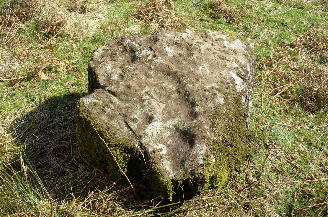
Contextually relevant to the two adjacent carvings, this is the largest of the three stones and comprises of a number of natural deep marks associated with between eight or ten man-made cup-markings.  They’re not all immediately apparent, but stand out more as and when natural lighting conditions change.  All of them are on the north and northwestern section of the stone, and measure between 1-3 inches across.  This is the least visually impressive of the stones in this petroglyph cluster.

Folklore

The carvings here were said by one of the locals to have been part of a “druid’s circle, which we played in as children, and were always told had been a special place of the druids in ancient times.”

References:

  1.  Coles, F.R., “Report on stone circles in Perthshire principally Strathearn,” in Proceedings of the Society of Antiquaries, Scotland, volume 45, 1911.
  2. Haggart, D., “Notice of the discovery of a stone cup and cup-marked stones at Lochearnhead,” in Proceedings of the Society of Antiquaries, Scotland, volume 22, 1888.

Acknowledgements – Huge thanks to Paul Hornby for help and use of his photos.

© Paul Bennett, The Northern Antiquarian 

St. Mungo’s Well, Gleneagles, Perthshire

Holy Well:  OS Grid Reference – NN 9376 0719

Also Known as:

  1. Canmore ID 25905

Getting Here

St Mungo's Well, Gleneagles
St Mungo’s Well, Gleneagles

The best way here is to walk a mile to find it.  All the way up the road from Gleneagles Standing Stones to Glendevon, right at the very top where the two glens meet, there’s a small road heading to the Fishery. 100 yards along, park up. Then take the old green road back down the Glen, north towards Gleneagles, parallel with the new road. A mile or so down you’ll reach the farmhouse, but a coupla hundred yards before this, in a wooden gap in the electric fence, you can walk straight downhill to the large pool below you. Y’ can’t really miss it!

Archaeology & History

The strong cold spring of water known as St Mungo’s Well, now gathers into a large crystal clear pool and is gorgeous to drink and very refreshing!  All around the edges are the brilliant yellow masses of gorse, held amidst widespread vivid hues of green in this most rocky of landscapes.  Tis a gorgeous setting here….

St Mungo's Well, 1860 map
St Mungo’s Well, 1860 map

Unfortunately there is no literary information that tells us why this spring of water, amongst the many others all around these hills, gained the ‘blessing’ of one of those roaming christians and was deemed to be ‘holy’.  The greatest likelihood, as usual, is that the waters had some important heathen association which our peasant ancestors would have been able to tell us about if their animistic tales hadn’t been outlawed and demonized by the incoming cult — but we’ll probably never know for sure.  As a result, we know nothing now of its medicinal qualities or old stories.

The transference of its old name (whatever it may have been) to their ‘St. Mungo’ may date from when the character was wandering with his christians in the 7th century, but we have no literary account proving as such.  The name ‘St Mungo’ was an alternative name (a nickname if y’ like) of St. Kentigern — or at least that’s what the church historians tell us.  There is no history of Kentigern or St Mungo up the glen, but we do have a more prosaic account that tells of a Mr Mungo Haldane of Gleneagles, a member of the Scottish parliament in 1673 onwards; he was succeeded by another Mungo Haldane MP in 1755.  However, it’s highly unlikely that these political characters gave their name to the well.

The clear waters, looking south
Crystal clear perfect drinking water

Even the Scottish holy wells surveys are pretty silent on this beautiful site.  It was mentioned in Morris’ (1981) survey, but with no real information.  The earliest account seems to come from an article written in the Perthshire Advertiser in 1856, and thankfully reproduced in the otherwise tedious genealogical history of the Haldane (1880) family; but even here, the narrative simply mentions the presence of the well and no more.  Described in a walk up Gleneagles, it told:

“Journeying westward along the desolate moor…we soon came in front of Gleneagles, a narrow picturesque glen in the Ochils, through which the old road from Crieff leads into Kinross-shire.  The hills here, as throughout the whole range, are strictly pastoral, but in no place more so than Gleneagles.  Crowning the heights on both sides of the glen, we have craigs ragged and bare enough; but their show of beetling hard sterility is as nothing to the winding receding mass of grassy heights that bound the view. In looking on that quiet, sunny, Sabbath-like retreat, one would be apt to deem the name a misnomer, and yet it is not much above a hundred years since the monarch of birds had a home among its cliffs.  There, too, the Ruthven Water that dashes past Auchterarder has its rise — not in a scarcely seen bubbling spring almost covered with moss, but issuing at once into daylight at the bottom of yonder steep in volume sufficient to drive a mill.  In ancient times, as now, it must have been an object of mark, as it is called St. Mungo’s Well; but who this St. Mungo or St. Magnus was — whether the ghostly patron of Glasgow, Auchterarder old chapel, or the guardian saint of this particular spot, we cannot tell.  But he seems to have relished cold water; and it is satisfactory to know that he must have got his fill of it there, if his cell happened to be in the vicinity.”

The well was mentioned in passing in the Object Name Book in 1860 and shown on the earliest Ordnance Survey maps.

Folklore

Apart from the fact that the waters here never run dry, we have no other folklore. However it should be noted that St. Mungo’s Day was January 14th — which may have been when the qualities of the spring were deemed most efficacious, or when olde rites were enacted here.  However, a hundred yards down we pass the stream known as Bride’s Burn, probably in honour of the heathen Queen St. Brigit, whose name and myths are integral to our great Earth goddess, the Cailleach and whose celebration date is only two weeks later than that of Mungo.  Hmmmmmmm…..

References:

  1. Attwater, Donald, Penguin Dictionary of Saints, Penguin: Harmondsworth 1965.
  2. Haldane, Alexander, Memoranda Relating to the Family of Haldane of Gleneagles, C.A. MacKintosh: London 1880.
  3. MacKinlay, James M., Folklore of Scottish Lochs and Springs, William Hodge: Glasgow 1893.
  4. Morris, Ruth & Frank, Scottish Healing Wells, Alethea: Sandy 1982.
  5. Watson, Alexander, The Ochils – Placenames, History, Tradition, Perth & Kinross District Libraries 1995.

© Paul Bennett, The Northern Antiquarian

Druidsfield (02), Lochearnhead, Perthshire

Cup-Marked Stone:  OS Grid Reference – NN 58759 23087

Also Known as:

  1. The Druidsfield 2 cup-marked stone
    The Druidsfield 2 stone

    Canmore ID 24126

Getting Here

Follow the same directions as if you’re going to the much overgrown, earthfast Druidsfield 01 carving. Adjacent is an upstanding block of large rock, right next to which is the flat surface of this Druidsfield 2 carving. If it’s overgrown, rummage around. You can’t miss it!

Archaeology & History

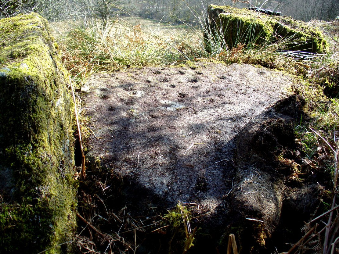
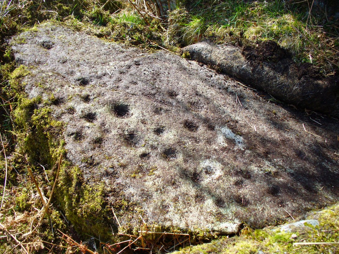
This carving and its compatriots have almost been forgotten about it seems.  Buried beneath rolls of vegetation, this long flat rock covered in cup-markings seems to have played a part in some larger megalithic structure—but whatever it was is difficult to work out.  As you walk around the place it gives the distinct impression that some form of tomb was once in evidence, which may have been the case.  The Scottish archaeology giant Audrey Henshall is said to have found no evidence of a chambered tomb, but this may have been something smaller, less impressive.

When Mr Haggart (1888) wrote about this carving, he too thought that the carvings had been part of a tomb—this being the horizontal surface at the bottom.  He wrote that,

“the one forming the floor area of the dolmen being a square-shaped boulder of diorite, having fifty cups, varying from three and a half inches to an inch in diameter, the outlines of which look as fresh as if chiselled a year or two ago.”

The main cluster of cups

This indicates it had only recently been uncovered.  There are lots of other archaeological remains scattered all round here, from different periods of history; but the other Druidsfield 1 and 3 carvings are found right next to each other, indicating this very spot was some site of neolithic or Bronze Age importance.  An accurate excavation of the site and the adjacent Druids Circle would be worthwhile.  I counted at least 44 cups on this rock when we visited last week, many of which are still quite clear.

The most recent Royal Commission (1979) briefing of the stone added nothing of relevance. They listed the site but it seems they never visited the place.

The portable bullaun-like deep-cut rock known as the Druid’s Stone is kept in private grounds nearby.  When members of Scottish heritage came to visit an adjacent site a few years ago, the lady of the house told how they walked right past it without giving it any notice. “They didn’t even see it under their noses,” she said.  Nowt new there!

Folklore

The carvings here were said by one of the locals to have been part of a “druid’s circle, which we played in as children, and were always told had been a special place of the druids in ancient times.”

References:

  1.  Coles, F.R., “Report on stone circles in Perthshire principally Strathearn,” in Proceedings of the Society of Antiquaries, Scotland, volume 45, 1911.
  2. Haggart, D., “Notice of the discovery of a stone cup and cup-marked stones at Lochearnhead,” in Proceedings of the Society of Antiquaries, Scotland, volume 22, 1888.
  3. Royal Commission on the Ancient & Historical Monuments of Scotland, Archaeological Sites and Monuments of Stirling District, Central Region, Society of Antiquaries of Scotland 1979.

Acknowledgements – Huge thanks to Messr Paul Hornby for help and use of his photos.

© Paul Bennett, The Northern Antiquarian

Druidsfield (01), Lochearnhead, Perthshire

Cup-Marked Stone:  OS Grid Reference – NN 58761 23087

Also Known as:

  1. Canmore ID 24126

Getting Here

Druidsfield Cup-Marked Stone

From Lochearnhead village going south along the main A84 road to Callander or Stirling, take the very last road on the right just as you’re going out of the village, up o Craggan and park up by St. Angus’ Church. Walk back down onto the A84, turning right and walk along for 100 yards. Then go back up into a boggy field, where you’ll notice some walling above you. Head to the top right of this, up to the edge of a garden. Hereby is a cluster of rocks in a jumble. That’s your spot!

Archaeology & History

Cup-marks along the edge and bottom of the stone

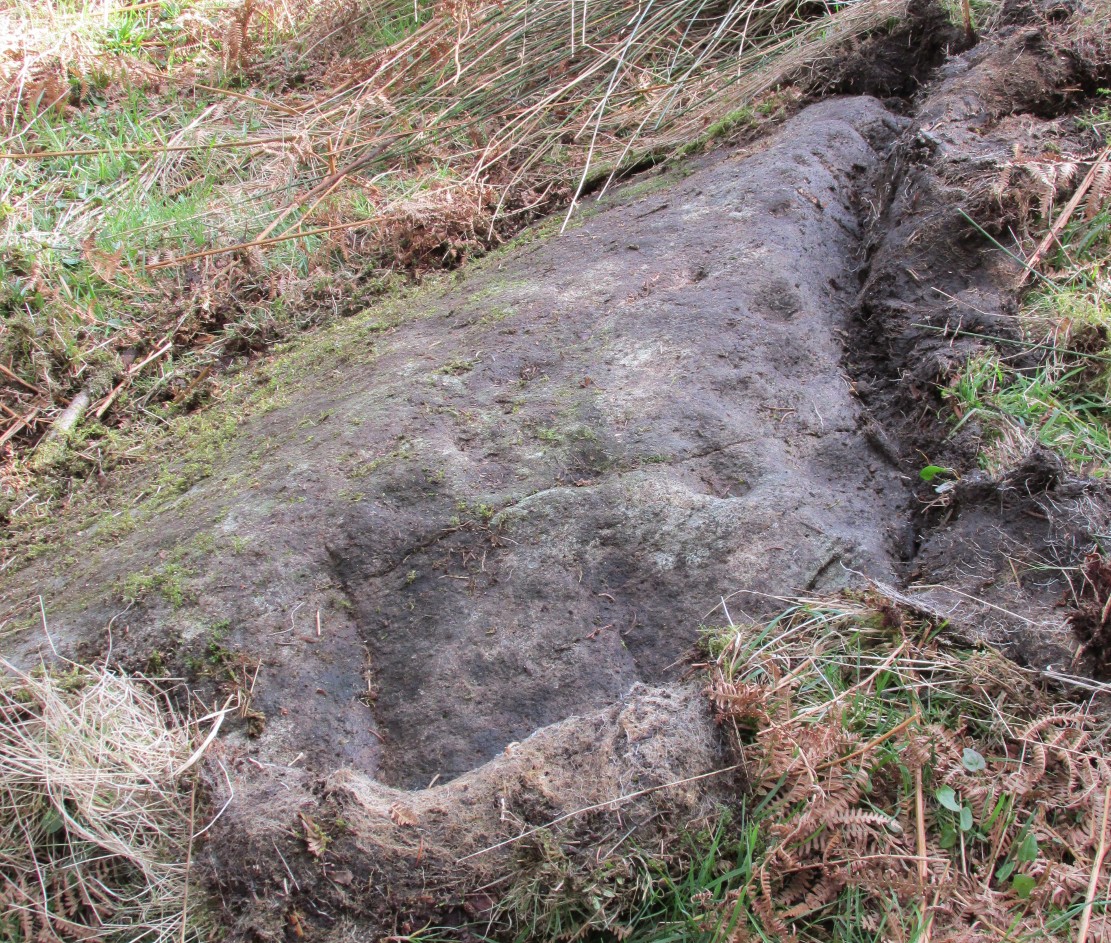
This takes a bit of finding in the undergrowth and is best checked out at the end of Winter.  Once overgrown it truly takes some finding.  But beneath the vegetation is a slender earthfast rock with a long ridge, a little bit like a spine, running from one end of the stone to the other.  Along this topmost spinal column we find a cluster of ten cup-markings, getting smaller in size the further along the spine we travel.  It’s a curious feature.  At the widest end of the rock where the widest and deepest cup-marks occur, another four cups have been etched into the northeastern sloping face below the largest cups.

When we came here, the sunlight was blocked by the surrounding trees, so we were unable to see if other elements had been carved onto the stone.  It is found in conjunction with two other rocks—Druidsfield 2 and 3 carvings—right next to each other, with designs of quite different visual structures, seemingly unconnected in any linear sense.  There also seemed to be a possibility that this was once part of a prehistoric tomb.  Later we found that both D. Haggart (1888) and Fred Coles (1911) had made similar comments, with Haggart specifically telling there to have been a collapsed tomb here in the 19th century.  He may have been right.  Extensive walled structures abound hereby−including one which old locals told us were remains of a Druid’s Circle, which we found close by.

Folklore

The carvings here were said by one of the locals to have been part of a “druid’s circle, which we played in as children, and were always told had been a special place of the druids in ancient times.”

References:

  1.  Coles, F.R., “Report on stone circles in Perthshire principally Strathearn,” in Proceedings of the Society of Antiquaries, Scotland, volume 45, 1911.
  2. Haggart, D., “Notice of the discovery of a stone cup and cup-marked stones at Lochearnhead,” in Proceedings of the Society of Antiquaries, Scotland, volume 22, 1888.

Acknowledgements – Huge thanks to Messr Paul Hornby for help and use of his photos.

© Paul Bennett, The Northern Antiquarian

Dalchirla (east), Muthill, Perthshire

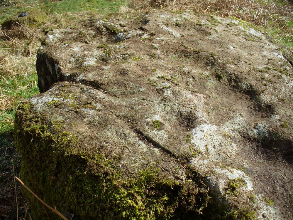
Standing Stones:  OS Grid Reference NN 82446 15893

Also Known as:

  1. Canmore ID 25355

Getting Here

Dalchira's standing stones
Dalchira’s standing stones

Along the A822 road between Crieff and Muthill, take the small western country lane just as you’re coming out of Muthill. Nearly 2 miles on, take the turn to the right, and then 100 yards or so from there turn sharp left. Keep along this country lane for about a mile till you reach the third track on your left.  Walk down the track and you’ll see the standing stones in the field on your left. A gate into the field is by the house.

Archaeology & History

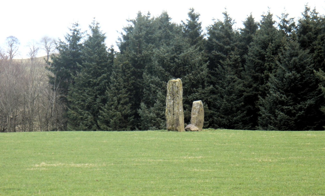
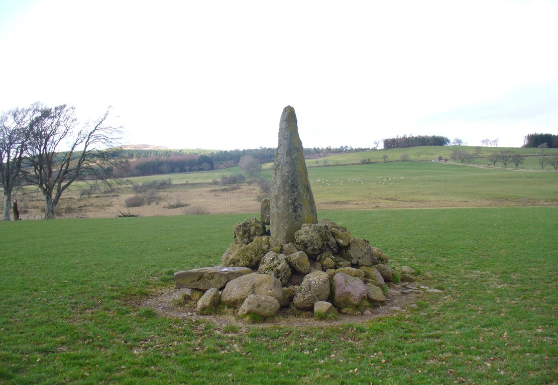
A fascinating pair of relatively large standing stones 317 yards (289.5m) SSE of the tall singular monolith of Dalchira North in the adjacent field.  Traditionally said to have once been part of s stone circle, it was marked as such when the Ordnance Survey lads came here in 1863, but there is very little evidence of such a megalithic ring today—and even the small stone lying in between the two uprights is probably a more recent addition to the site.  It certainly wasn’t mentioned by Fred Coles (1911) when he came here, who gave only a brief description of the place.

Dalchira East & the skyline notch of Lurgan Hill
Dalchira, looking east

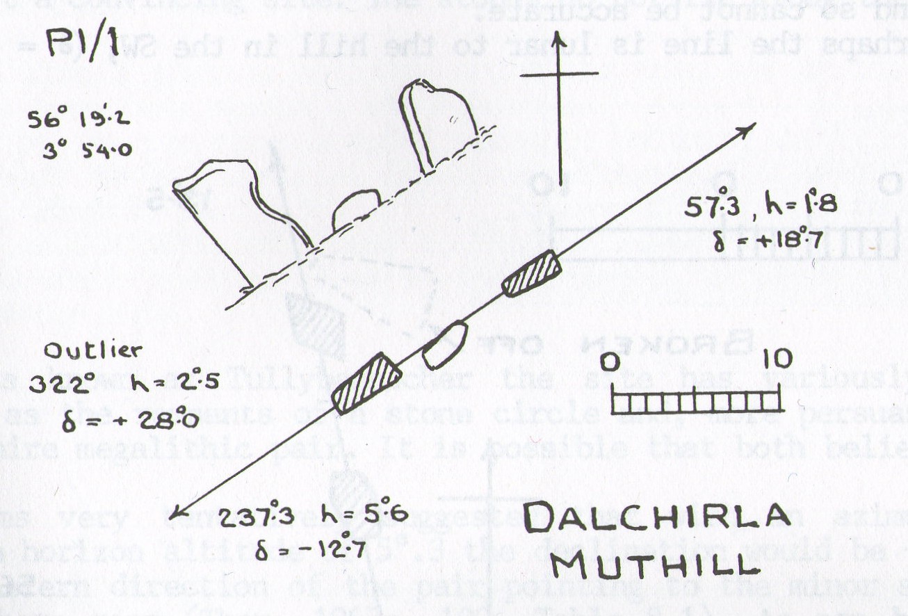
The stones were included in Margaret Stewart’s (1968) list of megalithic pairings as measuring 7ft 6in x 4ft 3in x 2ft and 4ft 3in x 3ft 6in x 1ft respectively, and 8ft apart.  There is a small stone laid down in between them which has cup-marks on it, but these indentations are natural nodules in conglomerate rock.  But the measurements and angles of Dalchira East were examined by the late great Alexander Thom (1967; 1990) who thought they had been positioned specifically to observe and predict lunar movements across the sky, saying that the alignment of these stones “shows the declination of the Moon rising at the minor standstill.”  He may have been right.

Thom's geometry of Dalchirla
Thom’s geometry of Dalchirla

In Aubrey Burl’s notes to Thom (1990) he told that the size and shapes of these stones, “have been interpreted as anthropomorphic, the taller, or alternatively the more pointed , usually at the west, being the male, the lower or flat-topped he female.” He subsequently included this site in his own work on megalithic stone rows (Burl 1993), without further comment.

Tis a peculiar site inasmuch there doesn’t seem to be much ‘feeling’ to the place.  I’m sure the site is gonna have its days, but more than likely the neat and tidy farmed theatre has subsumed the genius loci to all but the most auspicious of times—most likely generated when the pull of the Moon still tugs at any geomagnetic background memory… Still, it’s definitely worth looking at.

References:

  1. Burl, Aubrey, From Carnac to Callanish, Yale University Press 1993.
  2. Coles, Fred, “Report on Stone Circles Surveyed in Perthshire, Principally Strathearn” in Proceedings of the Society of Antiquaries, Scotland, volume 45, 1911.
  3. Finlayson, Andrew, The Stones of Strathearn, One Tree Island: Comrie 2010.
  4. Heggie, Douglas C., Megalithic Science: Ancient Mathematics and Astronomy in Northwest Europe, Thames & Hudson: London 1981.
  5. Stewart, Margaret E.C., “Excavation of a Setting of Standing Stones at Lundin Farm near Aberfedly, Perthshire,” in Proceedings of the Society of Antiquaries, Scotland, volume 98, 1966.
  6. Thom, Alexander, Megalithic Sites in Britain, Oxford University Press 1967.
  7. Thom, A., Thom, A.S. & Burl, Aubrey, Stone Rows and Standing Stones – 2 volumes, BAR: Oxford 1990.

© Paul Bennett, The Northern Antiquarian


Dalchirla (north), Muthill, Perthshire

Standing Stone:  OS Grid Reference – NN 82274 16125

Also Known as:

  1. Canmore ID 25356

Getting Here

The big fella in the field

Along the A822 road between Crieff and Muthill, take the small western country lane just as you’re coming out of Muthill. Nearly 2 miles on, take the turn to the right, and then 100 yards or so from there turn sharp left. Keep along this gorgeous country lane for about a mile till you reach the third track on your left and park up.  Walk down the track and you’ll see the standingh stone in the field on your right. Go all the way to the bottom where the farm is and go through the gate into the field.

Archaeology & History

The slim end of the wedge

Less than 2 miles southeast of the megalithic titan of  Dunruchan A, we find a slightly smaller monolith positioned on lower ground and humbled by a more manicured landscape close to the farmhouse.  But it’s still a big fella, albeit hemmed in by a mass of field clearance rocks piled up and around the base (two of which have odd carvings on them).  The stone is about ten-feet tell, being very slim on its north-south side and much wider on its east-west face.  For some reason I got the impression that the stone wasn’t standing in its original position; though in searching through my megalith library for further information on the site, l found that very little has been written about it.  The earliest literary evidence comes, as usual, from Fred Coles (1911), who simply told us:

“In a field south of Machany Water and NE of Dalchirla farm-steading 260 yards, there stands this tall and striking monolith… In essential features this stone much resembles most of the great schistose blocks which characterize the main portion of the Strathearn area; but it tapers upwards to a very thin and narrow summit that rather distinguishes it from its fellows. It stands 9 feet 4 inches above ground, and girths at the base 7 feet 11 inches.  It is set with its longer axis due north and south. Around its base there are several large masses of stone—not earthfast—amid a conglomeration of smaller pieces evidently cleared off the field.”

Fred Coles' 1911 drawing
Fred Coles’ 1911 drawing

The prehistoric cairn of Torlum to the north may have had some significance to the setting of the stone, but without excavation and details of its original site, we’re just grasping at straws when it comes to evaluating any potential geomancy or landscape relationships—with the megalithic stone row in the next field perhaps being an exception!

The moorlands above here, stretching for many a mile, is apparently lacking in any prehistoric remains if you listen to the official records. But with the Dunruchan megalithic complex only two miles away and the once-giant tomb of Cairnwochel over the southeastern horizon, we know that cannot be possible… Watch this space!

References:

  1. Coles, Fred, “Report on Stone Circles Surveyed in Perthshire, Principally Strathearn” in Proceedings of the Society of Antiquaries, Scotland, volume 45, 1911.
  2. Finlayson, Andrew, The Stones of Strathearn, One Tree Island: Comrie 2010.

© Paul Bennett, The Northern Antiquarian


Strowan, Crieff, Perthshire

Tumulus:  OS Grid Reference – NN 81998 20832

Also Known as:

  1. Canmore ID 25510

Getting Here

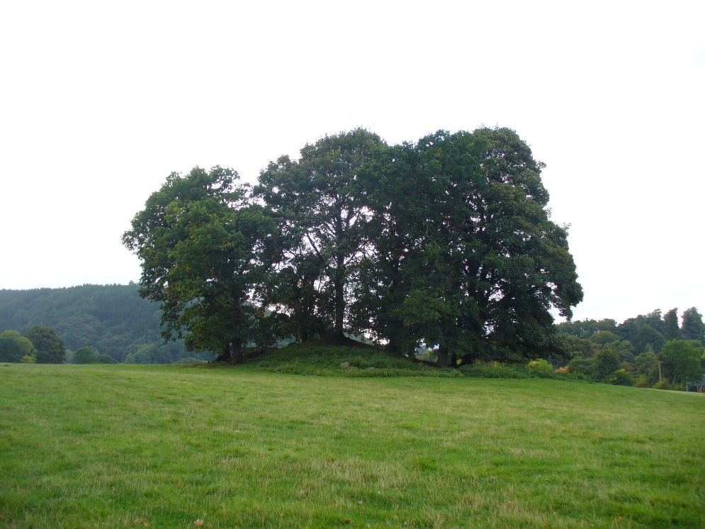
The faerie mound of Strowan

If you’re coming southwest out of Crieff on the A822, as you cross the river take the right-turn just before leaving the town along the country lane onto Strowan and Dalginross.  Nearly 2½ miles along there’s the small junction on your right to Strowan House and church. Just past this turning, the next field on by the roadside, has a large rounded tree-covered mound living quietly. That’s the fella!

Archaeology & Folklore

Found halfway between Crieff and Comrie in the field on the north-side of the road, this large oak-covered tumulus was, seemingly, first described in notes made by the old archaeologist O.G.S. Crawford following a quick visit he made here in 1936.  The place has, since then, never been excavated to find out exactly what might be hiding therein!  It’s quite a big fella too: about 10 feet high and 40 yards across (east-west)—similar in size and design to the prehistoric burial mounds at Tulloch and Kinpurnie.  Some large rocks make up the sides and edges of the mound, with smaller ones scattered here and there, giving the distinct impression of a very overgrown cairn of sorts.

Tis a quiet and tranquil arena, amidst fervent colours of meadows and old trees. Another 2 miles further down the same road is the equally tranquil (though ruined) megalithic ring of Dunmoid

© Paul Bennett, The Northern Antiquarian

St. David’s Well, Weem, Aberfeldy, Perthshire

Holy Well:  OS Grid Reference – NN 8445 5002

Also Known as:

  1. Canmore ID 25672
  2. Chapel Rock Spring
  3. Fuaran Creig a’ Chaibeul
  4. St. Cuthbert’s Well

Getting Here

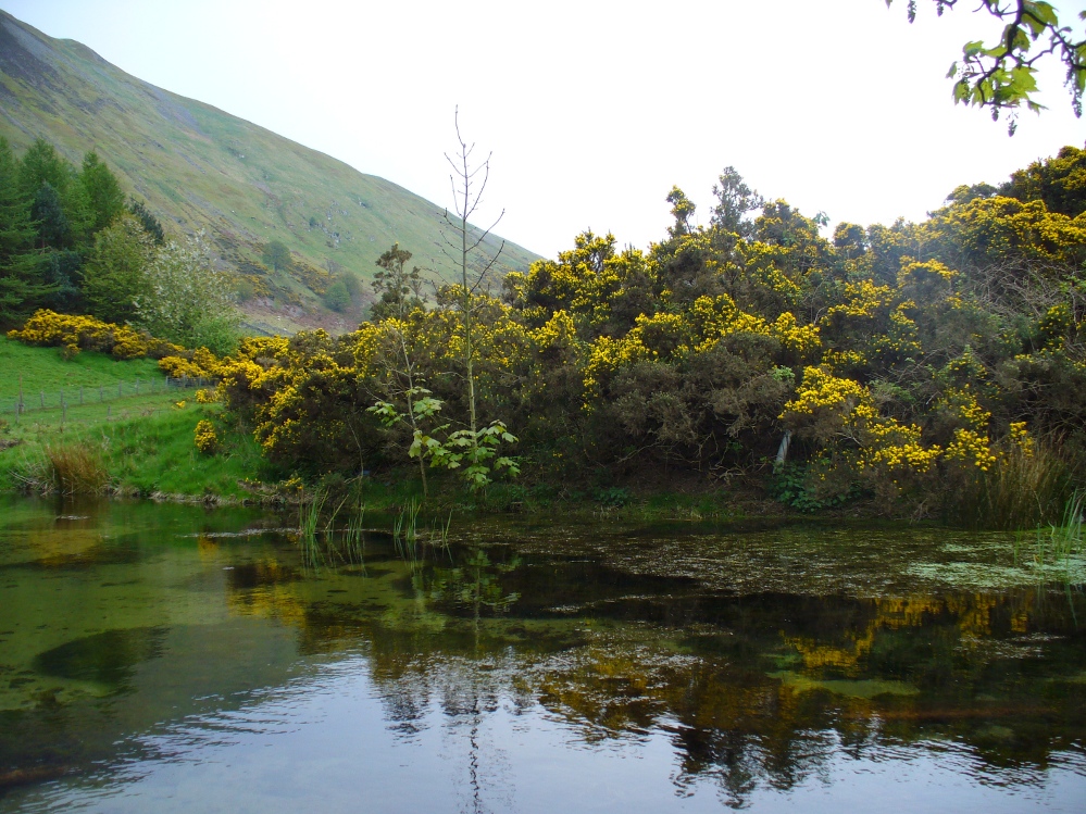
In the dark, dark wood... hides St. David's Well
In the dark, dark wood… hides St. David’s Well

The best way to find this site, in the middle of the large woods up the slopes, is to follow the circular mile-long tourist path that runs through it. Take the B846 road out of Aberfeldy over the bridge towards Dull and Weem.  As you go through Weem, watch closely for the signpost directing you into the trees of Weem Rock and Woods on the right. Follow this tiny road up until you reach the parking circle in the edge of the trees.  Follow the directed footpath up into the woods & keep to the winding track, up, zigzagging, and up again, until it levels out a bit and runs below the large long crags. Tis beneath here you need to be!

Archaeology & History

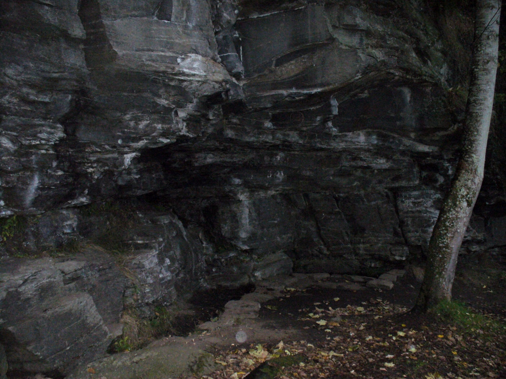
The pool of St David's Well
The pool of St David’s Well

Not far from the curious Weem Wood carvings, hidden beneath one section of the long high crags in remains of the ancient forest, is this trickle of fresh water which collects into a small stone-lined pool. (a small round plaque which reads ‘St. David’s Well’ on the cliff-face above the waters is helpful) It’s in a truly lovely setting, with a small ‘cave’ about 50 yards west along the same footpath and a modern carved ‘cross’ in front of it.

The well was formerly known as St. Cuthbert’s Well (date: 20 March) who, so legend tells, lived nearby—probably at the christian-druid college at Dull, a mile west of here. It was he who collected the waters from the rock face into the small pool we see today.  This used to be known as St. Cuthbert’s Bath.  But several centuries after the saint’s death, the local laird, Sir David Menzies, came and restored the well and gained a reputation for spending much time living hereby, sometimes in the small cave along the edge of the cliffs.  It was to him that the New Statistical Account wrongly dedicated the waters to in the 19th century—but the title has stuck!

Described in several old local history works, the site was included in the giant folklore tome on Scottish waters by MacKinlay (1893), who wrote the following:

“In the wood clothing the steep hill of Weem, in Perthshire, is St. David’s Well, said to be named after a former laird who turned hermit.  The spring has a considerable local fame, and many have been the wishes silently breathed over its water.  Part of an ancient stone cross lies at its margin, and on it the visitor kneels while framing his or her wish.”

Nothing of this ‘cross’ can now be seen, but it is said that its remnants are housed at Weem church in the village below.  Also in the 19th century, occasional christian gatherings were held here and as many as fifty people came “for religious services.” Thomas Hunter (1886) reported that “a collection of human bones” were found near the well in front of the crags. There is also what looks like a newly cut large cup-marking with two carved lines reaching out from it, heading towards the well, on a small ledge of stone close to the pool.

Folklore

Folklore tells that once, long ago, dragons lived in these old woods—overcome no doubt by the incoming christians who stole and denigrated the olde peasant ways of our ancestors.  In bygone times, locals used the waters here for their health-giving properties.  As Ruth and Frank Morris (1982) told,

“it was an ancient wishing well which was still visited in 1954, when such objects as pins and buttons and an occasional penny was thrown in.”

References:

  1. Ferguson, Malcolm, Rambles in Breadalbane, Thomas Murray: Glasgow 1891.
  2. Hunter, Thomas, Illustrated Guide to Perthshire, Robertson & Hunter: Perth 1886.
  3. MacKinlay, James M., Folklore of Scottish Lochs and Springs, William Hodge: Glasgow 1893.
  4. Morris, Ruth & Frank, Scottish Healing Wells, Alethea: Sandy 1982.

© Paul Bennett, The Northern Antiquarian