Follow the same directions to reach the Little Skirtful of Stones giant cairn. From here, walk 200 yards straight north until you hit the footpath at the top of the Woofa Bank crags. Walk left along the footpath and where it begins to slope downhill, note the large boulder right by the path and another 30 yards further on. Between these large rocks, turn left into the heather some 20 yards. You’re damn close!
Archaeology & History
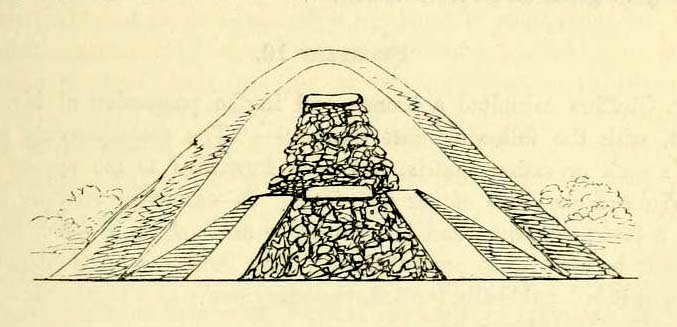
Close-up of covered tomb
Rediscovered on March 17, 2012, this small untouched prehistoric stone cairn, measuring 3½ yards by 2½ yards across and about 1 yard tall, was found thanks to the moorland heather being burnt, which has stripped the covering vegetation from the monument. It rests just a couple of yards away from a small, almost dried-up stream, seemingly in isolation. There are scattered remains of medieval workings nearby, between here and the Little Skirtful—some of which have intruded upon and destroyed earlier sites—but this particular cairn has a prehistoric pedigree. An excavation here would be worthwhile sometime in the future; but the problem is, there’s so much neolithic and Bronze Age material all over this area, it’s hard to know where to start!
From Burley train station walk up the road, turning right as you meet the moorland road. Go on for a couple of hundred yards until you run parallel with the Coldstone Beck stream. Walk up here for about 800 yards until the full moorland begins to open up ahead of you. Walk up the slope on your right (west) about 30 yards above the first of the ruined grouse-butts, towards the scattered mass of rocks before the small crags. The small standing stone on the edge of the ruins will catch your attention!
Archaeology & History
A fascinating small cairn which initially had us puzzling as to its very nature. Was it a cairn? Or was it a section of prehistoric walling? The former would seem to be the more likely, though an excavation here would obviously be helpful.
Standing stone, cairn-spoil & Coldstone valley to rearColdstone Cairn 2, looking west
Scanning the Earth hereby we found no surface remains, merely a section of disturbed ground where the small stones were placed and, obviously, removed in some number not too long ago. Stones from the cairn had obviously been robbed to construct the grouse-butts close by (something the local council officials seem to find acceptable). It would appear to be consistent in structure with many of the other cairns on this moorland, some of which are neolithic, but the majority date from the Bronze Age.* This particular cairn seems to be Bronze Age in nature.
The most defining element in the cairn is the small standing stone, less than two feet tall above ground level, within the southwestern area of the denuded tomb. No carvings could be noted on the stone, nor marks of any significance on the other smaller stones. Another cairn of similar age but in much better condition—the Coldstone Beck Cairn 01—can be seen when the heather’s burnt back, some 20 yards north.
* More than 100 singular small cairns exist around here, most of which have never been archaeologically assessed.
From Burley train station walk up the road, turning right as you meet the moorland road. Go on for a couple of hundred yards until you run parallel with the Coldstone Beck stream. Walk up here for about 800 yards until the full moorland begins to open up ahead of you. Walk up the slope on your right (west) about 40 yards above the first of the ruined grouse-butts, towards the scattered mass of rocks before the small crags. You’ll have to scout about a bit when the heather’s deep, but it’s there, hiding away!
Archaeology & History
Cairn in centre, looking east towards Otley Chevin
Like many prehistoric tombs on this moorland, this one has never before catalogued. Found about 20 yards north of Coldstone Beck Cairn 02, this larger and more complete megalithic structure, probably Bronze Age in nature, is of the traditional construction for cairns in this region: of small to medium-sized rocks that can be carried quite easily and deposited over a specified site, beneath which we’ll find either a ruined clay urn, or skeleton, or ashes.
The cairn measures just over 3½ yards in diameter east-west, and 3 yards north-south; it rises nearly a yard tall above ground level at the centre. Much of the internal construction has been compacted through centuries of soil and vegetational growth, with only the outer rocks of the structure being slightly loose. There are several other prehistoric cairns of the same size nearby, none of which have been recorded by the regional archaeologist round here.
Tumulus (destroyed): OS Grid Reference – SD 873 277
Archaeology & History
A prehistoric cairn or tumulus could once be found close to the grid-reference cited here, but all trace of it has long since been destroyed. The site was mentioned briefly in Thomas Booth’s (1899) short survey on the prehistoric tombs of the area, telling:
“I have omitted to mention in its proper place a find which took place at Holmes Chapel about the year 1826. The particulars are very meagre but, according to a local journal published some fifty years ago, called The Comet (edited by the late Abraham Stansfield), some workmen who were engaged in pulling down a barn at Thieveley discovered an ancient urn, whose contents were of a similar kind to those of other urns of this class.”
The “other urns” he mentions are those that have been found in prehistoric tombs on the north side of the same valley, including those at Cliviger Laithe, at Catlow, at Delf Hill and other sites close by. Remains of another prehistoric cairn can be found close by on top of the hill at Thieveley Pike to the south, where a beacon was built, damaging the original tomb.
A prehistoric round barrow with an ancient literary pedigree, dating back to Anglo-Saxon records according to A.D. Mills (1989), when is was described in the boundary records of 833 AD as ‘on burg‘. It was described again in local records as Buleberwe in 1270, then more like the form we recognize today as the Bulbarowe in 1545, and variants thereof many times since then.
Measuring about 18 yards across and standing four feet high, Grinsell (1959) defined the monument as a ‘Bowl Barrow’, due to the shape of the mound. A brief description of the site by the Royal Commission (1970) lads told:
“Bulbarrow (77500574), bowl, lies at about 870ft above sea-level near the summit of the chalk escarpment, here known as Bulbarrow Hill. The centre of the mound has been dug into. Diameter 54tf, height 4ft.”
Grinsell and the Royal Commission both made note of a “sharpened bone of deer”, reported by Mr Woolls (1839), but pointed out there was an uncertainty whether the bone was dug “from this or the Bull Barrow in Holt” parish.
All early forms of the burial mound’s name strongly suggest it derived to a once great bull. The reason for this cannot be known for certain, but if we follow Conrad (1959) or Eliade’s (1986) rationale, the animal here was very likely a sacred bull — akin to the more famous Bull of Minos, or Apis, or Nandi. The religious importance of sacred animals was just as widespread in the British Isles as it was elsewhere in the world (examples of bulls relating to prehistoric remains scatter the British Isles with a similar association: see the Bull Stone, Guiseley; the Creagantarbh stones and hillfort, Argyll, etc.). It would be good to know of any local folklore relating to oxen or other bovines in the Woolland area.
References:
Conrad, Jack Randolph, The Horn and the Sword: The History of the Bull as Symbol of Power and Fertililty, MacGibbon & Kee: London 1959.
Eliade, Mircea, Zalmoxis, University of Chicago Press 1986.
Grinsell, Leslie V., Dorset Barrows, Dorset Natural History & Archaeological Society 1959.
Mills, A.D., The Place-Names of Dorset – part 3, English Place-Name Society 1989.
Royal Commission on Historical Monuments (England), An Inventory of Historical Monuments in the County of Dorset – Volume 3: Central Dorset, Part 2, HMSO: London 1970.
Cup-and-Ring Stone: OS Grid Reference – SY 6800 8601
Also Known as:
Winterborne Came 18b Carving (Grinsell)
Archaeology & History
Charles Warne’s 1848 drawing of the old tumulus
On January 27, 1848, the great Dorsetshire antiquarian Charles Warne sent a letter to the British Archaeological Association about a series of three large tumuli he’d explored south of Dorchester in Dorset, within which he’d found some fascinating remains. And in what he called “the last of these mighty mounds (and well do they merit the appellation from their vastness),” which “measured rather more than ninety feet in diameter, and sixteen feet in height,” the most intriguing remains emerged. In the middle of what L.V. Grinsell (1959) catalogued as the Winterborne Came 18b tumulus, Mr Warne told:
“About the centre, at a depth of some three feet from the surface, was found lying flat a rough unhewn stone, with a series of concentric circles incised; this, on being removed, was seen to have covered a mass of flints from six to seven feet in thickness, which being also removed we came to another unhewn irregular stone, with similar circles inscribed, and as in the preceding case, covering another cairn of flints, in quantity about the same as beneath the first stone.”
“…It will be seen that the most singular feature connected with this tumulus, is that of the incised stones: examples of which I am not aware have before been met with in like situations. It may be as well to forego any attempt at an elucidation, which must be purely hypothetical; but it seems more reasonable to believe that they bore some mystic reference, rather than that they were the unmeaning amusement of some Celtic idler.”
One of 2 carved stones found in the tumulus
Sir James Simpson (1867) described these carved stones in his 19th century magnum opus, giving an early illustration of one of them, as shown here. You’ll note that the carving is devoid of any central ‘cup’ as commonly found, consisting simply of a mere series of concentric rings.
If anyone knows the whereabouts of this and its companion stone today, it would be good to see them. Are they kept in some local museum?
References:
Grinsell, Leslie V., Dorset Barrows, Dorset Natural History & Archaeological Society 1959.
Royal Commission on Historical Monuments (England), An Inventory of Historical Monuments in the County of Dorset – Volume 2: South-East, HMSO: London 1970.
Simpson, James, Archaic Sculpturings of Cups, Circles, etc., Upon Stones and Rocks in Scotland, England and other Countries, Edmonston & Douglas: Edinburgh 1867.
Warne, Charles, “Removal of Three of the Large Tumuli on the Came Estate, near Dorchester,” in Journal of the British Archaeological Association, volume 3, 1848.
Tumulus (destroyed): OS Grid Reference – SP 641 715
Also Known as:
Oster Hill
Archaeology & History
At the northeastern edge of Torkington Lodge, nearly a mile east of West Haddon, the antiquarian John Bridge (1791) told of the existence of prehistoric barrow that was still visible here around the year 1720. Described by the Royal Commission lads (1981), when they visited the site they found that “no trace of a mound exists.” Just a few years earlier the place-name analysts, Gover, Mawer & Stenton (1975) told that:
“There is a tumulus here and it would seem most likely that the name goes back to Old Scandinavian austr, ‘east’, and haugr, hence “eastern barrow.”
Folklore
Mr J. Bridge (1791) reported how the local people said, “according to vulgar tradition, are buried several officers who fell in battle” within the tumulus. He also suggested the name of the mound derived from “the tumulus of Publius Ostorius”: a Roman statesman and general who governed Britain from 47-52 AD.
References:
Bridge, John, The History and Antiquities of Northamptonshire – volume 1, Thomas Payne: Oxford 1791.
Gover, J.E.B., Mawer, A. & Stenton, F.M., The Place-Names of Northamptonshire, Cambridge University Press 1975.
Royal Commission on Historical Monuments, England, An Inventory of the Historical Monuments in the County of Northamptonshire – Volume III: Archaeological Sites in North-West Northamptonshire, HMSO: London 1981.
Tumulus (destroyed): OS Grid Reference – SE 302 337
Archaeology & History
Remains from Briggate’s tomb
We don’t know for sure whether the burial site that once stood near Leeds city centre was a cairn, a tumulus, or just a stone-lined cist (stone grave), but due to the prevalence of similar prehistoric sites in the neighbourhood, it’s most likely to have been a small tumulus that once existed here. All trace of it has obviously gone. The most detailed reference we have of this place was the account given by the 19th century Leeds historian, James Wardell (1853), who thankfully gave us the drawing of remains found within the tomb and who wrote:
“In the year 1745, a most interesting discovery occurred, of an urn containing ashes, calcined bones, and a stone axe perforated for a shaft, which were found by a carpenter at a depth of about two feet, on sinking a tenter post, in a field near to the top of Briggate, in Leeds. The urn was of rude formation, imperfectly baked, and ornamented after the usual maimer of the Britons, with encircling rows of indentations; it measured about twelve inches in height, and was placed with its mouth upwards, having a cover, wliieh was broken by the workman. The whole of these artielt^s were taken pos- session of by Mr. Alderman Denison, the owner of the field, who resided near ; their subsequent fate is unknown, and their loss as a local one is to be deplored; but fortunately small sketches of them were made at the time, which has enabled me to give the drawings contained in Plate I. These relics lay claim to an earlier date…and have appertained to some warrior of the prehistoric period, whose simple, yet solemn funeral rites, were here performed, and in memory of whom the cairn, or the barrow was raised.”
There is a remote possibility that the position of St. John’s Church, a short distance north of Briggate, may have had some relationship with this sacred burial site. St. John was the christian church’s midsummer saint.
References:
Wardell, James, The Antiquities of the Borough of Leeds, John Russell Smith: London 1853.
Follow the same directions as if you’re visiting the Apronful of Stones giant cairn, above Giggleswick. Walk past the giant cairn for a coupla hundred yards until you reach the large section of fallen walling, which you can clamber over and head towards the small rise of the Sheep Scar enclosure 100 yards in front of you. Walk to the far end of this walled enclosure and look down the slope to your left, for 50-60 yards where you’ll see a small rocky mound rising above the edge of the hollow footpath. That’s it!
Archaeology & History
This lovely old overgrown prehistoric cairn seems to one of what were once the remains of many other old tombs that scattered this grassy rocky plain, on the western ridge between Stainforth and Settle. Although there are what seems to be the remnants of others nearby, this particular stone heap, its edges buried beneath centuries of earth, is a fine little-known specimen that deserves attention after so long a period in the sleep of ignorant moderns. The cairn is found within an area that Harry Speight (1892) called the “Field of the Dead”, where he came across “traces and remains of human graves which carry us back to the far dim ages of unwritten history.” Whether he saw this particular cairn rising up above the edge of the old track that winds up from Borrins in the valley below, he doesn’t say — but I’d be amazed if the diligent Speight missed it!
The overgrown cairn, looking NWCairn centre, with Sheep Scar enclosure above
Standing more than a yard high, when Paul Horby and I paced this old ruin, it measured 10 yards by 12 yards across — though so much loose and overgrown stone was beneath the surface that it could be much bigger. The top of the cairn had come loose, perhaps explored by some antiquarian in times gone by, exposing a considerable mass of small rounded and misshapen rocks, typical of such constructions. When Harry Speight found the place more than a hundred years earlier, he described the situation much as we’d found it, telling of,
“other mounds of similar and smaller dimensions within the same area, some of which have been examined, but others do not appear to have been disturbed. Many of the barrows or ‘raises’ have at some time or other been carelessly dug into in the hope of finding valuables, and as doubtless in most cases nothing was found but rude chests or coffins, containing bones, these were tossed aside and no record of them deemed worthy of preservation.”
A situation we find still prevalent thanks to the ignorance of some archaeologists in some regions of Yorkshire to this day (despite what they tell folk). We could see nothing of any note in our brief look at this old cairn, except that it had the usual hallmarks of prehistory in its form, probably Bronze Age. Possible remains of other similar-sized cairns can be seen a little further up the slope on the northeastern edges of the enclosure. The prehistoric Sheep Scar Cairn Circle and other ancient remains scatter the fields all round here; something indicated by the place-name Borrins found in the woods below the ridge, meaning simply, ‘burial place.’ (Smith 1956: 57-8)
References:
Smith, A.H., English Place-Name Elements – volume 1, Cambridge University Press 1956.
Speight, Harry, The Craven and Northwest Yorkshire Highlands, Elliott Stock: London 1892.
Follow the same directions to reach the recently discovered Slade-02 carving; and simply walk 30 yards southwest. The scattered ruins of numerous small stone piles, visible only when the heather’s been burnt back, is what you need to be looking for.
Archaeology & History
First discovered on a Northern Antiquarian outing in July 2011, it’s difficult to give an accurate appraisal of this site as much of the landscape all round here is very overgrown in deep heather. Added to this, there is evidence of more recent medieval and post-medieval industrial activity that’s intruded and/or affected the earlier prehistoric remains that are evident here. But these factors aside, we can say with certainty that here is a previously unrecognized prehistoric cairnfield — and it may be of some considerable size.
Ruined hut or cairn circle
We have so far located at least seven individual cairns and a cairn circle in relative proximity to each other, thanks to local rangers burning back the heather. It was the discovery of the cairns which then led to the discovery of the nearby cup-and-ring stones. Amidst the cairn-spoils there are also distinctive lines of stone, indicative of either walling or embankments of some form or another. Some of the stone making up this cairnfield appears to have been robbed. We also found that in walking through the deeper heather surrounding this ‘opening’ (where it had been burned away a few months previously), a number of other man-made piles of stone were evident that seemed to indicate more cairns. There is also evidence of further lines of prehistoric walling, whose precise nature is as yet unknown. But we do know that people have been on this moorland since Mesolithic times (structural and other remains of which are still evident less than a half-mile away).
The site requires greater attention the next time the heather’s been burnt back.
References:
Davies, J., “A Mesolithic Site on Blubberhouses Moor, Wharfedale,” in Yorkshire Archaeological Journal, part 161 (volume 41), 1963.