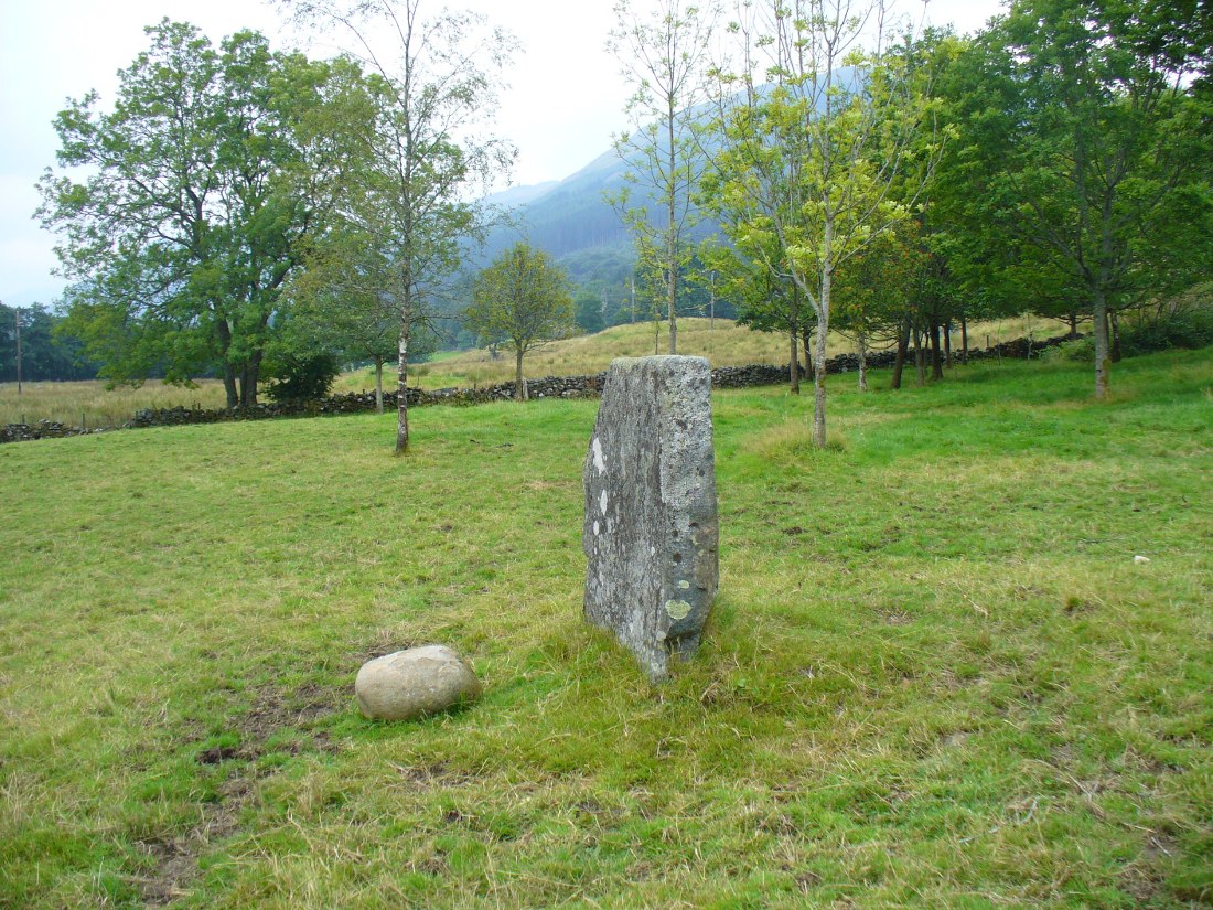
The Crofts, Doune, Perthshire

Cists (destroyed):  OS Grid Reference – NN 7247 0188

Also Known as:

  1. Canmore ID 24760

Archaeology & History

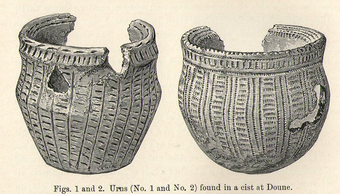
Urns in The Croft cist, Doune

Somewhere in the woodland park, before the area was “ruined”, as Moray Mackay (1984) put it, by “sand and gravel workings”, and within 100 yards of the re-positioned Trysting Stone, there once remained the ruins of ancient tombs—probably neolithic or Bronze Age in nature.  The ‘cists’ as they’re known (stone-lined graves), were described in several short articles at the beginning of the 20th century, shortly after their rediscovery.  Drawing upon the initial article by Joseph Anderson (1902) in the Scottish Antiquaries journal, W.B. Cook (1904) wrote:

“The doubling of the (railway) line from Dunblane to Callander has necessitated the altering of a road at the Crofts, Doune, and on Tuesday, 8 May, while digging, the navvies came across two stone cists containing bones.  The cists were made of stone slabs.  On Thursday, the men came on another cist about five feet from the surface. It was 3 feet long and 2½ feet broad, composed of round stones, and a quantity of bones were found in it, and also an urn. Unfortunately a cart-wheel passed over the urn, smashing it.  The pieces were, however, carefully collected and cemented and they are now in the possession of Mr Smith, Clerk of Works to the Caledonian Railway Company, Doune.  One of the cists first found was quite empty, but the other contained a large number of human bones, the largest about 1½ inches long.  The coffins were about 15 inches from the surface, and lay from east to west.  They measured 2 feet 9 inches in length, and in breadth and depth about 18 inches. They are constructed of local stone, and near the spot there has been a dyke running from the burgh to the sand holes, as the foundation was visible when the soil was being removed.  Some of the stones indicate that a house might have stood near the spot, but there had been no public burying-place nearer than at Kilmadock and at the little chapel of Inverardoch previous to 1784.”

In Mr Joseph’s (1902) article, he told us there wasn’t one, but two urns which, after some considerable effort, were reconstructed.  I’m not a great lover of urns misself, although when found in conjunction with the dead, we must ask, what was in them (if anything) when they were placed with the deceased?  Food? Herbal beverages? Shamanic potions?  In this case, we don’t know; and so all we are left with is Mr Anderson’s description of them:

“Urn No.1 is of the usual type of the so-called ‘food-vessel’, 4¾ inches in height by 5 inches in diameter at the mouth, the lip slightly bevelled inward, and the whole exterior surface ornamented. The ornamentation consists entirely of lines impressed into the soft clay with what seems to have been the roughly broken end of a small twig about ⅛-inch in diameter.  On the level of the lip there are two parallel lines of short scorings going completely round the upper surface. On the exterior surface there is a kind of slightly concave collar half an inch in width immediately under the brim, which is ornamented with short perpendicular indentations about a quarter of an inch apart. Underneath the collar the vessel expands slightly to the shoulder and then contracts to a flattened base of three inches in diameter. The part above the shoulder is slightly concave externally, but the scheme of decoration above and below the shoulder is the same, consisting of a series of short impressed lines scarcely half an inch in length ranged round the circumference in horizontal rows about a quarter of an inch apart, and crossed perpendicularly by lines about half an inch apart, not impressed, but scored into the clay. The perpendicular lines above the shoulder are more divergent than those below the shoulder, which converge towards the bottom in consequence of the tapering form of the lower part of the vessel. The paste is coarse, and mixed with small stones; the wall of the vessel is about a quarter of an inch thick, and the colour a reddish brown on both the exterior and interior surfaces, but quite black in the fractures exposing a section of its thickness.

“Urn No.2 is of the same wide-mouthed, thick-lipped form of the so-called food vessel type, 5 inches high and 5½- inches in diameter at the mouth. The lip is bevelled inwards, and the general shape of the vessel somewhat resembles that of No. 1, except in the lower part, which, instead of tapering to a flat bottom, narrows from the shoulder in a much more gradual curvature to the bottom. The ornamentation also is much more elaborate, though partaking of the same general character, inasmuch as it is a scheme of impressed markings, in bands arranged alternately in vertical and horizontal directions and covering the whole exterior surface of the vessel. On the bevel of the rim is a horizontal band of three lines of impressed markings, surmounted on the upper verge of the rim by a row of shallow oval impressions less than ⅛ of an inch apart. Under this there is a horizontal band of impressed markings as with the teeth of a comb, and below that the general scheme of ornament is carried out in alternate bands of about half an inch in width, running vertically from collar to base. The one set of these bands consists of three parallel rows of impressions of about ⅛ of an inch in width, and ⅛ of an inch apart, which seem to have been produced in the surface of the soft clay by a comb-like instrument, while the other set of bands has been produced by marking the spaces between the triple bands in the same way with a similar instrument, but placing the lines horizontally and closer together.”

A short distance from here, more cists were found. It’s possible that a prehistoric graveyard this way lay, countless centuries ago…

Folklore

Moray Mackay (1984) reports that the Doune fairs used to be held here.

References:

  1. Anderson, Joseph, “Notices of Cists Discovered in a Cairn at Cairnhill, Parish of Monquhitter, Aberdeenshire; and at Doune, Perthshire,” in Proceedings Society of Antiquaries, Scotland, volume 36, 1902.
  2. Cook, W.B. (ed.), “Antiquarian Find at Doune,” in Stirling Antiquary, volume 3, 1904.
  3. Mackay, Moray S., Doune Historical Notes, Forth Naturalist & Historian: Stirling 1984.
  4. Royal Commission Ancient & Historical Monuments, Scotland, Archaeological Sites and Monuments of Stirling District, Central Region, Edinburgh 1979.

© Paul Bennett, The Northern Antiquarian 

Holy Well, Cambusbarron, Stirlingshire

Holy Well (destroyed?): OS Grid Reference – NS 7787 9252?

Archaeology & History

A small but ancient chapel once existed in Cambusbarron, long ago, located about one hundred yards east of the Chapel or Christ’s Well.  William Drysdale (1904) told that, apart from the Chapel Well and nearby St. Thomas’ Well, “several other wells in the locality were believed to possess healing virtues.”  It was J.S. Fleming (1898) who said that, “attached to Cambusbarron Chapel two other holy but nameless wells are stated to have been in existence in 1866, on the brink of Glenmoray Burn, near the chapel itself.”

A writer for the Stirling Observer in 1871 told that one of these holy wells was in fact to “be seen near the brink of a little burn which trickles from the miniature glen of Glenmoray, visible on the hillside, just below the lowest reservoir” above Touch, more than a mile away (heading up towards St Corbet’s Well).  The other was said to be near Johnnie’s Burn, a mile to the west.  In Fleming’s (1898) opinion however, neither of these sites were feasible, as he walked all along the course of both burns and could find no other wells.  Does anyone know any different?

References:

  1. Drysdale, William, Auld Biggins of Stirling, Eneas Mackay: Stirling 1904.
  2. Fleming, J.S., Old Nooks of Stirling, Delineated and Described, Munro & Jamieson: Stirling 1898.

© Paul Bennett, The Northern Antiquarian

Auchensalt, Thornhill, Stirlingshire

Broch:  OS Grid Reference – NN 6533 0099

Also Known as:

  1. Canmore ID 24398
  2. Easter Borland
  3. Keir

Getting Here

Auchinsalt broch, looking south

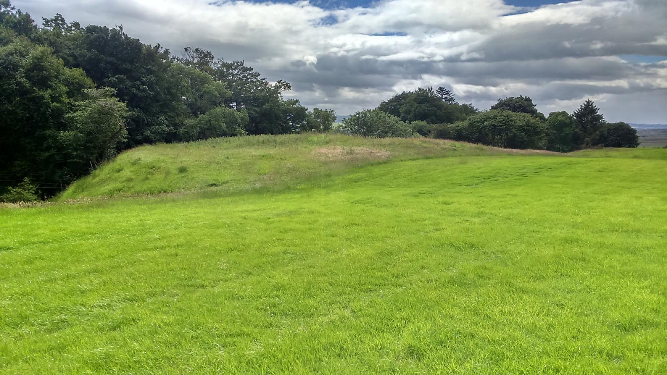
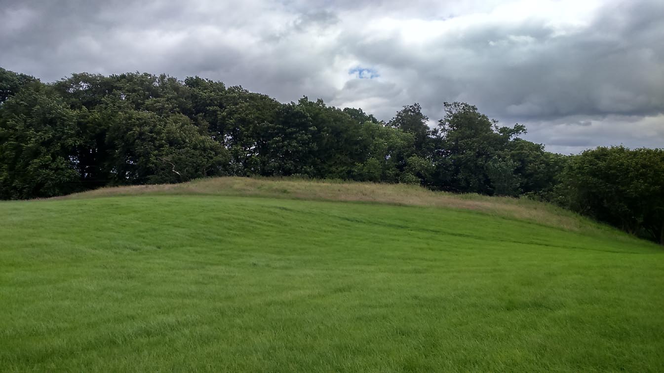
Take the A873 from Thornhill to Aberfoyle, and literally 1 mile west of Thornhill turn right up the track up and past Easter Borland farm (as if you’re heading up to Auchensalt).  250 yards past the farm, a large field opens up.  Walk 100 yards east along the side of the wall towards the trees and follow the tree-line upstream 250 yards (don’t go into the lovely little glen) until, on your right, you’ll see a reasonably large area of grassland that rises up, with a steep-ish slope down to the burn below.  This is the remains of the broch.

Archaeology & History

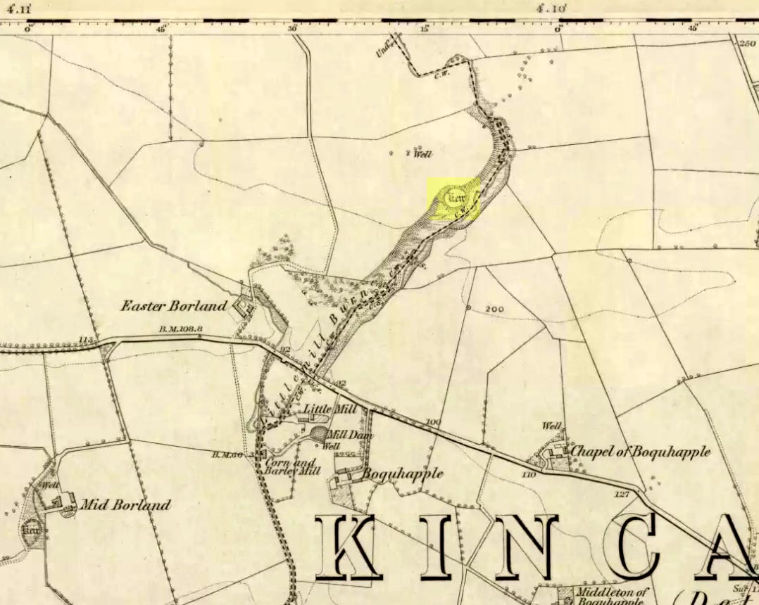
Shown as a ‘Keir’ on the 1866 OS-map, this is an old Scottish dialect word, barely used at all nowadays (folk need to start using it again!) which meant “an ancient fortification” or “rude forts”.  The word is mentioned in early Statistical Accounts in 1795 and in the Second Account of 1845 the “Kiers at Auchinsalt” are mentioned specifically, albeit in passing….

Auchinsalt ‘Keir’ on 1866 map

When we visited the site yesterday, very little could be seen due mainly to the summer vegetation covering the area.  A very small section of open walling was noted on its western side, and beneath the undergrowth a roughly oval structure was in evidence on the rise between the edge of the field and the drop into the small glen below.  Something obviously man-made lies beneath the grasses, but in the last 100 years or so there has been debate as to whether it was a fort, a dun or a broch.  The consensus at the mo, tells Euan Mackie (2007), is that it’s a broch!

Auchinsalt broch, looking east

Measuring some 25 yards across, the walling that makes up the broch was between 4-6 feet wide all round, and about 2 feet high.  There seemed to be aggregates of large scattered stones inside and outside the main oval feature.  If there was an entrance, it seemed to be at the western side, but I wasn’t sure about this. In truth, unless you’re a hardcore broch fanatic, you’d be truly disappointed with the dilapidated state of this monument.  Much better ones can be seen just a few miles away…

References:

  1. Chrystal, William, The Kingdom of Kippen, Munro & Jamieson: Stirling 1903.
  2. Grant, William (ed.), The Scottish National Dictionary – volume 5, SNDA: Edinburgh 1960.
  3. MacKie, Euan W., The Roundhouses, Brochs and Wheelhouses of Atlantic Scotland c.700 BC-AD 500, BAR: Oxford 2007.
  4. McCulloch, Stuart J., Thornhill and its Environs, Munro Trust: Perth 1995.

Acknowledgements:  Huge thanks to Paul Hornby for getting us here. Cheers matey!

© Paul Bennett, The Northern Antiquarian

Clachan Aoraidh, Balquhidder, Perthshire

Stone Circle (ruins):  OS Grid Reference – NN 5389 2076

Also Known as:

  1. Canmore ID 24151
  2. Worshipping Stones

Getting Here

Clachan Aoraidh looking W

Along the A84 road betweeen Callander and Lochearnhead, take the small road west when you reach Balquhidder Station, towards Balquhidder village.  Go along here for 1½ miles (2.5km) as if you’re gonna visit the Puidrac Stone; but 200 yards past this, go through the gate on the south-side of the road into the boggy field for about 150 yards towards the River Balvag.  You’re looking for several stones, as in the photos.  You’ll find ’em. (you may get soaked though!)

Archaeology & History

The stones, looking NW

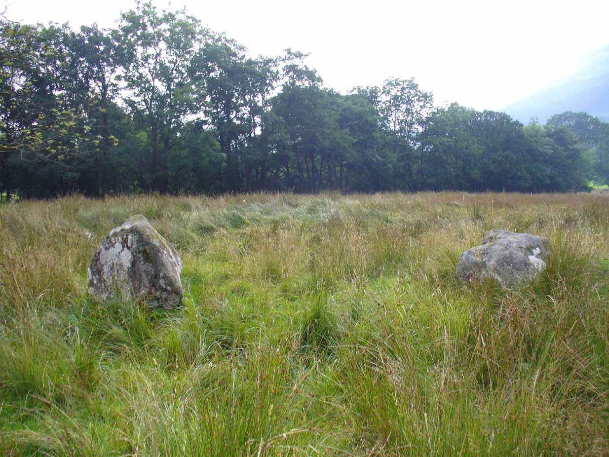
After many thousands of years, this innocuous-looking group of small stones found in the very boggy field immediately west of the Puidrac Stone looks nothing like it once did. Some modern academics would have you think there was nothing here of prehistoric interest, but oral tradition and earlier writings tell otherwise. Although not shown on the early OS-maps, it was first described in James Gow’s (1887) articulation on the antiquities of the area, in which he told:

“A short distance east from the present (Balquhidder) parish church, in the haugh below the manse, there are seven stones remaining of a circle which appears to have been about 30 feet in diameter; only one stone is in its original upright position, but there are fragments of others lying about; as usual, they are known as “Clachan-Aoraidh,” or worshipping stones, and are not likely to be disturbed during the lease of the present tenant.”

Looking E, with Puidrac Stone just visible left of telegraph post

A few years later when Thomas Ross (1919) visited the area with a Prof Cooper and others, they reported the single standing stone still in position and the anglicized name of the Worshipping Stones was still in evidence amongst locals.

Arc of fallen stones by the trees

Nowadays the site is in ruin.  Two of the stones stand out when the rushes aren’t too high, with one earthfast and its companion prostrate; but as you can see in the photo (right), there remains a sunken arc of two other stones laid down, running away from the larger ones, with a fifth overgrown and nearly covered by vegetation and the young trees.  In all probability, tradition is probably right here: this is the remains of a stone circle.

Folklore

The field in which these denuded megalithic remains are found, was, wrote Thomas Ross (1919),

“the site of a long-popular market called ‘Feill Aonghais’, i.e., St Angus’ Fair.  It was held, according to Mr Campbell, in May; according to Mr Gow, on “the Saint’s Day, the 6th of April.”  It was quite the custom…to hold a fair after divine service on the Patronal Feast. The folks came to “kirk and market” on the same day, and mixed good fellowship and manly sport with their worship and their business.”

If you were to hold a fair there nowadays, likelihood is it would get flooded!  Christian myths tell of a “St. Angus” taking over whatever the heathen traditions were in this domain, more than a thousand years back.

References:

  1. Gow, James M., “Notes in Balquhidder: Saint Angus, Curing Wells, Cup-Marked Stones, etc”, in Proceedings of the Society of Antiquaries Scotland, volume 21, 1887.
  2. Ross, Thomas, “Saint Angus’ Stone, Balquhidder,” in Transactions of the Scottish Ecclesiological Society, volume 6 – part 1, 1919.

© Paul Bennett, The Northern Antiquarian

Leckie Broch Carving (02), Gargunnock, Stirlingshire

Cup-and-Ring Stone:  OS Grid Reference – NS 6926 9399

Getting Here

Ornate face of Leckie-2 carving
Ornate face of Leckie-2 stone

Take the A811 road between Stirling and Kippen and go up into Gargunnock, From the village centre, go along the Leckie Road (not the Main Street!) for half-a-mile, then turn left up the tiny road. ¾-mile (1.15km) along, a small bridge crosses the Leckie Burn (a.k.a. St Colm’s Burn).  From here, walk up the footpath into the woods for 100 yards or so and cross the waters.  When you see the large overgrown rocky rise of the Leckie Broch covered in pesky rhododendrons, walk up its left-side where (presently) a clearing has been made and the carved rocks stand out.

Archaeology & History

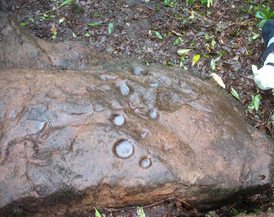
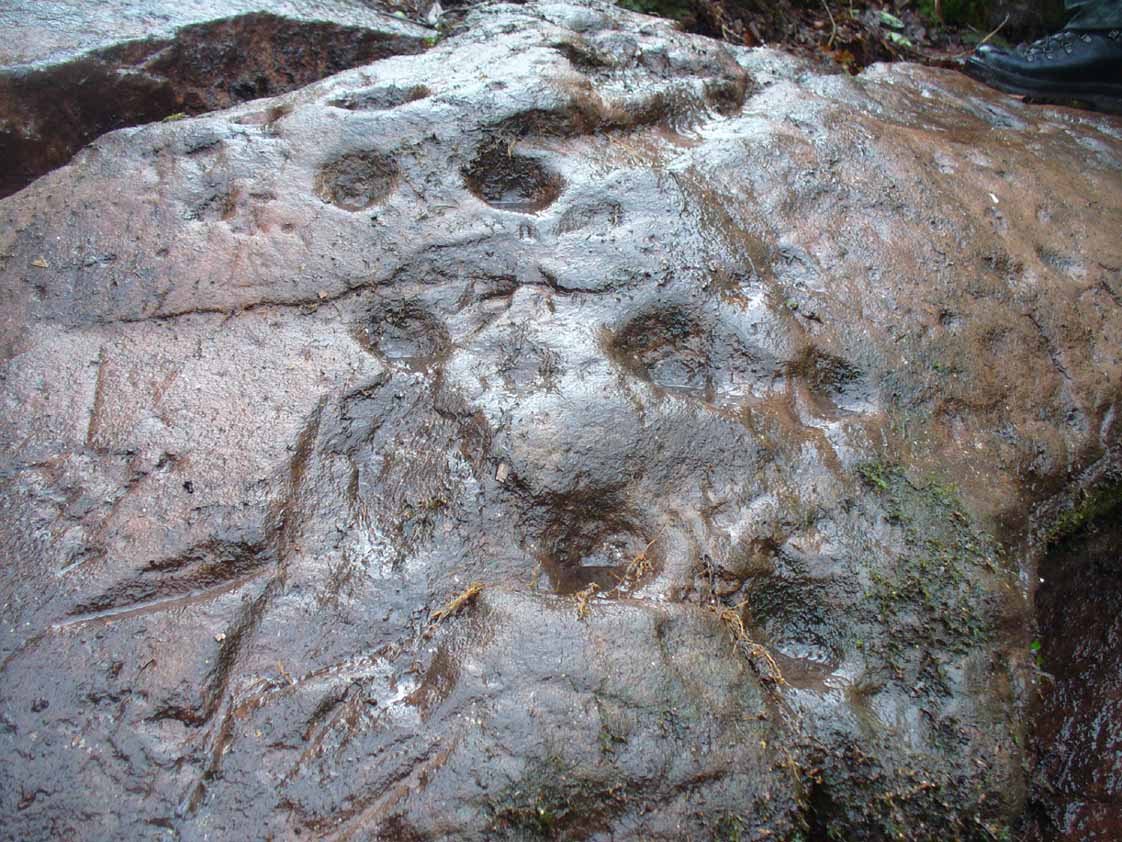
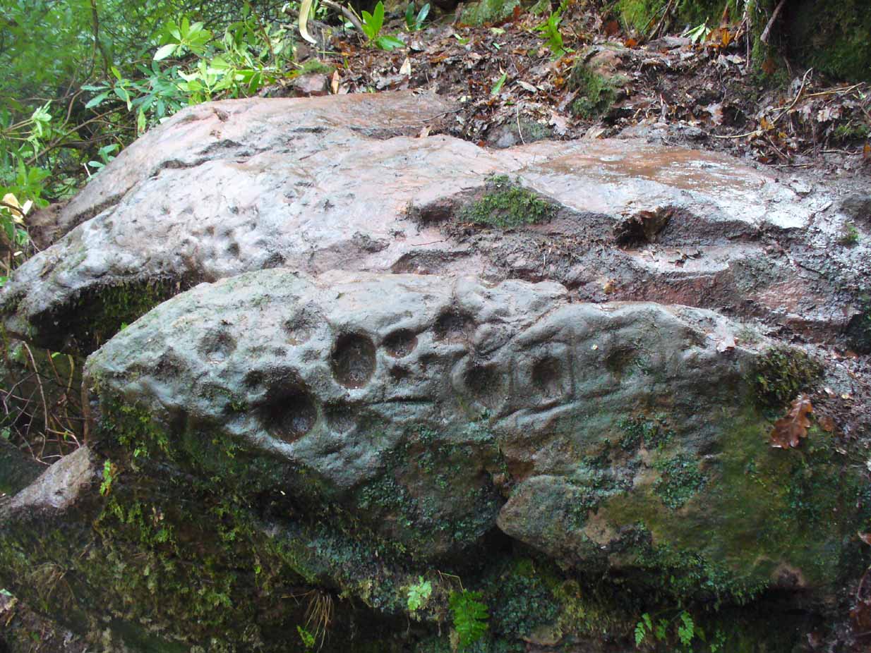
A very curious design here!  Possibly carved at the same time as the Leckie broch to which it is attached—possibly not—we have here a curious amalgam of Nature’s incisions and human design, culminating in cup-and-rings and cups-and-squares no less!  When we came to visit it a few days ago, Lisa Samsonowicz found the stone hiding away, buried beneath a thin layer of natural cover.  The rest of the team thereafter enabled a much clearer pictures of the carving.

Star motif & other cups
Allison McLaren sitting on the new find
Young Allison on the new find (photo courtesy John McLaren)

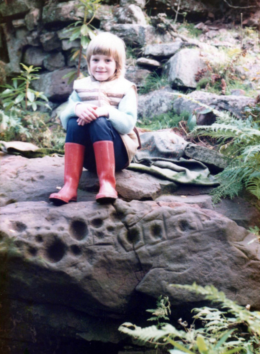
We’re not quite sure who first rediscovered the carving. In an early photo of the site taken in the late ’70s or early ’80s, a young Allison McLaren sits highlighting the design.  But she wasn’t the fortunate lass who discovered it!  One account describes a local woman, Lady Younger of Leckie House, who was out walking her dog, accidentally dislodging some of the rocky debris of the Iron Age broch and unearthing the petroglyphs, thereafter taking Allison along to see it.  The other account tells of it being noticed for the first time during an excavation of the broch by Euan MacKie and his team.  Whichever it was, Prof Mackie (1970) was certainly the first person to write about it.  He told:

“Part of the sandstone face of the northern end of the promontory on which stands the Leckie dun is covered with well preserved cup-marks, presumably much older than the dun.  They were discovered when rubble and soil fallen from the dun was removed.  Some of the cup-marks stand alone and some are surrounded by what appear to be incised rectangles in a ladder pattern.  There are other, less clear markings.”

Ron Morris' 1981 sketch
Ron Morris’ 1981 sketch
Small & large cupmarks

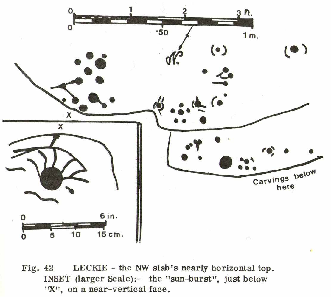
There then followed a series of written accounts, small and large, about the Leckie broch—but little else was said of the carvings.  It wasn’t until Ronald Morris (1981) came to see them a few years later that they gained a slightly lengthier description.  He described how the petroglyph was,

“carved over about 3m (yds) at heights of 1-2m (yds) on faces now sloping mostly 0-90º NW, with 3 cups-and-one-near-hexagonal-ring up to 12cm (4½in) diameter, a ‘sun-burst’ and other grooves, and at least 40 cups up to 12cm (4½in) diameter and up to 8cm (3in) deep.  On a vertical E-facing slab there are also many grooves, some of which connect lines of cups. Some grooves resemble a ‘sea-horse’, an ‘axe’, etc. All except the cups are probably incised, but some may be natural.”

Large cupmarks on sloping face
Looking down the spine of 2 rocks

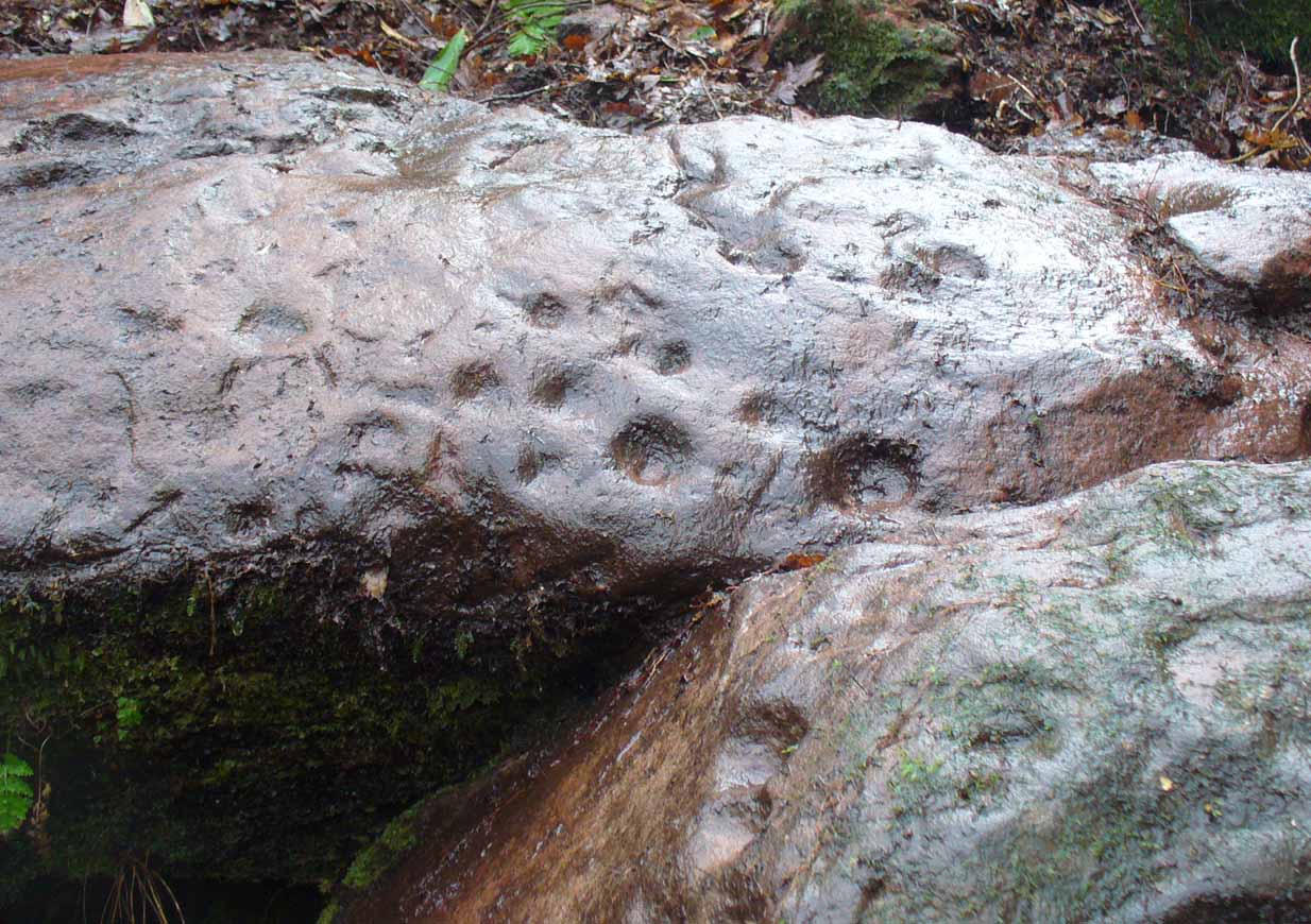
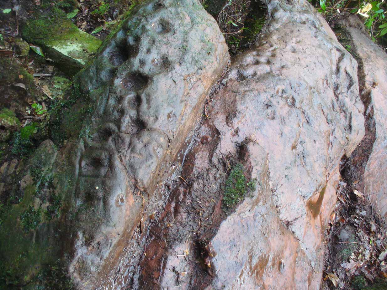
The entire design in fact covers two separate sections of rock.  On the vertical face of one stone is a curious conjoined cup-and-rectangle, attached to a cup-and-square, attached to a traditional cup-and-ring.  A cluster of other cups, large and small, are immediately left of this odd geometric pattern.  The ‘cups’ within this section of the petroglyph are quite deep and, it would seem, were geological in nature but have been touched-up by human hands.  Immediately below this rectangle-square-circle sequence, faint carved lines run a little further down the face of the rock.  They were difficult to see clearly and require subsequent visits to enable a more complete picture. Along the top of this section of rock are several cups, one or two of them seeming to have faint rings around them.  (at the very bottom of this vertical carved face, at ground level, a small section of man-made walling is visible, which was no doubt a section of the huge broch)

Above the top of this vertical carved face is a gap between this and a second, larger earthfast stone.  This has a series of cups, some with faint rings around them, but most of them are just cups, both shallow and deep, running down the slope of the rock.  A notable ‘star’ of five cups surrounding a single-cup stands out on this section.  Some of them seem to have been geophysical in nature, but again have been touched-up and added to.

Cluster of curious peck-marks

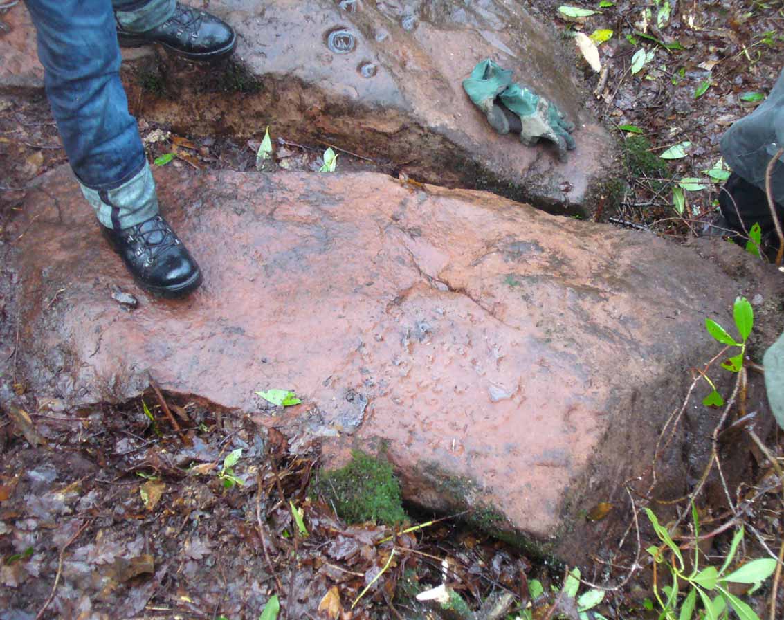
Slightly higher still, on another third section of rock, a curious cluster of weird ‘pecks’, almost in a square pattern, with a possible cup-mark close to the edge of the stone is clearly visible.  The edge of this rock seems to have been quarried and the markings here may just be mason marks preceding the breaking of the stone in the Iron Age.

Walk around to the south-side of the broch and there, in the walling, on a vertical stone face, is the small cup-marked Leckie 1 carving.

One final note of concern: the carving (and the broch) have become overrun with rhododendrons, to the point where they are severely damaging the monuments here. They need to be curtailed before further archaeological destruction occurs. Help!

References:

  1. MacKie, Euan, “Leckie, Cup-Marked Rock,” in Discovery & Excavation Scotland, 1980.
  2. MacKie, Euan, “The Leckie Broch, Stirlingshire,”, in Glasgow Archaeological Journal, volume 9, 1982.
  3. McLaren, John, Personal Communications, 7.2.17 & 16.2.17.
  4. Morris, Ronald W.B., The Prehistoric Rock Art of Southern Scotland, BAR: Oxford 1981.

Links:

  1. Gargunnock Village History

Acknowledgements:  Immense thanks to Lisa Samsonowicz, Fraser Harrick, Nina Harris, Frank Mercer and Paul Hornby for all their work, enabling a clear picture of the site.  And a huge thanks to John McLaren of the Gargunnock Village History site for allowing us to include the early photo of the carving here – thanks John! 🙂

© Paul Bennett, The Northern Antiquarian 


Trysting Stone, Doune, Perthshire

Standing Stone:  OS Grid Reference – NN 7256 0182

Also Known as:

  1. Canmore ID 24761
  2. Deil’s Head
  3. Devil’s Head
  4. Fairy Stone
  5. Gold Stone

Getting Here

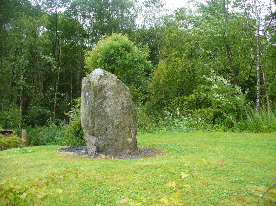
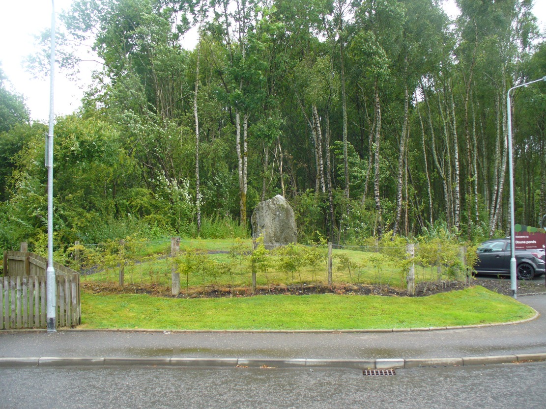
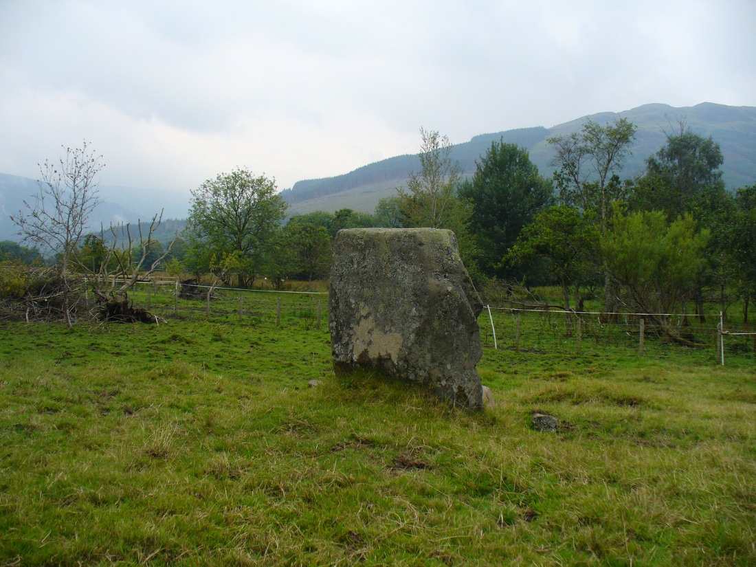
Trysting Stone of Doune

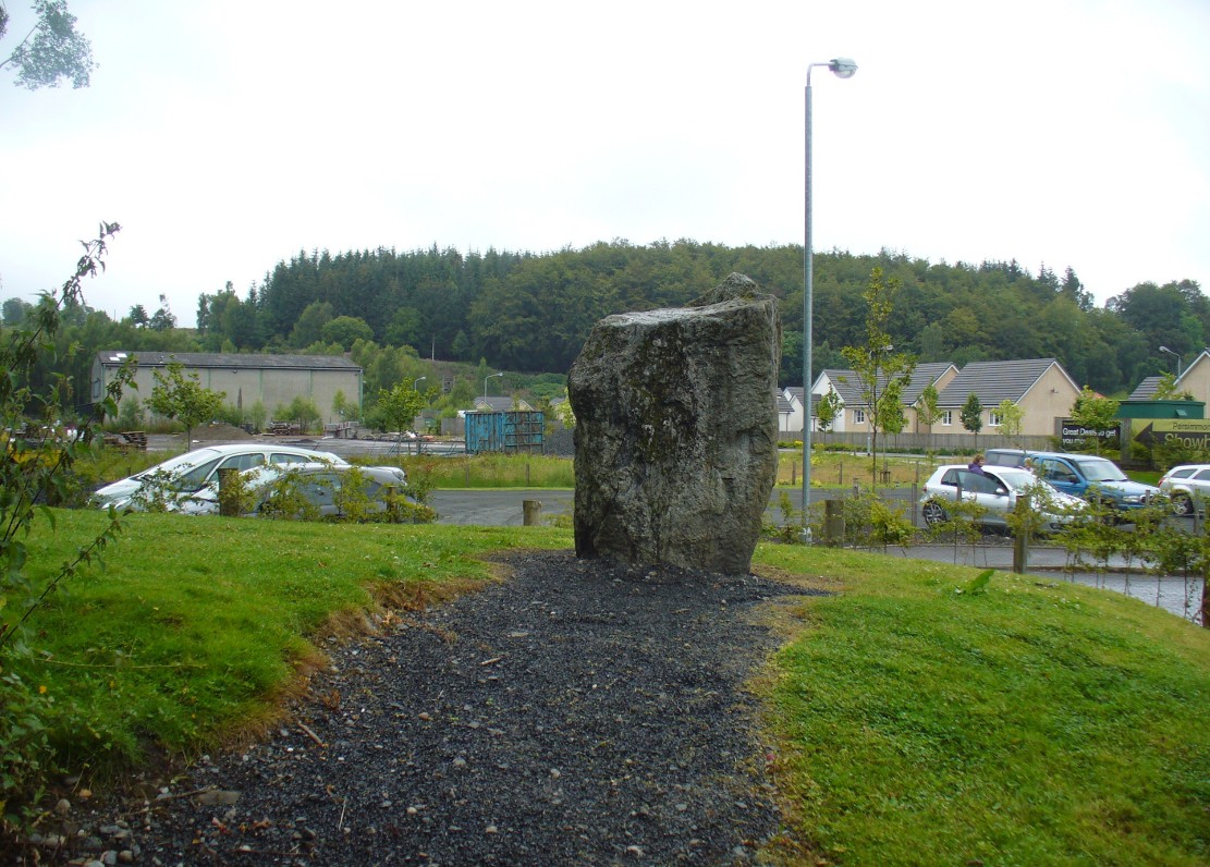
From the old cross in the middle of the village, walk along the A820 Balkerach Street main road (NOT down George Street) until you reach Station Wynd on your right.  Walk up here for 100 yards towards the new housing estate (don’t buy these places – they’re dreadful quality beneath the veneers) and there, on a small grassy rise on the left just before the car park, stands our stone!

Archaeology & History

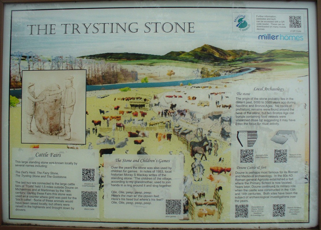
This little-known monolith on the northern edge of little Doune village, was recently moved a short distance from its original position thanks to another one of those sad Barratt housing estates being built here; but at least it has received protection with the surrounding fence and notice board telling its brief history and folklore (better than being destroyed I s’ppose).

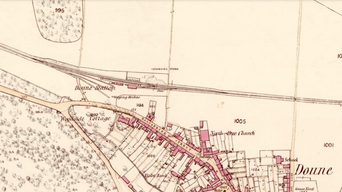
Stone marked on 1866 OS map
Stone on 1866 OS map

Standing less than five feet tall, local lore tells that it has been moved around close to this spot several times in the last couple of centuries.  Although not mentioned in Hutchinson’s (1893) essay on local megaliths, the stone was highlighted on the 1866 Ordnance Survey of Doune, where the non-antiquated lettering showed how it was thought to be Roman in origin, not prehistoric.

Folklore

Trysting Stane, looking NE

The name of the stone comes from it being used as a place where deeds were sworn, with the stone as witness to the words proclaimed by both parties (implying a living presence, or animistic formula of great age).  This activity was continued in the local ‘trysts’ or cattle fairs held a mile away, where buyers swore the sale of cattle at this stone—again with the stone being ‘witness’ to the spoken deals.  It was also used as a counter where gold was exchanged for cattle bought and sold during the Michaelmas and Martinmas Fairs.  Sue Harvey (2006) told that this standing stone,

“was called the Devil’s Head and was used during past Doune fairs to count gold on when cattle were being bought and sold.”

In local newspaper accounts from the 1950s, local historian Moray S. Mackay (1984) told how the children of the village used to gather round the stone, holding hands, and sing,

Olie Olie, peep, peep, peep,
Here’s the man with the cloven feet,
Here’s his head, but where’s his feet?
Olie Olie, peep, peep, peep.

Notice board telling its tale...
Notice board telling its tale…
Looking at the stone on its rise

This implies the stone once possessed a myth relating to a petrified ancestral deity of animistic (pre-christian) origin, but as yet we have found no additional information allowing us a confirmation of this probability.  A correlate of this theme—i.e., of the stone being the head of a deity—is found in West Yorkshire (amongst many other places), where one of the little known Cuckoo Stones was once known to be a local giant until a hero-figure appeared and cut off his head, leaving only his body which was then turned to stone.  Mircea Eliade (1958; 1963) cites examples of animistic religious rites and events explaining this early petrification formula via creation myths, etc. (we find very clear evidences of animistic worldviews and practices still prevailing in the mountains just a few miles north and west, still enacted by local people)

Folklore also alleged that the stone was Roman in nature, but neither archaeology nor the architectural form of the stone implies this.  Roman stones were cut and dressed—unlike the traditional looking Bronze Age, rough, uncut fella standing here.

References:

  1. Eliade, Mircea, Patterns in Comparative Religion, Sheed & Ward: London 1958.
  2. Eliade, Mircea, Myth and Reality, Harper & Row: San Francisco 1963.
  3. Harvey, Sue, Doune and Deanston, Kilmadock Development Centre 2006.
  4. Hutchinson, A.F., “The Standing Stones of Stirling District,” in The Stirling Antiquary, volume 1, 1893.
  5. Mackay, Moray S., Doune – Historical Notes, Forth Naturalist: Stirling 1984.

© Paul Bennett, The Northern Antiquarian


Mid Lix, Killin, Perthshire

Cup-and-Ring Stone:  OS Grid Reference – NN 5513 2987

Also Known as:

  1. Canmore ID 24093

Getting Here

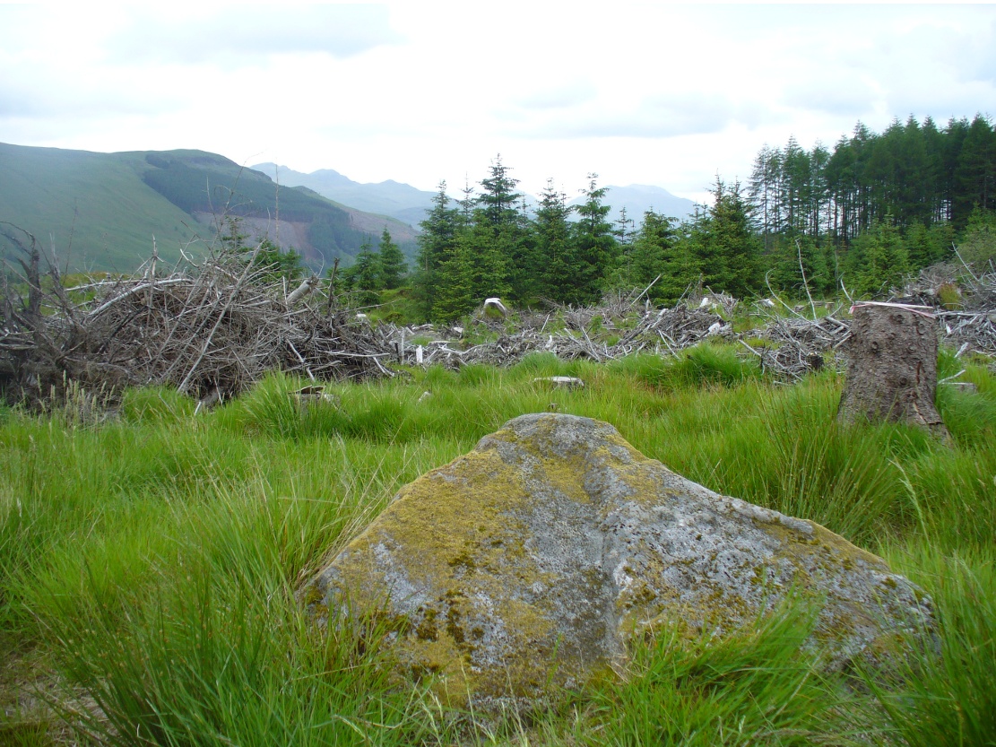
Mid Lix stone, looking north

As you go along the road between Lochearnhead and Crianlarich, about 200 yards before reaching the turning to Killin, stop at the Mid Lix dirt-track.  Cross the road and walk back uphill for about 75 yards, then walk into the denuded remains of the forest.  There are several notable rocks peeking up from the wood, one of which has many well-formed cup-markings on, about 25 yards from the roadside.  If you look around here, you’ll find it.

Archaeology & History

Mr Cash's 1912 drawing
Mr Cash’s 1912 drawing

This seemingly isolated petroglyph, still in a very good state of preservation, was first reported in the 19th century by a Mr Haggart (1883), who described it in a letter to the late great J. Romilly Allen.  He wrote:

“I have also, since you last wrote to me, discovered another cup-marked stone at the farm of Mid Lix, near Killin.  It is a very good specimen, with between sixteen and twenty marks, well cut and distinct.  I was passing the farm three weeks ago, and I thought, from the name Lix — which is a Gaelic word corrupted from Lie, the plural of Leac, a tomb-stone or flagstone — that it was very likely to have stones with marks, and I asked John Little, farmer, to keep a look out for such.  He did so, and found the one mentioned within twenty yards or so of the road leading to Killin Railway Station, and between the farm and the roadway, due west of the farm-house.”

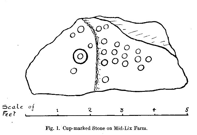
Subsequently, thirty years later Mr Cash (1912) visited and described the petroglyph in more detail in his survey of sites around Killin.  He told that,

“In 1882 or 1883 this was reported to Mr Allen by Mr Haggart; it was shown to me by Mr Haggart.  It lies about 100 yards south of the railway, and 20 yards east of the Glen Ogle road.  It is a low triangular pyramid; the cups are on the west face, which lies at an angle of about 35°, and measures 5 feet across its base, and just over 3 feet along its median line.  It carries twenty-one cups, as shown in the figure.  One cup has round it a ring 6½ inches in diameter.  The cups vary in diameter from 2¼ to 3 inches, and in depth from ¼ to ¾  inch.  In his paper on “Cup-marked Stones near Aberfeldy,” read in 1884, Dr Macmillan said that he did not know a single example of a concentric ring round a cup on the stones found on the shores of Loch Tay or in Glendochart or Glen Lochay.”

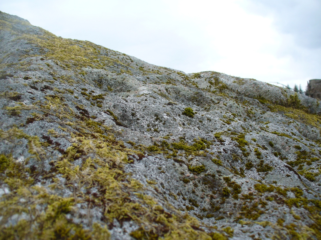
Cluster of cups, close up

When we visited the site earlier, the grey clouds prevented us getting good images of the carving and made visibility of the design more troublesome (typical rock art dilemma!); but we counted a minimum of 23 cup-marks on the stone.  There is a small cluster of small rounded stones around the west and north-western base of the stone, but whether these are collected rubble or the denuded remains of a cairn could not be discerned upon our visit.

References:

  1. Cash, C.G., “Archaeological Gleanings from Killin,” in Proceedings of the Society of Antiquaries of Scotland, volume 46, 1912.
  2. Gillies, William A., In Famed Breadalbane, Munro Press: Perth 1938.
  3. Haggart, D, ‘Notice of the Discovery of Cup-Marked Stones near Killin, Perthshire‘, in Proceedings of the Society of Antiquaries of Scotland, volume 17, 1883.
  4. Morris, Ronald W.B., The Prehistoric Rock Art of Southern Scotland, BAR 86: Oxford 1981.
  5. Royal Commission on the Ancient and Historical Monuments of Scotland, The Archaeological Sites and Monuments of Stirling District, Central Region, HMSO: Edinburgh 1979.

 © Paul Bennett, The Northern Antiquarian


Corrie (1), Gartmore, Perthshire

Cup-and-Ring Stone:  OS Grid Reference – NS 49502 95052

Also Known as:

  1. Canmore ID 43472

Getting Here

The cup-and-ring stone

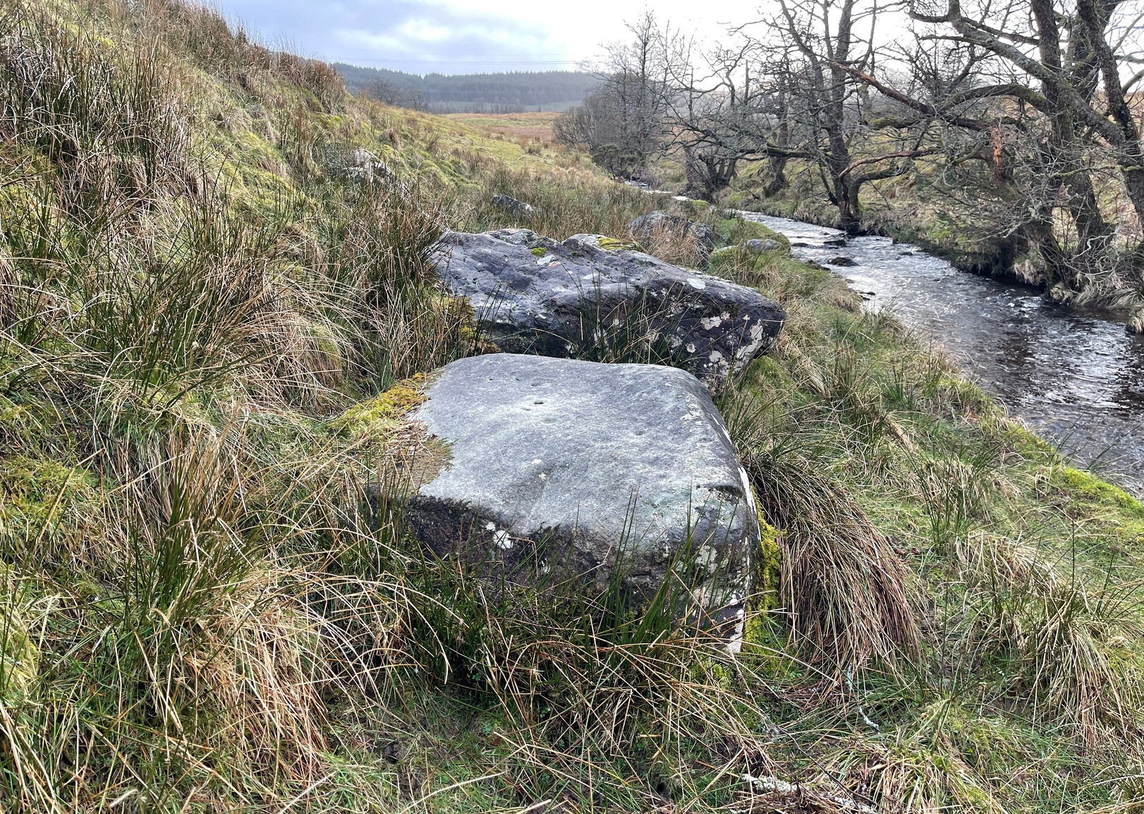
On the A81 road from Aberfoyle to Strathblane, about a mile south of Aberfoyle take the tiny right turn (keep your eyes peeled!) to Gartmore.  At the end of the village, turn right at the T-junction.  Just over a mile along the tiny road, just over the tiny road-bridge, turn right again up up the dead straight road to Drymen for nearly a mile and park up.  A dirt-track is on your right: walk along here for ¾-mile (1.2km) and in a large field on your left a huge rock sits (no carvings on it).  Keep walking on the track and where the field ends, a path to your left runs above a small burn.  Naathen, 150 yards along here, look down at the waters and there’s a clump of large rocks. Check ’em out!

Archaeology & History

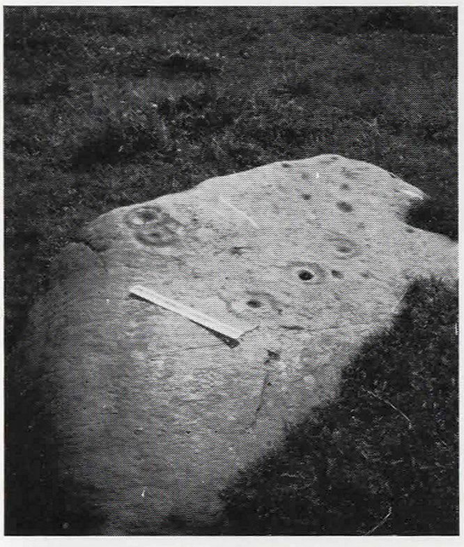
Morris’ old photo (from PSAS 1967)

This stone and others were mentioned in MacNair’s (1973) essay in the popular history guide to the region, after it had seemingly been rediscovered a few years earlier by Ron Morris (1967; 1969), who listed it in his petroglyph catalogues.  It was originally located at the top of the slope above the burn, but was rolled down here shortly after Morris discovered the cup-and-rings on it.  The farmer at the time had made a bore-hole into the rock with the intention of blowing it up, but Morris found it just in time and the stone managed to survive!

Faint CnR’s just visible

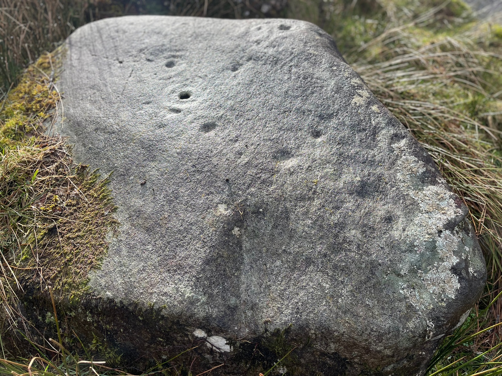
It’s a large rock with a decent ornate design that was clearly visible when Morris surveyed it (see photo, right).  It comprises of, “a cup-and-two-rings, 18cm (7in) diameter, 6 cups-and-one-ring (2 of which are tangential) and at least 8 cups.  All rings are complete.  Greatest carving depth 2cm (¾in).”  There also appears to be a line of four or five small cup-marks running in a short line by one of the lower cup-and-rings, but these are very faint indeed.  The double cup-and-ring mentioned by Morris is the one at the top-centre in my photo, but the next cup-and-ring down may also be a double-ring.  At the top-right of the photo is where two cup-and-rings are conjoined.

Since being rolled down the slope to the side of the burn, the carving’s much more in the shadows and is more difficult to work out.  Sadly on the day when I visited here, Nature bestowed on me a wet and cloudy firmament, so the design was even more difficult to see, as my photos illustrate.

Morris (1981) told that “other stones in the immediate vicinity bear possible cup-marks,” and one of these may exist just a couple of stones away (Corrie 2), leaning up into the grasses: this is another rock that has been pushed down the slope and has curious natural cup-markings on it, with one or two that could be man-made, but we need a geomorphologist to have a look at it and tell us one way or the other.

References:

  1. Edlin, Herbert L. (ed.), Queen Elizabeth Forest Park, HMSO Edinburgh 1973.
  2. MacNair, A.S., “History,” in Edlin’s Queen Elizabeth Forest Park, HMSO 1973.
  3. Morris, Ronald W.B., “Stirlingshire: Corrie Farm (Gartnabrodnaig) – Cup Marks,” in Discovery & Excavation, Scotland, 1967.
  4. Morris, Ronald W.B., “The cup-and-ring marks and similar sculptures of Scotland: a survey of the southern Counties,” in Proceedings of the Society of Antiquaries, Scotland, volume 98, 1967.
  5. Morris, Ronald W.B., “The Cup-and-Ring and Similar Early Sculptures of Scotland; Part 2 – The Rest of Scotland except Kintyre,” in Transactions of the Ancient Monuments Society, volume 16, 1969.
  6. Morris, Ronald W.B., The Prehistoric Rock Art of Southern Scotland, BAR: Oxford 1981.

© Paul BennettThe Northern Antiquarian

Tulloch, Doune, Perthshire

Tumulus:  OS Grid Reference – NN 71782 01194

Also Known as:

  1. Canmore ID 24771

Getting Here

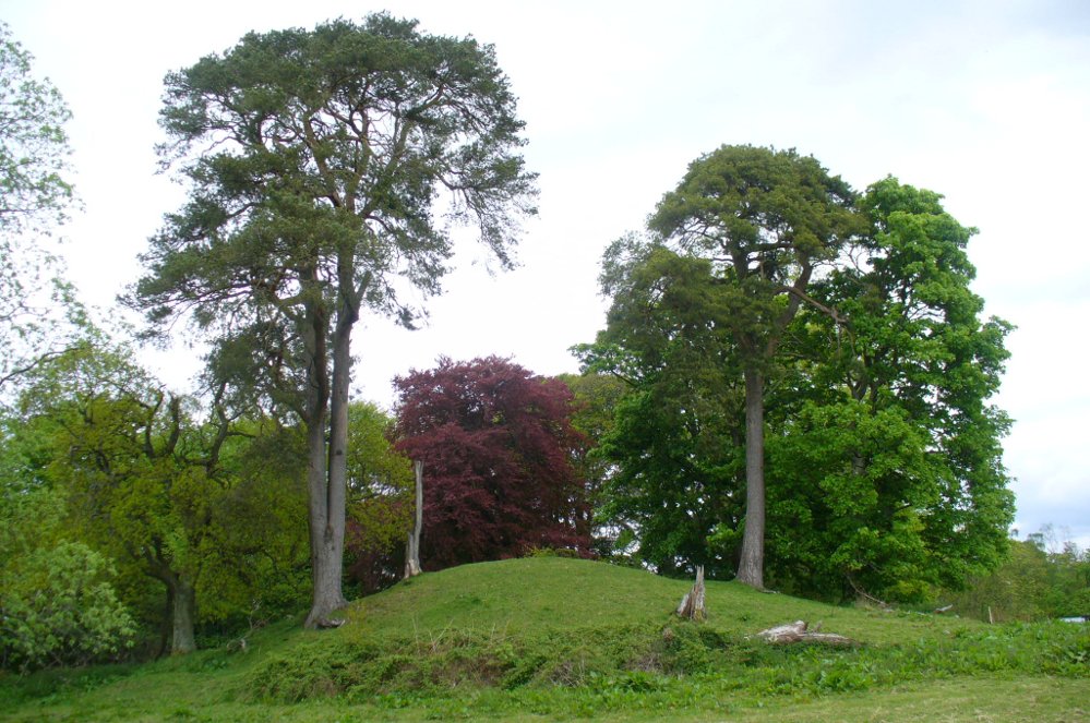
Tulloch Knowe from the road

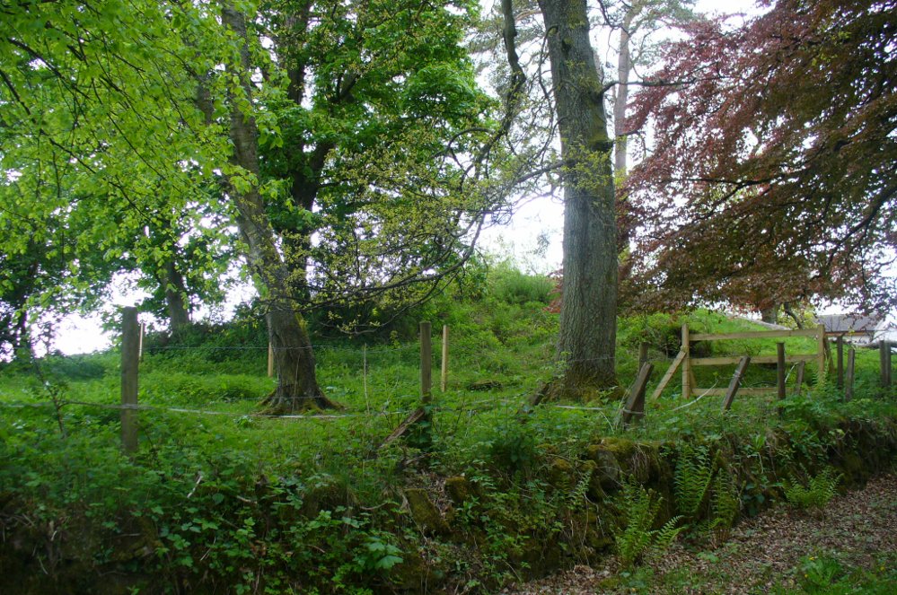
Head out of Doune village and take the A84 to Stirling. Just a few hundred yards along, over the old river bridge, take the first right along the B8032 (don’t head into Deanston).  Barely 500 yards along on the left-hand side, between the farmhouse and a small group of houses, note the large tree-lined mound in the middle, just over the fence.  It’s quite a big fella – you can’t really miss it.

Archaeology & History

The mound and its trees

This is an almost archetypal fairy mound of a monument—and a mighty one at that!—living quietly in the field with its olde trees for company.  Despite its size, it has brought little by way of archaeological attention and has, to my knowledge, never been excavated.  Probably a Bronze Age burial mound, the tomb stands more than 15 feet high and is some 30 yards across east-west and 35 yards north-south.  The Royal Commission (1979) listing of the mound says simply that “this large cairn measures 34m in diameter and up to 5m high.”

References:

  1. Royal Commission on the Ancient & Historical Monuments of Scotland, Archaeological Sites and Monuments of Stirling District, Central Region, Society of Antiquaries of Scotland 1979.

© Paul Bennett, The Northern Antiquarian

Puidrac, Balquhidder, Perthshire

Standing Stone:  OS Grid References – NN 54058 20794

Also Known as:

  1. Canmore ID 24141

Getting Here

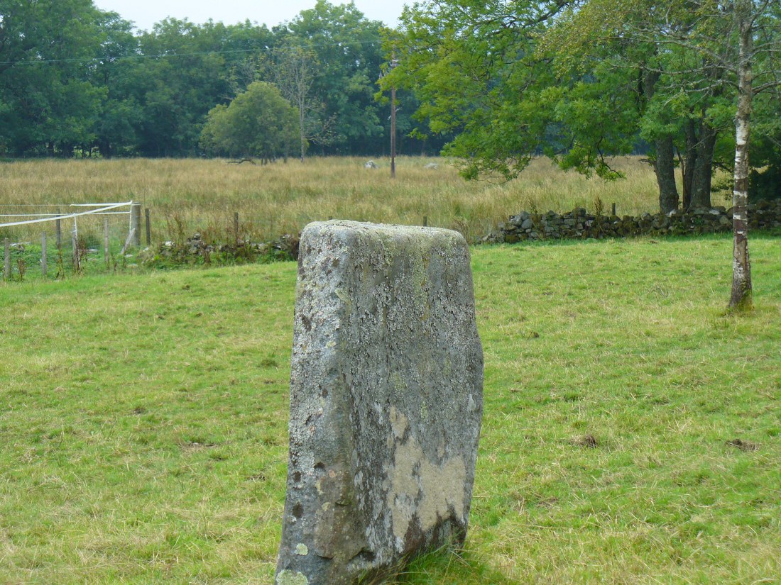
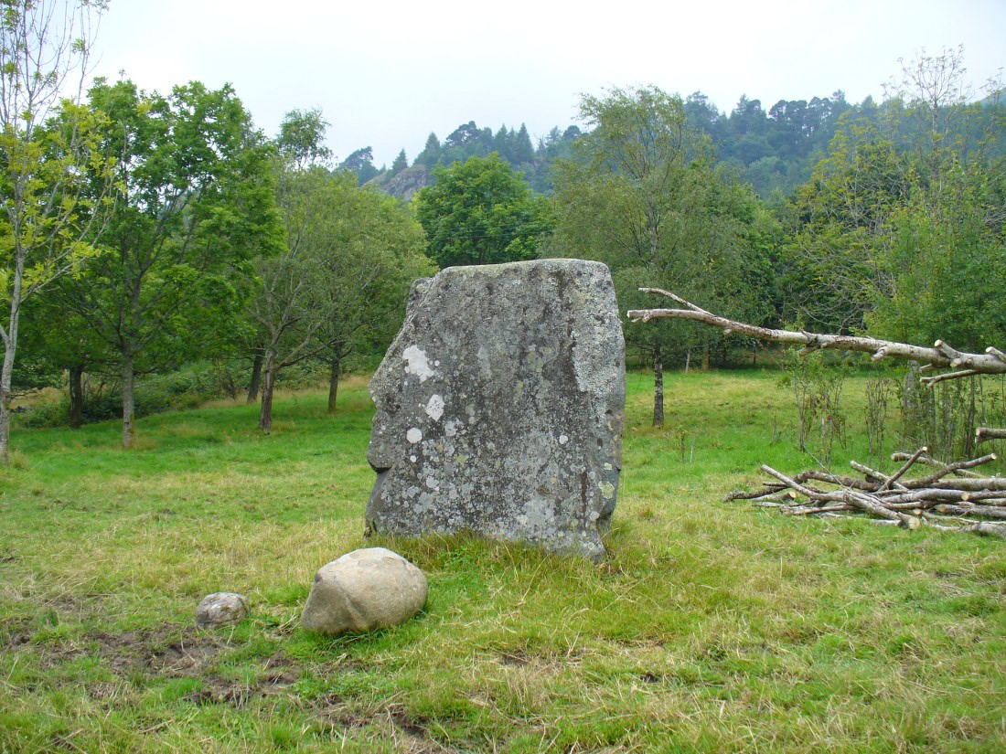
Puidrac Stone, looking SE

From Balquhidder village, take the road east towards Auchtubh as if you’re gonna visit the Priest’s Stone, just past the house of Tom na Cruich on the right-hand side of the road. When you get to the house, if you ask the owners there how best to get to the stone, they are very friendly and very helpful in pointing you in the right direction.

Archaeology & History

This solitary standing stone first seems to be mentioned in J.W. Gow’s (1887) essay on the prehistoric antiquities of this part of Rob Roy’s country.  Found below the house and hillock where the old gallows used to be, he told:

“On the level ground below (Tom na Croich) …there is a prominent monolith, standing about 4½ feet above ground, quite flat, on the top. It is shaped like a wedge, with the edge to the east, and is famous in Balquhidder as the place where trials of strength took place.”

Note the stones in the next field
Note the stones in next field
Puidrac Stone, looking north
Puidrac Stone, looking N

Below the standing stone is a small rock, whose predecessor played an important part in some local traditions relating to this site. (see ‘Folklore’ below)  Also, due west of here in the next field, you will be able to see a couple of seemingly upright stones in the tall reeds 200 yards away, which early records say were part of a stone circle—now much in ruin—known as Clachan Aoraidh or the Worshipping Stones.  There is the possibility that this single stone was an outlier to the circle.  It’s astronomy might be worth checking….

Folklore

When we visited the stone last week, the owners of the house above asked if we’d managed “to lift the stone”—and I wondered what they meant at first, until they told us the folklore about the site.  They narrated the tale almost exactly as it had been described first of all in J.W. Gow’s (1887) essay, which said the following:

A new ‘lifting stone’ in front of Puidrac

“It is shaped like a wedge, with the edge to the east, and is famous in Balquhidder as the place where trials of strength took place.  A large round water-worn boulder, named after the district, ‘Puderag’, and weighing between two and three hundredweight, was the testing stone, which had to be lifted and placed on the top of the standing stone. There used to be a step about 18 inches from the top, on the east side of the stone, on which the lifting stone rested in its progress to the top. This step or ledge was broken off about thirty years ago, as told to me by the person who actually did it, and the breadth of the stone was thereby reduced about 8 inches. This particular mode of developing and testing the strength of the young men of the district has now fallen into disuse, and the lifting-stone game is a thing of the past.  A former minister of the parish pronounced it a dangerous pastime.  Many persons were permanently injured by their efforts to raise the stone, and it is said that he caused it to be thrown into the river, but others said it was built into the manse dyke, where it still remains.  There were similar stones at Monachyle, at Strathyre, and at Callander, and no doubt in every district round about, but the man who could lift ‘Puderag’ was a strong man and a champion.”

The present stone that is positioned on the ground below the standing stone was put here in much more recent times.

References:

  1. Gow, James M., “Notes in Balquhidder: Saint Angus, Curing Wells, Cup-Marked Stones, etc”, in Proceedings of the Society of Antiquaries Scotland, volume 21, 1887.

AcknowledgementsTo Kenny and Laura for their help and guidance here. Huge thanks!

© Paul Bennett, The Northern Antiquarian