Black Hill Long Cairn, Low Bradley, Skipton, North Yorkshire

Cairn:  OS Grid Reference – SE 0092 4756

Also Known as:

  1. Black Hill Long Barrow
  2. Bradley Moor Long Barrow
  3. Bradley Moor Long Cairn
  4. King’s Cairn

Getting Here

Follow the same directions for getting to the Black Hill Round Cairn.  It’s less than 100 yards away – you can’t miss it!

Archaeology & History

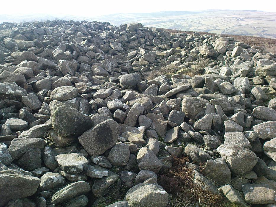
This is a superb archaeological site — and it’s bloody huge! It’s big and it’s long and it sticks out a bit – which is pretty unique in this part of the Pennines, as most other giant cairns tend to be of the large round variety.  Although the site was originally defined by Arthur Raistrick (1931) as a long barrow, J.J. Keighley (1981) told how, “it was found to be a round cairn imposed on a long cairn.”  And it’s an old one aswell…
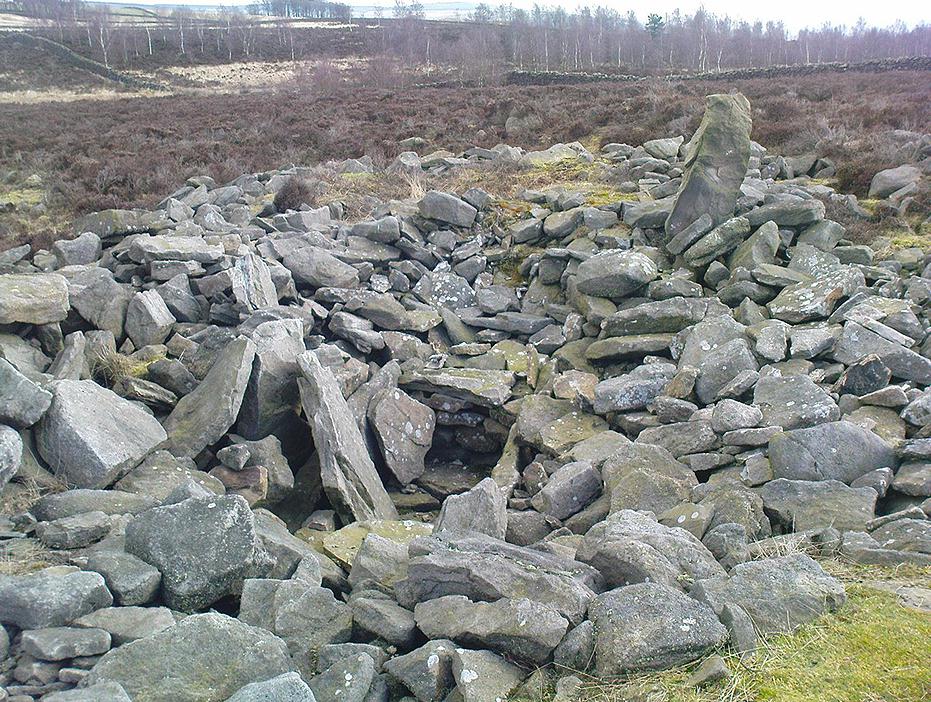
Near the SE end of the giant cairn
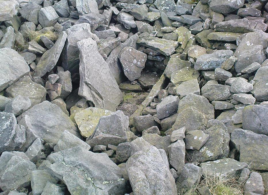
Close-up of the main cist

More than 220 feet long and 80 feet in diameter at its widest southeastern end, as we walk along the length of the cairn to its northwestern edge, its main body averages (only!) 45 feet in diameter.  Made up of tens of thousands of rocks and reported by Butterfield (1939) to have had an upright stone along its major axis, the “height varies from 4-8ft, but the cairn has been much despoiled and disturbed,” said Cowling in 1946. He also told how,

“Excavation revealed that almost in the centre of the mound were the remains of a cist made of roughly dressed stone flags and dry walling, covered by a large stone. Under a stone slab, laid on the floor of the cist, were fragments of (burnt and unburnt) bone and a small flint chipping.”

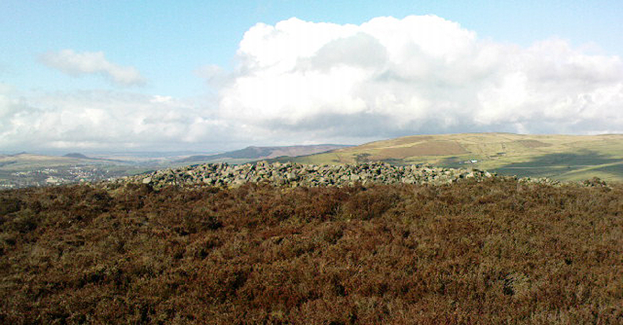
This is a very impressive site and deserving of more modern analysis. The alignment of the tomb, SE-NW, was of obvious importance to the builders, believed to be late-neolithic in character.  The tomb aligns to two large hills in the far distance in the Forest of Bowland which we were unable to identity for certain.  If anyone knows their names, please let us know!

Folklore

The older folk of Bradley village below here, tell of the danger of disturbing this old tomb. In a tale well-known to folklorists, it was said that when the first people went up to open this tomb for the very first time, it was a lovely day. But despite being warned, as the archaeologists began their dig, a great storm of thunder, lightning and hailstones erupted from a previously peaceful sky and disturbed them that much that they took off and left the old tomb alone. (I must check this up in the archaeo-records to see if owt’s mentioned about it.)

References:

  1. Ashbee, Paul, The Earthen Long Barrow in Britain, Geo Books: Norwick 1984.
  2. Butterfield, A., ‘Structural Details of a Long Barrow on Black Hill, Bradley Moor,’ in YAJ 34, 1939.
  3. Cowling, E.T., Rombald’s Way, William Walker: Otley 1946.
  4. Keighley, J.J., ‘The Prehistoric Period,’ in Faull & Moorhouse’s West Yorkshire: An Archaeological Survey, I, WYMCC: Wakefield 1981.
  5. Raistrick, Arthur, ‘Prehistoric Burials at Waddington and Bradley,’ in YAJ 30, 1931.

© Paul Bennett, The Northern Antiquarian

Black Hill Round Cairn, Low Bradley Moor, Skipton, North Yorkshire

Cairn:  OS Grid Reference – SE 0087 4753

Also Known as:

  1. Black Hill Cairn
  2. Bradley Moor Round Cairn
  3. Queen’s Cairn
The Black Hill Round Cairn, Bradley Moor - looking north
The Black Hill Round Cairn, Bradley Moor – looking north

Getting Here

Various ways here.  Best is probably taking the footpath onto Farnhill Moor a few hundred yards east of Kildwick Hall.  Head for the cross-bearing Jubilee Tower (supposedly built upon an ancient cairn), NW, keep going past it uphill until you reach the walling 350 yards north, where a seat let’s you have a rest.  Climb over the wall! Alternatively, walk eastwards and up through the steep but gorgeous birch-wooded slopes of Farnhill Wood; and as the moortop opens up before you, the great pile of rocks surmounts the skyline ahead. You can’t miss it! (NB: the spot cited on the OS-map as the cairn is in fact another site, 100 yards NW)

Archaeology & History

Its an awesome place in an awesome setting. You can see 360-degrees all round from this giant mass of rocks — something which was of obvious importance to the people who built it. If it had been placed 20-30 yards either side of here, that characteristic would not occur. Indeed, this is the only place anywhere on these moors where such a great view was possible. Important geomancy, as they say (or whatever modern term they give it these days).

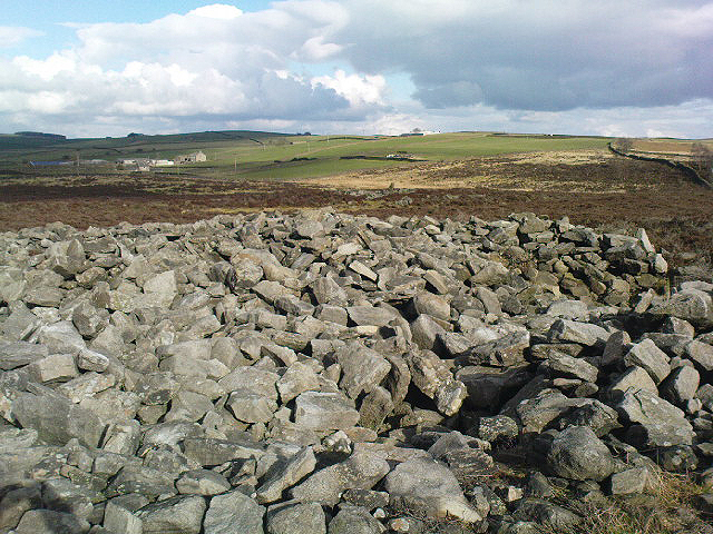
Bradley Moor Cairn - looking down to the Long Cairn
Bradley Moor Cairn – looking down to the Long Cairn
Small section of the old cairn

Although the tomb is still of considerable size (at least 100 feet across) and made up of thousands of stones, it has been severely robbed of stone in years passed, for walling and other building materials.  A number of other small cairns scatter the heathlands a few hundred yards roundabout this central giant (though are hard to find in the deep heather); and there is a distinct cairn circle about 100 yards to the northwest, which has yet to be excavated.  This cairn circle can be made out quite easily if you stand on the ridge about 30 yards west of here, looking down the slope.  An then of course we have the equally huge  Black Hill Long Cairn, less than 100 away, aligned northwest-southeast, which obviously had an important archaeological relationship with this giant round cairn.  Also around this and the adjacent long cairn, numerous flints and scrapers have been found, showing humans have been here since at least the early neolithic period.

This site in particular gives me the distinct impression that it was the most important of the various sites upon these moors. It’s got a distinctly female flavour to it – and it’s old name of the Queen’s Cairn seems just right.  Maybe it’s the fact that when I first visited the place, a great thunderstorm broke through the previously perfect skies, scattering lightning bolts all round for perhaps thirty minutes — so I stripped down and held my arms outwards, screaming to the skies in the pouring rain!  Thereafter, no clouds appeared in the skies for the rest of the day.  It was a brilliant welcome to the place!

References:

  1. Cowling, E.T., Rombald’s Way, William Walker: Otley 1946.
  2. Keighley, J.J., ‘The Prehistoric Period,’ in Faull & Moorhouse’s West Yorkshire: An Archaeological Survey, I, WYMCC: Wakefield 1981.
  3. Raistrick, Arthur, ‘Prehistoric Burials at Waddington and Bradley,’ in YAJ 119, 1936.

© Paul Bennett, The Northern Antiquarian

Clach na Glaistig, Iona, Argyll

Legendary Rocks:  OS Grid Reference – NM 262 222

Also Known as:

  1. Glaistig’s Stone

Folklore

One of the best known supernatural creatures in the Scottish Highlands and Islands was one called the Glaistig: an elemental described variously as, “a thin, grey woman with yellow hair reaching to her heels and attired in green raiment”; or a deity both beneficial and dangerous, “often described as half-woman, half-goat.”  Katherine Briggs (1979) wrote that sometimes this creature

“sometimes has the attributes and habits of the Cailleach Bheur, sometimes assumes animal form, often that of a goat, but more often she is described as half-woman, half-goat.”

Something decidely shaman-like!

In many of the places where she was found, she would tend for the cattle and in order to appease her, local people would pour milk into the hollowed stones by which she lived (at some places these were cup-and-ring stones).  The Iona Glaistig was no exception.  The great Scottish writer A.A. MacGregor (1947) mentioned this creature and its stone in one of his classic books, saying:

“In the shieling days of Iona when, during the summer months, the inhabitants of the east end and of the west end of that island were wont to pasture their cows alternately for fourteen days on the common grazing at a spot known as Staonnaig, a Glaistig dwelt in a hollow rock near at hand. For this Glaistig, the Iona women at milking-time each evening poured a little milk on what is still pointed out at the Glaistig’s Stone.”

This “pouring of milk” onto hollows in stones is a custom found in cultures from Europe eastwards into India and, no doubt, even further afield.  The precise whereabouts of this sacred stone remains hidden.

References:

  1. Briggs, Katherine, A Dictionary of Fairies, Penguin: Harmondsworth 1979.
  2. MacGregor, Alasdair Alpin, The Peat Fire Flame, Ettrick Press: Edinburgh 1947.

© Paul Bennett, The Northern Antiquarian

Man Stone, Askwith Moor, North Yorkshire

Cup-and-Ring Stone:  OS Grid Reference – SE 16722 50595

Also Known as:

  1. Carving no.516 (Boughey & Vickerman)

Getting Here

Man Stone (by Inmaculada Ibanez-Sanchez)

Truly takes a bit of finding this one!  I s’ppose the easiest way to locate it is by approaching it from the south, from Askwith village, up Hall Lane.  Keep walking up the footpath to Top Moorside Farm; then past it, sticking to the same path.  A hundred yard or so past here we get onto the moor itself.  As you hit the moor, you’ll see that the land rises slowly ahead of you: this is Hollin Tree Hill and you need to walk up here (don’t do this in the summer as it’ll be covered in bracken and you’ll not find a damn thing!).  Just before the land starts to levels-out at the top of this small rise, you’ll come across some hut circles.  You’re here!

Man Stone
image courtesy of Graeme Chappell

You can also come to this carving via the Askwith Moor parking-bit, then walk along the well-trod footpath, past the triangulation pillar of Shooting House Hill for a coupla hundred yards, then walk straight south into the moor.  But to those of you who aint got the nose for it, there’s no footpaths here and some folk might easily lose their way.  However, if you reach the rise of Hollin Tree Hill a few hundred yards down the moor, watch out for those same hut circles mentioned elsewhere atop of the rising land.  You’re damn close!

Archaeology & History

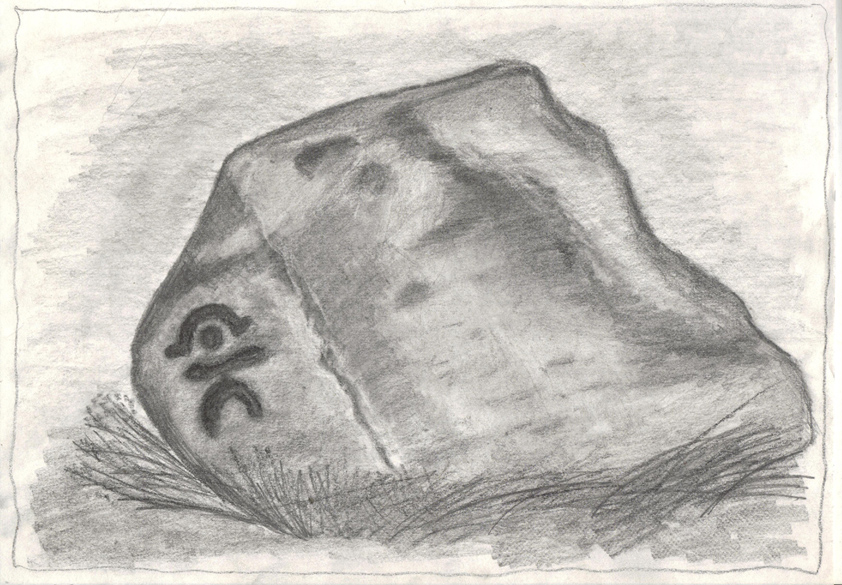
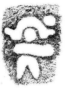
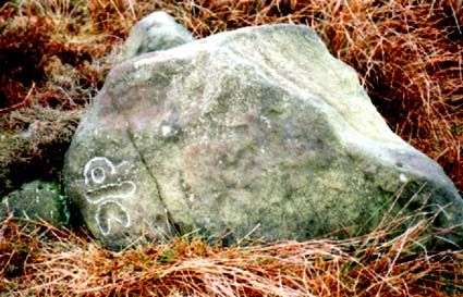
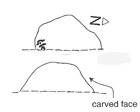
One of my very favourite cup-and-ring carvings this one!  It was discovered about 1991 when Graeme Chappell and I were on one of our many archaeology wanderings, seeking out prehistoric remains on the moors north of Ilkley.  First described and illustrated in Bob Trubshaw’s (1996) archaeomythics journal, it was later included in The Old Stones of Elmet (2001: 149-152).  But when we first found it, this carving – on the vertical face of a small stone, beside an unexcavated hut circle – sent me a bit crazy, as the ‘human’ image in the carving struck me immediately. Needless to say, Graeme was all calm about it while I jumped around like an excited tit!  As far as we’re aware, this is the earliest representation of a human figure in the British Isles.  There are several other contenders in cup-and-ring design, but this seems the most probable of the lot.  Graeme Chappell took a rubbing of the stone several years after we’d found it and the outline clearly shows the image of a human figure.  The carving was later catalogued by rock art students Boughey & Vickerman (2003) in their  Yorkshire survey as ‘stone 516.’  A female compatriot, the Woman Stone, can be found a few hundred yards east of here, at the bottom of the slope by the near horizon.

The fact that the carving occurs on the southern vertical face of a prehistoric hut circle may have had some significance about the structure itself.  Petroglyphs on hut circles are rare—and this one occurs right at the entrance to the structure, the door into the circle.  It may represent an image of the person who lived in this hut circle, or perhaps symbolized the nature of the character living there.  The carving shows that the person was wearing a head-dress, akin to a horned-man figure – but much much earlier than anything previously recognised in British iconography.  The figure may well be a shaman who, perhaps, lived at this circle.  The carving was probably painted in lichens and other dyes

The Man Stone carving
Boughey & Vickerman sketch

Be careful not to wander around looking for this when there’s fog on the hills.  You’re unlikely to find it!  On an excursion up here several years back with Prof. Thomas Dowson and students from the Southampton University Rock Art course, we wandered about all over the place in the dense fog but were unable to find the damn thing!  Twas a bittova freaky day, as half the students started crying (they thought I’d got them truly lost in the middle of nowhere as I didn’t have a map, a compass, walking boots, etc – which is how I usually do my wanderings, but they weren’t to know that!) and we must have walked within 10 yards of the carving, but it remained hidden from our prying eyes.  But if you like your rock art, check this one out!

References:

  1. Bennett, Paul, The Old Stones of Elmet, Capall Bann: Milverton 2001.
  2. Boughey, Keith & Vickerman, E.A., Prehistoric Rock Art of the West Riding, WYAS 2003.
  3. Trubshaw, Bob, “Unique British Anthropomorphic Rock Carving”, in At the Edge, no.4, December 1996.

© Paul Bennett, The Northern Antiquarian