Hollin Tree Hill, Askwith Moor, North Yorkshire

Settlement:  OS Grid Reference – SE 1671 5067

Getting Here

Very troublesome to locate when the heather’s deep. To get here take the Askwith Moor Road heading north and park-up at the big gritted parking spot halfway along. Cross the road (west) and walk up a little and onto the moorland track.  When you hit the triangulation pillar, walk down (left) onto the moor, heading for the small rise in the land a few hundred yards away. Once there, start walking down its sloping south-face, watching for any evidence after 100 yards. Be vigilant!

Archaeology & History

One of 4 hut circles in very good state of preservation

This small settlement was first found on 18 July, 2004, when a small group of us, in search of the troublesome Man Stone carving, were lucky to be on the moors shortly after the heather had been burnt back, amidst this archaeologically rich area of Askwith Moor, on the northern end of Hollin Tree Hill.

There were at least four hut circles found here (on the right of the track as you walk up the slope), with one in particular — the northernmost of the group — in a very good state of preservation.  This particular circle measured approximately 20 feet in diameter, with an entrance to the south side.  It is marked by a low earthfast boulder on the northeast side, visible even when the heather is deep.

Although we counted four such circles, it’s very likely that an intensive search would uncover more remains on this hillside.  In revisiting this site in October 2016, the heather had grown back over the entire complex and the circles were very difficult to see; but we were able to discern the one on the very top of the hill (the one in the photo).  The other hut circles, lower down the slopes, were notable only by zigzagging back and forth until we walked onto loose walling.

© Paul Bennett, The Northern Antiquarian

Dun Bhuirg, Iona, Argyll

Hillfort:  OS Grid Reference – NM 2649 2462

Also known as:

  1. Canmore ID 21638
  2. Dun Cul Bhuirg

Getting Here

Take the road that cuts across the island, west, until you reach the stupid golf-course.  Walk across it, heading for the coast (not the building at Culbuirg), then follow the little footpath up until you reach the large rocky rise about 500 hundred yards north.  That’s it!

Folklore

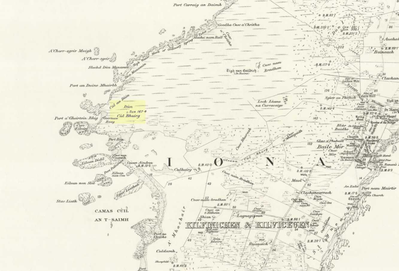
Dun Bhuirg on 1881 map

Shown on the 1881 OS map of the region, the small remains of this Iron Age hillfort was said to be the place where St. Columba saw a rain-cloud which he predicted would bring a plague of ulcers to the people of Ireland. To prevent such a plague, Columba thence dispatched a monk called Silnan to Ireland, armed with some bread which he’d blessed. This bread was then dipped in consecrated water and given to those afflicted with the plague, who were thereafter cured.

Wee-ird……

Another tradition told that this old fort was once an important meeting place for the druids, though Geoff Holder (2007) writes that this is little more than a “spurious nineteenth century tradition” which he dismisses as without foundation. Though a short distance from here, he also told how one “Fiona MacLeod” (real name, William Sharp) one night watched the ghost of the Culdee, Oran, a couple of hundred yards away, “and so he never went that way again at night.”  In truth, traditions of druidism tend to be animistic traits: legends remembered from pre-christian days, and blanket dismissals of such folklore are themselves untrustworthy—especially on this Isle of the Druids.

References:

  1. Holder, Geoff,The Guide to Mysterious Iona and Staffa, Tempus: Stroud 2007.
  2. MacLeod, Fiona, Iona, Floris: Edinburgh 1982.

© Paul Bennett, The Northern Antiquarian

Ciceley Low, Houndkirk Moor, South Yorkshire

Ring Cairn:  OS Grid Reference – SK 27535 80800

Getting Here

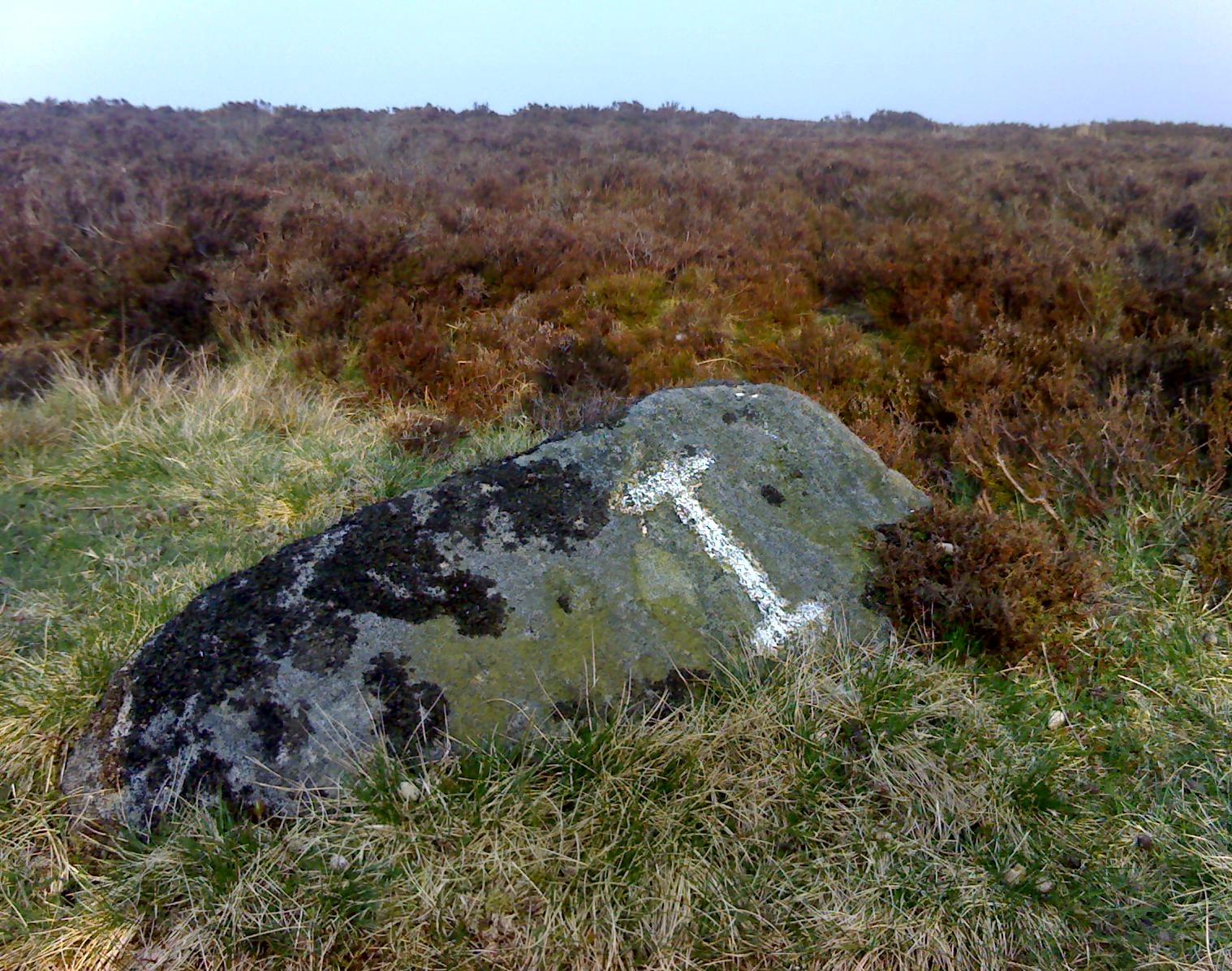
Located just off Hathersage Road, by Parsons House outdoor pursuits centre with parking in a roadside layby. Don’t Park at Parsons House – they won’t like it!  Head up the old road besides Parsons house and take the entrance onto the moor about 100 metres past the pursuits centre track.  If memory serves me correct, it’s by the second wall on the right. Follow the post-and-mesh fence to the end of the wall and turn right, following the wall for around 70 metres down hill and you’ll be able to see the cairn’s bank before you in the heather.  The stone pictured lays in the banking by the entrance which faces NNW.

History and Archaeology.

There’s no excavation taken place here that I know of, but the site is well known and mentioned in an old report I found Here.   The article also contains an old map of the area showing the site.

Also mention is made of a stone referred to as the Fingeram stone.  There is a stone laid flat in the position marked on the map,  but I’m unsure whether it’s the standing stone mentioned.  According to the old text the ring cairn has a diameter between 83ft and 95ft.  Directly to the north and roughly 50 metres onto the moor, in line with the wall, is an interesting egg-shaped  and weather-worn boulder that’s also worth a look at.  This whole area is a sea of sandstone.

© Geoff Watson, The Northern Antiquarian


North Ring, Mucking, Stanford-le-Hope, Essex

Enclosure (destroyed):  OS Grid Reference – TQ 675 811

Archaeology & History

North Ring, Mucking (after Brown, 2001)

This large circular enclosure, measuring about 120 feet across, seemed to be a small settlement with several internal structures (fences, pits, cremations and a sunken-floored structure) that was first excavated in 1978 and described as a Bronze Age enclosure.  Akin to a henge monument in some ways, this small settlement site had two entrances: one on the east and the other opposite on its west side.  However, the main ‘entrance’ was on the eastern (sunrise) side, where post-holes laid a pathway over the ditch and into the structure itself.

The excavation on the eastern side of site revealed two periods of construction with associated structures, including three circular buildings.  Some excavations to the east produced evidence for a range of contemporary activities.  The assemblage of Late Bronze Age material included pottery, metalwork, cremation remains, sickle moulds and equipment for salt production.  For further info and imagery, see the Link below.

References:

  1. Bond, Dermot, Excavation at the North Ring, Mucking, Essex, East Anglian Archaeology 1988.
  2. Brown, N., “The Late Bronze Age Enclosure at Springfield Lyons in its Landscape Context,” in Essex Archaeology & History, volume 32, 2001.

Links

  1. North Ring, Mucking

© Paul Bennett, The Northern Antiquarian


Springfield Lyons, Chelmsford, Essex

Enclosure:  OS Grid Reference – TL 7357 0818

Archaeology & History

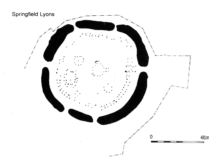
Springfield Lyons enclosure (after Brown, 2001)

We’ve known that there was an excessive number of prehistoric archaeological sites in and around the Chelmsford region for quite a long time now, but defining precisely the age and nature of the finds takes some doing! (as you’d expect)  It hasn’t helped, of course, with the housing estates and other ecologically destructive building operations in and around the area, screwing up a more accurate and patient assessment of the material there.  And this predicament was exemplified with the Springfield Lyons neolithic causewayed enclosure just as much as at the Springfield Cursus and other sites nearby.

Although excavations here found a large, deep ditch with impressive ramparts and entrance, in Oswald, Dyer & Barber’s (2001) survey of these giant monuments, they defined the remains here as “probable,” pending further investigations.  But the site was primarily defined by the large deep ditch, broken in several places round its edges with the ’causeways’ built leading onto the site.  The enclosure gave good views over the small valley from here and had streams running either side of it.

Adjacent to the site were the remains of a “small circular enclosure with multiple entrances,” saying that excavation here,

“has proved that it is of late Bronze Age date and might be interepreted variously as a defended settlement, or a ritual monument.”

This external small enclosure site was then conjectured, quite spuriously it’s gotta be said, to be a mini-version of the great causewayed enclosure monument, saying:

“Its siting and form both hint that it could have been a conscious imitation of, or re-invention of, the perceived form of the earthworks of the neolithic enclosure.”

I like the idea, it’s gotta be said — but without direct evidence we’ve gotta take this idea with a large pinch of salt!

…to be continued…

References:

  1. Brown, N., ‘The Archaeology of Essex 1500 – 500 BC,’ in Bedwin, O. (ed.), The Archaeology of Essex, ECC: Chelmsford 1996.
  2. Brown, N., “The Late Bronze Age Enclosure at Springfield Lyons in its Landscape Context,” in Essex Archaeology & History, volume 32, 2001.
  3. Oswald, Alastair, Dyer, Caroline & Barber, Martyn, The Creation of Monuments: Neolithic Causewayed Enclosures in the British Isles, EH: Swindon 2001.
  4. Priddy, D., ‘Excavations in Essex, 1987,’ in Essex Archaeology & History, 19, 1988.

© Paul Bennett, The Northern Antiquarian

Stanbury Hill Enclosure, Bingley Moor, West Yorkshire

Enclosures:  OS Grid Reference – SE 109 433

Getting Here

Follow the same directions as to find the Lunar Stone, Spotted Stone, etc.  Go thru East Morton village up the steep moorland road, east, and where the road levels out there’s a right turn and a trackway on your left which leads onto the moor.  Go ½-mile up this track till you hit a moorland ‘footpath’ signpost.  Stop here and walk due west (left) for a coupla hundred yards.  If the heather’s grown back you aint much chance of finding owt – but if there’s only low growth, amble about zigzagging – and keep your eyes peeled!

Archaeology & History

Section of cairn rubble & walling

Although there’s been no written record of the Stanbury Hill remains until very recently, it seems quite probable that Mr Stuart Feather would have come across at least parts of these remains when he uncovered the rock-art in the same vicinity, but he never made public his finds.  He was a diligent researcher and finder of cup-and-ring stones, nose to the ground sorta chap, and it would be odd for him to miss the other remains on this hill.  For as we now know, there are undeniable evidences of considerable neolithic and/or Bronze Age walling scattered along (mainly) the southern side of Stanbury Hill, running mainly along an east-west axis, but there are also examples of the walling running roughly north-south.  In at least one position near the western end of the ridge, halfway down the south-facing slope, is what seems to be the unmistakable trace of an enclosed hearth.  At the time of writing a series of archaeological digs are, slowly, being done hereabouts, so it will be good to read their final evaluations.

Very close to some parts of the walling we find the remains of old cairns, and at least one cup-and-ring stone has been carved along the axis of one line of walling (it reminded me very much of the Bronze Age settlement remains found at Snowden Moor, over the northerly horizon, in the Washburn Valley).  Several other previously unreported cup-marked stones have also been found here (we’ll highlight them on TNA in the coming weeks).

Upon first impression the remains found upon and around Stanbury Hill seem more related to mortuary practices than what we’d call ‘domestic’ living practices, as the prevelance of carvings and cairns indicates.  But we’ve gotta be cautious here, as in many sites the dead were kept with the living; and as we find in many traditional or aboriginal cultures, the land of spirits and that of the living are much more closely allied than in our profane ‘Western’ paradigm.

More from this site in due course…

© Paul Bennett, The Northern Antiquarian

Yarnbury Settlement, Grassington, North Yorkshire

Settlement:  OS Grid Reference – SE 012 655

Getting Here

Dead easy.  Take the road up through Grassington village, up Moor Lane, onto the grassy tops towards Yarnbury.  As the road levels out, and before you reach the tree-border of Yarnbury house, there’s a field on your left-hand side, opposite the one where the Yarnbury Henge lives.  If y’ go in there to check out this walling, shut the effing gate!

Archaeology & History

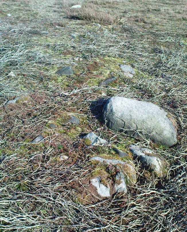
Section of walling, Yarnbury

It appears that there’s little information on the remains of what seems to be some Iron Age walling a few hundred yards away, northwest of the little Yarnbury ‘henge’ monument.  Mikki Potts noticed it first of all, in one of the Northern Antiquarian ambles here t’other day.  The walling is quite distinct and typical of finds elsewhere, particularly the excessive Iron Age and Bronze Age walling remains less than a mile west of here, down the slopes near Grasssington.  At least two lines of walling are clearly apparent, running roughly northeast-southwest.  Another section runs off towards the extant walling back towards the road.  But more intriguing (for me anyway!), is what seems to be the remains of an old circle less than 100 yards north, on the other side of the footpath in the same field.

We didn’t spend too much time here and so another visit is obviously needed for further exploratory wanderings, but there appear to be further remains.  Although much of the terrain hereabouts is scattered with an excess of medieval archaeological relics — including some disused shafts at the very top of this same field — this section of walling has all the hallmarks of a much earlier period.  (sadly, a lot of the early mine-workings up here has destroyed a considerable amount our earlier prehistoric heritage).  As one local told us a a coupla weeks back, “There’s loadsa stuff up here which aint in the record books!”

Certainly seems like it!

(In the event that these remains turn out to be of a later period, this profile entry will be removed from TNA.)

© Paul Bennett, The Northern Antiquarian

Stoop Hill, Askwith Moor, North Yorkshire

Hut Circle:  OS Grid Reference – SE 1739 5076

Getting Here

From the Askwith Moor dusty parking spot, walk up the road for 160 yards where, on each side of the road, you’ll see a straight line running across the moors.  On the left-side (west) walk onto the moor for 50-60 yards along this line, then dead straight west into the heather for another 50-60 yards and look around.  It’s hard to see if the heather’s grown.

Archaeology & History

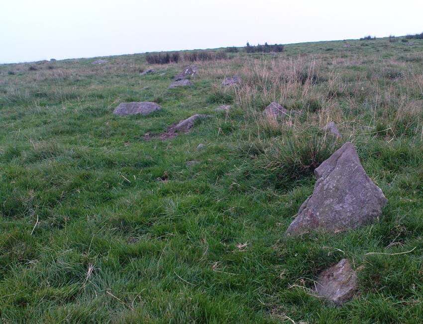
Found by Richard Stroud on July 20, 2004, this single hut circle is in faint evidence.  About twenty feet across with a section of the low walling either missing, or more probably buried in the peat.  Although no other hut-circles were immediately visible, this was probably because of the excessive heather-growth.  I have little doubt that others will be close to this one, as the area is littered with prehistoric sites.  The petroglyph catalogued as Askwith Moor 529 is very close to this hut circle.

© Paul BennettThe Northern Antiquarian

Castle Hill, Upper Cumberworth, West Yorkshire

Settlement:  OS Grid Reference – SE 2042 0697

Getting Here

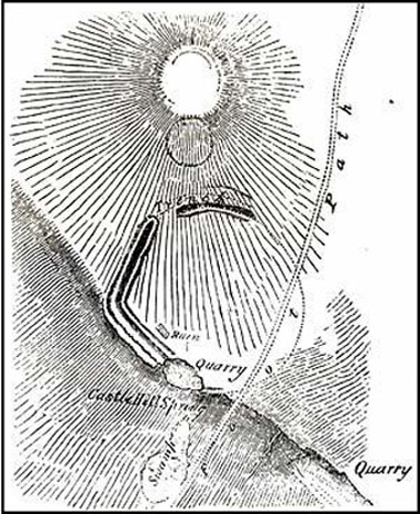
Morehouse’s 1861 plan

Taking the A629 road between Shepley and Ingbirchworth, as you hit the staggered crossroads at High Flatts, take the west turn up the slightly sloping straight road of Windmill Lane.  Just where the road ‘kinks’ at a small bend, stop and look into the field on your left.

Archaeology & History

Deemed by some as a hillfort, and others as settlement remains, what little are left of the remaining earthworks here were first described by local historian Henry Morehouse in 1861.  Found about a mile west of Upper Denby, the site was described in the Victoria County History as being “on a commanding though not exactly a defensive situation on the slope of a hill.” This remark coming from the belief (and that’s all it is) that this was an Iron Age castle site.  In 1924 James Petch said of it,

“The earthwork seems originally to have been almost square, and two sides and an angle remain. The external ditch is from ten to twelve feet broad in its present state.”

While Faull & Moorhouse (1981) tell of there being “evidence for Neolithic activity” here, modern surveyors reckon it as an old prehistoric settlement — which makes sense; though little of the site remains to be seen today.

References:

  1. Faull, M.L. & Moorhouse, S.A., West Yorkshire: An Archaeological Survey, I, WYMCC: Wakefield 1981.
  2. Morehouse, Henry James, History and Antiquities of the Parish of Kirkburton and the Graveship of Holme, Roebuck: Huddersfield 1861.
  3. Petch, James A., Early Man in the District of Huddersfield, Huddersfield 1924.

© Paul Bennett, The Northern Antiquarian

Urn Stone, Green Crag, Ilkley Moor, West Yorkshire

Cup-and-Ring Stone: OS Grid Reference – SE 12832 46163

Also Known as:

  1. Carving no.130 (Hedges)
  2. Carving no.287 (Boughey & Vickerman)

Getting Here

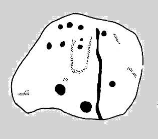
Drawing of the Urn Stone (after Hedges 1986)

Follow the directions for getting to the Haystack Rock, then bear right (west) along the footpath, past the little Three Cups Stone, until the path bends and goes up onto the moor.  A hundred yards or so, walk left into the heather (you’re straddling the remains of considerable prehistoric walling and enclosure remains by now) and look around.  You’ll find it!

Archaeology & History

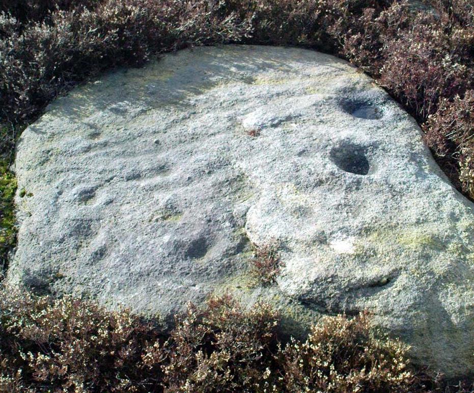
I was only about 12-years old when I first saw this and the nearby prehistoric carvings — but when I came to look for any references to it as a boy, there were none I could find at the time.  Then, ten years later when John Hedges (1986) brought out his fine work on the cup-and-ring art of Ilkley Moor, its presence was shown in pen-and-ink at last.  Found amidst the remains of an extensive settlement or series of walled enclosures, the carving’s name comes from the curious urn-like element that Hedges showed faintly.   There is also an additional ring around one of the cups above the ‘urn’.

Excavations that were done on the prehistoric ‘enclosure’ close to this petroglyph in the 1990s, uncovered the remains of a decent amount of ‘grooved ware’ pottery and worked flint (Edwards & Bradley 1999), dated between 2900 and 2600 BC.  As such pottery has been found elsewhere in Britain within and/or near earthworks and other prehistoric remains (obviously!), its incidence here isn’t really too much of a surprise.  However, Edwards & Bradley (1999) speculate — albeit vaguely — that there may be a link between the cup-and-rings here and the pottery, saying, “if so, the rock carvings (here) might be indicating a place of special significance.”

This may be so: considering the prevalence of rock-art along the geological ridge and its close association with the large number of burial cairns.  If it can be ascertained that the charred remains of humans were kept inside the pottery or vases, the relationship between death and the carvings (well established on this part of Ilkley Moor) would be reinforced.

References:

  1. Boughey, Keith & Vickerman, E.A., Prehistoric Rock Art of the West Riding, West Yorkshire Archaeology Service 2003.
  2. Edwards, Gavin & Bradley, Richard, ‘Rock Carvings and Neolithic Artefacts on Ilkley Moor, West Yorkshire,’ in Grooved Ware in Britain and Ireland (edited by Cleal, R. & MacSween, A.), Oxbow: Oxford 1999.
  3. Hedges, John, The Carved Rocks on Rombald’s Moor, WYMCC: Wakefield 1986.

© Paul Bennett, The Northern Antiquarian