Fairy Mine, Bingley Moor, West Yorkshire

Miscellaneous:  OS Grid Reference – SE 12 43

Archaeology & History

Fairy Mine, Bingley Moor
Fairy Mine, Bingley Moor (photo by James Elkington)

This is a strange one.  A really strange one…..  The site would not have even been written about had it not been for James Elkington pushing me to make its existence visible to a wide audience.  As with many sites that I’ve rediscovered, this is one of many that I never seem to write about, for various reasons…although I did do a short piece on it (Bennett 2001) many years back in a little earth mysteries mag, but kept the location quiet.  But now, James has got me to change my mind about it.  If anyone can throw any light onto what they think this site might be, feel free to let us know. With the exception of is early history, this is its story…

Close-up of the entrance (photo by James Elkington)

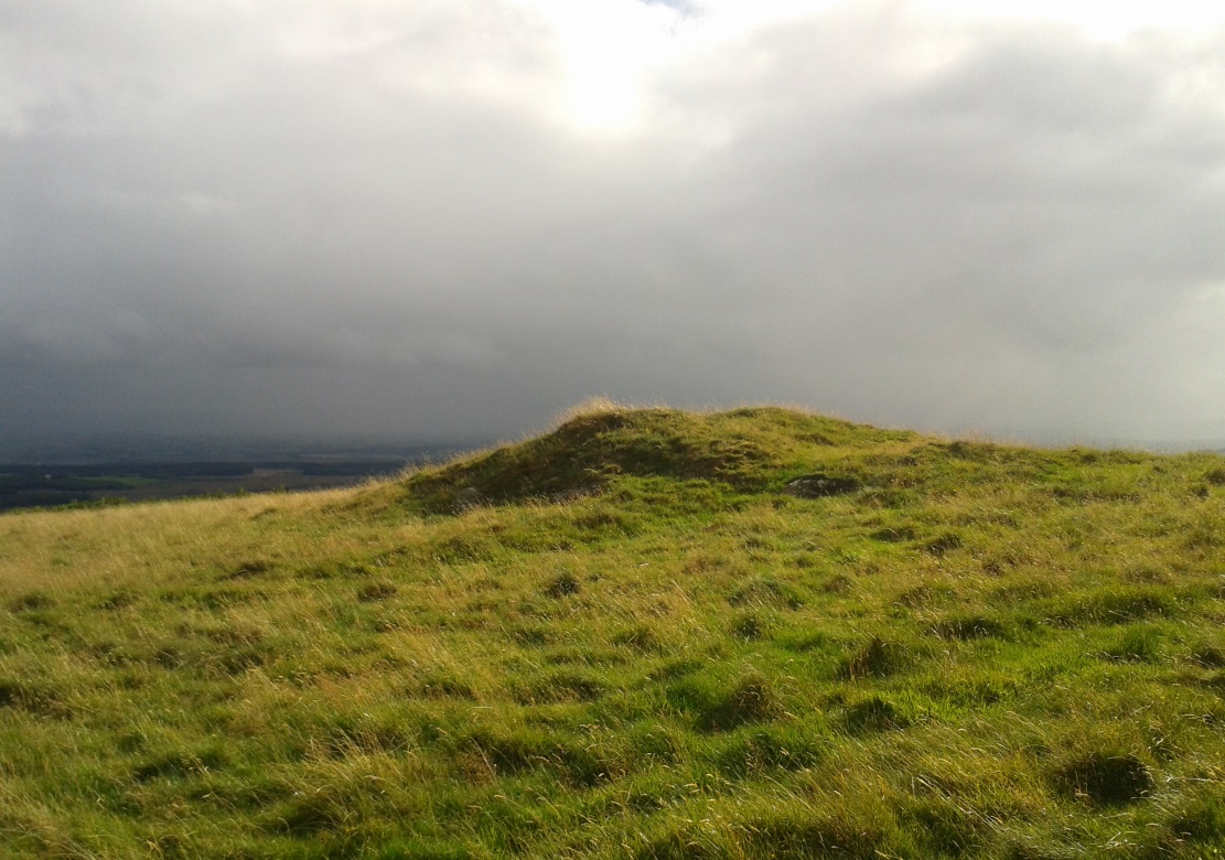
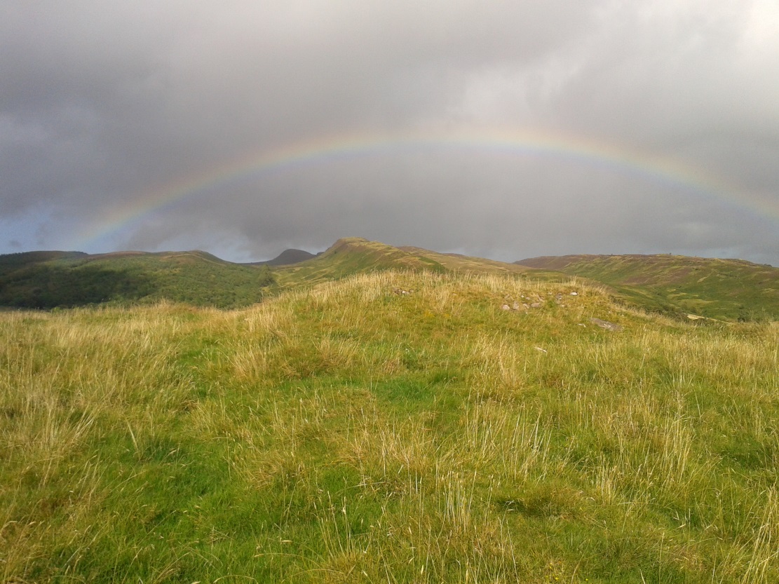
One weekend in the early Spring of 1977, Jon Tilleard and I made our weekly wander onto the southern edges of Rombalds Moor, doing little as usual apart from maybe seeking out the curious cup-and-ring stones and other ancient remains, along with walking through the obligatory bogs and wetlands, getting filthy and wet through as healthy kids do at that age.  After making our way to Horncliffe Well (generally our first point of call most weeks), we decided to head straight west, off-path as always, and eventually sat ourselves down for something to eat near Wicking Crags on Bingley Moor.

As we packed up again, readying ourselves to walk further onto the moor, John stood upright.  In doing so, he dislodged a stone by his feet—right where I was still sitting on the ground!

“Watch out!” he exclaimed loudly—and I quickly rolled forward to get out of the way of the impending stone.  Thankfully it wasn’t too big.  But then as I turned round to see what had happened, I saw John stood on the small rocky rise he’d been sitting upon—and right beneath his feet, the stone that he’d dislodged had been hiding a very curious secret indeed…

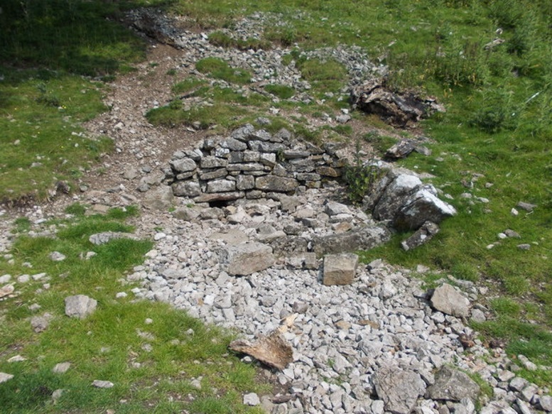
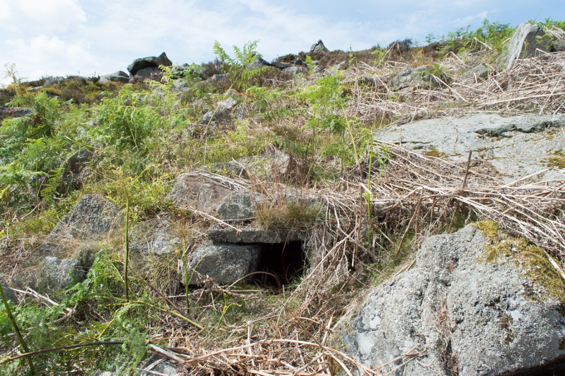
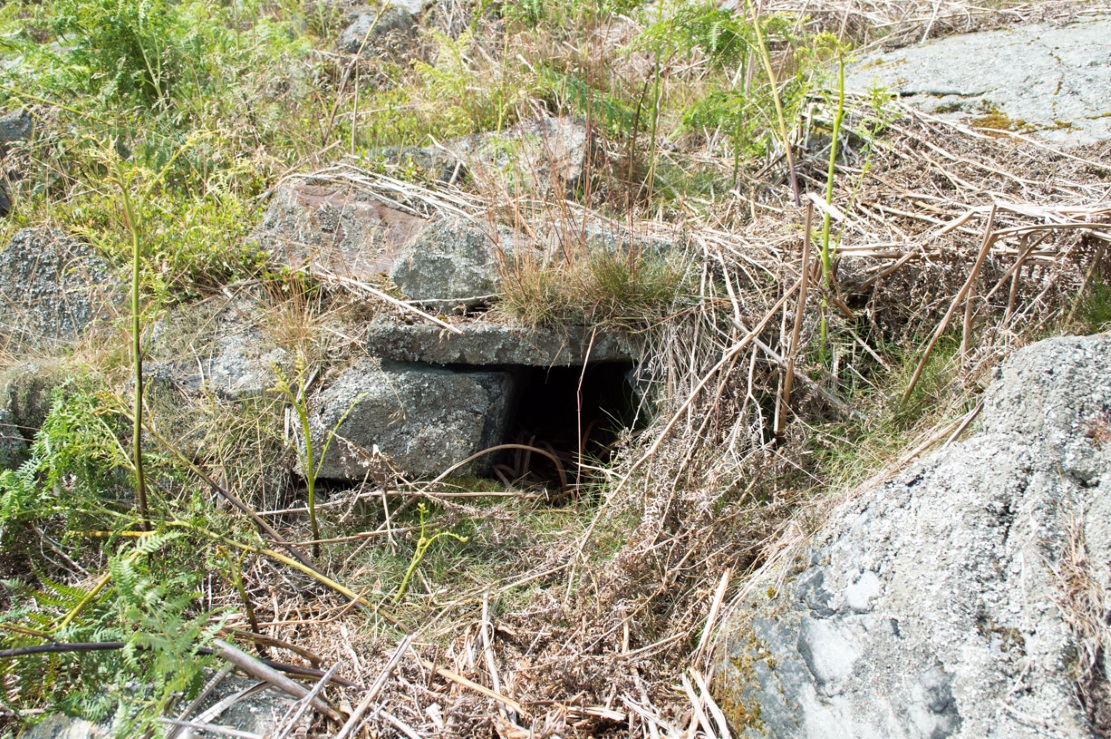
As the photos show, a small opening led into the Earth right underneath where Jon had been sitting.  The stone he’d accidentally kicked away had covered and sealed a previously unrecorded entrance.  Now, after however many centuries it had been closed and secret, he’d uncovered it again.  For us two fourteen-year-old lads gazing into this passageway, our imaginations started running riot!

“What the hell izzit!?”—we must have exclaimed a dozen times or more to each other!  To this day, we still don’t know.

I’m not sure how long we stayed here after we’d first found it, but before we left we made sure that the covering stone which had sealed the entrance was propped back upright, securely, so that no one else could find it.  The site was quite a way off-path, at the head of a very large boggy area where—to this day—people very rarely walk (in all my years of walking these moors, I’ve yet to see another human walking in this area).

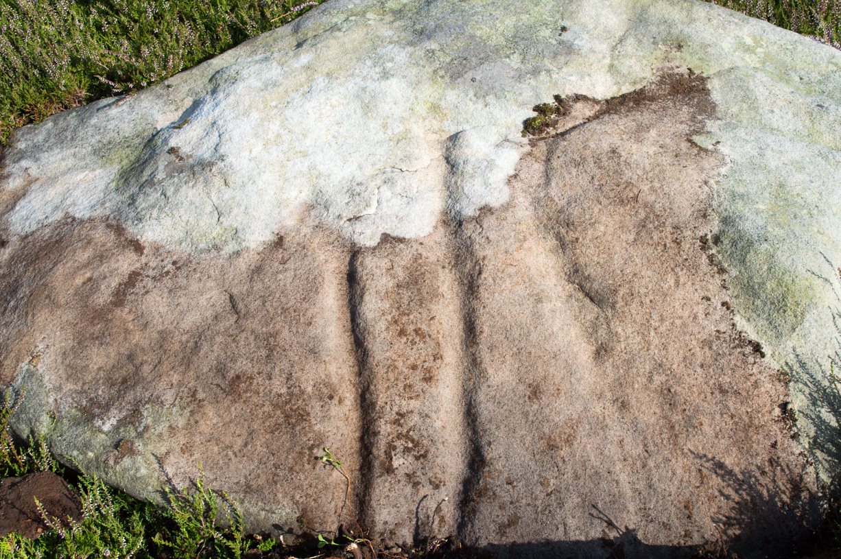
In looking into the tunnel for the very first time, the ground on the outside was of course covered by the usual moorland vegetation; but an inch behind where the stone had sealed this tunnel, the floor was grey dust, all the way in.  There were no animal tracks, neither mice nor others, no droppings, no nothing (which we thought was rather unusual).  No plants of any form were evident.  This ‘door’ had been closed for a very long time it seemed.  …Today if you visit the site, ferns and other small plants have encroached several feet into the tunnel.

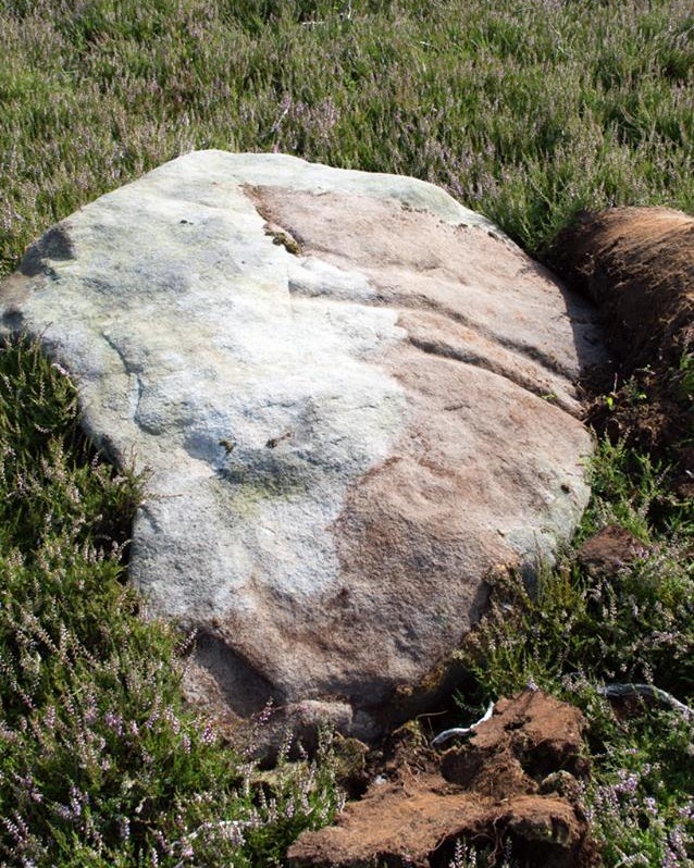
The entrance itself is about 14 inches across, and from the ground to the top covering stone the entrance is less than 12 inches high, showing quite clearly that no humans can walk in or out of it.  Which added to the puzzle: what the hell is it?  And why was it sealed with a covering stone?  But the more we looked (it became our regular port of call each time we were on the moors) the more obvious it became that a huge amount of work had gone into creating this antiquarian oddity.

As Winter came and cleared all the vegetation surrounding the site, we got an increasingly clear picture of it.  But this wasn’t before we tried to get inside!  Jon and I failed, but our torches showed that it went in for about 20-30 feet or so and then appeared to be stop, blocked by another stone.  Thankfully I had a younger brother, Phil, who was seven-year old at the time—so we took him up to have a look at the place.  We figured that only a small person could get inside the tunnel, but we didn’t tell him this (nor my parents!) until we arrived.

With torch in hand, Phil slithered into the entrance and, eventually, his little feet disappeared into the ground.  He didn’t seem too happy about it as I remember—but I was his big brother! (cruel – cruel – cruel!)  Shouting back down to us as he slithered further and further in, when he reached the blocking stone in the tunnel he exclaimed—”You can go round it!”

“What!? Really!?”

We were excited.

“Keep going Phil,” we urged.  But he wouldn’t.

“I’m scared Paul,” he said.  “I won’t be able to get back out”—or something along those lines.  And he was probably right.

But he managed to get his young tiny body slightly round the blocking stone that he’d reached and shone the torch-light down the extended tunnel.  He told that the it just kept going into the hill still further, keeping the same size and dimensions and straightness for about the same distance again—but then it started to curve very slightly, bending to the left (northwest) until it disappeared underneath the entire hillside, stretching out of sight. It seemed from his description, subsequently, that the tunnel went on for another 50 feet at least.

Once he was safely back out, he reiterated how far in it seemed to go.  We walked up the hill under which it had been built and Phil bimbled to roughly where he thought the tunnel was as he saw it with the torchlight.  Standing on the hilltop, this was obviously an extraordinary feat as there are thousands of tons of rock and earth covering it!  Curiously, years later, a dowser who visited the place walked the same route that Phil had described when he went inside it (we told the dowser nothing of Phil’s venture until afterwards).

Denuded walling leading to entrance
Denuded walling leading to entrance (photo by James Elkington)
Low walling leading to the 'Mine'
Low walling leading to the ‘Mine’ (photo by James Elkington)

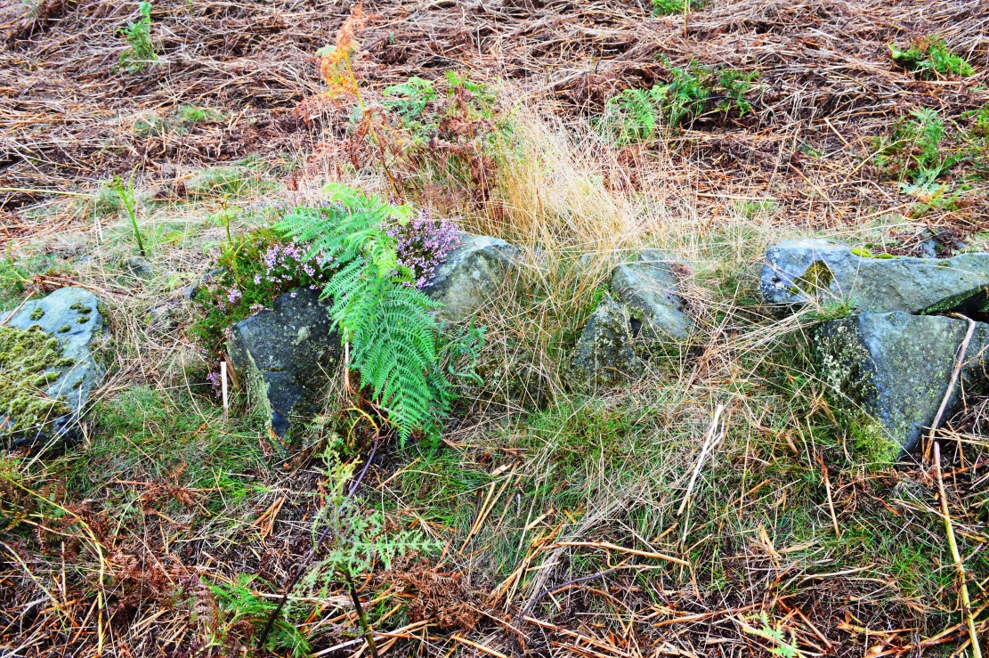
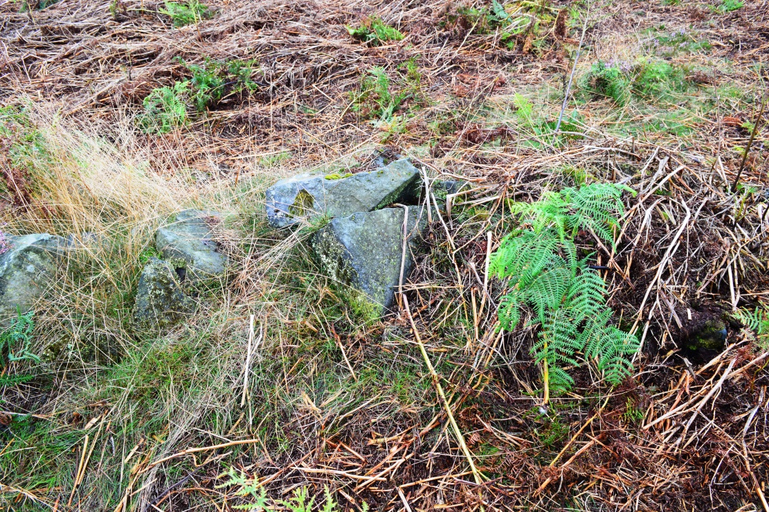
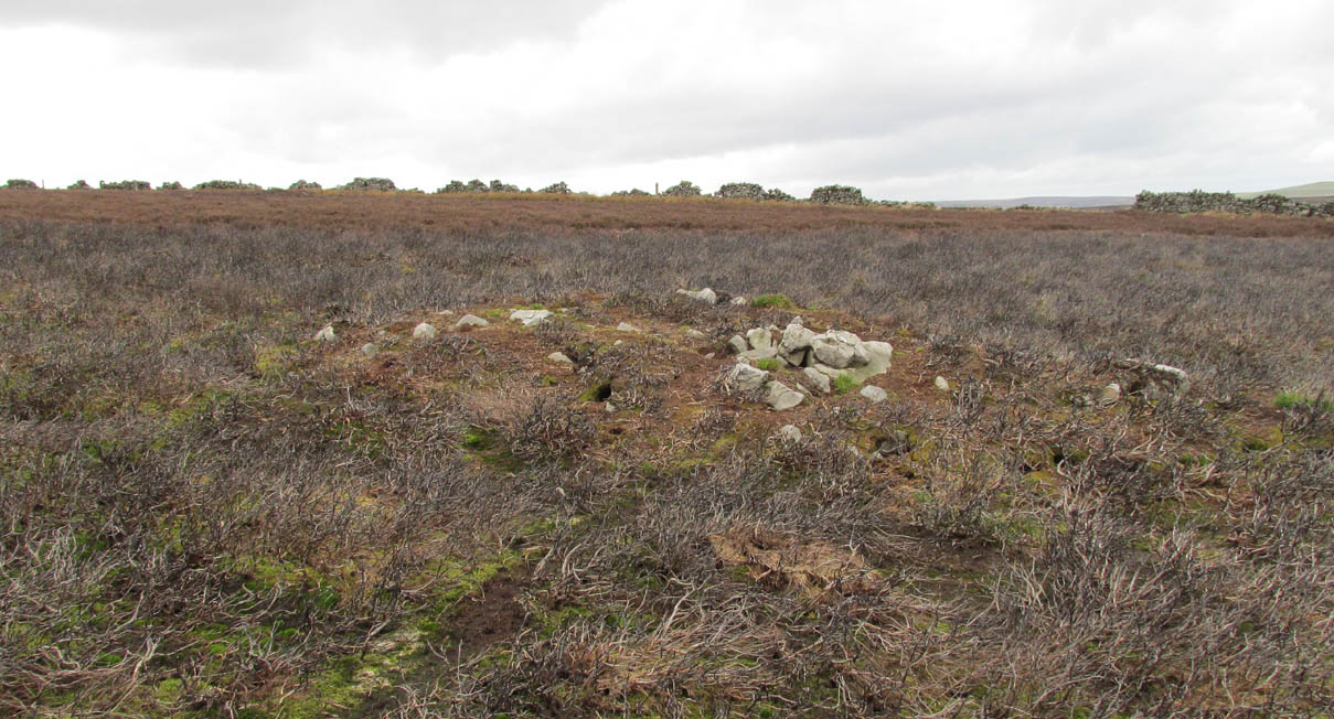
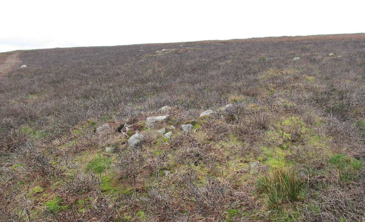
When all the moorland vegetation has died back, you can clearly see how the tunnel has been built upon by a large mass of earth and rocks, some of them loose.  All round it is an extended collapse of what seems to be quarried stone tumbling down the hillside.  At the top of the hill are the remains of old walling and at least two walled structures—although they appear to be post-medieval in nature, not prehistoric.  At the entrance itself is evidence of continued walling of some form.  It seems as if a wider man-made chamber of some sort may once have stood here, right in front of the present-day entrance.  Even if this proves not to be the case, there is very clear evidence that the tunnel which goes into the hillside was once longer, as low walling continues outside away from the entrance, bending away some 50 yards to the southeast, before ending with no indication of additional structural remains.  This walled structure swerving out from the entrance is equally perplexing.

The closest prehistoric feature is an unrecorded cairn and petroglyph a few hundred yards away.  As far as I’m concerned, this tiny little entrance into the ground isn’t prehistoric.  But I’m nonetheless still very intrigued by it, not least because of a few very strange things that subsequently occurred here after we’d discovered it.

Whoever did this, went to a helluva lot of trouble and immense effort to build it.  And for what?  …Since being opened nearly 40 years ago, very few people have been to see this curious entrance into the Earth.  I’ve kept its location hidden.  But amongst the visitors has been an archaeologist, a historian, antiquarian authors, occultists and friends.  None have been able to say what this site might be.  From souterrains to mine-shafts, probably the best suggestion so far was by Mr Paul Hornby who suggested it might have been some sort of kiln, as there seems evidence of fire against one of the stones.  But there are anomalies with the site that don’t quite fit the glove of a normal kiln.  The extended collapsed ‘tunnel’ which reaches way out, past the entrance which Jon broke in the 1970s, doesn’t make sense; nor the fact that the tunnel goes way into the natural hillside.  Indeed, many things here don’t make sense, simply—I presume—because we haven’t asked the right question yet.

But one thing seems obvious: there may be something at the end of this tunnel, deep inside the hill, which someone many centuries ago, for some odd reason, wanted to keep hidden for a long long time.  What’s at the end of this tunnel?  And if it’s valuable treasure deep in there—it is NOT going to some museum which then, in later years, will be sold off cheaply to some wealthy dood when the museum runs out of money.  It should be kept within the safe holdings of The Northern Antiquarian.  If this becomes an issue, whatever lies at the end will simply be re-buried elsewhere.

Fortean History

On that fine Spring morning when we first discovered this “mine shaft for little people” as we called it, before we went on our way, we placed the stone that Jon had dislodged that had covered the entrance back into position so that no one could see the opening leading into the ground and under the hill.  It was firm and secure when we left—we made sure of it.

The following Sunday morning we made our way back up past Horncliffe Well again and onto this little mine-shaft to sit and have summat to eat.  The rocky arena here made it difficult to locate, even though we knew where it was.  But when we eventually did find it again, the covering-stone was missing.  In fact it had been rolled a good 5 yards away from the entrance.  This was odd, we thought—considering that no one even knew of its existence.  We wondered if an animal had taken up residence inside, but there were no tracks or remains consistent with this initial idea.  We puzzled about it, ate our food, and said our au revoirs.  Before we left, we repositioned the covering stone again to block the entrance.  This time we made it a little more secure than previously.

The following Sunday morning we visited the site again—and the covering stone had been removed, again!  So we replaced it, securely, and visited the place a week later—and the same thing had happened again.  This occurred time after time, month after month, year after year.  Every single time we covered the entrance, something came and removed it.  Yet no one ever comes on this section of the moorland—and even if they did, the site is very difficult to locate.  Until now, the site has never been added to any archaeology or history records anywhere—so no one knew of its existence (in asking two of the moorland rangers who’ve worked here over the decades, neither of them knew what we were talking about).

When Andrew Hammond and I left school at 18 (in 1981), we decided as a ritual to bring our school books onto the moor and burn them as the sun was setting in the northwest.  We sat near the little mine-shaft and sang our songs of joys at being out of school at last—and as the darkness began to fall over the moor, we replaced the entrance-stone again.  Within 30 minutes Nature had cast pitch black across the moor and we fell asleep.

Awaking at sunrise the following day, we wandered down the slope to the little mine-shaft where we’d repositioned the stone only hours previously.  It had been moved again, several yards away from the entrance.  No animal could have moved it.  Whatever it was, it kept doing it every time we repositioned the covering stone.  No animal tracks, droppings, or any evidence whatsoever of Nature’s creatures being responsible for the constant removal of the covering stone has ever been found.  The constant removal of the covering stone remains a complete mystery.

When a dowser came and tried tracing the underground route of the tunnel in the early 1990s, his rods took him to the top of the rocky hill above, then led him in a small curve to the northwest for more than 100 yards before stopping.

Note:

In the event that archaeologists ever get round to excavating or assessing this site, I would appreciate being contacted before anything is done and would love to be involved in any work performed at the site.  I’ll be a good boy!  Other remains nearby (usually covered by heather) need appraising to enable a more complete analysis, otherwise all subsequent reports would lack wider archaeocentric contextualization.  Thanks, in advance. 🙂

References:

  1. Bennett, Paul., ‘Into a Mythic Domain – a Passage into the Ilkley Underworld,’ in Northern Earth, 87, Autumn 2001.

Acknowledgements:  Huge thanks to James Elkington for use of his photos to illustrate this site profile.

© Paul Bennett, The Northern Antiquarian


Nether Glenny, Port of Menteith, Perthshire

Cairn:  OS Grid Reference – NN 56470 01923

Also Known as:

  1. Canmore ID 24058

Getting Here

Nether Glenny cairn, looking south

Along the A81 road from Port of Menteith to Aberfoyle, watch out for the small road in the trees running at an angle sharply uphill, nearly opposite Portend, up to Coldon and higher. Keep going, bearing right at Mondowie, then stopping at the dirt-track 100 yards or so further up. Walk up the track, thru the gate, and another 100 yards or so higher up, go thru the gate on your left. Walk up the field alongside the fence until you’re on the level and you’ll see a large rounded mound about 75 yards in the same field to your left.

Archaeology & History

This little known prehistoric tomb sits within a landscape rich in very impressive neolithic and Bronze Age petroglyphs and probably had some relationship with one or more of the carvings in aeons past.  It is one of several tombs in the area.

Rainbow across the tomb

The site was only recently rediscovered in the 1980s, following an archaeological survey of the area before the forestry plantation was done.  Measuring about 20 yards across and about five feet high, the large mound consists of the traditional mass of hundreds, if not thousands of stones.  It seems that a ring of small uprights encircled and defined the edge of the cairn, although this element is only visible on its eastern side.  Its northern mass and edges have been dug into and ruined at some point in the past, leaving a mass of rubble visible beneath the encroaching grasses.  The tomb has not be adequately excavated, so we do not know whether it was built at the same time of the surrounding petroglyphs.  It must be noted (again) that the incidence of tombs and cup-and-ring stones is not infrequent.

The grassland plain where we stand here—with another tomb of very similar form about 100 yards to the north—reminded me somewhat of the Baildon Moor complex in Yorkshire, where rock art and burials are found side by side.

References:

  1. Bailey, G.B., ‘Nether Glenny (Port of Menteith parish)’, in Discovery & Excavation Scotland, 1987.

© Paul Bennett, The Northern Antiquarian


Ballochraggan 01, Port of Mentieth, Perthshire

Cup-Marked Stone:  OS Grid Reference – NN 55900 01005

Also Known as:

  1. Canmore ID 78352

Getting Here

Park by the entrance to Ballochraggan, which is set back off the A81 between Aberfoyle and Port of Mentieth.  Walk up the track, and just before you reach the cottage, notice the large boulder on your left, about 50 yards away. That’s it.

Archaeology & History

The Ballochraggan 1 Stone

This large dolmen-capstone-like boulder in front of the old cottage, was reported by Maarten von Hoek (1989) to possess about 10 faint cup-markings, with a large one near the centre of its upper surface. When Paul Hornby and I visited the site yesterday, several ‘cups’ were visible, but these were purely geological in nature; and even the large cup in the middle seemed somewhat dubious.  The markings are the product of conglomerate rock, where smaller softer types of stone that are embedded in the boulder fall away, leaving cupmark-like indentations and other hollows. There are a lot of conglomerate rocks in these hills and it is essential that all students make themselves aware of the difference between the geological ‘cups’ and those forged by humans.  In many cases this can be difficult, so apply the rule: if in doubt, kick it out—and err on the side of caution.

Some carvings in this region (and elsewhere in the country) possess conglomerate marks that have been enhanced and possess additional rings and carved lines.  On this particular stone, such marks do not seem to exist.  A dodgy example indeed…..

References:

  1. von Hoek, Maarten, ‘Menteith (Port of Menteith parish): Rock Art Sites’, in Discovery & Excavation Scotland, 1989.

Acknowledgements Huge appreciation to Paul Hornby for his photo and assessments.

© Paul Bennett, The Northern Antiquarian


Ballochraggan 12, Port of Mentieth, Perthshire

Cup-and-Ring Stone:  OS Grid Reference – NN 56106 01711

Also Known as:

  1. Ballochraggan 8.04
  2. Canmore ID 78307
  3. Mentieth 9
  4. Mentieth 44

Getting Here

Ballochraggan12 cup-and-ring

Takes some finding this one!  We parked up by the entrance to Ballochraggan on the A81 between Aberfoyle and Port of Mentieth.  Walk up the track, then up the burnside past the house. Keep to its right-side and head uphill towards the very top of the forestry edge, staying in the grasslands.  As you near the very top NE corner of the grassland boscage (NOT into the forest), about 100 yards before it, zigzag about through the gorse and keep your eyes peeled.  It’s there!

Archaeology & History

This is a small, flat, smooth piece of stone with a simple carving clearly visible, in a region replete with highly impressive multiple-ringed petroglyphs.  Very little has been said of this design and even the Canmore lads tell us only that the carving “includes one cup and ring marking and two cups within an oval ring.”  And that’s that!  However, other faint lines are evident on the surface of the stone, with the single cup-and-ring appearing to have another partial second-ring encircling a section of it.  Outlying this are very shallow worn lines that seem to bear the hallmarks of human interference, but they were difficult to see with any certainty and our camera didn’t pick up additional elements with any real clarity.  What seemed to be another cup-and-half-ring (not visible in the photos) was just beneath the edge of the grass where the rock fell back into the Earth.

Ballochraggan12, under cloud

The most catching element of the design is the very obvious ‘eye’ symbol peering up at us as we look down.  Whether this symbol was deliberate or not,  we can be sure that the old archaeologist O.G.S. Crawford (1957) would have loved it and added it to his old dreams of eye goddesses!

Other carvings nearby will blow your head off!  The recently discovered Mask Stone, right next to this Ballochraggan 12 carving, being just a taster of the things to come.

References:

  1. Brouwer, Jan & van Veen, Gus, Rock Art in the Menteith Hills, BRAC 2009.
  2. Crawford, O.G.S., The Eye Goddess, Phoenix House: London 1957.
  3. Naddair, Kaledon, et al, ‘‘Menteith (Port of Menteith Parish): Rock Ccarvings’’, in Discovery & Excavation Scotland, 19, 1992.
  4. Royal Commission on the Ancient and Historical Monuments of Scotland, The archaeological sites and monuments of Stirling District, Central Region, HMSO: Edinburgh 1979.

Acknowledgements Huge appreciation to Paul Hornby for use of his photos.  Cheers mate!

© Paul Bennett, The Northern Antiquarian


St Bertram’s Well, Ilam, Staffordshire

Holy Well:  OS Grid Refence — SK 1371  5141

Getting Here

St Bertram’s Well, north of Ilam © Copyright Neil Theasby & licensed for reuse under Creative Commons Licence
St Bertram’s Well, Ilam © Neil Theasby, reused under Creative Commons Licence

The genuine St. Bertram’s well is not easy to find and I recommend using the OS map carefully. It is reached by taking the footpath that leads off at the left passing the cross out of the village. Follow this until the end of the dry stone walling on the right and then divert from the footpath to the right where the well can be seen. The second well is easily found in the field between the church and the Hall.

Archaeology and History

Bertram is an interesting local saint, dating from around the 7th-8th century. Briefly, he is said to be of Royal Irish lineage but after making a princess pregnant, escaped to England where he sheltered in the woods around Ilam.  The story is told by Alexander, a monk, in the 13th century who notes:

“They were in hiding in a dense forest when lo ! the time of her childbirth came upon them suddenly ; born of pain and river of sorrow!  A pitiful child bed indeed!  While Bertellinus went out to get the necessary help of a midwife the woman and her child breathed their last amid the fangs of wolves. Bertellinus on his return imagined that this calamity had befallen because of his own sin, and spent three days in mourning rites”.

As a result he became a hermit living in a cave in the valley near Ilam.  Despite the earliest mention being Plot, the local geography is suggestive that this is the site of an early Christian hermitage site, although no mention of a well is noted in his legends it can be noted.  Currently, the well is surrounded on four sides by varying low stone walling, about two feet or so at its highest (although it appears to have been built up and down over the time I have visited the well).  The spring flows from a small, less than a foot square chamber, enclosed in stone and set into the bank through a channel in the rubble flow and out along the path towards it.

Since the 1990s, on the first Saturday in August, the Orthodox Church makes a pilgrimage to the site and blesses the well.  Interestingly, literature available from the National Trust shop fails to mention this well, but notes a more substantial second St Bertram’s Well close by the church and surrounded by a rectangular stone wall with steps down, the water arises here at greater speed and flows into the nearby River Manifold. Visually it is more impressive and more accessible but whether there is any long tradition of this second well is unclear, but authors such as the Thompsons’s (2004) The Water of Life: Springs and Wells of Mainland Britain and Bord (2008) Holy Wells of Britain appear to have fostered its reputation.

Incidentally, the church boasts the remains of St Bertram’s shrine with foramina and the church yard has two Saxon crosses, making a visit to the village a must for those interested in early medieval history.

Folklore

“St Bertram’s Ash… grows over a spring which bears the name of the same Saint… The common people superstitiously believe, that tis very dangerous to break a bough from it: so great a care has St Bertram of his Ash to this very day.  And yet they have not so much as a Legend amongst them, either of this Saint’s miracles, or what he was; onely that he was Founder of their Church”

Such notes Plot (1686) The Natural History of Stafford-Shire, the earliest reference of this fascinating site.  By Browne (1888) in his An Account of the Three Ancient Cross Shafts, the Font, and St Bertram’s Shrine, at Ilam, noted that the ash had gone, but the water was still being used.  He states that:

“The late Mrs Watts Russell always had her drinking water from it.”

Extracted and amended from the forthcoming Holy wells and healing springs of Staffordshire by R. B. Parish (2008)

http://insearchofholywellsandhealingsprings.wordpress.com


Trysting Stone, Doune, Perthshire

Standing Stone:  OS Grid Reference – NN 7256 0182

Also Known as:

  1. Canmore ID 24761
  2. Deil’s Head
  3. Devil’s Head
  4. Fairy Stone
  5. Gold Stone

Getting Here

Trysting Stone of Doune

From the old cross in the middle of the village, walk along the A820 Balkerach Street main road (NOT down George Street) until you reach Station Wynd on your right.  Walk up here for 100 yards towards the new housing estate (don’t buy these places – they’re dreadful quality beneath the veneers) and there, on a small grassy rise on the left just before the car park, stands our stone!

Archaeology & History

This little-known monolith on the northern edge of little Doune village, was recently moved a short distance from its original position thanks to another one of those sad Barratt housing estates being built here; but at least it has received protection with the surrounding fence and notice board telling its brief history and folklore (better than being destroyed I s’ppose).

Stone marked on 1866 OS map
Stone on 1866 OS map

Standing less than five feet tall, local lore tells that it has been moved around close to this spot several times in the last couple of centuries.  Although not mentioned in Hutchinson’s (1893) essay on local megaliths, the stone was highlighted on the 1866 Ordnance Survey of Doune, where the non-antiquated lettering showed how it was thought to be Roman in origin, not prehistoric.

Folklore

Trysting Stane, looking NE

The name of the stone comes from it being used as a place where deeds were sworn, with the stone as witness to the words proclaimed by both parties (implying a living presence, or animistic formula of great age).  This activity was continued in the local ‘trysts’ or cattle fairs held a mile away, where buyers swore the sale of cattle at this stone—again with the stone being ‘witness’ to the spoken deals.  It was also used as a counter where gold was exchanged for cattle bought and sold during the Michaelmas and Martinmas Fairs.  Sue Harvey (2006) told that this standing stone,

“was called the Devil’s Head and was used during past Doune fairs to count gold on when cattle were being bought and sold.”

In local newspaper accounts from the 1950s, local historian Moray S. Mackay (1984) told how the children of the village used to gather round the stone, holding hands, and sing,

Olie Olie, peep, peep, peep,
Here’s the man with the cloven feet,
Here’s his head, but where’s his feet?
Olie Olie, peep, peep, peep.

Notice board telling its tale...
Notice board telling its tale…
Looking at the stone on its rise

This implies the stone once possessed a myth relating to a petrified ancestral deity of animistic (pre-christian) origin, but as yet we have found no additional information allowing us a confirmation of this probability.  A correlate of this theme—i.e., of the stone being the head of a deity—is found in West Yorkshire (amongst many other places), where one of the little known Cuckoo Stones was once known to be a local giant until a hero-figure appeared and cut off his head, leaving only his body which was then turned to stone.  Mircea Eliade (1958; 1963) cites examples of animistic religious rites and events explaining this early petrification formula via creation myths, etc. (we find very clear evidences of animistic worldviews and practices still prevailing in the mountains just a few miles north and west, still enacted by local people)

Folklore also alleged that the stone was Roman in nature, but neither archaeology nor the architectural form of the stone implies this.  Roman stones were cut and dressed—unlike the traditional looking Bronze Age, rough, uncut fella standing here.

References:

  1. Eliade, Mircea, Patterns in Comparative Religion, Sheed & Ward: London 1958.
  2. Eliade, Mircea, Myth and Reality, Harper & Row: San Francisco 1963.
  3. Harvey, Sue, Doune and Deanston, Kilmadock Development Centre 2006.
  4. Hutchinson, A.F., “The Standing Stones of Stirling District,” in The Stirling Antiquary, volume 1, 1893.
  5. Mackay, Moray S., Doune – Historical Notes, Forth Naturalist: Stirling 1984.

© Paul Bennett, The Northern Antiquarian


Forty Acres (3), Stelling, Marske, North Yorkshire

Cup-and-Ring Stone:  OS Grid Reference – NZ 0758 0058

Getting Here

Surface of Forty Acres 3 carving
Surface of Forty Acres (3) CnR

From Marske village, take the road west and uphill to the villages of Fremington and Reeth.  At the top of the hill where the fields open up, several hundred yards along on your right, past the field with the track, a footpath sign points you up onto the moor. Go up the field till you hit the wall that goes right to the top of the moor. Where the four walls meet, go straight across and then walk northwards along the line of walling for 2-300 yards, keeping your eyes peeled for a solitary stone on its own, 100 yards west.  You’ll find it.

Archaeology & History

Deep carved line features

A pretty basic petroglyph located within a massive arena of prehistoric sites dating from the neolithic and continuing through the Bronze Age period and beyond.  Found a few hundred yards northwest of the once giant cairn of Cock Howe, this design is characterized mainly by the two large deep channels deliberately cut into the stone that run from the middle of the upper surface down to ground level.  One of them emerges from a single cup-marking, at an angle; whilst the other comes from the edge of a natural crack in the rock.  The channels are wide and flattened. Other faint lines can be discerned too, which may have originally been carved.  We need to explore this design in different lighting conditions to see if there are additional features here.

Looking east-ish
Looking east-ish

An archetypal cup-marking can seen on the vertical edge of the stone and three other faint ones scatter the top.  Another small ‘cup’ is along the southern vertical face of the rock which, when we found it, thought was natural; but a photograph of the stone by James Elkington seems to show a ring surrounding much of the cup-mark.  We need to go back and take another look at the place.

A number of other carvings described in Paul and Barbara Brown’s (2008) survey can be found in the region.

References:

  1. Brown, Paul & Barbara, Prehistoric Rock Art in the Northern Dales, Tempus: Stroud 2008.

© Paul Bennett, The Northern Antiquarian


Douky Bottom Ring, Arncliffe, North Yorkshire

Enclosure:  OS Grid Reference – SD 95126 68887

Also Known as

  1. Dowkerbottom

Getting Here

Douky Bottom Ring
Douky Bottom Ring

Go up the B6160 road, heading for Kilnsey Crag.  A few hundred yards past here, take the road to Arncliffe and, several hundred yards along, keep yer eyes peeled for the (usually) decent craggy dry stream bed on your left (west). Follow this upstream till you hit the large cave, continuing uphill above the crags, following the steep walling upwards to the next set of crags.  Above these, another long straight line of walling continues in the same direction you’ve been walking. Follow this along until it meets up with another large line of walling, heading NE.  Walk along here till this wall changes direction NE, but here you need to walk across the grasses westwards, past the large cave for another 100 yards.  You’ll find it!

Archaeology & History

This is a simple but well-preserved circular monument, probably constructed in the Iron Age, just 100 yards past the incredible Douky Bottom cave (in which various prehistoric remains have been found).  No excavations appear to have been made here, yet the near-perfect ring is in very good condition indeed.  The monument consists of thousands of small stones – taken from the huge scree immediately behind the structure – whose uppermost visible mass overlays a much older and larger pile of stones, all of roughly the same size.

Douky Bottom ring, looking NE

The ring is less than 10 yards across and gives the impression of it being a large hut circle—which it may or may not be.  Without an excavation we cannot know its function with any certainty.  Other, much larger prehistoric enclosures and settlements are close by, mainly to the northeast; and you have the truly bizarre rock piles on the ghostly horizon crags, whose histories are quiet indeed….  For any antiquarians amongst you who’d like a good day out, give this region a try!  It’s a truly intriguing arena with much much more hiding away than any of the archaeology records can tell you about.

Acknowledgements:  Many many thanks to James Elkington for guiding us to the sites in this region.

© Paul Bennett, The Northern Antiquarian


Cock Howe, Skelton Moor, Marske, North Yorkshire

Cairn:  OS Grid Reference – NZ 0811 0063

Getting Here

Cock Howe1 cairn

Take the minor high road between the hamlets of Marske and Fremington (up Hard Stiles from Marske side), turning up Stelling Road at the crossroads, and ⅔-mile (1.1km) along, turn right up Helwith Road. ¾-mile (1.2km) along, on the right, walk thru the gate onto the moor following the walling.  Nearly 400 yards on you meet a junction of walling: walk past this until you reach the next line of walling and then follow it northeast for just over 500 yards. Once there, look for the mounds in the heather immediately south, less than 50 yards away.

Archaeology & History

This is one of the “isolated cairns of fair size” mentioned in passing by Tim Laurie (1985) in his survey of the massive settlement and field systems scattering this gorgeous moorland arena.  It is one amongst a scatter of several in and around the eastern height of Cock Howe hill on the south side of Skelton Moor.  The area has sadly been scarred by an excess of old lime mines—many of which are visible close by—damaging with some severity the excess of prehistoric remains on these moors, none of which have yet been excavated in any detail.  This cairn included.

More cairns to the rear

Even though much of the heather here had been burnt back when James Elkington and I visited the place recently, the pile of stones was still very embedded into the peat.  The moorland rabbits had dislodged some of the stones, highlighting the mass of rocks much better.  It stands nearly a metre high and is roughly 7 yards by 8 yards in diameter from edge to edge, structurally similar to the many Bronze Age cairns scattering Rombalds Moor, Askwith Moor and other Yorkshire clusters.  A second cairn of similar size and stature exists some 30 yards to the southeast (visible on one of the photos).

For anyone who might visit this site, the most impressive features hereby are the huge settlement remains scattering the moors just north of the wall a few yards away.  When the heather has been burnt back, a veritable prehistoric city unfolds before your eyes, with extensive lengths of walling, hut circles and what can only be described as huge halls, in which tribal meetings probably occurred – much of it in superb condition!  Well worth visiting.

References:

  1. Laurie, T.C., “Early Land Division and Settlement in Swaledale,” in Upland Settlement in Britain: the Second Millennium B.C. and After, ed. Don Spratt and Colin Burgess, BAR British Series 143, 1985.
  2. Martlew, R.D., Prehistory in the Yorkshire Dales, YDLRT: York 2011.

© Paul BennettThe Northern Antiquarian


Richard Wood South, Thornton Steward, North Yorkshire

Cup-Marked Stone (missing):  OS Grid Reference – SE 16940 87301

Archaeology & History

A prehistoric carving that is missing and possibly destroyed since being rediscovered in 2001 by Barbara Brown (2008) and subsequently described in her book on North Yorkshire petroglyphs.  She told it to be in “Thornton Steward field hedge bottom” and was a simple glyph, being a

“rectangular slab (with) single cup-mark located in hedge bottom part of old walling.”

When she revisited the site with her husband in 2006, the old hedge and wall had been removed, with “new hedging in place.”  The carved stone may be buried within a pile of clearance stones adjacent to the hedgerow, but it has yet to be relocated.  If anyone finds it, please let us know!  It was one of several cup-marked stones that exist in the wider neighbourhood.

References:

  1. Brown, Paul & Barbara, Prehistoric Rock Art in the Northern Dales, Tempus: Stroud 2008.

© Paul Bennett, The Northern Antiquarian