Holy Well (destroyed): OS Grid Reference – NS 6029 6547
Also Known as:
Minister’s Well
Archaeology & History
Site of the Priests Well in 1865
A ‘holy well’ with a bit of a difference when it was designated as such, however many centuries ago. Found on the southern slopes below Glasgow ‘s Cathedral, just a few yards west above the Molendinar Burn (upon which Wishart Street now sits), this was deemed to be a well only to be used by the christian ministers or priests from above. Local people were not supposed to drink here it seems! Instead, they were supposed to either drink from the burn, or walk a short distance down to the Lady Well (now badly polluted) 175 yards to the southeast. I don’t expect many Glasgow folk paid that much attention to such arrogant ministerial laws!
Shown on the earliest OS-map, simply as a ‘Well’, this is one of at least four water sources within a square mile of the Cathedral (including St. Mungo’s and Lady Well) that were deemed as ‘sacred’. It truly makes you wonder what on Earth was here before the christians came along and built their huge temple on the rocks above…. What animistic heathen rites and traditions were suppressed around this natural landscape before the toxic blanket of christianity was imposed upon us?
Healing Well (destroyed): Os Grid Reference – NS 5931 6500
Also Known as:
West Port Well
Archaeology & History
Once found near the old crossroads of Trongate, Arygle Street and Stockwell Street, the Trongate Well is another of old Glasgow’s lost sites, piped-off and added to the city’s water system sometime in the 19th century. A pity, as the fresh water from here was highly regarded (moreso than the modern stuff with its chlorine and other unnecessary additives). The well could be found where the Highland Gaelic Society built their own public house and, as a result, was very popular with local folk. It was,
“Opposite the old Black Bull in Trongate…afterwards covered in, which was famous in the palmy days of cold punch, and which is alluded to in Cyril Thornton as ‘the West Port Well.’” (MacGeorge 1880)
Old cattle markets were held here and MacGeorge (1880) wrote how it was a very popular and favourite place in its day, “surrounded by large numbers of the town’s people waiting a supply.”
The old Black Bull pub was much used by drovers and across from it was the old draw well, whose waters were of such renown that they were described in the verse, The Lament of Capt Paton, thus:
“Or if a bowl was mentioned,
The Captain he would ring,
And bid Nelly to the West Port,
And a stoup of water bring;
Then he would mix the genuine stuff,
As they made it long ago,
With limes that on his property
In Trinidad did grow.
O! we ne’er shall taste the like
Of Captain Pateon’s punch no mo’!”
Healing Well (destroyed): OS Grid Reference – NS 594 645
Archaeology & History
Mentioned briefly in James MacKinlay’s (1893) classic survey, this site was an ancient draw-well sunk near the old city centre but, like the ancient Moot Hill close by, has long since been destroyed. It is described amidst Andy MacGeorge’s (1880) historical survey of the ancient wells where he wrote:
“There was another…at the Barras Yet, near the port of that name at the foot of Saltmarket. It is mentioned in a minute of council in 1664, which ordains that ‘in respect of the heighting of the calsay at the Barrazet the well there be heightit twa stones higher round about, for preservation of childerin falling therein.’”
Although its exact whereabouts is not known, the proximity of the old fountain known as the Sir William Collins Memorial Fountain 100 yards east into the Glasgow Green Park at the bottom of the Saltmarket, might have robbed the Barrasyett Well of its water supply to gain existence.
Holy Well (destroyed?): OS Grid Reference – NS 553 658
Archaeology & History
This is the conjectural title conferred by T.C.F. Brotchie (1920) upon a Well uncovered during construction of the Pearce Institute in Govan in 1908. It was certainly an old site and very well made by the sound of it: being “a stone-built well some ten feet deep (and) some eight feet below the present surface of the ground.” Brotchie thought it to be medieval in age – and he may have been right.
On asking local people if they knew anything about the site, he was lucky to meet “a very old man, a Mr Rellie”, who told him that when he was a boy his granny spoke of a lost “guid well (that) was near the kirk.” He continued:
“I have no doubt that the well discovered in 1908 was the guid well, and judging from its proximity to the god’s acre, and also from adjective ‘guid’, that the well was at one time the holy well of St. Constantine, who in the 6th century founded a church in Govan. Of course, that is conjecture, but I venture to think that the conjecture is reasonably well founded.”
The church is immediately adjacent and is indeed dedicated to St. Constantine. Inside of it are a variety of fascinating archaeological relics: not least of which is what Sam Small (2008) called the ‘Pagan Sun Stone’ upon which is carved an ancient swastika! That – I’ve got to see!
Holy Well (destroyed): OS Grid Reference – NS 667 653
Archaeology & History
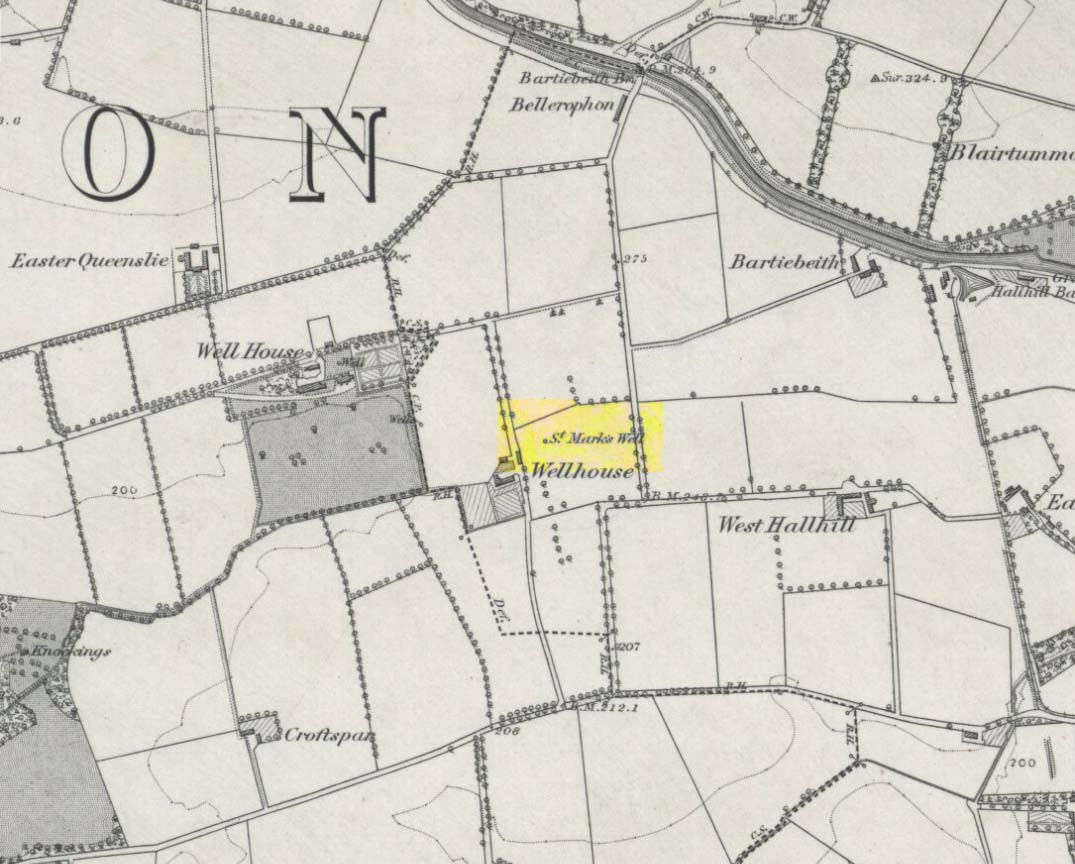
St Marks Well on 1864 map
Information on this long forgotten holy well that once flowed a few miles east of Glasgow city centre, beneath what is now Wellhouse estate, is all but lost. Local history works of the area tell us little (though there must surely be something somewhere?) and even the place-name surveyor of this area—Peter Drummond (2014)—could find nothing. Noted by the Ordnance Survey lads in 1858, when they came to re-survey the area again in 1899 its waters had, it seems, been covered and carried into the ‘Well house’ less about 50 yards to the southwest (another ‘Wellhouse’ found 150 yards further west is the site that gives the estate its present name). From thereon, this wellhouse and St. Mark’s Well fell into the forgotten pages of history and, sadly it seems, even its oral tradition has died…
The origin and nature of the ‘well house’ isn’t too troublesome, as Drummond (2014) explains:
“The name Wellhouse exists in several places in Scotland, and could indicate a ‘house beside wells’, or a protective ‘house over wells’; the early record here suggests the former, since the first Glasgow Water Company’s Act was obtained in 1806, many years later.”
However, the reasons behind the dedication to St. Mark at this probably heathen arena in times gone by, seems to be quite a mystery. Perhaps the folklore of the saint concerned may be of some help.
Customs practiced on St. Mark’s Eve and St. Mark’s Day (April 24-5) are replete with animistic elements throughout and are certainly not christian! Six months after the old New Year, we find rituals once more allowing, not for the passing of, but the emergence of the dead: bringing the spirits into the Spring and Summer. Divination rites were practiced with Cannabis sativa no less! Prophecy and wise-women were advisors to the young. Walking backwards around wells were known at some St. Mark’s wells; whilst others without his name—but on this saint’s day—were leapt across, symbolizing the crossing of danger and darkness in the ritual calendar. All around this period of time, up to and including Beltane, the end of the dark cold year has passed, and these plentiful rites are prequels to the lighter days, warm spring, summer and good autumn: all vital rites for the people in their myths of the eternal return…
St. Mark’s Well at Glasgow meanwhile, seems to have lost its old tales… Surely not?
References:
Banks, M. MacLeod, British Calendar Customs: Scotland – volume 2, Folk-lore Society: Glasgow 1939.
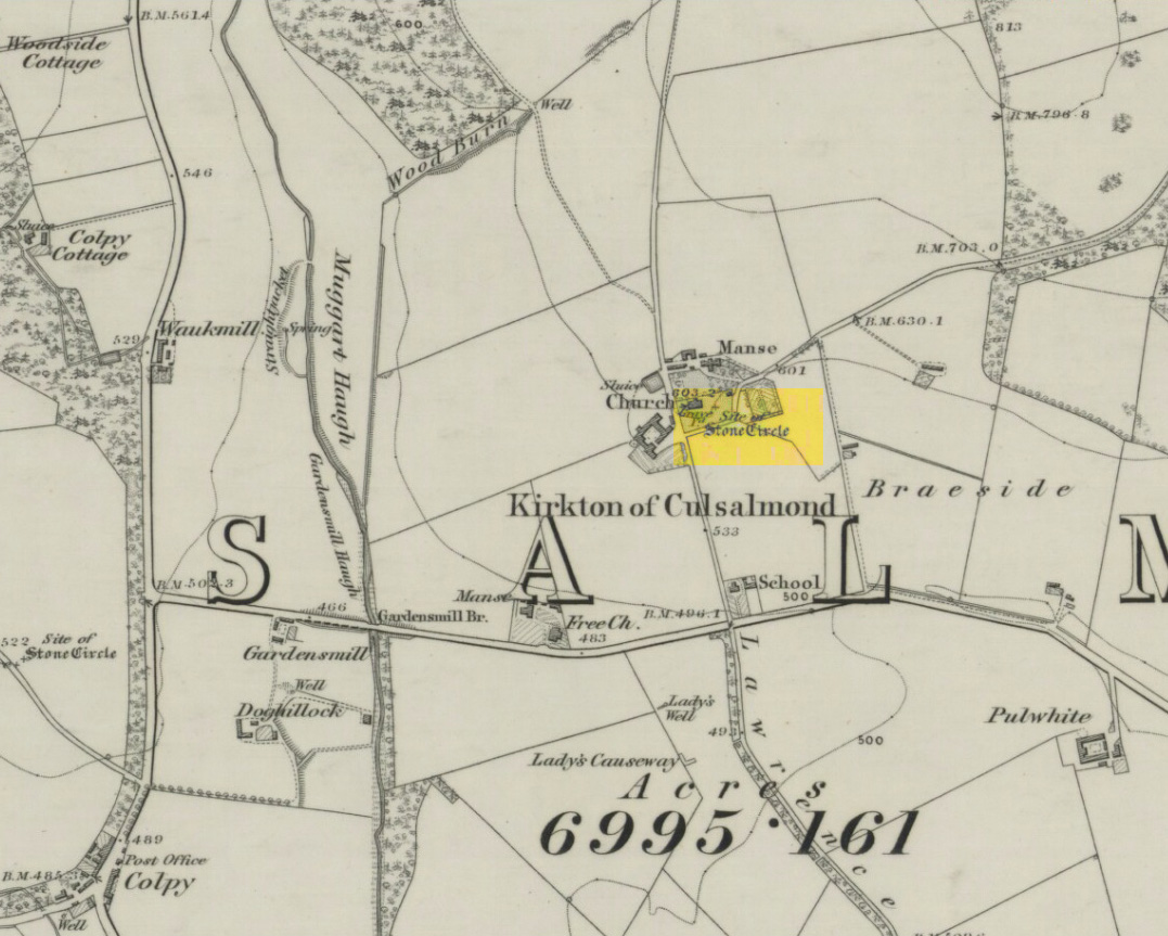
After standing at the same spot for 3000 years or more, near the beginning of the 19th century this stone circle was destroyed by the self-righteous christian cult that was rampaging its way through cultures far and wide. After all, they needed to rid the area of local traditions and “improve” the locals, whether they liked it or not! Thankfully however, one of their creed—a reverend Ferdinand Ellis: minister of the parish for forty years—recorded its destruction in the New Statistical Account between 1834-45. Amongst a variety of important traditional monuments that once existed hereby,
“A Druidical place of worship anciently stood about the middle of the churchyard or burying ground. It consisted of a circle of twelve upright large granite stones from Benochee, which were overturned when the first Christian temple was erected. One of these was taken up in 1821 and now remains above ground, near the spot where it was taken up. The other eleven are still underground. This is proof that the first christian missionaries, in this country, erected their places of worship as near as possible to the holy hills of the heathens, that the people might be more easily persuaded to assemble there.”
‘Persuaded‘ being a very broad term indeed when it came to the land confiscation of indigenous folk…
The stone that Ellis said “was taken up in 1821 and now remains above ground” was gone when Fred Coles (1902) surveyed the site, but he told how an earlier antiquarian and writer for the Scottish Society of Antiquaries, J.G. Callander, lived nearby, and who was
“told by the aged sexton, Florance, that he many a time came across a great stone, when preparing graves, and that he had himself blasted these more than once.”
It seems that all trace of this single stone, and the rest of them, either still lay in the ground or were used for local building material.
When John Barnatt (1989) came to add this circle in his corpus, for some reason he postulated that
“the number of stones suggest it was a recumbent stone circle”,
…that is: a stone circle possessing one large stone in the ring that’s laid down with two standing stones either side. However, there seems no real evidence to show that this was the case.
References:
Barnatt, John, Stone Circles of Britain – volume 2, BAR: Oxford 1989.
Browne, G.F., On Some Antiquities in the Neighbourhood of Dunecht House, Aberdeenshire, Cambridge University Press 1921.
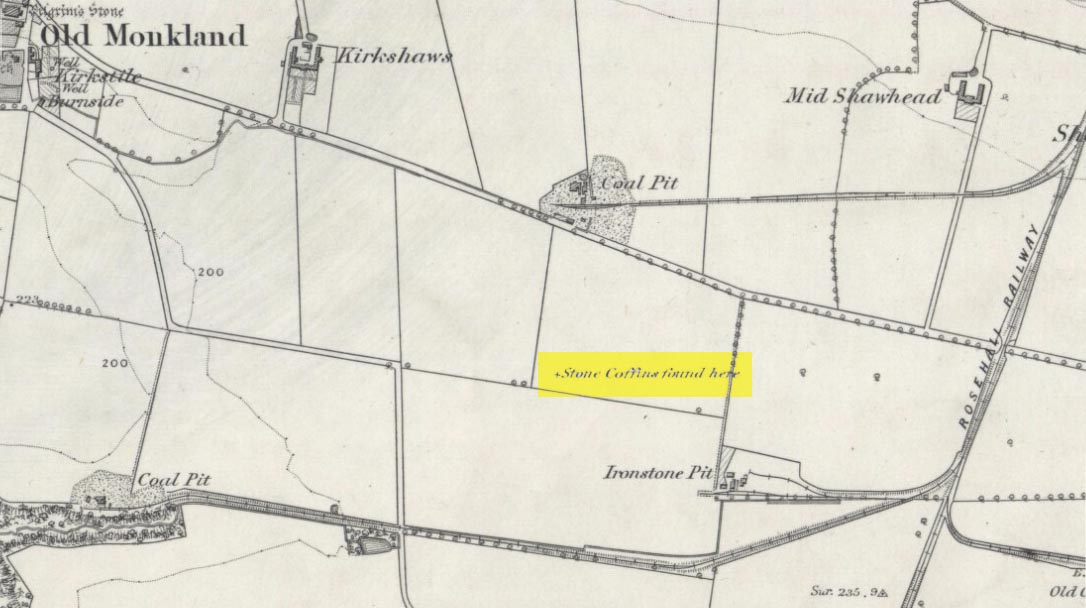
On the flat meadowlands below the slopes of Old Monkland, half-a-mile southeast of the legendary Pilgrim’s Stone, an old mound once lived. It may have been here for thousands of years but, with the encroachment of the toxic Industrialists, its time was coming to an end. The mound was levelled in 1832 and, beneath it, relics from a truly ancient past were unearthed – and destroyed of course. The account of its demise was told in the Glasgow Evening Post of May 26 that year. Many years later, the Royal Commission (1978) lads unearthed the information and included the site in their inventory for prehistoric sites in Lanarkshire. They told:
“In 1832 four cists were discovered during the levelling of a small mound 900m SE of Old Monkland Church. The cists, which measured about 1m by 0.6m, contained the remains of crouched inhumations, two of them double burials with the skulls at opposite ends of the cists. A stone hammer-head and a coin were found in one cist, the latter no doubt indicating subsequent disturbance. There is now no sign of the site, and it is not certain from the report whether the cists were inserted into a small natural mound or were covered by a barrow.
“The present farmer states that his father discovered a single cist during ploughing in the same field; it contained a pottery vessel which the landowner, Mr Sholto Douglas, was thought to have presented to a museum, but it cannot now be traced.”
References:
Royal Commission on the Ancient & Historical Monuments of Scotland, Lanarkshire: An Inventory of the Prehistoric and Roman Monuments, HMSO: Edinburgh 1978.
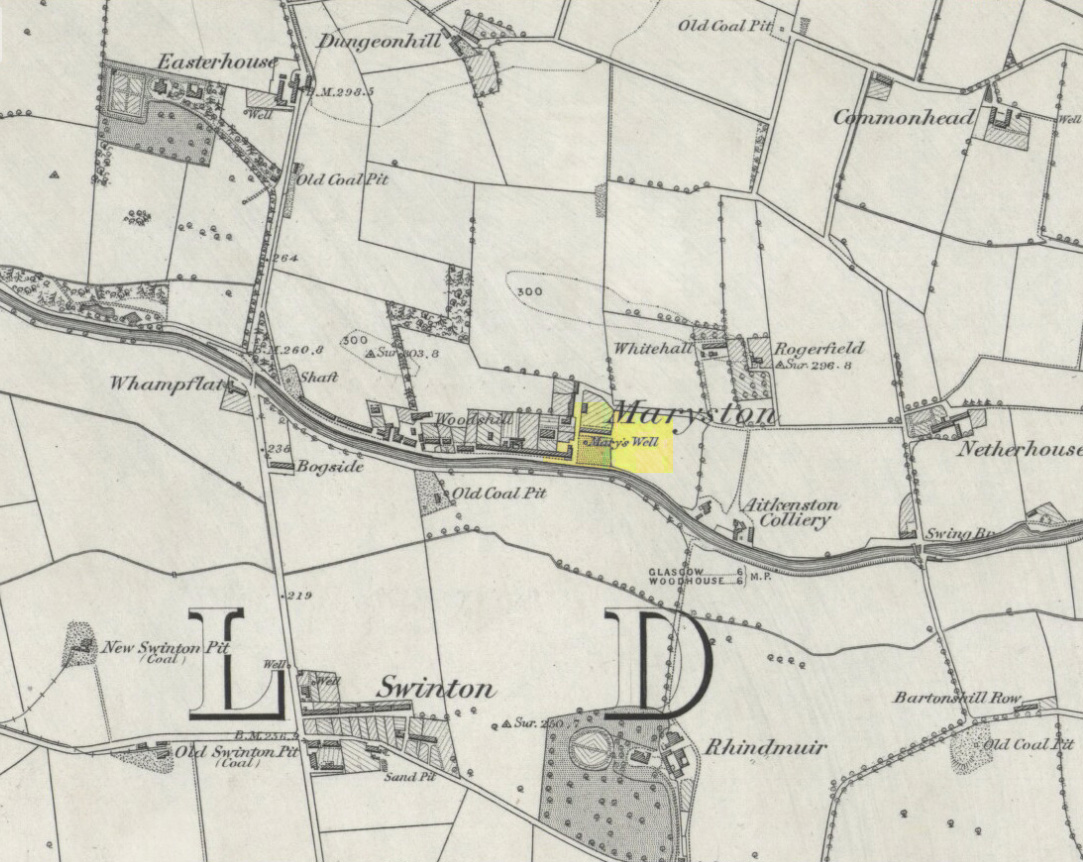
This old well, named after Queen Mary (one of at least three dedicated to her in Lanarkshire), was illustrated on the earliest Ordnance Survey map of the area in 1864. Local tradition tells us that the site gained its name when the great Mary Queen of Scots visited this old healing well, amidst a period when she stayed at Provan Hall 1½ mile away. Both she and her horse stopped and drank here for refreshment.
Site of Mary’s WellMary’s Well on 1864 OS-map
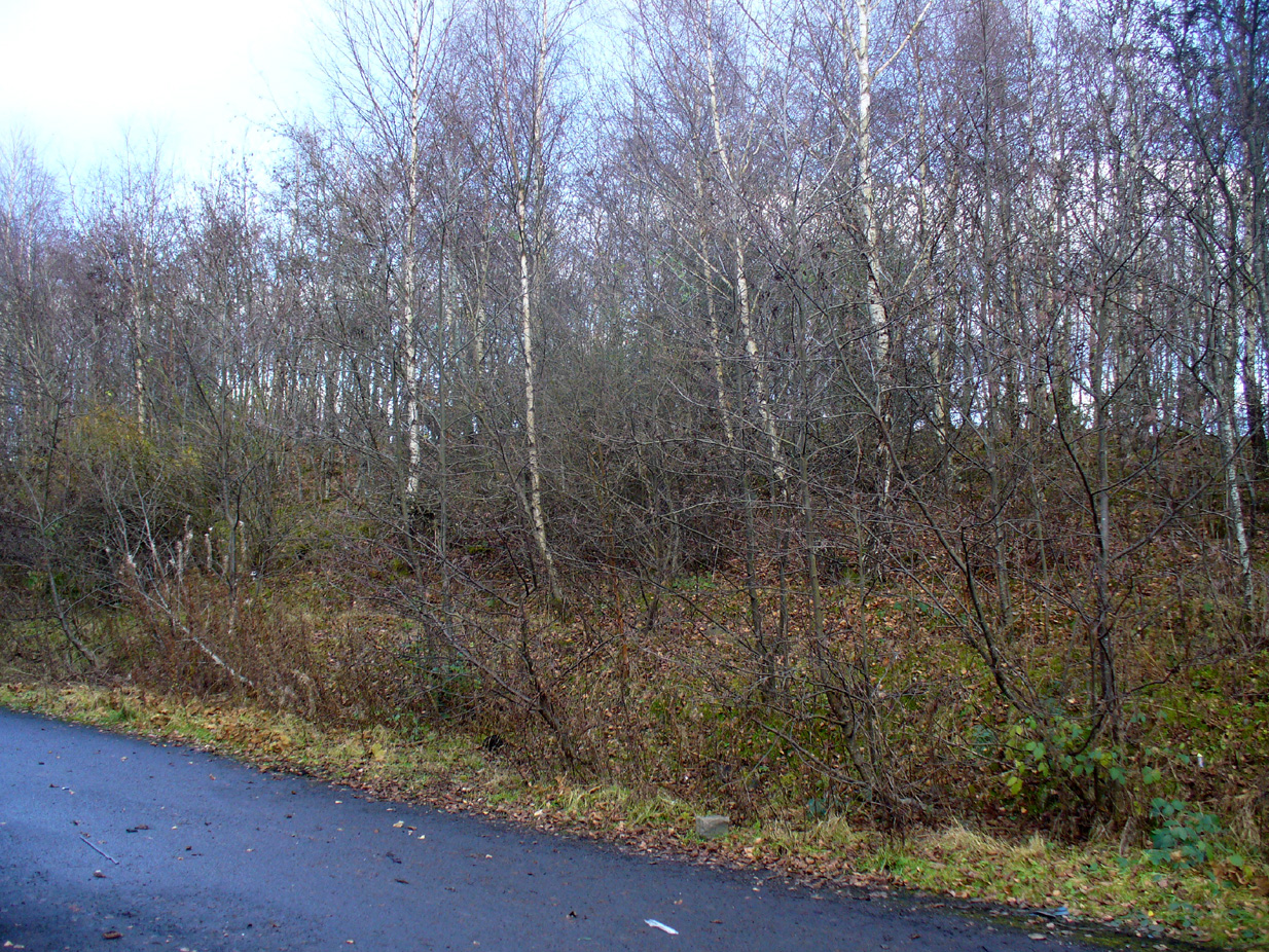
In the 19th and early 20th century, the well was converted into a pump and supplied the water to a row of cottages that used to be here. When we visited the site yesterday, no trace of the pump, nor any spring of water could be found. It seems that a huge pile of industrial crap has been piled on top of the well, then trees planted to give the impression that Nature has taken back the place. The well seems to have been completely destroyed (the photo here shows the spot where the well should be, just a few yards into the young trees). Due to this site being an important part of Scotland’s heritage, its ignorant destruction must be condemned.
Acknowledgements: Big thanks to the team – Nina Harris, Paul Hornby and Frank Mercer – for their work here. And to Dan Holdsworth and John Bestow for their additional input.
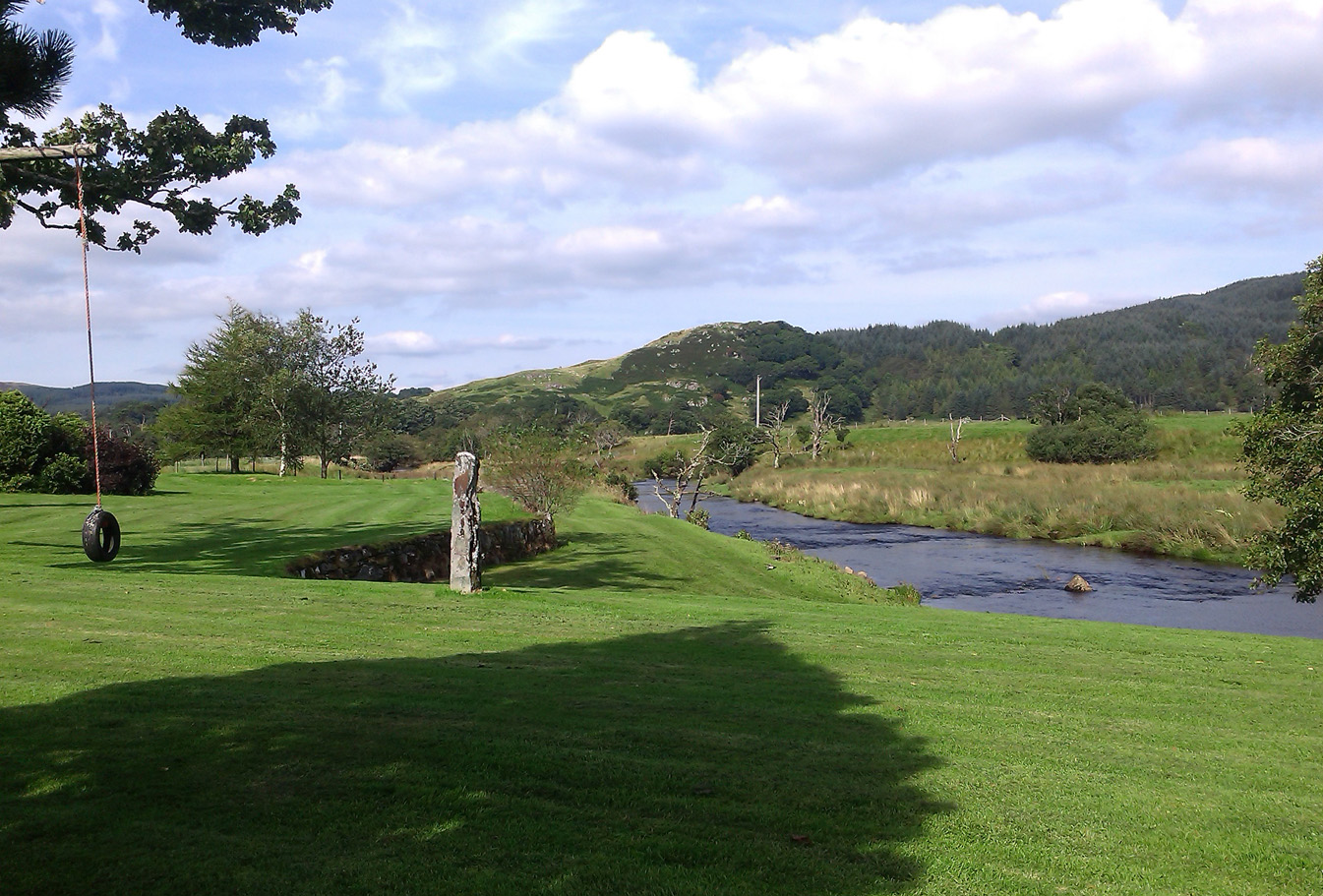
From Lochgilphead, take the A816 road north for several miles (towards the megalithic paradise of Kilmartin), keeping your eyes peeled for the road-signs saying “Dunadd.” Turn left and park-up. Instead of walking up the craggy fortress, follow the road-track to the house and, alongside the River Add, you’ll see the standing stone in the well-mown garden on your right.
Archaeology & History
As a monolith within the Kilmartin Valley complex, this is a slight, almost gentle standing stone, missed by most when they visit the other larger sites in Argyll’s Valley of the Kings. Set upright close to the gentle winding River Add and only a few yards from the ancient ford that bridged the waters beneath the shadow of Dunadd’s regal fortress, the late great Alexander Thom (1971) wrote about it in his exploration of lunar alignments found at other nearby standing stones. This one however, was 3° out to have any astronomical validity.
Described only in passing by a number of writers, the greatest literary attention it has previously been afforded was by the Royal Commission lads (1988), whose notes on it were short:
“An irregularly-shaped block of stone, 1.35m high and 1.35m in girth at the base, is situated 25m S of Dunadd farmhouse, it is aligned NNW and SSE, and the top the SSE edge appear to have been broken off.”
…My first visit here was when I lived north of Kilmartin and each time I found the same ‘gentle’ feeling, in all different weathers: a most unusual phenomenon, as there tends to be changes in psychological states between rain, sunshine, frosts, dark night and mists. But there was a consistency of subtlety; a regularity in genius loci—probably due to its proximity to the River Add, the lowland tranquility below the crags. It’s a wonderful little place. Well worth visiting if you go to Dunadd.
References:
Campbell, Marion, Mid-Argyll: An Archaeological Guide, Dolphin Press: Glenrothes 1984.
Lane, Alan & Campbell, Ewan, Dunadd: An Early Dalriadic Capital, Oxbow: Oxford 2000.
Royal Commission on the Ancient & Historical Monuments of Scotland, Argyll – Volume 6: Mid-Argyll and Cowal, HMSO: Edinburgh 1988.
Ruggles, Clive L.N., “A critical examination of the megalithic lunar observatories,” in Ruggles & Whittle, Astronomy and Society in Britain, BAR: Oxford 1981.
Ruggles, Clive L.N., Megalithic Astronomy, BAR: Oxford 1984.
Holy Well (destroyed?): OS Grid Reference – TF 6753 0817
Archaeology & History
Once found in the small woodland known as the High Plantation, this holy well has, seemingly, long since fallen back to Earth. Mary Manning (1994) included it in her survey where she told that in earlier days it could be seen
“in a field which has drainage ditches and cultivation. Here was formerly marshy land draining to the Nar and lying on the south slope of the Nar valley.”
She thought that the title ‘Silver Well’ meant it was a holy site, but others told that it was due to a silver scum that formed on the surface of the waters—and it was a chalybeate (or iron-bearing spring) this is possible.
It was described in Francis White’s (1854) Directory of Norfolk for Shouldham:
“On Mr. Cotton’s estate is a fine chalybeate spring, called Silver Well, which gives rise to a small rivulet which passes through the village. Near this a new spring was discovered about 20 years ago, and both of them possess similar properties to those of Tunbridge Wells.”
This secondary “spring” was another chalybeate well, above which a stone obelisk was erected in 1839.
Folklore
In relation to the object found in the well, Manning (1994) thinks “the objects found could have been pagan votive offerings in a venerated well.” She also told that:
“The well is the subject of a local legend, which takes two forms. One version is that at the Dissolution, treasure from one of the abbeys was hidden in the well. The second says that workmen repairing the well brought up a container/box of silver ware, which was inadvertently dropped back and never recovered. Both tales attribute the silver colour of the well water to the effect of passing over silver treasure.”
A variation on this was noted by folklorist W.B. Gerish (1892) who told that the silver which the workmen dropped back into the well, did so as a result of the devil fighting them over it, and they fled!
References:
Anonymous, Kelly’s Directory of the Counties of Cambridgeshire, Norfolk and Suffolk, Kelly’s Directories Ltd 1925.
Gerish, W.B., Norfolk Folklore Notes, 1892.
Hope, Robert Charles, Legendary Lore of the Holy Wells of England, Elliott Stock: London 1893.
Manning, M., Taking the Waters in Norfolk, NIAS: Norfolk 1994.
White, Francis, Gazetteer and Directory of Norfolk, 1854.