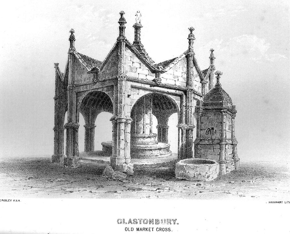
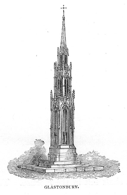
The present day Market Cross that stands in Glastonbury’s High Street, ornate though it may look, replaced a much earlier and more memorable monument. The one we see today, said Charles Pooley (1877),
“at the junction of the four streets, was erected in 1846, after the design of B. Ferrey, Esq., at the instance and the cost of a private individual. It is a Gothic pinnacled structure of a simple type, with no pretensions to elaborate architectural display.”
The ancient Market CrossThe new Market Cross
A very poor substitute for the cross that stood in its place in earlier centuries, from all accounts. Before the modern spire was erected, an earlier, larger and more ornate structure — that seems to have been first described in John Leland’s classic Itinerary (1744 ) in the middle of the 18th century, simply as “the Market Crosse in the West Ende” — was the meeting point for the tradesmen and villagers of Glastonbury. Although Rahtz & Watts (2003) followed Leland in giving only passing mention to this once ornate structure, thankfully a number of earlier antiquarians gave the old cross a bit more literary attention. Mr Pooley (1877) again informs us:
“Warner, who was in Glastonbury in 1799, says, “In my way to the Abbey, I passed the Market Cross, and old polygonal structure, its apex crowned with a little naked figure, bearing strong marks, in its position and employment of that grossness of taste, in which the sculptors of the 15th century so frequently indulged.”
Other writers weren’t as puritanical in their descriptions. In John Britton’s (1807) tour of the architectural curiosities of the region he remarked:
“Though a large and extremely curious structure…it is scarcely noticed in the topographical annals of the county; its history is, therefore, perhaps entirely lost. Since the drawing was taken in 1802, the Cross had been suffered gradually to fall into ruins, part of the centre column then only standing.” He continued: “There is something peculiarly unique in the shape and ornament of this building. A large column in the centre, running through the roof, and terminating with a naked figure, clustered columns at each angle with odd capitals, bases, etc., and gables with pinnacles of unusual shape, all unite to constitute this one of the eccentricities of ancient building. From the time of the Norman Conquest to the Dissolution of the Engilsh Monasteries, the varied and progressive styles of architecture are satisfactorily defined, and a very general uniformity prevails in all the buildings of particular eras; but the specimen before us differs from anything that we have yet met… In the year 1802 there was a mutilated inscription on it, with the year 1604, but we cannot say that this date refers to the time of its building. There were also some armorial bearings carved on different parts of it. Among these were the arms (a cross between two cups) of Richard Beere, the last Abbot but one of Glastonbury. The presence of the canting device of Richard Beere would probably determine the date of its erection.”
Mr Pooley’s (1877) own description of the old cross told that,
“It was built of hewn stone on an octagonal plan, having clustered pillars ranged round a central column supporting the roof. Three steps, the lower one benched, surrounded the base of the shaft, for the convenience of the market people. The gables were terminated by moulded pinnacles, and the central shaft, which rose above the roof, was surmounted by a statue. Adjoining the cross was an ancient conduit, having a vaulted roof, and supplied with water from a reservoir at the uper part of town. These structures being in want of repair…it was determined to pull them down, which was done accordingly in the year 1808.”
So the next time anyone visits Glastonbury’s tall spired cross in the middle of the town, remember its old and much more ornate predecessor. Perhaps some of you arty-types down there could do a replica of the old thing with its naked figurines and resurrect it from its forgotten past…
References:
Britton, John, The Architectural Antiquities of Great Britain, Longman, Hurse: London 1807.
Leland, John, The Itinerary, James Fletcher: Oxford 1744.
Michell, John, New Light on the Ancient Mystery of Glastonbury, Gothic Image: Glastonbury 1990.
Pooley, Charles, The Old Stone Crosses of Somerset, Longmans, Green & Co.: London 1877.
Rahtz, Philip & Watts, Lorna, Glastonbury: Myth and Archaeology, Tempus: Stroud 2003.
Get up to the Twin Towers right at the top of Ilkley Moor (Whetstone Gate), then walk east along the footpath, past the towers for about another 100 yards, looking out on the other side of the wall until it meets with some other walling running downhill onto Morton Moor. Follow this walling into the heather for a few hundred yards. Where it starts dropping down the slope towards the small valley, stop! From here, follow the ridge of moorland along to your left (east) and keep going till you’re looking down into the little valley proper. Along the top of this ridge if you keep your eyes peeled, you’ll find the stone cross base sitting alone, quietly…
Archaeology & History
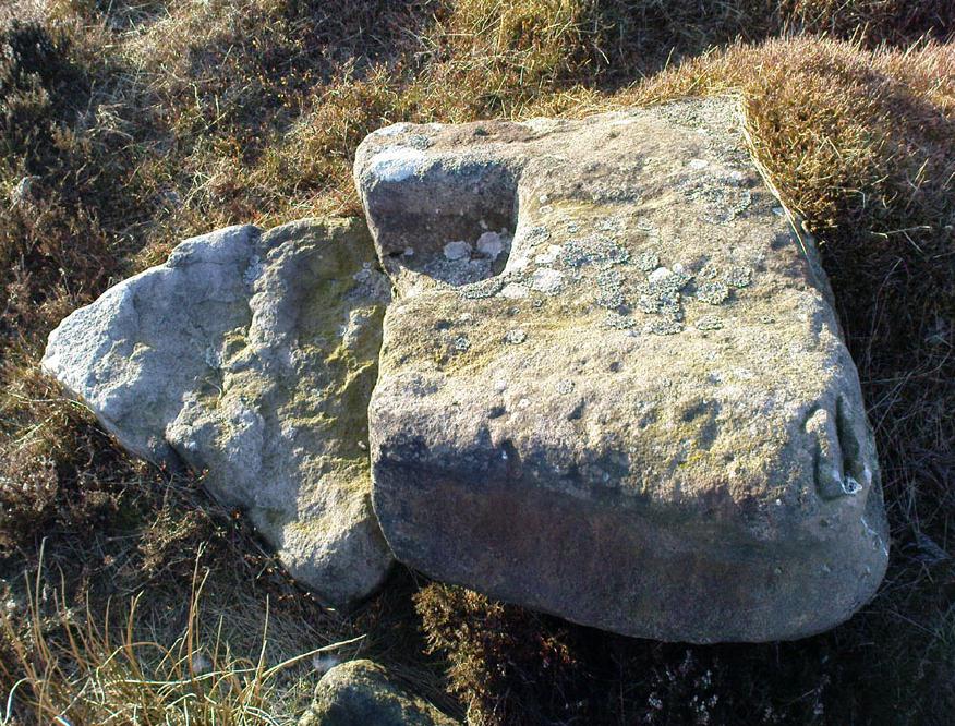
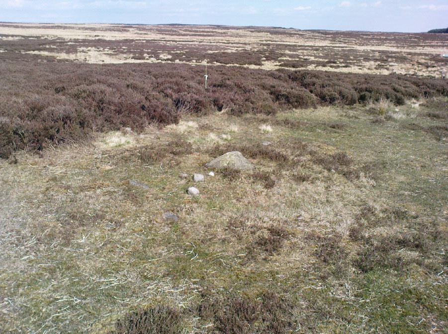
This old relic, way off any path in the middle of the moor, has little said of it. Whilst its base is still visible — standing on a geological prominence and fault line — and appears to taken the position of an older standing stone, christianised centuries ago, the site is but a shadow of its former self. When standing upright may centuries back, the “cross” was visible from many directions. We discovered this for ourselves about 20 years back, when Graeme Chappell and I sought for and located this all-but-forgotten monument. When we found the stone base, what seemed like the old stone cross lay by its side, so we repositioned it back into position on July 15, 1991. However, in the intervening years some vandal has been up there and knocked it out of position, seemingly pushing it downhill somewhere. When we visited the remains of the cross-base yesterday (i.e., Dave, Michala Potts and I) this could no longer be located. A few feet in front of the base however, was another piece of worked masonry which, it would seem, may have once been part of the same monument.
Cross-base, looking northClose-up of cross-base
Years ago, after Graeme and I had resurrected the “cross” onto its base, I went to visit the Bradup stone circle a few weeks later and found, to my surprise, the upright stone in position right on the skyline a mile to the northeast, standing out like a sore thumb! This obviously explained its curious position, seemingly in the middle of nowhere upon a little hill. This old cross, it would seem, was stuck here to replace the siting of what seems like a chunky 3½-foot long standing stone, lying prostrate in the heather about 10 yards west of the cross base.
Stuart Feather (1960) seems to be the only fella I can find who described this lost relic, thinking it may have had some relationship with a lost road that passed in the valley below here, as evidenced by the old milestone which Gyrus and I resurrected more than 10 years back. Thankfully (amazingly!) it still stands in situ!
If you aint really into old stone crosses, I’d still recommended having a wander over to this spot, if only for the excellent views and quietude; and…if you’re the wandering type, there are some other, previously undiscovered monuments not too far away, awaiting description…
References:
Bennett, Paul, The Old Stones of Elmet, Capall Bann: Chieveley 2001.
Feather, Stewart, “A Cross Base on Rombald’s Moor,” in Bradford Antiquary, May 1960.
Feather, Stewart, “Crosses near Keighley,” in Cartwright Hall Archaeology Group Bulletin 5:6, 1960.
From East Morton village, take the moorland road, east, and up the steep hill. Where the road levels out there’s a right turn, plus (more importantly!) a trackway on your left which leads onto the moor. Go up this track and keep walking till you hit a moorland ‘footpath’ signpost. Just before this walk due west (your left) into the heather for about 10 yards. Look around! (if the heather’s long and overgrown, you might have trouble finding it) If you find carved stone 109, you’re less than 10 yards off this one!
Archaeology & History
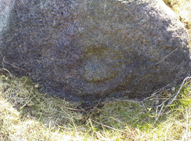
First reported by Stuart Feather and described in a short note of the Yorkshire Archaeological Register* of 1977. This was one of two small carved stones next to each other amidst the “denuded remains of a cairn 3m in diameter and 0.35m high.” The stone we can still see here is a small one, seemingly near the very centre of the cairn, with its carved face looking northwards. The carving is a simple double-ring surrounding a central cup: an almost archetypal cup-and-ring stone.
Crap photo of the double-ring
The other ancient carved stone that was once seen next to this (catalogued as carving 111) has in recent years been stolen by an archaeological thief no less! Any information that anyone might have telling us who’s stolen this heritage piece, or where it might presently reside, can be emailed to me in confidence. Or…the thief who’s taken it can return the carving to the site and put it back where it belongs before we find out where you live. Simple as!
(Soz about the poor photo of this carving. For decent ones of this stone you need to get here when the sun’s in a better position. I’ll hopefully get some better images next time we’re up there when the light’s better.)
References:
Boughey, Keith & Vickerman, E.A., Prehistoric Rock Art of the West Riding, WYAS 2003.
Hedges, John (ed.), The Carved Rocks on Rombalds Moor, WYMCC: Wakefield 1986.
Moorhouse, S. (ed.), “Yorkshire Archaeological Register: 1977,” in Yorkshire Archaeology Journal, volume 50, 1978.
* Does anyone have any idea who you report such new discoveries to so that they can be reported in Yorkshire Archaeology Society’s ‘Register’? I’ve asked ‘em several times about a number of previously unrecorded sites that we’ve located, so that they can make a record of them, but I never get a reply.
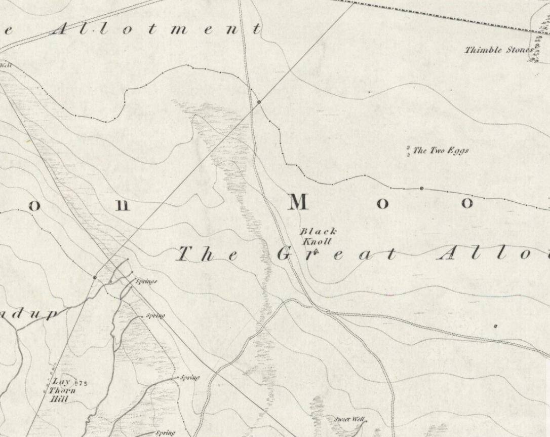
Takes a bitta finding this one. From the Twin Towers at the top of the moors (Whetstone Gate), walk east along the footpath, past the towers for about another 100 yards, looking out on the other side of the wall until you meet with some walling running downhill onto Morton Moor. Follow this walling for a few hundred yards till it drops down a small valley; then follow the valley down, keeping to its left-hand side, swerving a little round Black Knoll above you. Cross the dried-up stream and about 100 yards ahead of you (southeast), heading towards the Sweet Well, zigzag about (once the heather’s grown back here, this’ll take some finding!). Good luck!
Archaeology & History
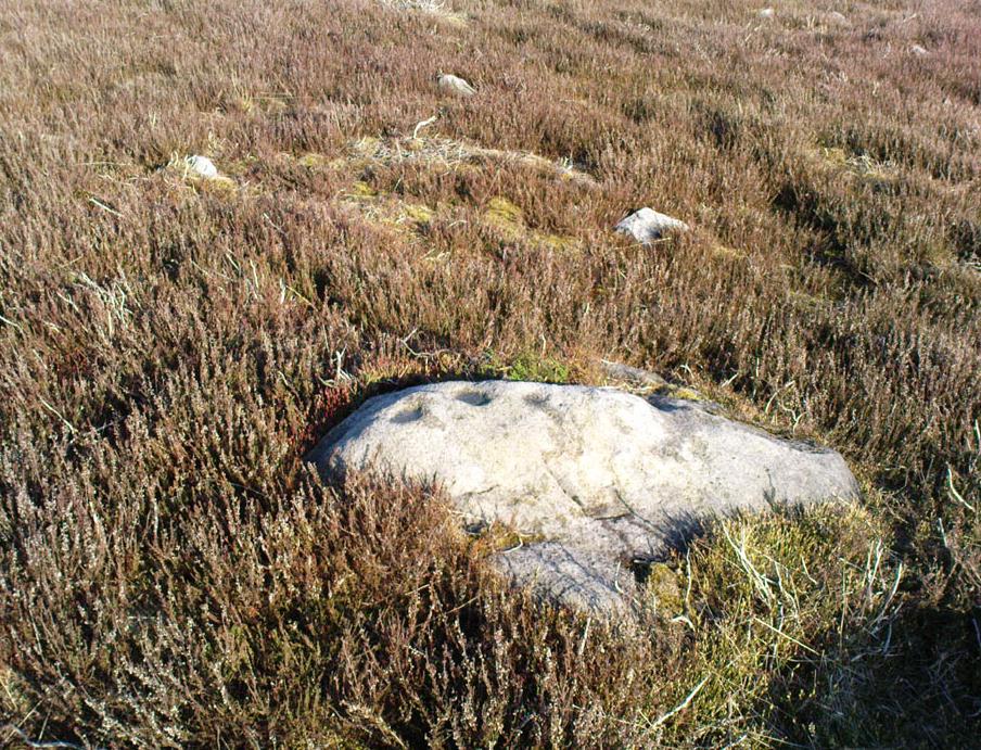
Cup-markings, looking north
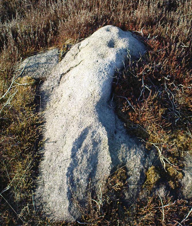
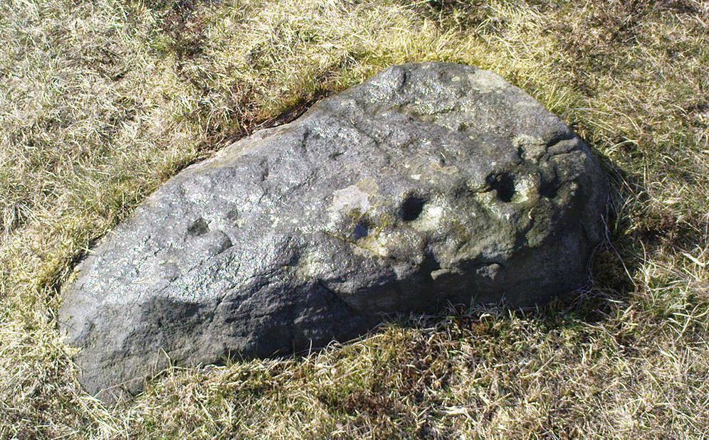
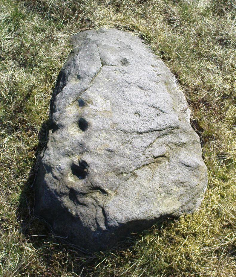
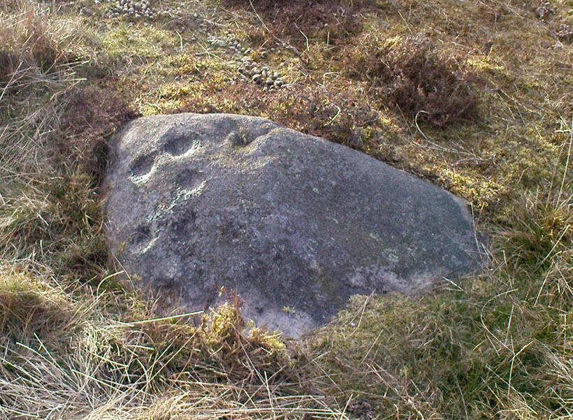
There’s no previous history to this site and archaeological records indicate no prehistoric remains in this region. However, we (that is Dave, Mikki and me) found this and a number of other sites yesterday in a bimbling wander, to and fro, through boggy-heaths and deep heather. It’s a previously unrecorded cup-marked stone, with what seems like an attached burial cairn right by its side (yet again!). The cairn is 3 yards by 2 yards across. Two very distinct cup-marks can clearly be seen near the top of the small stone, with a possible third just below. A curious though natural yoni-like erosion can be seen on the lower side of the stone which may have some significance to people into that sorta thing! Whether it had owt to do with the cup-markings is another thing altogether!
From East Morton village, take the moorland road, east, and up the steep hill. Where the road levels out there’s a right turn, plus (more importantly!) a trackway on your left which leads onto the moor. Go up this track and keep walking till you hit a moorland ‘footpath’ signpost. Just before this walk due west (your left) into the heather for about 10 yards. Look around! (if the heather’s long and overgrown, you might have trouble finding it)
Archaeology & History
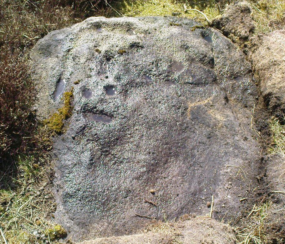
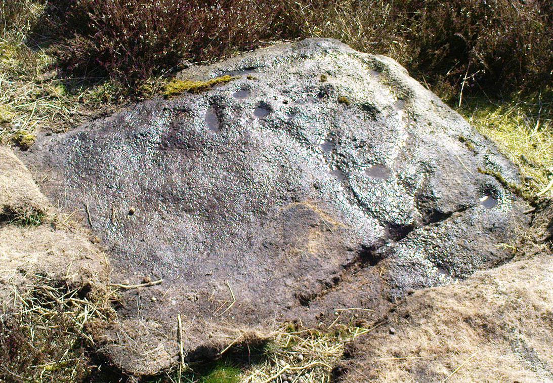
Thought to be one of several carvings that were first reported by Stuart Feather and described in the Yorkshire Archaeological Register* of 1977: near the “denuded remains of a cairn” (there are in fact two here) is “a further cup-marked rock adjacent.” This is thought to be the one registered in John Hedges’ (1986) survey as ‘stone 91’. It’s a cute little thing, about 10 yards south of carving 110 (itself sited near the centre of a much-denuded burial cairn).
Carving 109, when wet!and when dry!
Similar in design to some of the Baildon Moor cup-marked stones (see carving no.126), the primary design here is a simple one: five cup-markings run along the edge of the small stone, with a small carved “line” running between two of the cups, as if denoting separation; whilst on the lower middle part of the stone is another, single cup, a little more worn than the others. It seems likely that this carving, like its double-ringed companion a few yards away (and others on this part of the moors) was in some way associated with the nearby prehistoric cairns.
References:
Boughey, Keith & Vickerman, E.A., Prehistoric Rock Art of the West Riding, WYAS 2003.
Hedges, John (ed.), The Carved Rocks on Rombalds Moor, WYMCC: Wakefield 1986.
Moorhouse, S. (ed.), “Yorkshire Archaeological Register: 1977,” in Yorkshire Archaeology Journal, volume 50, 1978.
* Does anyone have any idea who you report such new discoveries to so that they can be reported in Yorkshire Archaeology Society’s ‘Register’? I’ve asked ’em several times about a number of previously unrecorded sites that we’ve located, so that they can make a record of them, but I never get a reply.
From Bingley, head up to Eldwick (either road, it doesn’t matter) until you hit the crossroads at the top where you go up Heights Lane onto the moors (ask someone if you’re struggling). Right at the top where the lane meets the moorland road, straight across is a dirt-track onto the moor. You’re going up there! Walk up for about 350 yards, then go into the heather on your left. About 20-30 yards in, keep your eyes peeled for the stone in the photo. It’s low down, a few feet across either way, but easily missed when it gets covered in heather.
Archaeology & History
Todmoor carving’s cup & lines
Up here again today — Mikki Potts, Dave and me — this was first carving we came to. It was first discovered by the late great Stuart Feather (1961) on one of his many forays onto these moors. It’s a bittovan odd carving: deep wide grooves, seemingly carved out by humans, in which some other cups have then been carved; plus an odd scatter of other singular cup-markings, what looks like a double-cup, and a long winding line running from near the middle to the stone’s western edge. All the carved elements have been etched onto the southern half of the stone. The lovely little Todmor standing stone is about 50 yards northwest of here.
References:
Boughey, Keith & Vickerman, E.A., Prehistoric Rock Art of the West Riding, WYAS 2003.
Feather, Stuart, “Mid-Wharfedale Cup-and-Ring Markings. Nos. 5 & 6,” in Cartwright Hall Archaeology Group Bulletin, 6:7, 1961.
Hedges, John (ed.), The Carved Rocks on Rombalds Moor, WYMCC: Wakefield 1986.
Follow the same directions to find Middleton Moor’s 441 carving. Then, go across the small stream a bit further down the slope and up up the slope until you’re on the level. Once on this small rise in the land, look up the slight slope where approaching the the fenced area. You’re close!
Archaeology & History
Middleton Moor carving 445
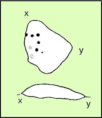
On the Middle Ridge between the streams of Delves Beck and Dryas Dike, this small rounded triangular-shaped carved stone has eight simple cup-markings eroded, but notable on its smooth surface. Boughey & Vickerman (2003) suggest some may be gunshot marks, which has to be considered at several of the seeming ‘cup-markings’ on this moor. (particularly at Carving no.440 less than 100 yards away) Archaeo-astronomers amongst you will note the Cassiopeia-like central design on this design — though this is probably coincidental (it might have tickled mi fancy when I was going thru my astroarchaeology phase many years back, but not anymore).
References:
Boughey, Keith & Vickerman, E.A., Prehistoric Rock Art of the West Riding, WYAS 2003.
Cup-and-Ring Stone: OS Grid Reference – NZ 0774 7048
Archaeology & History
1928 photo of carving
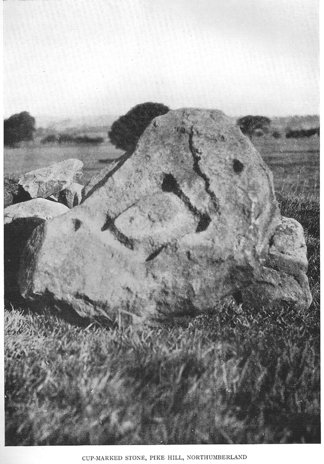
Found inside a prehistoric tomb that was excavated in the late 1920s “by Messrs R.C. and W.P. Hedley at Pike Hill, near Stamfordham,” this fascinating-looking carving was found on a stone that “was overlying the primary burial” cist in the middle of the tumulus, measuring “2 feet 9 inches long by 2 feet wide and 12 inches deep, with an orientation on the longer axis of NE.” As we can see in the old photo that accompanied Mr Hedley’s (1928) short article in Antiquity journal, four single cups are arranged in a rough square and are joined with each other by a single line, running from cup to cup, outlining a clear quadrilateral formation. Two other single cups are outliers on the left and right side of the ‘square.’
A second smaller cist was also found inside the same mound and on the central inner face of this was another, more simplistic carving described as “a very fine cup-mark 1½ inch in diameter and ¾-inch deep.” These carvings are no longer in situ (I think they’re in Newcastle Museum) and apparently this second single cup-marked stone can no longer be located.
References:
Beckensall, Stan, Northumberland’s Prehistoric Rock Carvings, Pendulum: Rothbury 1983.
Beckensall, Stan, Prehistoric Rock Motifs of Northumberland – volume 2: Beanley to the Tyne, Abbey Press: Hexham 1992.
Hedley, R. Cecil, “Ancient British Burials, Northumberland,” in Antiquity Journal, volume 2, December 1928.
Early photo of the North Hill tomb (Crawford 1928)
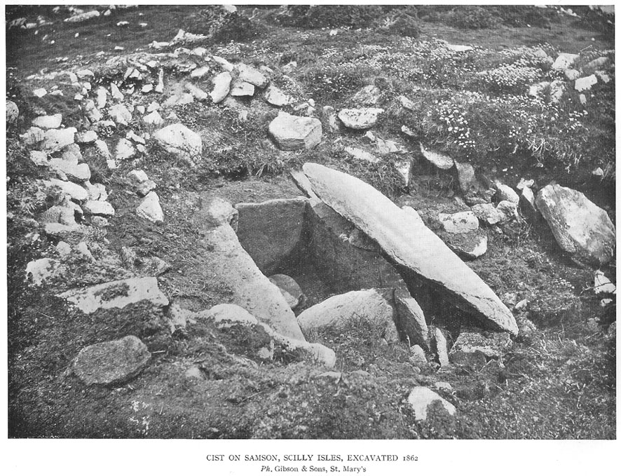
On the north side of Samson island there are several chambered tombs and cairns scattered around the edges of aptly-named North Hill; but the one illustrated here was one of the first to be excavated in 1862-3. Although O.G.S. Crawford (1928) wrote about the site in his essay on Cornish cists — from where this old black-and-white photo of the site has been taken — it was described in much greater detail in Borlase’s (1872) archaeological magnum opus of the day. In his time, this now much-denuded burial site had all the outer hallmarks of being a large tumulus. This was described in some detail in a paper written by one Mr Augustus Smith (read at a Meeting of the Royal Institution of Cornwall in May, 1863) who was fortunate enough to be one of the first people to unearth this great tomb and find the site untouched since it had been laid, thousands of years earlier. Citing extensively from Smith’s notes, Borlase told:
“The Barrow…is situated with four or five others, mostly rifled on the…high ground at the northern end. “The mound, in its outer circumference, measured about 58 feet, giving, therefore, a distance of near upon 30 feet to its centre, from where the excavation was commenced. For about 18 or 20 feet the mound appeared entirely composed of fine earth, when an inner covering, first of smaller and then or large rugged stones, was revealed. These were carefully uncovered before being disturbed, and were then one by one displaced till a large upright stone was reached, covered by another of still more ponderous dimensions, which projected partially over the edges of the other. At length this top covering, of irregular shape, but measuring about 5 feet 6 inches in its largest diameter, was thoroughly cleared of the superincumbent stones and earth, and showed itself evidently to be the lid to some mysterious vault or chamber beneath.” On the lid being removed, there was “disclosed to view an oblong stone chest or sarcophagus beneath” on the floor of which, “in a small patch,” “a little heap of bones, the fragmentary framework of some denizen of earth, perhaps a former proprietor of the Islands—were discovered piled together in one corner.
“”The bones were carefully taken out, and the more prominent fragments, on subsequent examination by a medical gentleman, were found to give the following particulars: – Part of an upper jawbone presented the alveolæ of all the incisors, the canines, two cuspids and three molars, and the roots of two teeth, very white, still remaining in the sockets. Another fragment gave part of the lower jaw with similar remains of teeth in the sockets. All the bones had been under the action of fire and must have been carefully collected together after the burning of the body. They are considered to have belonged to a man about 50 years of age…
“”The bottom of the sarcophagus was neatly fitted with a pavement of three flat but irregular-shaped stones, the joints fitted with clay mortar, as were also the insterstices where the stones forming the upright sides joined together, as also the lid, which was very neatly and closely fitted down with this same plaster.
“”Two long slabs, from seven to nine feet in length, and two feet in depth, form the sides, while the short stones fitted in between them make the ends, being about 3½ feet apart, and to fix which firmly in their places, grooves had been roughly worked in the larger stones.” The paving stones had been “embedded immediately upon the natural surface of the granite of which the hill consists.”
References:
Borlase, William Copeland, Nænia Cornubiæ, Longmans Green: London 1872.
Crawford, O.G.S., “Stone Cists,” in Antiquity Journal, volume 2, no.8, December 1928.
This is an outstanding site visible for miles around in just about every direction – so getting here is easy! If you’re coming from Harrogate, south down the A658, turn right and go thru North Rigton. Ask a local. If you’re coming north up the A658 from the Leeds or Bradford area, do exactly the same! (either way, you’ll see the crags rising up from some distance away)
Archaeology & History
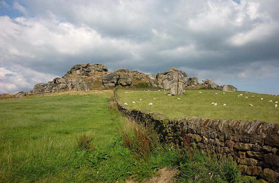
Almscliffe Crags – looking east
This giant outcrop of rock rises out from the meadowlands here like a miniature volcano, visible for many miles all round. The history and legends surrounding the aged edifice are prodigious and the view from its tops on a fine day is one to be remembered. It is likely, although there is little corroborative historical evidence, that is was an “omphalos”, or navel centre of the universe for the local people many centuries ago. A great cutting runs through its centre and “runs from nearly north to south, and forms the boundary between the townships of Rigton and Stainburn, so that a portion of the rock is in each township.” On the respective sides of this division are carved the letters “T.F.” and “E.L.”, being the initials of the families who owned the land here in olden days, Thomas Fawkes [of the legendary Guy Fawkes’ family] and Edwin Lascelles, of the ancient Harewood family.
Although Almscliffe Crags have been described in a great many local history books, it almost beggars belief to find it omitted from all the ancient mystery or “sacred sites” books ever written. Curious… Such lesser sites as Alderley Edge, the Cow and Calf rocks, Kilburn’s White Horse, Twelve Apostles stone circle, and many more, whilst having their respective virtues, don’t touch this place for ritual or sacred intent.
First described in the early 13th century records of Fountains Abbey, A.H. Smith (1961) thought the name of Almscliffe itself originally came from a hypothetical lady’s name, which seems an all-too-easy proclamation to make, instead of the humble option of “I don’t know”! But Smith wasn’t the only one to throw some curious ideas up about the etymology of Almscliffe. Said by some local etymologists to derive from the Celtic Al-, a rock or cliff, and mias, an altar, there are other attempts to bring its rocky form into a consensus meaning. The anglo-saxon Ael or El, being fire, and messe, or mass; and the Scandinavian Ormcliff, being the “cliff of the serpent”. In Jones’ History of Harewood (1859), he tells
“it to have derived its name from the distribution of almes, at certain times, agreeably to the tenor of legacies left to the chapel which stood there in the sixteenth century, and was at that time dedicated to the Virgin Mary.”
It’s difficult to say which one tells its true title. Many a druidic tale has also been carved into its form. Such is the nature of this site that Grainge (1871) wrote how,
“it would not be difficult to show, with the exception of the artificial temple or circle of stones, this place possesses all the accessories of that ancient worship as…typical of the worship of the sun.”
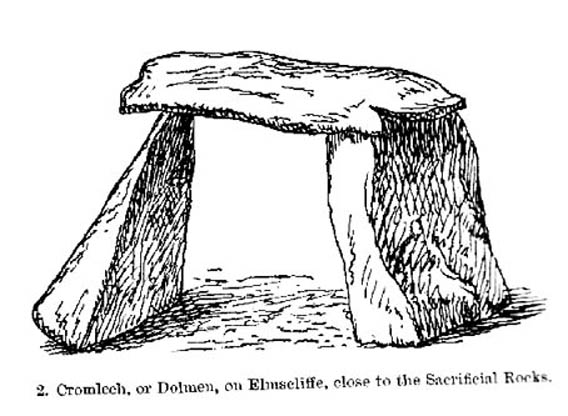
Simpson’s 1879 drawing of the Almscliffe ‘cromlech’
A remark that was even echoed by one of Yorkshire’s finest and most sober historians, Harry Speight. (1903) Grainge also pointed out that in his day there were three standing stones by the great Crags, one fallen, but “two of these rocks yet stand upright.” A few years later we find that the ranting christian writer, Henry T. Simpson (1879), described similar megalithic remains here, though his description was of a “cromlech.” (illustrated here) I can find no trace, nor further references to these relics; but think it reasonable to suggest that, perhaps, Simpson’s cromlech and Grainge’s standing stones may have been one and the same monument.
In the field 100 yards immediately north of the Crags (the one with the two rocks in it) there used to be seen the remains of some primitive early walling, suggestive of a small, early settlement site. Very little can be seen of these remains today and, as far as I’m aware, no archaeological survey was ever done of them. In all honesty, it’s highly probable that a number of other important prehistoric sites were once in evidence at varying distances around Almscliffe Crags…
Folklore
The creation myth of Almscliffe tells that, long long ago, the great giant Rombald — whose main place of residence tended to be Ilkley Moor — was having a fight with the devil upon his homeland heath. As is common in the myths of giants, the ‘devil’ picked up a great boulder and threw it at Rombald, but it missed and fell just short of the village of North Rigton, creating Almscliffe Crags. A variation of this tale tells that it was Rombald and his wife having the argument and she threw the stones to create the place. Several sites have been named as the place where the mythological argument occurred: the Cow and Calf rocks, the Great Skirtful and Little Skirtful of Stones all cited in the folktales of our Yorkshire peasants. Another variation of the tale tells that the devil was simply carrying some stones (as devils and giants are renowned to do in the folk-tales of the world) and he accidentally dropped them where the Crags now stand. Such rock-throwing tales are, once more, symptomatic of cailleach tales more commonly found in Ireland and Scotland.
There are a great many cup-markings on the top surface of these Crags, most of which seem natural, but it is not unreasonable to think that, perhaps, some may have been carved by human hands? (not sure misself) Eric Cowling (1946) sincerely believed the antiquity of some carvings here. One of them particularly, three feet across and eighteen inches deep, though seemingly natural, has for several centuries been known as the “Wart Well.” Its name is attributed to folklore that is more commonly found in Ireland and the Scottish highlands; that is, should you have a wart, prick it with a pin until a drop or two of blood drips into the water that gathers in the stone bowl, then dip your hand in afterwards. The wart is sure to vanish. Another method to achieve the same end is to merely wash the skin affliction in the water, and it will soon fade. (Interestingly, an old psychotherapist friend, afflicted with the damned things, did just this and they promptly vanished.)
A more minor creation myth tells that the stone bowls we see on top of the Crags here – including the Wart Well – was actually made when the giant Rombald stepped from his home onto the Crags and left his footprint embedded in the rock face. He was said to have made it in just one step, from the Giant Skirtful of Stones prehistoric cairn [where one legend reputes him buried].
Faerie folk were also long held to live here. On the northwest side of the Crags is the entrance to a small cave that was always known as the Faerie’s Parlour, as it was said to be an entrance to their supernatural world. In times past, many people have scrambled down into the cave, but never reached their Otherworldly paradise. William Grainge (1871) wrote how the little people “were all powerful on this hill and exchanged their imps for children of the farmers round about.” This is typical of old changeling lore! In outlying villages surrounding the Crags there is a particular excess of faerie and old heathen lore.
One very curious-sounding tale tells how a goose was sent down the hole and, after some considerable time, re-emerged 3½ miles away out from a well near Harewood Bridge. The goose is one of the many symbols of the sun and one of its primary symbolic attributes is that of winter. Interestingly perhaps, as the rock art writer Graeme Chappell has pointed out, the underground journey of the goose from Almscliffe to Harewood Bridge coincides closely with the rising of sun on morning of the winter solstice. This tale may simply be a folk remnant — and an archaic one at that — of just that event: ritualising winter solstice from these Crags. In Norse lore, shamans tell of geese carrying the great god Wotan across the skies at the coming of the Yule period.
Another ritual date that was celebrated here was Beltane, or May 1. Not only do we find many of the outlying villages possessed their own maypoles, but in 1879 Mr Simpson of Adel reported seeing Beltane fires atop of these rocks. Other meetings were made here as the Crags are spliced in half by the local boundary line, and perambulation records show that people came here during the ‘beating of the bounds’, as they used to be called. This boundary perambulation moot ingredient is what strongly implies the site to have had ritual importance. And the fact that a mass of folktales emerge from here adds to this. Then of course we have the physical situation of the Crags at the heart of the mid-Wharfedale landscape. All these ingredients combined, strongly suggest the site would have been, not just the ritual meeting place of tribal elders in pre-christian times, but an omphalos: it rises majestically from the land and all monuments gaze towards its giant form. Important giant prehistoric monuments from the hills miles away tell of myths that come and go from this proud mass of stone. Although we have other omphali just over the extended horizons from Almscliffe, this is where the World began in the creation myths of ancient times in mid-Wharfedale, at the heart of the ancient kingdom of Elmet.
But there is still more lore to be told of these rocks…
The centre piece of the Crags is known as the Altar Rocks. Upon its western side is carved the “figure of a large tree, which we take to be the monogram of the Celtic Jupiter,” says Grainge. This assumption is derived from an eighteenth century writer who, said Speight (1903), told that “Almnus and Alumnus are titles of Jupiter, to whom this high altar was dedicated.”
The highest part of the Crags, to the west, is known as Lover’s Leap where, in 1766, a daughter of a respectable Rigton farmer of the name Royston, having been disappointed in love, decided to kill herself. She jumped, so legend reputes, from a point some sixty feet above ground, but a strong wind blowing at the time caught hold of her dress and carried her through the air until she landed safely in an adjoining field with naught but a sprained thumb! The said lady realised the stupidity of her ways and was said to have lived out a long and fine life.
In recent years earthlights (UFOs) have been seen floating above and around the great outcrop. It is likely that these were the same things which, in days of olde, the people would call the faerie. I highly recommend visiting the place!
References:
Bennett, Paul, The Old Stones of Elmet, Capall Bann: Milverton 2001.
Bogg, Edmund, From Eden Vale to the Plains of York, James Miles: Leeds 1895.
Bogg, Edmund, Higher Wharfeland, James Miles: Leeds 1904
Cowling, E.T., Rombald’s Way, William Walker: Otley 1946.
Eliade, Mircea, Patterns in Comparative Religion, Sheed & Ward: London 1958.
Grainge, William, History & Topography of Harrogate and the Forest of Knaresborough, J.R. Smith: London 1871.
Jones, John, The History and Antiquities of Harewood, Simpkin Marshall: London 1859.
Simpson, William, Archaeologia Adelensis, W.H. Allen: London 1879.
Smith, A.H., The Place-Names of the West Riding of Yorkshire – volume 5, Cambridge University Press 1961.
Speight, Harry, Kirkby Overblow and District, Elliott Stock: London 1904.