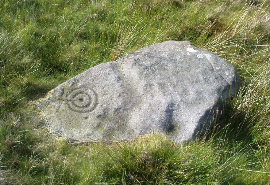
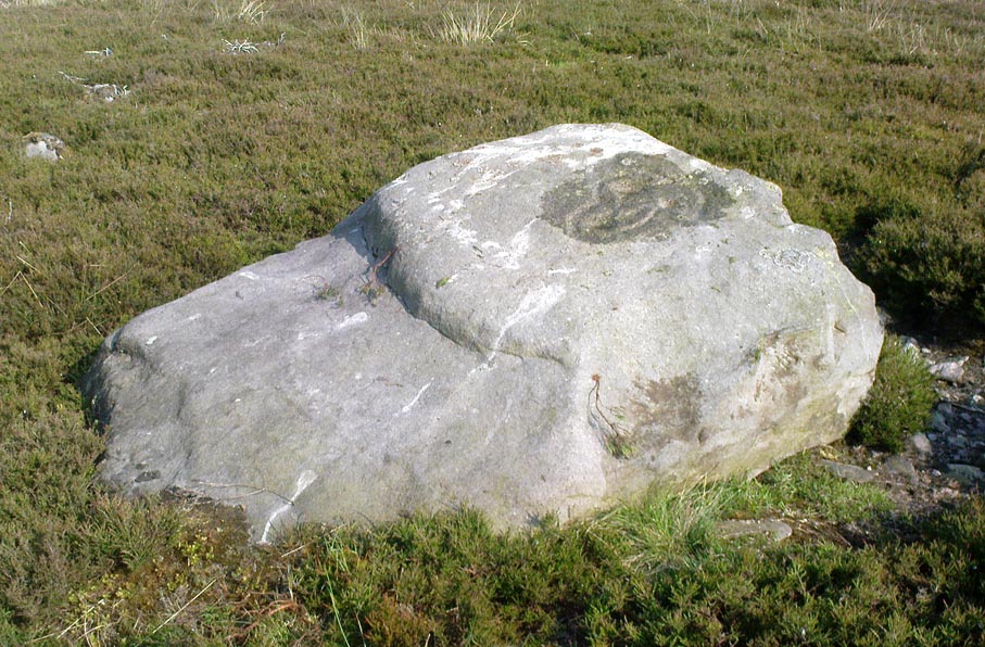
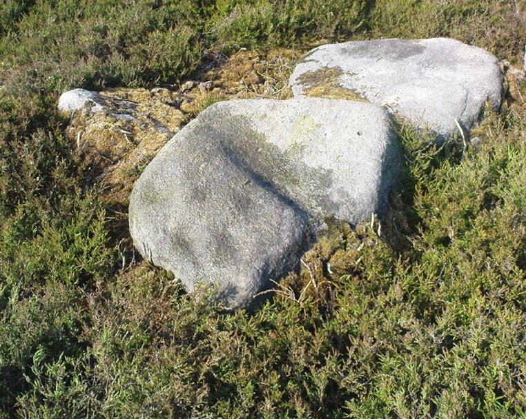
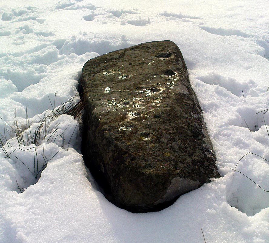
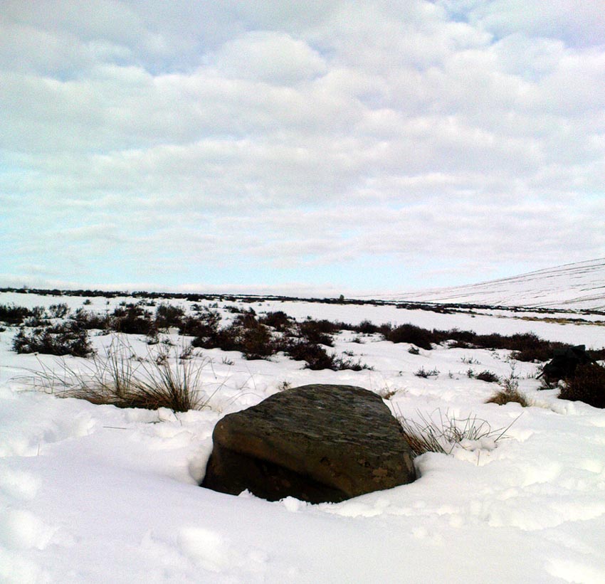
Green Gates stone (257), Ilkley Moor, West Yorkshire

Cup-and-Ring Stone:  OS Grid Reference – SE 11499 46049

Also Known as:

  1. Carving no.103 (Hedges)

Getting Here

Green Gates (257) stone

Take the road from Ilkley town centre up towards the White Wells and keep following it along until it curves up and onto the moor itself and becomes a rocky dirt-track.  Go up here, past the old quarries (left) until you hit the footpath which runs east (left) onto the flat level of the moorland. Follow this footpath along for literally half-a-mile, where a footpath runs up onto the tops of the moorland.  Go up here for 100 yards and you’ll see a small standing stone by the right-hand side of the footpath; on the left, into the moorland about 20 yards away, this carving is to be found!

Archaeology & History

This is an excellent, archetypal cup-and-ring stone carving and is in a very good state of preservation.  Found just a few yards away from the aptly-named Pitchfork Stone, the carving here on a large single stone mainly comprises of a double cup-and-ring.  A couple of other possible outlying cup-marks can be seen: one just below the double-ring, and the other towards the top-end of the rock.  It was first reported by Stuart Feather in the Bradford Archaeology Group’s journal in 1961, then listed in the surveys of Hedges (1986) and his followers.
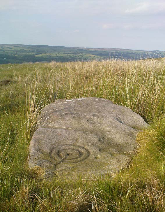
Carving 257, looking NE

When Michala Potts, Dave Hazell and I we visited this carving the other day, some halfwit had been up here in the not-too-distant past and, as with some of the carvings on the moors north of Ilkley, had daubed some paint or oily resin onto the carvings themselves to specifically highlight aspects of the carved rock (not one part of the uncarved stone had anything on it).  We aint quite sure exactly what the substance is that’s been daubed onto the carvings (it aint ordinary paint), but seems like an oil or industrial substance.  And, whoever’s done this, obviously seems to have some knowledge of the rock art they’re painting over: they certainly have good grid-references and enjoy walking the hills.  This aint just some idiot/s into vandalizing the carvings for the sake of it, nor the whim of some airy-fairy New-Ager.  Whoever’s done this (and it’s been done on other cup-and-rings around this locale) have deliberately set out to locate and paint over specific carvings — a number of them off-path — with the intention it would seem to highlight them for photographic enhancement.  So — whichever retard has done this, might I suggest that you keep your industrial waste where it belongs: in your own house you fucking moron!   If anyone knows who is doing this to the carvings round here, please email me (anonymously if necessary) with all relevant info.  Any such communications regarding this matter will be kept strictly confidential.

References:

  1. Boughey, Keith & Vickerman, E.A., Prehistoric Rock Art of the West Riding, WYAS: Leeds 2003.
  2. Hedges, John, The Carved Rocks on Rombald’s Moor, WYMCC: Wakefield 1986.

© Paul Bennett, The Northern Antiquarian
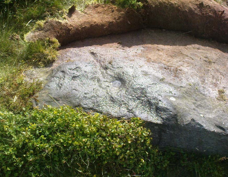

Coronation Cairn carving (270), Ilkley Moor, West Yorkshire

Cup-and-Ring Stone:  OS Grid Reference – SE 1226 4636

Getting Here

Walk up from Ilkley to the White Wells and keep following the footpath upwards, up the steps and onto the moor itself.  Once you’ve got to the top of the steps above the rocky valley, look straight up the slope in front of you and walk directly up the hill.  As you near the top, there’s a large cairn sat on the brow of the hill (known as the Coronation Cairn).  This ‘ere carving is just a few yards below it.

Archaeology & History

Very little has been written of this albeit innocuous carving — if indeed it is a carving!  Found on the large (though overgrown) flat stone just a few yards below the Victorian cairn, all that we appear to have here is a large cup-marking with a small arc pecked around its southern side and a distinct straight line running outwards from the cup (though the line doesn’t actually touch the cup-mark and does give the distinct impression of being pretty recent).  A sort of “cup-and-half-ring” with extended line is perhaps the best description!

Close-up of cup & lines
Carved Stone 270

It was first reported by some English Heritage archaeologist — which, as is generally acknowledged, isn’t necessarily a good pointer for authenticity when it comes to identifying prehistoric rock art.* But it’s certainly got a bit more about it than some “carvings” they’ve reported in the past!  Boughey & Vickerman (2003) made the following notes of this stone:

“”Low, flat gritstone rock quarried away on E side, fairly smooth but uneven.  One large cup and deep groove slightly curving round edge of cup.”

Which is about right.  I don’t really think too many of you will be into this unless you’re a real rock-art fanatic!

References:

  1. Boughey, Keith & Vickerman, E.A., Prehistoric Rock Art of the West Riding, WYAS: Leeds 2003.
  2. Hedges, John, The Carved Rocks on Rombald’s Moor, WYMCC: Wakefield 1986.

* A number of cup-marked stones identified by English Heritage archaeologists have transpired to be nothing more than natural erosion. 

© Paul Bennett, The Northern Antiquarian
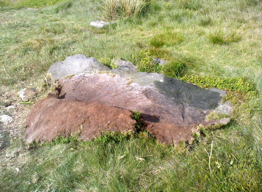

Higher Town Bay, St. Martin’s, Scilly Isles

Cist:  OS Grid Reference – SV 934 153

Also Known as:

  1. Monument no.303793

Archaeology & History

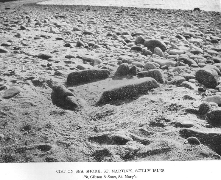
The remains of this old tomb were first noted by Mr Alexander Gibson, whose photograph of the site is here reproduced.  Thought by Paul Ashbee (1974) to date from between the Iron Age and Romano-British period, the site was first described in O.G.S. Crawford’s (1928) essay in Antiquity journal.  It was just one of several such sites in relative proximity to each other and which, due to them being so close to the sea, have been all-but washed over by Nature’s advance.  Mr Crawford told that this,

“cist on the shore…is on St. Martin’s, between Crethus Hill and English Island Point, about 20 yards from the edge of the rushy bank, and at approximately high water-mark.  It is oriented north and south and is 3 feet long by 2 (feet) wide.  It has now no capstone.  The cist when found was full of coarse, gravelly sand and stones, which were cleared out; amongst this were parts of leg bones (the joint-ends missing) and smaller fragments; then a piece of a human jaw, without teeth, and finally the skull.  The facial portion was missing.  The skull fell to pieces on removal but it and all the other pieces were preserved and the cist filled in again.”

In the same article, Crawford notes that,

“nearby, to the west, were two or three other cists of the same type, and many years ago yet others were observed, both round this bay and at Lawrence’s, to the west of Crethus Hill.”

References:

  1. Ashbee, Paul, Ancient Scilly, David & Charles: Newton Abbot 1974.
  2. Crawford, O.G.S., “Stone Cists,” in Antiquity Journal, volume 2, no.8, December 1928.
  3. Weatherhill, Craig, Cornovia, Halsgrove 2009.

Links:

  1. Pastscape Notes on Monument no.303793

© Paul Bennett, The Northern Antiquarian

Town Lane, St. Mary’s, Scilly Isles

Cist:  OS Grid Reference – SV 9157 1175

Also Known as:

  1. Monument no.304025

Archaeology & History

Town Lane cist

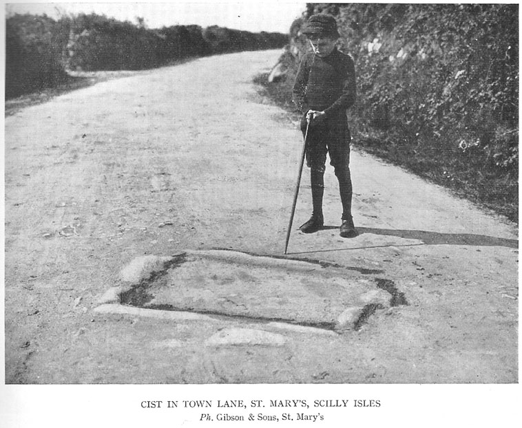
In Crawford’s (1928) article on stone-lined burials, or cists, this was one site that he described from the Scilly Isles, though little can be seen of the site nowadays as a road was built on top of it.  It was first discovered by a Mr Alexander Gibson (who took the photo, here reproduced) and was described as “the cist in the road”, due to its position in the middle of the old lane.  A number of flints and other Crawford told that it,

“is in Town Lane, about midway between Holy Vale and the Marconi Station, St. Mary’s (lat. 49° 55′ 35.2″ N, long. 6° 17′ 52.5″ W).  Nothing is known about it, but presumably it was found when the road was made by Mr Augustus Smith more than 80 years ago.  It measures about 3 feet in length by 2 feet in width, and is oriented approximately NE-SW.  There is said to have been another near it, but Mr Gibson has searched without success.”

In Paul Ashbee’s (1974) fine archaeological survey, he describes there being several other small prehistoric burials found in fields a little further down the same lane.

References:

  1. Ashbee, Paul, Ancient Scilly, David & Charles: Newton Abbot 1974.
  2. Crawford, O.G.S., “Stone Cists,” in Antiquity Journal, volume 2, no.8, December 1928.

© Paul Bennett, The Northern Antiquarian

Great Wood Laithe (019), Skipton, North Yorkshire

Cup-Marked Stone:  OS Grid Reference – SD 99620 50551

Also Known as:

  1. Carving no.3 (Hedges)
  2. Carving no.19 (Boughey & Vickerman)

Getting Here

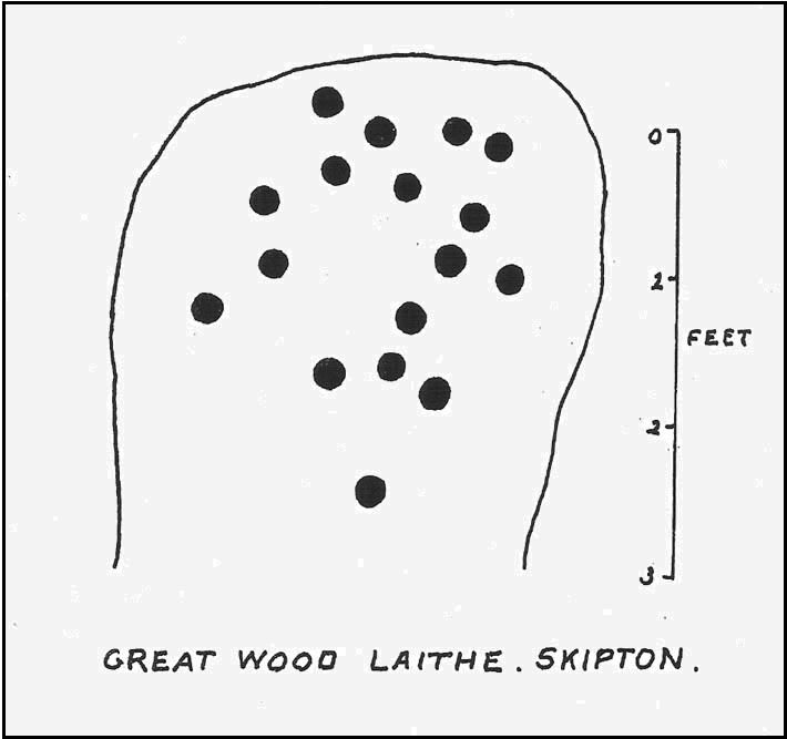
Cowling’s 1964 drawing

From Skipton centre get to the Horse Close estate on the southern side of the town and look up to the fields on the sloping hill above it with the small woods above ’em.  Head up towards the trees, but before you get there go into the fields on your right, and in one of them you’ll see what looks like a pile of rocks near the middle.  Head for it!

Alternatively, follow the directions to reach the Horse Close Hill enclosure, then walk down into the field on its western edge.  You can’t really miss it!

Archaeology & History

This carving first saw the light of pen-and-paper in the early 1960s, soon after the Yorkshire antiquarian Eric T. Cowling (he of Rombald’s Way fame) was led to the site by his wandering nose and the aid of local people.  He sent a letter to the editor of the Bradford archaeology group at the time (a certain Mr Sidney Jackson), which told:

“South-west of the wood which gives its name to the Great Wood Laithe at the western end of Rombalds Moor and overlooking Skipton from the east, is a cup-marked boulder: NGR – SD 99625055.  In the middle of the field alongside the wood is an outcrop of rock which has been almost levelled with the adjacent field surface by the dumping of boulders from the surrounding ploughlands.

“The top of the outcrop rises to a dome-shaped projection which bears simple cup-markings.  These average two in diameter and total 17 in number.  The whole surface of the stone is weathered, and suitable light may reveal more details.”

And, faded though it is, in better lighting conditions it seems there may be more than twenty cup-marks on the rock.  Certainly this is what the surveys of Hedges (1986) and Boughey & Vickerman (2003) concluded.  There are other carvings close by and, on the hillside immediately above you, the denuded remains of a very impressive prehistoric settlement site known as Horse Close Hill.  Well worth having a look at!

References:

  1. Boughey, Keith & Vickerman, E.A., Prehistoric Rock Art of the West Riding, WYAS: Leeds 2003.
  2. Cowling, E.T., “Cup-and Ring Boulders,” in Cartwright Hall Archaeology Group Bulletin, 9:5, May 1964.
  3. Hedges, John (ed.), The Carved Rocks on Rombald’s Moor, WYMCC: Wakefield 1986.
  4. Ramm, H.G., “Yorkshire Archaeological Register, 1964,” in Yorkshire Archaeological Journal, volume 41 (part 163), 1965.

© Paul Bennett, The Northern Antiquarian 

Wallace’s Stone, Dunblane, Stirlingshire

Standing Stones / Stone Row:  OS Grid Reference – NN 83259 02293

Also Known as:

  1. Lairhill Stones

Getting Here

Follow the same directions as to reach the cup-marked Sheriffmuir Carving, which is just a coupla hundred yards away to the southwest.  On a clear day you can see this standing stone from the pub by the roadside, a few hundred yards away!

Archaeology & History

Wallace Stone (photo credit – James Elkington)

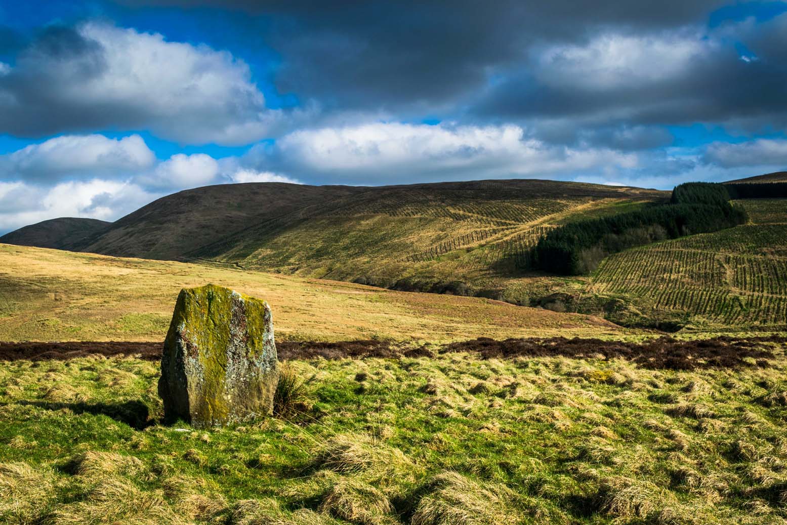
This is alleged to be just one standing stone in a straight line of five once-upright monoliths.  Starting at the southwestern end of this row we have the 7ft-long cup-marked Sheriffmuir Carved stone — which certainly looks as if it stood upright in the not-too-distant past — and as we move up the line we pass another that’s been split in half.  Another earthfast-looking rock is the next contender, before we reach our famous Wallace Stone, standing upright and proud on this moorland ridge.  It’s about 6ft tall and 3ft across at its widest and certainly acts as a marker for the line of stones that allegedly stood upright here.  And if we walk just a bit further up we have another big stone laid on the ground which is alleged to be a part of the same alignment.

The split stone (photo credit – James Elkington)

If it is an authentic megalithic row, it’s not included in either the Thoms’ (1990) two-volume work on the subject, nor Aubrey Burl’s (1996) compendium a few years later.  And though the alignment looks good, I’ve found ones just like this in the Pennines where we have just one upright left and then a line of other seemingly prostrate stones running dead straight either side of the singular upright (and have kept mi gob shut about ’em for sensible reasons), so I’m not too sure what to think.

But, alignment aside, the Wallace Stone itself is a damn good standing stone and well worth checking out.  It’s highly probable that other prehistoric remains still lurk, undiscovered, amidst these heaths…like the lost stone circle to be found nearby…

Folklore

A slight variation on a theme about this spot:  in both accounts the stone was named after the legendary Scottish independence fighter, Sir William Wallace.  The folklore tells that he and his fighting clans gathered here in 1297 preceeding the Battle of Stirling Bridge; whilst the variation tells that the stone here was actually erected around that time to commemorate the event.  This tale was first narrated by a local story-teller called Blind Harry and was found by local historian A.F. Hutchinson (1893) to be a case of mistaken identity!

References:

  1. Burl, Aubrey, From Carnac to Callanish: The Prehistoric Stone Rows and Avenues of Britain, Ireland and Brittany, Yale University Press 1993.
  2. Heggie, Douglas C., Megalithic science: ancient mathematics and astronomy in north-west Europe, Thames & Hudson: London 1981.
  3. Hutchinson, A.F., “The Standing Stones and other Rude Monuments of Stirling District,” in Transactions of the Stirling Natural History and Antiquarian Society, 1893.
  4. Royal Commission on the Ancient & Historical Monuments of Scotland, Archaeological Sites and Monuments of Stirling District, Central Region, Society of Antiquaries of Scotland 1979.
  5. Thom, A., Thom, A.S. & Burl, Aubrey, Stone Rows and Standing Stones – 2 volumes, B.A.R.: Oxford 1990.

Acknowledgements:  Big thanks as always to James Elkington for use of his photos in this site profile – prints of which are available from the man himself!

© Paul Bennett, The Northern Antiquarian

Death’s Head Carving (577), Askwith Moor, North Yorkshire

Cup-and-Ring Stone:  OS Grid Reference – SE 17795 51235

Also Known as:

  1. Carving no.577

Getting Here

Follow the directions to find the Tree of Life Stone, then follow the main footpath uphill from it.  Once on the level, look out for a couple of large rocks abaat 100 yards to your left.  Check ’em out, cos it’s on one of ’em!

Archaeology & History

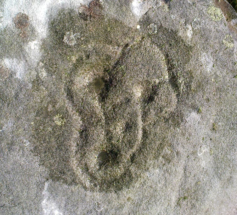
This is another decent carving living on these prolific moors.  Found near the end of a lengthy line of prehistoric walling that runs east-west over this part of the moor, the general Rorsharch-response to this carving is of some sorta skull or screaming face.  My impression of it the other day was, “it looks like a pig!”

Although mentioned by numerous writers, the first description of it was in Eric Cowling’s (1937) essay on the cup-and-ring stones north of Otley, saying:

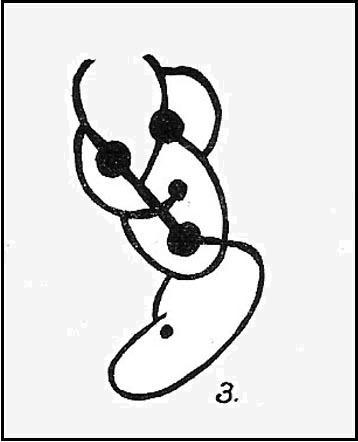
“On an isolated table stone, situated at the upper end of the shallow valley which drains Snowden Carr, the writer found a marking having a strangely skull-like appearance, but which is really a group of three large cups which are linked by inter-turning curved grooves.”

Close-up of main design
The Death’s Head Rock

He then strives to make links between this carving and the design on the Swastika Stone above Ilkley — which in some way is a little similar, i.e., as a three-armed triskele swastika; but the notion is perhaps as accurate as saying it represents a cloud, or a tree, or bird-flight, or any number of other natural phenomena.  Beckensall’s (1999) brief note of the stone — despite getting his grid-ref off by a few hundred yards — described it as “four cups linked and enclosed by grooves, unconvincingly suggesting a skull to some people.”  With Boughey & Vickerman (2003) saying:

“Fairly large, upstanding rock with surface sloping down to N. Figure of four cups linked by and enclosed by grooves: entire pattern resembles a skull, hence the name ‘Death’s Head Rock.'”

References:

  1. Beckensall, Stan, British Prehistoric Rock Art, Tempus: Stroud 1999.
  2. Boughey, Keith & Vickerman, E.A., Prehistoric Rock Art of the West Riding, WYAS 2003.
  3. Cowling, Eric T., “Cup and Ring Markings to the North of Otley,” in Yorkshire Archaeological Journal, part 131, 33:3, 1937.
  4. Cowling, Eric T., Rombald’s Way: A Prehistory of Mid-Wharfedale, William Walker: Otley 1946.

© Paul Bennett, The Northern Antiquarian

Step Stone, Snowden Crags, Askwith, North Yorkshire

Cup-Marked Stone:  OS Grid Reference – SE 17841 51306

Getting Here

Get to the Fence Stone carving and walk up to the top of the hill about 50-60 yards away.  Once on the long flat rock, walk less than 20 yards WNW until you see the stone in the picture.

Archaeology & History

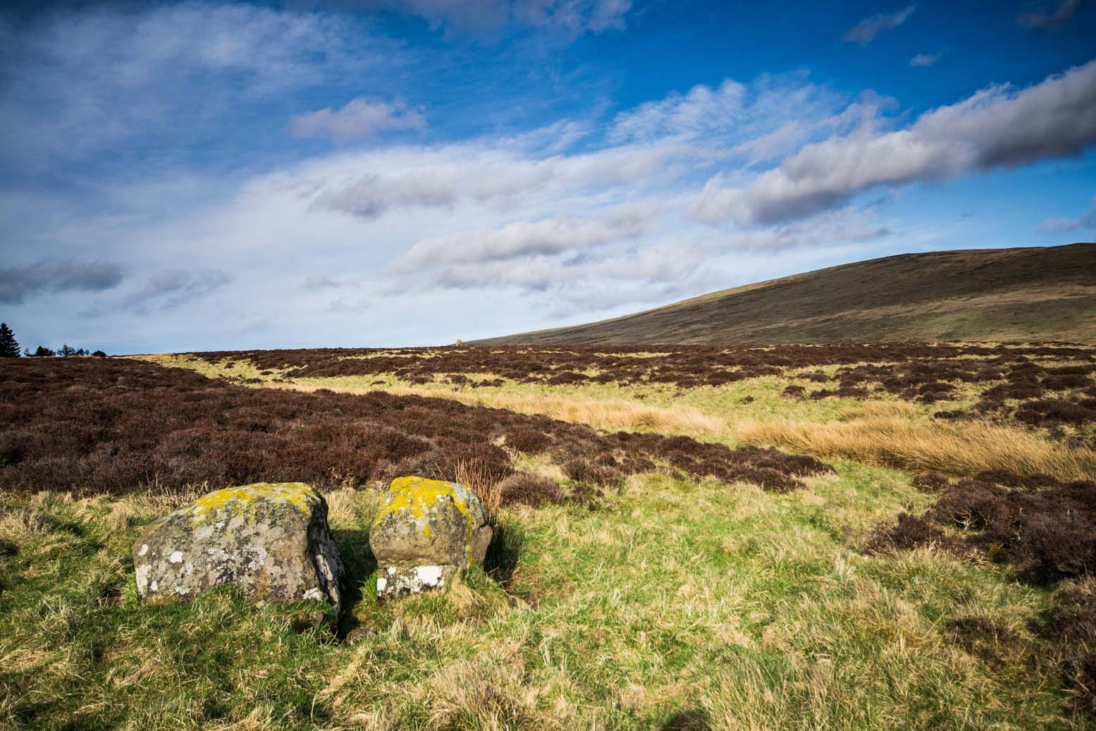
So named due to it being shaped like a little singular step on a stone, this cup-marked carving was first found in the middle of May, 2010, around the same time Michala Potts located the Snowden Crags cairn circle.

Step Stone, Snowden Crags
Close-up of the cups

First described and illustrated on the Avebury Forum on June 3, 2010, this cup-marked rock is found in association with a number of (as yet) unexcavated prehistoric remains, close to some Iron- or Bronze Age walling and a distinct hut circle, close to one of the D-shaped enclosures 20 yards away.*  When I first found it there seemed to be just two simple cups on it, but upon viewing it several times over the last few weeks in differing lighting conditions, it seems there may be as many as 4 cups on the southwestern face of the rock.  In one of the images here, you get the impression that there could actually be five cups — but I’m gonna play safe and just say there are three such cups here.

* At least 3 large, prehistoric, D-shaped enclosures have been isolated on these moorlands, with diameters ranging between 15 and 80 yards.  None of these have yet to receive serious archaeological attention!

© Paul Bennett, The Northern Antiquarian

Boomers Stone, Askwith Moor, North Yorkshire

Cup-and-Ring Stone:  OS Grid Reference – SE 17204 51280 —  NEW FIND

Getting Here

From the Askwith Moor Road car-parking spot, walk up the road (north) for 350 yards and go thru the gate on your left.  Once thru it, keeping walking up and along the edge of the fence following the line of the road until the path goes downhill.  Near where it levels out, walk into the moor proper for about 150 yards or so.  You’re close!

Archaeology & History

Cup-and-slight-ring stone, Askwith Moor

First found by Messrs Dave Hazell and Paul Hornby on the afternoon of Thursday, June 3, 2010, amidst scouring operations on the moors hereby.  This large stone has one conspicuous cup on its south-facing slope with faint remains of a half-ring on its eastern side.  A distinct arc above the immediate top of the cup joins up with the pecked quarter-ring section and may have been added to by human hands aswell, certainly giving it a half-ring effect.  There are a couple of decent natural cups along the top-edge of the stone aswell.

A brief discussion then began as to why someone would only carve half a ring, or less, surrounding the cup-marking.  But the fella doing this could have easily been distracted by a boar, a wolf, or even worse – his northern wife!

A little further west, barely 100 away, rising up the edge of the slope, Geoff, Dave and Paul found several more examples of what seem to be distinct remains of prehistoric cairns on the edges of High Low Ridge.  Like Dave and Paul’s Boomers Stone, they aren’t in any previously published archaeological surveys either.

© Paul Bennett, The Northern Antiquarian 

Sheriffmuir Carving, Dunblane, Stirlingshire

Cup-Marked Stone:  OS Grid Reference – NN 83074 02143

Getting Here

From Dunblane, head up the Glen Road for nearly a mile, turning left up the Sheriffmuir Road and all the wya on till you reach the pub near the T-junction another couple of miles on.  OK – get thru the gate and onto the moor, roughly in a straight line with the pub behind you for about 400 yards.  You’re damn close! (if you find the nice standing stone known as the Wallace Stone, walk  250 yards southwest from here).

Archaeology & History

Almost nothing has been written of this cup-marked stone, found at the southern end of what’s alleged to be an authentic megalithic stone row alignment, running northeast to southwest — although this alignment isn’t included in either Aubrey Burl’s (1993) or Alexander Thom’s (1990) textbooks dealing with such matters.

Cup-marks highlighted in ice!
Cup-marked rock with the Wallace Stone in the distance

When we came here last winter in temperatures of around -6°C (one helluva good day!), curiously only this and the other stones along this “stone row” were actually uncovered on the moorland.  Quite bizarre to be honest!  Many of the other rocks scattering this small moorland edge were covered in several feet of snow.  We were lucky I s’ppose…though I’ve gotta get back up here again shortly and see the site in summertime (midges up mi crotch, cleggs-a-biting – oh such joy!) cos I can’t believe this is the only cup-marked stone hereby.

The rock itself is more than seven-feet long and has at least twenty archetypal cups carved into its slightly-slanting face — although when we visited the stone, several of these were difficult to see and, as the images show, even more difficult to photograph (of the 20 I took of this stone alone, only one was of any value in highlight the cups) .  The stone gave the impression that it may have stood upright in the not-too-distant past — which would of course give the notion of this as part of megalithic avenue a considerably more potent status.

Some dood alleged that this potential stone row, with this cup-marked stone at its southwestern end, marked an astronomical alignment — but for the life of me I can’t remember who it was! (it’s my age creeping up on me at last!)

References:

  1. Burl, Aubrey, From Carnac to Callanish: The Prehistoric Stone Rows and Avenues of Britain, Ireland and Brittany, Yale University Press 1993.
  2. Heggie, Douglas C., Megalithic science: ancient mathematics and astronomy in north-west Europe, Thames & Hudson: London 1981.
  3. Thom, A., Thom, A.S. & Burl, Aubrey, Stone Rows and Standing Stones – 2 volumes, B.A.R.: Oxford 1990.

© Paul Bennett, The Northern Antiquarian