Stone Circle (destroyed): OS Grid Reference – NO 332 430 (approximation)
Archaeology & History
This stone circle wasn’t logged in either Barnatt (19890 or Burl’s (2000) standard megalith inventories. The only mention of it seems to be in Alex Elliott’s (1911) rare work on the region, in which he described it as being located “within the grounds of Mylnefield”. All trace of it would seem to have gone. Elliott told it to have been,
“elliptical in form and consisted of six large boulders – three at the east, three at the west, with a gap between capable of holding an equal number of stones.”
References:
Elliott Alexander, Lochee – As it Was and As it Is, J.P. Mathew: Dundee 1911.
Cup-and-Ring Stone (lost): OS Grid Reference – NY 5019 2776
Also Known as:
Archaeology & History
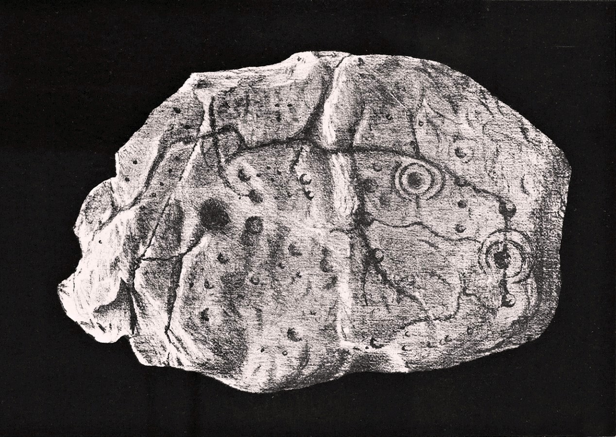
Taylor’s 1883 sketch
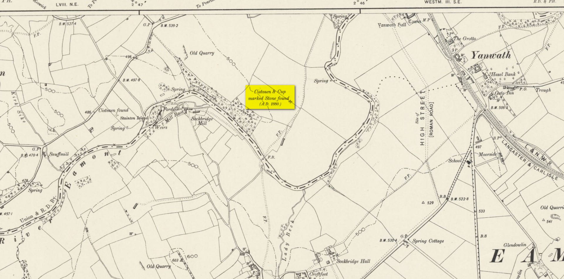
The geographical position of this site was shown on the 1897 Ordnance Survey map, albeit in the past tense as it had been destroyed not long after after being uncovered. Thankfully however, local antiquarian Mick Taylor (1882; 1883) did a damn good job recording what had been found here, and although he had remains of the stone in his possession shortly after it had been found, the carving has subsequently been lost. Thankfully Mr Taylor left us with a good drawing of the design (right).
Located a short distance west of the grand henges of Mayburgh and King Arthur’s Round Table, the carving was found some ten inches below the ground during work that was being done to lay some new fencing. The lads doing the work hit some stone and found it to be covered with a number of standard cup-and-ring motifs facing downwards. This carved stone, wrote Taylor (1882), was in fact “the cover of a kist-vaen”, a.k.a, prehistoric stone burial cist. He then proceeded to give a lengthy account of the site and the carving, telling:
Site shown on 1897 map
“There are traces of ancient occupancy, and vestiges of cairn structure still to be discerned on the hill-side on which it was found, but no barrow nor mound covered this particular grave. A space had been excavated for the interment dipping into the limestone rock to a depth of about 3 feet; the length of the grave was 4 feet, and the breadth about 3 feet 6 inches. Cobble stones had been used partially to line the cavity, but there was no flagging at the sides or bottom. The space was filled with blackish soil, amid which was a quantity of burnt bones, all in a fragmentary state. No implement nor shreds of pottery could be found, but there were several pieces of charcoal. It had evidently been an interment of cremated remains.
“The massive stone which formed the cover of the kistvaen I saw in situ immediately after its discovery.
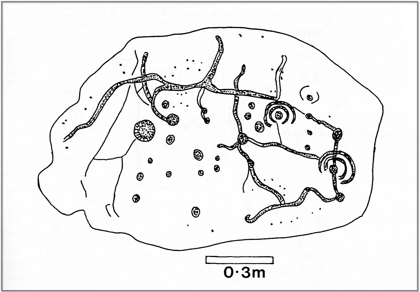
Beckensall’s impression of the design
“This stone is a natural slab of white freestone; it is of a broadish ovoid form, 5 feet 4 inches long, and at the centre 3 feet 6 inches broad, tapering towards each end; and it varies from 8 inches to 13 inches in thickness. The superior surface is rough and irregular, and scored in many places with marks of the ploughshare and harrows, which have passed over it in frequent cultivation. The interior surface, which was presented towards the grave, shows a fairly smooth cleavage, and on it were carved the sculptured markings which I shall describe.
“The slab, which is in my possession, was unfortunately broken in three or four pieces by the hammer of the workman, but I have put it together, and when viewed with a certain light when the shadows are deep, the sculpturings may be well made out, and appear to be arranged as follows: near the bottom there is a central cup deeply carved, about 3 inches in diameter; around this there are two concentric rings, somewhat faintly incised, the outermost of which has a diameter of 6 inches. From this central cup proceed two grooves 6 inches long, which bisect the concentric circles, and traverse in a straight line to join a similar cup on each side of the central one. From this line of cups three gutters meander upwards over the surface of the slab; the main channel takes a direction upwards on the right side of the stone, and receives a number of branches like the tributaries of a river from each side, and terminates on the free margin of the upper part of the stone. On the lowest quarter of the stone to the right there is a large hollow cup 3 inches in diameter, around which also there are two well-executed concentric rings, the largest with a diameter of 6 inches. These rings are cut by a radial groove which joins a gutter in the centre of the stone, and in the opposite direction, at a point in their circumference, they fall into and are subtended by the larger side channel. These are the only two cuttings on the stone which present this annular arrangement; on the other hand, the simple cup markings are numerous, in fact, twenty-four may be counted. One of these cups is greatly larger than any of the rest. It is situated in the centre of the upper half of the slab, and on first view forms the most strikingly characteristic feature of the tablet. This cup is 6 inches in diameter, and is carved out to the depth of 3 inches. The chisel marks are distinct and fresh, as if done yesterday; and there is a smoothness and regularity of execution about it, which evinces that more pains have been taken with it than with some of the other incisions. The other cup-markings vary from 1 inch to 3 inches in measurement. A number of them (about twelve of them may be counted) are associated with the furrowed lines, either forming the beginning of a gutter, or joining or being included in the line of the channel itself. These form the series of the larger cup-markings, and are an inch or more in depth. On the other hand, others of these cups are isolated, and scattered singly, and apparently without regular order over the surface, and unconnected with the branch-like lines; these for the most part are mere shallow depressions, and with less defined margins. Again, there is another class of markings on the stone; they are very numerous, and are dispersed apparently irregularly over all the surface; these are little pits or pick marks, small irregular holes picked into the stone, evidently done with some pointed tool.”
Taylor thought that these “small irregular holes” had been made with a flat-edged chisel whacked with a hammer, and the cup-marks “by a flint or harder stone.” In examples I’ve found in Perthshire where the tools have been left at the site, both a harder stone was found at one (for some reason actually laid within the cup-mark and left there before it had been finished), whilst a flint was laid in the cup-mark of another carving (although that example seemed to be more a deliberate deposit rather than being the tool that made the carving).
Anyhow, considering the poor condition of the carving when Taylor described it—”broken in three or four pieces”—there’s little likelihood of it having survived. But, on the off-chance that someone’s mum or granny has it hiding in the rockery at the back of the garden somewhere, give us a shout….
References:
Beckensall, Stan, Cumbrian Prehistoric Rock Art, Abbey Press: Hexham 1992.
Beckensall, Stan, Prehistoric Rock Art in Cumbria, Tempus: Stroud 2002.
Taylor, Michael W., “On a Sculptured Stone with Cup and Ring-Markings, found at Redhills, near Penrith,” in Proceedings Society of Antiquaries Scotland, volume 16, 1882.
Taylor, Michael W., “On a Cup-marked Stone found at Redhills, near Penrith,” in Transactions Cumberland & Westmorland Antiquarian & Archaeological Society, volume 6, 1883.
Acknowledgements: Huge thanks for use of the Ordnance Survey map in this site profile, reproduced with the kind permission of the National Library of Scotland.
From Silsden, head up to Brunthwaite village and follow the same directions as if you’re going to see the Brunthwaite (1) cup-marked stone and, once there, look at the walling immediately behind it and you’ll see, at the base of the wall, peeking out is a small earthfast boulder. It’s about a yard away. You’ll find it.
Archaeology & History
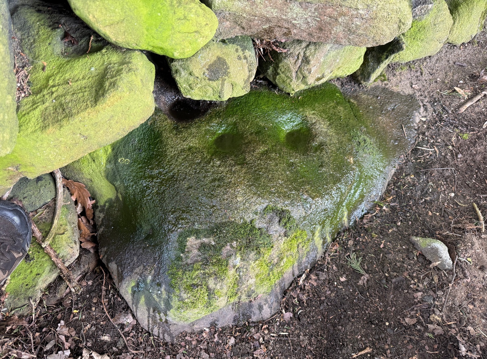
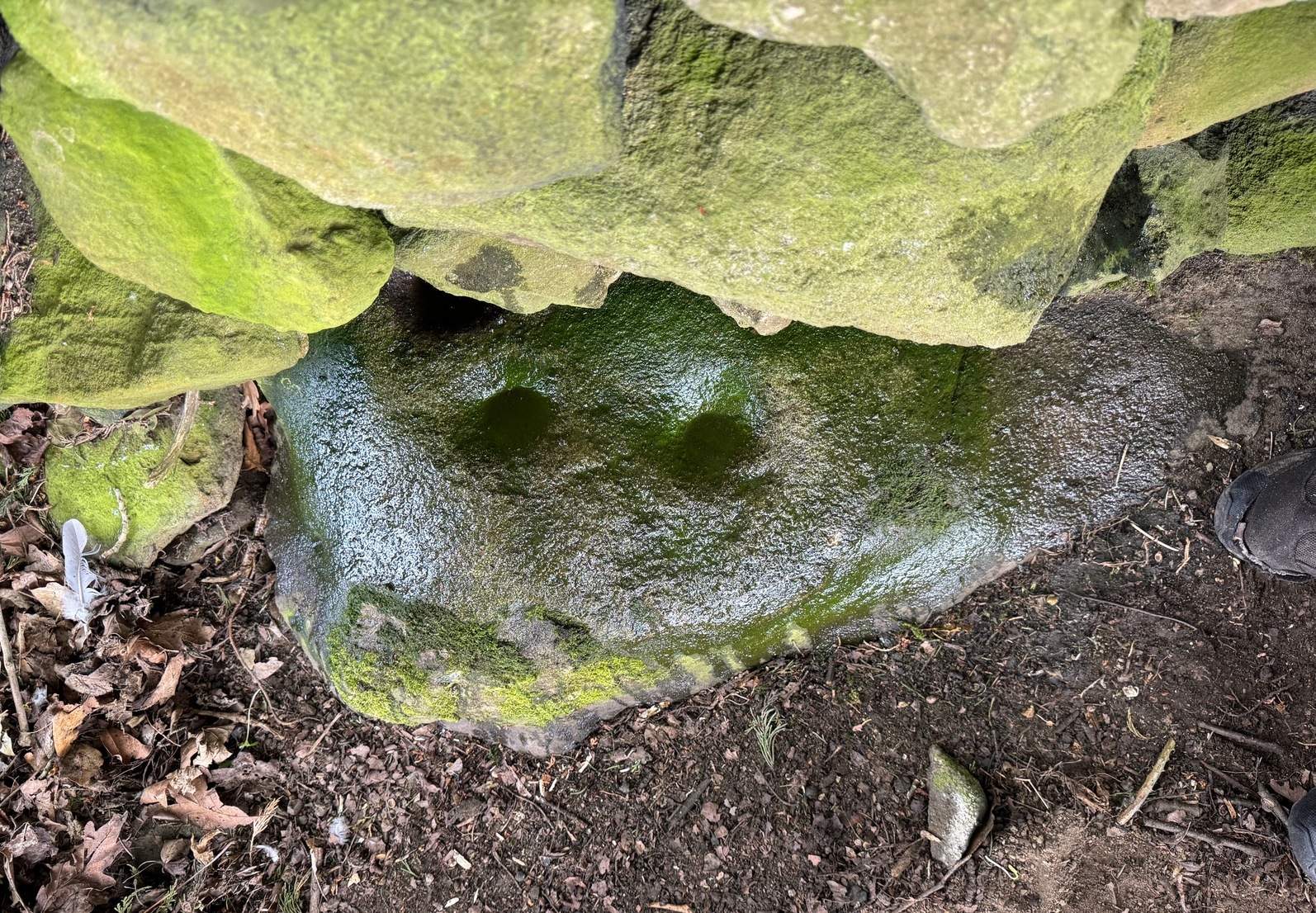
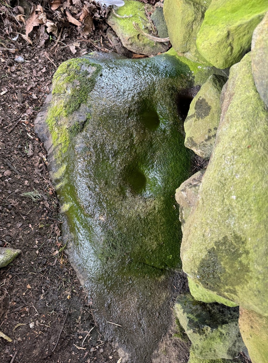
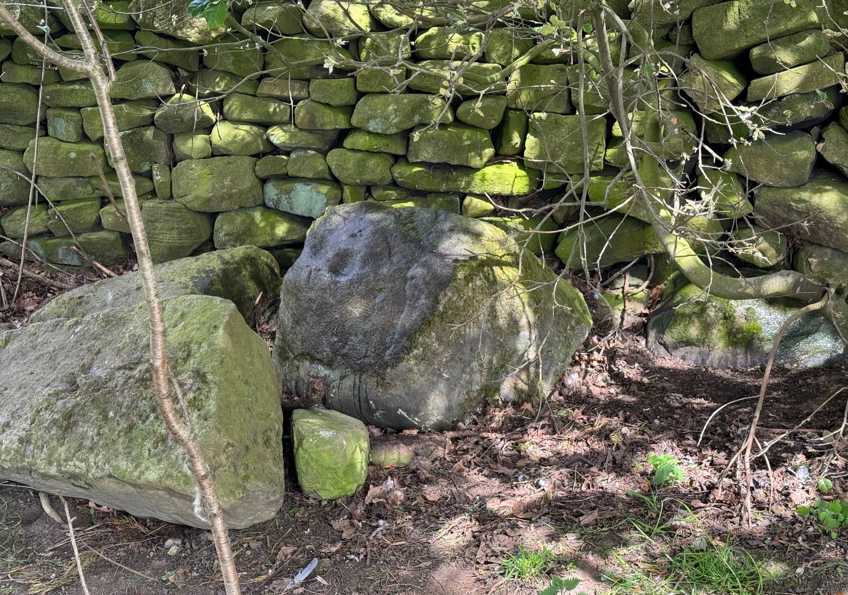
Sticking out from the edge of the walling at ground level is this low small cup-marked stone, rediscovered by rock art explorer Tom Cleland just a few weeks ago. It sits behind the cluster of rocks that were dumped here not too many years back. The carving comprises of at least three well-defined and quite deep cups, only two of which were initially visible until we cleared out a third one that had become filled with soil. It’s possible that there’s more of them on the stone, but we’d have to take the wall down to find that out!
The stone seems to be earthfast and may have remained in the same spot, untouched, since when it was first carved four or five thousand years ago—and certainly the depths of the cups suggest that its it’s been pretty much covered over for most of its life. The walling that’s been built on top of it is pretty recent by comparison; but it’s notable that its petroglyphic neighbour, the High Brunthwaite (3) carving, 175 yards to the east, is also an earthfast rock with the field-wall built on top of it.
Its somewhat minimalist appearance reminds me of several of the cup-marked petroglyphs at the top of Shipley Glen, six miles southeast of here, including the Baildon Moor (126) and (130) carvings…
Acknowledgements: Massive appreciation to Thomas Cleland for finding this carving and showing us it’s whereabouts.
Cup-and-Ring Stone (removed): OS Grid Reference – NZ 1475 6350
Archaeology & History
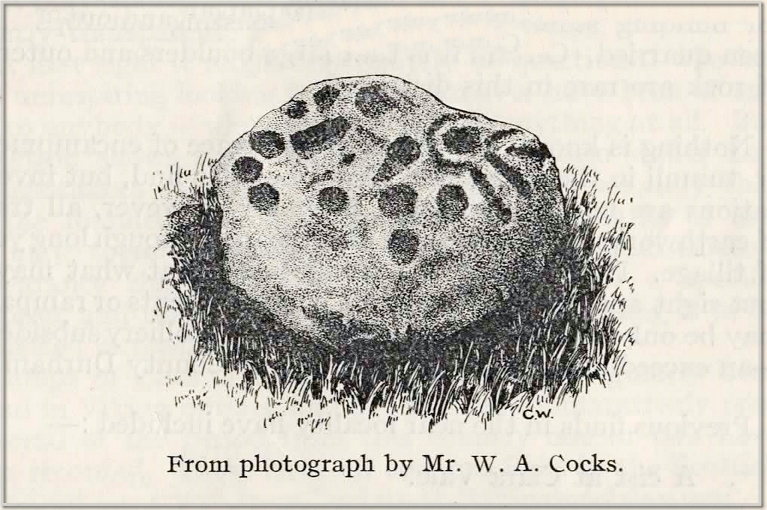
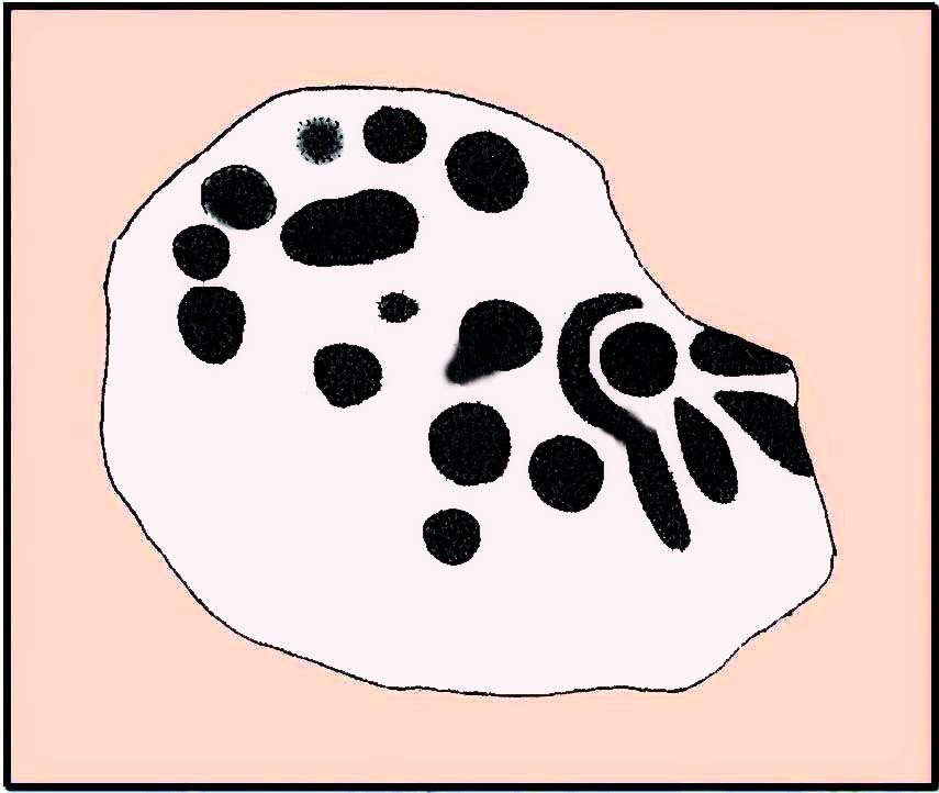
This carving presently lives in what Beckensall & Laurie (1998) described as “the stone store” at the Museum of Antiquities at the University of Newcastle-upon-Tyne, but it was discovered in some walling close to the road on the south-side of Ryton by a Mr William Cocks in 1934. The carved rock is relatively small—measuring “roughly two feet five inches, by one foot ten inches, by one foot three inches in thickness”—and was obviously not in its original position, but would have lived relatively close to the walling into which was placed. Mr Cocks told that,
1934 sketch of the carvingModified Beckensall sketch
“the stone bears one “cup and ring” with four radial ducts, the latter being in an exceedingly fine state of preservation. There are also ten plain cups of circular form; one cup with a deep conical duct; and one large cup which appears to have been formed by uniting two circular cups. All show the “pocking” or tool marks of manufacture, and these are especially noticeable in the radial ducts.”
The cup-marked Ryton (1) stone was found some 250 yards to the west and the Ryton (3) petroglyph was less than half-a-mile north, making it likely that other types of prehistoric remains once existed in this locale.
References:
Beckensall, Stan, Northumberland’s Prehistoric Rock Carvings – A Mystery Explained, Pendulum: Rothbury 1983.
Beckensall, Stan & Laurie, Tim, Prehistoric Rock Art of County Durham, Swaledale and Wensleydale, County Durham Books 1998.
Cocks, W.A., “The Ryton ‘Cup and Ring’ Marked Rock,” in Proceedings Society of Antiquaries Newcastle-upon-Tyne, volume 6, no.8, 1934.
As you’re going into Silsden up the A6034 road, over the canal bridge, turn right (east) and go up Howden Road for half-a-mile, then go left up Hawber Lane and after 250 yards veer right along Brunthwaite Lane. After nearly another half-mile, through gorgeous High Brunthwaite hamlet and just as the road bends round past the last of the gardens and houses, go through the gate into the field on your right. You’re needing to look at the walling here, which runs alongside the road, but on the field-side, barely 10 yards up. A cluster of rocks has been piled-up against the wall. The largest rounded broken one is the one you’re looking for.
Archaeology & History
Looking across the cups
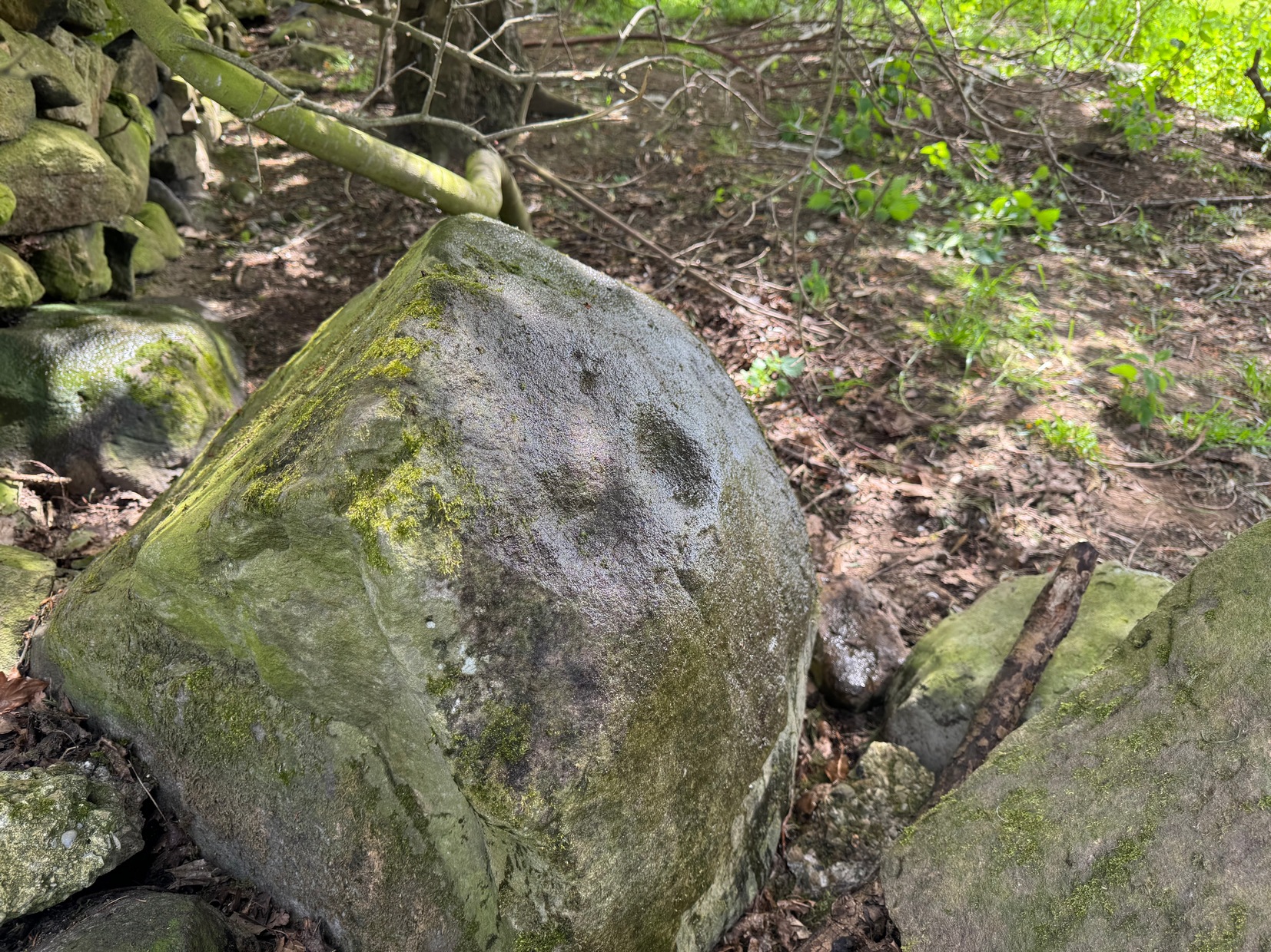
Discovered recently by the petroglyph explorer Thomas Cleland, this is one of two cup-marked stones in close attendance to each other. It’s nowt special to look at—unless you’re an ardent rock art buff!—as it consists of just two large well-formed cup-marks on its near-vertical face: the most distinct one being some two-inch across and a half-inch deep. The stone was obviously rolled here from very close by and just piled up against the wall and has been broken from a larger piece of rock, but we could see no other cup-marks on the others laid around it (although we couldn’t lift and turn the others over to see if there was anything on their undersides). The earthfast High Brunthwaite (2) cup-marked stone is just a yard away at the base of the wall.
Acknowledgements: Massive appreciation to Thomas Cleland for finding this carving and showing us it’s whereabouts.
Stone Circle (destroyed): OS Grid Reference – NN 9020 0985
Also Known as:
Blackford Glebe
Brookfield House
Archaeology & History
In the 18th Century there stood, on the slight rise of the land about 150 yards south of Brookfield House, one of those “circles of stones…in the glebe”, of the sort that “are supposed to have been places of Druidical worship,” wrote John Stevenson. (1792) Sadly, sometime in the 19th Century, the entire site was uprooted and destroyed, leaving no trace of the place. Not good…. 🙁
References:
Stevenson, John, “Parish of Blackford,” in The Statistical Account of Scotland – volume 3, (edited by, John Sinclair) William Creech: Edinburgh 1792.
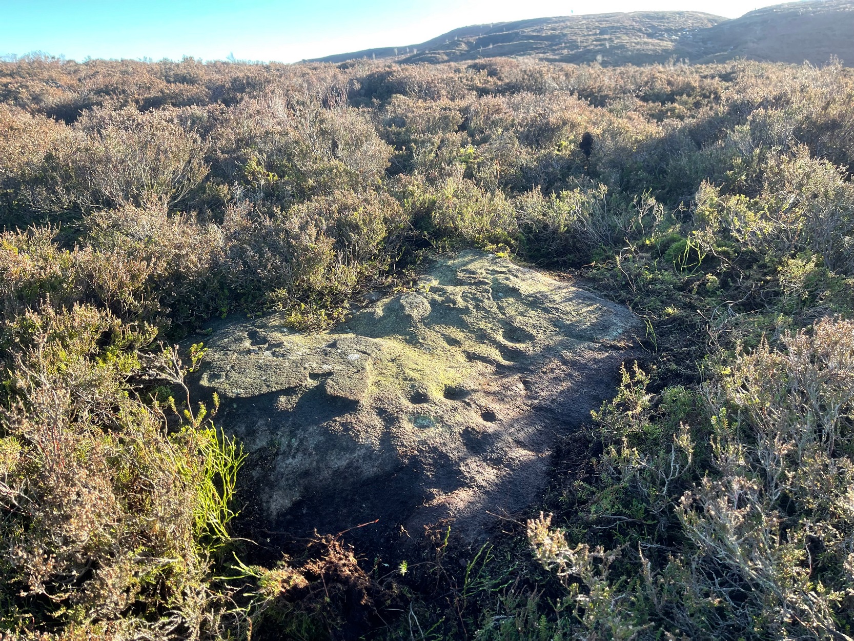
From the Cow & Calf car-park, walk towards and past the gigantic Calf rock, swerving round the fallen mass of rocks and into the trees at the back. Walk uphill to the Hanging Stones cup and ring stones, then keep heading—down the slope then back up the next one—west, for barely 100 yards until you’re on the level ground again, following the footpath alongside the heather. Barely 50 yards along, keep your eyes peeled in the heather for a low flat rock just a few yards in. Forage around and you’ll find it.
Archaeology & History
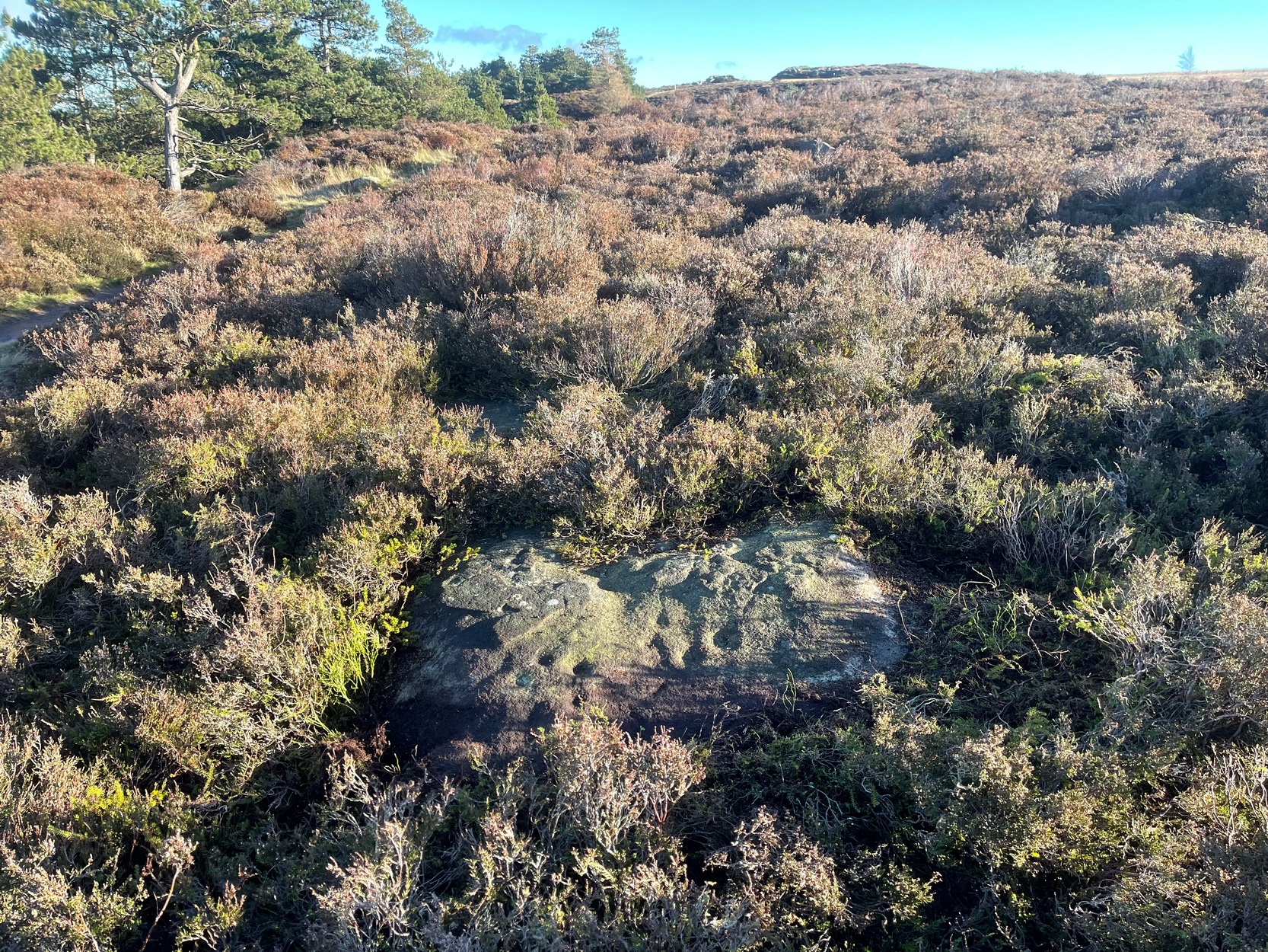
You’ll no doubt be seeing this carving after you’ve visited the impressive Hanging Stones petroglyphs 150 yards to the east. And you’ll probably be disappointed in its lack of visual grandeur when compared to its more ornate eastern neighbour. But the petroglyph fans among you should give it your attention.
Hedges 1986 sketchLooking to the SE
When the dawn or evening daylight cuts across the rock, the design looks much better than at sun high, perhaps telling us that the message of the stone coincided with those periods of the day. The gentle folds of the stone itself morph into the carving: evening and morning light cutting subtle shadowy folds across the rock, giving it an organic texture that our aboriginal ancestors told to be a vital essence of stone itself. The two small clusters of cup-marks upon this stone become greater than their basic design when brushed with the shadows and glows of a sunset. And when our aboriginal peoples painted them in ochre and other colours, an even greater mythos emerged—but sadly it is forgotten here….
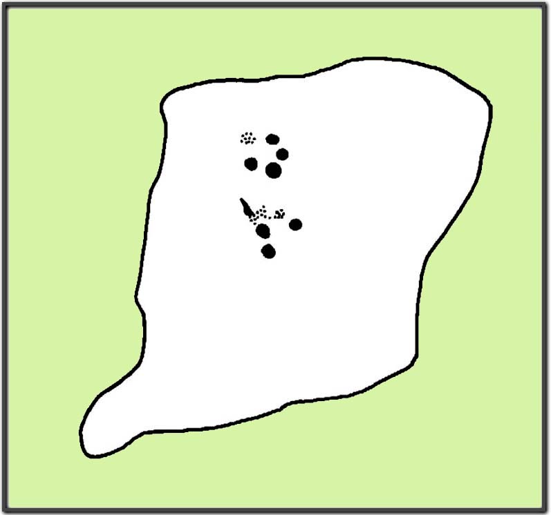
When looked at with the simplistic eyes of the archaeo-mind, this and its compatriots are little more than a number of marks on lifeless rocks. This stone for example was described in John Hedges’ (1986) survey as being just “two groups of four and five cups and grooves”—nothing more—with naught but an echo in Boughey & Vickerman’s (2003) later work. The carving has neighbours even more basic in the heather close by…
References:
Boughey, Keith & Vickerman, E.A., Prehistoric Rock Art of the West Riding, WYAS: Wakefield 2003.
Hedges, John (ed.), The Carved Rocks on Rombalds Moor, WYMCC: Wakefield 1986.
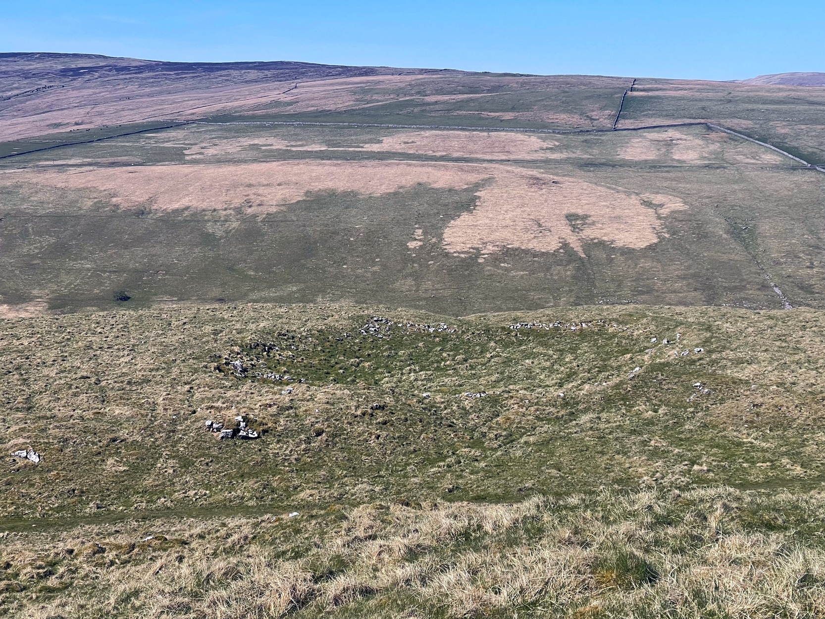
From Arncliffe village, walk past the front of the Falcon Inn village pub and along the track called the Monk’s Road. After a short distance it becomes a dirt-track where the old house lives. Less than 200 yards past the old house, a footpath takes you over the wall, then you walk 200+ yards southwest and through another wall, then up the curvaceous footpath diagonally WSW up the steep hill until you go over another wall where the land levels out. Follow the footpath along the edge of the steep drop for just over a mile where you’ll cross the fifth wall (the Clowder (1) enclosure is up above you by the rock outcrop to the left) and 100 yards along, just north of the footpath, you’ll see a large hollow defined by rocks and low walling. You’ve arrived!
Archaeology & History
The south & eastern walls
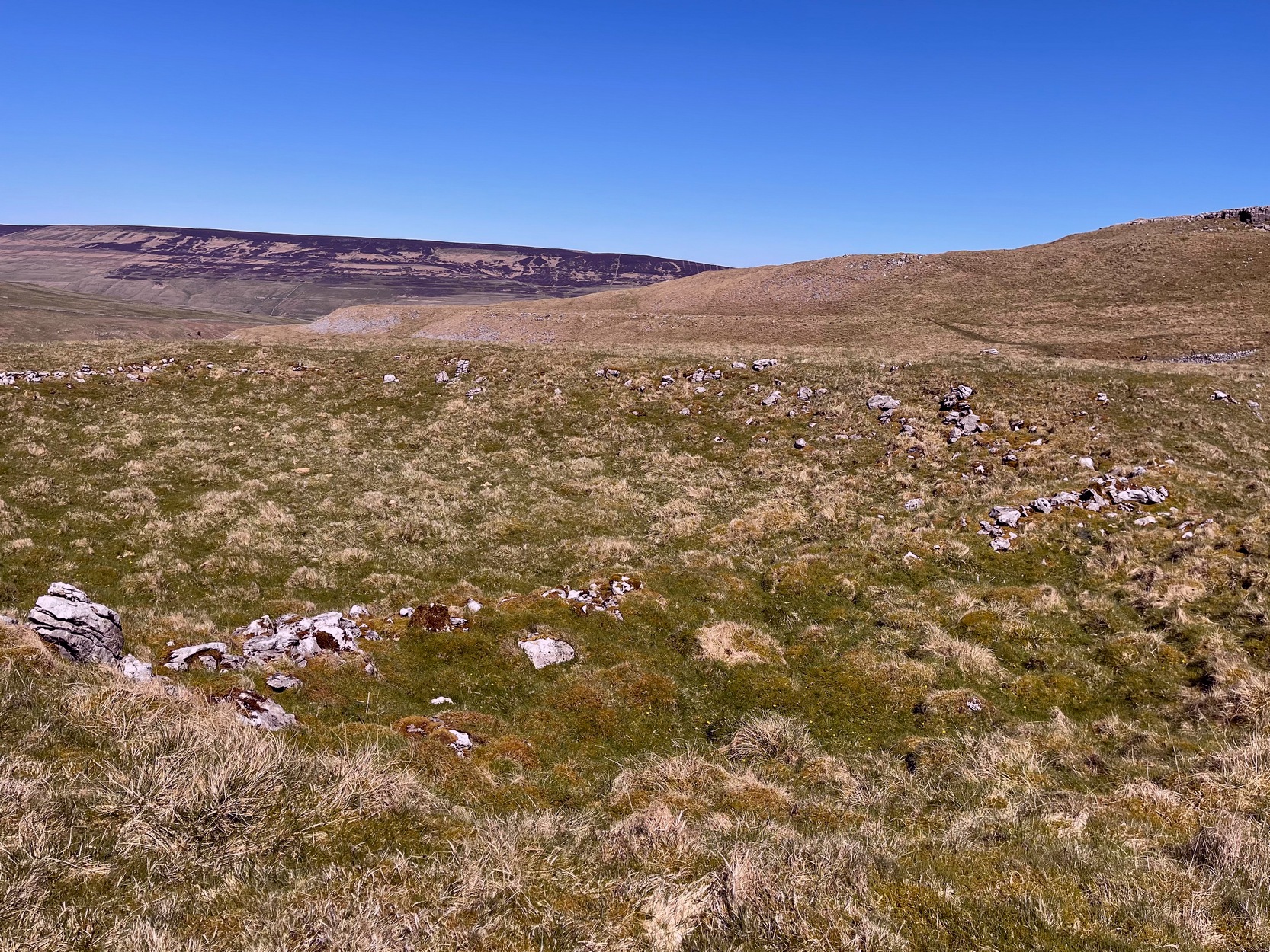
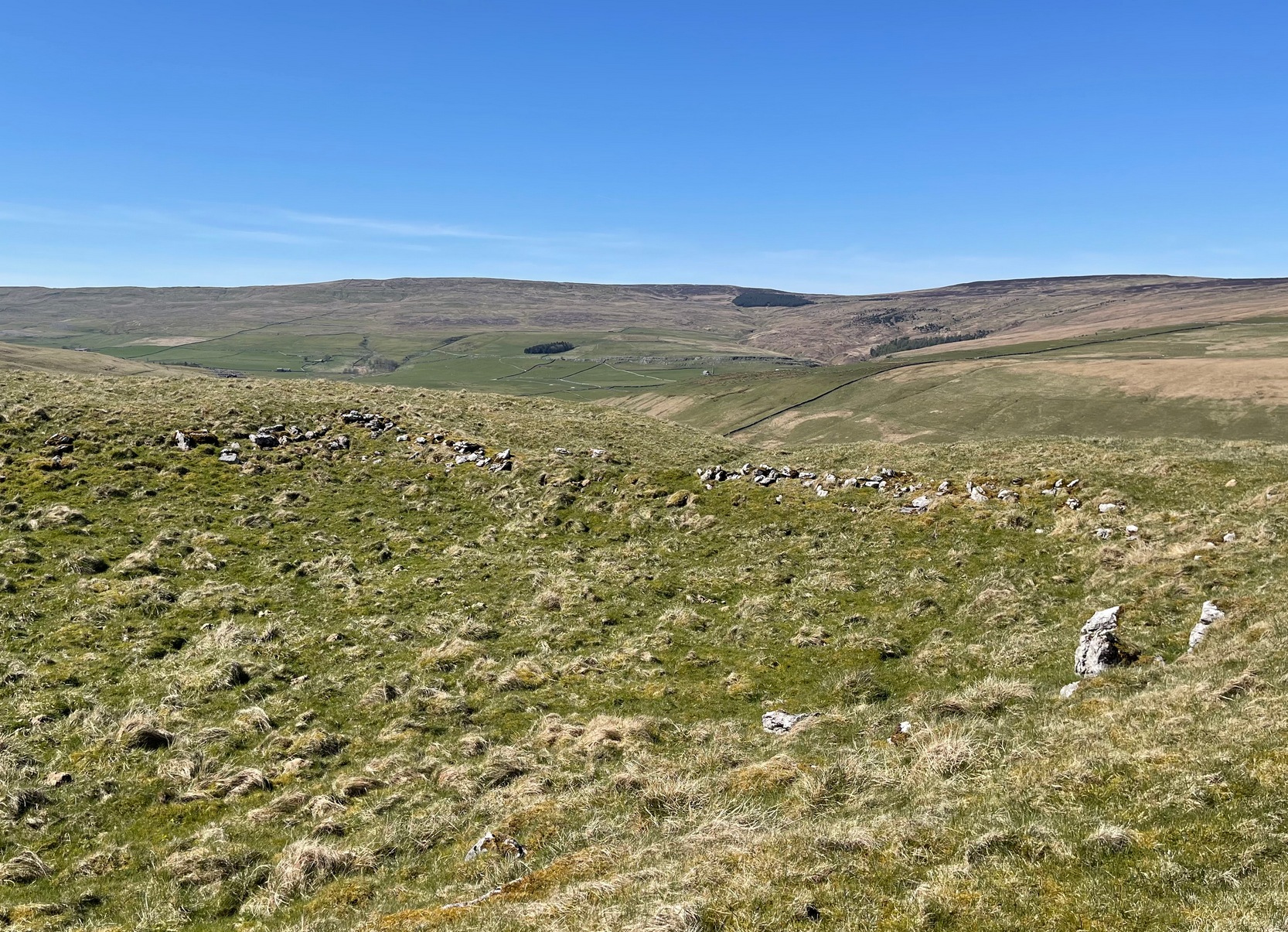
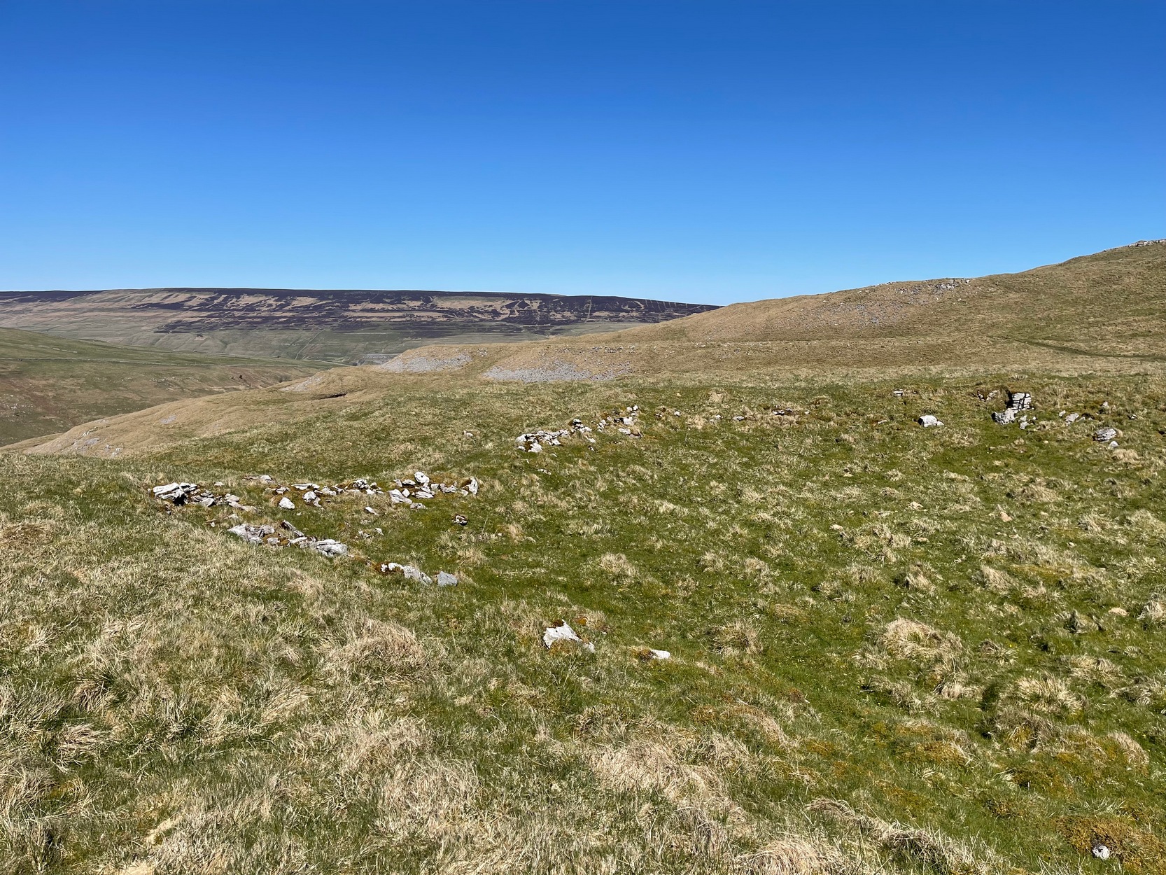
Amidst the scattered remains of the extensive Dewbottoms settlement complex, this large hollowed walled enclosure is pretty clear to see. Measuring 40 yards north-south across its longest axis and 31 yards east-west, the structure is like an erratic rectangle in shape, with entrances in the middle of its northern wall and, perhaps, another along the southern side too. It’s quite deep too, being several feet lower than the land around it, keeping it protected from any strong winds above: an ingredient that would obviously have been taken into consideration when it was being built. The walling that defines the structure is a contrived mix of Nature’s own semi-circle of earthfast limestone rock, with intermittent gaps filled-in with thousands of small stones placed there by humans, 2-3000 years ago. It’s quite impressive when you see it in the flesh.
Northern wall & dipped entranceThe west & northern walls
The site appears to have an Iron Age to Romano-British pedigree – although I’m hedging a bet that the place was probably still in use during medieval times. The enclosure has the appearance of some sort of prehistoric village hall. There are no hut circles or any other walled structures inside the overall enclosure, meaning it may have been used, perhaps, for tribal village gatherings; or it might just have been a large enclosure for cattle. Only an excavation would tell us one way or the other.
Anyhow, if you’re coming up to see the Dewbottoms complex from Arncliffe, this is the first main thing that you’ll come across. From here, to your immediate south and west, there’s a mass of prehistory beneath your feet. Make a long day out of it as you’re gonna be somewhat overwhelmed by the magnitude of it all.
References:
Charlesworth, D., ‘Iron Age Settlements and Field Systems,’ in Proceedings of the Archaeological Journal, 125, 1968.
Dixon, John & Phillip, Journeys through Brigantia – volume 2, Aussteiger: Barnoldswick 1990.
Raistrick, Arthur & Holmes, Paul F., Archaeology of Malham Moor, Headley Brothers: London 1961.
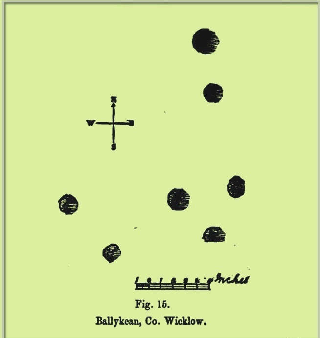
This is one of at least fourteen petroglyphs in this parish that have been either lost or destroyed since their initial description in the 19th century. It was described in George Kinihan’s (1884) survey as a “flat irregular stone, sloping slightly towards the east: the cups are seven in number”, in a design similar to that of the constellation of Cassiopeia. When the Archaeological Survey of Ireland looked for the carving in 1990 it could not be located. Corlett (2014) suggests that a collection of rocks in a hollow to the north may conceal this and some of the other carvings in this cluster.
References:
Corlett, Christiaan, Inscribing the Landscape: The Rock Art of South Leinster, Wordwell: Dublin 2014.
Kinihan, George H., “Proceedings: Cup-marked and Inscribed Stones in the Counties of Wicklow and Wexford”, in Journal Royal Society Antiquaries Ireland, (4th series) volume 6, 1884.
Cup-Marked Stone (lost): OS Grid Reference – SG 21584 42271
Also Known as:
Ballykean ‘Stone K’ (Kinihan 1884)
Archaeology & History
This is one of at least fourteen petroglyphs in this parish that have been either lost or destroyed since their initial description in the 19th century. It was described in George Kinihan’s (1884) survey as being, “a small peaked stone, having on the western side two small cups.” The carving has not been seen since then and he seems to have made no sketches of the stone. When the Archaeological Survey of Ireland looked for the carving in 1990 it could not be located.
References:
Corlett, Christiaan, Inscribing the Landscape: The Rock Art of South Leinster, Wordwell: Dublin 2014.
Kinihan, George H., “Proceedings: Cup-marked and Inscribed Stones in the Counties of Wicklow and Wexford”, in Journal Royal Society Antiquaries Ireland, (4th series) volume 6, 1884.